26
0Activity Feed

**Updated SummitX**: changes include editing username, image upload, title indicator, and improved object sorting.
SummitX has been updated. This article describes the changes that have taken place over the past three days.
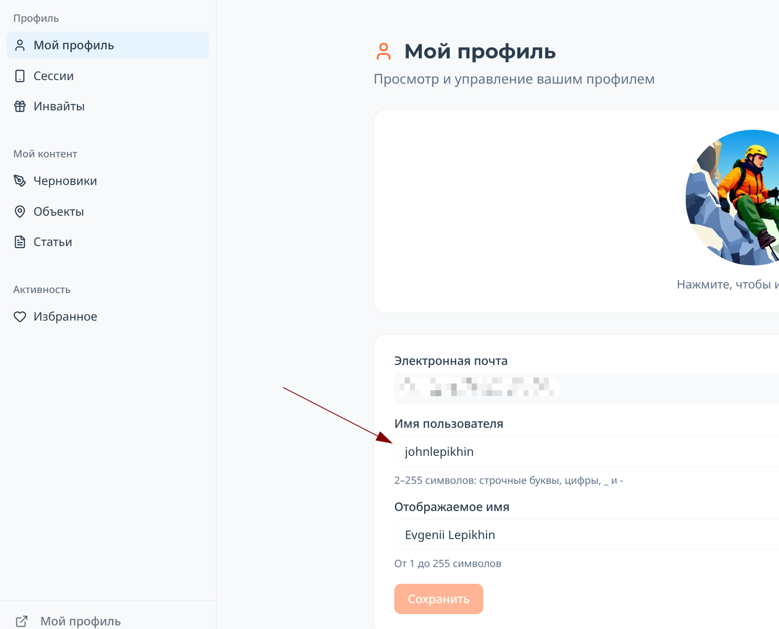
Editing username
In your personal account (for the Russian localization of the site, this is https://summitx.info/ru/account/profile), you can now change the strange username issued to you upon registration to something beautiful and familiar:
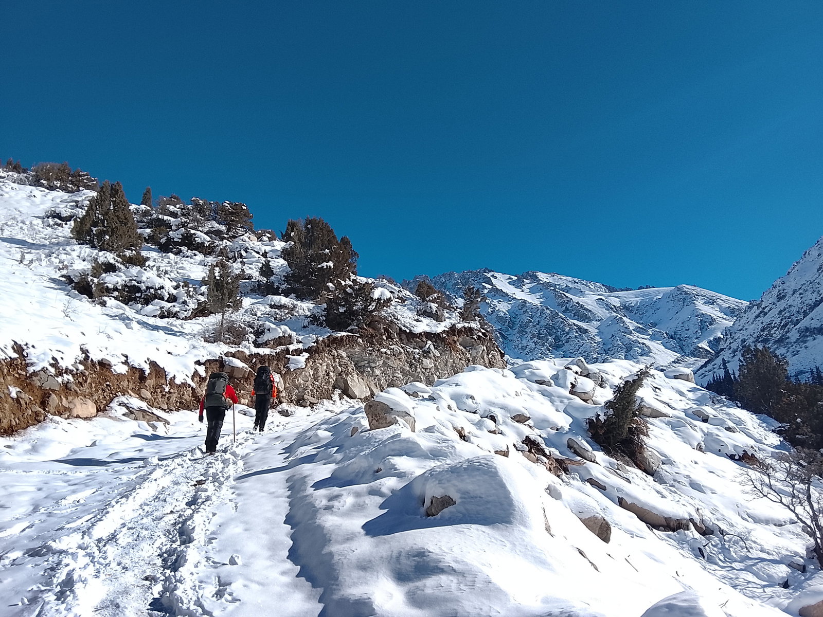
List of your articles in your personal account
Take a look at the image above: a section "My content → Articles" has appeared in your personal account. It will display all the articles you have ever written on the site.
Uploading images to articles and comments
Now, when inserting an image, the image upload process is displayed:
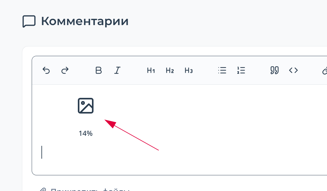 This allows you to understand what is happening with the image and know when it will be fully uploaded.
Header indicator
Route Description: З гребню
 SSummitMate
Report on the ascent of Peak NPI (3423 m) via the western ridge, describing a Category 1B complexity route and the approaches to it.
Report
on the ascent to the summit 3423 m (peak NPI) via the western ridge from Otryog pass, presumably category 1B, first ascent
Ascent Passport
- Region: Western Caucasus, Aксаут region, Bolshaya Marka valley, section 2.2 of the classifier of routes to mountain peaks.
- Summit: 3423 m (peak NPI), via the western ridge.
- Proposed category: 1B, first ascent.
- Route type: rock.
- Height difference: 150 m (total – 650 m) Route length (technical part): 250 m. Length of sections with category III difficulty: 100 m.
23
0Video Guide to "Mobilnye" Route (5A) on Korona by Dima Pavlenko
 ELEvgenii Lepikhin
Video guide to the "Мобильных" route (5A) to the first Korona tower by experienced alpinist Dima Pavlenko.
Video guide to the "Мобильных" route (5A) on the first tower of the Crown by Dima Pavlenko.
Loading video...
21
0Website Updates – Part 2
ELEvgenii Lepikhin### Website Update: Enhanced Features for Users * Mirror site for Russian users * Invitation-free registration * Internal link support for streamlined navigation
And a few more important news about the site
Mirror for Russians [beta]
Since many people have problems accessing the site from Russia, it was decided to set up a mirror that should partially or completely solve the problem: https://ru.summitx.info/ru. Everything is the same, but without circumvention tools. You probably saw a pop-up message about this mirror when you visited the site. To make it easier to remember the address, a link has been added to the Russian version of the site in the footer.
Registration without invite codes
Now you don't need an invite to register on the site! But you can still enter a friend's invite during registration to support their rating.
Internal links
To make it easier to link to routes, peaks, passes, or articles from articles and comments, support for internal links has been added. Simply insert a link to the desired object into the text, so that readers see a well-formatted link with the language already substituted, which is convenient for them. A few examples: https://summitx.info/ru/routes/58783382/about https://summitx.info/ru/objects/ranges/12443833/about https://summitx.info/ru/objects/peaks/12739493/about
19
0Route Description: В ребру
SSummitMate
A description of the climbing route to Gvandra and Uzunkol via the eastern ridge from the False Myrdı pass, with details on passage and safety recommendations.
GvandrauZunkol — description of the climbing route "ZA" from SK Greta
Route description:
From the Myrdy bivouac, ascend via scree and moraines to the snowy slopes on the right. Climb the slopes to reach the Myrdy glacier plateau. From the plateau, move towards the Western summit of Myrdy. Ascend via snowy slopes and a wide couloir to the right of the summit to reach the Lozhny Myrdy pass. The Eastern ridge (second from the Ak-Tyube pass) is located opposite this pass. If approaching the ridge from the pass, then:
- Cross the plateau perpendicular to the pass saddle
- Ascend to the right lower part of the ridge rocks via snowy (steep at the top) slopes
19
0Pavlenko's Video Guide: 3A to the first tower of the Crown
ELEvgenii LepikhinVideo guide to the 3A route to the first tower of the Crown by experienced alpinist Dima Pavlenko.
Video guide for the 3A route to the first tower of the Crown by Dima Pavlenko.
Loading video...
17
0The New Year on summitx.info started with an update: a notification system has been added, allowing users to subscribe to articles about geographical objects and manage their subscriptions. The article cover system has also been revamped.
The site has undergone a New Year's update. There are many changes, and I'll cover the key ones.
Notification System
The site is gradually acquiring features that will make communication more comfortable. The introduction of notifications (the "bell" in the site header) is a logical continuation of this development. The system is quite complex, so there will likely be more work to eliminate errors. The notifications follow the site's concept - linking physically existing objects on Earth to the virtual space. Therefore, you can subscribe not just to "new articles," but to all articles posted for the peaks/routes of the Caucasus, or subscribe to new articles about a mountain or even a specific route that interests you.
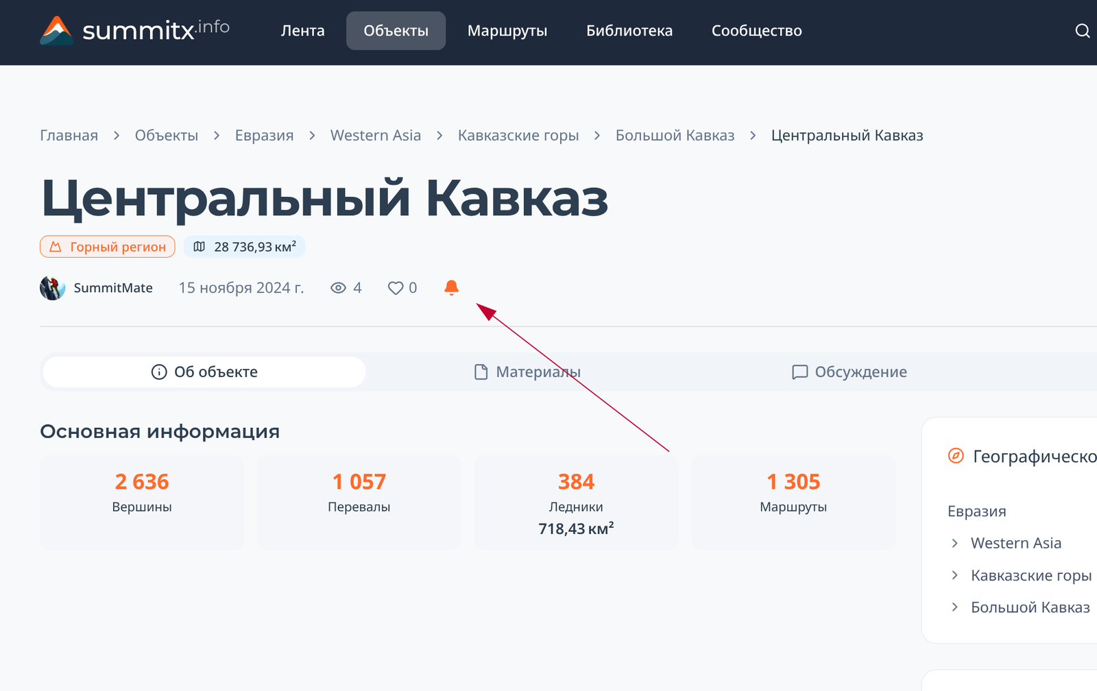
Subscribing to a Mountain Region/Peak/Route
On the geographical object's page, you can subscribe to articles about it and all its child objects. For example, by subscribing to "Central Caucasus," I will receive notifications about stories about Bezengi, descriptions of new routes on Ushba, etc.
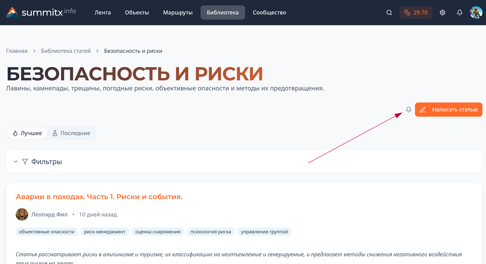
Subscribing to a Library Section
A subscription button for new articles in the library has appeared on the section page:
Subscribing to a Forum Section
16
0Ability to Add Regions
ELEvgenii Lepikhin
Now on summitx.info any user can add a mountain region - a valley or a gorge, which will simplify navigation and planning ascents.
Now any registered user can add valleys and gorges as mountain regions. Examples of added regions:
- https://summitx.info/ru/objects/ranges/64823512/about
- https://summitx.info/ru/objects/ranges/64824755/about
- https://summitx.info/ru/objects/ranges/64824505/about
Why this is valuable to the community
- The added region is automatically integrated into the hierarchy. All its mountains, passes, and routes are automatically linked to it. Those planning ascents, searching for routes, or studying the area will find it much easier to navigate: they can easily look up the 5As in Ak-Sai. They won't have to search for these 5As among all the 5As of the vast Kyrgyz Ala-Too range.
- The gorge gets its own page with the ability to ask questions about it on the forum, post or article specifically about this gorge.
- A visitor can easily see the boundaries of the valley, which can be especially useful for mountain tourists.
How to add a gorge or valley
It's very easy to do. A minimally formatted valley requires literally a few seconds.
15
0Safety Issues that are "Really Painful" for Russian Active Tourism
 ЛФЛеопард Фил
The article discusses pressing safety issues in alpinism and tourism, including instructor certification, avalanche awareness, the culture of accident analysis, and physical training of participants.
 1) Certification of guide instructors
Essentially, a new axis of reality for active tourism is being set. As of July 2024, this has become a mandatory framework for commercial accompaniment on complex routes; the authority for certification has been given to all-Russian sports federations, there are schedules for 2025–2026, and many regions are living in "hurry to re-certify by 01.10.2026" mode. Why is this topic hot? It changes responsibility, market, tolerances, and gives rise to a new type of generated risk - "paper competence" and "checkmarks instead of skills".
2) Avalanche literacy as a necessary base, not an elective for enthusiasts
A sore topic that has worn everyone out. Strangely, in tourism, suddenly, more attention is being paid to this than in mountaineering. In mountaineering, avalanche training is traditionally embedded in the training system (initial training, "Rescue in the Mountains" badges), although the quality of this training can, to put it mildly, vary. In tourism (hiking, skiing, and mountaineering), the situation is more heterogeneous. Now, more attention is being paid to it against the backdrop of a general increase in interest in active recreation and new legislative initiatives. In some circles, this has become a topic of even more discussion due to the wider audience coverage and less initial regulation - unlike mountaineering. Although, I confess, the over-regulation of mountaineering has always caused me bewilderment. Unlike many European countries or the USA, where mountaineering is often seen as a personal matter and the responsibility of the individual (with an emphasis on insurance and private guide schools), Russia maintains a centralized sports approach. Again, suddenly, while we envy them, many European mountaineers sometimes envy us, considering our state's approach more structured and understandable. What a weird thing.
15
0Route Description: с севера по галстуку
SSummitMate
Ascent to the summit Main Ptysh via the "Tie" route category of difficulty: a detailed description of the path, belay, and recommendations for climbers.
Fig. 39
3. Ascent to the summit of Glavny Ptysh via the "tie" — beyond the category of difficulty (see Fig. 39)
From the Ptyshsky pass, move right along the glacier (protection!) towards a large rocky ridge. Ascend the rocky ridge 40–50 m upwards to a bivouac. From the pass, it takes 1 hour. From the bivouac, ascend 90–100 m upwards along the broken rocks (rockfall hazard!), exit onto a snowy slope with a steepness of 35–40°, and from there, move right-upwards towards a rocky outcrop. Ascend 50–60 m up the rocky outcrop (protection via protrusions!), exit onto a steep snowy slope (45°), and from there, cross a bergschrund onto a rocky outcrop in the "tie" couloir. Ascend 40 m up the rocks (protection via protrusions!), then traverse the steep snowy couloir leftwards (protection!), and exit onto rocks. Ascend 60 m up the rocks (protection via protrusions!) to a steep snowy slope (60–65°), and from there, ascend 180–200 m straight upwards (protection!) to a platform to the right of a gendarme. To the right of the gendarme, ascend scree, then move left behind the gendarme along rocks of medium difficulty towards a narrow icy couloir. Cross the couloir leftwards (piton protection!), exit onto rocks of medium difficulty, and ascend straight upwards onto a ridge. Ascend to the summit along the broken rocks of the ridge. From the bivouac on the rocky outcrop to the summit, it takes 6 hours. The descent follows the ascent route and takes 5–6 hours. The route from the bergschrund to the summit is prone to rockfall!
Recommendations for climbers
- The number of participants in a group should not exceed 6 people.
- The initial bivouac is on a rocky ridge.
- Departure time from the bivouac should not be later than 4 am.
15
0Showing 21–30 of 7076 results