
Report
on the ascent to the summit 3423 m (peak NPI) via the western ridge from Otryog pass, presumably category 1B, first ascent
Ascent Passport
-
Region: Western Caucasus, Aксаут region, Bolshaya Marka valley, section 2.2 of the classifier of routes to mountain peaks.
-
Summit: 3423 m (peak NPI), via the western ridge.
-
Proposed category: 1B, first ascent.
-
Route type: rock.
-
Height difference: 150 m (total – 650 m)
Route length (technical part): 250 m. Length of sections with category III difficulty: 100 m. Average steepness of the technical part: 30°.
-
Pitons left on the route: 0
"Pitons" used on the route: 6 (loops). Bolt pitons and ITO were not used.
-
Total time: 10 h, 1 day.
-
Descent from the summit: via the south-west couloir.
-
Leader: Dergachev Andrey Viktorovich, II sports category, instructor III category.
Participants:
- Smolin Andrey, III sports category
- Dudka Alexander, beginner
- Polyakova Tatyana, beginner
- Pavlichenko Anna, beginner
- Boguslavskaya Yulia, beginner
-
Date of ascent: August 17, 2003 (August 1, 2006)
Departure from base camp: 8:00 Arrival at Otryog pass: 10:00 Start of the route (ridge): 11:00 Summit arrival: 13:00 Return to base camp: 18:00
-
Federation of Mountaineering and Rock Climbing of Rostov region.
-
Responsible for the report Dergachev A.V. aderg@narod.ru
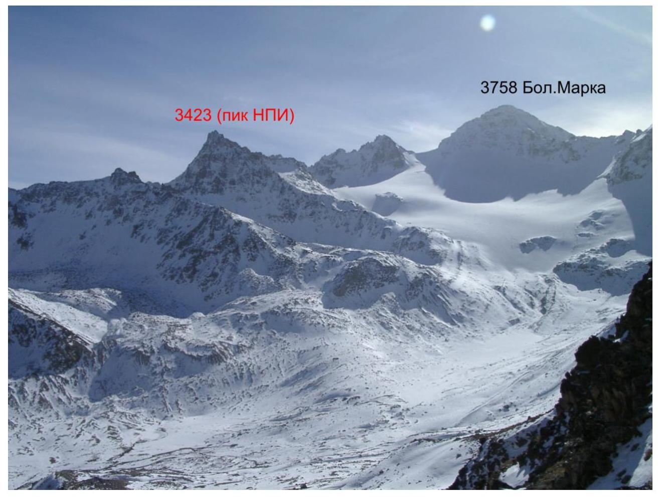
Fig. 1. General view from the north-west (from Oryuchat pass). November 6, 2003
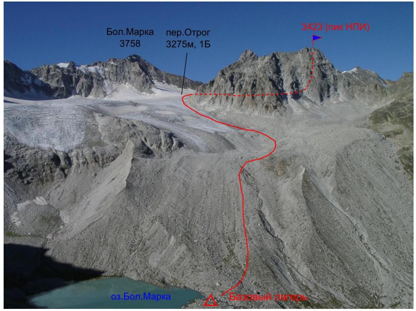
Fig. 2. General view from the north-east. August 16, 2003
Geographical description of the region and the object of ascent
The object of ascent – an unnamed summit with a height of 3243 m – is located in the Zelenchuksky district of the Karachay-Cherkess Republic, in the Teberda ridge of the Western Caucasus. In fact, the massif of the summit is a nunatak, dividing the eastern and western branches of the Bolshaya Marka glacier, similar to the Pazardzhik massif in Arkhyz. The summit was chosen as an object of first ascent in 2002 as part of the preparation for the Novocherkassk Mountain Club's mountaineering event, dedicated to the anniversary of the Novocherkassk Polytechnic Institute – NPI, now officially named YURGPU(NPI). The mountaineering event was planned to take place in the Aксаут valley in the summer of 2003, and as part of it, it was planned to ascend the unnamed summit and name it after NPI. The planned ascent was eventually made on August 17, 2003.
The ascent was made from the side of the Bolshaya Marka river valley, a right tributary of the Aксаут river. The base camp was located near the Bolshaya Marka lake, from which the right source of the homonymous river flows.
It is more convenient to reach the base camp by walking along the Bolshaya Marka river valley from the Krasny Karachay aul (16 km, one day's journey). In the Bolshaya Marka valley, there are shepherd's camps and good trails (except for the upper part, about 3 km). There is a dirt road to the Krasny Karachay aul along the Aксаут valley. The nearest settlement with regular bus service is the Kardonikskaya stanitsa, 40 km from the Krasny Karachay aul.
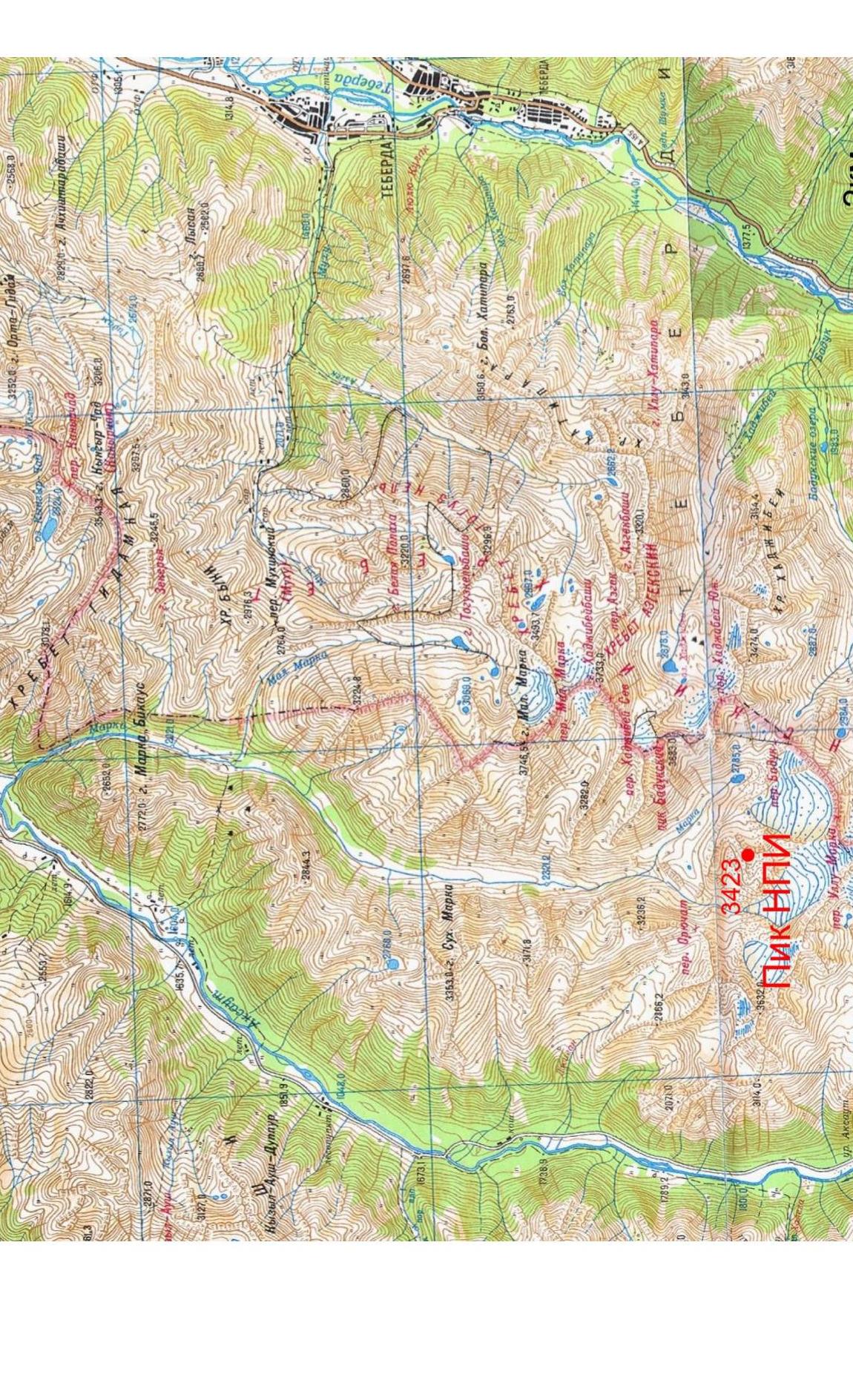
Fig. 3. Overview map of the region
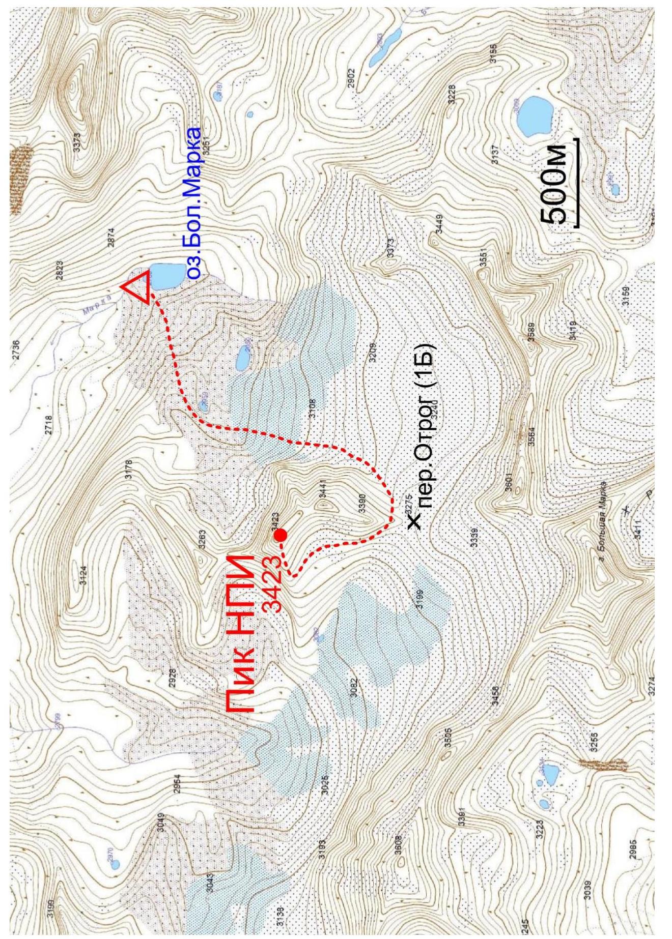
Fig. 4. Route map
Table 1. List of technical sections of the route
| Section № | Length, m | Steepness, ° | Terrain type | Difficulty category | Number of pitons |
|---|---|---|---|---|---|
| R0–R1 | 130 | 20 | Rocky-scree ridge | I–II | 0 |
| R1–R2 | 120 | 30 | Rocky ridge | II–III | 6 |

Fig. 5. Route photo
Description of the approach to the start of the technical part of the route
The summit 3423 is visible to the west from the base camp near the Bolshaya Marka lake. Climb the scree slope to the foot of the summit, to the Bolshaya Marka glacier. At the end of summer, the glacier is open. In the scree (slope 15°) ascend along the wall of the summit 3422 to the saddle, separating it from the Bolshaya Marka summit. This is the Otryog pass (3275 m, 1B). 2 hours from the base camp. Then, on medium, sometimes large scree and gentle rocky slabs, move towards the western ridge. Ascend to the ridge towards the characteristic "tooth". The beginning of the technical part of the route is on the ridge (3 hours from the base camp).
Description of the route passage
Section R0–R1. Along the scree ridge with outcrops of destroyed rocks, stay on the right side of the ridge, ascend to the rocky walls. 130 m, I–II.
Section R1–R2. Up the 50° rocky wall or via the chimney to the rocky ridge. Then move along the ridge, staying on the right part. The large gendarme is bypassed on the left. 120 m, II–III.
Descent from the summit to the south-west. 40 m rappel to the scree couloir, then down the couloir.
Route photos
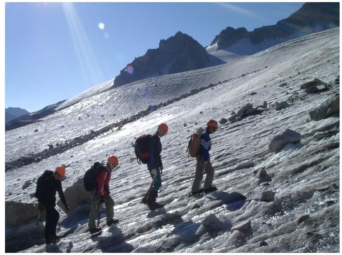
Fig. 6. Ascent to the Otryog pass via the glacier (2003)
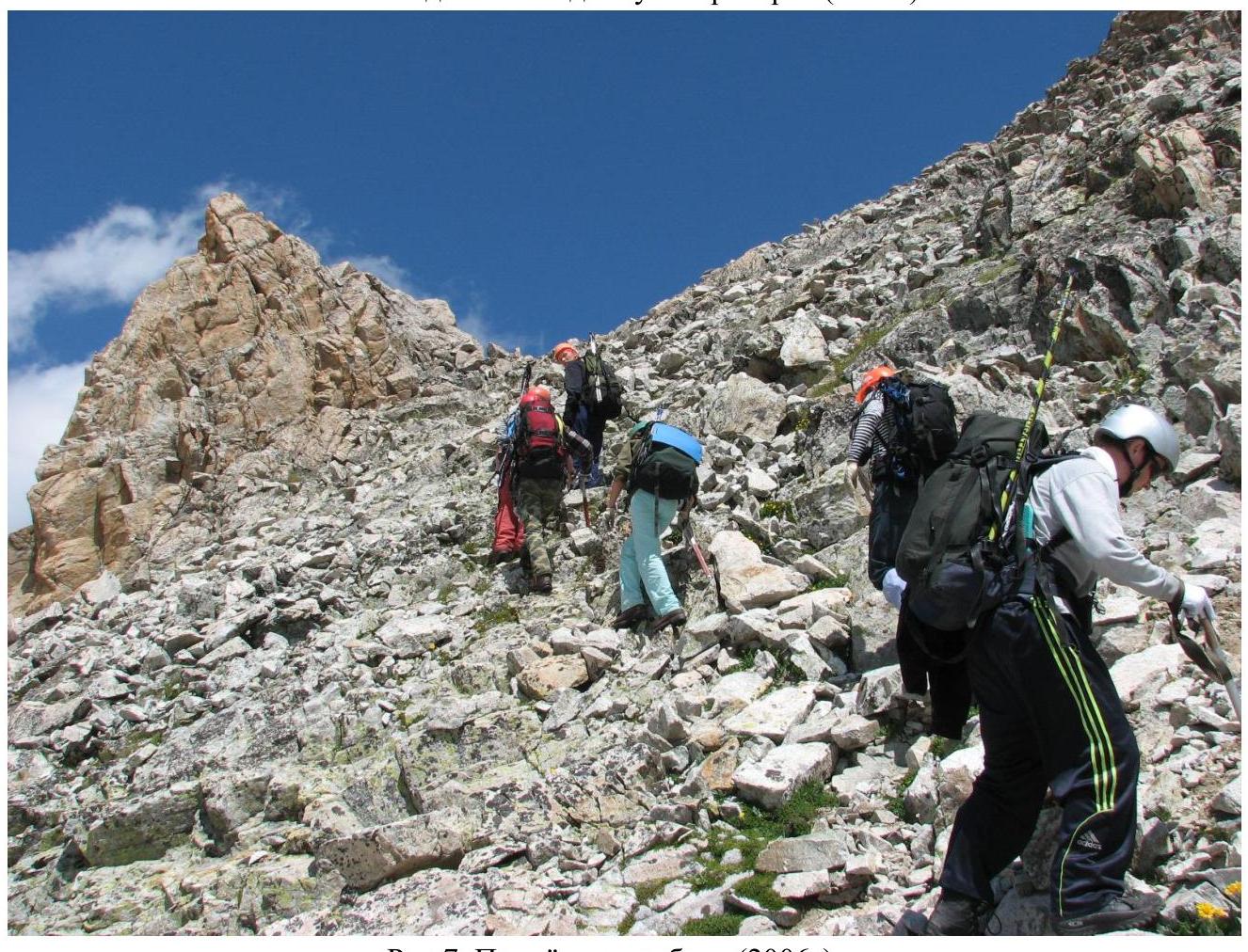
Fig. 7. Ascent to the ridge (2006)
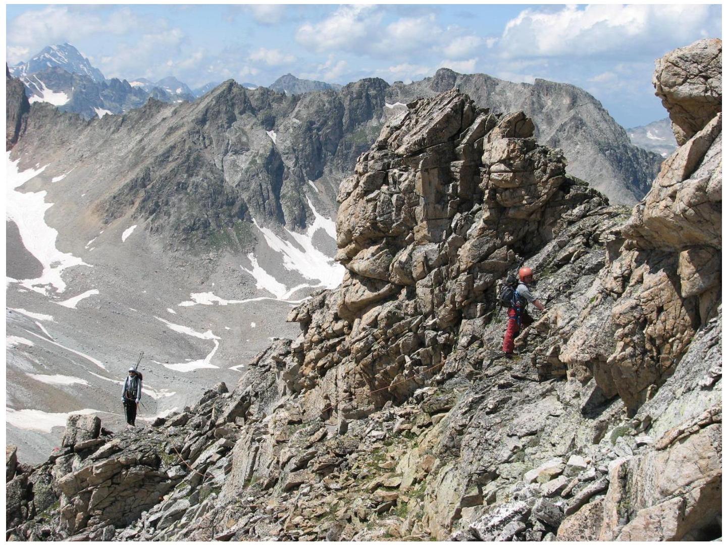
Fig. 8. Section R0–R1 (2006)
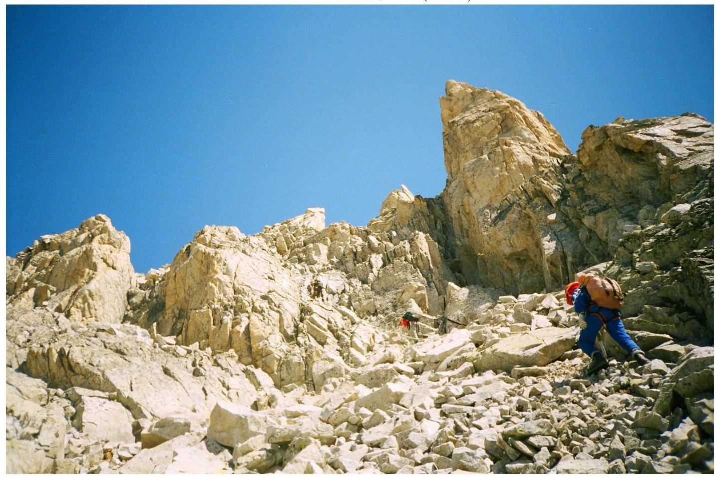
Fig. 9. Section R1–R2 (2003)

Fig. 10. Section R1–R2. Ascent to the rocky ridge (2006)
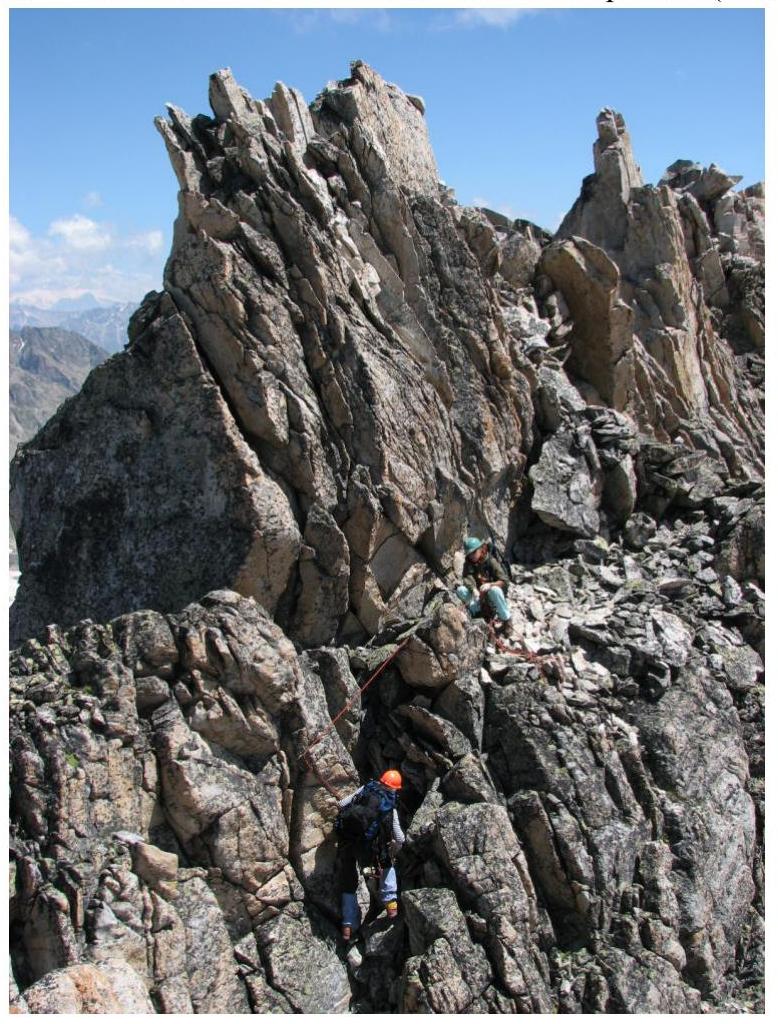
Fig. 10. Section R1–R2 (2006)
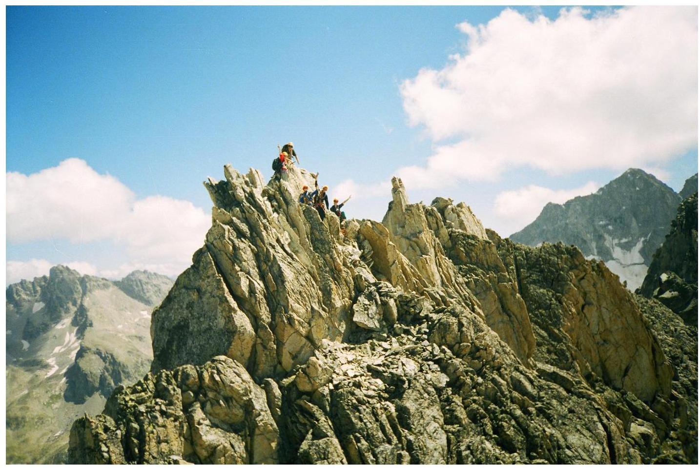
Fig. 11. Group on the summit (2003)
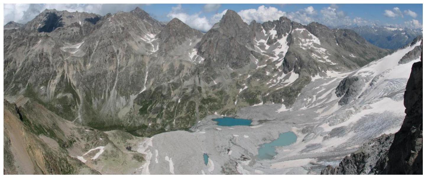
Fig. 12. View from the summit to the east (2006)
Fig. 13. View from the summit to the south (2006)
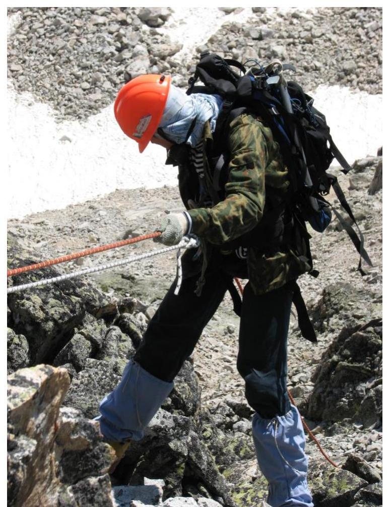
Fig. 14. Descent from the summit (2006)
General conclusions
This route was repeated by us on August 1, 2006, also under the leadership of A. Dergachev (group composition – Smolin Andrey, III sports category; S. Nefedov, III sports category; Elena Nesterova, III sports category; Alexey Bolesov, beginner; Vyacheslav Rogachev, beginner; Alexey Ponomarev, beginner). The report is compiled based on the materials of both ascents.
The nearest classified route in the area – category 1B to the Bolshaya Marka summit – is technically simpler but longer. A similar route in terms of difficulty is Sulakhat via the northern ridge, category 1B. The route category 2A to Pazardzhik (Arkhyz) is more similar in terms of terrain.
Based on the objective difficulty of the technical part of the route to the summit 3423 m via the western ridge and comparing it with other routes climbed by the participants earlier, it is proposed to classify it as category 1B.
It is proposed to name the summit peak NPI in honor of the Novocherkassk Polytechnic Institute and its mountaineering club.
Comments
Sign in to leave a comment