Zarafshan Range
Route Description: С ребру
 SSummitMate
The ascent to the summit of Maria (4970 m) in the Fann Mountains via the North-Eastern edge, category 5B complexity, made in 1979 by a group of climbers led by Dronov D.Z.
I. The ascent category is technical. 2. The ascent area is the Fann Mountains, Zarafshan Range. 3. The peak, its height, and the ascent route are
- Peak MARIIA, 4970 m, via the northeast edge, category 5B difficulty, 3rd ascent of the route.
- Route characteristics: height difference — 1460 m, length of sections with 5–6 category difficulty — 1425 m, average steepness of the route — 60°, average steepness of the most difficult sections — 80–90°.
- Pitons driven: rock pitons — 89, including 5 for creating intermediate belay points; chock stones — 65, including 4 for creating intermediate belay points; ice screws — 32.
- Time taken to reach the summit — 25 hours.
- Number of bivouacs and their characteristics:
Route Description: С ребру
SSummitMateReport on the ascent to Peak "Maria" (4970 m) via the N-NE wall, category 5-6 difficulty, in the Fann Mountains in 1970.

Ascent to Peak "Maria" - 4970 m, 5B-6B cat. diff.
For the 1970 CS DSO "Spartak" mountaineering championship
via the right ridge.
The Spartak Tashobl Soviet DSO mountaineering section's training camp took place from June 23 to July 22 in the northwestern part of the Fann Mountains.
Ku likalon Valley, 1970. In 1969, a group of GDR mountaineers led by Karl Hentz climbed Peak Maria via the northern ridge and then traversed Peak Mirali, rating this traverse as a climb of the highest difficulty category.
The Tashobl Soviet DSO "Spartak" team followed the Leningrad climbers on the N-NE wall. During pre-season preparations, the group couldn't find a description of the route and only received verbal consultations from eyewitnesses of the ascent. Thus, the ascent was not much different from a first ascent.
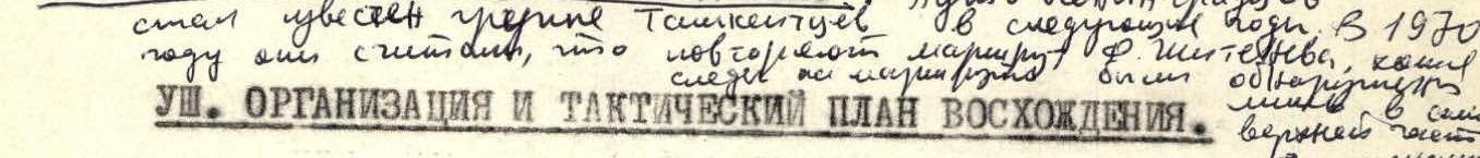
VIII. Organization and Tactical Plan of the Ascent
By July 2, the team completed a training and reconnaissance climb on Peaks "Svobodnoy Korei" (3B cat. diff.) and "Severny" (4A cat. diff.), both with predominantly rocky routes.
Route Description: С кф. 3 гребня
SSummitMateAscent to the summit of Maria (4970 m) via the northern spur of the western ridge, category 5B. Description of the route and its passage.
Ascent Passport
1. Ascent class: technical
2. Ascent area, ridge: 5.3. Zaravshan Ridge
3. Peak, its name, height, ascent route: p. Maria (4970 m)
Via the northern counterfort of the western ridge
4. Proposed difficulty category: 5B, second ascent
5. Route characteristics: height difference 1670 m
Length of sections 5–6 km (traverse 795 m) Average steepness: 65°
6. Pitons driven: for belay:
Route Description: С кф. 3 гребня
SSummitMateDescription of the ascent to the summit of Maria (4970 m) via the N buttress of the 3rd ridge, difficulty category 5B, climbed by a team of climbers in 1980.
Ascent Log
(third ascent) I. Ascent class — technical 2. Ascent area — Pamir, Fann Mountains 3. Maria peak via North counterfort of the 3rd ridge (4970 m) 4. Difficulty category — 5B 5. Route characteristics: elevation gain — 1670 m, length of 5–6 km/tr. sections — 795 m, average steepness — 65° 6. Pitons hammered: | | rock | ice | bolt | chocks |
Route Description: С кф. 3 гребня
SSummitMateAscent to the summit Mariya (4970 m) via the northern spur of the western ridge, category of difficulty 5B, first ascent, Fan Mountains.
Ascent Passport
I. Ascent class — technical. 2. Ascent area, ridge — Fan Mountains, Zarafshan Ridge. 3. Peak, its height, ascent route — Mt. Maria, 4970 m, via the north buttress of the western ridge, first ascent. 4. Proposed difficulty category — 5B. 5. Route characteristics: length of sections with 5–6 difficulty category — 940 m; total height difference of the entire route — 1670 m; average steepness — 53°; height difference of the buttress itself — 1450 m; average steepness — 62°; height difference of the rocky part of the buttress — 850 m; average steepness — 70°. 6. Pitons driven: rock — 152, ice — 37.
Route Description: С гребню
SSummitMateDescription of the ascent to the peak Mariya via the north ridge, made by the LOS SDSO "Burevestnik" group, complexity category 5A.
ASCENT DESCRIPTION TO THE MARIA PEAK VIA THE NORTHERN RIDGE
Approximate 5A category difficulty
Class of technically challenging ascents
The route was traversed by the LOS SDSO "Burevestnik" team
1. Group Composition
The ascent was made by the LOS SDSO "Burevestnik" group in the following composition:
- SMRCHIK V.L. — leader, 1st sports category
- TIKHVINSKII S.B. — participant, CMS
Route Description: центру С стены
SSummitMateSecond ascent of route n. 0 Shumilov up the North-Eastern wall of v. Zindon (4800 m) in the Fann Mountains; rated 6B.
- Climbing category — technical
- Climbing area — Fann Mountains, Pamir-Alay
- Climbing route with peak names and elevations: via the NE wall of Zindon 4800 m (O. Shumilov's route), second complete ascent
- Proposed difficulty category — 6B
- Route description: elevation gain — 1200 m, length of sections with 5–6 difficulty grade — 930 m, average steepness — 80°
- Pitons hammered: for belaying (for creating intermediate belay anchors): rock — 318/40, ice — 27, bolt — 7/14
- Total climbing hours — 57
- Number of bivouacs and their description:
Route Description: центру С стены
SSummitMateFirst ascent of the north wall of Zindon peak (4800 m, Pamir-Alay) via the center of the wall, a route of category 6 complexity.
- The ascent category — technical
- Ascent area — Fan Mountains, Pamir-Alay
- Ascent route with indication of peaks and their elevations: via the center of the north wall of ZINDON 4800 m, first ascent.
- Proposed difficulty category — 6B
- Route characteristics: height difference 1200 m, length of sections with 5–6 difficulty category — 1089 m, average steepness — 84°
- Number of pitons and chocks used for protection and artificial aids: rock — 334 (140), ice — 42 (2), bolt — 17 (16), chocks — 49 (37)
- Number of climbing hours — 118
- Number of bivouacs and their characteristics: 8 bivouacs, including:
- sitting in a tent — 3
- semi-reclining in a tent — 4
Route Description: С стене
SSummitMateReport on a challenging mountaineering route (category 6) with a detailed description of obstacles and climbing conditions.
The group started the route on July 8, 1977. Ahead of us, two days earlier, the group of "Artuch" tourist club, led by, started on the same route on July 8, 1977. First Day
- Departure from the bivouac on the moraine under the route at 5:30 am.
- We walked 100 m of a snowy slope and approached the bergschrund filled with snow.
- Further ascent to a snow-ice shelf, which leads to the left edge of the rock wall of the I belt. From the snow shelf, we ascended to a 35 m internal vertical corner with an overhanging wall, which leads to a small steep shelf. Above the shelf, the internal corner continues straight up for 30 m and ends with an overhang. Then, we moved left to a crack, leading to the beginning of the slab, bypassing the exit to a large stone on the snow shelf, as the first ascenders did (Emelyanenko Yu.). This deviation from the path of the first ascenders does not simplify the route and seems more logical under our conditions. The edge of the slab forms a steep internal corner with the wall, covered with flow ice, with a cornice and smooth walls. Ascent to the slab:
- Initially, through the right part of the crack (crevice), and then through the left
- Exit to steep blocky rocks, through which we ascended to the top of the slab. Here, we bivouacked at 17:00.
Route Description: С стене
SSummitMateFirst ascent of the north wall of Pik Zindon (Fan Mountains) — an extremely challenging climbing route, over 1000 m long, with pitches up to 75° and considerable technical difficulties.
Ascent Log
- Ascent category — technical
- Ascent region — Fan Mountains
- Ascent route — v. Zindon via the north wall, 4800 m
- Ascent characteristics: height difference 1000 m average steepness 75°, complex section length 880 m
- Pitons used: rock 207, including 24 wooden wedges ice 8, no bolt pitons
- Total climbing hours 95.5
- Number of nights and their characteristics — seven: