Activity Feed
Route Description: В кф. СВ стены
 SSummitMate
Climbing route description to Zamok peak (5070 m) via the eastern counterforce of NNE wall in Pamir-Alay, category of difficulty 5B.
Ascent Passport
- Ascent class: technical
- Ascent area: Pamir-Alai, Zeravshan Range
- Peak, its height, ascent route: Zamok, 5070 m, via the Eastern counterfort of the NNE wall, third ascent
- Proposed difficulty category: 5B
- Route characteristics: route length: 1100 m, height difference: 900 m, average steepness 70°, length of sections: fifth category – 280 m, sixth category – 35 m
- Pitons driven: for belaying, for creating ITO: rock 106, ice 2, bolt 1 (used someone else's)
- Number of climbing hours: 18 hours, climbing days – two
- Number of bivouacs and their characteristics:
Route Description: СВ стене
SSummitMateAscent to Zamok peak (5070 m) via N.N.E. wall in the Hissar Range, 5B difficulty category, second ascent.
ASCENSION DOCUMENT
- Class of ascension: technical
- Area of ascension: Gissar Ridge
- Peak, its height and ascent route: p. Zamok, 5070 m, via N.N.E. wall
- Difficulty category: 5B rated, second ascent
- Route characteristics: total altitude difference 1230 m, average steepness of the route 71°, including technical parts 78°, route length 1868 m and sections of cat. diff. (m): 1 — 130, 2 — 160, 3 — 120,
Route Description: С стене
SSummitMateFirst ascent of the north wall of Pik Zindon (Fan Mountains) — an extremely challenging climbing route, over 1000 m long, with pitches up to 75° and considerable technical difficulties.
Ascent Log
- Ascent category — technical
- Ascent region — Fan Mountains
- Ascent route — v. Zindon via the north wall, 4800 m
- Ascent characteristics: height difference 1000 m average steepness 75°, complex section length 880 m
- Pitons used: rock 207, including 24 wooden wedges ice 8, no bolt pitons
- Total climbing hours 95.5
- Number of nights and their characteristics — seven:
Route Description: С кф. 3 гребня
SSummitMateAscent to the summit Mariya (4970 m) via the northern spur of the western ridge, category of difficulty 5B, first ascent, Fan Mountains.
Ascent Passport
I. Ascent class — technical. 2. Ascent area, ridge — Fan Mountains, Zarafshan Ridge. 3. Peak, its height, ascent route — Mt. Maria, 4970 m, via the north buttress of the western ridge, first ascent. 4. Proposed difficulty category — 5B. 5. Route characteristics: length of sections with 5–6 difficulty category — 940 m; total height difference of the entire route — 1670 m; average steepness — 53°; height difference of the buttress itself — 1450 m; average steepness — 62°; height difference of the rocky part of the buttress — 850 m; average steepness — 70°. 6. Pitons driven: rock — 152, ice — 37.
Route Description: С кф. 3 гребня
SSummitMateDescription of the ascent to the summit of Maria (4970 m) via the N buttress of the 3rd ridge, difficulty category 5B, climbed by a team of climbers in 1980.
Ascent Log
(third ascent) I. Ascent class — technical 2. Ascent area — Pamir, Fann Mountains 3. Maria peak via North counterfort of the 3rd ridge (4970 m) 4. Difficulty category — 5B 5. Route characteristics: elevation gain — 1670 m, length of 5–6 km/tr. sections — 795 m, average steepness — 65° 6. Pitons hammered: | | rock | ice | bolt | chocks |
Route Description: С кф. 3 гребня
SSummitMateAscent to the summit of Maria (4970 m) via the northern spur of the western ridge, category 5B. Description of the route and its passage.
Ascent Passport
1. Ascent class: technical
2. Ascent area, ridge: 5.3. Zaravshan Ridge
3. Peak, its name, height, ascent route: p. Maria (4970 m)
Via the northern counterfort of the western ridge
4. Proposed difficulty category: 5B, second ascent
5. Route characteristics: height difference 1670 m
Length of sections 5–6 km (traverse 795 m) Average steepness: 65°
6. Pitons driven: for belay:
Route Description: С ребру
SSummitMateReport on the ascent to Peak "Maria" (4970 m) via the N-NE wall, category 5-6 difficulty, in the Fann Mountains in 1970.

Ascent to Peak "Maria" - 4970 m, 5B-6B cat. diff.
For the 1970 CS DSO "Spartak" mountaineering championship
via the right ridge.
The Spartak Tashobl Soviet DSO mountaineering section's training camp took place from June 23 to July 22 in the northwestern part of the Fann Mountains.
Ku likalon Valley, 1970. In 1969, a group of GDR mountaineers led by Karl Hentz climbed Peak Maria via the northern ridge and then traversed Peak Mirali, rating this traverse as a climb of the highest difficulty category.
The Tashobl Soviet DSO "Spartak" team followed the Leningrad climbers on the N-NE wall. During pre-season preparations, the group couldn't find a description of the route and only received verbal consultations from eyewitnesses of the ascent. Thus, the ascent was not much different from a first ascent.
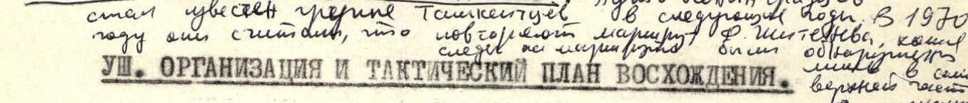
VIII. Organization and Tactical Plan of the Ascent
By July 2, the team completed a training and reconnaissance climb on Peaks "Svobodnoy Korei" (3B cat. diff.) and "Severny" (4A cat. diff.), both with predominantly rocky routes.
Route Description: СВ стене
SSummitMateAscent to the peak Maria via the North-Eastern edge, category 5B, in the Fann Mountains, made in 1979 by a group of climbers from Karaganda.
Mt. Maria, 5B, via North-Eastern Ridge (A. Vakhmenin's route, 78)
Ascent Passport
Ascent category — technical. Ascent area — Fann Mountains, Zarafshan Range. Peak, its height, ascent route — Mt. Maria, 4970 m, via north-eastern ridge, 5B category of complexity, 3rd ascent of the route. Route characteristics:
- Height difference — 1460 m
- Length of sections with 5–6 category of complexity — 1425 m
- Average steepness of the route — 60°
- Average steepness of the most complex sections — 80–90° Pitons driven: | Pitons driven | For belaying | ITO |
Route Description: левой части С стены
SSummitMateAscent to Mirali peak (5120 m) via the north wall in the Fann Mountains, grade 6B, first ascent in 1982.
1.14
Ascent Passport
I. Technical category.
2. Zarafshan ridge, Fann Mountains (northern part).
3. Mirali peak, 5120 m, via the north face.
4. Proposed: category 6B, first ascent.
5. Elevation gain — 1540 m, length — 1800 m (3500–5040).
Length of sections with category 5–6B difficulty — 700 m. Average steepness of the wall section
of the route — 74° (3500–5040). Average steepness of the main sections:
- 75° (3500–4340)
Route Description: центру С стены баст.
SSummitMateDescription of a 6A category complexity route to the Zamok peak via the center of the northern wall of Parandas shoulder in the Fann Mountains, climbed by a team led by A. Vinokurov in 1989.
- Climbing category — technical.
- Climbing area — Fan Mountains.
- Summit Zamok via the center of the north face of Parandas shoulder, combined.
- Complexity category — 6A.
- Route characteristics: height difference 1200 m. Length of sections with 5–6 cat. sl. — 950 m. Average steepness of the wall part of the shoulder 80°.
- Number of pitons: rock — 82/12 ice — 2/0 protection — 68/8 bolts — 0