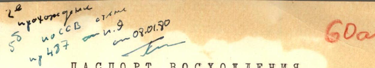
ASCENSION DOCUMENT
- Class of ascension: technical
- Area of ascension: Gissar Ridge
- Peak, its height and ascent route: p. Zamok, 5070 m, via N.N.E. wall
- Difficulty category: 5B rated, second ascent
- Route characteristics: total altitude difference 1230 m, average steepness of the route 71°, including technical parts 78°, route length 1868 m and sections of cat. diff. (m): 1 — 130, 2 — 160, 3 — 120, 4 — 270, 5 — 1010, 6 — 178
- Pitons driven: for rock protection 225, ice screws 11, bolt pitons 4. For creating ITO 8.
- Total number of climbing hours 50 h 10 min
- Number of overnight stays and their characteristics: 1 — comfortable, 1 — sitting, 2 — semi-reclining
- Surname, name, patronymic of the leader and participants and their sports qualification:
- Kiselyov Anatoly Mikhailovich, leader, Candidate for Master of Sports
- Burenin Yuri Alexandrovich, participant, 1st sports category
- Kompaniyets Igor Vasilyevich, participant, Candidate for Master of Sports
- Samsonov Vladimir Anatolyevich, participant, 1st sports category
- Date of departure on the route: July 5, 1977 and date of return from the route: July 10, 1977
- Team coach: Kiselyov Anatoly Mikhailovich
Brief explanations for the table
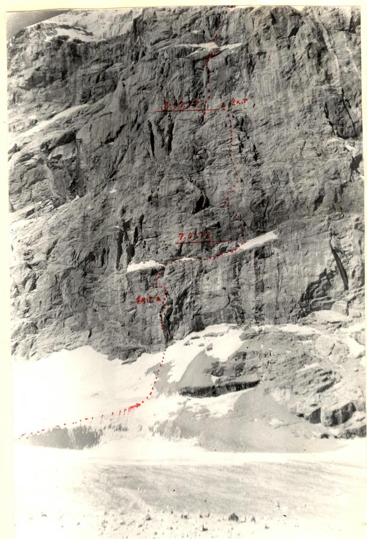
July 5, 1977
Processed part of the wall: sections R1–R9.
80 m along steep ice to a distinctly protruding rock "sickle" in the wall. Along the "sickle": 15 m up, traverse left 5 m and again up to the 1st control turret. Up to the right under a black cornice 20 m. The cornice is passed with a ladder and then 35 m up to debris-covered ledges, along which left to an internal corner, along it to a wide debris-covered inclined ledge crossing the entire wall massif. Pulling up backpacks.
July 6, 1977
Along the ledge to the right for 160 m, bypassing in the middle part rocks like "ram's foreheads," covered with ice and water — very dangerous! Exit under a 40-meter sheer wall. To the left, above, on a wide ledge, set up a bivouac.
Processed sections R13–R16. 40 m straight up, to the left of a waterfall, into an oblique, ruined crack, along which left up to a black triangle. 10 m before the black triangle, turn right onto a narrow ledge turning into a crevice, which leads to rocks like "ram's foreheads."
July 7, 1977
40 m up into a narrow chimney, in places turning into an internal corner with a series of small overhangs, in one place using a ladder — 110 m. The section is constantly under fire from dislodging ice above!
Exit onto a debris-covered inclined ledge, on which we set up a sitting bivouac. The whole day — pulling up backpacks.
July 8, 1977
Along the ledges left, slightly down, to the base of a water-filled chimney. The beginning of the chimney is passed under water flows. Exiting the chimney, traverse left 15 m and again up 30 m onto a rock slab — all on friction. Traverse left on friction and descend 15 m down to a narrow ledge, along which left up 25 m to the base of the second chimney.
The chimney is wide, with a plug, about 60 m. Before entering the chimney — 2nd control point.
Pulling up backpacks along the entire section. After the chimney:
- 40 m straight up
- 50 m left up into a rock window, which leads 20 m along ledges to a ridge
We quickly pass the ridge and turn left into a wide, ruined chimney, along which we exit onto a comfortable platform. To the right, up, we traverse onto one rope and ascend 40 m up to the base of the pre-summit bastion. The wall is sheer, entirely cut by cornices, which sometimes overhang up to 2 m. Here, in a grotto, we make a semi-reclining bivouac.
July 9, 1977
The first 80 m present a serious problem. Up a narrow crevice 15 m, then left up 20 m along crevices and small holds to an overhang. Traverse under the overhang along a crevice left, rocks wet, then left up along an internal blunt corner formed on the right by the same overhang, exit onto a small ledge for two feet.
From here, again along crevices, using ladders, we pass the overhanging part of the wall. Exit onto a ledge. Then another 30 m up — to the right along an internal corner and crevices onto the next, wider ledge. 3rd control point.
Further to the right up 20 m, then left up 15 m and traverse left 20 m along slabs. Another 20 m to the right and again traverse 60 m left along narrow slabs and ledges. Then up 15 m and through 2 m of overhang to the right, 30 m traverse along slabs. We exit onto a good debris-covered ledge, where we set up a bivouac.
July 10, 1977
Traverse left up 30 m along ledges, 15 m of sheer wall, almost without holds, up and again traverse left 40 m along the wall, bypassing it. Descent down 15 m leads into a steep, short couloir filled with ice. Along ice, then along snow and scree up to the summit dome, 20 m to the right of the summit turret.
Descent from the summit of Zamok along the southern ice slope, via the black gendarme, is not difficult (can be rated as 2B cat. diff.).
Table of main route characteristics
| I | 2 | 3 | 4 | 5 | 6 | 7 | 8 | 9 | 10 | II | I2 | I3 |
|---|---|---|---|---|---|---|---|---|---|---|---|---|
| 8.07.77 | min., rock destruction, water | |||||||||||
| 18. | 80 | 40 | friction, ledges | 5 | pitons | clear | 7:20 | 4 | – | – | sitting | |
| 19. | 90 | 45 | chimney, rock destruction, water | 5 | -»- | -»- | 9 | – | – | |||
| 20. | 80 | 15 | friction, rock wall | 5 | -»- | -»- | 3 | – | – | |||
| 21. | 80 | 30 | rock monolith | 5 | -»- | -»- | 7 | – | – | |||
| 22. | 80 | 6 | traverse wall | 6 | -»- | -»- | 4 | – | – | |||
| 23. | 90 | -15 | descent | – | -»- | -»- | – | 1 | – | |||
| 24. | 40 | 25 | narrow ledge | 5 | -»- | -»- | 4 | – | – | – | ||
| 25. | 90 | 60 | chimney with plug | 5 | -»- | -»- | 10 | – | 1 | |||
| 26. | 85 | 40 | rock monolith | 5 | -»- | -»- | 8 | – | – | |||
| 27. | 70 | 50 | rock monolith | 5 | -»- | -»- | 9 | – | – | |||
| 28. | 50 | 20 | rock destruction | 4 | -»- | -»- | 3 | – | – | |||
| 29. | 50 | 80 | rock destruction | 2 | -»- | -»- | 2 | – | – | |||
| 30. | 60 | 40 | rock destruction | 3 | -»- | -»- | 1 | – | – | |||
| 31. | 60 | 40 | destroyed chimney | 4 | -»- | -»- | 21:10 | 3 | – | – | semi-reclining | |
| 9.07.77 | ||||||||||||
| 32. | 80 | 40 | rock destruction | 4 | -»- | -»- | 7:30 | 4 | – | – | ||
| 33. | 90 | 80 | rock monolith | 6 | -»- | -»- | 19 | – | – | |||
| 34. | 100 | 6 | rock monolith | 6 | -»- | -»- | 2–3 | – | – | |||
| 35. | 85 | 30 | rock monolith | 5 | -»- | -»- | 6 | – | – | |||
| 36. | 70 | 20 | rock monolith | 5 | -»- | -»- | 3 | – | – | |||
| 37. | 80 | 15 | rock monolith | 5 | -»- | -»- | 3 | – | – | |||
| 38. | 75 | 20 | rock monolith | 5 | -»- | -»- | 4 | – | – | |||
| 39. | 75 | 60 | traverse along narrow ledges | 5 | -»- | -»- | 5 | – | – | |||
| 40. | 80 | 15 | rock monolith | 5 | -»- | -»- | 5 | – | – | |||
| 41. | 100 | 2 | rock monolith | 6 | -»- | -»- | 20:40 | 4 | – | 0,1 | sitting | |
| 10.07.77 | ||||||||||||
| 42. | 80 | 30 | friction slabs | 5 | pitons | clear | 8:00 | 3 | – | – | ||
| 43. | 90 | 15 | rock monolith | 5 | -»- | -»- | 5 | – | – | |||
| 44. | 80 | 40 | traverse narrow | 5 | -»- | -»- | – | – | – | |||
| 45. | 90 | -15 | descent | – | -»- | -»- | 1 | – | – | |||
| 46. | 50 | 20 | ledges | 4 | -»- | -»- | 3 | – | – | |||
| 47. | 40 | 80 | ice | 2 | -»- | -»- | – | 6 | – | |||
| 48. | 40 | 110 | snow, scree via ice | 1 | -»- | -»- | – | – | – | |||
| 49. | 30 | 20 | ridge | 1 | -»- | -»- | 13:40 | – | – | – |