6
0Sokuluk
Mountain range528.82 km²
The Best Month for Ala-Archa
 ELEvgenii Lepikhin
Weather in Ala Archa National Park by month: temperature, stability, precipitation, and safety recommendations for climbers.
People often ask about the weather in Ala-Archa, when the best season is, and when it's safe to ice climb. I've decided to put this information into a micro-article.
January
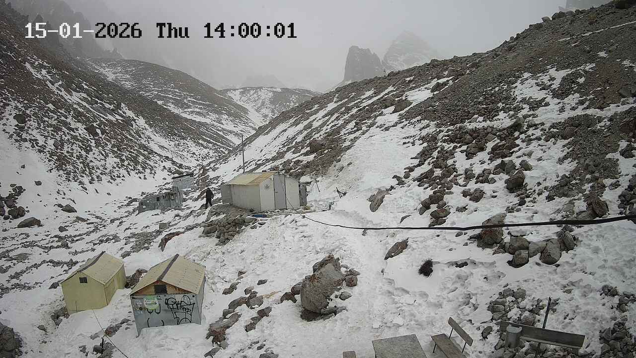 Stable weather, many sunny days, often calm. The temperature at Ratschek hut is -10 to -20°C with rare deviations from this range. However, there's only 2 hours of sunlight per day, not enough to warm up.
February
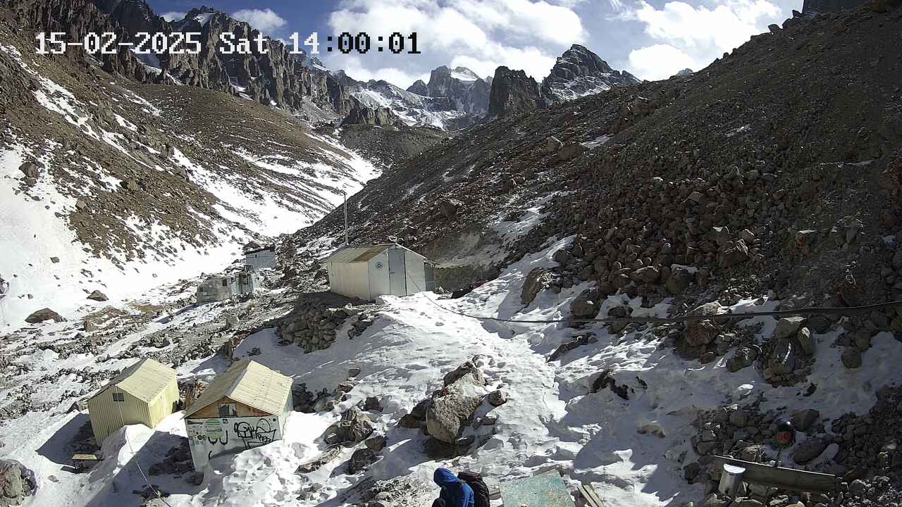 Almost like January, but towards the end of the month, stability is lost – March is approaching.
March
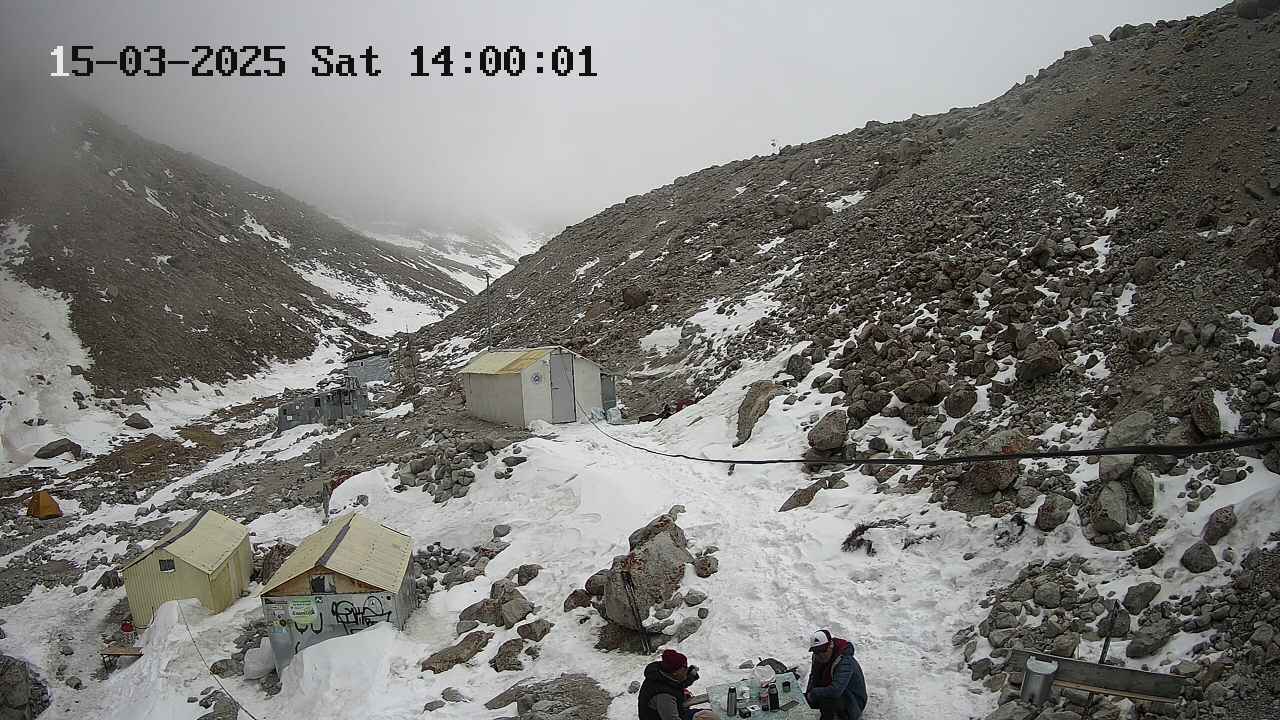 Very unstable weather. Stormy winds can last for 2 consecutive days, and fog can hang for 2 weeks. Heavy snowfalls are rare but possible. On good days, even in early March, it's sometimes possible to walk in a T-shirt when the sun is out. Daytime temperatures range from -10 to +5°C.
April
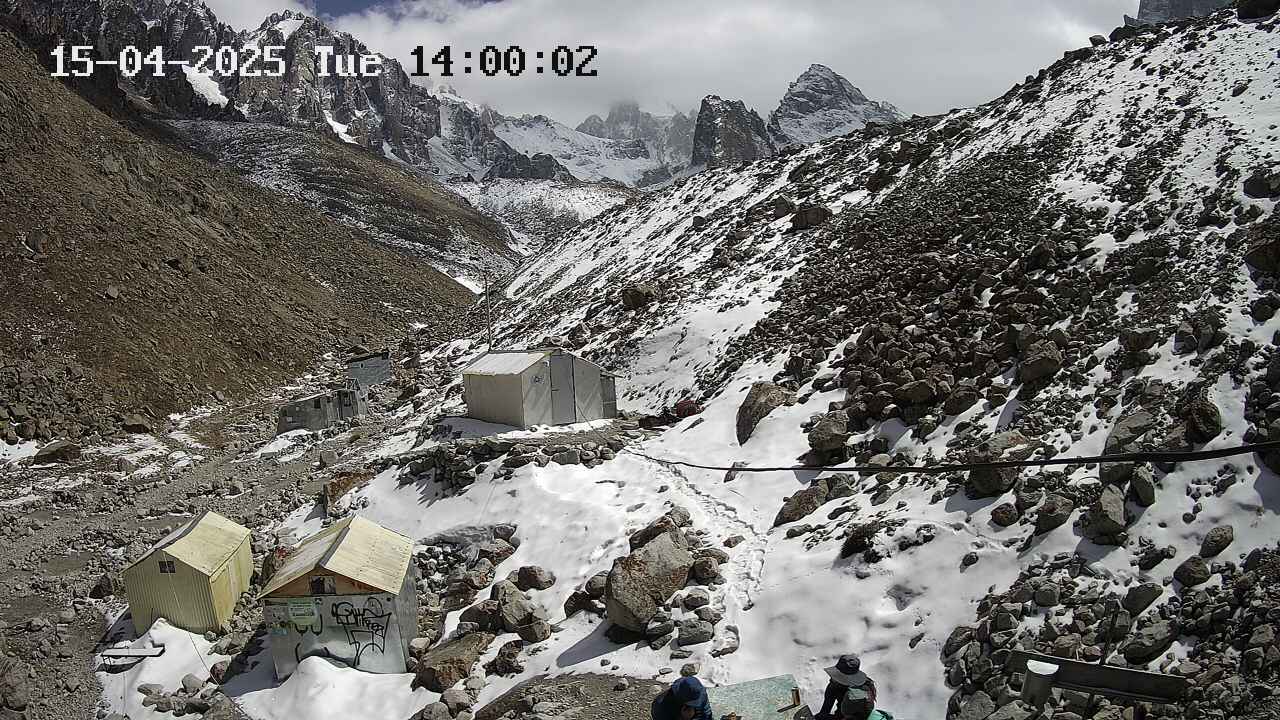 The same March winds, but it gets warmer.
May
Route Description: центр. кф. СЗ стены
 SSummitMate
Report on the first ascent of Chon-Tor peak (4180 m) via the NW wall with a detailed description of the route and the team's tactics.
V. Chon-Tor 4180 m
Ascent Passport
- Region — Tian Shan, Kyrgyz Ala-Too Range, 7.4
- Peak — Chon-Tor 4180 m, via the central buttress of the NW wall, "The Spirit of Adventure"
- Proposed — 6A cat. diff., first ascent
- Route characteristic — rock
- Route sections characteristic Total elevation gain — 892 m Wall section elevation gain — 638 m
3
0Route Description: Glazunov
SSummitMate
*Report on the first ascent of the route of 6A category of complexity via the north-west wall of Chon-Tor peak (4165 m) in Tian Shan*
Alpinism Federation of the Republic of Buryatia
"Gory Baikala" Alpinism Club
Report on the ascent of the team from the Republic of Buryatia for participation in
the Russian Championship in Alpinism in the snow-ice class
To the summit of Chon-Tor 4165 m
Via the right bastion of the Northwest Wall 6A, first ascent
Ulan-Ude 2016
Ascent Passport
- 7.4 — Tian Shan, Kyrgyz range, Belogorka gorge (Sokuuluk river).
4
0Route Description: СЗ кф.
SSummitMate
Description of the route along the northwest wall of the mountain, R2 complexity category, with technical details and assessment of the complexity of individual sections.
R2 60 m 75° IV
R1 40 m 2A
R0 150 m 2A
+
+
0
0Route Description: СЗ кф.
SSummitMateDescription of the route to the summit 3900 m via the north-western counterforce, category of difficulty 3B, with recommendations and notes on passage and belay.
Route Description
to peak 3900 m (site "Uglovoy") via NW ridge, cat. III Having left the bivouac located near the Hydrometeorological Station on Golubina Glacier, cross the glacier and approach the route. Section O–I — an inclined, free rock shelf with a slope of 35° is traversed simultaneously with belay on protrusions. A control cairn is located on a small ledge. From the control cairn, go straight up the wall with a slope of 65° — a passage of medium difficulty, 40 m. Convenient belay points. 8–9 pitons per rope. Section 2–3 — an exit to a gendarme — 60 m: the slope increases to 75°, belay points are convenient, rocks are heavily destroyed, also 8–9 pitons per rope. 4 hours from the start of the route. Bypassing the gendarme (section 3–4) along the main shelf with a slope of 40° simultaneously with belay through protrusions. Further, 120 m along a steep wall of medium difficulty with a slope of 85° (in some places up to 90°). Piton belay — up to 10 pitons per rope. From here, moving simultaneously in traverse to the left along destroyed rocks, exit to the summit. 4 hours from the gendarme. Descent along the ridge to the last gendarme (simultaneous movement). From the last gendarme, rappel 60 m to the western side with an exit to the main shelf. Further, to the ice-snow plateau and down the couloir of route 2A to peak 4 IO 7, descend to Golubina Glacier. Recommendations:
- Most of the route is traversed on friction, so it is not recommended to move along the route in bad weather. Note: I. In general, according to the length of sections of category IV, the route deserves category 4A difficulty, however, its relatively small overall length allows recommending it to be classified as 3B.
- The large number of pitons indicated in the report is explained by the low qualification of the participants (III sports category) and the fact that this ascent was a first ascent.
0
0Route Description: СЗ кф.
SSummitMateClimbing passport for Peak Uglovoy (3900 m), first ascent, 3B difficulty category, Kyrgyz Range, Golubina lake area.
Ascent Passport
to p. Uglovoy (3900) First Ascent
- Type of ascent — rock climb. 2. Region of ascent — Kyrgyz range, Golubina lake area
- Peak "Uglovoy" (conditional name) 3900 m according to NW classification, rock climb route
- Proposed category of difficulty — 3B. 5. Route characteristics: height difference — 450 m, length — 530 m, including sections of III–IV category of difficulty — 220 m, average steepness — 58°
- Pitons hammered — 14/2 protection gear — 11/4
0
0Route Description: С гребню
SSummitMateDescription of the ascent route along the northern ridge to the Peak 30 let VLKSM (Kyrgyz Range), complexity category 2B, ascent duration is about 7 hours.
Location. The Peak 30 let VLKSM is located on the ridge of the Jalamyshsky spur of the Kyrgyz Range and is its first peak to the north of the junction, where this spur branches off in a practically meridional direction from the Sokuluksky spur. To the north of the peak, its other neighbor, the Panfilov Peak, rises. From the summit to the east, a counterfors runs, which flows along the Yu. Adygene glacier, making a turn to the north. The entire northern slope of the counterfors is covered with a hanging glacier, which forms a small glacier at the foot. The western slope of the peak is steep and dissected by numerous rocky ribs made of crystalline chlorite schists. Externally, the summit resembles a regular three-faced pyramid and is well visible from the entire Adygene area.
Ascent via the North Ridge
The route, like the previous one, starts from the "Elektro" campsite and coincides with it in the initial part. After the slope of the Elektro peak turns to the west, you should not go to the left morene of the Yu. Adygene glacier. You need to continue moving along the same hollow in the southern direction, where the beautiful pyramid — the goal of the ascent — is almost always visible. The hollow leads to the valley between the Panfilov Peak and the Peak 30 let VLKSM, which forms two chambers here:
- the northern one
- the southern one, adjacent directly to the Peak 30 let VLKSM From this valley, the bottom of which is paved with morenic ridges, it is necessary to ascend to the ridge connecting the two mentioned summits. There are two variants of the path to this ridge:
- The first one: along the slope with an exit to the col (the 30 let VLKSM pass) from the southern chamber. The path to the pass runs along a loose scree.
0
0