
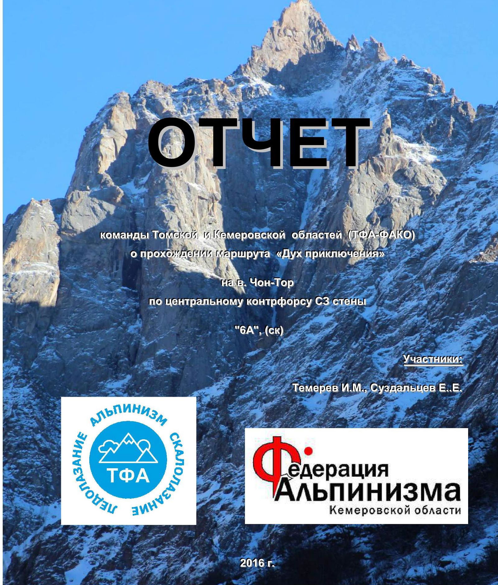
V. Chon-Tor 4180 m
Ascent Passport
- Region — Tian Shan, Kyrgyz Ala-Too Range, 7.4
- Peak — Chon-Tor 4180 m, via the central buttress of the NW wall, "The Spirit of Adventure"
- Proposed — 6A cat. diff., first ascent
- Route characteristic — rock
- Route sections characteristic Total elevation gain — 892 m Wall section elevation gain — 638 m Route length — 1250 m Average slope of the entire route — 56° Average slope of the wall section — 70° Length of 6 cat. diff. sections — 365 m 5 cat. diff. — 400 m
- Equipment left on the route: anchor hooks — 3
bolt hanger hooks — 0,
chocks — 0.
Total TME used — 423.
Including:
- removable protection — 246
- rock anchors — 106
- rock flanges — 60
- rock hooks — 10
- hole skyhooks — 1
- Total climbing hours — 28 days — 3, descent — 6 h
- — Leader: Temerev Ivan Mikhailovich, MS Team member: Suzdaltsev Egor Evgenievich, CMS
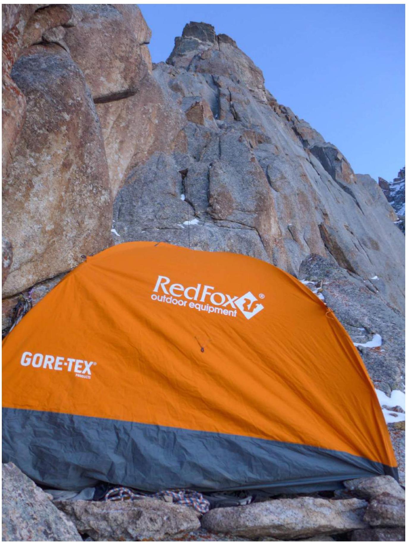
- Route entry: 07:00, January 22, 2016 Summit: 16:35, January 24, 2016 Overnights on the route: 2 during ascent and 1 during descent, all on ledges in a tent. Return to Base Camp: 14:00, January 25, 2016
- Responsible for the report: I.M. Temerev, +7 952 882 31 51, ivantem@ngs.ru.
Video about the ascent available at Loading video...
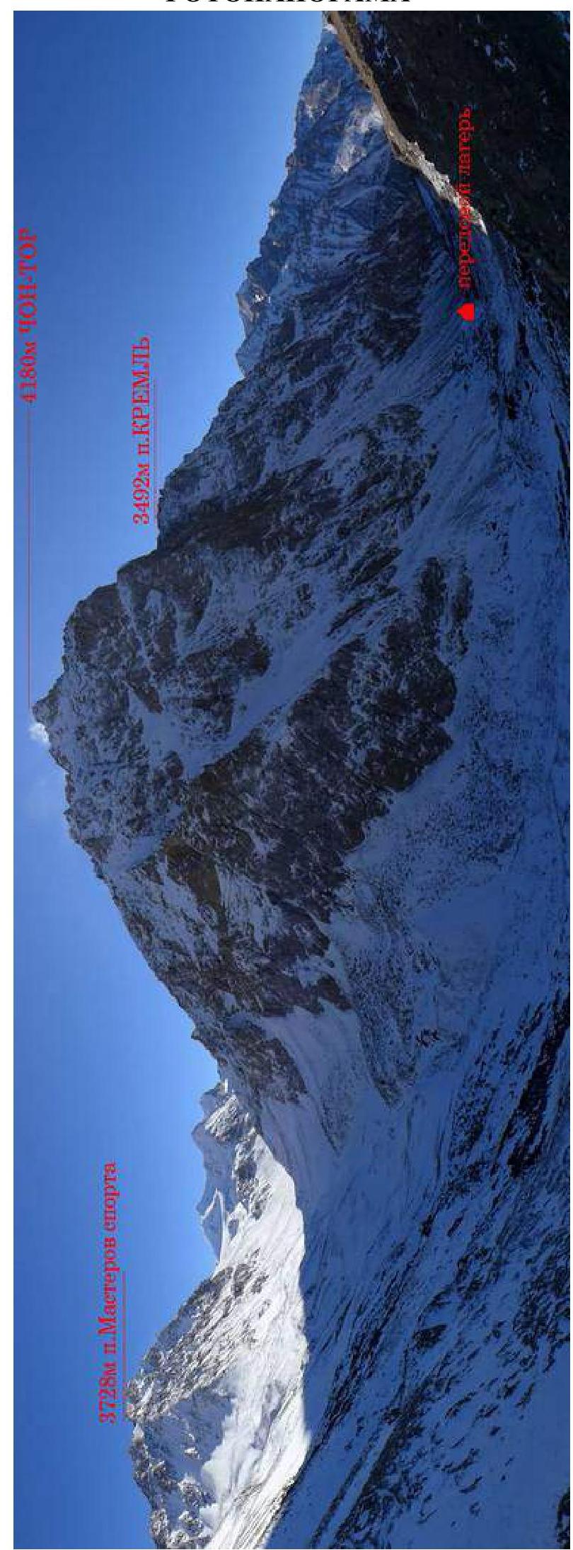
Area Map
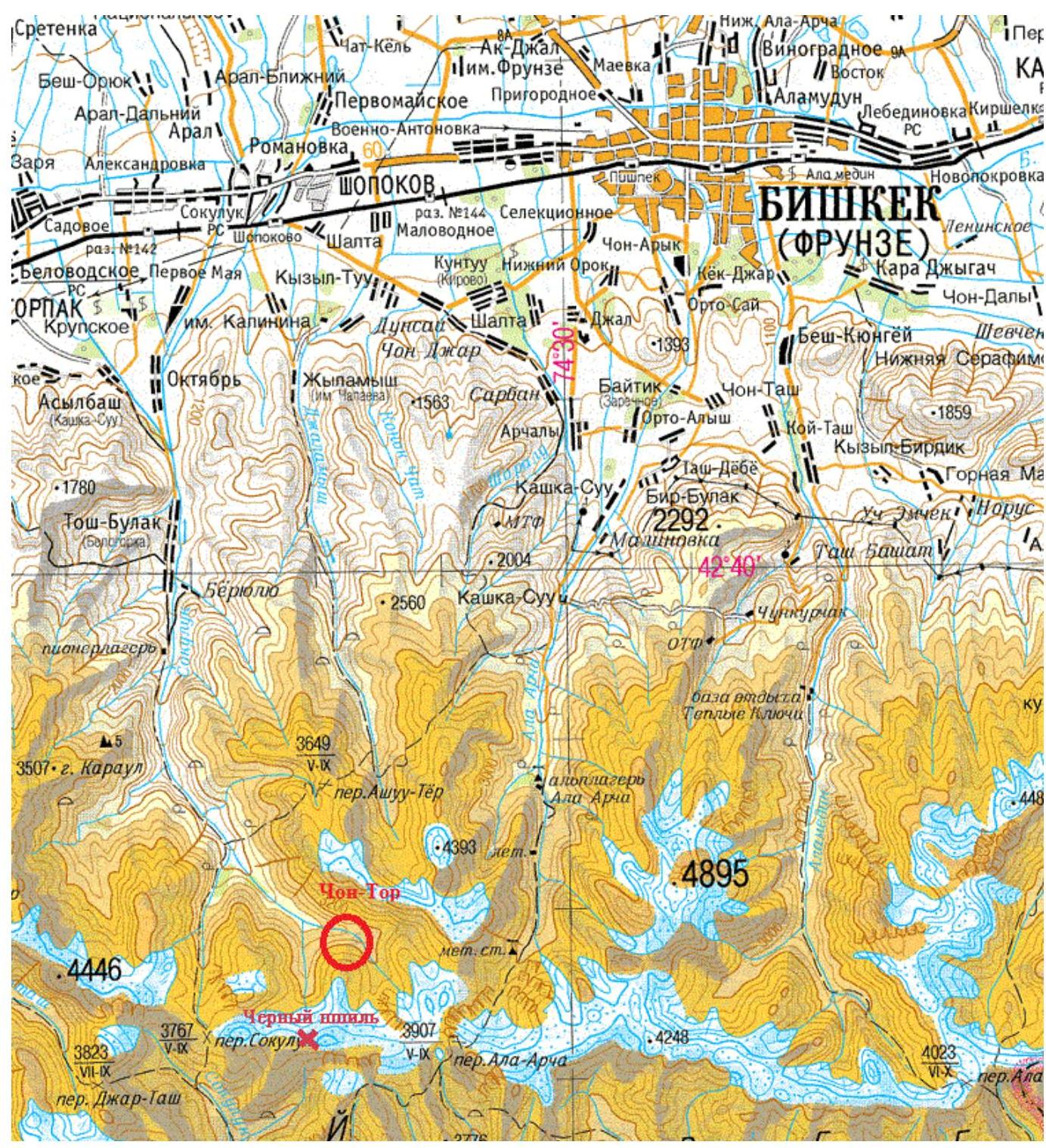
Mutual Location Diagrams of Peaks and Passes in the Northern Tian Shan (Kyrgyz Ala-Too Range) Upper Reaches of the Ala-Archa Valley

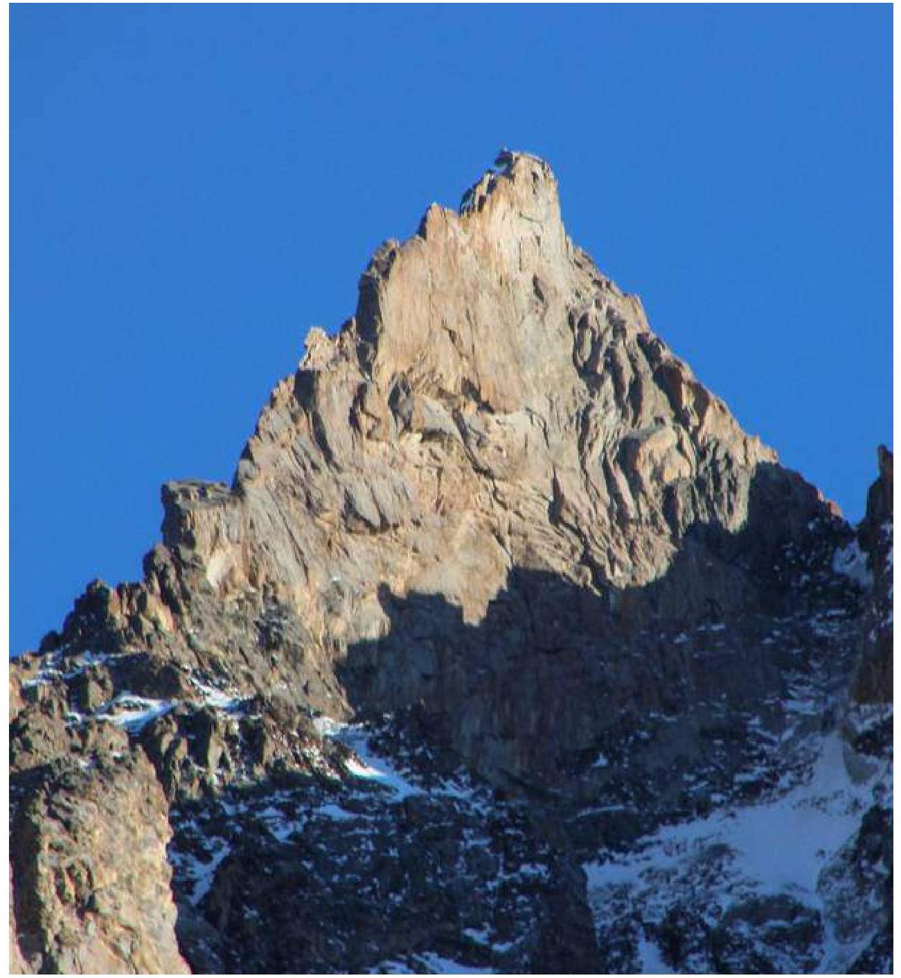
General Photo of the Summit with the Route
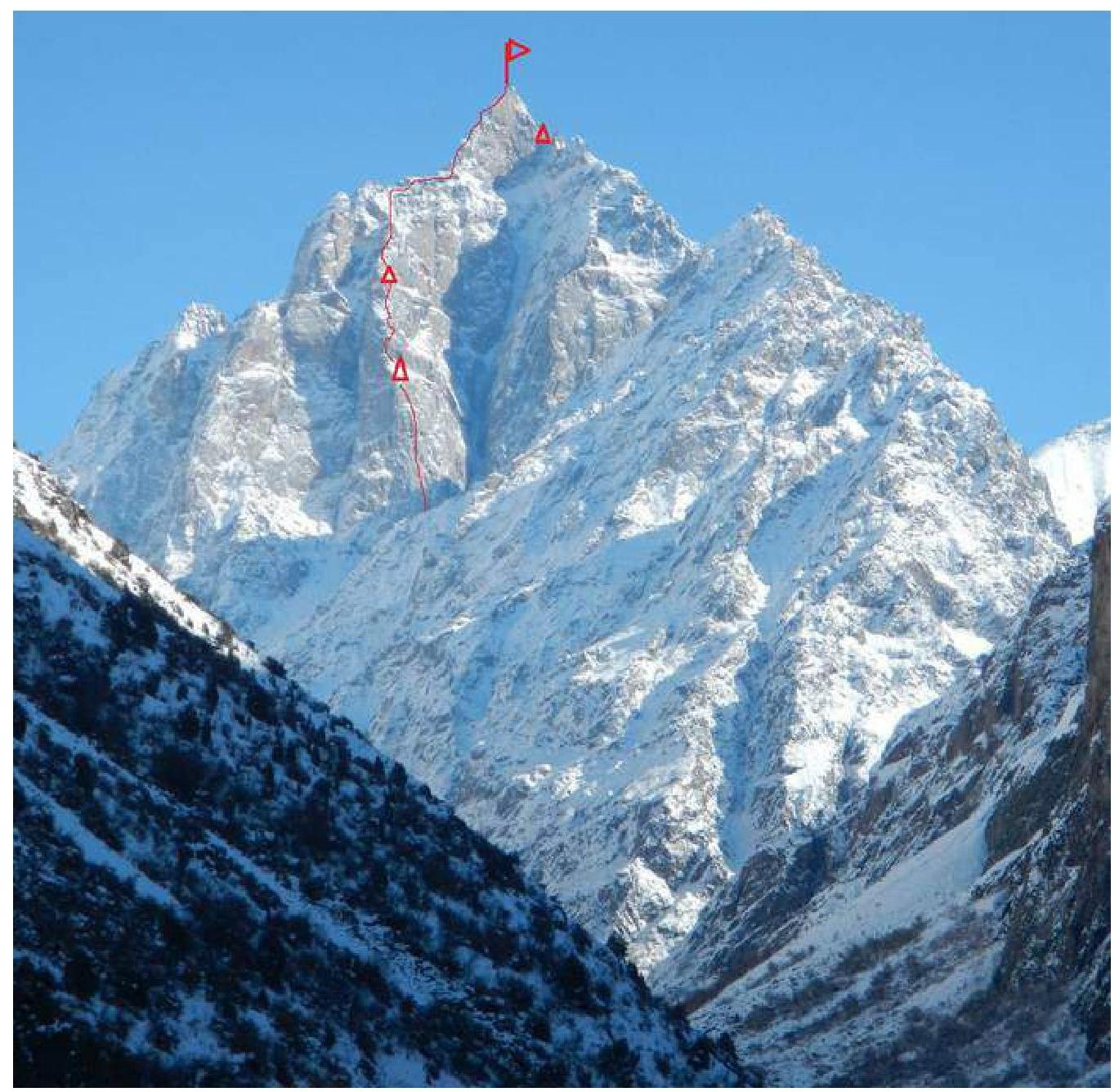
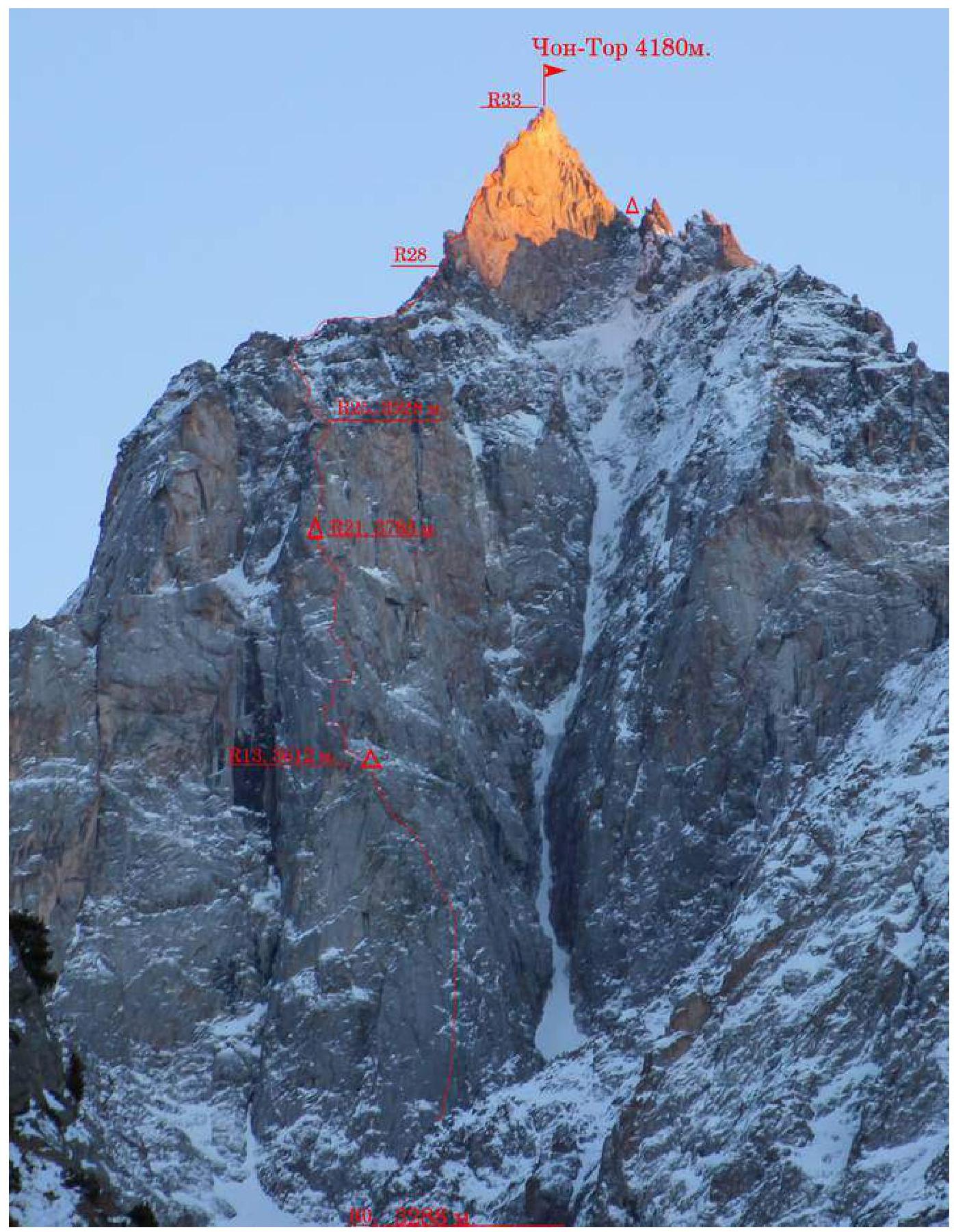
Route Profile
Summit Tower Profile
Drawn Route Profile

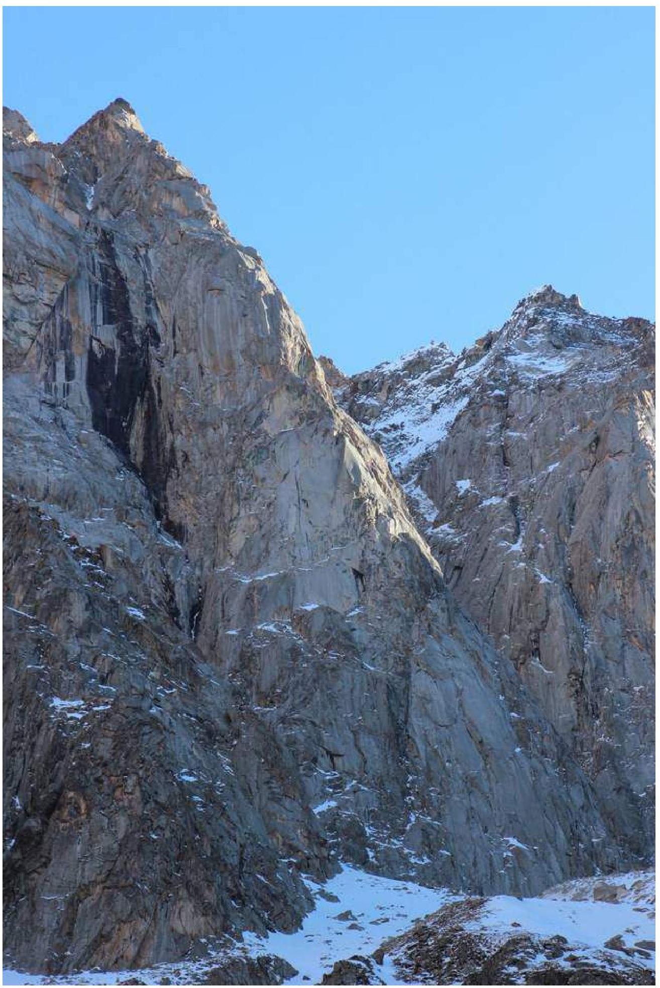
Photopanorama
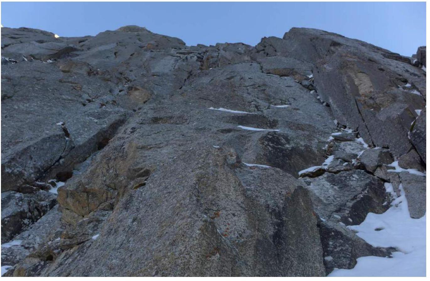
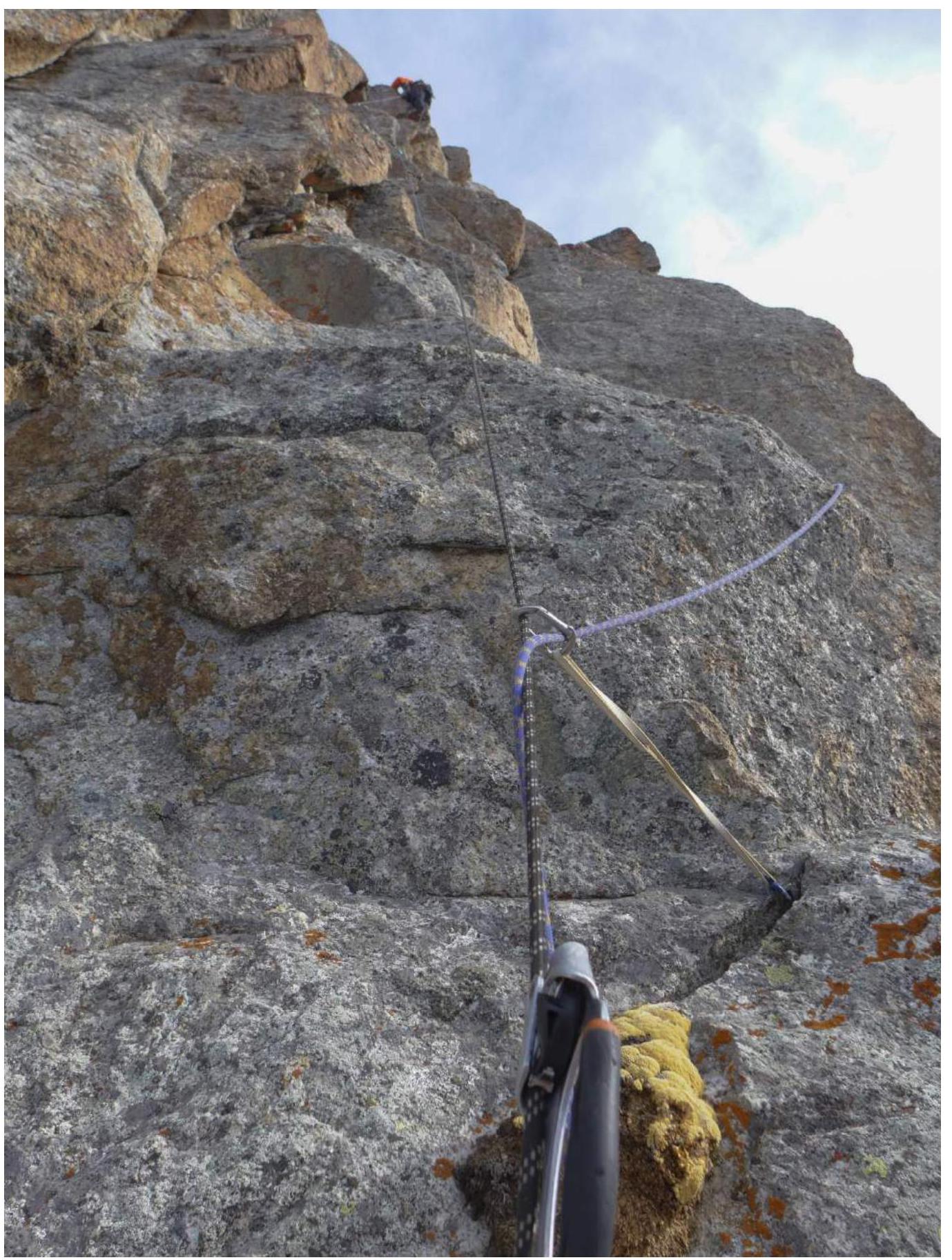
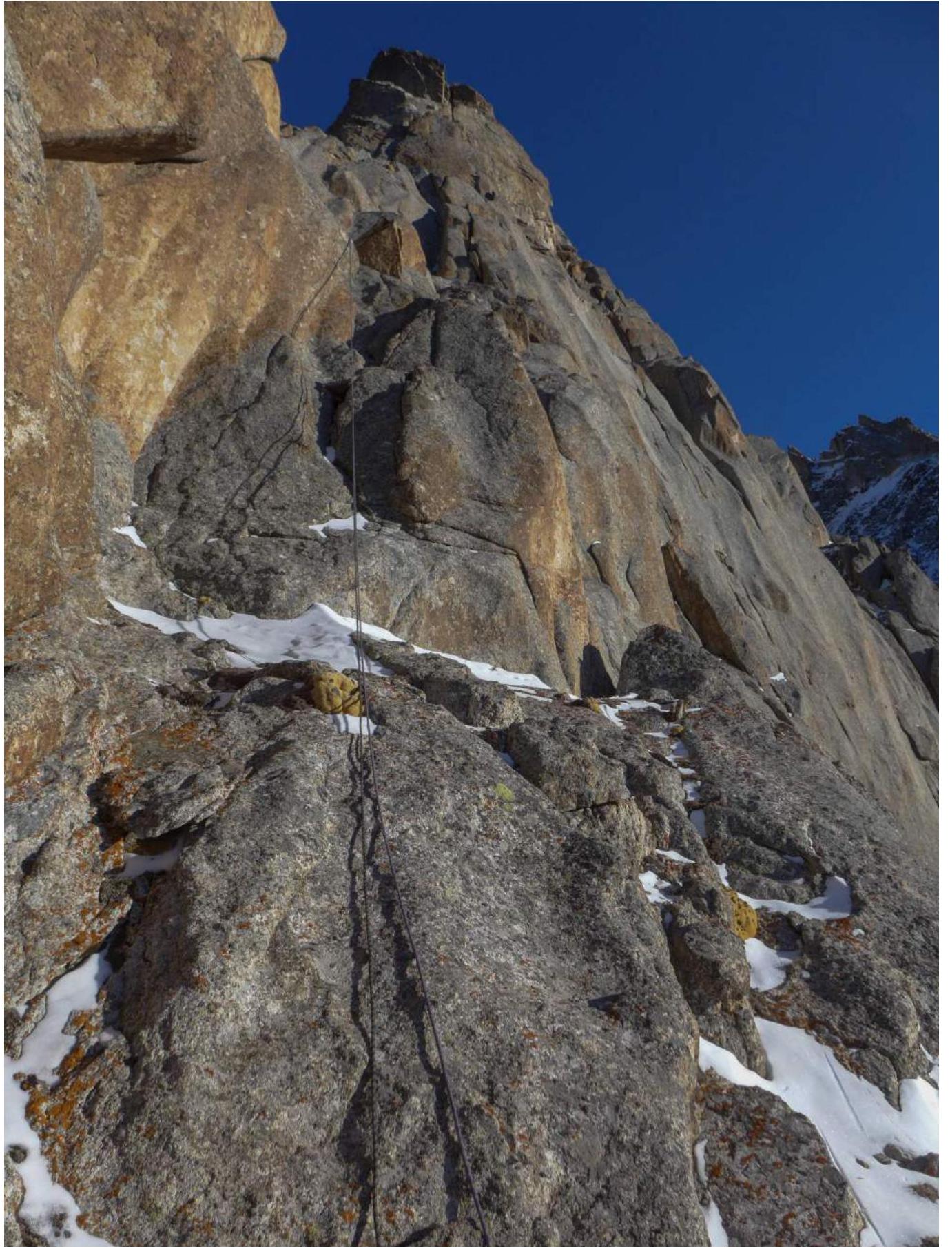
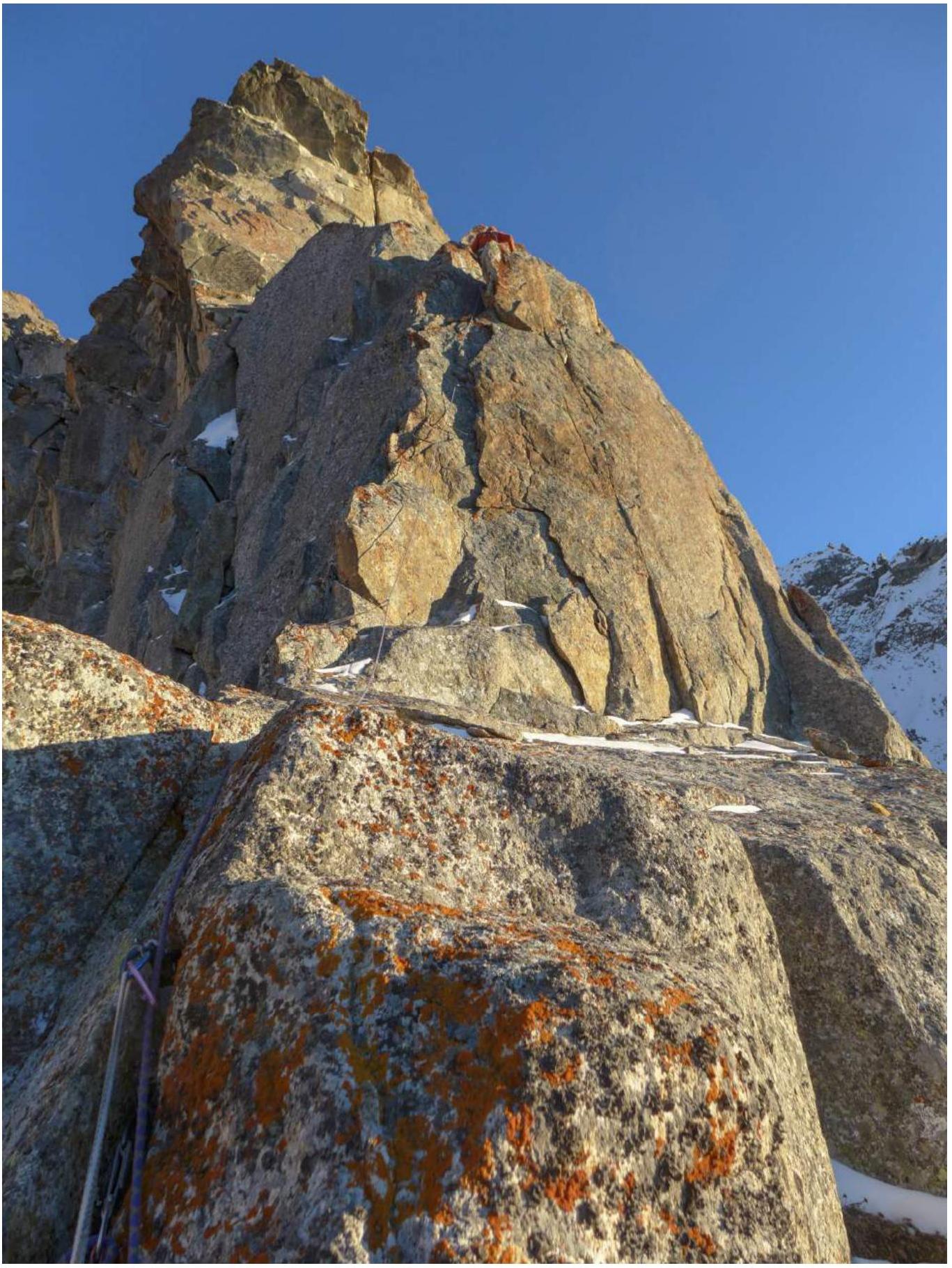
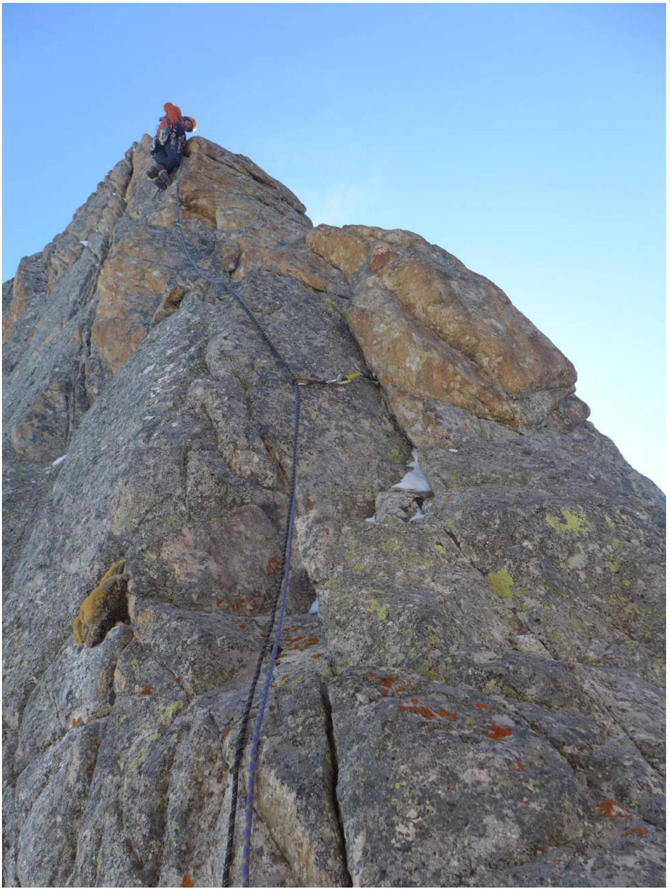
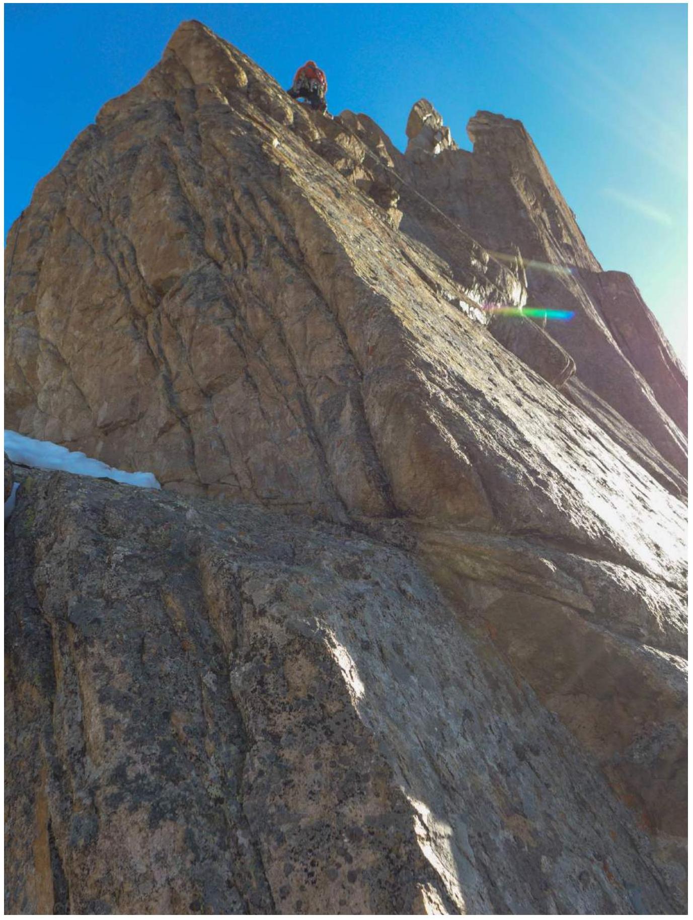
Technical Route Photo
Tactical Team Actions
We chose what we believe to be the most logical and challenging line on the wall. The route is relatively safe as the entire movement follows the buttress.
- On January 21, 2016, we established an advanced base camp in the Chon-Tor valley, 200 m below the base of the wall.
- By 17:00, we carried all the equipment under the wall to the start of the route.
- We began the ascent on January 22 without prior processing and acclimatization above 3000 m.
- We brought a satellite phone but decided to leave it in the advanced base camp after discussion.
January 22, 2016:
- Started work on the route at 07:00.
- Movement was simultaneous with the leader being belayed by the second team member from a fixed anchor.
- E.E. Suzdaltsev led.
- After completing section R9 at 15:00, I.M. Temerev took the lead.
- We stopped for the night at 17:30.
January 23, 2016:
- Started work at 07:00.
- I.M. Temerev led.
- We reached one of the key sections of the route — a continuous section of TME.
- We processed 1.5 ropes to section R23 by 18:00 and descended to the overnight bivouac.
January 24, 2016:
- Started work at 07:30.
- Completed the wall section by 10:30.
- The exit was heavily deteriorated.
- We then moved simultaneously along the ridge.
- At section R26, we switched to alternate movement.
- We began processing the summit tower at 14:00.
- Reached the summit at 16:35 and started descending via the SE wall 10 minutes later.
- We made two rappels on our own anchors and set up an overnight bivouac (prepared a platform).
January 25, 2016:
- Started descent at 07:00.
- Organized a 60 m rappel about 350 m down in a couloir narrowing — left a similar anchor as on the summit.
- Continued on foot, gradually moving right and switching to adjacent couloirs.
- The entire descent (over 600 m of elevation loss) was through firn couloirs.
- The descent route — from bottom to top — is not visible.
Route Diagram in UIAA Symbols
| Section # | Length, m | Slope, deg. | UIAA Symbol Diagram | Cat. Diff. |
|---|---|---|---|---|
| R9–R10 | 40 | 50° |  | V |
| R8–R9 | 10 | 80° | VI+ | |
| R7–R8 | 25 | 85° | VI, A2 | |
| R6–R7 | 30 | 75° | VI+, A1 | |
| R5–R6 | 20 | 65° | V | |
| R4–R5 | 25 | 90° | VI, A2 | |
| R3–R4 | 30 | 45° | IV | |
| R2–R3 | 30 | 80° | VI, A2 | |
| R1–R2 | 30 | 70° | V+, A1 | |
| R0–R1 | 30 | 75° | V+, A0 |
| Section # | Length, m | Slope, deg. | UIAA Symbol Diagram | Cat. Diff. |
|---|---|---|---|---|
| R19–R20 | 50 | 80° |  | VI, A2 |
| R18–R19 | 15 | 70° | VI, A3 | |
| R17–R18 | 15 | 45° | 3 | |
| R16–R17 | 8 | 75° | VI, A2 | |
| R15–R16 | 25 | 75° | VI, A2 | |
| R14–R15 | 30 | 90° | VI+, A3 | |
| R13–R14 | 15 | 70° | V- | |
| R12–R13 | 30 | 30° | V | |
| R11–R12 | 75 | 60° | IV | |
| R10–R11 | 20 | 70° | V |
| Section # | Length, m | Slope, deg. | UIAA Symbol Diagram | Cat. Diff. |
|---|---|---|---|---|
| R26–R27 | 100 | 30° |  | III |
| R25–R26 | 50 | 20° |  | II |
| R24–R25 | 25 | 90° |  | VI, A3 |
| R23–R24 | 10 | 75° | 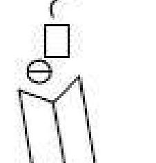 | V |
| R22–R23 | 50 | 75° | 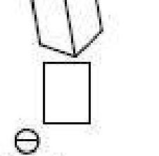 | V+ |
| R21–R22 | 50 | 75° | 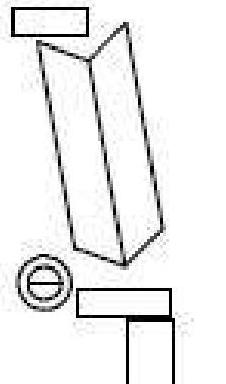 | V |
| R20–R21 | 15 | 80° | IV |
| Section # | Length, m | Slope, deg. | UIAA Symbol Diagram | Cat. Diff. |
|---|---|---|---|---|
| R32–R33 | 15 | 55° | V | |
| R31–R32 | 55 | 65° | V+, A1 | |
| R30–R31 | 50 | 75° | VI, A1 | |
| R29–R30 | 25 | 80° | VI, A2 | |
| R28–R29 | 50 | 70° | III | |
| R27–R28 | 150 | 5° | I |
Route Description by Sections
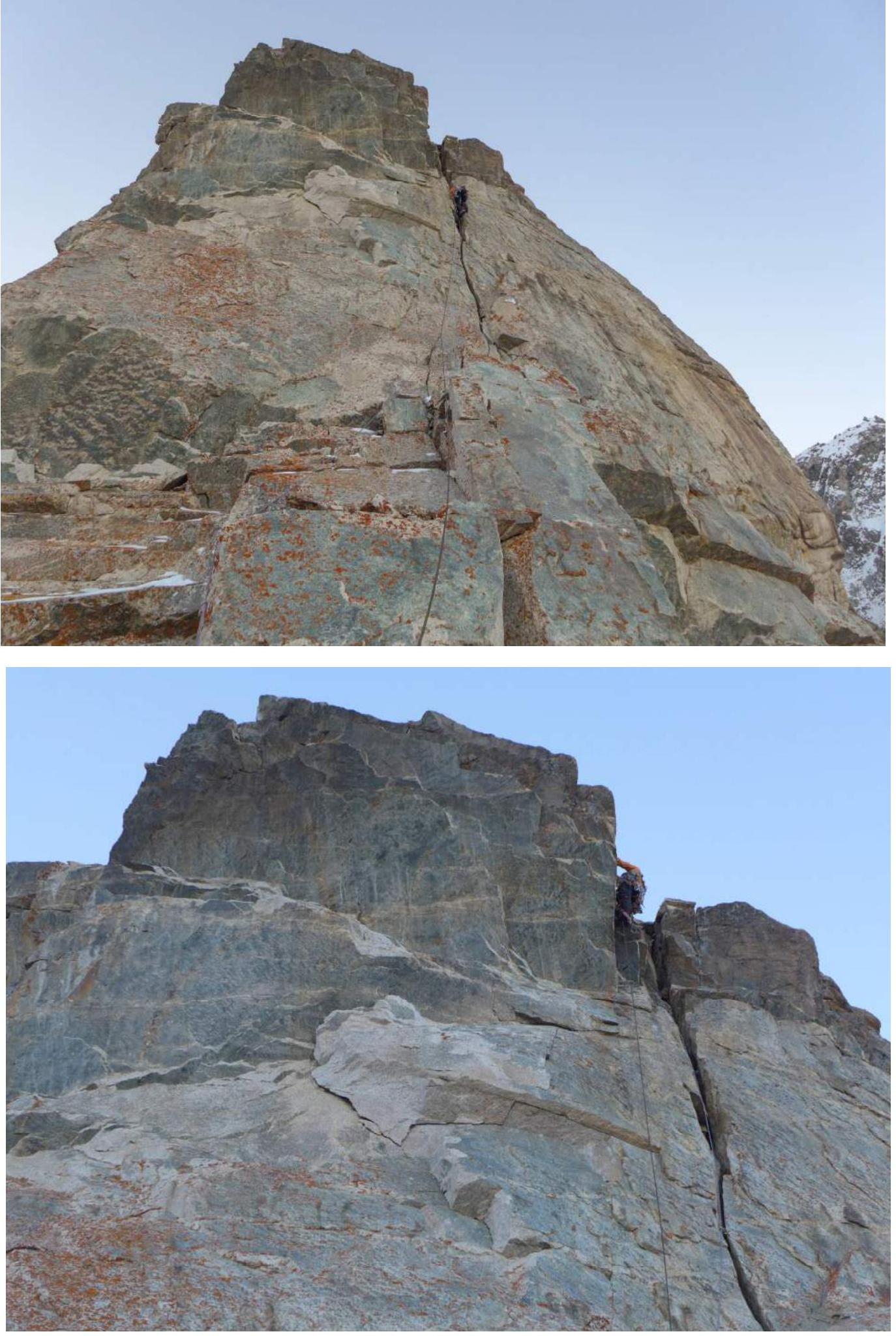
R0–R1 Monolithic internal corner, movement straight up with a slight deviation to the right, cracks filled with snow. Periodic movement on TME.
R1–R2 Along the internal corner. Station on an indistinctly marked ledge under a small cornice.
R2–R3 The cornice is bypassed on the right along a rock wall, followed by TME along a crack. Then a small rock wall.
R3–R4 A series of small internal corners and walls. Station on a snowy ledge.
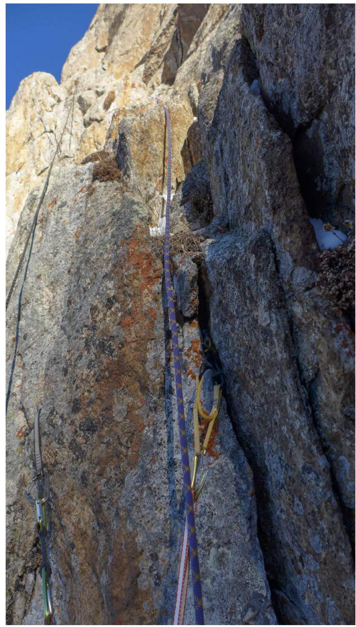
R4–R5 Along the ledge to the left 5 m. Then TME along a crack transitioning into a small internal corner. The crack is filled with snow and earth. местами TME on mossy knobs.
R5–R6 Small rock wall, followed by an indistinct internal corner.
R6–R7 Internal corner abutting a rock wall, strenuous climbing.
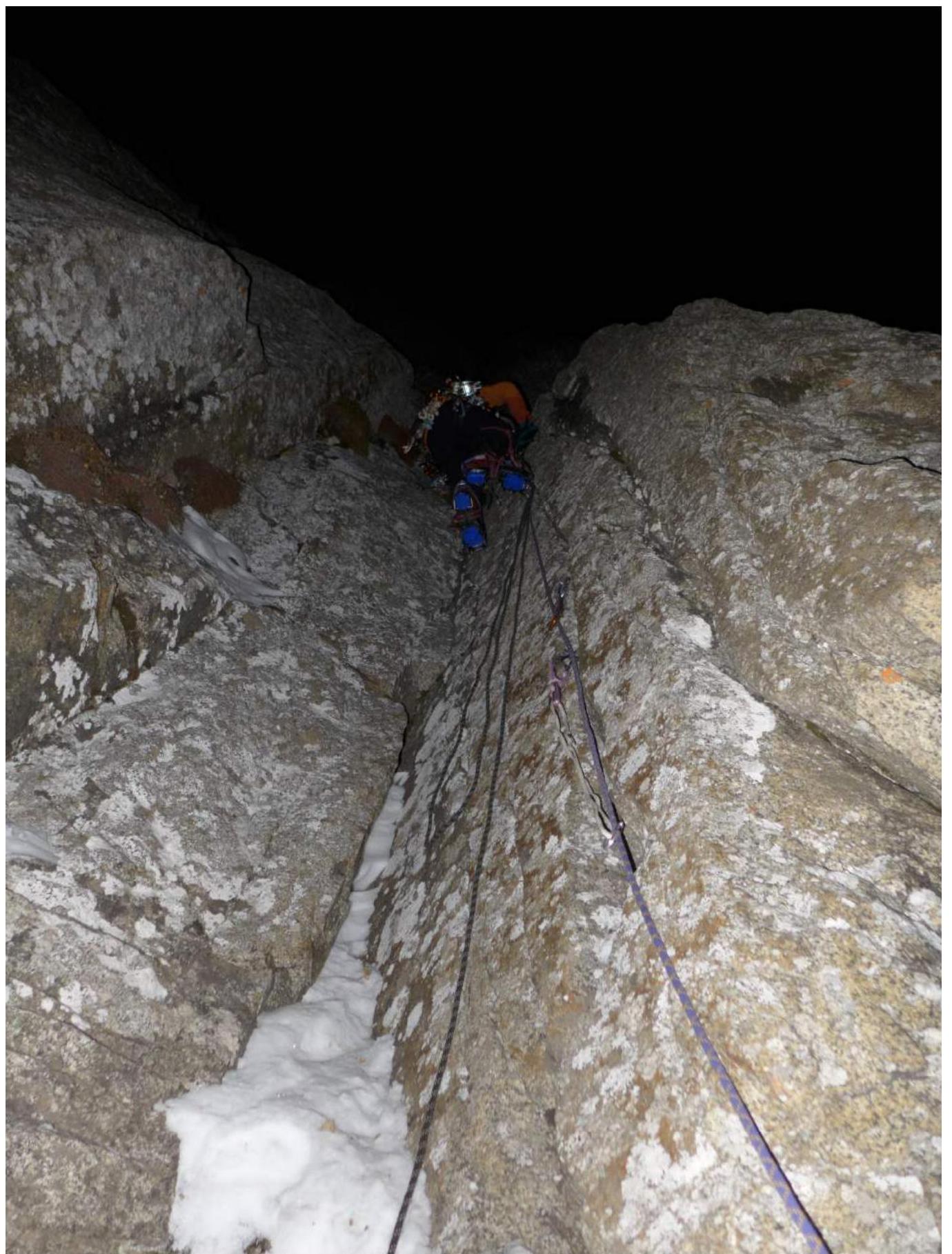
R7–R8 TME along a crack. The crack is heavily clogged with earth. Then left through a very narrow chimney. Station at the base of the chimney.
R8–R9 Strenuous climbing up the chimney.
R9–R10 Series of internal corners and sloping ledges.
R10–R11 Left through a rock wall into the base of an internal corner.
R11–R12 Movement along the internal corner, deviating diagonally to the left.
R12–R13 Through a small wall and along sloping ledges, we approach the overnight bivouac site. The ledge is very narrow for two people.
R13–R14 Approach under a vertical wall. Climbing is strenuous, with several steps on TME.
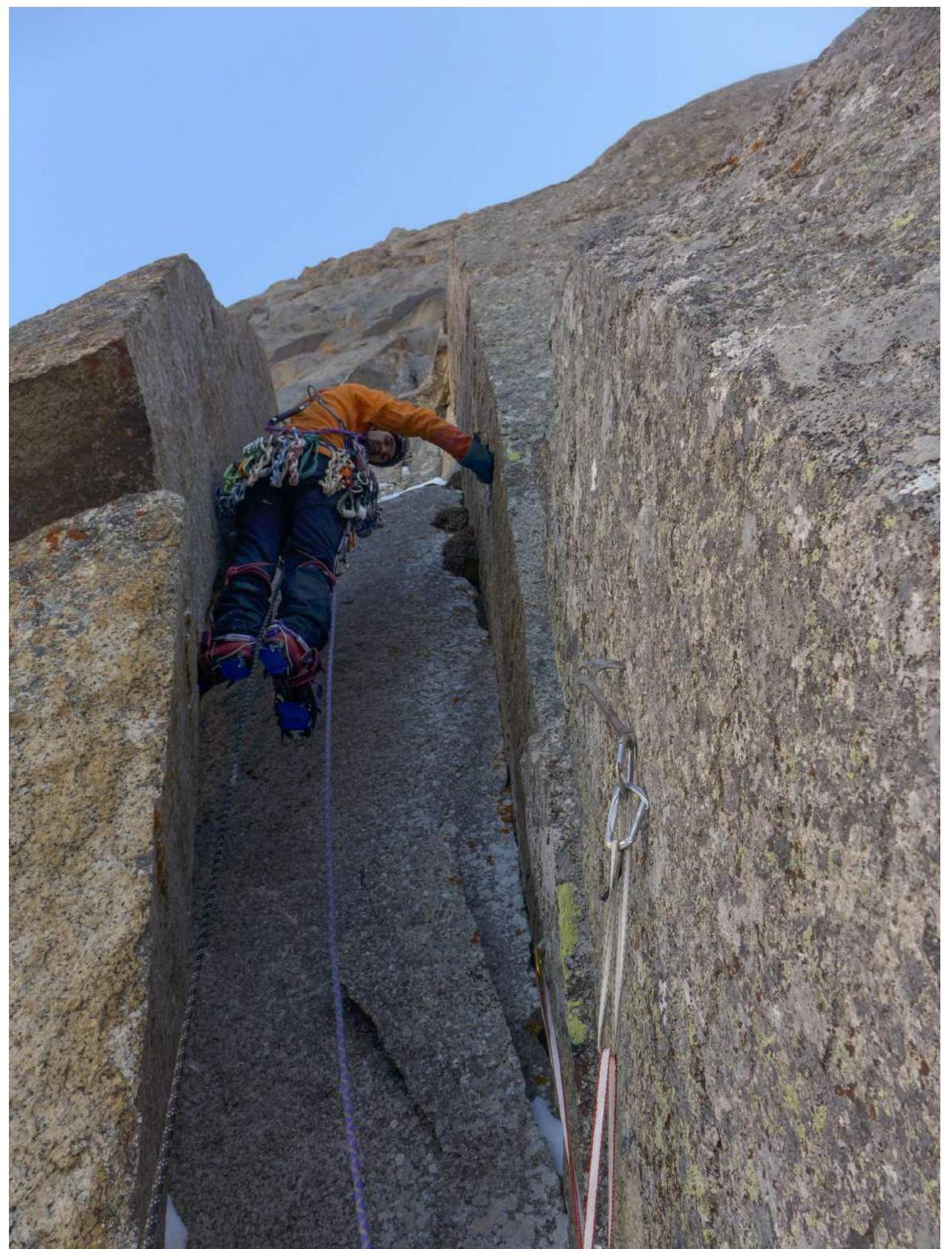
R14–R15 Wall with a series of discontinuous cracks. Strenuous TME on unreliable points. Movement is hindered by frozen earth in narrow cracks. Pendulum swing from one crack to another.
R15–R16 Right around the corner into the base of an internal corner.
R16–R17 TME along a crack on the right wall of the corner, bypassing a small cornice, followed by a traverse left 5 m. Exit onto slabs.
R17–R18 Sloping slab leading to a small rock wall. Convenient ledge in front of the wall.
R18–R19 Through the wall, TME along a very thin, shallow crack. Extremely unreliable points (anchors barely hammered in). At the exit, one hole for a 6 mm skyhook. Possibly, in summer with rock shoes, this section can be climbed.
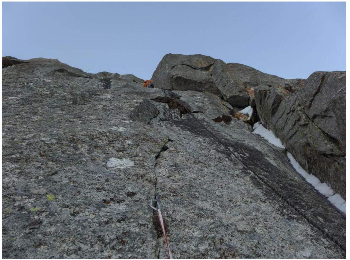
R19–R20 Up and right along a crack around the corner into the base of a large internal corner. Then movement along the internal corner. Climbing is interspersed with TME.
R20–R21 Simple, destroyed wall leading to a good ledge at the base of a large internal corner.
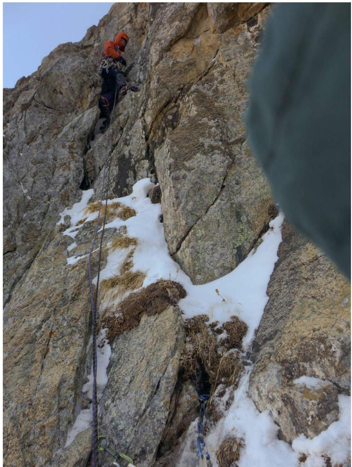
R21–R22 Movement along the internal corner.
R22–R23 Rock wall and then along the internal corner.
R23–R24 Small wall leading to an edge. Approach under a wide crack.
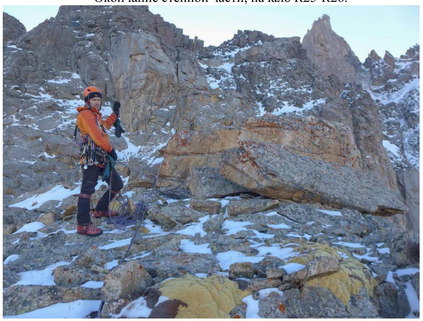
R24–R25 Up the crack under a cornice. The rock becomes increasingly destroyed. We knocked off several large blocks. TME on large camalots. BD #4 required. Before exiting through the destroyed cornice, we move left onto a destroyed rock wall. Very strenuous TME. Many loose blocks at the transition; can be knocked off when moving on a rope to the second climber. End of the rock bastion.
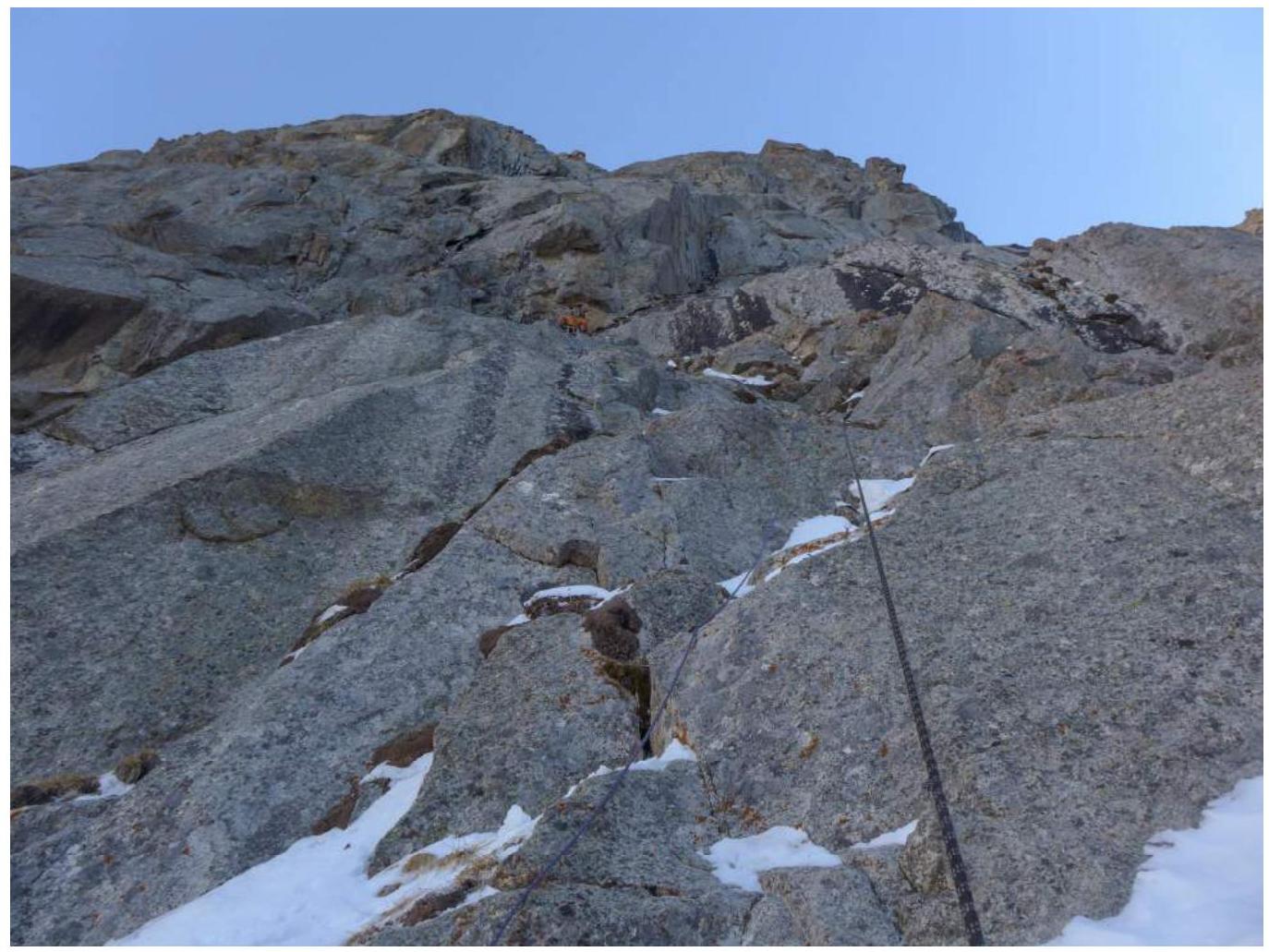
R25–R26 Movement along a simple ridge.
R26–R27 Along snow-covered destroyed rocks, moving towards the eastern ridge.
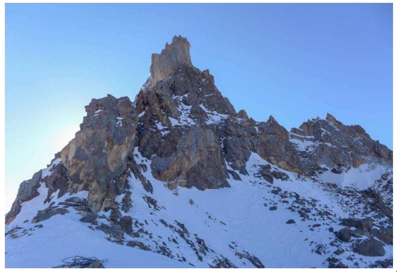
R27–R28 Along a wide ridge towards the summit tower.
R28–R29 Highly destroyed rocks. Approach under the summit tower.
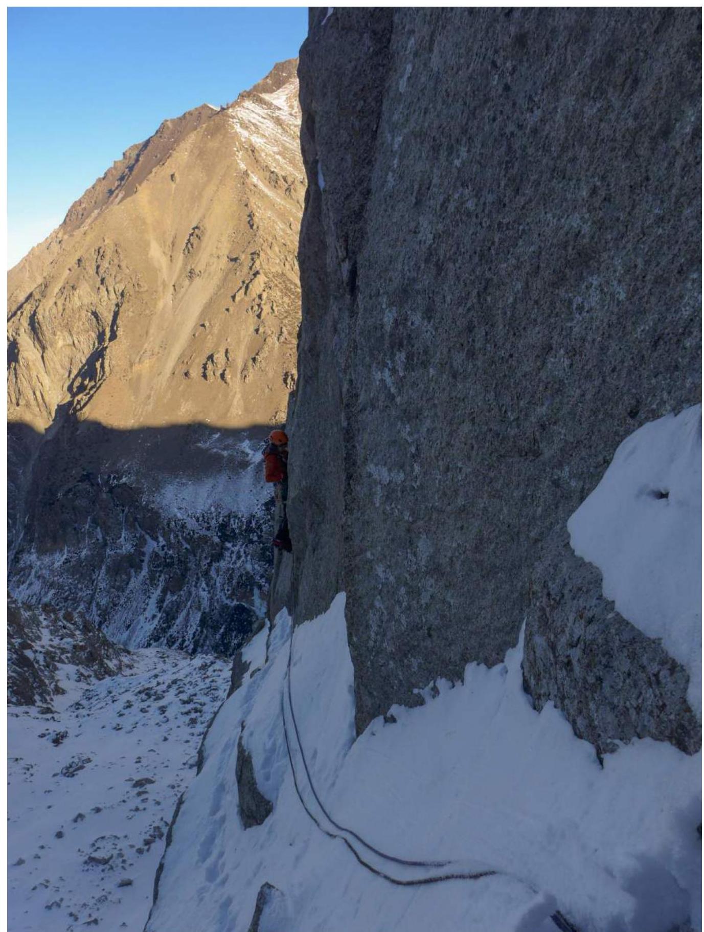
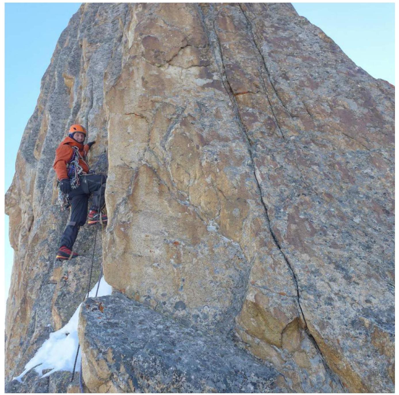
R29–R30 TME along monolithic cracks on the eastern edge of the summit tower. 3 m rappel.
R30–R31 Along the right face of the edge and then along the ridge. местами the ridge is very narrow (movement in a " saddle" position), местами the rocks are heavily destroyed.
R31–R32 Movement along the left, snow-covered face of the ridge. Many destroyed stones, very loose snow that doesn't stick to the rocks. Had to dig into the relief.
R32–R33 Along the ridge to the summit.
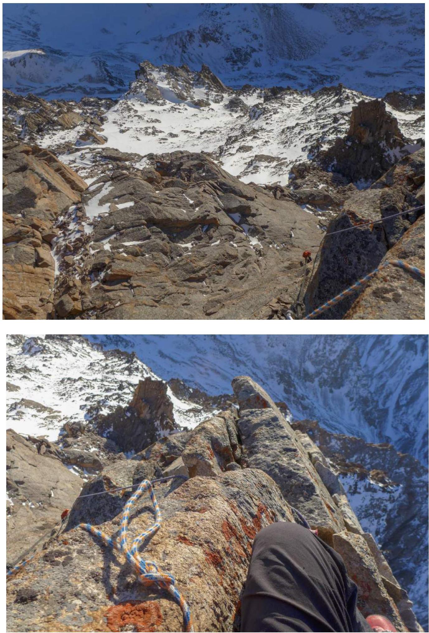
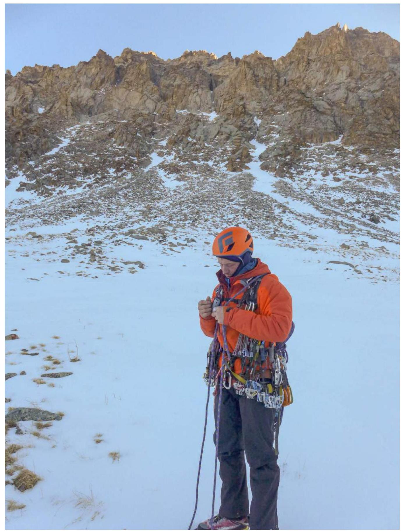
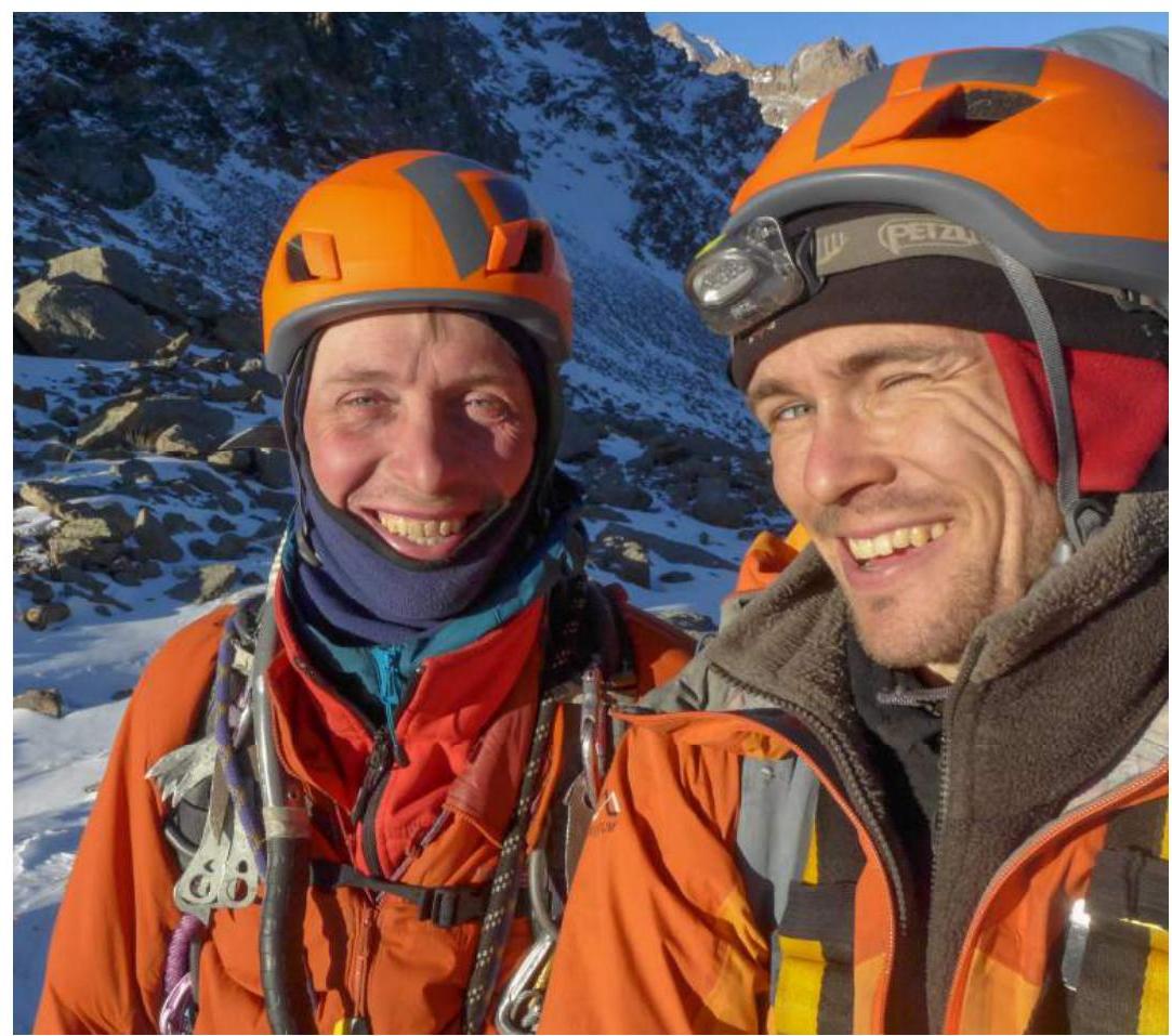
Photo Illustration
Approach along the Sokuluk valley.
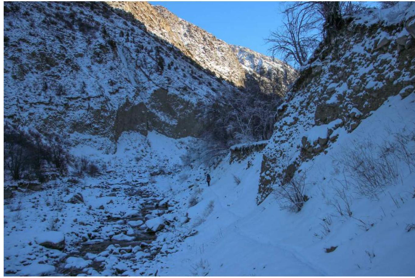
In the background of the route. Photo from the advanced base camp (taken with a camera in timer mode).
View of the buttress when approaching along the couloir.
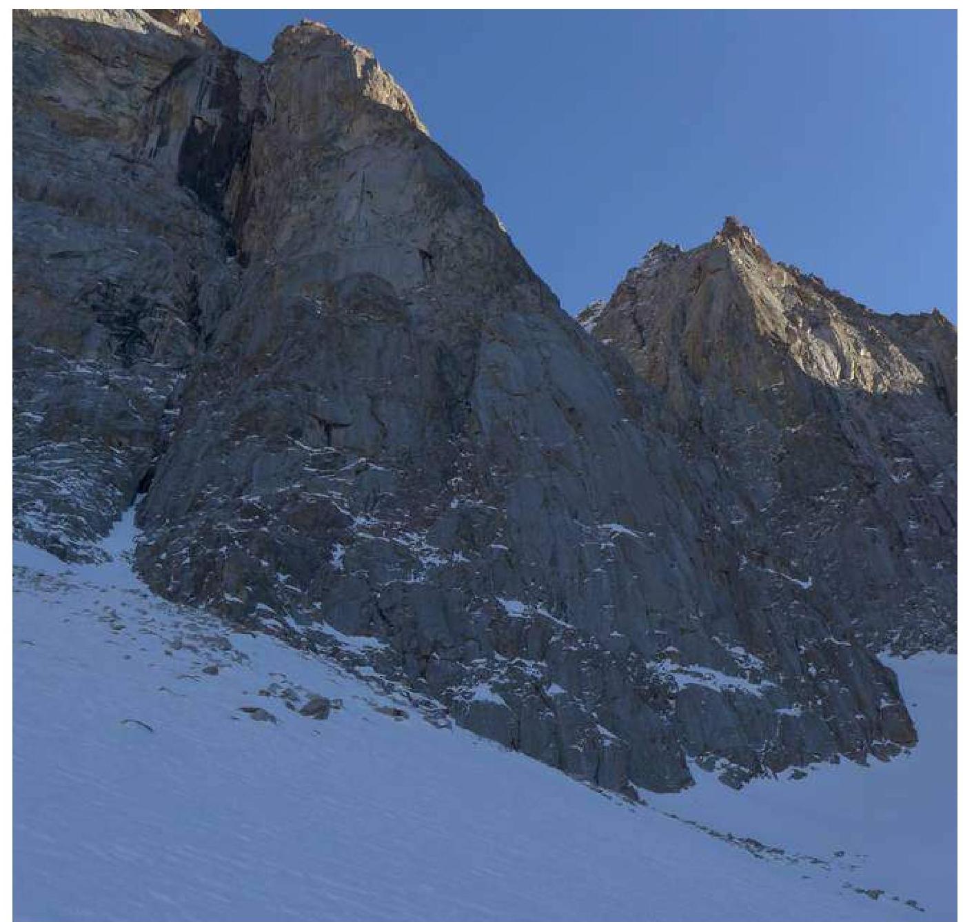
View of the buttress when approaching along the couloir.
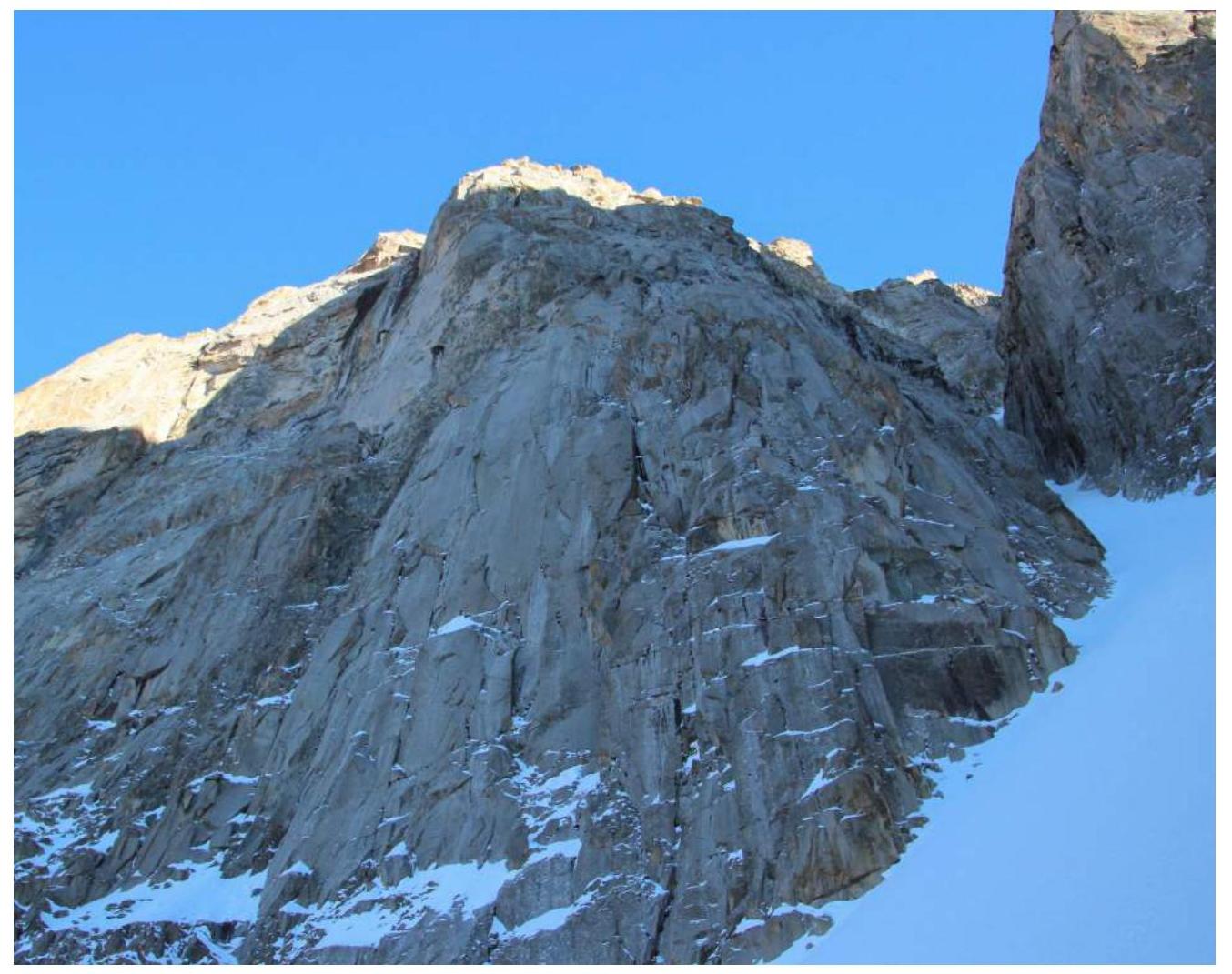
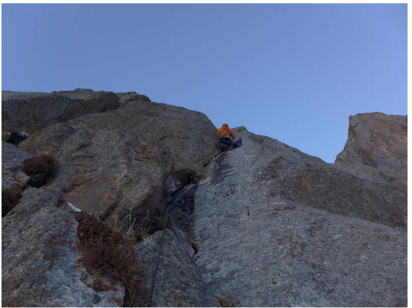
View of the buttress from the start of the route
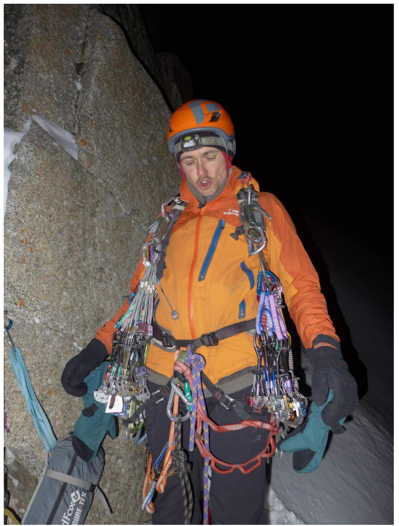
Morning before the start
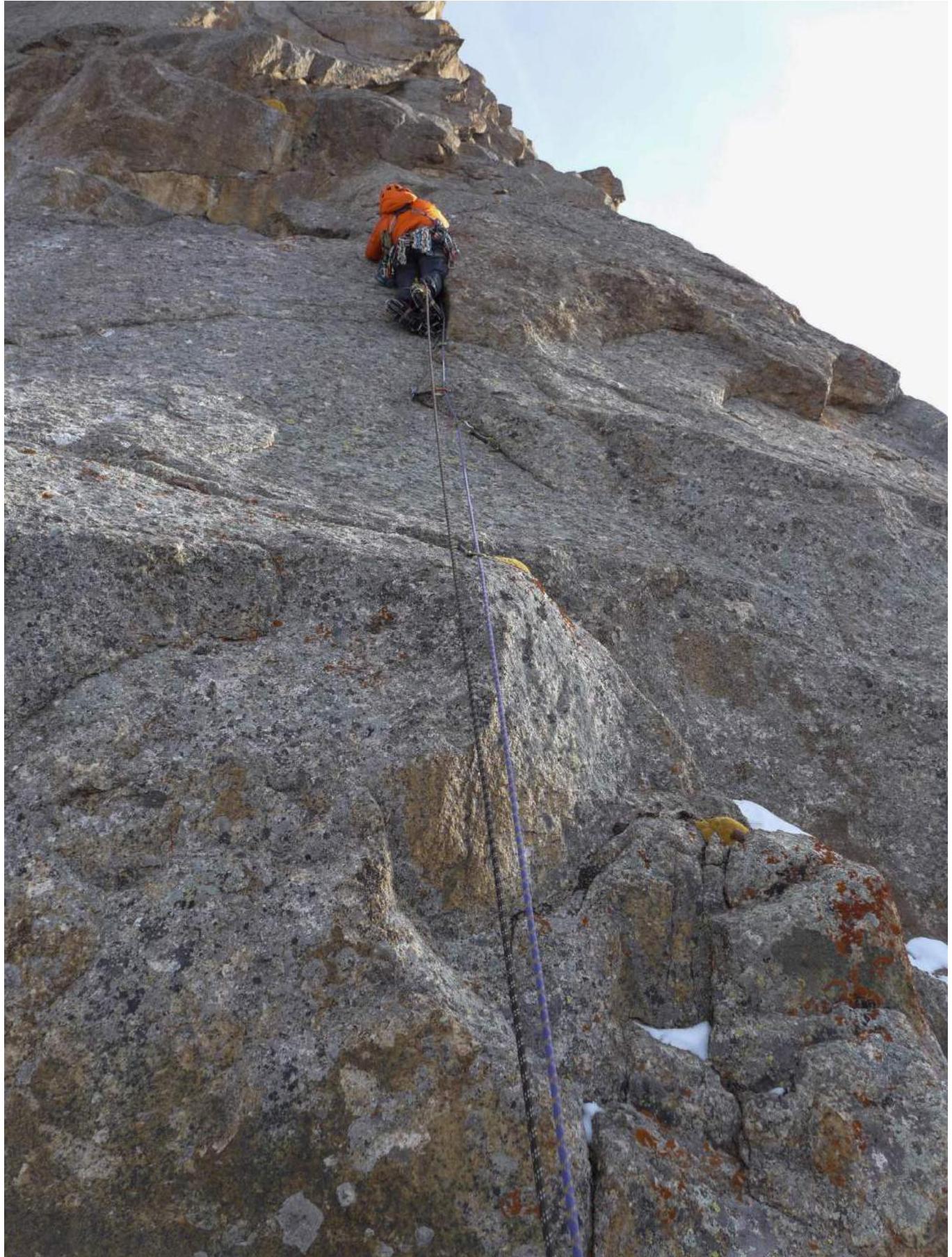
R4–R5
R5–R6
R11–R12
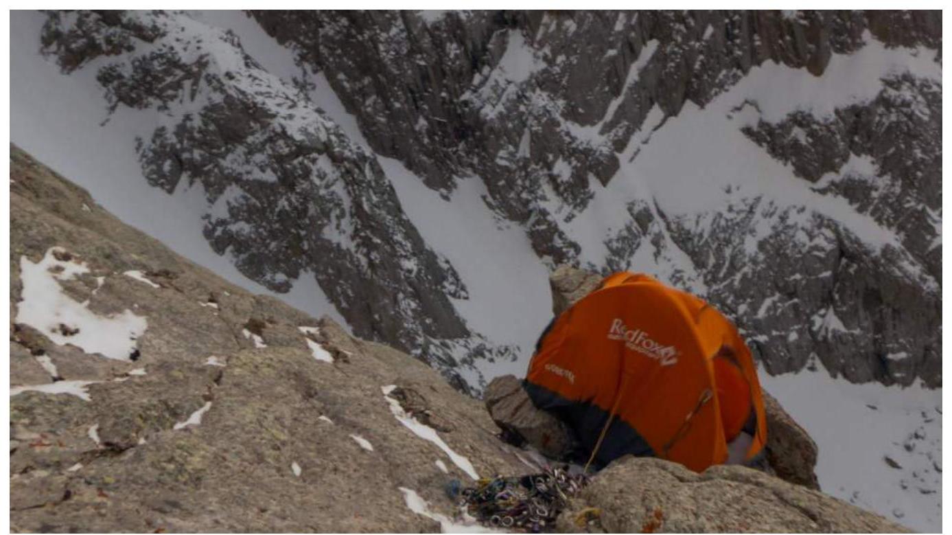
First overnight bivouac site
R14–R15


R18–R19
R21–R22
Second overnight bivouac site
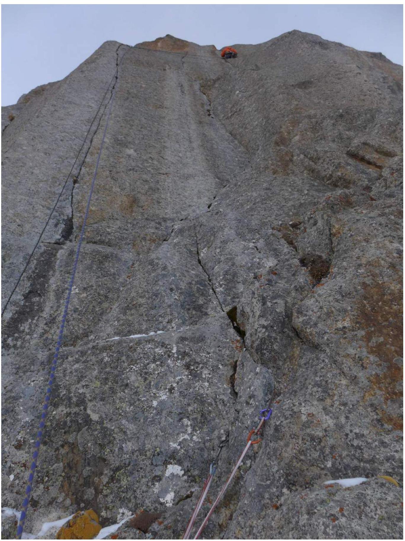
R24–R25
End of the wall section, start of R25–R26.
R27–R28
R29–R30
R30–R31
R30–R31
R31–R32

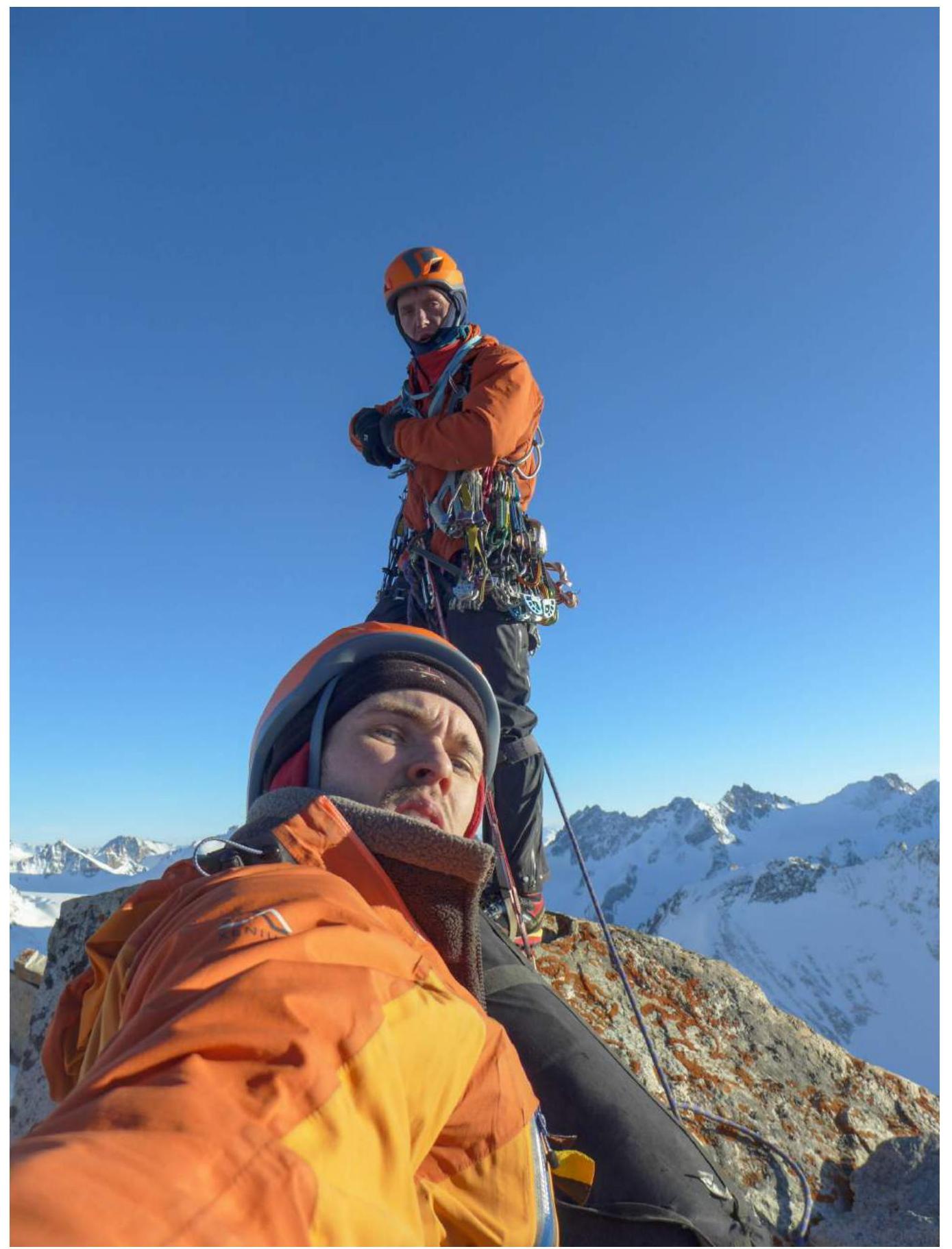
On the summit
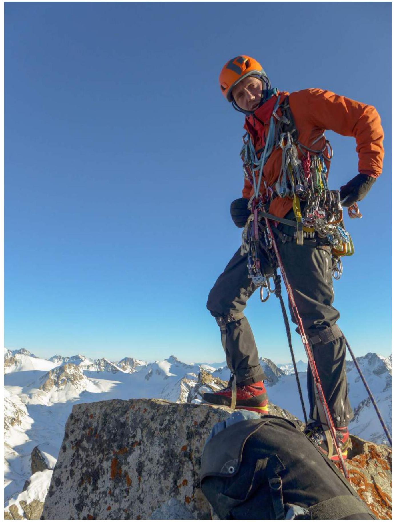
On the summit
View from the summit onto the SE slope towards the descent
View from below onto the SE slope after the descent
The descent couloirs are visible. Despite our expectations, we did not find a note or a cairn on the summit. As we were anticipating a completely different descent, we were very concerned about the situation's development and rushed to start moving. Therefore, we did not leave our note or cairn.
The summit tower is very steep, and reaching it from any side is only possible by climbing. Consequently, descending in the same manner seems extremely problematic, if not impossible.
We left a descent anchor.
We did not find any signs of human presence on the summit. Based on this, we assume that our ascent is the first.
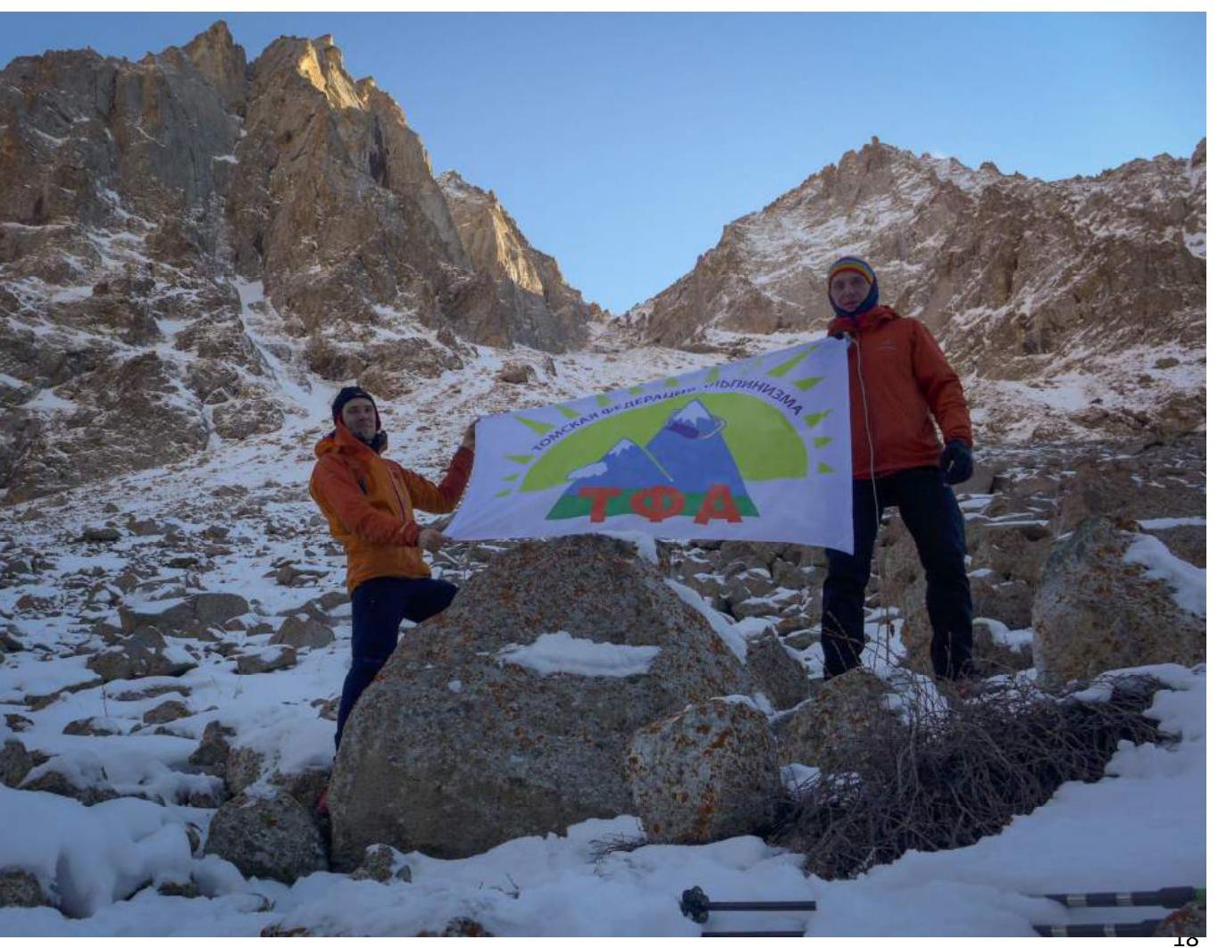
Thanks to Alexander Agafonov, Mikhail Vorozhishchev, and Ravil Temirgaliev for their help in organizing and preparing the ascent.
Regarding the history of the peak's name, Mikhail Vorozhishchev (Tomsk) wrote on the Risk.RU website:
«I'll explain the origin of the version regarding the name of this peak — Kremlin. At the end of 2014, A.A. Agafonov posted a photograph of the peak on a social network with the caption — 'there is an unconquered peak nearby, called — Black Spire'. Knowing the area and that p. Black Spire is located in the Kichitor valley and is not visible from below, I was surprised. Plus, only tourist groups had reached the summit of Black Spire — three times. I started examining the photographs and realized that it was referring to the nodal peak marked on the tourist map as 4054 m.
Further, on the area maps prepared by Vadim Lyapin, I saw that one of the peaks was labeled 'Kremlin'. I contacted Vadim, and he replied that he had taken the names of the peaks in the area from Marechek's archives. After that, looking at the photographs, it was reasonable to conclude that they couldn't have named a 'bump' in the lateral ridge 'Kremlin' — it's likely a map error.
Thus, the version emerged that 'Kremlin' is actually the name for the nodal peak 4054 m, not the 'bump' in the ridge 3492».
This version was shared with Ivan.
The proposed name was taken from a comment by a user with the nickname Yukon3:
«January 28, 2016. I spent my childhood in these mountains. The peak has been known to local Kyrgyz as Chon-Tor (Big Gates)».
Comments
Sign in to leave a comment