
Alpinism Federation of the Republic of Buryatia "Gory Baikala" Alpinism Club
Report on the ascent of the team from the Republic of Buryatia for participation in the Russian Championship in Alpinism in the snow-ice class To the summit of Chon-Tor 4165 m Via the right bastion of the Northwest Wall 6A, first ascent
Ulan-Ude 2016
Ascent Passport
- 7.4 — Tian Shan, Kyrgyz range, Belogorka gorge (Sokuuluk river).
- Chon-Tor peak 4165 m. Via the right bastion of the Northwest wall. Peak coordinates: 42°48′07″ N, 74°34′84″ E.
- Cat. diff.: 6A, first ascent.
- The nature of the route is combined.
- Height difference of the route: 900 m (by altimeter 3250–4165).
Length of the wall part without the ridge: 1205 m. Length of sections:
- V cat. diff. — 330 m
- VI cat. diff. — 205 m. Average steepness:
- main part of the route — 70°
- entire route — 57°
- Pitons left on the route: 0
- Team's climbing hours: 16.02.2016 from 10:00 to 19:00 — 9 hours 17.02.2016 from 9:00 to 14:56 — 6 hours Total: 15 hours 00 minutes, Days: 1.5. Overnight stays: 1 on a ledge, lying down.
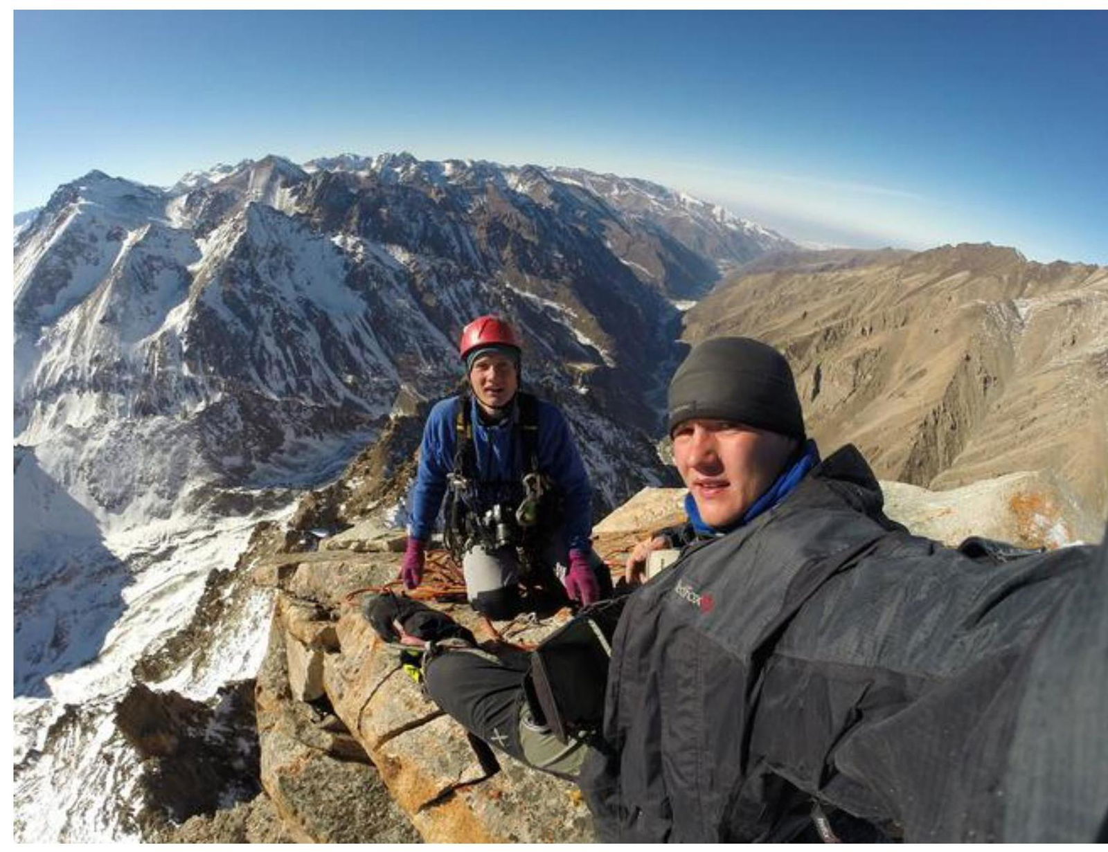
- Leader: Glazunov Evgeny Vladimirovich (MS) Participant: Glazunov Sergey Vladimirovich (CMS)
- Coach: Glazunov Evgeny Vladimirovich (MS)
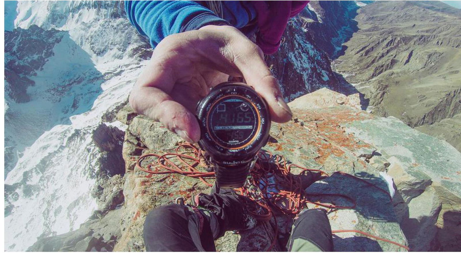
- Exit from BL to the route: 6:22, 16.02.2016. Start of work on the route: 16.02.2016, 10:00 On the summit: 14:56, 17.02.2016. Return to BL: 18:30, 17.02.2016.
- Alpinism Federation of the Republic of Buryatia "Gory Baikala" Alpinism Club
Tactical Actions of the Team
Chon-Tor peak, unofficial names: "Kremlin", "Black Castle", "Black Spire", is located in the upper reaches of the Belogorka gorge (Sokuuluk river) of the Kyrgyz range, within 20 km west of Ala-Archa. The approach to the gorge is relatively simple, making it attractive for alpinism events. Mobile communication is absent in the gorge; it is advisable to have a satellite phone. The idea of ascending this peak was born in 2014 when A.A. Agafonov told us about the wall and published a photograph of its bastions online. Therefore, when planning for the winter season, we counted on making a first ascent after the end of the Russian Championship in Ala-Archa. During the RC, we learned that a Tomsk team had preceded us by 3 weeks and climbed one of the bastions.
Ascent plan:
- February 15: after the closure of the Championship, we spent the night in Bishkek, then moved to the Belogorka gorge, traveling in a duo in a maximally lightened style, leaving all unnecessary equipment, including ice gear, with a week's supply of food and fuel. By 16:00, we reached the base camp location, left bivouac gear, went to the middle of the ascent couloir, left a cache, and descended to the camp at 19:30 for an overnight stay.
- February 16: at 5:20, we exited the camp for the ascent; at 10:00, we began work on the route; at 19:00, we stopped for the night, hanging one rope above the ledge.
- February 17: at 9:00, we started climbing, passing the rope processed the previous evening; at 14:56, we reached the summit; at 18:30, we descended to the base camp.
- February 18: we walked 25 km on foot, descended to the Belogorka settlement, from where we returned to Bishkek by car.
The team approached the route in a maximally lightened style, taking:
- 2 warm jackets
- 1 windproof jacket
- 2 pairs of spare gloves for each participant
- 1 down sleeping bag
- a tent
- 2 mats
- a camera
- about 3 kg of food
- a first-aid kit
- a jetboil
- 2 small gas canisters.
Initial backpack weight was around 12 kg.
This ascent was one of the best and most enjoyable for us, given our readiness and the difficulties encountered on the route. We received the best impressions from the clear and coordinated work in conditions of autonomous stay in the area and the accomplishment of a first ascent. It can be confidently said that this route corresponds to the declared category of difficulty by its characteristics:
- steepness,
- length,
- category of difficulty of sections. The route remained entirely clean. No pitons were used.
View of the summit from Google Maps


General view of the summit

Bastions of Chon-Tor
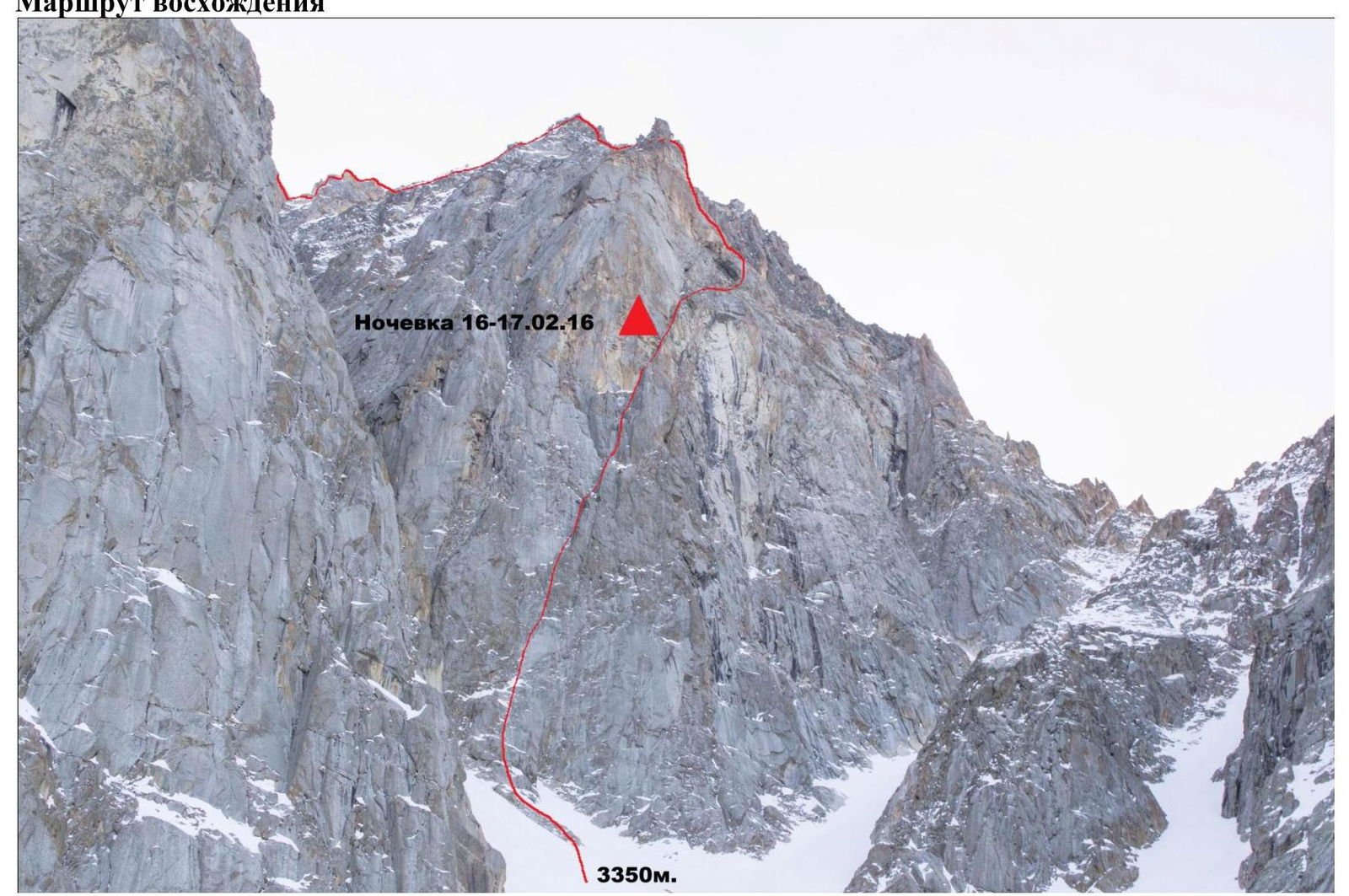
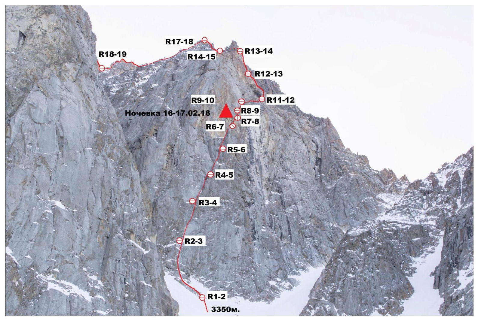
Ascent Route
Photos of route sections (some sections are not marked due to the specifics of the route's exposure on the wall)

Summit Tower
UIAA Scheme sheet 2
Chon-Tor peak 4165 m
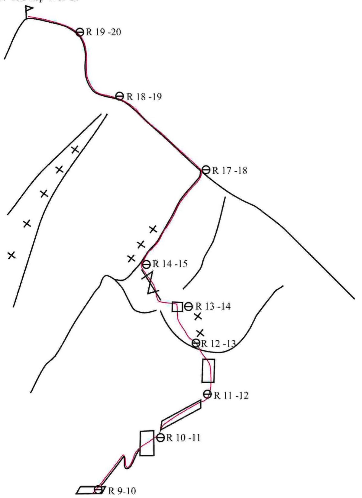
UIAA Scheme sheet 1

Route Description by Sections
R0–R1. Steep firn slope in very poor condition, dense firn, with loose snow underneath like grit. Possible slab avalanche, requires careful and attentive movement, maintaining interval between participants! Approach to the rocks. Start of the rock belt at an altitude of 3350 m by altimeter. 100 m, 30°, 1.
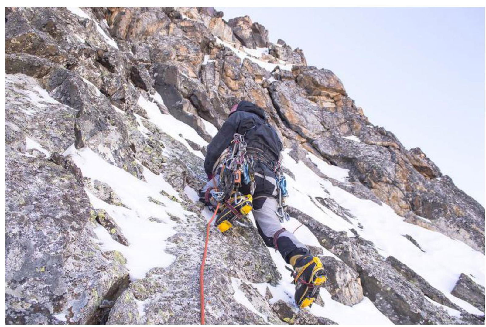
R1–R2. Movement through rocks towards the "gray spot" to the right and upwards, free climbing. Station on a snowy ledge under the "gray spot". 70 m. 60–70°, IV–V cat. diff.
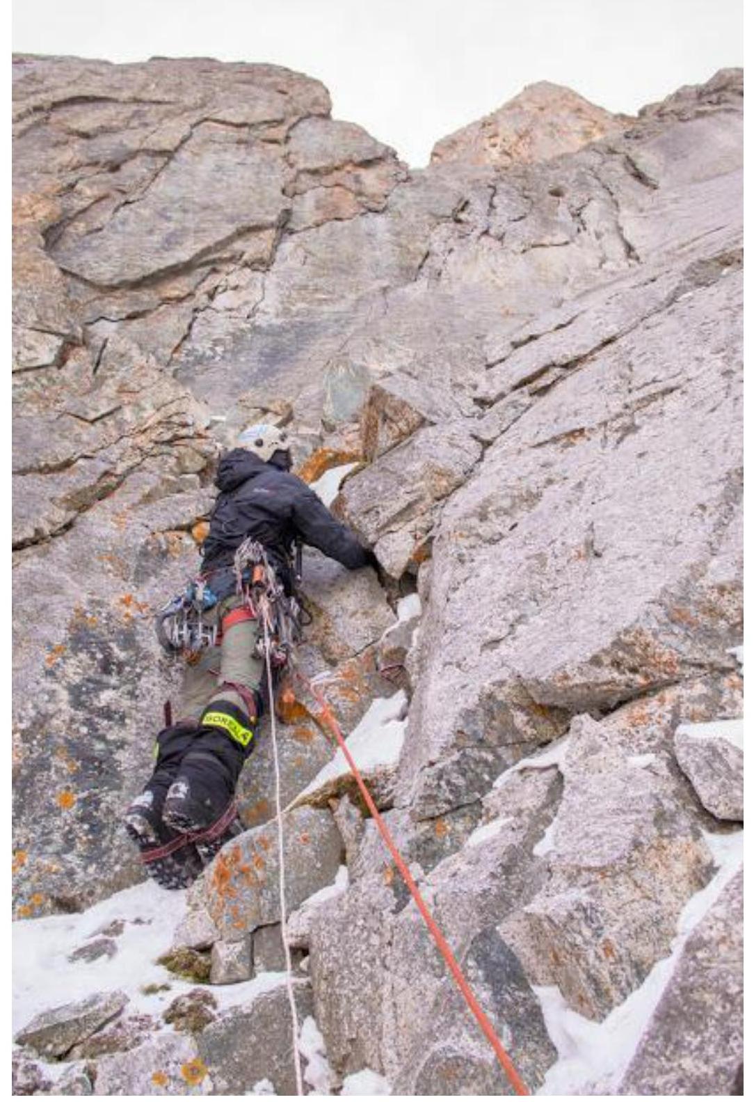
R2–R3. Up through the system of cracks at the left boundary of the "gray spot". Movement on aid climbing. Through a small cornice, exit onto a ledge, then left through rocks, climbing to another ledge at the base of a giant internal angle. 50 m. 85°, VI A1 cat. diff.
R3–R4. Right and up the angle, free climbing through large blocks; in the angle, there are loose rocks — be careful! The angle ends with a cornice of wedged loose rocks and blocks; its passage requires very careful aid climbing. Behind the cornice — a station on a small ledge. 50 m. 85°, V–VI A1.
R4–R5. Right through the angle by the most logical path, climbing alternating with aid climbing through monolithic cracks towards the "Red Rocks". 50 m. 85°, V–VI A1.
R5–R6. From the station to the right to a ledge under the "Red Rocks". From the ledge, a vertical wall is climbed through the right part. Then, exit onto a flattening under a large cornice, where a station was organized. 50 m. 90°, VI A1.
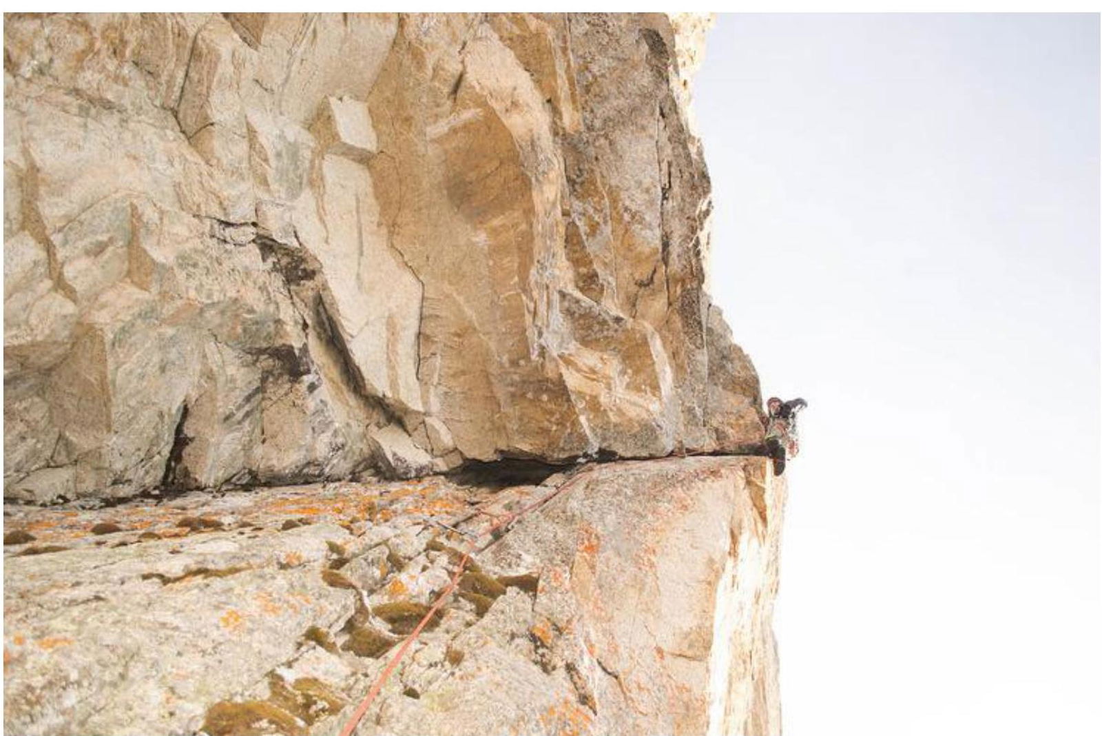
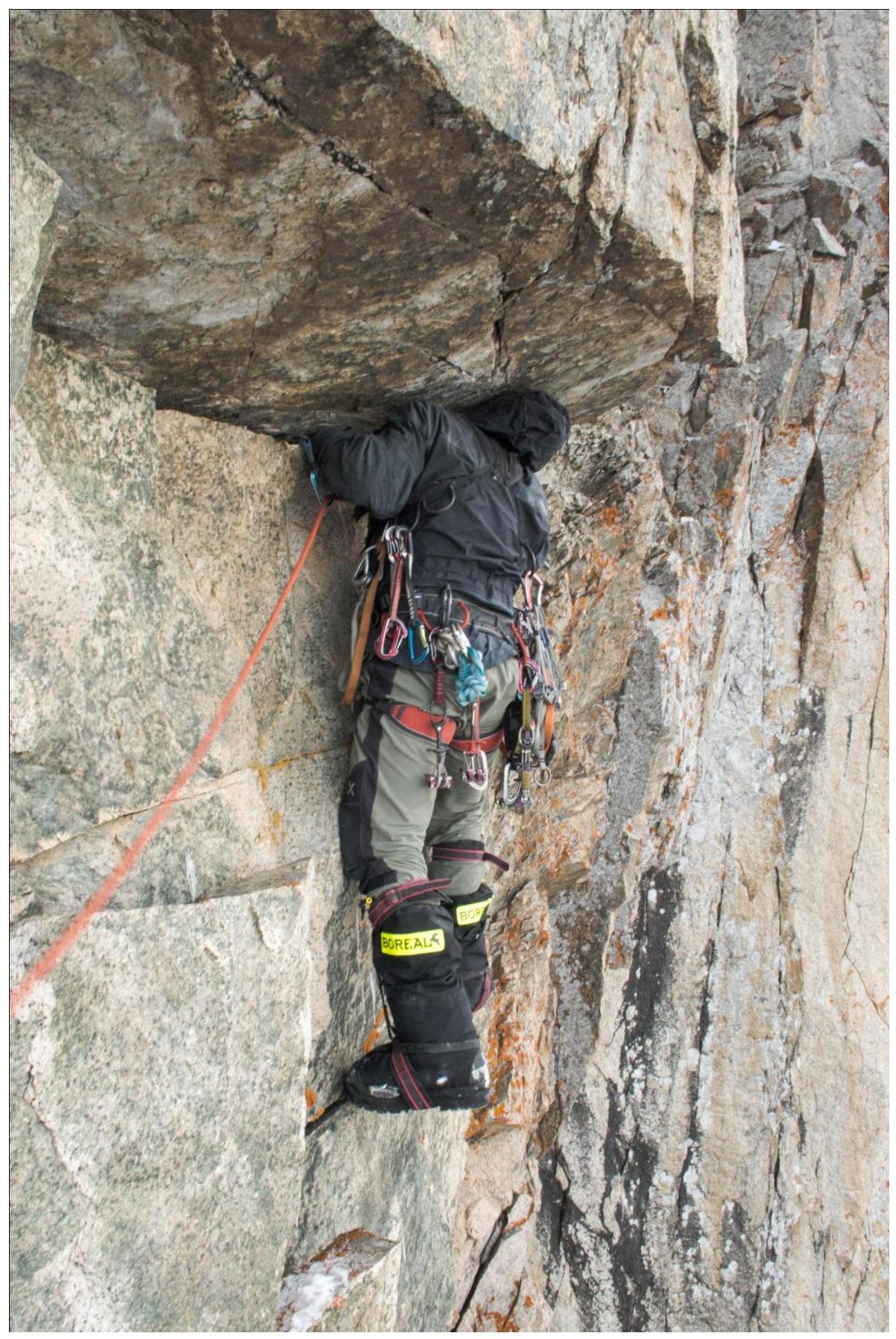
R6–R7. Approach to the cornice through broken terrain. Passing the cornice through a crack on sky hooks. Behind the cornice — a station on a small ledge. The crux of the route. 25 m. 90°, VI A2.
R7–R8. Right and up through the terrain. Difficult climbing through broken rocks. At the end of the section — a traverse left onto a ledge under a cornice. On the ledge, we laid out a platform, organized an overnight stay in a tent, having previously thrown down large rocks. The overnight stay location is safe, protected by a cornice. 25 m. 85°, 6.
R8–R9. From the ledge — a traverse right under the cornice and transition into a chimney. Further climbing through the chimney with several cornices. Cornices are passed on aid climbing. The section ends on a good ledge where it's convenient to organize a station. We finished work on this section on the first day of the ascent. 50 m. 85°, VI A1.
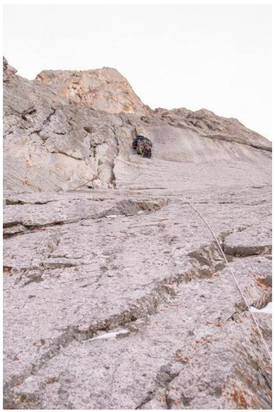
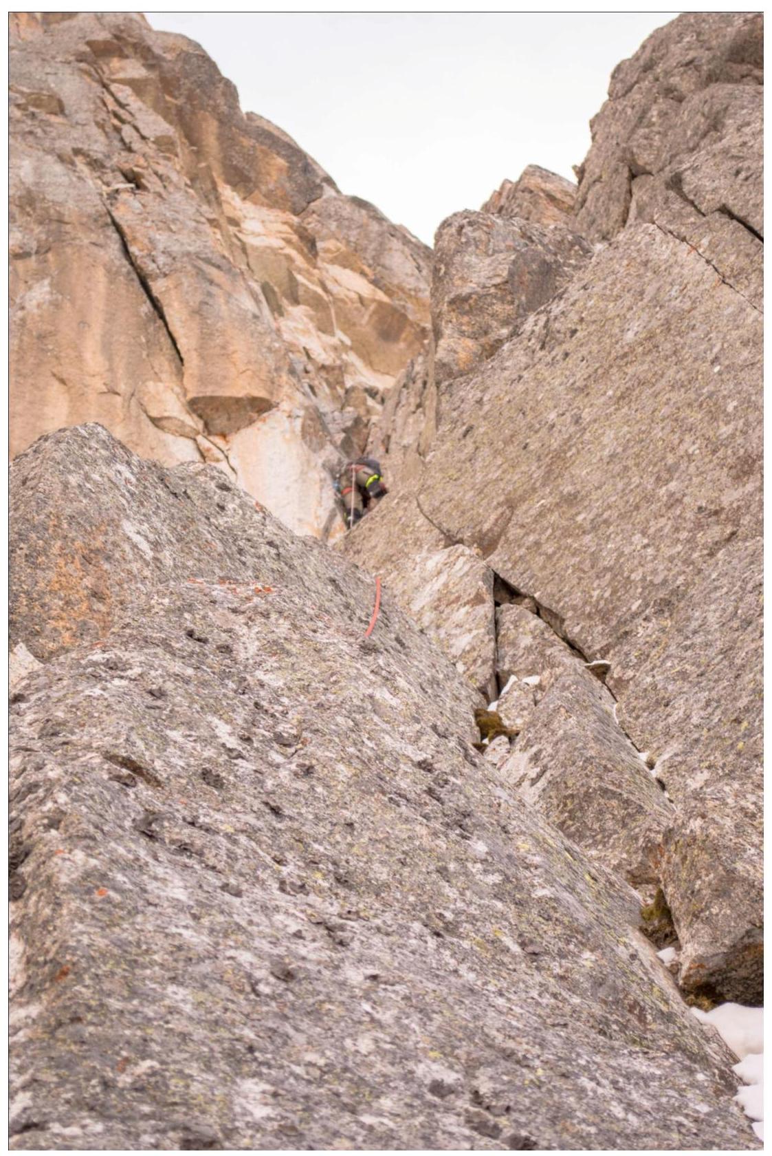
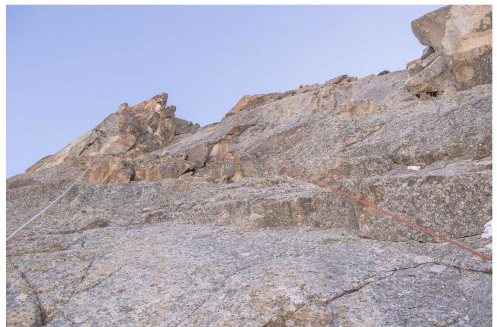
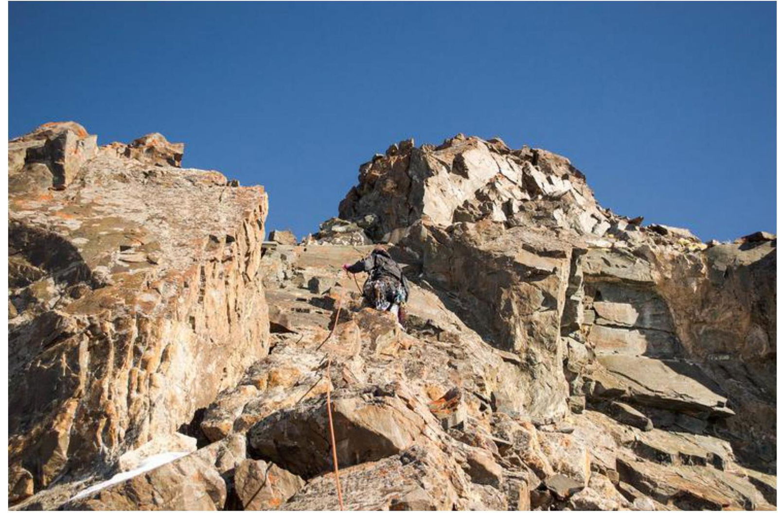
R9–R10. Movement through rocks right and up; after 15 m — a pendulum traverse to the right, then exit onto a large ledge (possible overnight stay). Further logical terrain deviates to the right, bypassing a huge, destroyed section of the wall from live blocks. Therefore, we decided to deviate from the straight line and continue movement, bypassing this belt along the right edge. From this section to the summit, the route was passed without aid climbing. 45 m. 75°, IV–V.
R10–R11. Traverse right along the ledge. 45 m. 45°, III–IV.
R11–R12. Along the boundary of the destroyed and monolithic belts, direction left and up. Climbing through slabs with monolithic cracks. Exit into a large depression in the destroyed belt. 50 m. 75°, V.
R12–R13. Through the left part of the depression towards the ridge of the bastion until it stops, simultaneous movement. In the middle of the section — a 5 m rock wall. 70 m. 60–65°, 3.
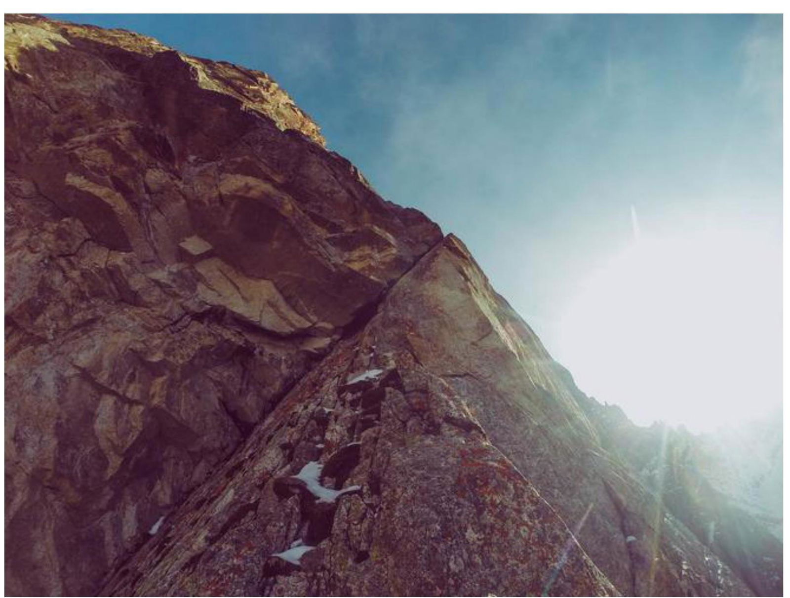
R13–R14. Rock wall with a crack in the destroyed belt — free climbing, exit onto the ridge of the bastion. 20 m. 75°, V.
R14–R15. Further to the exit onto the ridge, climbing in crampons. Descend a bit and move along slabs covered with snow. Station on camalots. 50 m. 55°, III–IV.
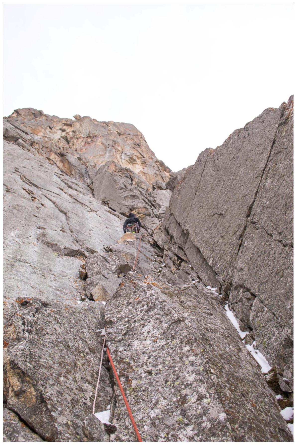
R15–R16. Free climbing through rocks of medium difficulty towards the ridge. 50 m. 70°, IV.
R16–R17. Exit onto the ridge through rocks of medium difficulty. 30 m. 55°, III–IV.
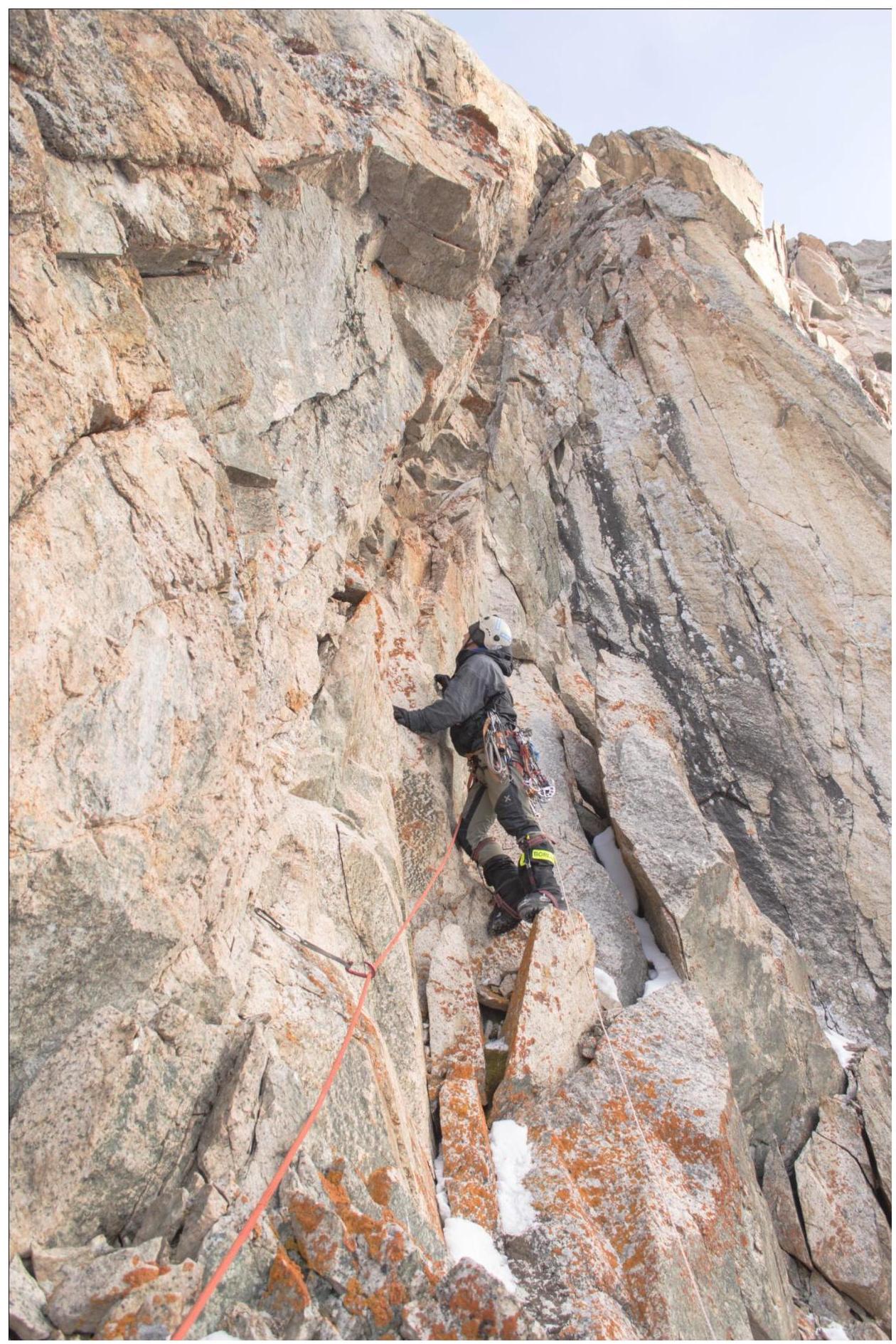
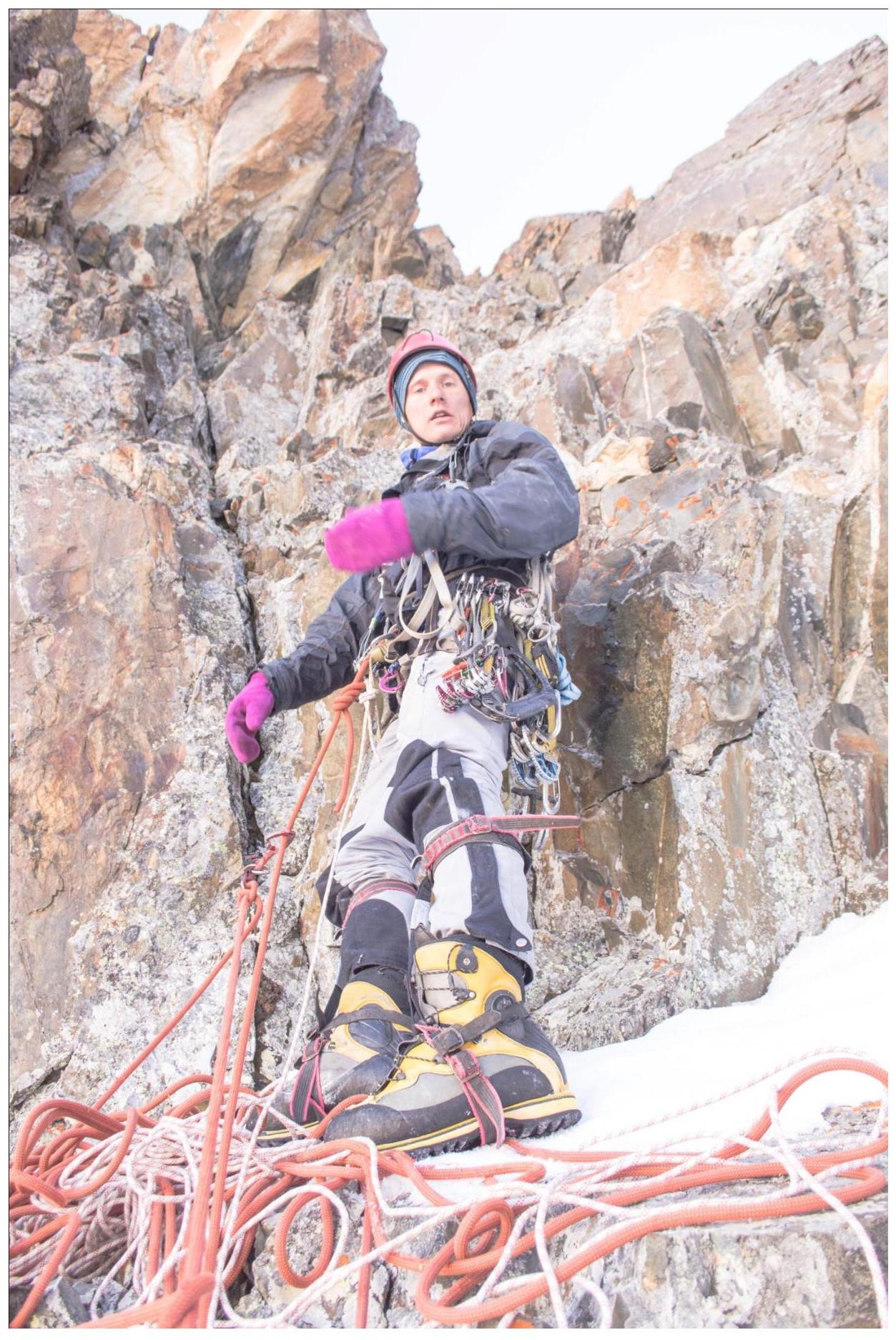
R17–R18. Movement along the ridge towards the summit tower. Obstacles are bypassed predominantly to the right from the south. The end of the section is on a col between an obstacle and the Tower. 300 m. 50°, III–IV.
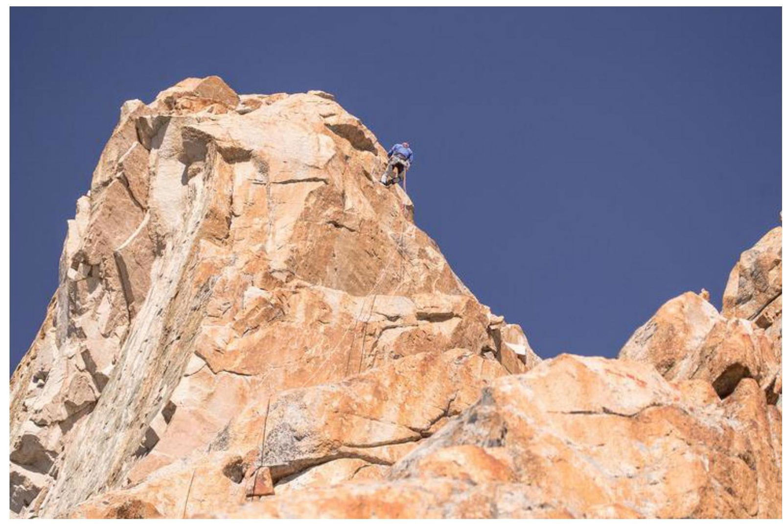
R18–R19. The summit tower is climbed head-on through a system of monolithic angles. Movement through an angle; at the end of the angle — a station on anchors before exiting onto a characteristic col. On this section and to the summit, the first climber worked in rock shoes, the second moved by climbing in boots. We left our gear at the end of the previous section. 50 m. 75°, V.
R19–R20. Exit onto the col, then ascend along the ridge to the summit through a series of walls. 25 m. 65°, IV–V.
On the summit, a fresh sling from the Tomsk team is hanging; we did not find a note. The Tomsk team did not leave a note, as I. Temerev later informed us.
We left our note and our sling made of green reepschnur as proof of our presence on the summit.
Descent from the summit via the ascent route: 1.5 rappels from the tower to the col R18, then down, simultaneously, through a system of couloirs to the south with a total height loss of about 700 m. In the middle of the descent — a small 15 m rappel. From the south side of the gorge, bypassing the Chon-Training Massif from left to right in the direction of movement, exit through a system of hanging cirques to the river. The river flows into Sokuuluk. By an old trail — descent to the base camp at the confluence of Sokuuluk with the aforementioned river.
Route Photo Illustrations
Start of section R2–R3
Section R2–R3
Section R4–R5
View of station R5
Section R5–R6
View from the station on section R6–R7
Passing the cornice, section R6–R7
Section R7–R8
Start of section R8–R9
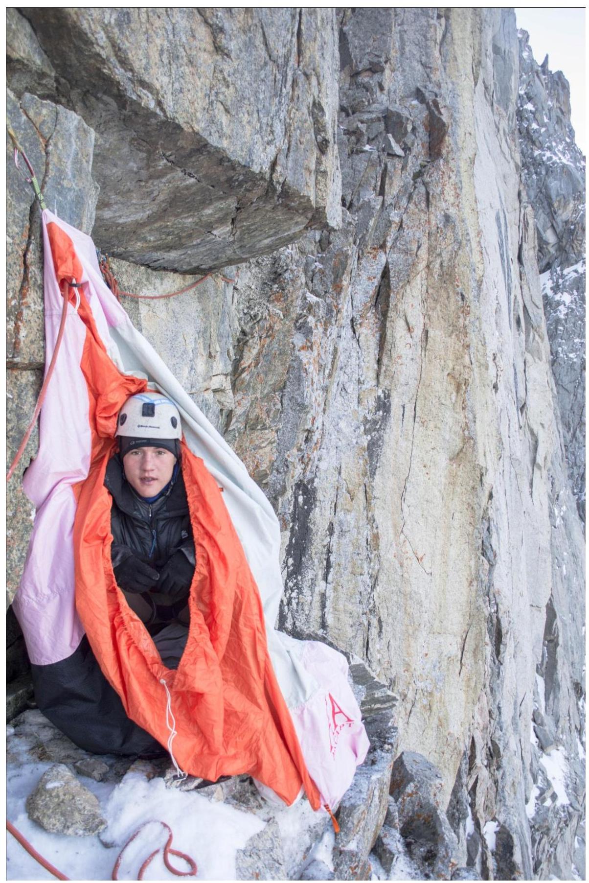
Overnight stay on R8
Exit onto the roof of the bastion, section R11–R12
Start of section R13–R14
Rope to the exit onto the ridge. Free climbing. Section R15–R16
Climbing along the ridge, section R17–R18
Section R19–R20 (photo taken during descent)
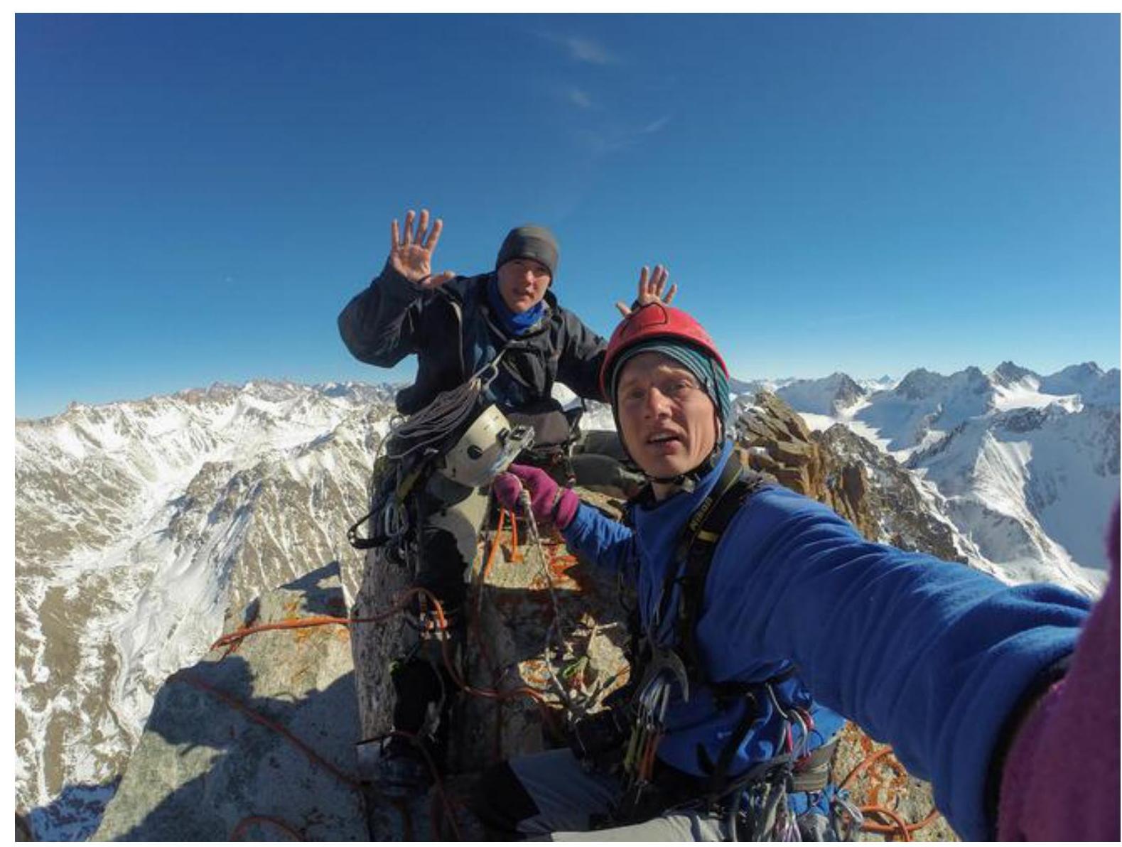
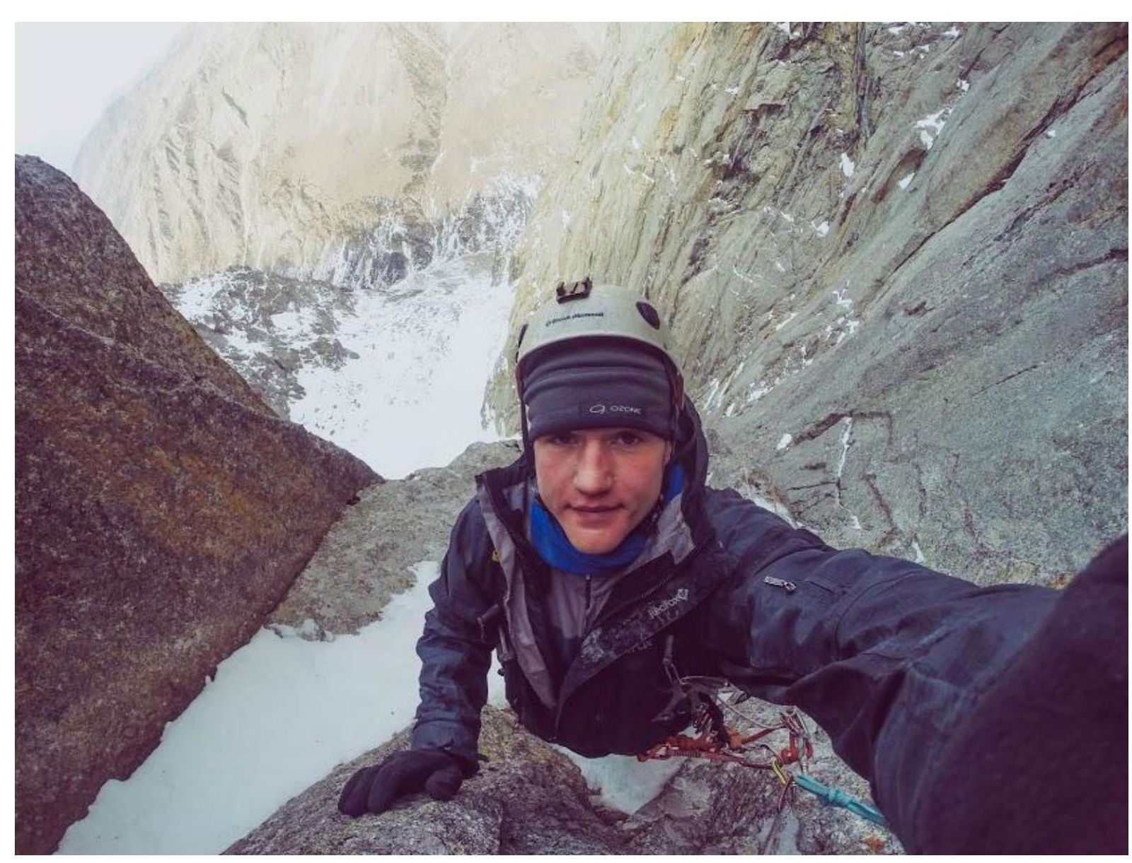
Photo on the summit
Digitized by Google!
Comments
Sign in to leave a comment