21
Activity Feed
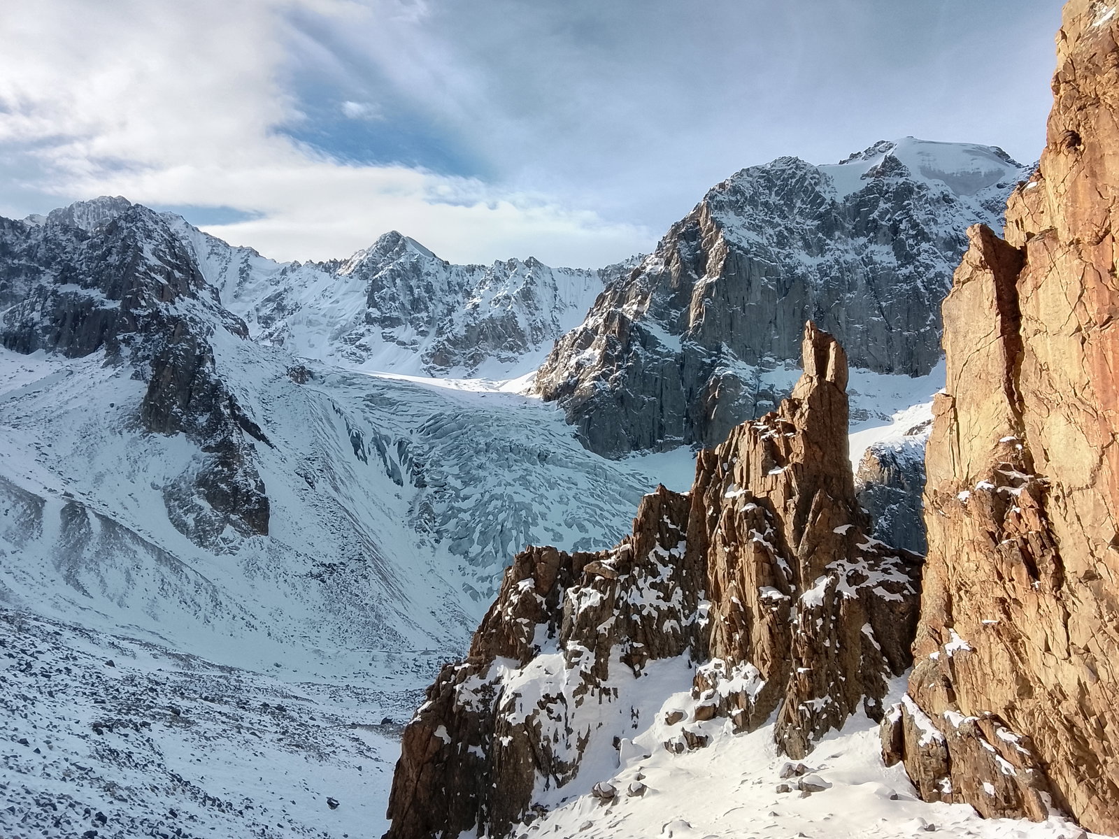
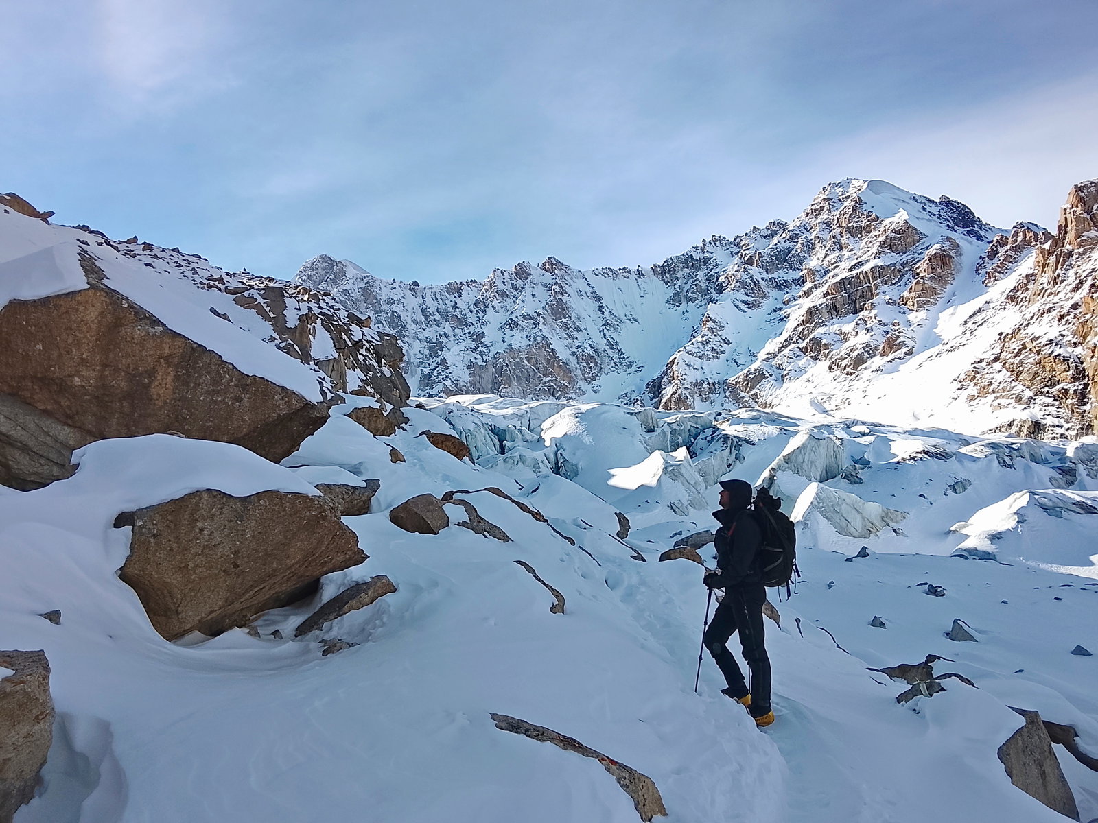
New alpine route: Fedorov
 ELEvgenii Lepikhin
Difficulty:4А / D-
Route type:Ice
Maximum elevation:
4810 mPasses through:Korona Peak
Kyrgyzstan → Uchitel glacier and Korona ridge area
One of the most popular routes to the Corona peak crest wall. It starts from the bergschrund, from which there are about 450 meters of even ice to the ridge. On the penultimate rope of the route, there is a small ice ridge, which is a bit more complicated than the main section of the route. The start of the route is 70-100 meters to the right of the https://summitx.info/en/routes/58844837/about route. In the Russian official classification, both these routes are considered variants of the same route.
New alpine route: Markevich' cascade
ELEvgenii LepikhinDifficulty:5Б / TD
Route type:Mixed
Maximum elevation:
4810 mPasses through:Korona Peak
Kyrgyzstan → Uchitel glacier and Korona ridge area
In autumn 2025, two ice streams formed on the northern wall of Pik Korona. The first ascent of the right stream (rated 5A in the Russian classification) was made by Aleksandr Parfyonov's team in early 2026. The first ascent of the left stream was made by Konstantin Markevich with Aleksey Pototskiy in the second half of March 2026. Further, according to Aleksey:
Last year was very hot in July. And as a result of this circumstance, two new routes formed on the northern wall of Pik Korona. The charm of these routes is that this year or next, such conditions may not happen, and these routes may not exist. But while they are there - we have to climb 😁 And we did. One route was climbed by Parfyonov with a partner in February, and the second one - Kostya Markevich and I last week.
Honest 5B and this is the coolest ice in the area. The icicle itself is 170 m of 87-degree lace cascade ice. And before that, there's another 30 meters of A3 ice climbing. The lower part is 450 m of gentle ice at 55-70 degrees.
 Loading video...
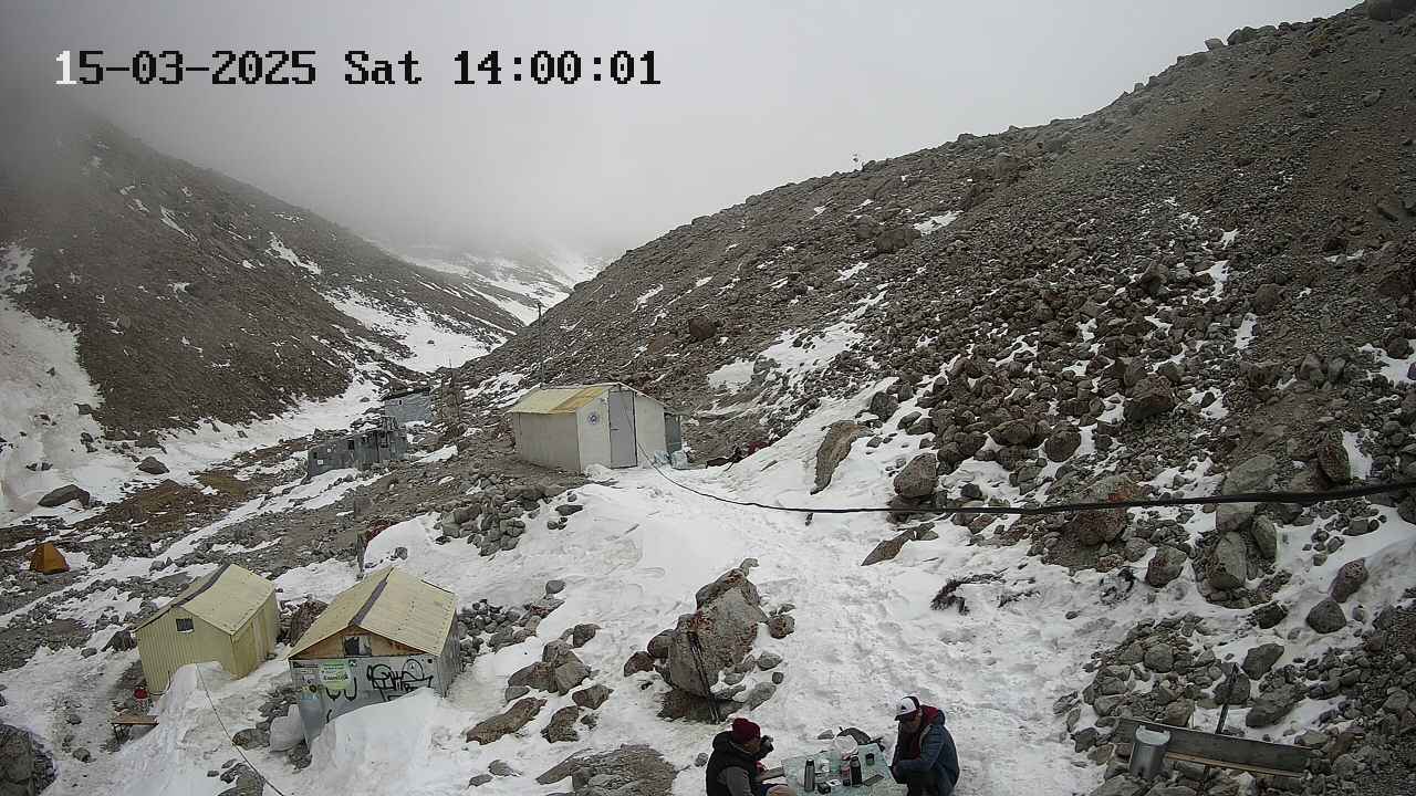
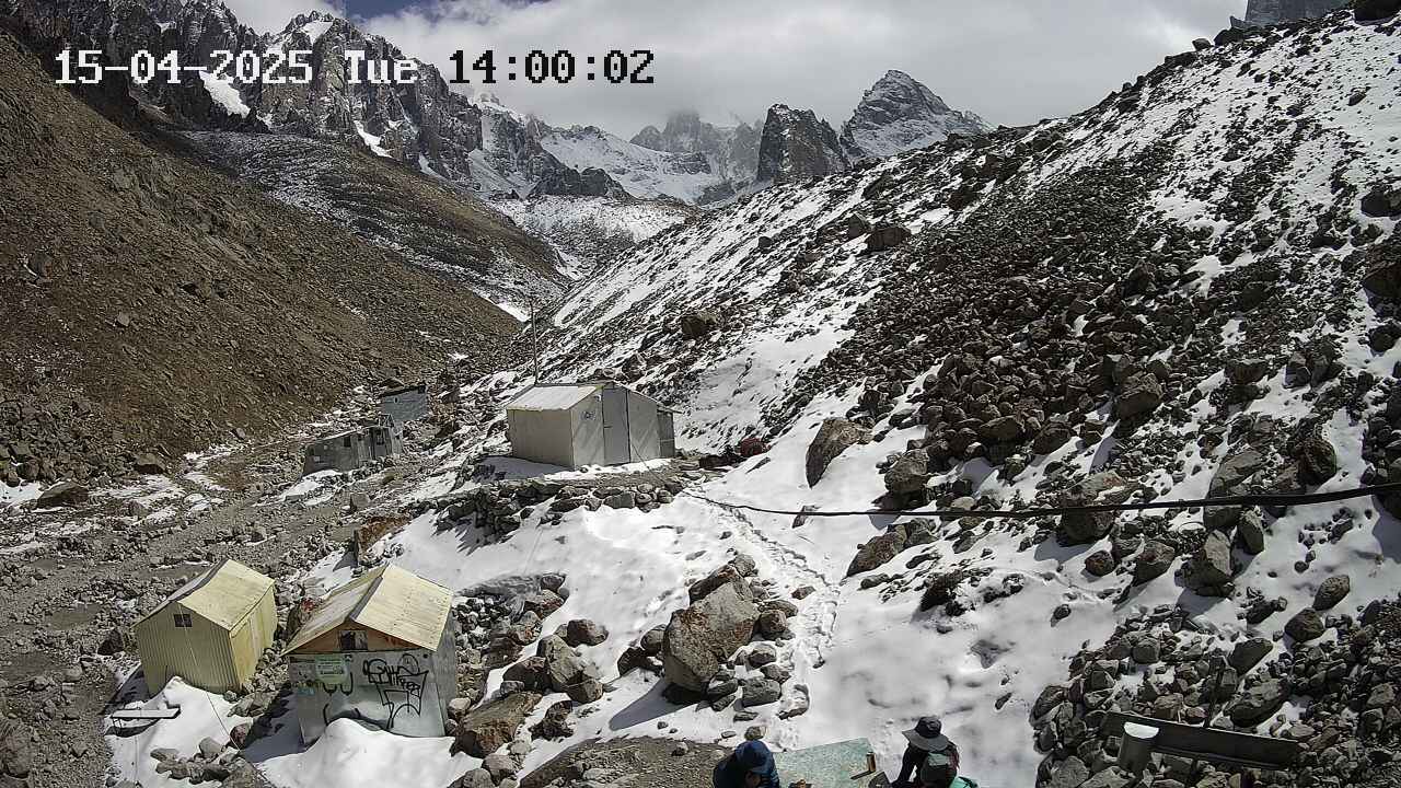
Work on the route

10

The article describes logistics, infrastructure, and seasonality for climbers in Kyrgyzstan's national parks, including information on transportation, accommodation, food, and weather conditions.
Logistics
How to Get There
By Private Vehicle
As of May 2025, entry to the national park is closed to vehicles with internal combustion engines. Entry for electric vehicles remains open and costs 800 som. There is a parking lot at the top, costing 50 som for an unlimited time.
By Taxi
You need to get to the entrance to the national park: https://www.openstreetmap.org/#map=19/42.655741/74.495202&layers=P. However, taxi drivers are not very fond of going there, so some minor difficulties may arise. The cost per car is around 600-800 som from the center of Bishkek.
By Public Transport
In May 2025, a free bus was launched. It starts from T. Usubaliev Square (often referred to as the old central square of Bishkek, near monuments and administrative buildings in the center) — a landmark in the city center.
Transport Inside the National Park
If you're not using a private vehicle, you need to pay 200 som per person to enter the national park. The number of days spent in the park is unlimited. Payment can be made in cash, by card, or with national QR transfers. Buses run around the clock from the entrance of the national park to the end of the road inside the park. The interval between buses is approximately every 10 minutes during the day and every 30-40 minutes at night.
56
0Accidents on Hiking Trips. Part 2. Groups.
 ЛФЛеопард Фил
Risk analysis in alpinism and tourism depending on the type of group and its goals, considering risk generation factors and event consequences.
 In the second part about accidents, we dissect different groups by their route passage characteristics, resources, and ultimately by how they generate risks.
In the previous chapter, we found that the generated risks have the greatest impact on the events occurring within a group. However, different groups generate risks differently, even when the same participants in different teams can create risks in completely opposite ways.
Since we consider groups as a whole, as a single entity - simply because a group struggles with events as a unified organism - we will examine resources and risk generation primarily in relation to groups. Nevertheless, at certain stages, which we will inevitably explore using the example of ambitious participants and risk-loving participants, we will see that individual risk generation has a significant factor, especially if it involves: a) clients of commercial groups; b) group leaders.
Let's first define the division of groups based on the outcome of the route passage.
In the second part about accidents, we dissect different groups by their route passage characteristics, resources, and ultimately by how they generate risks.
In the previous chapter, we found that the generated risks have the greatest impact on the events occurring within a group. However, different groups generate risks differently, even when the same participants in different teams can create risks in completely opposite ways.
Since we consider groups as a whole, as a single entity - simply because a group struggles with events as a unified organism - we will examine resources and risk generation primarily in relation to groups. Nevertheless, at certain stages, which we will inevitably explore using the example of ambitious participants and risk-loving participants, we will see that individual risk generation has a significant factor, especially if it involves: a) clients of commercial groups; b) group leaders.
Let's first define the division of groups based on the outcome of the route passage.
Groups by Route Passage Outcome
Regarding the route outcome, regardless of its complexity, groups are divided into: a) those that have completed the route; b) those that have dropped out of the route without an accident; c) those that have dropped out of the route with an accident. We do not consider exceptional cases that confirm the rules. This is a very logical but "childish" division, which, however, is necessary for us to intermediate the connection between groups and risks, both inherent and generated. So, why did the first group complete the route? Because:
39
1Patagonia: Solo Ascent of Torre del Paine
ELEvgenii Lepikhin
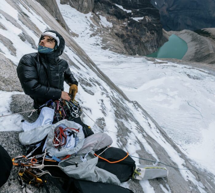
Stefano Ragazzo completed the first solo ascent of the "Riders on the Storm" route on the Central Tower of Torres del Paine, tackling the 1,300-meter wall in 15 days under extreme conditions.
Two years after the first free ascent of the legendary Riders on the Storm route on Torres del Paine's Central Tower, Stefano Ragazzo accomplished the impossible: the first solo ascent of the route. The Italian spent 15 days alone on the wall, tackling technically very challenging sections, terrible weather, and a problem with frostbitten toes.
Ragazzo climbed from February 21 to March 7. "For the first time in my life, I fought for something more than just the summit: for my life, or rather, for the constant thought, the desire to return to my girlfriend's arms," Ragazzo confessed on social media. "This thought kept me alive and was probably the main reason I can write these words now."
A Most Challenging Route
The Riders on the Storm route, first climbed in 1991 by Germans Kurt Albert, Bernd Arnold, Norbert Bätz, Peter Dittrich, and Wolfgang Güllich, is a 38-pitch, 1300-meter line on the east face of Torres del Paine's Central Tower in Patagonia. The route's difficulty is rated VI 5.12d (European scale 7c), A3. Frequent rockfall and icefall significantly increase the danger. The route includes a complex section using ITO, followed by a large pendulum across a smooth wall on pitch 16, and a huge overhang on pitch 26. In the 35 years since the first ascent, the route has been repeated only three times. Only a powerful team consisting of Sean Villanueva O'Driscoll, Nico Favresse, Sibbe Vanhee, and photographer Drew Smith managed to finally climb it free. All this suggests that the route is challenging enough to deter many top teams. A solo ascent seemed impossible.
Miraculously Avoiding Death
7
0The Best Month for Ala-Archa
ELEvgenii Lepikhin
Weather in Ala Archa National Park by month: temperature, stability, precipitation, and safety recommendations for climbers.
People often ask about the weather in Ala-Archa, when the best season is, and when it's safe to ice climb. I've decided to put this information into a micro-article.
January
 Stable weather, many sunny days, often calm. The temperature at Ratschek hut is -10 to -20°C with rare deviations from this range. However, there's only 2 hours of sunlight per day, not enough to warm up.
February
 Almost like January, but towards the end of the month, stability is lost – March is approaching.
March
 Very unstable weather. Stormy winds can last for 2 consecutive days, and fog can hang for 2 weeks. Heavy snowfalls are rare but possible. On good days, even in early March, it's sometimes possible to walk in a T-shirt when the sun is out. Daytime temperatures range from -10 to +5°C.
April
 The same March winds, but it gets warmer.
May
6
0Route Description: с юга
 SSummitMate
A description of the 1B mountaineering route to the top of **Ay-Petri** from the **Uzunkol** base, with a detailed analysis of the path and safety recommendations.
Ai-Petri Uzunkol — description of the 1B alpinist route from SK Greta
Route description:
From the "Uzunkol" base, cross the bridge to the right bank of the Uzunkol river, then downstream along the bank to the third (from the bridge) green couloir. Go up along it to the left — along the stream (no trail) to the uppermost grassy saddle in the first (it's always on the right) rocky ridge. From the base — 2 hours. Through the saddle, enter the neighboring talus cirque of Ai-Petri, cross it, and approach the base of the lateral rocky couloir, which divides the visible part of the summit slope in half. The landmark for the entrance to the couloir is a separate rocky outcrop. To the right of it are "ram's foreheads", to the left — a grassy slope with rocky outcrops. Higher up, the rocks turn into walls of reddish color.
28
0Pavlenko's Video Guide: Shvab Route 5A on Baychechekhey
ELEvgenii LepikhinVideo guide to the Schwab route (5A) on Peak Baychechekhey by experienced mountaineer Dima Pavlenko.
Video guide for the Schwab route (5A, rock) on Peak Baychechekhey by Dima Pavlenko.
Loading video...
28
0Accidents on Hiking Trips. Part 4. Adding and Subtracting Risks.
ЛФЛеопард Фил
The equation of risks in alpinism is examined, along with the impact of inherent and generated risks, and the role of experience and equipment.
 Before we move on to the chapter where we'll examine a more complex risk equation than the classical one, and analyze the role our experience plays in it, let's first clarify the concepts of risk addition and subtraction.
Risk addition poses a specific problem that warrants separate consideration.
We have inherent risks and generated risks. They can lead to events. From the chapter on risks, we've learned the following:
A) Events are inevitable
B) Risks always add up
The fewer the sum of risks, the lower the impact of the event on us. However, the force of the event may initially exceed our capabilities.
Let's start with an example: we're crossing a pass, and a rock falls on our head.
It's known that many tourists have crossed passes without ever being hit by a falling rock. Nevertheless, empirical experience shows that if a tourist hikes passes of category 1B...2A and above every year for 15 years in different regions, it's almost certain that they'll be hit by something falling from above at least once. Maybe a carabiner, ice axe, or a partner's boot. Or even crampons. Very rarely - intentionally )) If someone claims it hasn't happened to them, it means they just don't remember the last time it did. For an experienced tourist, selective memory loss is normal.
The same empirical experience of hiking in the same region over many years shows that there are years when everything is falling apart, even things that previously seemed reliable and stable.
Before we move on to the chapter where we'll examine a more complex risk equation than the classical one, and analyze the role our experience plays in it, let's first clarify the concepts of risk addition and subtraction.
Risk addition poses a specific problem that warrants separate consideration.
We have inherent risks and generated risks. They can lead to events. From the chapter on risks, we've learned the following:
A) Events are inevitable
B) Risks always add up
The fewer the sum of risks, the lower the impact of the event on us. However, the force of the event may initially exceed our capabilities.
Let's start with an example: we're crossing a pass, and a rock falls on our head.
It's known that many tourists have crossed passes without ever being hit by a falling rock. Nevertheless, empirical experience shows that if a tourist hikes passes of category 1B...2A and above every year for 15 years in different regions, it's almost certain that they'll be hit by something falling from above at least once. Maybe a carabiner, ice axe, or a partner's boot. Or even crampons. Very rarely - intentionally )) If someone claims it hasn't happened to them, it means they just don't remember the last time it did. For an experienced tourist, selective memory loss is normal.
The same empirical experience of hiking in the same region over many years shows that there are years when everything is falling apart, even things that previously seemed reliable and stable.
27
0Route Description: СЗ гребню
SSummitMate
Description of the combined 2B route to the Ak-Bashi summit via the Ak pass, including key sections, ascent and descent times.
Ak-Bashi from Ak Pass, combined, 2A
Route description:
From "Trud" campsite ascend snowy talus slopes to the foot of Ak Pass. Reach the pass via talus slope with small ledges. From the pass, follow the ridge left, bypassing the first sentinel on the right. In the first half of summer, when the ledges are covered with snow, the sentinel is ascended "head-on" along its crest. Then, via ledges right of the ridge, reach its snowy section. Ascend 400-meter snowy ridge to a saddle before the first summit. The summit is ascended via broken rocks. Descend from the summit into a gap along the right side of the ridge (loose rocks!). From here, via talus gully and broken ridge, ascend the main summit of Ak-Bashi. 6 hours from the campsite. Descent from the summit via the ascent route to the campsite takes 3 hours.
- Departure time from the campsite should be no later than 5:00;
- Ascending to Lozhny Ak Pass is not recommended as snow slabs are possible on the slope at the beginning of summer, and a steep glacier becomes exposed by the pass in autumn.
26
0Showing 11–20 of 7076 results