Report
On the first ascent to the summit of Zvezdny via the right part of the northeast wall 6A category of difficulty by the team from Krasnoyarsk Krai (REDFOXTEAM) from October 11 to 14, 2019
I. Ascent Passport
| 1. General Information | ||
|---|---|---|
| 1.1 | Full name, sports rank of the leader | Alexander Vladimirovich Zhigalov — Master of Sports |
| 1.2 | Full name, sports rank of the participants | Timofey Pavlovich Ivanov — Candidate for Master of Sports |
| 1.3 | Full name of the coach | Nikolay Nikolaevich Zakharov, Valery Viktorovich Balezin, Alexander Vladimirovich Zhigalov |
| 1.4 | Organization | Krasnoyarsk Krai Federation of Alpinism |
| 2. Characteristics of the Ascent Object | ||
| 2.1 | Region | Sayan Mountains |
| 2.2 | Valley | Western Sayan, Ergaki Ridge |
| 2.3 | Section number according to the 2013 classification table | 6.2 |
| 2.4 | Name and height of the summit | Peak Zvezdny – 2265 m |
| 2.5 | Geographical coordinates of the summit | |
| 3. Characteristics of the Route | ||
| 3.1 | Route name | Via the right part of the northeast wall |
| 3.2 | Proposed category of difficulty | 6A |
| 3.3 | Degree of route exploration | First ascent |
| 3.4 | Nature of the route terrain | Rocky |
| 3.5 | Height difference of the route | 590 m |
| 3.6 | Route length | 955 m |
| 3.7 | Technical elements of the route (total length of sections of various difficulty categories with indication of the terrain nature (ice-snow, rocky)) | 1st cat. diff. Ice/rock/combination — 85 m. 2nd cat. diff. Ice/rock/combination — 290 m. 3rd cat. diff. Ice/rock/combination — 70 m. 4th cat. diff. Ice/rock/combination — 60 m. 5th cat. diff. Rock/combination — 125 m. 6th cat. diff. Rock — 450 m. Rock 6, A2 — 355 m. Rock 6, A3 — 95 m |
| 3.8 | Average steepness of the route, ° | 71° |
| 3.9 | Average steepness of the main part of the route, ° | 80° |
| 3.10 | Descent from the summit | Via Temerev's route, 6A category of difficulty, down the NE wall towards Tsvetnye Lakes |
| 3.11 | Additional characteristics of the route | Lack of water. Available as snow and ice on the shelves |
| 4. Characteristics of the Team's Actions | ||
| 4.1 | Time of movement (team's working hours, indicated in hours and days) | 33 hours – 4 days |
| 4.2 | Overnights | On shelves, in a tent |
| 4.3 | Time spent on route preparation | none |
| 4.4 | Departure on the route | 7:45 AM, October 11, 2019 |
| 4.5 | Reaching the summit | 11:20 AM, October 14, 2019 |
| 4.6 | Return to the base camp | 6:10 PM, October 14, 2019 |
| 5. Characteristics of Weather Conditions | ||
| 5.1 | Temperature, °C | –5…–7 |
| 5.2 | Wind speed, m/s | 10–15 |
| 5.3 | Precipitation | none |
| 5.4 | Visibility, m | excellent |
| 6. Person Responsible for the Report | ||
| 6.1 | Full name, e-mail | Alexander Vladimirovich Zhigalov, 0jog@bk.ru Timofey Pavlovich Ivanov, timofey_ivp@mail.ru |
II. Description of the Ascent
1. Characteristics of the Ascent Object
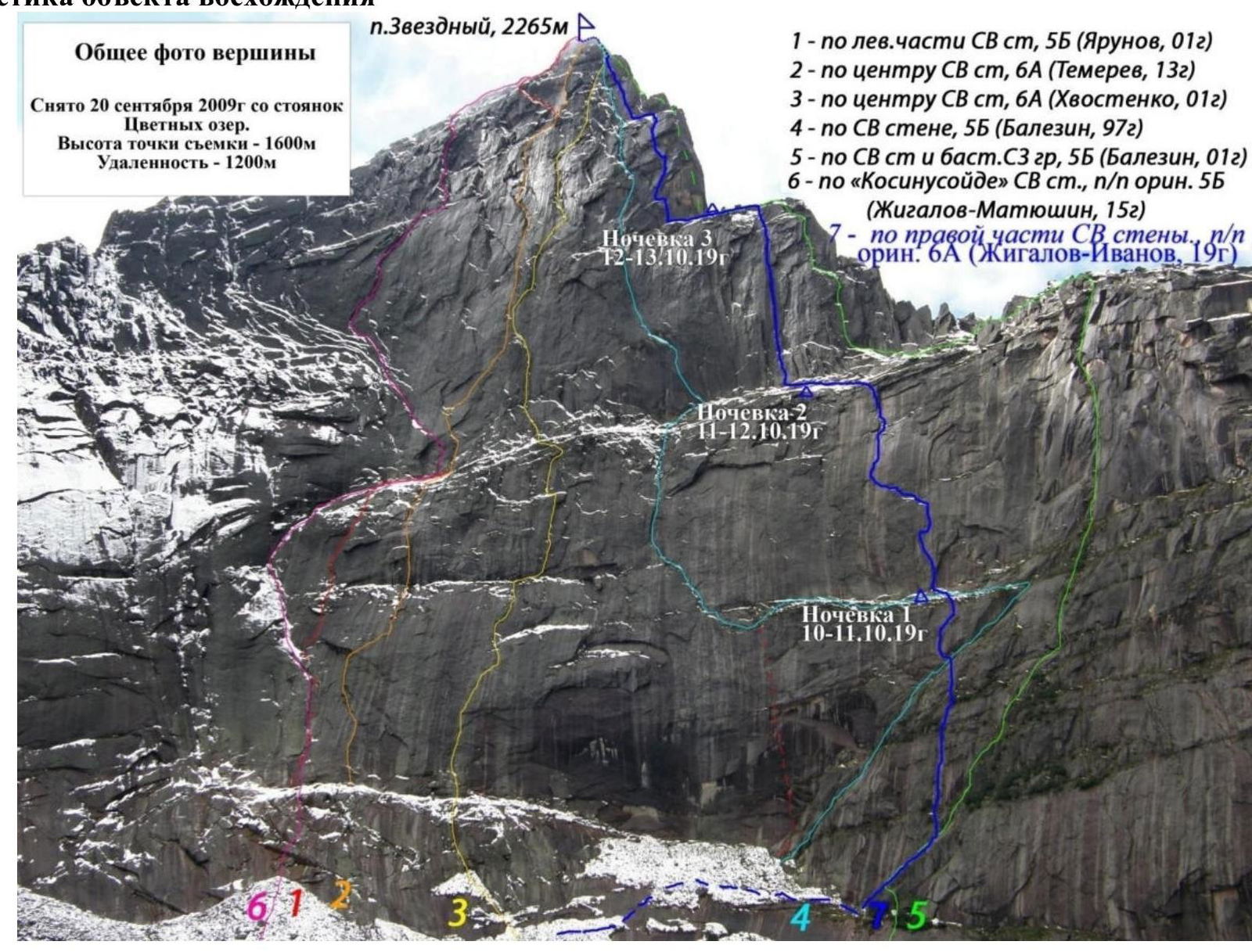 General photo of the summit
Taken on September 20, 2009, from the Tsvetnye Lakes campsite.
Height of the shooting point — 1600 m.
Distance — 1200 m.
Peak Zvezdny, 2265 m.
Night 3: October 12–13, 2019
General photo of the summit
Taken on September 20, 2009, from the Tsvetnye Lakes campsite.
Height of the shooting point — 1600 m.
Distance — 1200 m.
Peak Zvezdny, 2265 m.
Night 3: October 12–13, 2019
- Via the left part of the NE wall, 5B (Yarunov, 2001)
- Via the center of the NE wall, 6A (Temerev, 2013)
- Via the center of the NE wall, 6A (Khvostenko, 2001)
- Via the NE wall, 5B (Balezin, 1997)
- Via the NE wall and the NW ridge bastion, 5B (Balezin, 2001)
- Via the "Cosinusoid" of the NE wall, first ascent, original, 5B (Zhigalov-Matyushin, 2015)
- Via the right part of the NE wall, first ascent, original, 6A (Zhigalov-Ivanov, 2019) Night 2: October 11–12, 2019 Night 1: October 10–11, 2019
1.2. Photo of the route profile from the right
 In the photo:
Peak Zvezdny – 2265 m
1675 m
Night 3: October 13–14, 2019
Night 2: October 12–13, 2019
Night 1: October 11–12, 2019
In the photo:
Peak Zvezdny – 2265 m
1675 m
Night 3: October 13–14, 2019
Night 2: October 12–13, 2019
Night 1: October 11–12, 2019
1.3. Drawn profile of the route
Profile of the route via the right part of the NE wall to Peak Zvezdny (2265 m)

1.4. Photopanorama of the area indicating the names of the summits, their heights, and passes
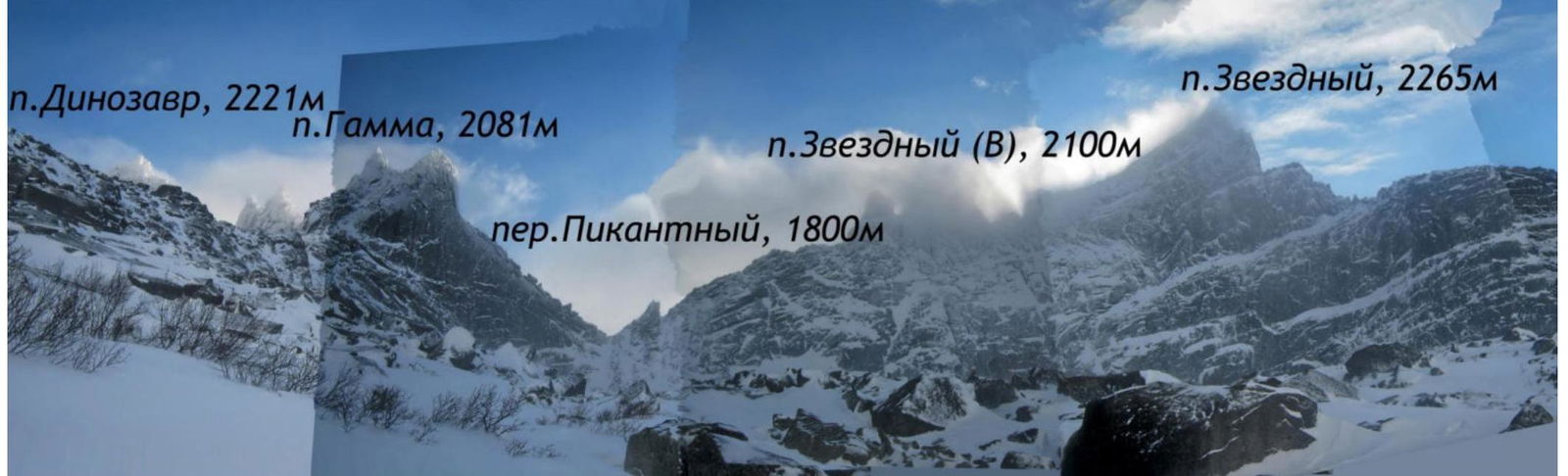 In the photo:
Peak Dinosaur, 2221 m
Peak Gamma, 2081 m
Peak Zvezdny, 2265 m
Peak Zvezdny (W), 2100 m
Pass Pikantny, 1800 m
In the photo:
Peak Dinosaur, 2221 m
Peak Gamma, 2081 m
Peak Zvezdny, 2265 m
Peak Zvezdny (W), 2100 m
Pass Pikantny, 1800 m
1.5. Map of the area at a scale of no more than 1:80,000, schematic map of the ascent object.
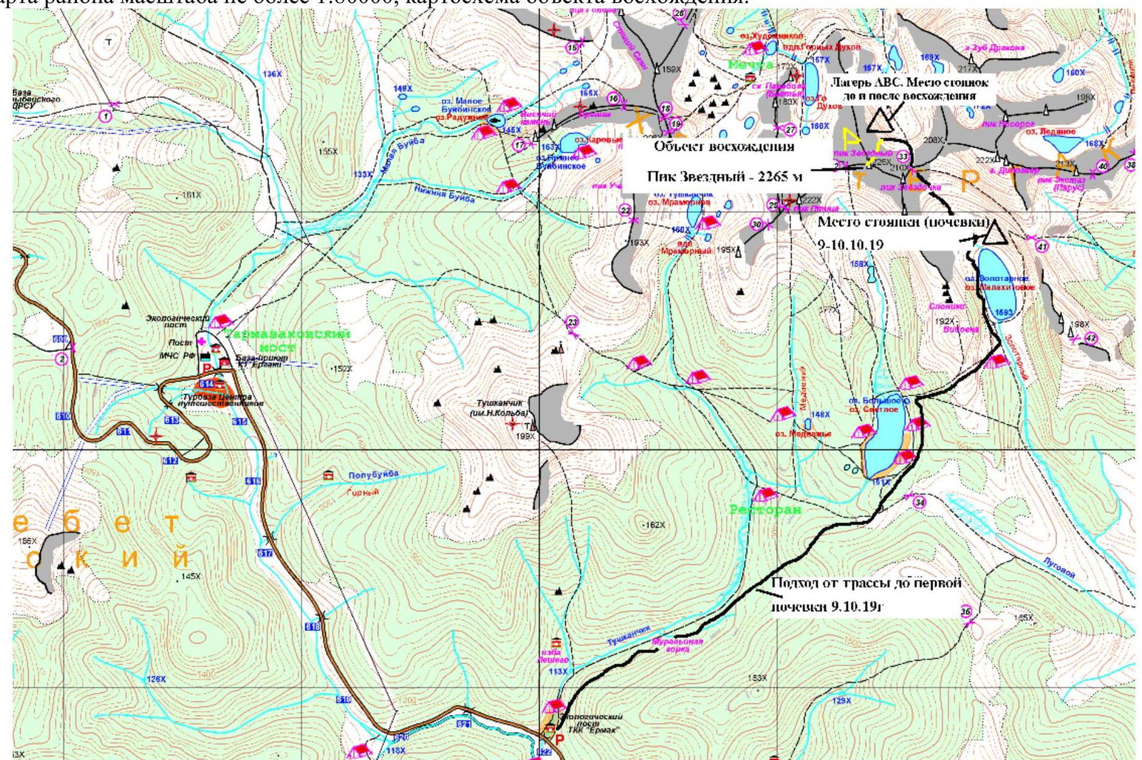 On the map:
ABC camp, Location of the Wild Spirits campsite before and after the ascent
Ascent object: Peak Zvezdny 2265 m
Campsite (overnight stay): October 9–10, 2019
Approach from the road to the first overnight stay on October 9, 2019
On the map:
ABC camp, Location of the Wild Spirits campsite before and after the ascent
Ascent object: Peak Zvezdny 2265 m
Campsite (overnight stay): October 9–10, 2019
Approach from the road to the first overnight stay on October 9, 2019
2. Characteristics of the Route
2.1. Technical photo of the route

2.3. Scheme of the route in UIAA symbols, drawn to a scale of 1:2000

3. Characteristics of the Team's Actions
3.1. Brief description of the route passage.
| Section # | Description | Photo # |
|---|---|---|
| R1–R2 | A section traversed via free climbing about 40 m on a mirrored surface covered with snow. Belay points mainly camalots. | |
| R2–R3 | A monolithic wall with a crack overgrown with grass, traversed via artificial aids (ITo). Unreliable points, mainly for grassy tufts that didn't freeze completely (points often pop out). Belay points mainly anchors, anchors with offset, fifi hooks, camalots. | |
| R3–R4 | About 40 m on mirrored surfaces sprinkled with snow, with a wall, cracks overgrown with grass. Exit to a large shelf where the route intersects with V.V. Balezin's route (1998). Belay points mainly anchors, fifi hooks, camalots. | |
| R4–R5 | A monolithic wall with cracks overgrown with grass, traversed via ITo. Up and right via a series of small shelves leading to a large shelf. Unreliable points. Tufts thaw in the sun, points pop out. Belay points mainly anchors, anchors with offset, fifi hooks, camalots. | Photo 1 |
| R5–R6 | Along the shelf left to a hanging internal corner. Overnight 1 location. | |
| R6–R7 | A hanging internal corner with cracks filled with ice. Further left and up, the corner turns into a wall filled with ice, followed by a "sickle" going right. The "sickle" transitions into a monolithic wall. The entire section is traversed via ITo. Belay points mainly anchors, anchors with offset, fifi hooks, camalots. | Photo 2, Photo 3 |
| R7–R8 | Traverse left and up via inclined shelves transitioning into walls. Belay points on grassy tufts. A bolt is hammered on station R8. Belay points mainly anchors, anchors with offset, fifi hooks, camalots, bolt. | |
| R8–R9 | First key section. Via the "sickle" going left, extremely unreliable terrain. Further, the "sickle" transitions into a monolithic wall with virtually no terrain. ITo, sky hooks (about 5 steps). Belay points mainly anchors, sky hooks, bolts. | Photo 4, Photo 5 |
| R9–R10 | Monolithic wall with virtually no terrain. Section traversed via ITo, sky hooks (about 10 steps), with an intermediate bolt hammered (ear removed). Belay points mainly anchors, sky hooks, bolts. | Photo 4, Photo 5 |
| R10–R11 | Left and up via a series of internal corners filled with ice, leading to a large middle shelf. Belay points mainly anchors, anchors with offset, fifi hooks, camalots. | Photo 6 |
| R11–R12 | Left along the shelf about 130 m. Overnight 2 location. | |
| R12–R13 | Monolithic wall with a series of cracks overgrown with grass, transitioning into an internal corner overgrown with grass. Belay points mainly anchors, anchors with offset, fifi hooks, camalots. | Photo 7 |
| R13–R14 | A long vertical internal corner, narrowing towards the top, partially overhanging. Belay points unreliable, cracks filled with ice and overgrown with grass. Station organized at the base of a corniche. Belay points mainly anchors, anchors with offset, fifi hooks, camalots. | Photo 8 |
| R14–R15 | Through the corniche transitioning into an internal corner via cracks filled with ice. Belay points mainly anchors, anchors with offset, fifi hooks, camalots. | |
| R15–R16 | Through an overhang, exiting onto a series of monolithic walls, cracks of which are overgrown with grass. Belay points mainly anchors, anchors with offset, fifi hooks, camalots. | Photo 9 |
| R16–R17 | After a small wall — exit to a large shelf. Overnight 3 location. | |
| R17–R18 | Traverse left along the shelf about 50 m, to the start of section R18. | |
| R18–R19 | Vertical internal corner overgrown with frozen grass, going left and up, exiting onto a shelf. Belay points mainly anchors, anchors with offset, fifi hooks, camalots. | Photo 10, Photo 13 |
| R19–R20 | Vertical monolithic wall, crack of which goes right and up. Further, an internal corner goes up to station R20. On station R20, a bolt is hammered with a control cairn. Belay points mainly anchors, anchors with offset, fifi hooks, camalots. | Photo 11, Photo 13 |
| R20–R21 | Via the internal corner through an extremely inconvenient overhang, which cannot be bypassed. Further, a monolithic wall with cracks overgrown with grass. Belay points mainly anchors, anchors with offset, fifi hooks, camalots. | |
| R21–R22 | Second key section of the route. Overhanging monolithic wall, crack of which is overgrown with grass, transitioning into a corniche, followed by a chimney with a plug. Further, exit to a large shelf. Points unreliable. Belay points mainly anchors, anchors with offset, fifi hooks, camalots. | Photo 12 |
| R22–R23 | Along the shelf left about 20 m to the start of the internal corner. Belay points mainly anchors, camalots. | |
| R23–R24 | Internal corner going left and up. Belay points mainly anchors, anchors with offset, camalots. | |
| R24–R25 | Monolithic wall going under a corniche, after which it continues. Belay points mainly anchors, anchors with offset, fifi hooks, camalots. | Photo 14 |
| R25–R26 | Large chimney exiting into an internal corner with a corniche. Further — a large convenient pre-summit shelf. Belay points mainly anchors, anchors with offset, camalots. | |
| R26–R27 | Via a series of inclined slabs — exit to the summit. |
Photo 1. Timofey Ivanov traversing section R4–R5
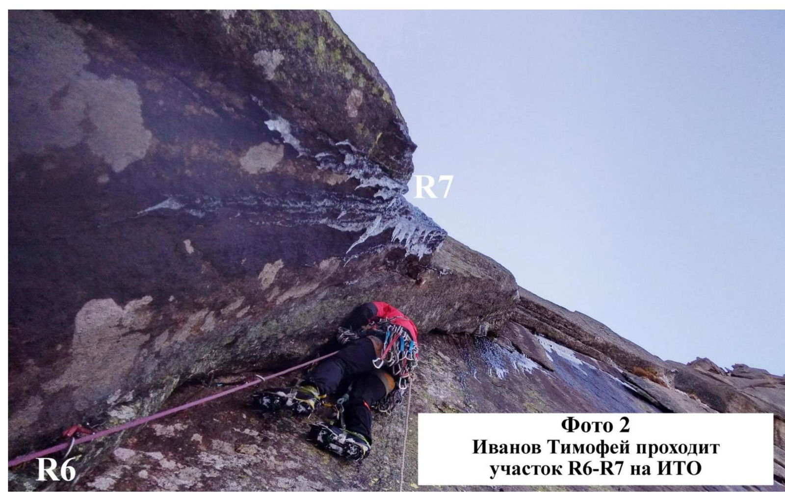
Photo 2. Timofey Ivanov traversing section R6–R7 on ITo

Photo 3. Alexander Zhigalov traversing the upper part of section R6–R7 on ITo
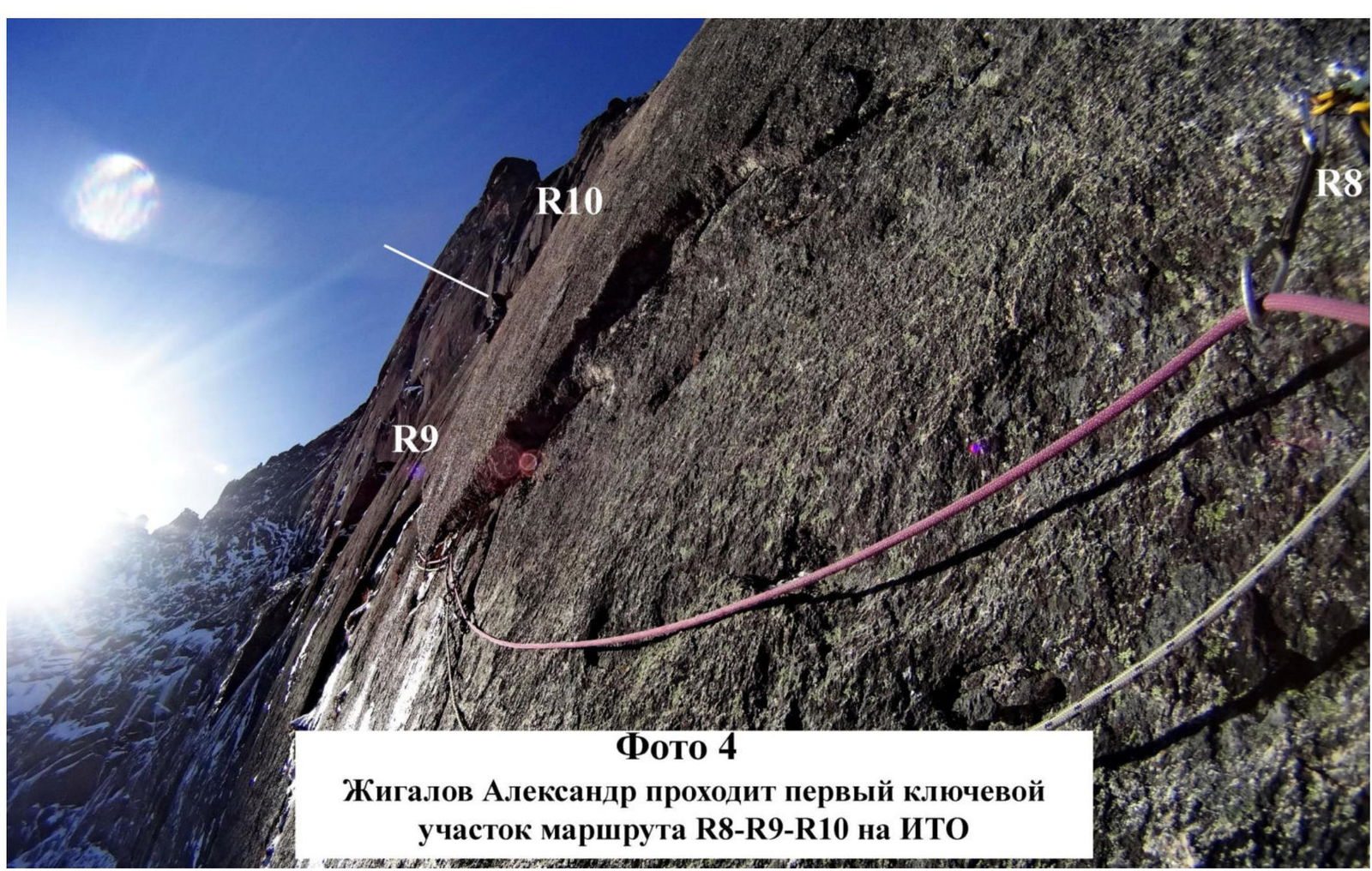
Photo 4. Alexander Zhigalov traversing the first key section of the route on ITo:
R8
R9
R10
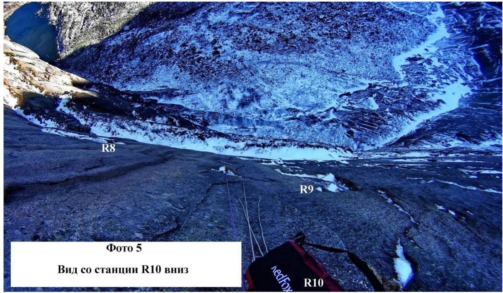
Photo 5. View from station R10 downwards
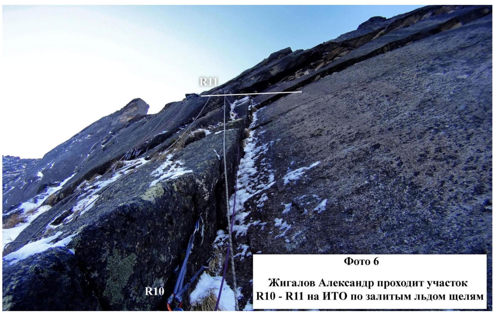
Photo 6. Alexander Zhigalov traversing the section on ITo via ice-filled cracks:
R10
R11
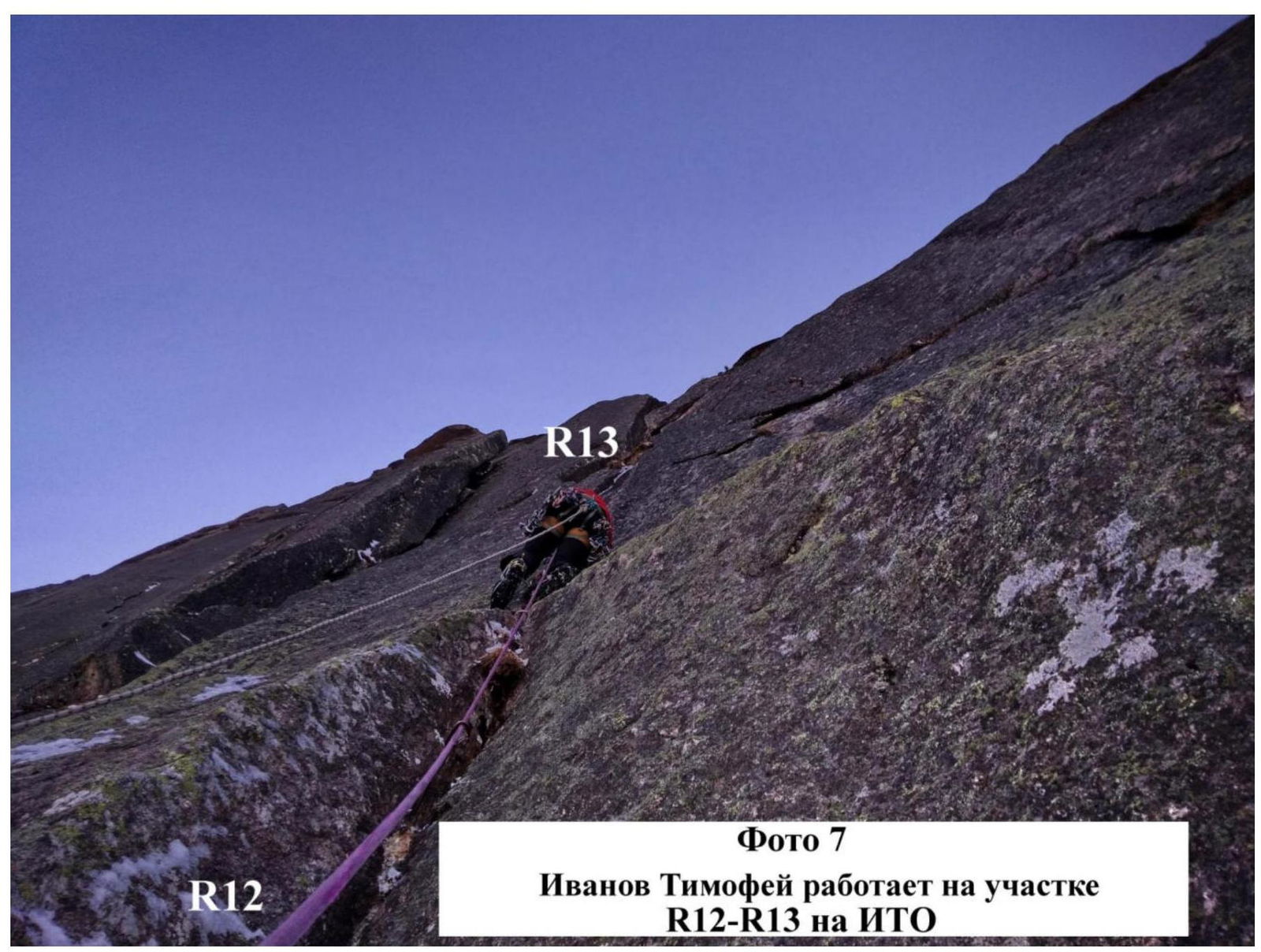
Photo 7. Timofey Ivanov working on section R12–R13 on ITo
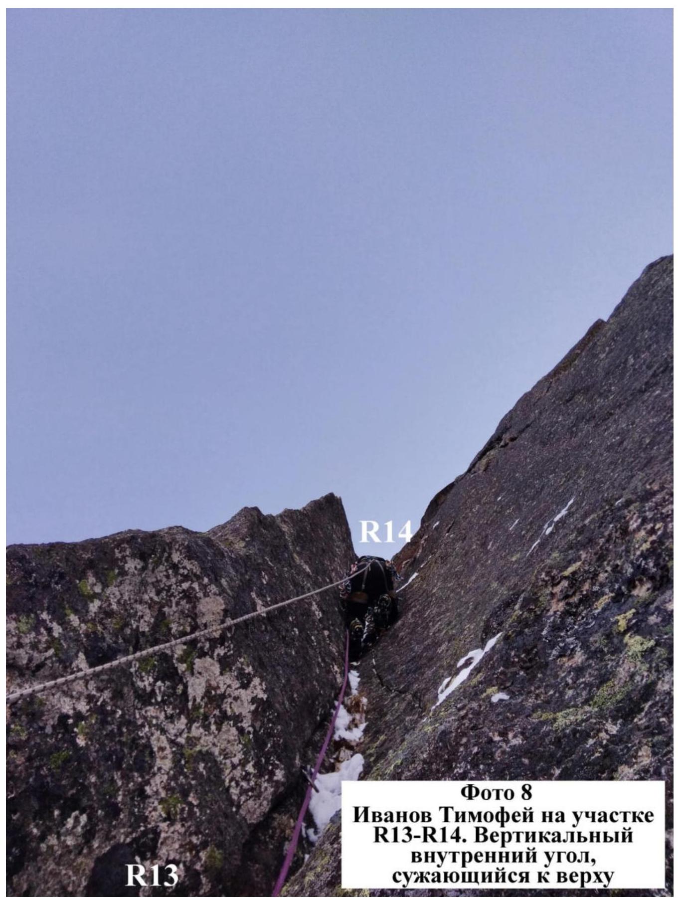
Photo 8. Timofey Ivanov on section R13–R14. Vertical internal corner narrowing towards the top
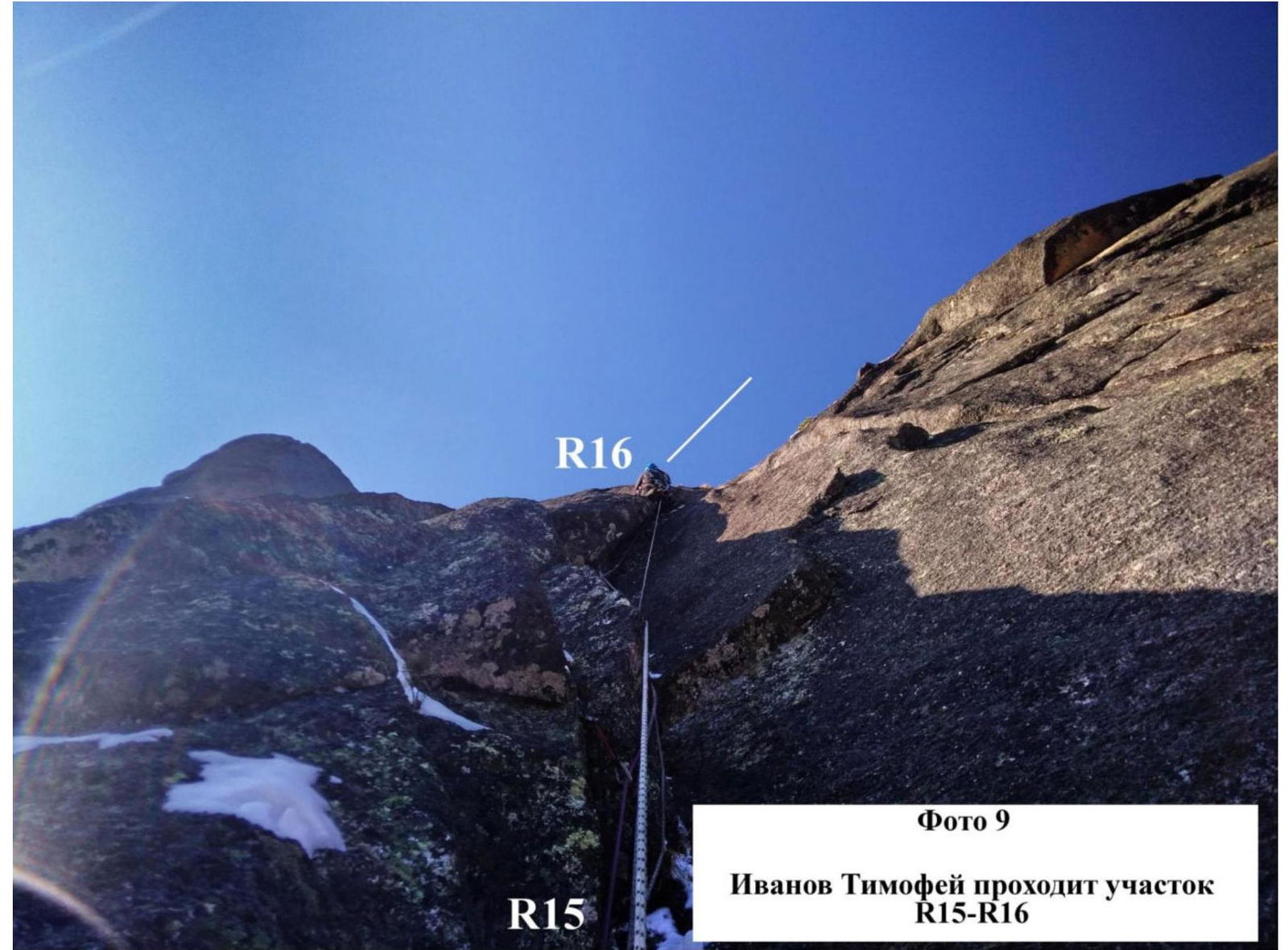
Photo 9. Timofey Ivanov traversing section R15–R16
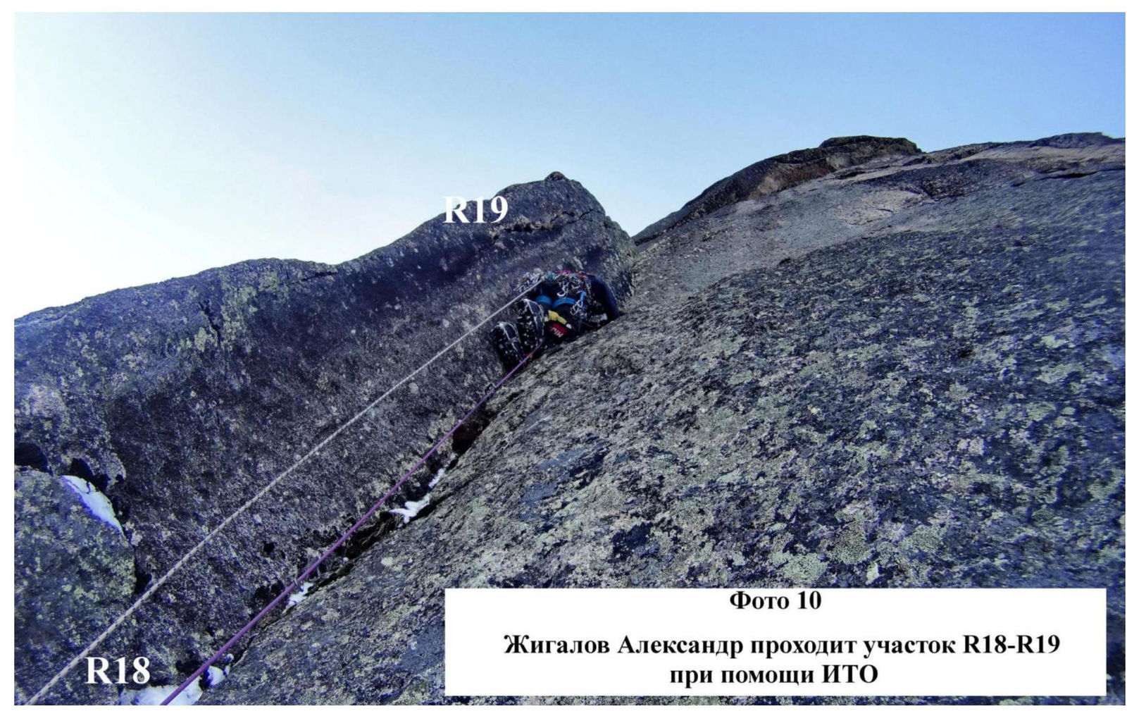
Photo 10. Alexander Zhigalov traversing section R18–R19 with the aid of ITo
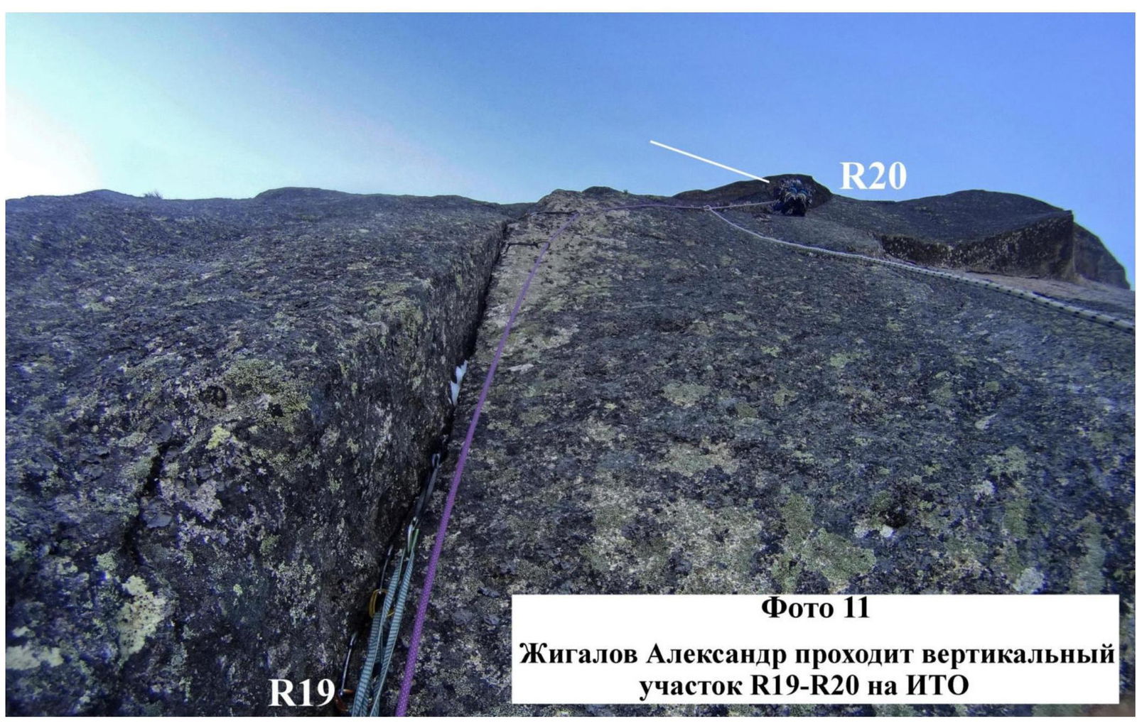
Photo 11. Alexander Zhigalov traversing the vertical section R19–R20 on ITo

Photo 12. Upper part of the second key section of the route. R21–R22
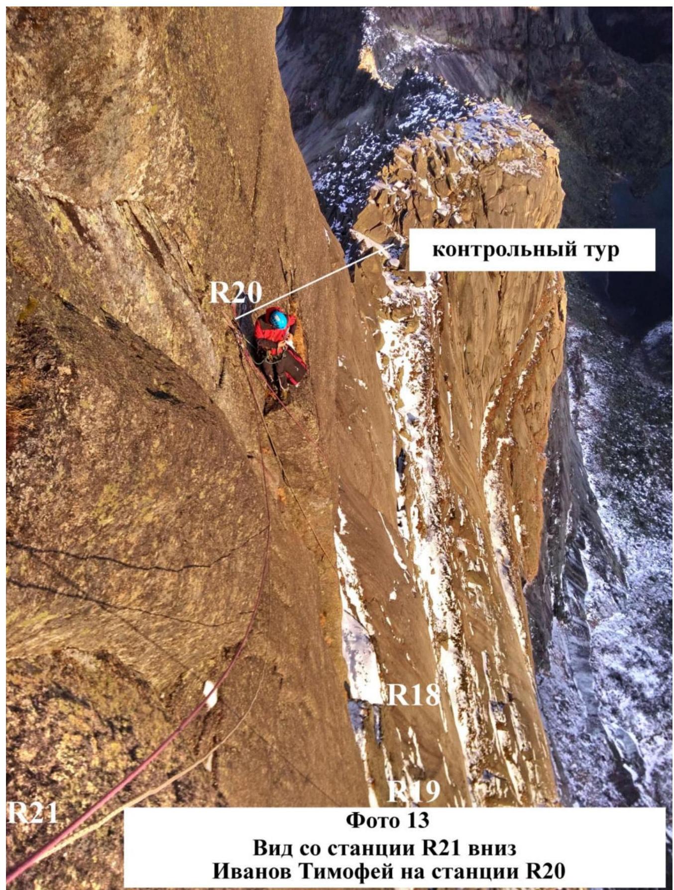
Photo 13. View from station R21 downwards — Timofey Ivanov on station R20
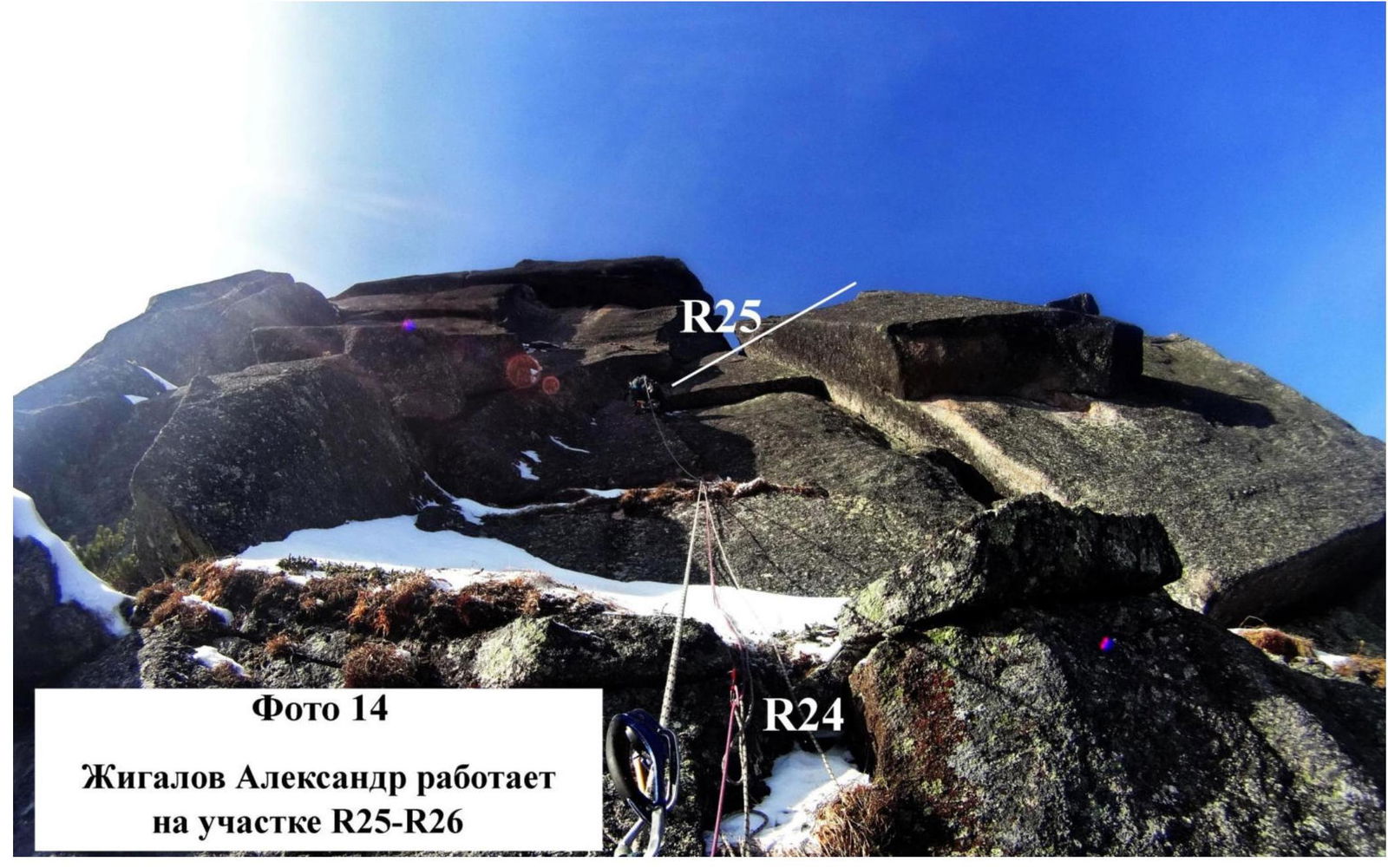
Photo 14. Alexander Zhigalov working on section R25–R26
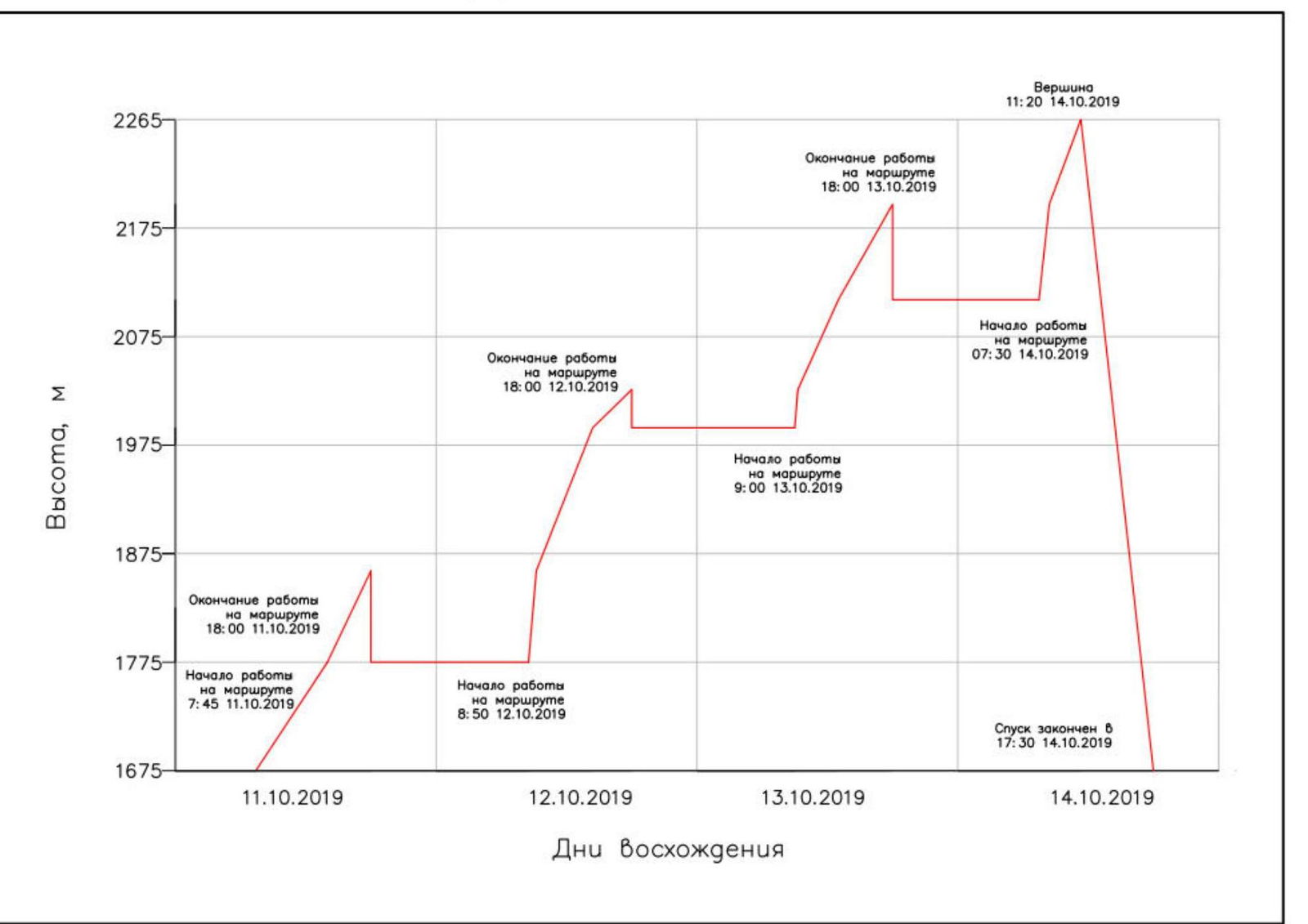
Ascent graph of the team:
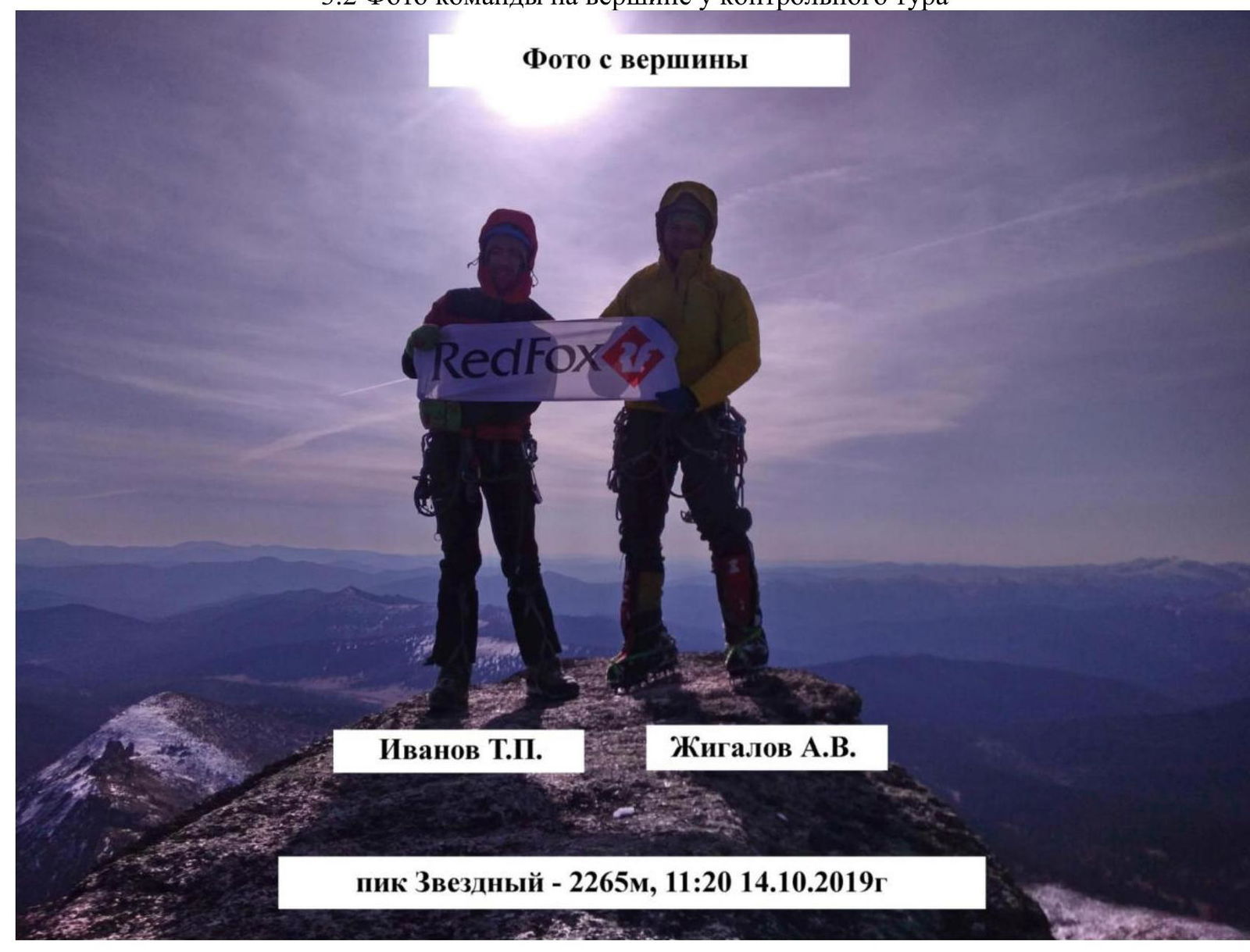
3.2. Photo of the team on the summit at the control cairn
3.3. In the team's opinion, the route is objectively safe because:
- the mountain is monolithic granite,
- icicles only thawed in the morning with the sun's appearance.
The team maintained communication on the route using the Tele2 mobile operator. Sometimes managed to catch mobile internet.
We wish future climbers good weather and pleasant time on the route.
Descent from the summit is via Temerev's route, 6A category of difficulty. Immediately under the summit tower, a bolt is visible, marking the start of the descent route towards the NE wall.
The team has experience with 6A category of difficulty ascents in this area, including on Peak Zvezdny. We believe the route corresponds to the 6th category of difficulty. The height difference, length of sections with 5 and 6 category of difficulty, and the angle of inclination meet the requirements for the 6th category of difficulty in all parameters.
A rather complex route:
- The longest among all other routes on this wall.
4. Characteristics of Weather Conditions
The autumn period in Ergaki is very unpredictable. Previous expeditions always took place under very poor weather conditions. This year we managed to catch a weather window. All days of the ascent had stable weather. No precipitation. On the penultimate day, October 13, the weather window was disrupted: a strong wind picked up, which did not subside until we descended from the wall on October 14.
Daytime temperature was: –4…–7 °C. Nighttime temperature dropped to –10…–12 °C.