Ascent Passport
- Region: Eastern Sayan, Tunkin Goltsy, section 6.1.2
- Pik Lyubvi 2121 m via waterfall ice on the right stream of the SW ridge
- Proposed 2B category of difficulty in winter, first ascent.
- Route type: combined.
Elevation gain: 1111 m (GPS); Average slope of the entire route: 32°; Total route length: 2100 m; VI category of difficulty: 0 m; V category of difficulty: 0 m; IV category of difficulty: 12 m; III category of difficulty: 60 m;
- Total number of "hooks" used on the route: 20
Left behind: 0; Placed: 0; Rock: 0; Ice: 20; ITO: 0;
- Total climbing time: 7 h 10 min
Route started: 08:15, December 19, 2015. Reached the summit: 15:25, December 19, 2015. Returned to base camp: 17:40, December 19, 2015.
- Leader and coach: Voylichenko S.K., CMS, instructor III category. Participants: Bobrov D., z.; Zhdanov D., III sp. razryad; Kolesnikova O., z.
- Responsible for the report: Voylichenko S.K. kim@inbox.ru
- Organization: Irkutsk Alpine Section.
Irkutsk – 2015
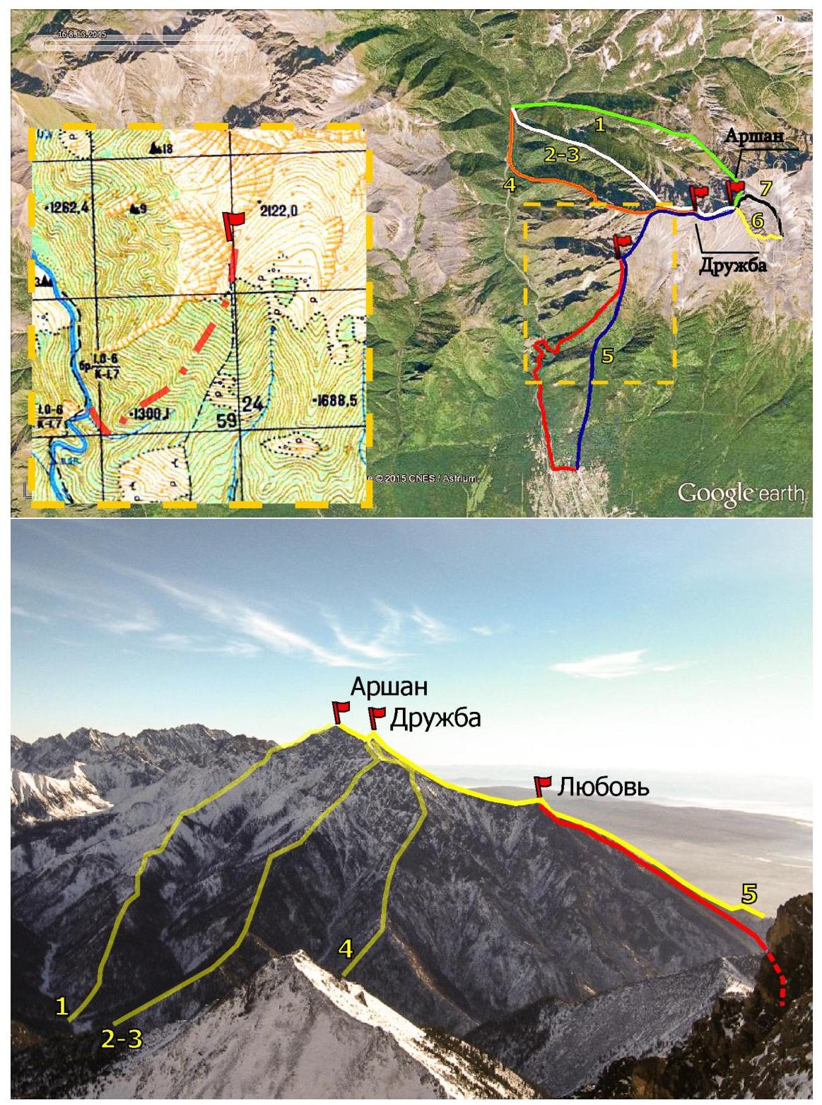
Fig. 1: General layout of routes and panorama of peaks. Routes on Arshan:
- 1 — 1B Trubnikov 1971;
- 3 — 3A Luzanin 1970;
- 5 — 2B Bonadysenko 1995;
- 6 and 7 — 2A and 3B Khandazhapov 2005. Routes on Druzhba:
- 2 — 2A Prokopyeva 1988;
- 4 — 3A Afanasyev 2010. The climbed route is shown in red. Photo taken from v. Trekhglavaya (C) on Nov 8, 2015.

Fig. 2: Technical photograph of the route.
- Lower photo — technically challenging (ice) part of the route, sections R0–R5 (photo taken on Dec 5, 2015 from the W slope of the gorge).
- Upper photo — general view of the SW ridge, S ridge, and summit, sections R6–R8 (photo taken on Oct 4, 2015 from the ridge west of the gorge).
Brief geographical overview of the area and sporting characteristics
The unclassified peak 2100 m (according to the map) is colloquially known as "Pik Lyubvi" among locals. At the foot of the peak is the resort village of Arshan (900 m above sea level). The peak is popular among tourists:
- it is part of the alpine route 2B to p. Arshan (Bonadysenko 1995, listed as route #7 in the classifier);
- many trails are trodden on the southern slope;
- an annual run-up to the peak is held as part of the Irkutsk Region Skyrunning Championship in the "vertical kilometer" discipline, Fig. 1.
Pik Lyubvi is located in the southwestern part of the ridge connecting p. Druzhba (2500 m) and p. Arshan (2544 m). To the west, the ridge is bounded by the Kyngarga river gorge, and to the east, it connects through a narrow saddle to p. Bronenosets (2464 m). The northern slopes of the peak are strongly destroyed, overhanging rocks that drop into the abyss. The eastern slopes:
- form the cirque of p. Druzhba;
- are composed of scree and large rock fragments.
The western slopes:
- represent a series of heavily destroyed counterforts descending to the bottom of the gorge;
- are covered with vegetation in the lower part.
The idea of climbing the route arose due to the limited number of routes with an icy character in the Eastern Sayan mountains. A feature of the route is the waterfall seasonal ice that freezes by the end of November along the stream flowing into the Kyngarga from the eastern slope of the gorge. The favorable climbing period is from early December to mid-April. Technical photographs of the route are shown in Fig. 2. This route should be considered as a training route; participants are strongly recommended to practice on ice before ascending, and the leader is expected to have confident mastery of ice tools.
When moving along the waterfall ice, the danger from rocks is minimal; however, the ice freezes in ledges, and there is a high probability of falling onto an inclined shelf if one falls. The profile of the icy part of the route is shown in Fig. 3. When moving as a group along the ridge overgrown with bushes, caution is necessary. There is little snow on the slopes, and steps are not formed; under the snow, there is grass and rock slabs; when leaving the ridge to the side, there are many burnt stumps.
The ascent participants express gratitude to Afanasyev A.E., Kiselev K.V., and Antonov E.V. for valuable recommendations and discussion during the route assessment.
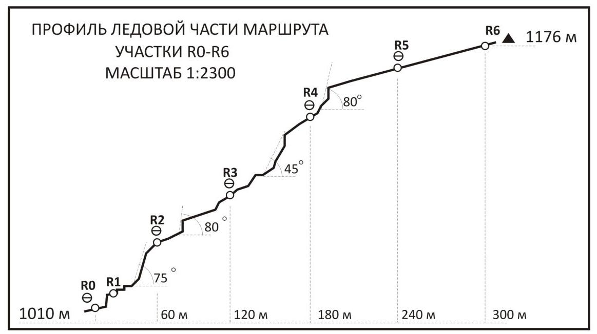
Fig. 3: Hand-drawn profile of the icy part of the route. Sections R0–R6.
Route description
From the village, we move along the Kyngarga river on the orographic left bank. It takes 40–50 minutes to reach the "Pereval Durakov".
Descent from the pass to the river along a frozen rocky scree, then along the river for 15–20 minutes, to the point where two powerful "icefalls" (frozen streams) descend from the western slope of the ridge leading to the peak, 50 m apart.
We start the ascent along the right stream. Beginning of the route.
On the day of departure, the weather was clear and windless, the temperature was −20°C in the morning and −15°C during the day. The group left the base camp in p. Arshan at 06:20. We reached the pass in 40 minutes. The ascent and descent on the pass took another 20 minutes. Along the river for 15 minutes to the start of the route. Start of the route at 08:15, altitude 1010 m, coordinates 51°56′01.00″ N and 102°25′32.00″ E.
It took 2 hours 35 minutes (10:50) to complete the icy part of the route. To the left of the direction of movement, there is a control cairn, from which there is an exit to the ridge. Altitude 1176 m.
The group reached the summit at 15:25. GPS height 2121 m, coordinates 51°56′43.88″ N and 102°26′24.75″ E. Time on the route 7 hours 10 minutes.
Descent began at 16:00 along the path of route 2B along the S ridge, return to base camp at 17:40.
Section R0. 4 m, IV, 85°. At the entrance to the narrow canyon, we set up a station. Upon entering the canyon, we come across an internal corner — a chimney with ice accretion. Ice wall 4 m, demanding work with ice tools. Exit to an inclined shelf. Section R1. 56 m, III, 75°. A series of vertical ice steps 1.5–2 m high. Insurance through ice screws. The canyon gradually widens, we come across a rock wall; to the left of us is a powerful, wide ice wall. The ice wall is traversed by traversing left. Movement along inclined ice shelves. End of 60 m rope, fixed rope.
Section R2. 60 m, II+, 30°, (4 m, 80°, III+). The vertical ice wall is taken on the right side, using small convenient ledges, III+. Insurance through ice screws. Work with ice tools. Exit to a gentle, extended section of simple ice. Organization of fixed rope.
When descending along the ascent path at this point, to the right of the descent direction, just before the edge of the wall:
- a convenient tree for rappelling 60 m to the bottom of the gorge.
Further movement is simultaneous in rope teams. The stream bed makes a turn to the right. Movement becomes more difficult; steep steps up to 1 m appear.
Section R3. 60 m, II+, 45° (3 m, 85°, IV). As we move forward, the difficulty increases. Ahead is a powerful cascade of vertical walls.
Organization of a station. The leader works with ice tools. Insurance through ice screws.
The ice wall ends with a complex vertical section 3 m, 85°, IV, passed on the left.
Exit to a wide inclined shelf, under the next ice wall, end of 60 m rope. Organization of fixed rope.
Section R4. 60 m, II+, 25° (5 m, 80°, IV). The vertical ice wall is traversed head-on. Demanding work with ice tools. Insurance from the station through ice screws.
Exit to a horizontal shelf. A long, gentle ice section is visible. We organize a station, receive the group.
When descending along the ascent path at this point:
- to the right of the descent direction — a convenient tree for rappelling 60 m to the start of section R3.
Section R5. 60 m, I+, 25°. Gentle ice section. Simultaneous movement. The stream bed makes a turn to the left. Control cairn to the left. Exit to the left from the ice onto a slope overgrown with bushes.
Section R6. 150 m, II-, 35°. From the control cairn, we head straight up to the ridge. Movement along a snowy, grassy slope among bushes and burnt trees. After 150 m, exit to the ridge.
Section R7. 1160 m, I, 32°. Along the ridge to the S ridge. The ridge is a grassy slope with rock outcrops, the detour of which is hampered by windfall. Simultaneous movement. Before reaching the ridge:
- the ridge turns into a wide slope;
- exit to the edge of the forest zone.
Section R8. 490 m, I-, 28°. Upon reaching the ridge, the cirque of p. Druzhba becomes visible. Along the ridge up 150 m — simple inclined rock slabs. After 100 m — a rock ascent; upon climbing it, the summit becomes visible. Then 350 m of snowy, grassy slope and the pre-summit ascent. Simultaneous movement.
Descent to the village along the trail on the S ridge. In case of approaches from the base camp from the "arrow", descent is possible along the ascent path, and two rappels of 60 m to a tree will be required.
Route characteristics table
| Section # | Length | Steepness | Difficulty | Used | In UIAA symbols |
|---|---|---|---|---|---|
| R8 | 490 m | 28° | I- | - | |
| R7 | 1160 m | 32° | I | - | |
| R6 | 150 m | 35° | II- | - | |
| R5 | 60 m | 25° | I+ | 2 | |
| R4 | 60 m (5 m) | 25° (80°) | II+ (IV) | 4 | |
| R3 | 60 m (3 m) | 45° (85°) | II+ (IV) | 4 | |
| R2 | 60 m (4 m) | 30° (80°) | II+ (III+) | 4 | |
| R1 | 56 m | 75° | III | 4 | |
| R0 | 4 m | 85° | IV | 2 | |
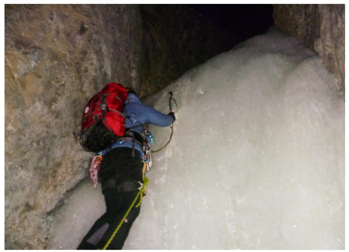 |
Fig. 4: Section R0. Start of the route. Leader Bobrov D. overcomes a wide chimney with ice accretion 4 m, 80°, IV.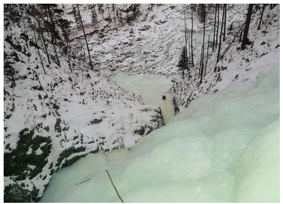
Fig. 5: On sections R0–R1. View of the first 60 m rope from station R2. Below, at station R0, participant Kolesnikova O.
Fig. 6: Second 60 m rope from station R2. A 4-meter steep ice wall is overcome using ledges on the right.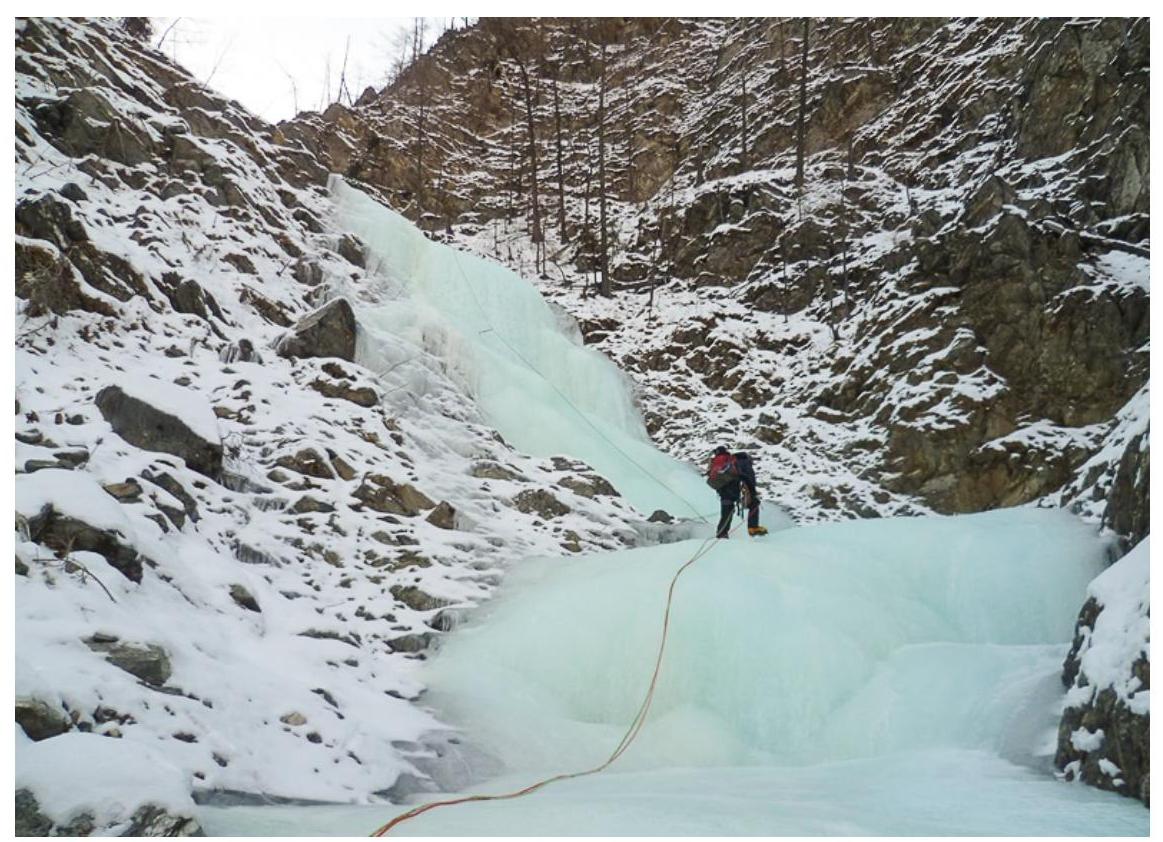
Fig. 7: Third 60 m rope from station R3. Section R3 ends with a vertical wall 3 m, 85°, IV. On the fixed rope is participant Zhdanov D.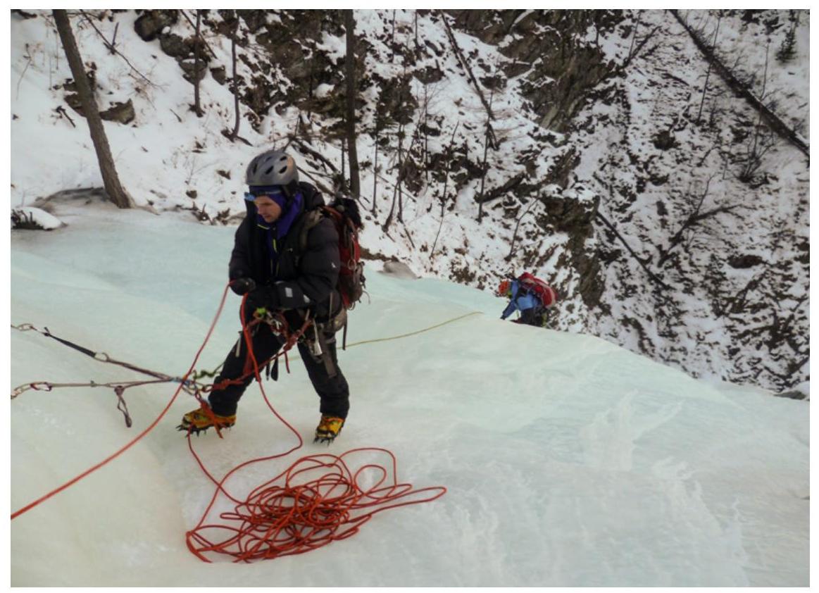
Fig. 8: Station R4. End of the third rope. On belay is Zhdanov D., on fixed rope is Kolesnikova O.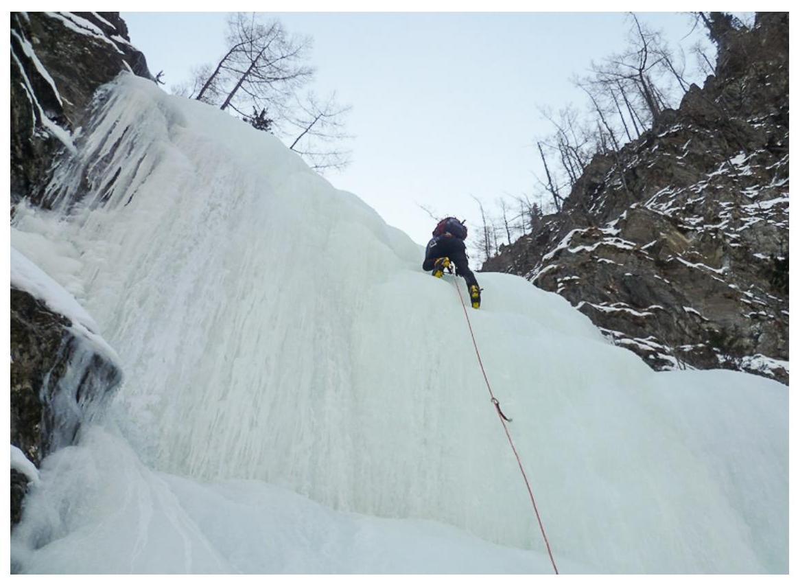
Fig. 9: Fourth 60 m rope on section R4. Leader Bobrov D. overcomes an ice wall 5 m, 80°, IV.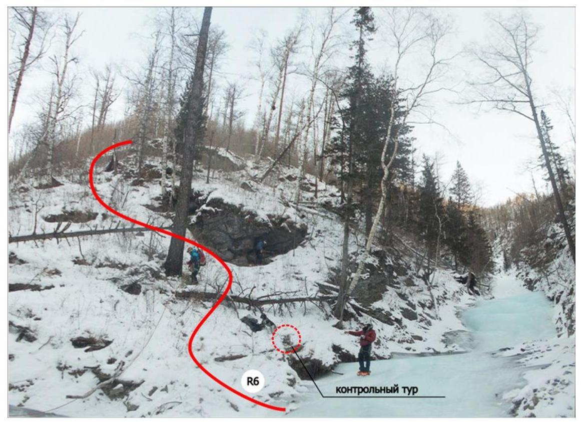
Fig. 10: End of the fifth 60 m rope and the icy part of the route. Sections R5–R6. Control cairn to the left.
- Up the slope to the ridge 150 m.
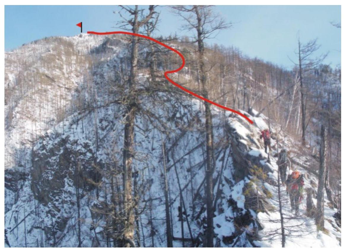
Fig. 11: On section R7. Simultaneous movement along a low-snow ridge to the S ridge 1 km.
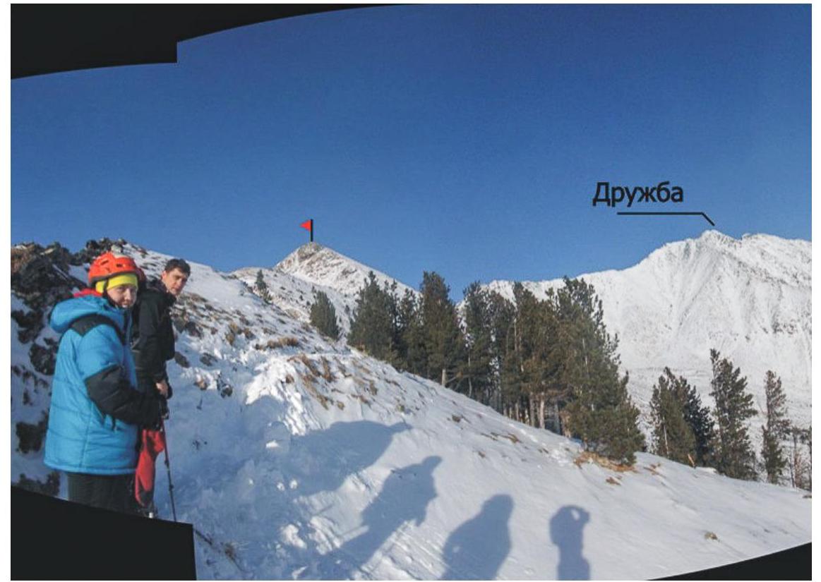
Fig. 12: On section R8. Trail on the S ridge. There are 400 m left to the summit.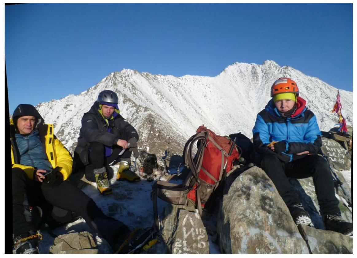
Fig. 13: Group photo at the summit. From left to right:
- Bobrov D.
- Zhdanov D.
- Kolesnikova O.
- control cairn


