
Report
On the ascent of Tykhen-Ardyn peak (3192) via the "Gutter of the southeastern wall" route, category 4A, in winter by the team of the Irkutsk Alpine Section from 09.11.2021 to 09.11.2021.
I. Ascent Passport
| 1. General Information | ||
|---|---|---|
| 1.1 | Full name, sports rank of the leader | Zhdanov D.A. 2nd sports rank |
| 1.2 | Full name, sports rank of the participants | Antonov O.A. 1st sports rank |
| 1.3 | Full name of the coach | |
| 1.4 | Organization | Irkutsk Alpine Section |
| 2. Characteristics of the Ascent Object | ||
| 2.1 | Region | Bolshoy Sayan |
| 2.2 | Valley | "Muguvak" |
| 2.3 | Section number according to the 2013 classification table | 6.1.1. |
| 2.4 | Name and height of the peak | Tykhen-Ardyn 3192 m (according to the classifier) |
| 2.5 | Geographical coordinates of the peak (latitude/longitude), GPS coordinates *(1) | N 51°44′56.93″ E 100°35′41.90″ |
| 3. Route Characteristics | ||
| 3.1 | Route name | Gutter of the SE wall |
| 3.2 | Proposed category of difficulty | 4A in winter conditions |
| 3.3 | Degree of route exploration | First ascent |
| 3.4 | Relief characteristics of the route | Combined |
| 3.5 | Height difference of the route (calculated) | 457 m (according to the classifier) 440 m (by GPS) |
| 3.6 | Route length [m] | 706 m |
| 3.7 | Technical elements of the route (total length of sections of varying difficulty with indication of relief type (ice-snow, rock)) | 1st cat. diff. ice, rock — 164 m. 2nd cat. diff. ice, rock — 341 m. 3rd cat. diff. ice, rock — 52 m. 4th cat. diff. ice, rock — 108 m. 5th cat. diff. ice, rock — 34 m. 6th cat. diff. ice, rock — 7 m. |
| 3.8 | Average steepness of the route, ° | 43° |
| 3.9 | Average steepness of the main part of the route, ° | 47° (R1–R9) |
| 3.10 | Descent from the peak | Eastward via route 2B to "Gorniy" pass, then southward into Muguvak valley |
| 3.11 | Additional route characteristics | The route was climbed in winter conditions |
| 4. Characteristics of the Team's Actions | ||
| :-- | :-----------------------------------------------------------------------------------------------------: | :--------------------------------------------------------------------------------------------------------------------------: |
| 4.1 | Time on the move (team's working hours, indicated in hours and days) | 10 hours — working hours on the route. 19.5 hours — working hours from BL to BL. 4.5 hours — approach to the route from BL. |
| 4.2 | Overnights | - |
| 4.3 | Time spent on route processing | - |
| 4.4 | Departure onto the route | 9:00; 09.11.2021 |
| 4.5 | Arrival at the peak | 19:00; 09.11.2021 |
| 4.6 | Return to the base camp | 23:50; 09.11.2021 |
| 4.7 | Number of ice screws used | 33 pcs |
| 4.8 | Number of anchors used | 18 pcs |
| 4.8 | Number of chocks used | 10 pcs |
| 4.8 | Number of friends used | 3 pcs |
| Including UIAA | - | |
| 4.9 | TOTAL equipment used | 64 pcs |
| 5. Weather Conditions | ||
| 5.1 | Temperature, °C | −7…−12°C |
| 5.2 | Wind speed, m/s | Calm on the southern slope, NW wind 10 m/s on the ridge |
| 5.3 | Precipitation | None |
| 5.4 | Visibility, m | Clear |
| 6. Responsible for the report | ||
| 6.1 | Full name, e-mail | Zhdanov D.A., gerendal@mail.ru |
On November 9, 2021, the duo Oleg Antonov — Dmitry Zhdanov completed an ascent via the previously unclimbed ice gutter on the southeastern wall of Tykhen-Ardyn peak. We completed the main part of the route in 7 pitches, category 4–6. The entire route was climbed in 10 hours. We waited 3.5 years for our turn. We first identified the line in April 2018. During this time, we observed the route, gathered information, took photos from different angles, consulted, and trained. Many thanks to everyone who helped, observed, and assisted with transportation, reconnaissance, and belaying on the descent. Friends, a huge thank you for your support! Sergey Petrov, Tatyana Filippova, Alexey Buynevich, Nikolai Yakovchits, Dmitry Generalchenko, Alexander Golovin, Igor Novikov, Oleg Muravyev, Sergey Voylichenko…
- The team's route to Tykhen-Ardyn peak via the SE wall gutter.
1.1. Technical photograph of the route thread: upper part.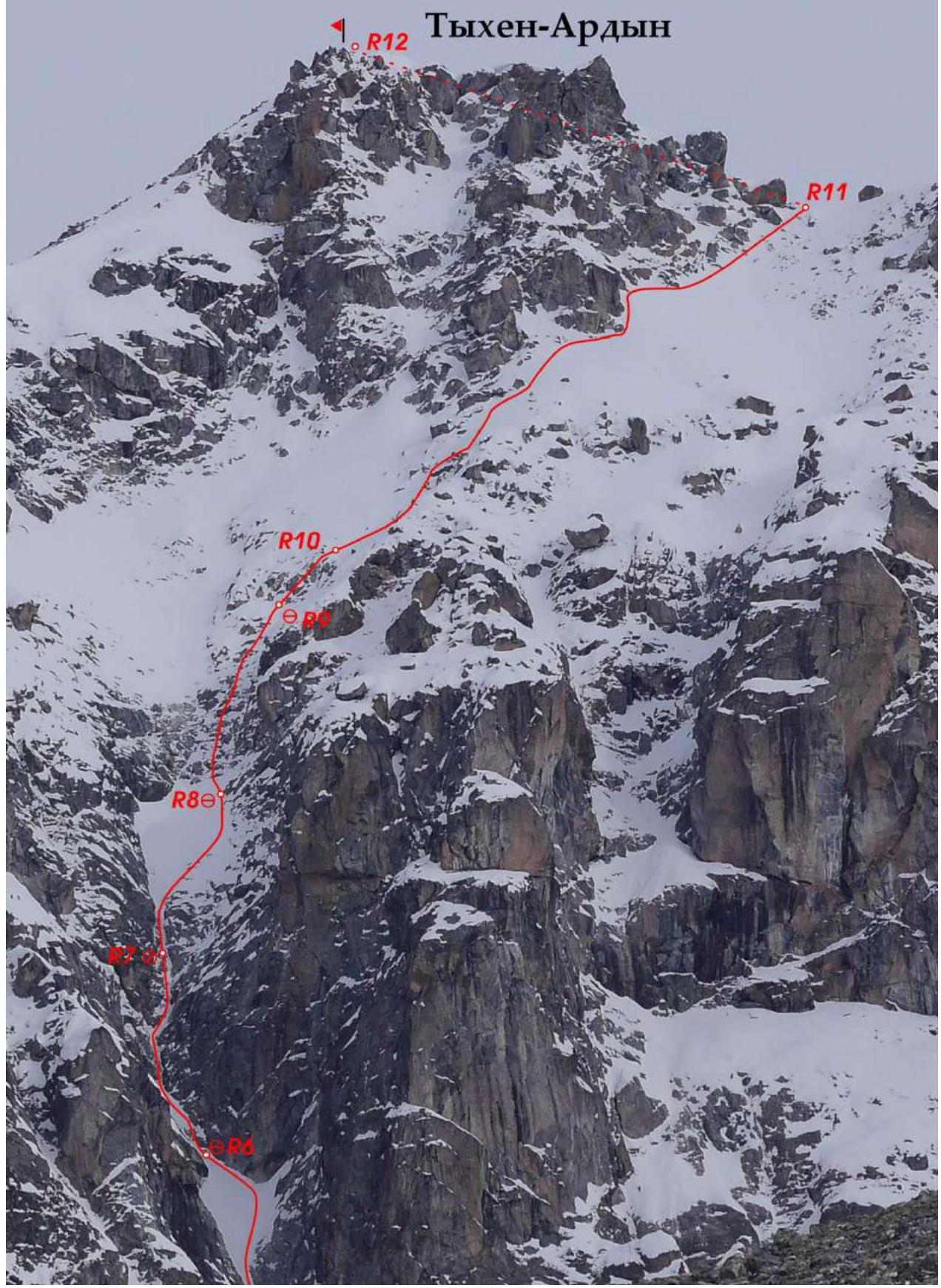 1.2. Technical photograph of the route thread: middle part.
 1.3. Technical photograph of the route thread: lower part.
1.4. Route Profile
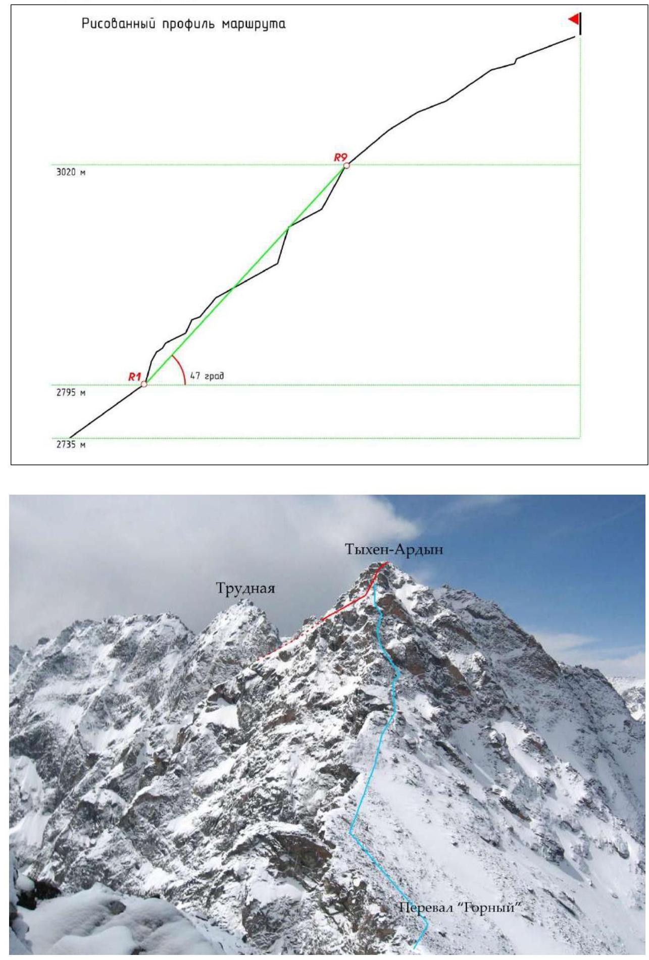
The steepness of the upper snow field is 25–35°.
2. General Characteristics of the Ascent Area

Photopanorama of the area. Photograph from the summit of Krylya Sovetov peak 3341 m.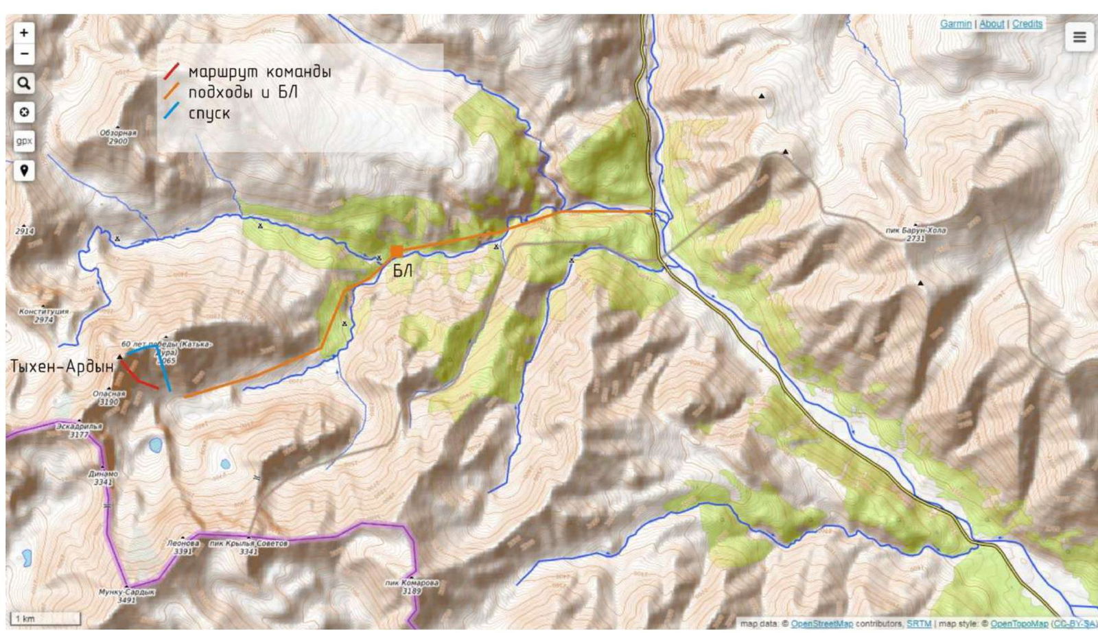
Map of the ascent area: https://opentopomap.org/#marker=15/51.74917/100.59528 ↗
3. Characteristics of the Team's Actions
3.1. Tactical Plan of the Team
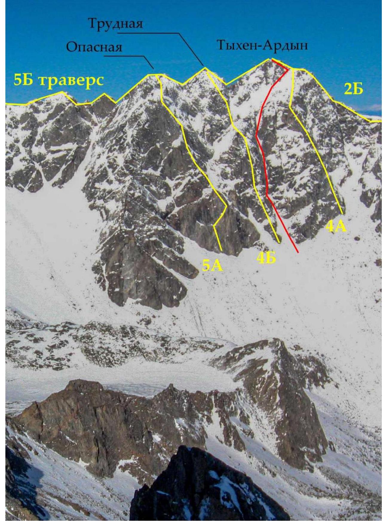
There are only 3 routes to the summit of Tykhen-Ardyn:
- 2B via the E ridge,
- 4A via the SE spur,
- 5B traverse of Dinamo — Tykhen.
The ascent was planned for late autumn (November 9) due to more stable snow conditions in the area and favorable weather conditions compared to the spring period.
Before the ascent, stable frosty weather with temperatures down to −20°C without precipitation persisted in the area for several days. On the day of the ascent, the air temperature during the day was around −10°C, with calm conditions on the southern slope and a northwest wind on the ridge.
On November 8, the team departed from Irkutsk to the region and was transported to the "strelka". On November 9 at 4:30, they began their ascent. The approach to the route (2735 m) from BL (1800 m) took 4.5 hours. The team of climbers (Antonov O. — Zhdanov D.) was accompanied by a support team (Petrov S. — Filippova T.). The support team's tasks included maintaining radio communication and ascending Tykhen-Ardyn via the eastern ridge, through Gorniy pass, to ensure the climbers' ability to orient themselves in the dark during their descent.
3.2. Tactical Actions of the Team on the Route
The Antonov O. — Zhdanov D. team worked on a double rope. Both participants climbed the route using ice tools. On the R0–R7 section, Antonov O. led, while on the R7–R12 section, Zhdanov D. led.
The group's equipment: 11 ice screws (2–10 cm, 4–12 cm, 4–13 cm, 1–18 cm), 6 anchors, 5 chocks, 2 friends, 3 slings, 10 quickdraws, 2 dynamic ropes 1/2, 60 m each, 2 pairs of ice tools.
Radio communication was maintained every hour. The descent from the summit to Gorniy pass was carried out with headlamps in the dark, following the tracks of the support team; on the ridge, they established 3 rappels of 60 m and one rappel of 30 m from the pass into the descent couloir. They were under the route by 22:00 and arrived at BL by 23:50.
3.3. Description of the Route Climb by the Team
The route to Tykhen-Ardyn peak via the SE wall gutter begins at an altitude of 2735 m, coordinates N51°44′46.19″ E100°35′58.79″.
R0–R1
The right side of the avalanche cone of the couloir, 100 m (2). Deep, loose snow. Mulda. Station on the left on 2 anchors.
R1–R2
Up the porous (airy) rime ice to the rock overhang, 17 m (5). From under the overhang, rightward along thin ice along the boundary between ice and rock, 5 m (6). Mixed climbing. Search for places to install short 10–12 cm ice screws.
A gently sloping snow shelf, 8 m (3). Here, an intermediate, inconvenient station was established: on the left on two ice screws, reinforced with the first point from the station on two blocked ice screws and an anchor. This station was forced due to a lack of equipment, and it is advisable to avoid it and move on to the entire rope length of 50–60 m under the shelter of the wall on the right.
From the shelf upward, there is a section of 5 m (5) of vertical snow and very thin rime ice; due to this, it is impossible to install an ice screw or drive an anchor from the climbing position. Upon exiting, very careful mixed climbing on smoothed rocks. Intermediate protection was provided by blocking several points at the beginning of the section. An inclined shelf in the ice, 5 m (3). Station on the right under the нависанием стены on 3 anchors (ice falls from the wall).
R2–R3
Traverse of a snow-covered inclined shelf from the station leftward, 5 m (2). A rock plug in the ice is passed on the right, 6 m (4). A snow-covered gutter, 25 m. Station on the left on 2 ice screws.
R3–R4
Through rocks and porous ice in the shape of an "hourglass", 12 m (5). Exit under a rock block wedged across the width of the entire gutter, which is bypassed on the right along monolithic rocks, exit from under the нависание through a roll onto the right heel, 2 m (6). Snow-covered gutter, 20 m. Station on the left on an anchor and an ice screw.
R4–R5
Rime ice on snow and rocks, 28 m (2–4). Station on the left on 2 anchors.
R5–R6
Snow-covered gutter, loose snow, 50 m (1). Station on the right on 2 ice screws.
R6–R7
Upward along smoothed rocks and rime ice to the base of the rocks, an internal corner to the right, a narrow, thin ice stream, 45 m (4). Careful mixed climbing with unreliable protection on ice, short ice screws, ice crumbling to the base, protection on rock is difficult. Inconvenient station on 2 ice screws on poor ice.
R7–R8
Continuation of difficult climbing on rocks with deep crevices and rime ice, 10 m (4). Keeping to the right side of the wide, avalanche-prone mulda, 30 m. Station in the right part of the base of the rocks on 3 anchors.
R8–R9
Upward along complex rocks, 50 m (4). Snow slope. Station on 3 chocks at the base of the rock island.
R9–R10
Simultaneously up the snow-covered rocks until the summit tower comes into view, 30 m (3). Protection behind the terrain.
R10–R11
Loose snow on avalanche-prone slopes, bypassing the summit tower on the right, 140 m. Protection behind the terrain and chocks. Exit onto the eastern ridge.
R11–R12
To the summit, 100 m along the snow-covered ridge via route 2B. To the right of the ridge: a chimney, the summit ridge.
3.4. UIAA Scheme
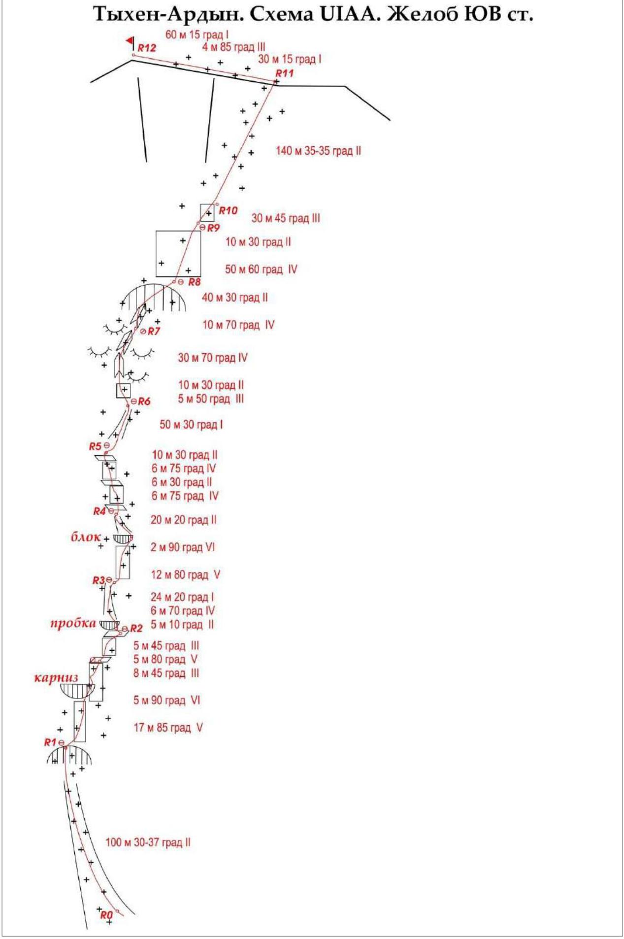 Tykhen-Ardyn. UIAA Scheme. SE wall gutter.
3.5. Character and Complexity of the Relief on the Route by Sections
| Section | Relief Character by Sections | Ice Screws | Anchors | Chocks | Friends | UIAA Complexity | Length [m] | Average Steepness [deg] |
|---|---|---|---|---|---|---|---|---|
| R0–R12 | TOTAL | 33 | 18 | 10 | 3 | from 1 to 6 | 706 | 43 |
| R0–R1 | Avalanche-prone couloir. Mulda | 2 | 2 | 100 | 30–37 | |||
| R1–R2 | Rime ice | 5 | 5 | 17 | 85 | |||
| Rock overhang | 2 | 6 | 5 | 90 | ||||
| Inclined shelf, ice, snow | 1 | 2 | 3 | 8 | 45 | |||
| Rocks, rime ice | 2 | 5 | 5 | 80 | ||||
| Inclined shelf, ice, snow | 3 | 3 | 5 | 45 | ||||
| R2–R3 | Oblique snow-covered shelf | 2 | 5 | 10 | ||||
| Rock plug | 1 | 1 | 4 | 6 | 70 | |||
| Snow-covered gutter | 2 | 1 | 24 | 20 | ||||
| R3–R4 | Rocks in rime ice | 3 | 1 | 5 | 12 | 80 | ||
| Monolithic rocks, overhang | 1 | 2 | 6 | 2 | 90 | |||
| Snow-covered gutter | 1 | 1 | 2 | 20 | 20 | |||
| R4–R5 | Rime ice, rocks | 2 | 4 | 6 | 75 | |||
| Inclined shelf, ice, snow | 2 | 6 | 30 | |||||
| Rime ice | 4 | 4 | 6 | 75 | ||||
| Snow-covered gutter | 2 | 2 | 10 | 30 | ||||
| R5–R6 | Snow-covered gutter | 2 | 1 | 50 | 30 | |||
| R6–R7 | Rocks in rime ice | 2 | 3 | 5 | 50 | |||
| Rocks in rime ice | 1 | 2 | 10 | 30 | ||||
| Rocks in rime ice | 5 | 4 | 30 | 70 | ||||
| R7–R8 | Rocks in rime ice | 2 | 4 | 10 | 70 | |||
| Snow-covered mulda | 3 | 2 | 40 | 30 | ||||
| R8–R9 | Complex rocks | 1 | 3 | 4 | 50 | 60 | ||
| Snow slope | 2 | 1 | 2 | 10 | 30 | |||
| R9–R10 | Snow-covered rocks | 2 | 3 | 30 | 45 | |||
| R10–R11 | Avalanche-prone slope | 1 | 2 | 140 | 25–35 | |||
| Snow-covered ridge | 1 | 30 | 15 | |||||
| R11–R12 | Chimney | 1 | 3 | 4 | 85 | |||
| Snow-covered ridge. Summit | 1 | 60 | 15 |
3.6. Brief Description of the Route Climb
| Section | Description | Photo Number |
|---|---|---|
| R0–R1 | Avalanche-prone couloir, mulda, 100 m. | |
| R1–R2 | Vertical thin rime ice, 17 m (5), traverse rightward under rock overhang, 5 m (6). Shelf, 8 m (3). Loose rime ice, 5 m (5), inclined shelf in rime ice, 5 m (3). | 1, 2, 3 |
| R2–R3 | Traverse of oblique shelf leftward, 5 m. Rock plug in ice with slight нависание, 6 m (4). Snow-covered gutter, 24 m. | |
| R3–R4 | Rocks in rime ice in the shape of an "hourglass", 12 m (5). Monolithic rocks of the gutter, rock plug (overhang) bypassed on the right, 2 m (6). Snow-covered gutter, 20 m. | 4 |
| R4–R5 | Cascades of rime ice on snow and rocks (4). | 5, 6 |
| R5–R6 | Deep snow in a wide gutter, 50 m. | 7 |
| R6–R7 | Rocks in rime ice upward, then rightward along an internal corner filled with ice, 45 m (4). | 7 |
| R7–R8 | Continuation of rocks in rime ice, 10 m (4). Exit into mulda. | |
| R8–R9 | Complex rocks, 50 m (4). Exit onto snow slope. | |
| R9–R10 | Snow-covered rocks. Simultaneously, 30 m (3). From here, the summit tower becomes visible. | 8 |
| R10–R11 | Bypass of the summit tower on the right along an avalanche-prone snow slope to the exit onto the eastern ridge, 140 m. | |
| R11–R12 | 100 m of route 2B category. To the right of the ridge, chimney, summit ridge. | 9 |
4. Recommendations
We assess the route as a labor-intensive combined 4A in winter. The route is recommended for well-trained sports teams of two. The leader must be confident in moving on ice and rocks, able to organize protection on poor terrain. It is essential to have short ice screws and anchors. When planning the ascent, one should monitor the weather forecast and minimize the risks of avalanche danger. Special attention should be paid to passing section R10–R11. When bypassing the summit tower on the right, there is a change in slope exposure from southern to eastern, resulting in the formation of wind slab. All stations can be organized in a safe location under the cover of rocks.
Section R1–R2 should be climbed as early as possible: in the morning, the Sun immediately starts illuminating the eastern wall in this area.
It is only possible to descend from the route at section R11, i.e., on the ridge. A quick descent via the ascent route is quite challenging — there are no rock outcrops, and iron will be required. As a recommendation — have a few spare pitons.
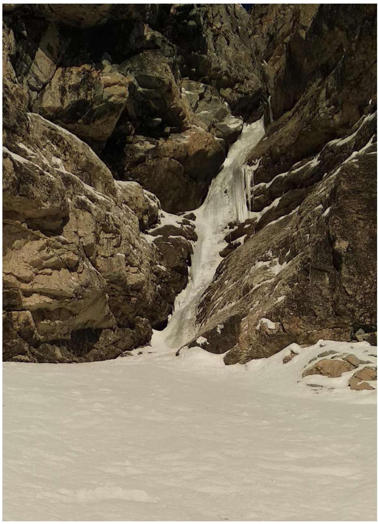
Photo 1. View of section R1–R2 from the mulda. Station R1 on the left on rocks at the beginning of the ice.
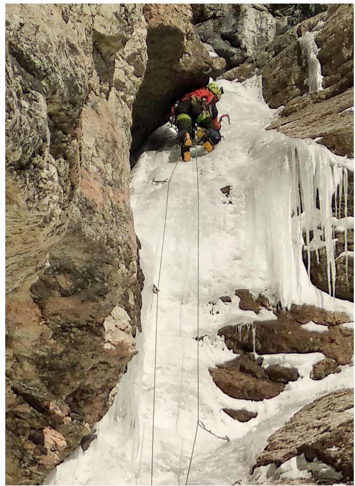
Photo 2. Leader on section R1–R2 working under the overhang, enlarged photo.
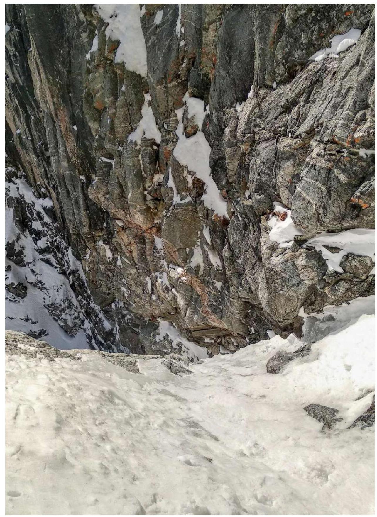
Photo 3. View downward onto the inclined shelf at the end of section R1–R2 from station R2.
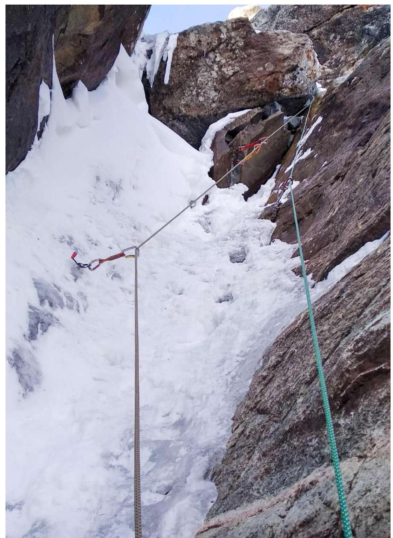
Photo 4. Crossing the rock block on section R3–R4.
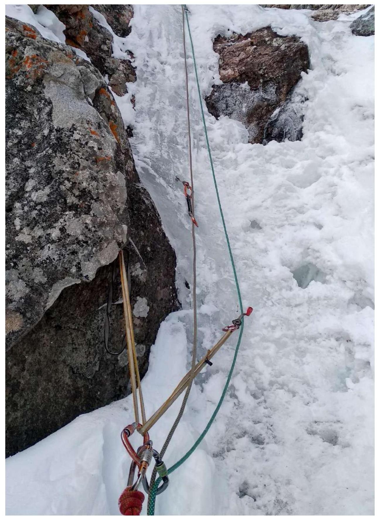
Photo 5. At station R4.
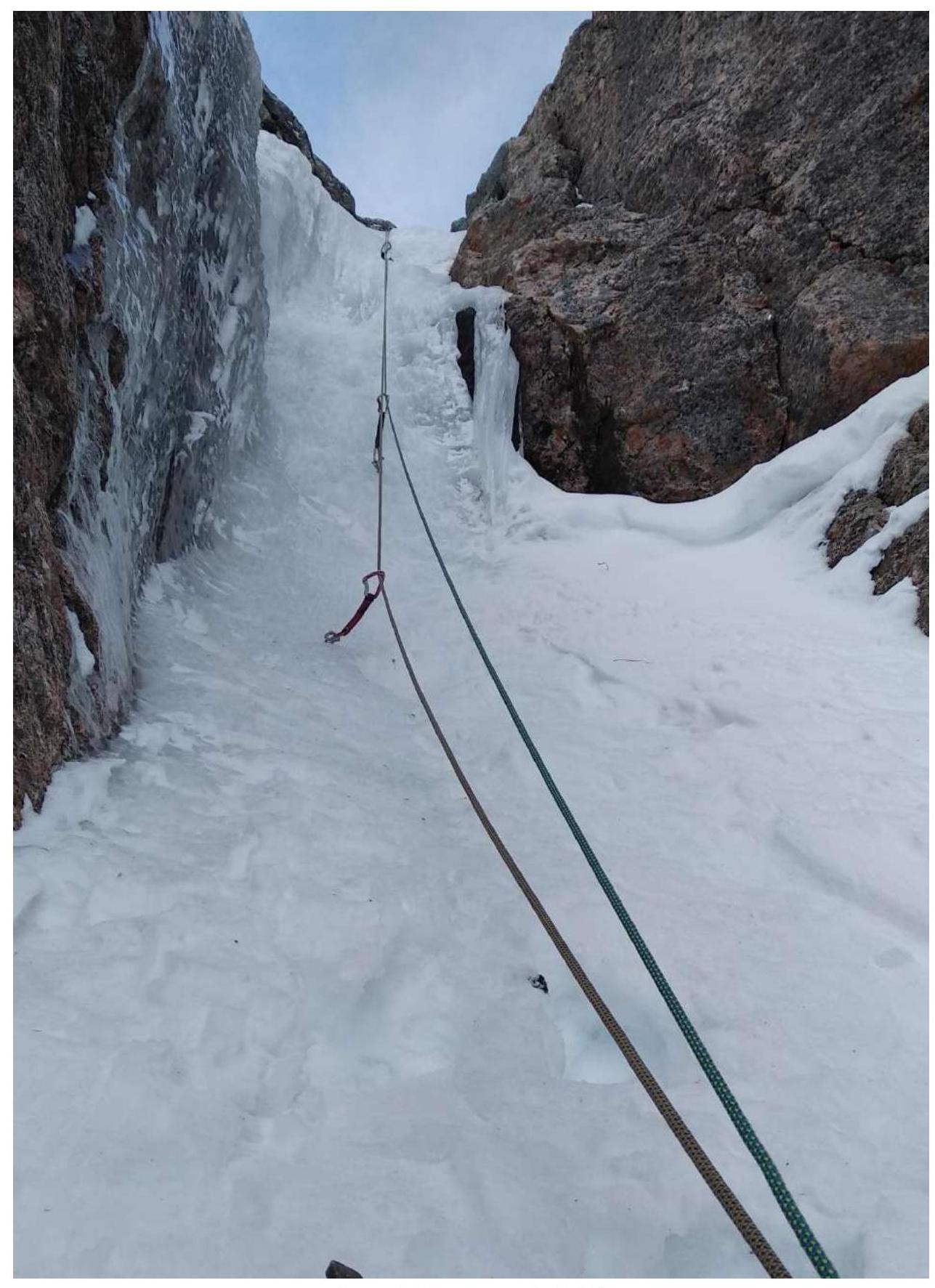
Photo 6. On section R4–R5.
Photo 7. At station R6. View downward onto section R5–R6.
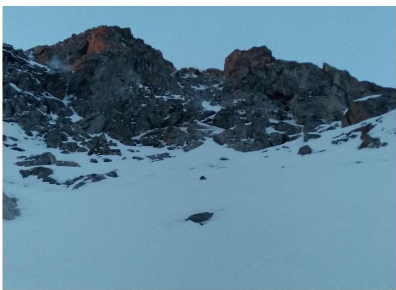
Photo 8. On section R10. View of the summit tower of Tykhen-Ardyn.
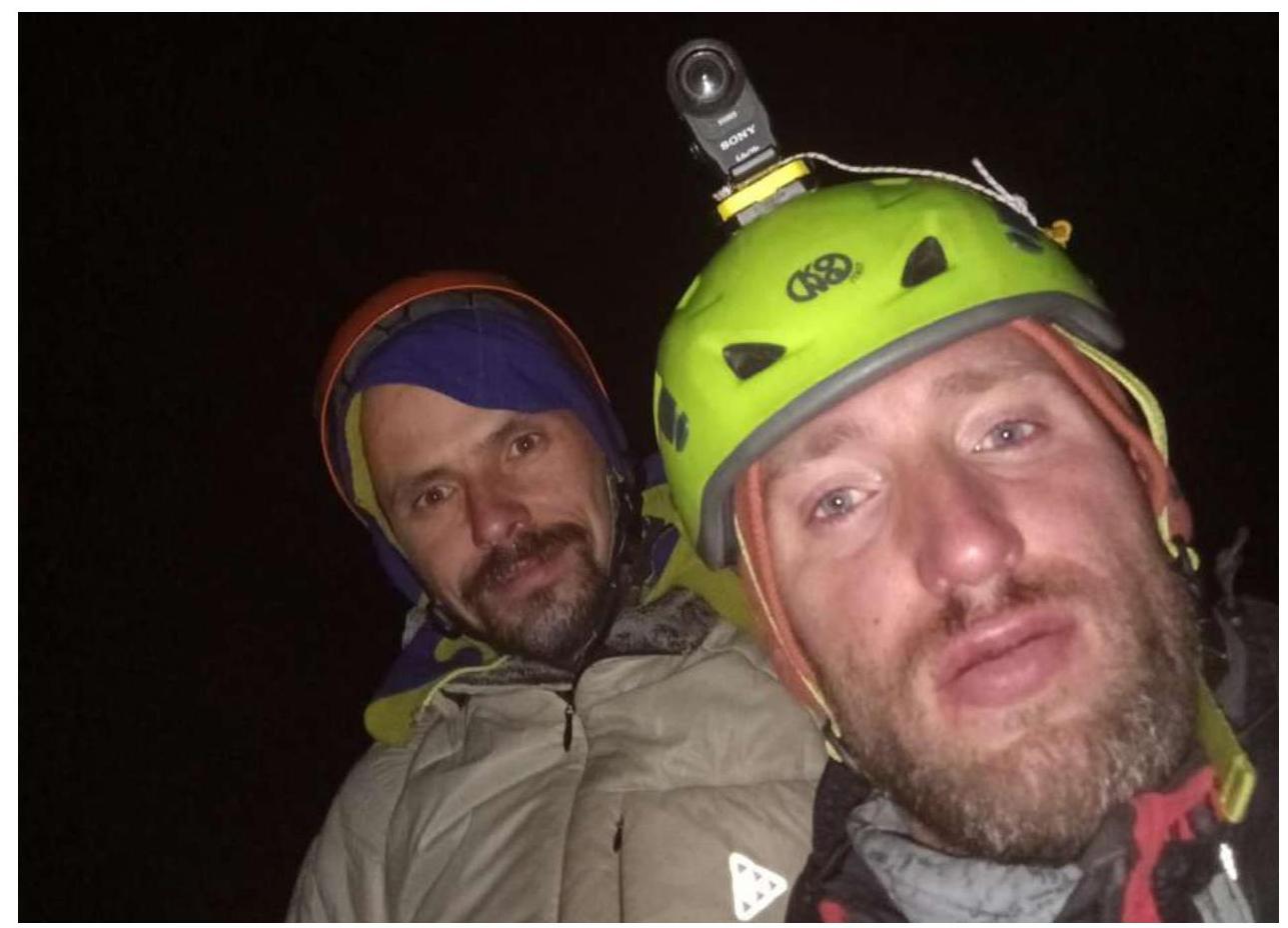
Photo 9. Photo from the summit. Zhdanov D. — Antonov O.
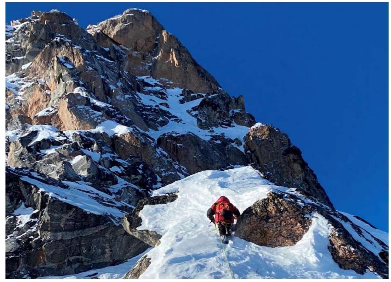
Photo 10. Support team. Petrov S. — Filippova T. on the eastern ridge, descent route 2B category.
Comments
Sign in to leave a comment