Passport
I. High-altitude technical class. 2. Pamir. Shakhdarin Range. 3. Peak — pik Moskovskoy pravdy (Gl) via the right part of the North-East wall. 4. 6th category of difficulty. 5. Height difference — 1250 m. Length — 1300 m. Length of sections 5–6 cat. diff. — 1200 m. Average steepness — 75° 6. Pitons driven:
| rock | bolt | chockstones | ice |
|---|---|---|---|
| 342 | - | 68 | 3 |
| 82 | - | 22 | - |
- Team's working hours 92 h and 10 days.
- Overnights — all 9 are sitting.
- Team leader: Ivanov Vladimir Viktorovich, CMS
Team members:
- Plotnikov Andrey Evgenievich, CMS
- Galin Vladimir Innokentievich, CMS
- Grishchenko Alexander Ivanovich, CMS
- Dyakovich Arkady Vasilyevich, CMS
- Kurgin Sergey Nikolaevich, MS
- Okhonin Sergey Alexandrovich, CMS
- Solovyov Alexander Grigorievich, CMS
- Coaches:
- Prokopenko Vladimir Ivanovich, MS
- Kurgin Sergey Nikolaevich, MS
- Approach to the route — July 19, 1983.
on the summit — July 28, 1983, descent — July 29, 1983.
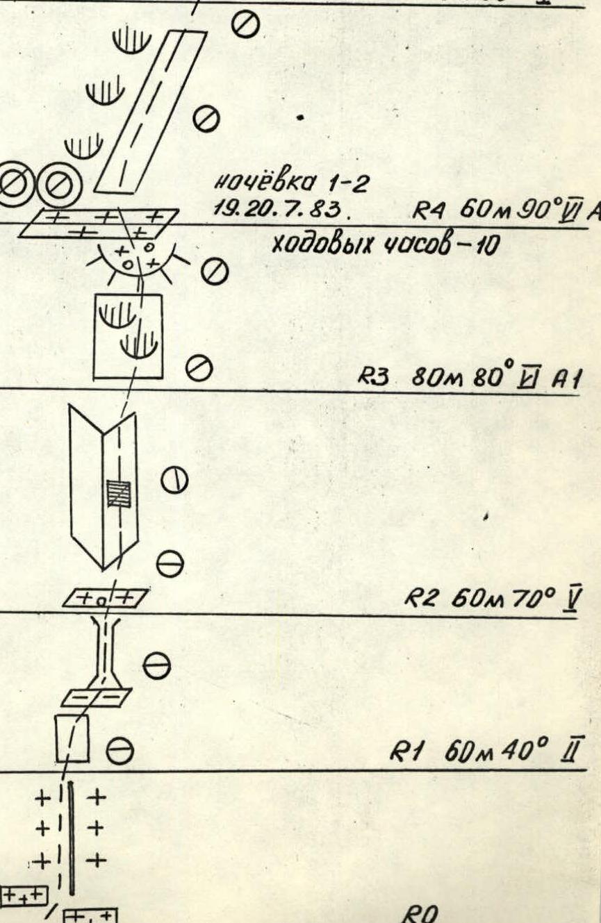
Overnight 3–4: July 21–22, 1983. R7: 40 m, 60°, V, working hours — 18 R6: 120 m, 90°, III R5: 80 m, 60°, V Overnight 1–2: July 19–20, 1983. R4: 60 m, 90°, A1, working hours — 10 R3: 80 m, 80°, A1 R2: 60 m, 70°, V R1: 60 m, 40°, II R0
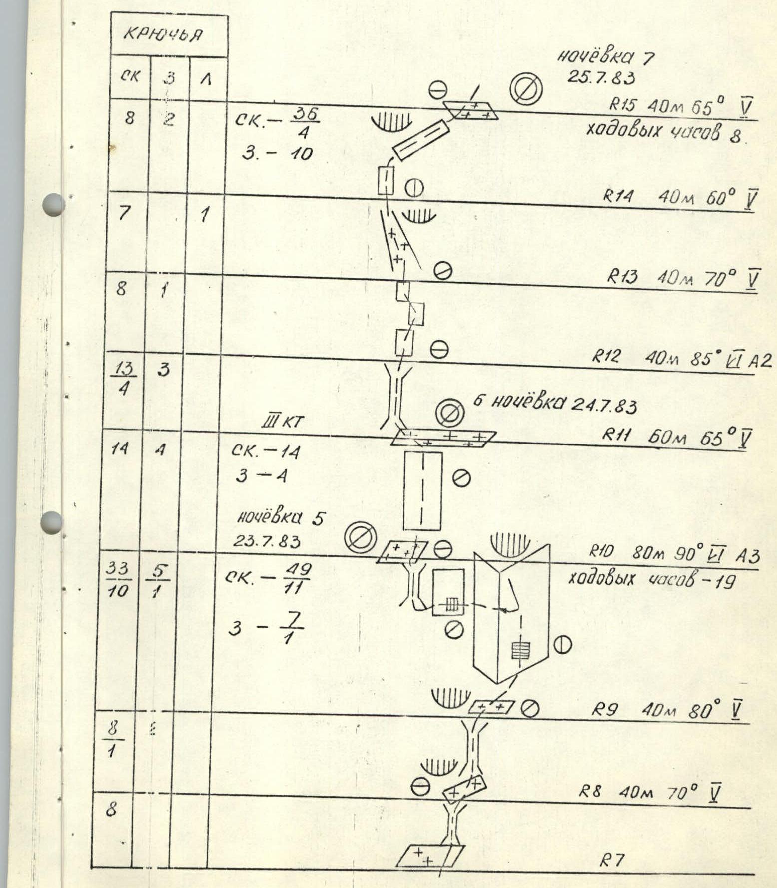
Overnight 7: July 25, 1983. R15: 40 m, 65°, V, working hours — 8 R14: 40 m, 60°, V R13: 40 m, 70°, V R12: 40 m, 85°, A2 Overnight 6: July 24, 1983. R11: 60 m, 65°, V Overnight 5: July 23, 1983. R10: 80 m, 90°, A3, working hours — 19 R9: 40 m, 80°, V R8: 40 m, 70°, V R7
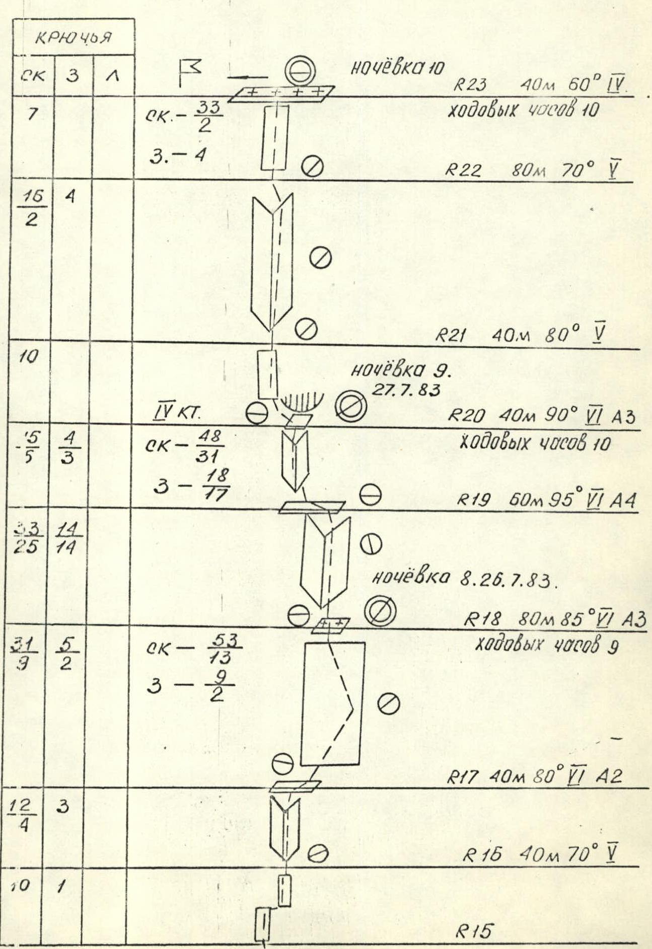
Overnight 10: R23: 40 m, 60°, V, working hours — 10 R22: 80 m, 70°, V R21: 40 m, 80°, V Overnight 9: July 27, 1983. R20: 40 m, 90°, VI A3, working hours — 10 R19: 60 m, 95°, VI A4 Overnight 8: July 26, 1983. R18: 80 m, 85°, VI A3, working hours — 9 R17: 40 m, 80°, VI A2 R15: 40 m, 70°, V
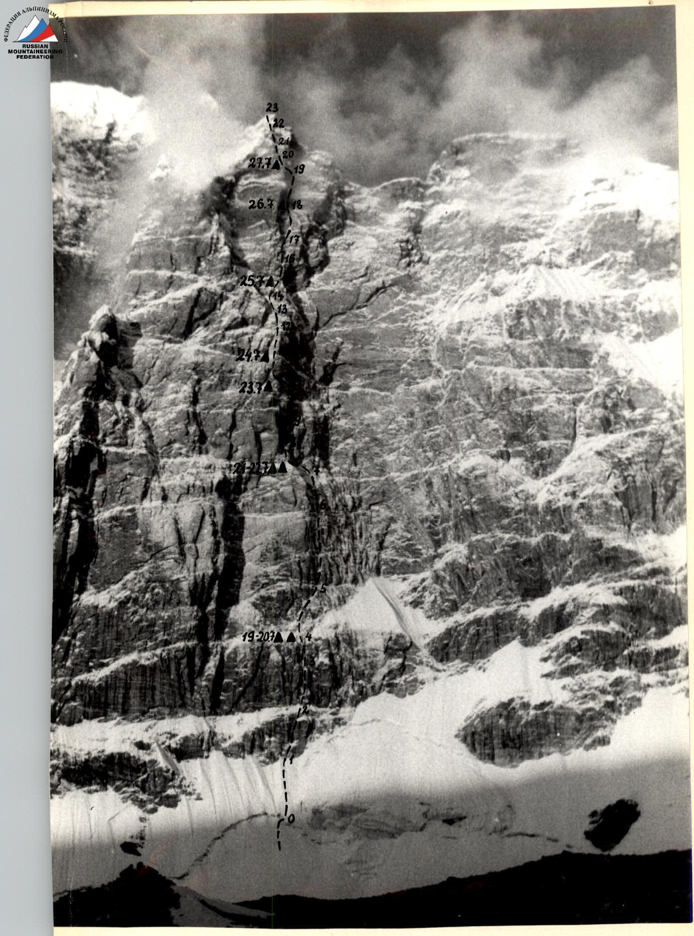
Right part of the North-East wall of p. Moskovskaya pravda (Gl)
——— ascent route
▲ overnight locations
Shooting point #1: July 15, 1983 9:00, "Smena-8"
Distance to the wall 2 km, height 4800 m.

Wall profile from the right
——— ascent route
▲ overnight locations
Shooting point #2: July 15, 1983 9:00, "Smena-8",
distance to the wall 3 km, height 5000 m.
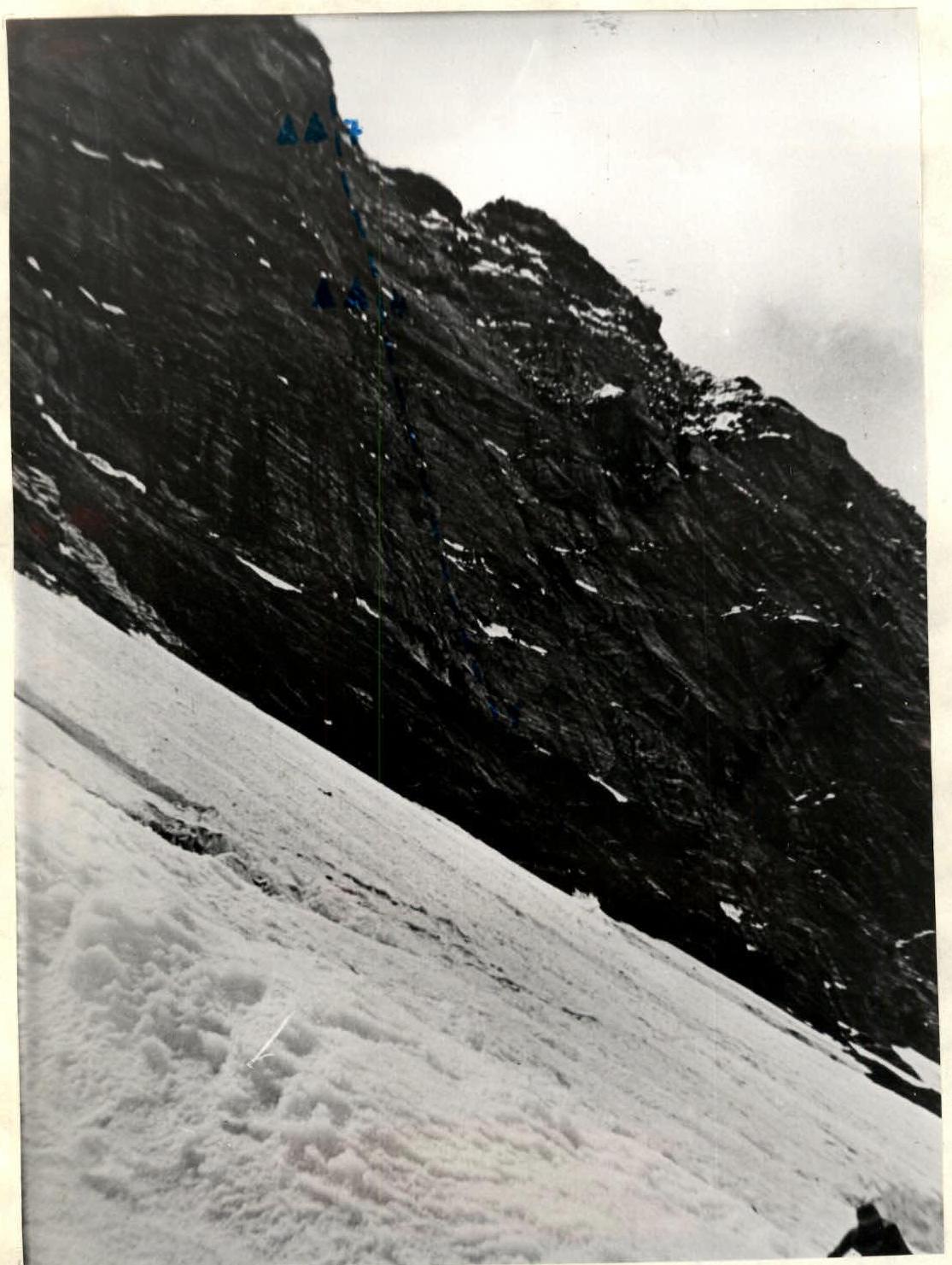
Wall profile from the left
——— ascent route
▲ overnight locations
Shooting point #3: July 18, 1983 15:00, "Praktika",
distance to the wall 15 km, height 4800 m.

Tactical actions of the team
The tactical scheme of the ascent was built based on the experience of previous complex routes taken by the team in different years and the real conditions at the beginning of the 1983 season in the South-West Pamir. The old tactic of the "stepping caterpillar" was taken as a basis, when 2 groups of 4 work independently, having a clear division of responsibilities. The first group paves the way and sets up sites, the second group "feeds" the first with food, ropes, pitons, and fuel. 2 groups of 4 on a steep, cold, and long wall is good both from the point of view of backup and safety. This factor was discussed with the Honored Coach of the USSR, E.T. Ilyinsky, even before the ascent to p. Dzhigit and it justified itself. The early exit allowed for an optimistic view on the possibility of rockfalls, which brought a lot of trouble to climbers on this wall. Based on observations, the tactical plan was refined, and the calculation of ropes, equipment, fuel, and food was made.
The overnight orientation was taken in the version of the first ascenders, however, the sharp difference in the state of the route from the conditions of the first ascent (icy rocks), according to V. Solonnikov, made us предусмотреть the possibility of double overnights with processing of the next section. If it were easier, the movement schedule would remain, but there would be no double overnights.
In general, the tactical plan was fulfilled, and the group of 4, Ivanov, Plotnikov, Solovyov, Grishchenko, performed the main volume of work ahead, and the group of 4, Kurgin, Galin, Dyakovich, Okhonin, did all the hauling and lifting, so that the first group did not feel "hungry".
The team was provided with reliable radio communication through the "Romashka" radio station. Practically at any moment, it was possible to call the observers on the radio, who had a 30×60 magnification telescope, and consult on the route.
The team expresses gratitude to coach V. Prokopenko, who performed the role of an observer-corrector.
Description of the route by sections
Section R0–R1. The bergschrund is passed through fractures without particular difficulties. The snow-ice slope is overcome in crampons with insurance through an ice axe.
Section R1–R2. The rocky part begins with a steep wall leading through a small ledge to a chimney. The chimney is climbed on the left side. The holds are reliable, insurance is piton with the use of "chockstones".
Section R2–R3. An extended internal corner with a monolithic wide crack on the right side. You need to go along it. In the upper part, the crack narrows. Intermediate insurance is inconvenient.
Section R3–R4. The corner turns into a wall with small overhangs. It is necessary to go through them using artificial aids. The wall leads to a snow ledge, where the 1st control cairn is located. Up to this point, the first climber wore rubber boots. In the cairn, there is a note from the Grigorenko-Prigoda group, "second ascent of the route".
Section R4–R5. Two ropes are passed under overhanging cornices slightly to the right. Very slippery. The cracks are filled with ice and covered with snow. Further, the picture does not change, although the rocks become vertical. The first climber changes rubber boots to vibrams. The pace of advancement slows down sharply.
Section R5–R6. The further path lies through internal corners. The first corner turns into a clear overhang in the upper part. Therefore, in its middle part, it is necessary to make a complex traverse to the right and continue the ascent along the neighboring corner. Climbing is complex with the use of artificial aids.
Section R6–R7. A small wall leads to a large snow-ice belt with rocky islands. A traverse along it to the left on a rope leads to the second control cairn. Here is a note from the Glushkovsky group (LETI).
Section R7–R8. From the snow belt upwards along a chimney filled with ice. Climbing is difficult due to the fact that all cracks are closed with ice.
Section R8–R9. After a small traverse along an inclined ledge filled with ice, again upwards along a chimney leading to a small inclined ledge under a cornice.
Section R9–R10. Here the structure of the rocks changes. The holds are unreliable, often break off. There are few places to drive pitons. The ascent goes along a large internal corner on its right side.
- At first, it goes along a loose crack, where in some places it is possible to use "chockstones".
- In the upper part, the path is blocked by a series of cornices. Passing them, apparently, requires a lot of time.
- The matter is complicated by the fact that the rocks, despite their steepness, are slippery, and it is practically impossible to climb in rubber boots.
It is decided to traverse to the left on a weakly expressed ridge. The traverse is complex along a horizontal crack. Then the ascent along a small chimney leads to an inclined ledge with ice and snow, where it is possible to set up an overnight stay.
Section R10–R11. Here the rocks are less steep. There are places to drive pitons and for "chockstones". The wall leads directly to equipped sites. They are completely filled with ice, and it takes 2 hours of work to hang tents and organize a sitting overnight stay. Somewhere here is the 3rd control cairn under the ice. But it is not possible to find it.
Section R11–R12. Slightly to the left along the ledge and upwards along a steep chimney. Slippery. Climbing is complex with the use of artificial aids.
Section R12–R13. A rope of easy climbing along small walls.
Section R13–R14. Further along a steep ice couloir with rocky islands.
Section R14–R15. After a small wall, a complex ascent to the right-upwards, bypassing a cornice on a snow inclined ledge. Climbing is difficult because the cracks are filled with ice. A site is set up on the ledge for a sitting overnight stay.
Section R15–R16. Two walls, going one after another, are passed with a small traverse in the middle part.
Section R16–R17. Further, there is a vertical internal corner. Climbing is complex (slippery) with the use of artificial aids.
Section R17–R18. An extended wall, which is the right part of a giant internal corner. Slippery. Cracks with ice. The ascent goes first in the right direction along small cracks, and then to the left, into the depth of the corner. Here is a small snow drift. It is possible to set up a bivouac site.
Section R18–R19. The internal corner turns into an overhanging corner. Here is a bolted route with four pitons. The section is quite extended and very laborious. Cracks on the left side allow the use of large "chockstones", artificial aids every meter, the overhang strongly pushes away from the wall. The giant corner continues, but according to the description, it is necessary to go through cornices to the left. The encountered pitons confirm the correctness of the route.
Section R19–R20. A steep internal corner with overhangs. Complex climbing. Cracks allow the use of chockstones. The corner leads to a niche with a cornice above, where the 4th control cairn is located. In the cairn, there is a note from the first ascenders! Here it is possible to accommodate four people lying down. There are eight of us. So, another sitting overnight stay.
II
Section R20–R21. To the left of the niche, there is an exit to a steep rocky wall. Section R21–R22. Further, the route goes along a blunt, fairly extended internal corner. The movement is slightly to the left.
Section R22–R23. A flattening wall leads under a small snow cornice. Overcoming it, we find ourselves on the ridge.
Further, the path to the summit goes to the left along the ridge.

Photo 2. Section R4–R5.

Photo 3. Lower part of section R5–R6.
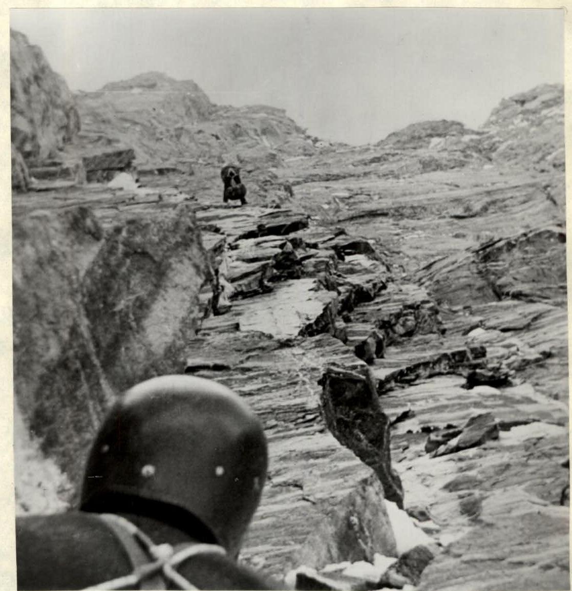
Photo 4. Upper part of section R5–R6.
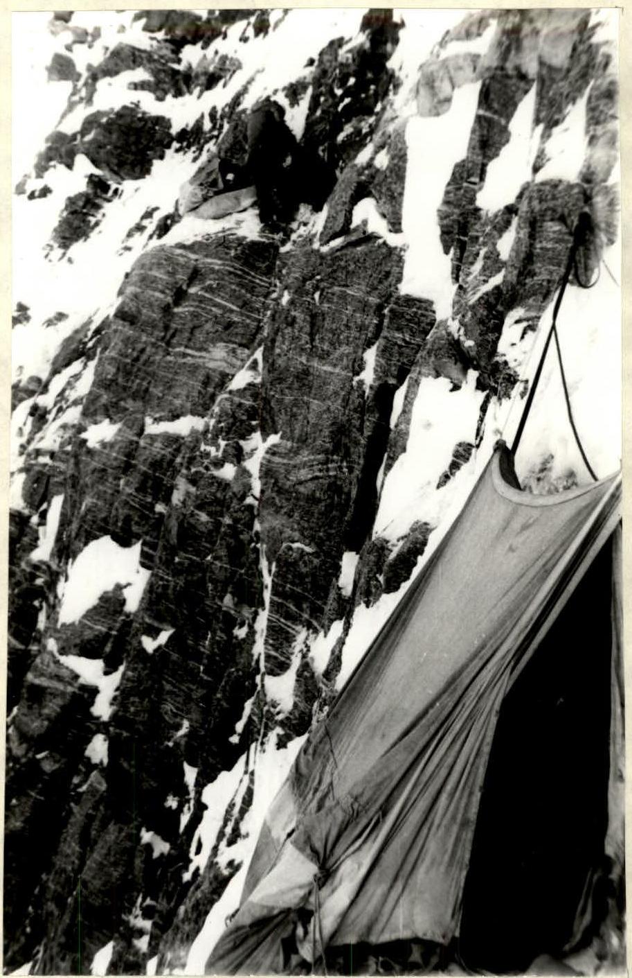
Photo 5. Overnight near the second control cairn.

Photo 11. Section R15–R16.
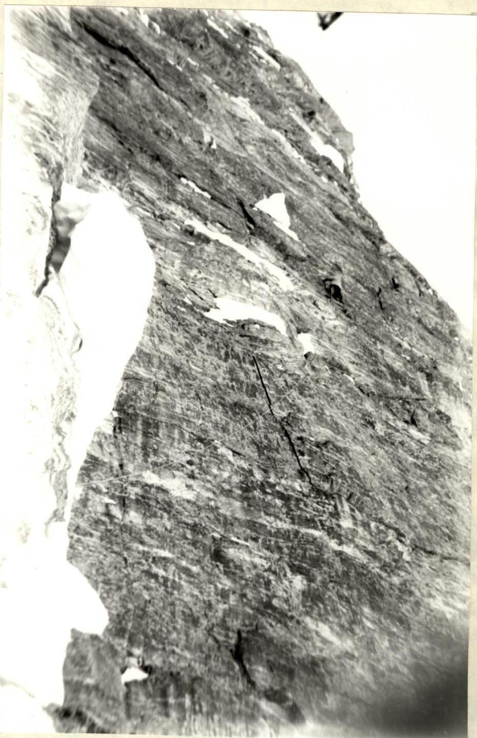
Photo 13. Section R17–R18.

Photo 14. Section R18–R19.