Ascent Log
Region: Central Caucasus, Bezingi region, No. in table 2.5
Peak name: West Shkhara
Route name: via N wall of E ridge (Razumov's route) with traverse to East Janggi
Difficulty category: 6B
Route characteristics: combined
Route elevation gain: 1457 m
Wall section length: 1730 m
Total route length: 4800 m
Length of sections with 5th cat. diff.: 285 m, 6th cat. diff.: 480 m
Average steepness of main route sections: 75°
Average steepness of the wall: 58°
Protection gear used
| Nuts | Friends | Ice screws | Pitons | On icy rocks, crampons and ice axes were used (instead of skyhooks) |
|---|---|---|---|---|
| 88/6 | 62/7 | 36 | 12 |
Travel time to West Shkhara: 42 hours, 3.5 days. Total time on route: 57 hours, 5 days. 3 days of bad weather on descent
Coach and Leader: Yuri Otarovich Japaridze — Master of Sports
Team members:
- Valery Viktorovich Boyko — Master of Sports
- Evgeny Valerievich Zhitnik — Candidate for Master of Sports
- Dmitry Evgenievich Pivikov — Candidate for Master of Sports
- Dmitry Sergeevich Khomchenko — Candidate for Master of Sports
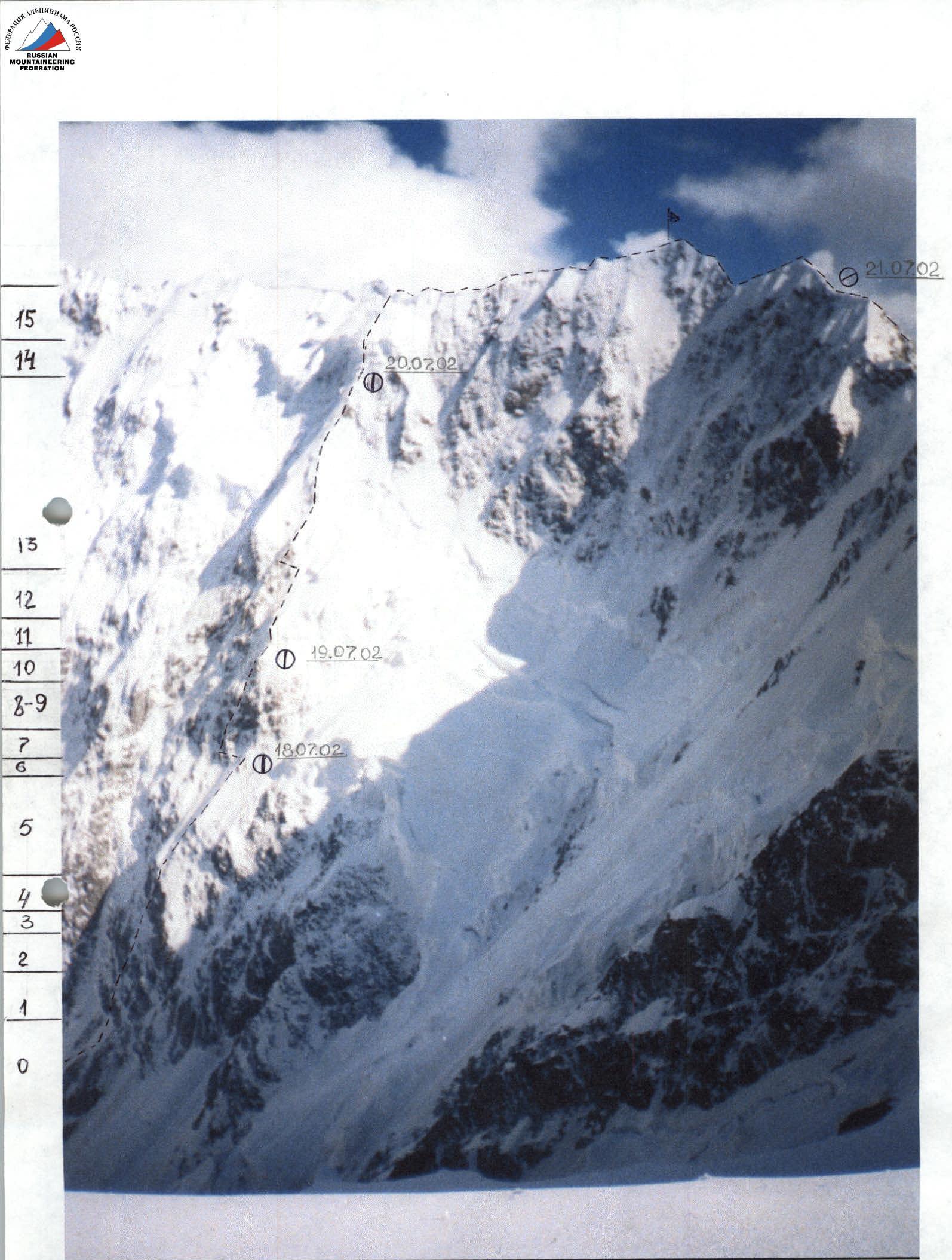
Departure to the route: July 18, 2002 Ascent to West Shkhara: July 21, 2002 Ascent to Janggi: July 22, 2002 Return to Base Camp: July 26, 2002
Panoramic photo of the region
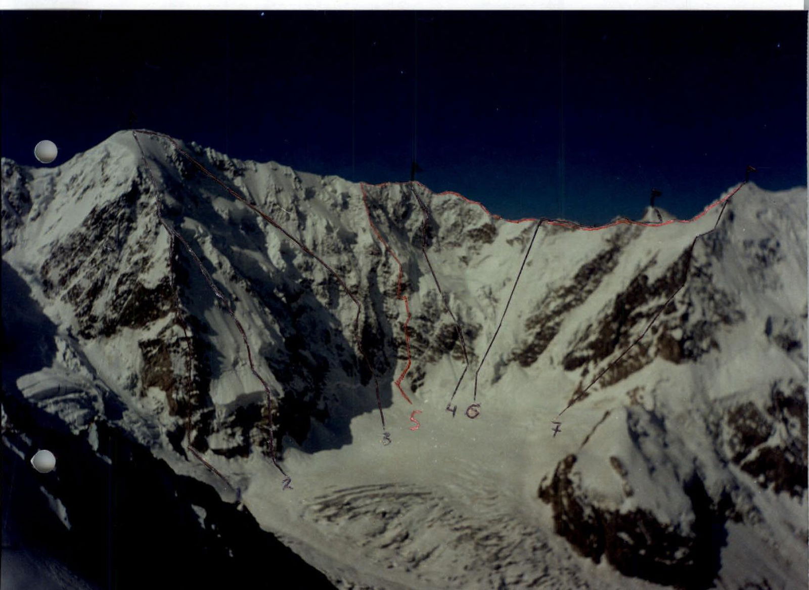
- Shkhara Main via N ridge (Tomashek) 5B cat. diff.
- Shkhara Main via left board of N wall (Bushmanov) 5B cat. diff.
- Shkhara West via N wall of W ridge (Shamalo) 6A cat. diff.
- Shkhara West via center of N wall (Balankovsky) 6A cat. diff.
- Shkhara West via N wall of E ridge (Razumov) 6B cat. diff.
- Shota Rustaveli via N wall (Laletin) 5B cat. diff.
- Janggi East via NE ridge (Kokkin) 4B cat. diff.
Climbing conditions and brief route characteristics
Anomalous weather phenomena in the Caucasus in 2002 complicated the already harsh climatic conditions in Bezingi, which in turn affected the degree of difficulty of the ascent.
Passing the rocky sections of the route required a great deal of tension and the use of all technical means and skills.
The lower three belts of rocks, 200–225 m long, were flooded with water streams due to the melting snow that had fallen higher on the slope. Water flowed into the sleeves and down the back, making climbing much more difficult.
The triangular wall in front of the first ice barrier was entirely covered with ice. To pass it, it was necessary:
- to wear crampons,
- to take ice tools in hand, which were used instead of skyhooks.
The "bottleneck" ice was also challenging, especially on the second ice barrier. Typical difficulties included:
- ice tools and crampons held poorly,
- ice screws often fell into voids,
- ice screws had to be re-drilled.
In addition, the top of the ice barrier was covered with a 4–5 m high snow cap.
A feature of the route is the limited maneuverability. Movement is only possible in a corridor no wider than 30 m, as ice avalanches are possible on both sides of the route.
Safe overnight stops on the wall can only be organized in three places, and it was necessary to reach them. Therefore, when developing a tactical plan, the emphasis was on the speed of passage through the wall section of the route. The weather conditions in Bezingi are such that more than 3–4 days of good weather should not be expected. This was later confirmed during the ascent.
On the 4th day, when the group was climbing along the ridge to Janggi, the weather deteriorated, and on the 5th day, a real hurricane developed, with a thunderstorm, and visibility reduced to 20 m. The group had to crawl to the control point on Janggi. Then they had to descend down the snowy ridge to the rocks in the same way. With great difficulty, the group set up a tent and spent three days in one place, waiting out the bad weather.
Organizing overnight stops required a lot of physical effort, as there were no platforms on the route, and they had to be cut out of the ice. The group reached the first overnight stop only after a 15-hour working day, and to avoid wasting energy on organizing a bivouac, it was decided to spend the night hanging on horizontal railings.
All team members have extensive experience in climbing routes of 6th cat. diff., including Ushba, Chatyn, Asan, p. 4810, Dalar, Chapdaru, and others.
They state that the ascent to West Shkhara via Razumov's route with a further traverse to Janggi is one of the most challenging routes in terms of its intensity and technical difficulties. This is also evidenced by the fact that we found a note left on West Shkhara by a group of traversers dated 2000. The route itself is visited even less frequently.
Route diagram
| Section No. | Friends | Nuts | Ice screws | Pitons | Graphical representation | Length (m) | Steepness, ° | Cat. diff. |
|---|---|---|---|---|---|---|---|---|
| R11 | – | – | 10 | – |  Ice Ice | 75 | 80–90 | VI |
| R10 | 4 | 8 | – | – |  Ice Ice | 80 | 60–90 | V+ |
| R9 | 4/2 | 2/2 | – | – |  | 10 | 110 | VI |
| R8 | 8 | 12 | – | – | 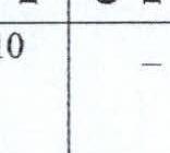 Ice (ice axes) Ice (ice axes) | 125 | 90 | V–VI |
| R7 | 12/3 | 10/3 | – | – | 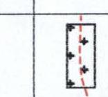 Ice (ice axes) Ice (ice axes) | 100 | 70–100 | V+ |
| R6 | 2 | 4 | – | – |  | 30 | 70 | V |
| R5 | – | – | 6 | – | 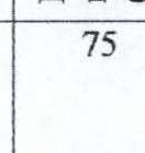 | 200 | 50–55 | IV |
| R4 | 4/2 | 10/1 | – | – | 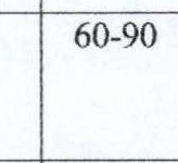 Wet rocks Wet rocks | 75 | 60–80 | V–VI |
| R3 | – | – | – | – | Wet rocks | 50 | 60 | IV |
| R2 | 8 | 16 | – | 4 | Wet rocks | 100 | 75–80 | V–VI |
| R1 | 5 | 5 | – | 8 | 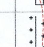 Wet rocks Wet rocks | 125 | 75–80 | V–VI |
| R0 | – | – | – | – |  | 80 | 50 | III |
| R15 | – | – | – | – | 145 | 45 | III | |
| R14 | – | – | 20 | – | 125 | 80–100 | VI | |
| R13 | 5 | 15 | – | – | Ice | 360 | 50 | IV+ |
| R12 | – | – | – | – | 140 | 50 | III |
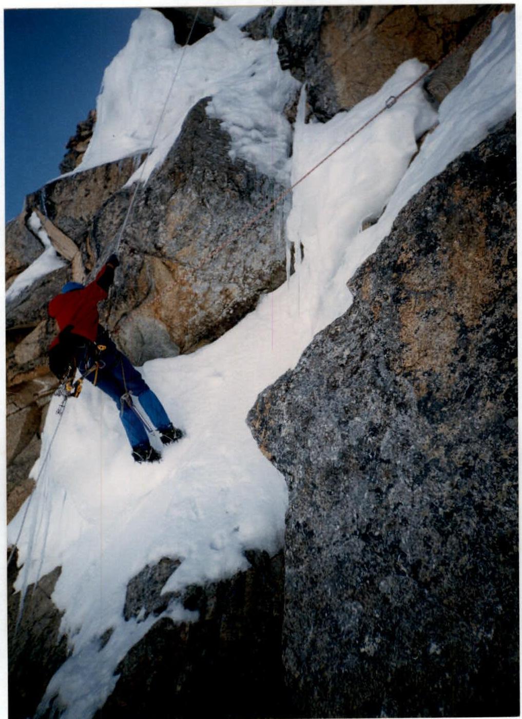
Photo #3, section 10. Icy "ram's foreheads".
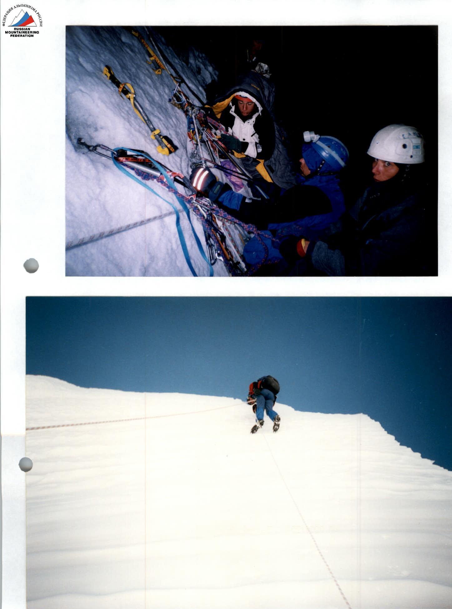
Photo #4–5, section 11. Overnight stop under the first ice barrier. Ascent to the top of the barrier.
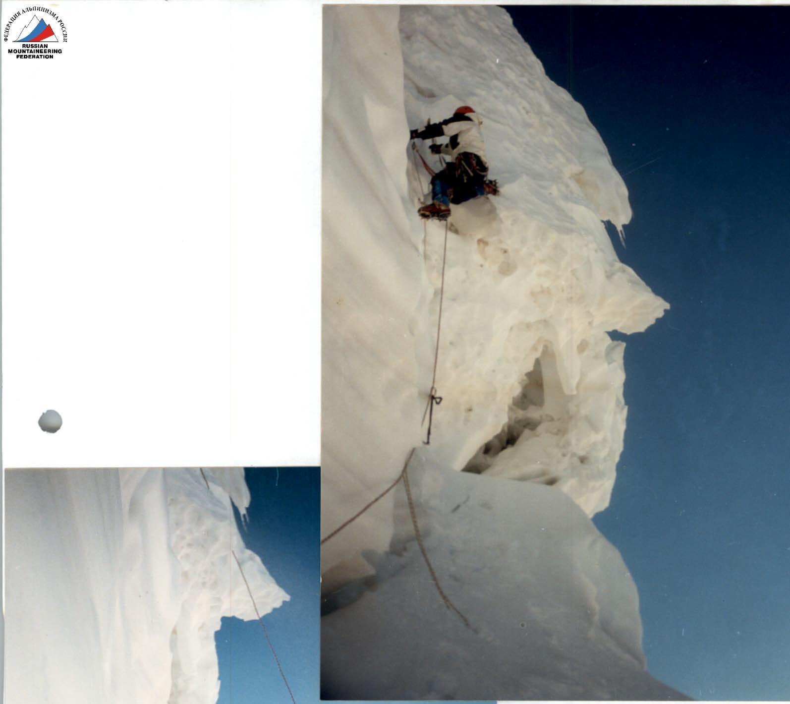
Photo #7–8, section 14. On the second ice barrier.


