St. Petersburg Alpinism Federation
Russian Alpinism Championship. High-Altitude Technical Class
Report
St. Petersburg Combined Team Krumkol Peak, 4688 m, via North Ridge Timofeev's Route, 1967, Category 6A
Ascent Passport
- Region 2.5. From Kitlod Pass to Gezewcек Pass (north of the Main Caucasian Ridge)
- Krumkol, 4688 m, via north ridge
- Complexity Category — 6A;
- Route Type — Combined;
- Route Description:
Route length — 2470 m, wall section length — 2070 m, route elevation gain — 1450 m.
Length of sections with 6B cat. diff. — 260 m, 5B cat. diff. — 300 m, mixed terrain M4 length — 95 m, ice terrain WI3 length — 20 m, average steepness of the wall section — 50°
- Protection Used on the Route:
Total (including ITD) 163 (13) Anchors and pitons 56 (6) Nuts and cams 72 (7) Ice screws 39 Bolts (removable bolts) 2 (0)
-
Total climbing hours — 29 h 40 min, days — 3;
-
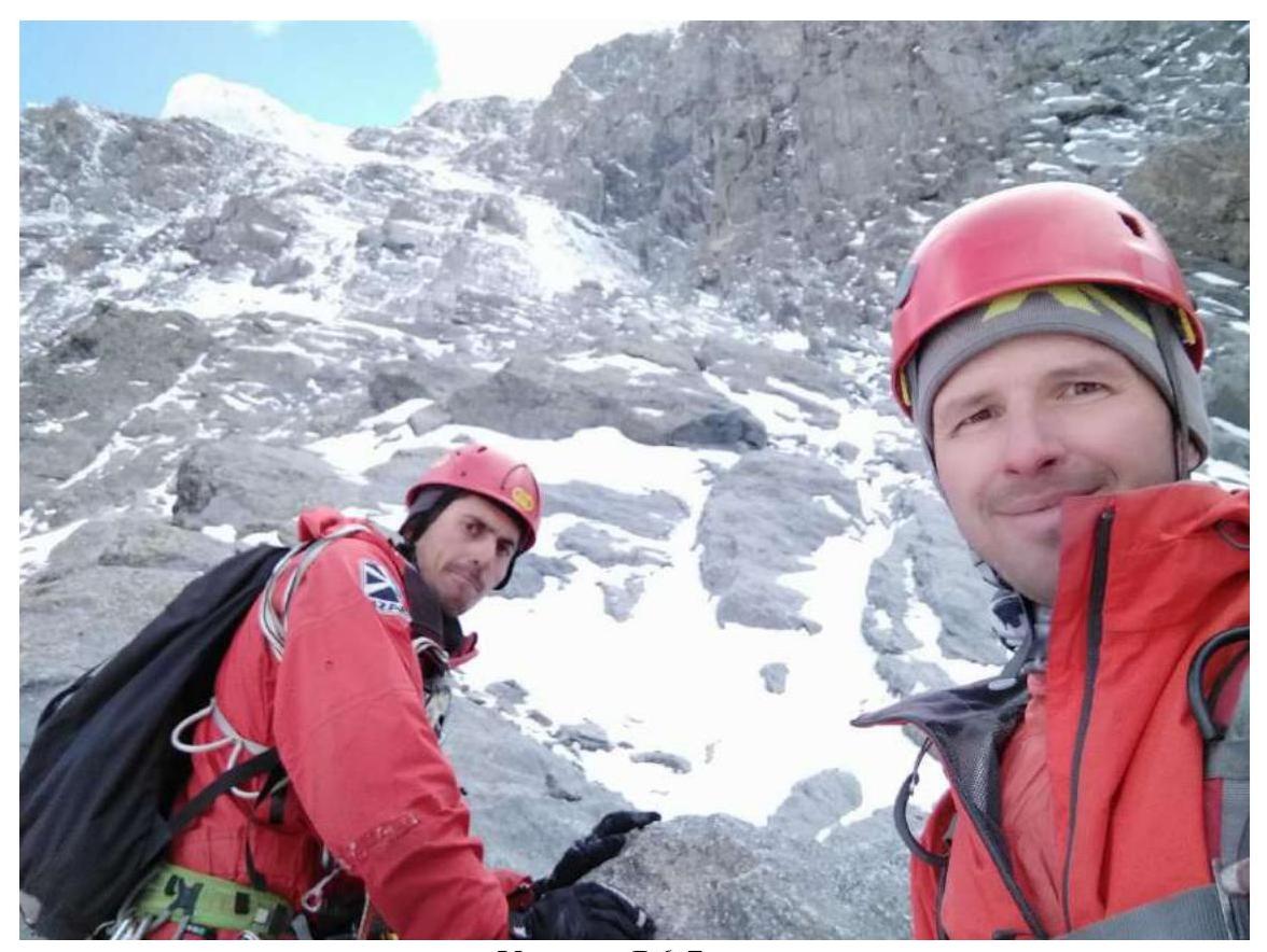
Team Leader: Matiynan A.A., Master of Sports Team Members: Ivanov A.S., Master of Sports
-
Team Coach: Timoshenko Tatyana Ivanovna
10. Departure Dates:
on the route — October 22, 2020 at 6:10, summit — October 24, 2020 at 13:50, return to Base Camp — October 25, 2020 at 18:50. Organization: FASPb
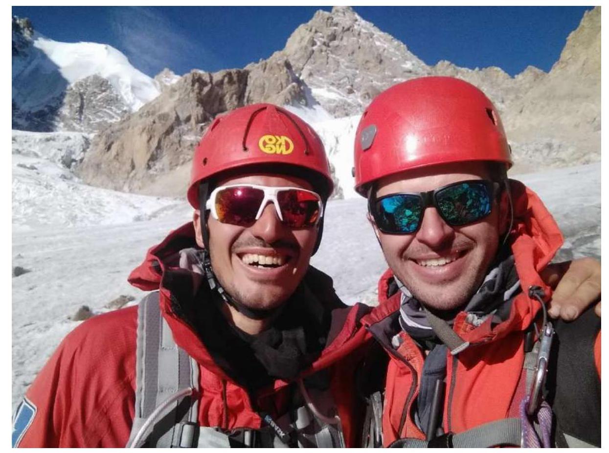
General Summit Photo
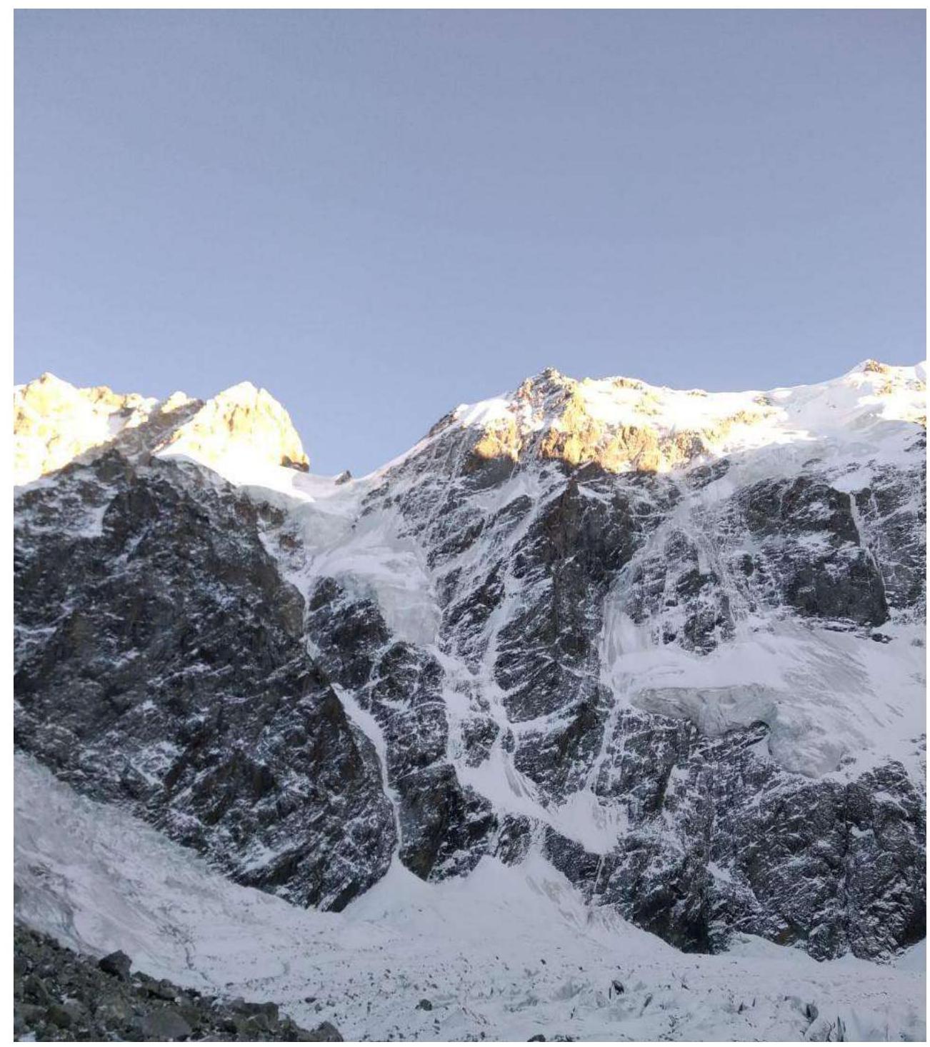
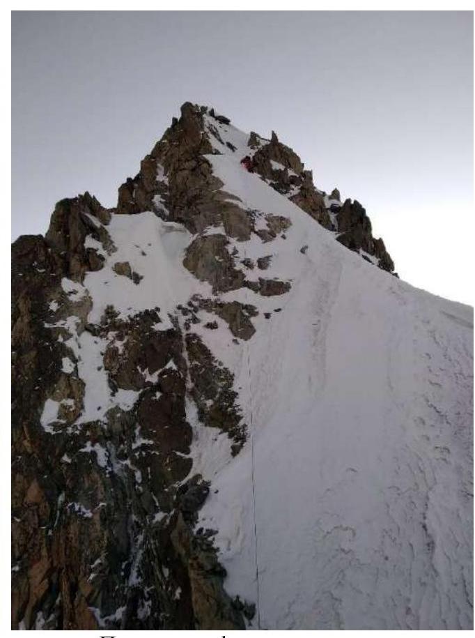
Photo of Krumkol's north face. Taken on October 21, 2020. Technical Photo
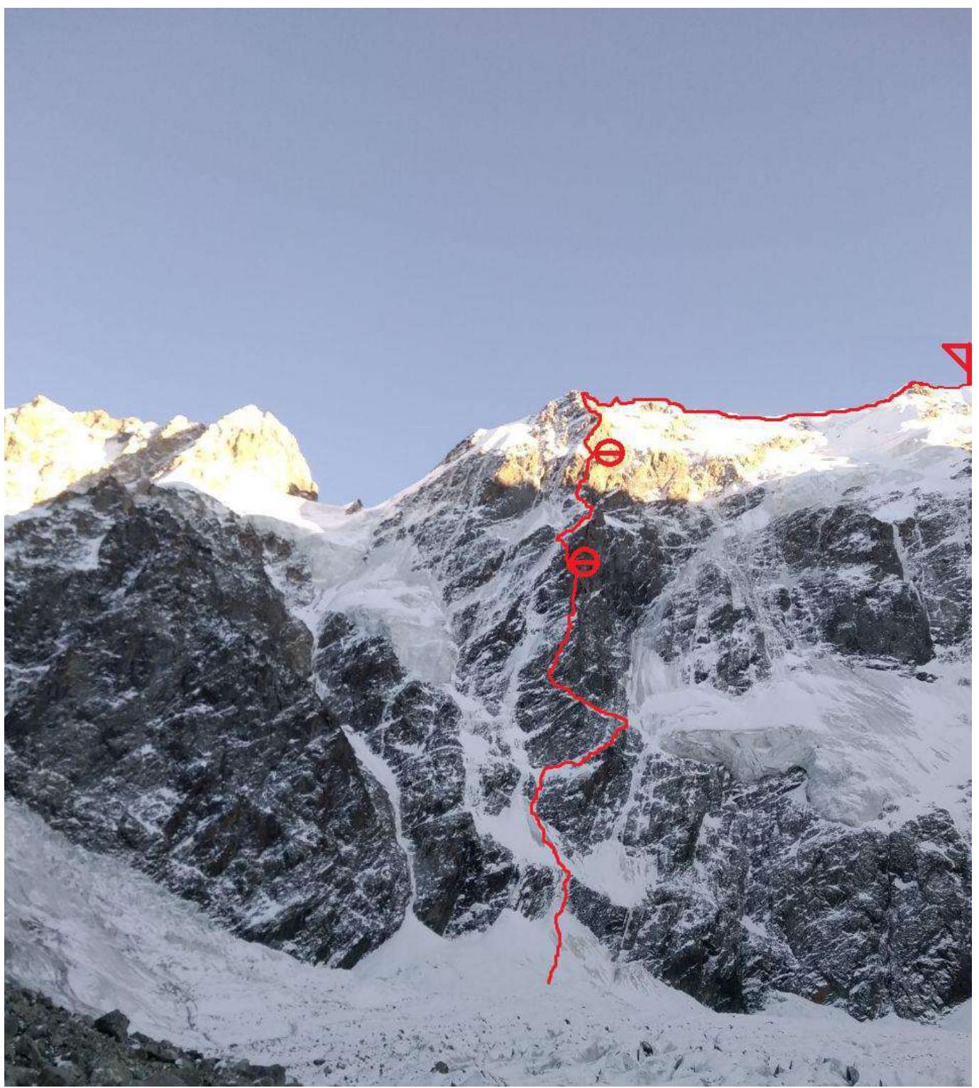
Route Diagram in UIAA Symbols

| Section | Length, m | Steepness, deg | Difficulty | Diagram | Protection Points (Ice Screws) | Protection Points (Rock Pitons) | Protection Points (Nuts and Cams) |
|---|---|---|---|---|---|---|---|
| R46–R47 | 400 | 0 | WI1 | 1 | |||
| R45–R46 | 60 | 0 | III | 1 | |||
| \multicolumn{8}{ | c | }{Dive 5 m.} | |||||
| R44–R45 | 35 | 60 | M3 | 1 | 1 | ||
| R43–R44 | 5 | 90 | M3 | 2 | 1 | ||
| R42–R43 | 40 | 0 | WI1 | 1 | 1 | 1 | |
| R41–R42 | 50 | 0 | III | 1 | 2 | 2 | |
| R40–R41 | 40 | 60 | M2 | 1 | |||
| R39–R40 | 50 | 60 | M3 | 1 | 2 | 1 | |
| 15 | 75 | ||||||
| R38–R39 | 30 | 60 | WI2 | ||||
| 15 | 0 | M3 | 2 | 1 | |||
| R37–R38 | 30 | 70 | VI | ||||
| 10 | 90 | VI, A1 | 3 / 1 | 4 | |||
| 10 | 50 | IV | |||||
| R36–R37 | 40 | 55 | V | 3 | 2 | ||
| R35–R36 | 25 | 60 | V | 2 / 1 | |||
| 5 | 90 | V, A0 | |||||
| R34–R35 | 30 | 60 | IV–V | 3 | |||
| R33–R34 | 30 | 55 | 3 | 1 | |||
| R32–R33 | 30 | 60 | IV–V | 1 bolt | 2 | 1 | |
| R31–R32 | 30 | 60 | 1 | 2 | |||
| R30–R31 | 30 | 55 | 1 | 2 | |||
| R29–R30 | 30 | 65 | M3 | 1 | 1 | 1 | |
| R28–R29 | 15 | 65 | M4 | ||||
| 10 | 80 | 2 | 1 | 1 | |||
| 10 | 70 | WI3 | |||||
| R27–R28 | 30 | 60 | M3 | 1 | 2 | ||
| R26–R27 | 30 | 75 | M4 | 1 | 3 | ||
| R25–R26 | 70 | 60 | WI2 | 3 | |||
| R24–R25 | 50 | 60 | WI2 | ||||
| 50 | 60 | WI2 | |||||
| 10 | 80 | WI3 | |||||
| 50 | 60 | WI2 | |||||
| R24–R25 | 7 | ||||||
| R23–R24 | 40 | 55 | V | 2 | 3 | ||
| 40 | 55 | V | 2 | 2 | |||
| R22–R23 | 40 | 55 | V | 2 | 2 | ||
| R21–R22 | 35 | 85 | VI, A1 | 1 bolt | 7 / 5 | 7 / 6 | |
| R20–R21 | 30 | 70 | V–VI | 2 | 3 | ||
| R19–R20 | 30 | 70 | V–VI | 5 | |||
| R18–R19 | 20 | 60 | IV | 2 | |||
| R17–R18 | 10 | 40 | |||||
| 25 | 60 | IV | 1 | 2 | |||
| R16–R17 | 10 | 60 | IV | ||||
| 15 | 40 | III | 3 | 2 | |||
| 15 | 70 | VI | |||||
| R15–R16 | 40 | 85 | VI | 2 | 4 | ||
| R14–R15 | 40 | 55 | III–IV | 1 | 2 | ||
| R13–R14 | 20 | 60 | IV–V | 2 | |||
| R12–R13 | 30 | 80 | VI | 2 | 2 | ||
| R11–R12 | 30 | 60 | VI | 3 | 1 | ||
| 10 | 80 | 3 | 1 | ||||
| R10–R11 | 10 | 90 | VI | 2 | 2 | ||
| 20 | 60 | IV | |||||
| R9–R10 | 30 | 55 | IV | 1 | 3 | ||
| R8–R9 | 30 | 60 | V | 1 | 3 | ||
| R7–R8 | 40 | 45 | M2 | 1 | |||
| 30 | 50 | WI1 | |||||
| R6–R7 | 70 | 45 | M2 | 1 | 2 | ||
| R5–R6 | 80 | 50 | WI2 | 4 | |||
| R4–R5 | 30 | 40 | WI2 | 1 | |||
| R3–R4 | 50 | 55 | M3 | 1 | 1 | 1 | |
| R2–R3 | 125 | 50 | WI2 | 3 | 1 | ||
| R1–R2 | 50 | 60 | M4 | 3 | 1 | 1 | |
| R0–R1 | 100 | 45 | WI2 | 3 |
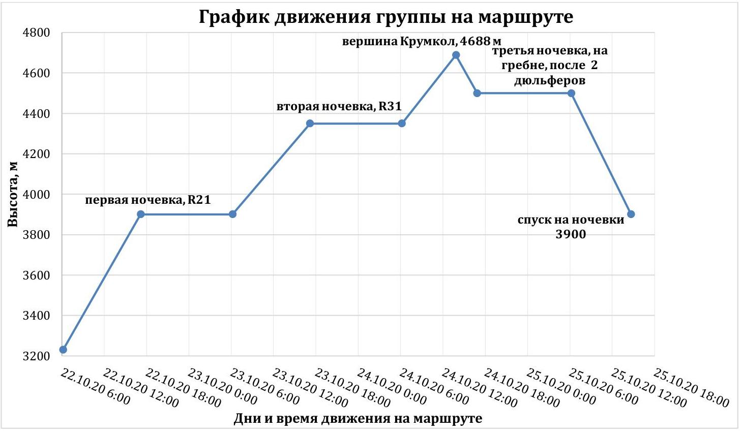
Ascent Graph
Verbal Description and Tactical Actions of the Team
On October 22, 2020, at 5:00, the team left the Krumkol camping site. At 6:10, they began working on the route.
Sections R0–R5 represent:
- snow-ice slopes with two mixed sections of moderate difficulty,
- the main challenge is finding suitable locations for protection points.
Next is a logical section:
- traverse to the right,
- ascent up iced rocks of medium difficulty,
- return via an oblique snow ledge to the left onto the north ridge under the complex rock formations (R8).
Next, the team wanted to climb in rock shoes, which could have significantly sped up the process, but it was cold, so they worked in crampons. The direction was upwards, slightly to the right. The path went along the left side of a very wide internal angle, a series of vertical walls and ledges led to a narrowing of the internal angle, and climbing of medium difficulty. Short sections of 6B cat. diff. were encountered.
Next:
- upwards through the internal angle to a convenient ledge,
- under a vertical monolithic wall — a good spot for a bivouac (R15).
Next, through a chimney to the right of the good ledge:
- 6B category rock climbing,
- again, thoughts about how nice it would be to climb in rock shoes if it were a bit warmer.
The rock climbing becomes easier. Climbing through internal angles and walls leads to a bolt (R20). There was a temptation to climb straight up, but this would have been a mistake that cost time: they had to leave an anchor and carabiner to descend back. Therefore, it is essential to traverse left from the bolt at a 45° angle, which is well-read from the terrain.
The traverse leads to:
- a vertical wall with a corniche,
- under the corniche — a convenient ledge for a bivouac and a bolt, where they set up camp at 17:10 (R21).
On sections R0–R21, Matiynan Artur led.
On October 23, 2020, they began moving at 6:10. This timing was chosen because it became light enough to work without a headlamp. From the ledge, 5 m down and left around the corner, then up a sheer wall for 35 m — this was the most challenging part of the route, and without rock shoes, it took about 2 hours.
The problem was transitioning from one ITD point to another, which required short underclimbs, and doing so in double boots was very challenging. If the weather had allowed them to work in rock shoes, there should not have been any issues.
After three ropes, the difficult rock climbing gave way to an ice slope:
- heading left and then upwards,
- followed by movement along a steep (60° to 80°) ice slope, bypassing rock outcrops on the north ridge. After 160 m, it led to a small snow saddle.
Here was a good spot for a bivouac (R25).
From the bivouac saddle, a variant for passing the third bastion was visible — via the "Timofeev's Sopel" (ice rivulet), the one on the left, in case issues arose.
Next, they moved along the ice rivulet:
- steepness reached 80° in places,
- despite the steepness, movement was relatively comfortable due to the narrow width (up to 1 m), allowing them to brace themselves using the rocks.
After 200 m from the start of the movement:
- the ice rivulet flattened out and ended in snow,
- followed by climbing through snowy rocks (R30).
After 40 m, between R31–R32, they found a good ledge to the right of the ridge, which they equipped for a bivouac. They reached it at 17:10 and were in their tent by 18:30 on a comfortable ledge.
On sections R21–R31, Matiynan Artur led.
On October 24, 2020, they traditionally began their ascent at 6:10 AM.
Movement in the upper part of the third bastion proceeded on the right side of the north ridge:
- climbing through difficult snowy rocks,
- transitioning into mixed climbing on an iced slope.
The slope narrowed to the size of an ice rivulet and ended at a vertical wall, under which there was an icy ledge suitable for a bivouac (R41).
From the ledge:
- right and upwards — 60 m along simple iced rocks,
- the first climber reached the ridge at 12:00 (R42).
Next:
- to the right lay a snow-ice ridge that ended at a forty-meter iced rock outcrop (a pinnacle),
- the climbing was mixed and not particularly difficult,
- on top of the pinnacle — a loop.
From the pinnacle — a 5 m rappel.
Next:
- along a snowy rocky ridge with a descent onto a wide snowy ridge with corniches, leading to the summit of Krumkol. They moved along the ridge simultaneously, with Artur Matiynan leading.
At 13:50, the pair reached the summit of Krumkol.
The descent from the summit:
- back to R42,
- then along the ridge towards the Krumkol Pровал (to the провали — 6 rappels, alternating with sections of simultaneous-variable movement along the ridge).
By 17:00, they had descended 2 rappels and set up a comfortable bivouac on the ridge.
On October 25, 2020, they began work at 6:10 AM.
They descended along the ridge another 4 rappels to the Krumkol Pровал.
To continue the descent from the провали, they needed to overcome a rocky pinnacle — they bypassed it on the left via iced, gentle rocks.
The further descent proceeded along an ice slope with oblique rappels to the left (facing the slope), so they climbed higher up the ridge to make the rappels less oblique.
They encountered:
- bergschrunds,
- crevasses in the slope.
They made 9 rappels on Abalakov's loops, continually moving left until the last rappel, emerging onto the gentle part of the closed glacier under Tikhonov Peak.
By 14:40, they had descended to a bivouac at 3900 m.
They reached the Безенги a/l by 18:50.
The team mostly moved simultaneously using the "Krasnoyarsk scheme," with some complex sections involving the organization of belays and alternate protection according to the classic scheme. The weather was overcast throughout, with virtually no precipitation, and sub-zero temperatures. It became significantly colder from the moment they arrived in Безенги.
In October, the route was quite snowy and featured many iced rocks, but since the sun still illuminated the right side of the north ridge from 13:00 to 16:00, there were also snow-free rocks that could and should have been climbed in rock shoes. However, due to the overcast weather and lack of sunlight, the entire route was climbed in crampons, and without ice axes and tools, there was little to be done on the route.
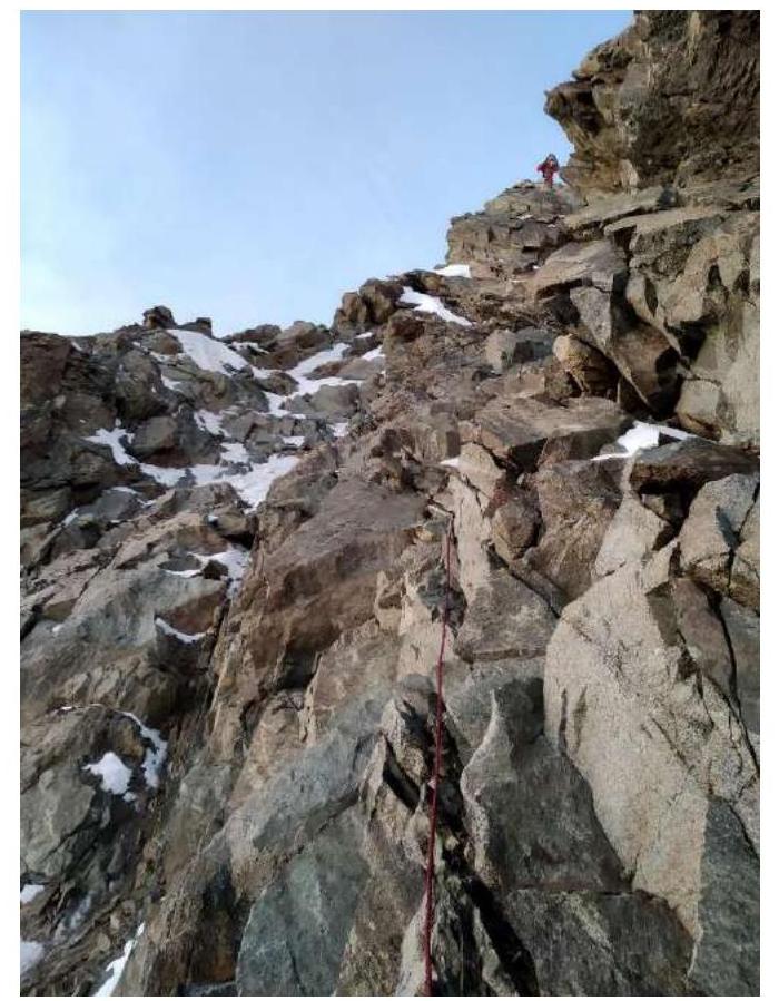
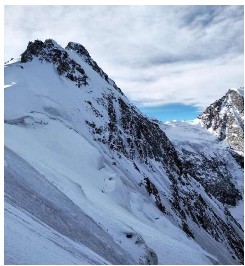
Report Photo Illustrations
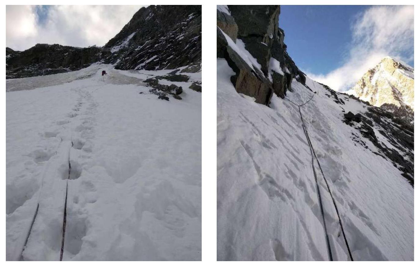
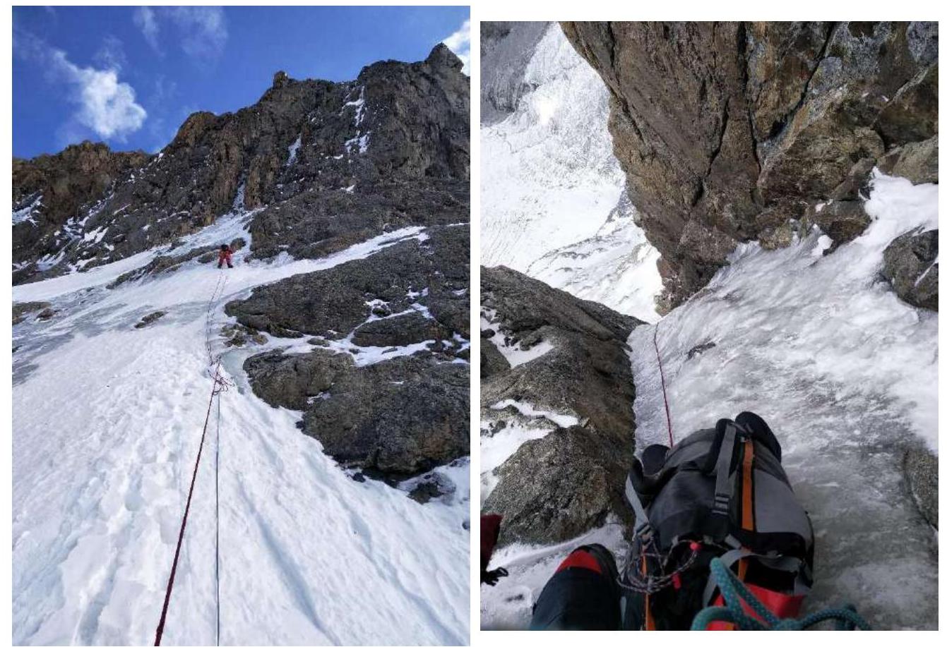
Section R2–R3
Section R5–R6
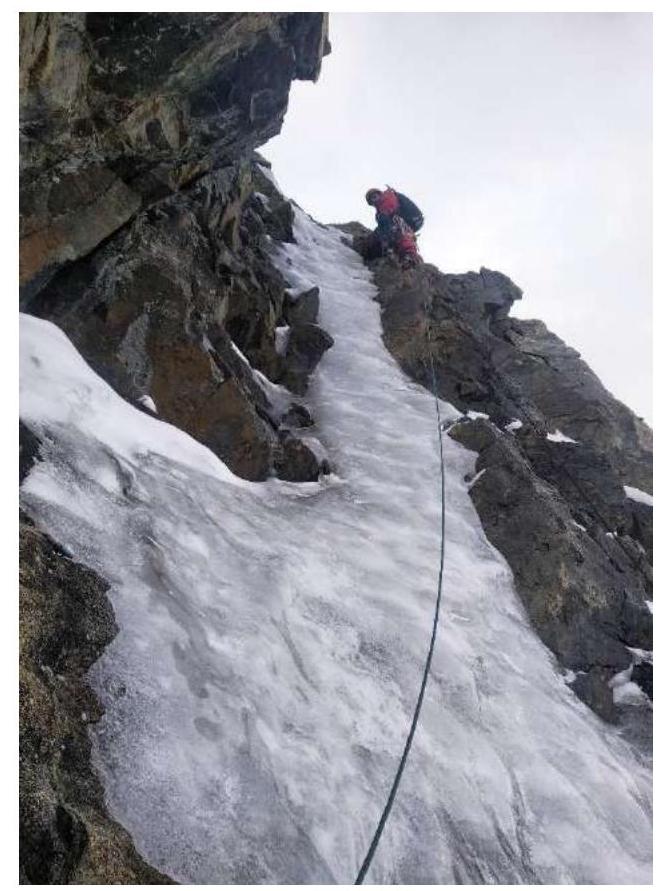
Section R6–R7
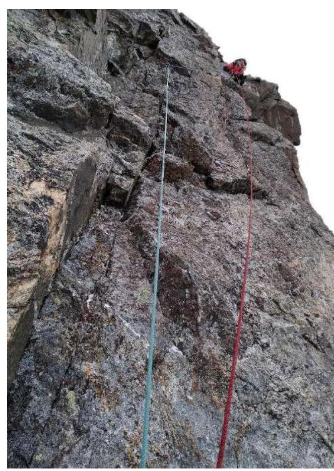
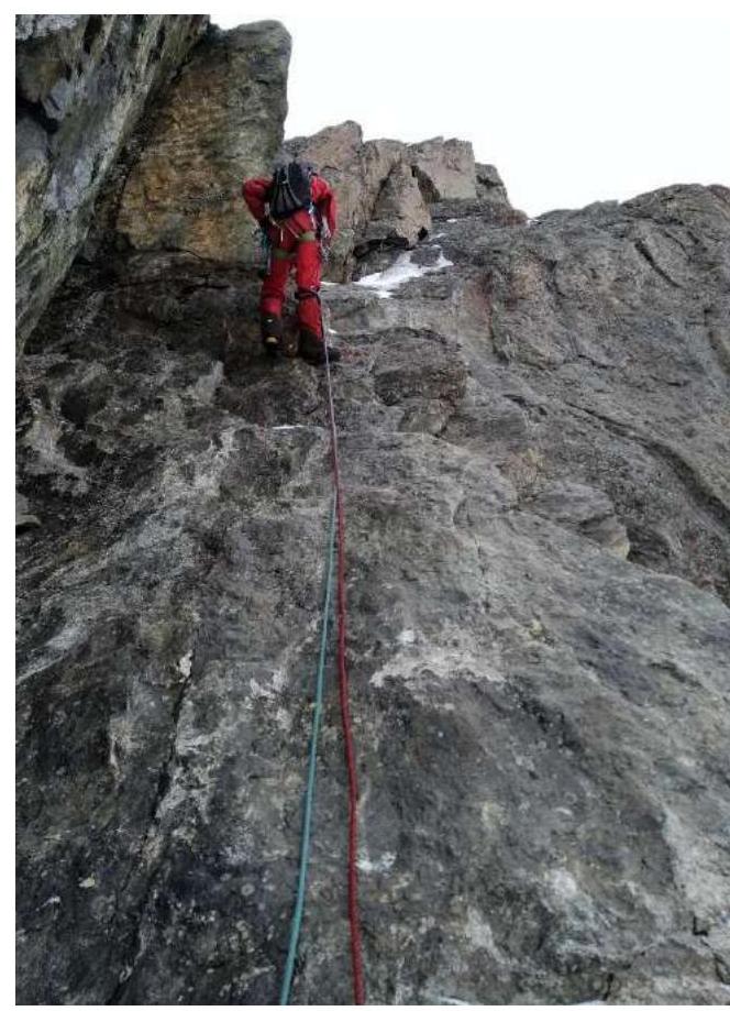
Section R8–R9
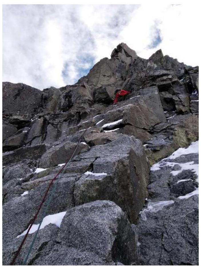
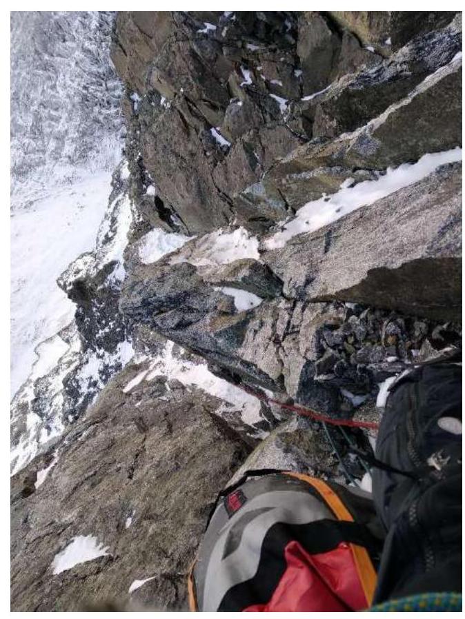
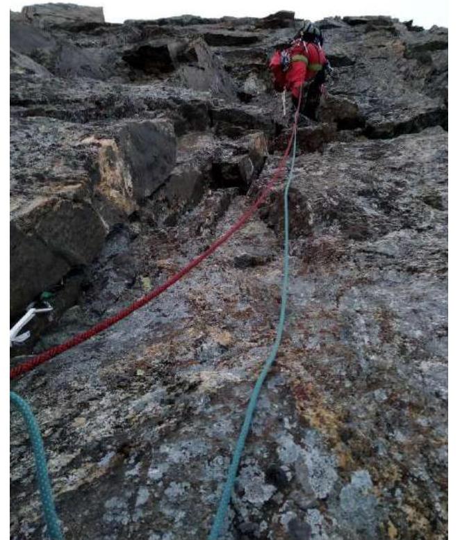
Section R11–R12
Section R9–R10
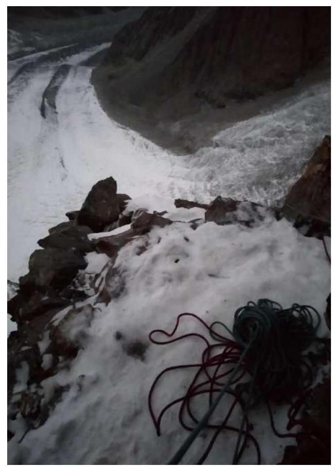
View down from R11
Section R15–R16

Section R17–R18
Ledge on section R16–R17
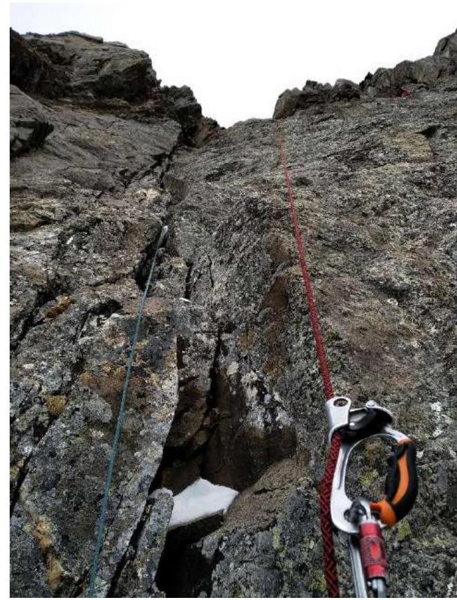
Section R18–R19
Bivouac on R21
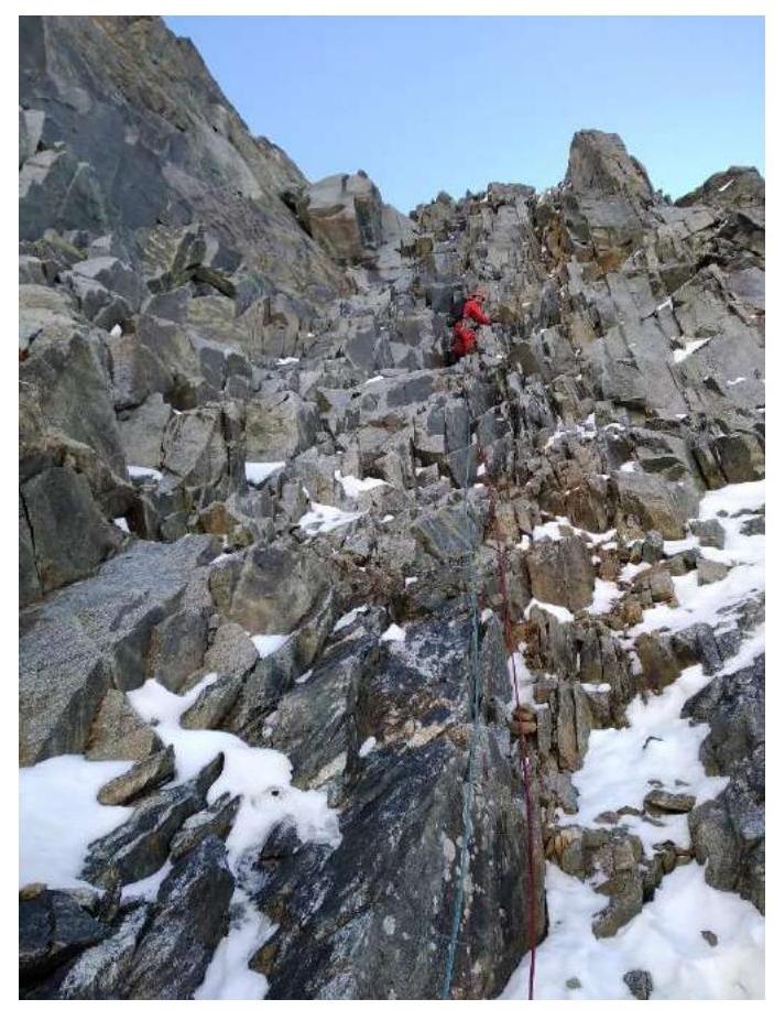
Section R21–R22
Section R21–R22
Section R22–R23
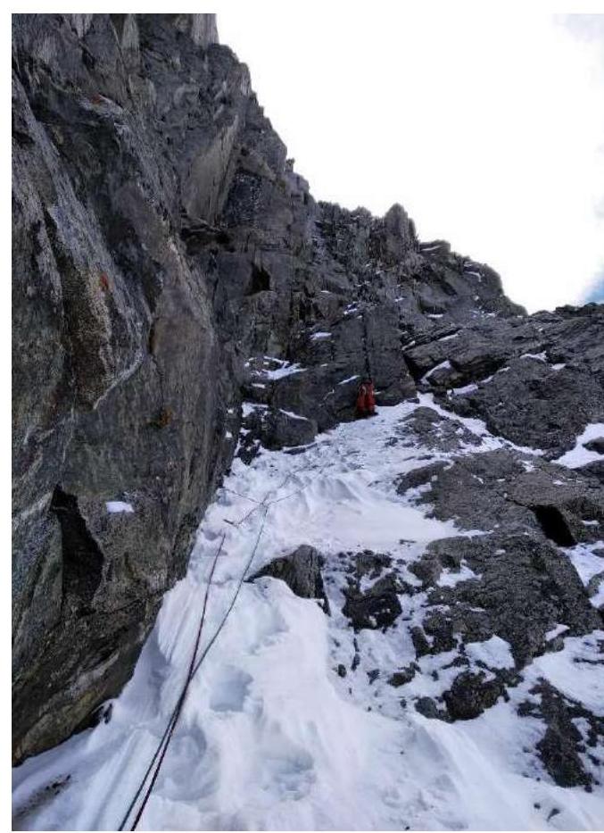
Section R25–R26 (mirrored)
Section R25–R26
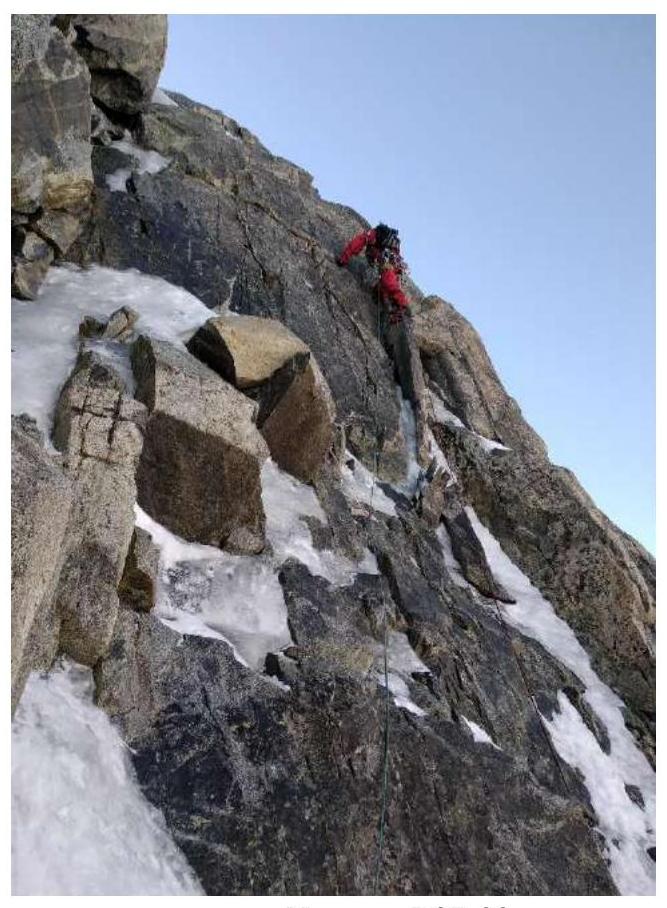
Section R26–R27
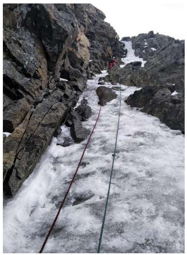
Section R27–R28
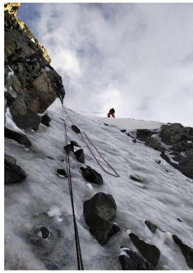
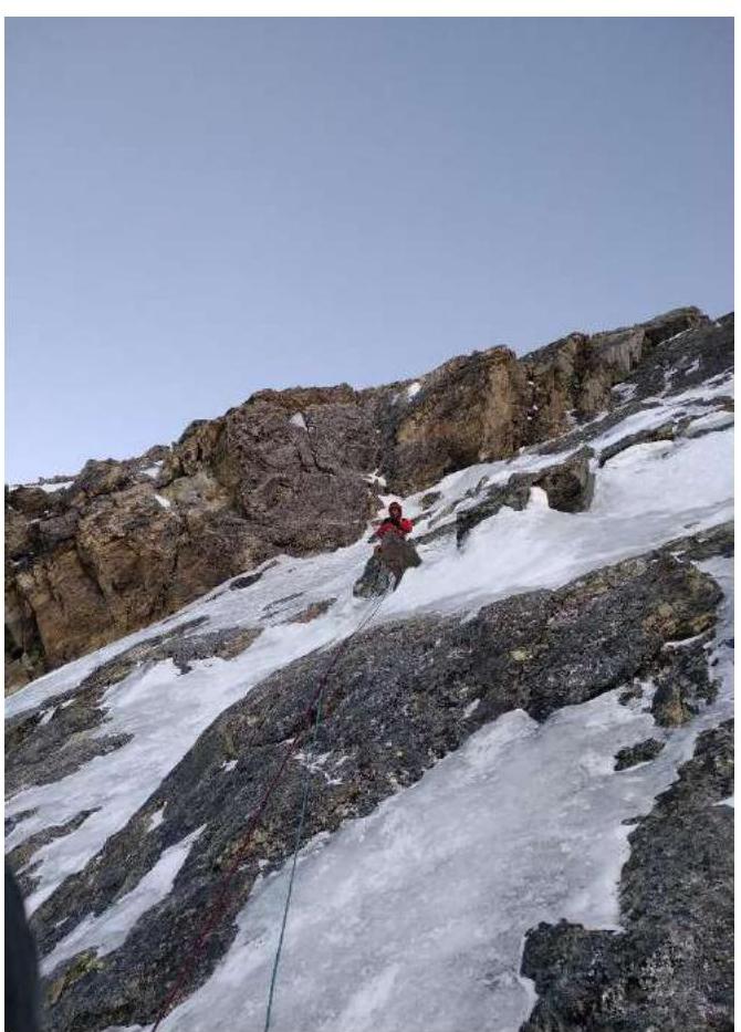
Section R29–R30
Section R28–R29

Bivouac on R31
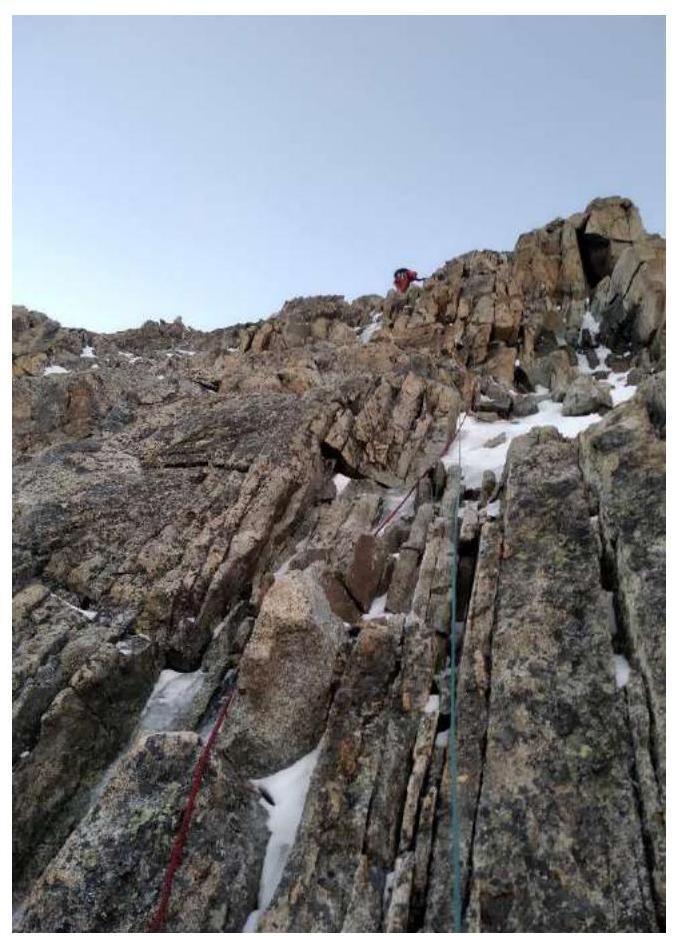
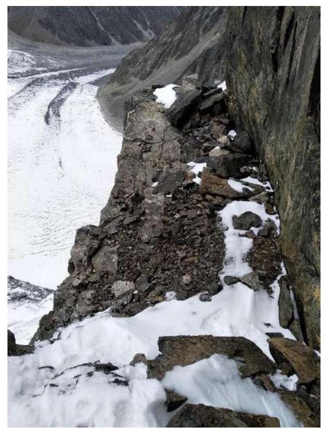
Section R31–R33
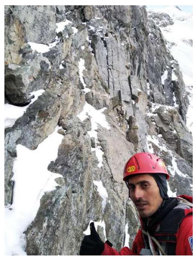
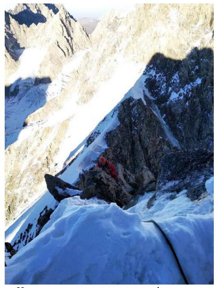
Section R37–R38
Section R33–R35

Section R44–R45
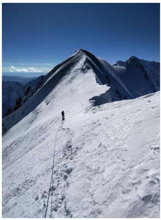
Ridge R46–R47
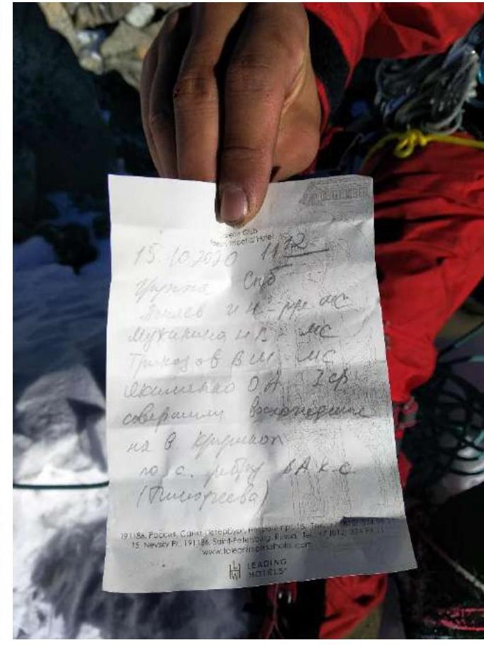
Note from the summit
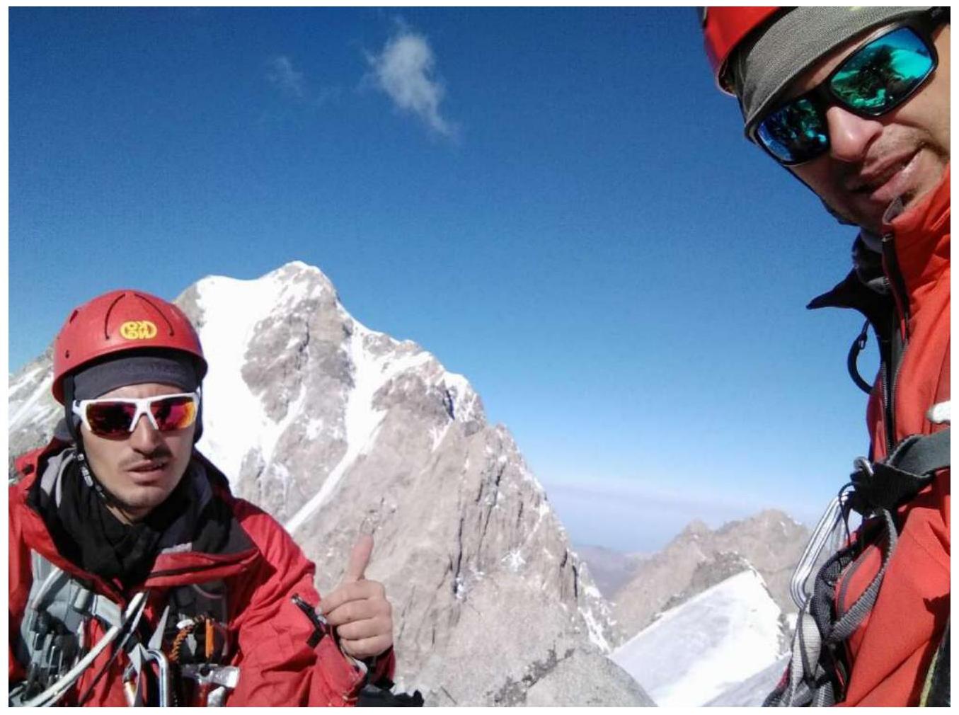
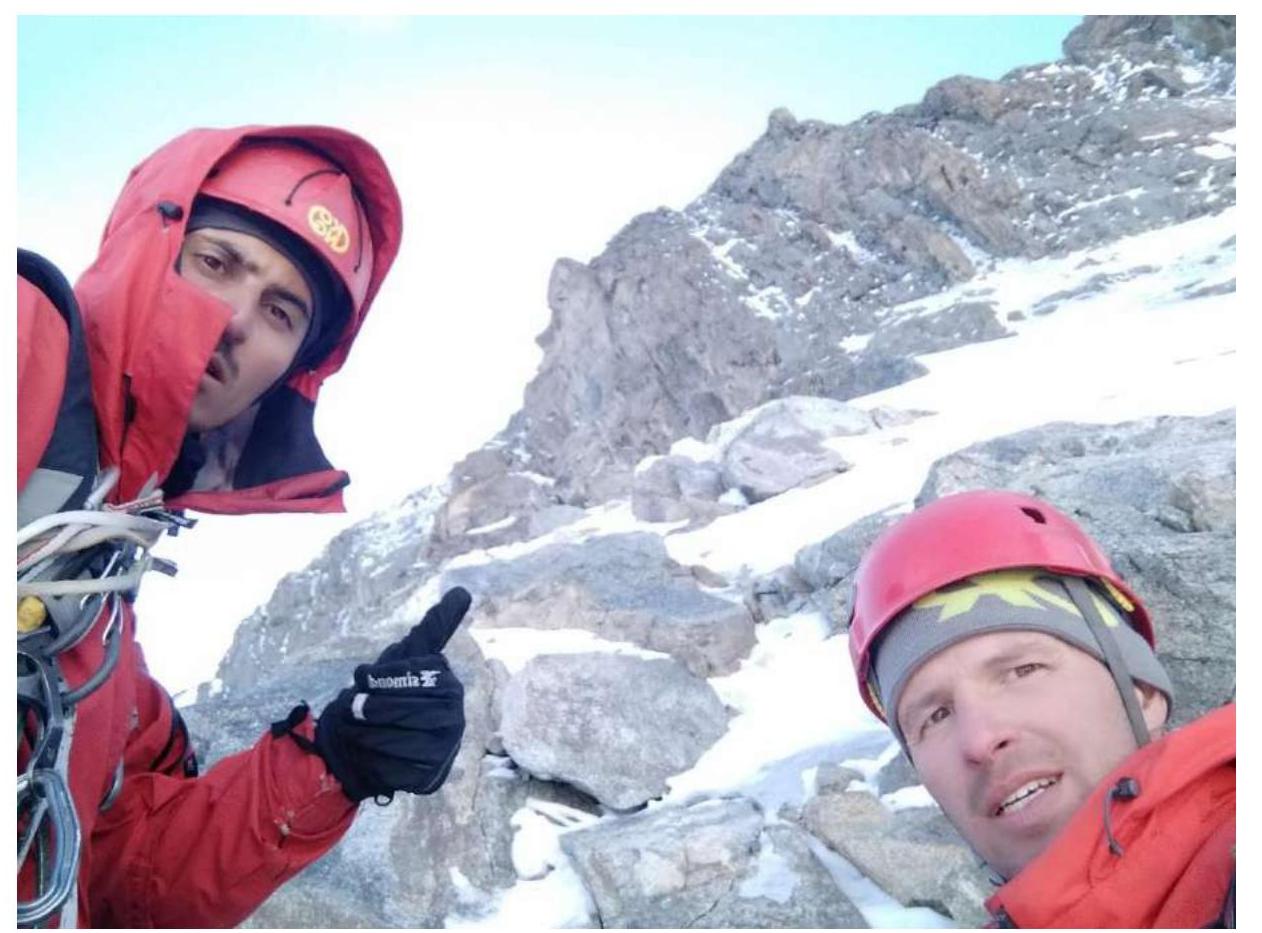
On the summit

On the summit
On descent, before the first rappel
After rappel, descent in three steps
Second rappel

Berg after oblique rappels from Krumkol Pровал
Route Profile

Descent along the glacier to bivouac at 3900 m
Good luck on the route and be careful on the descent!