RUSSIAN ALPINISM CHAMPIONSHIP TECHNICAL-ALTITUDE CLASS 2020
Report on the Ascent of Mt. Koshtan-Tau (5151 m) via the Left Part of the Central Buttress on the North Face
(Route by A. Simonik), 6A Category of Difficulty
THE ROUTE WAS CLIMBED BY THE COMBINED TEAM OF ST. PETERSBURG
Team Members:
- Viktor Mikhailovich Trikozov — team leader
- Ilya Nikolaevich Penyaev
- Tatiana Ivanovna Timoshenko — senior coach
Climbing Passport
- Central Caucasus, Bezengi region, Main Caucasian Range, section of peak No.2.5
- Name of the peak: Koshtan-Tau, 5151 m
- Name of the route: via the left part of the central buttress on the North face (A. Simonik)
- Category of difficulty: 6A
- Nature of the route: combined
- Height difference of the route: 1151 m
- Length of the route: 1500 m
Length of sections:
- Category V — 670 m
- Category VI — 180 m
- Average steepness: main part of the route — 70°, entire route — 60°.
- Number of pitons left on the route: total — 0; including bolt pitons — 0.
- Pitons used on the route: stationary bolt pitons — 0, including for ITO — 0; removable bolt pitons — 0, including for ITO — 0. Rock pitons (including anchor pitons) — 12, including for ITO — 3; camalots — 45, including for ITO — 2; chocks — 0; ice screws — 120.
- Team's total climbing hours to the summit: 22 h 30 min
Participants: Ilya Nikolaevich Penyaev, Master of Sports, Alpine Club "Gornik"
- Departure to the route: 5:00, October 22, 2020
Reached the summit: 15:45, October 23, 2020. Descent from the summit: 11:00, October 24, 2020. Return to Base Camp: 19:00, October 24, 2020.
| Date | Cloud Cover/Visibility | Precipitation | t° day/night | Sections Completed | Bivouac Location |
|---|---|---|---|---|---|
| 22.10. | Variable cloudiness (unlimited visibility) | Snow started after 18:00, heavy snow after 19:00 | –6/–8°С | R0–R13 | R13 |
| 23.10. | Variable cloudiness (unlimited visibility). Visibility 100–130 m after 15:00 | No precipitation, visibility at the summit 10–15 m, strong wind | –5/–10°С | R13–R26 | On the descent ridge, after the first rappel |
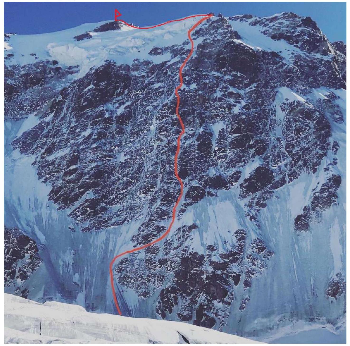
General photo of the route
Brief Description of the Route
The route can be divided into four main sections:
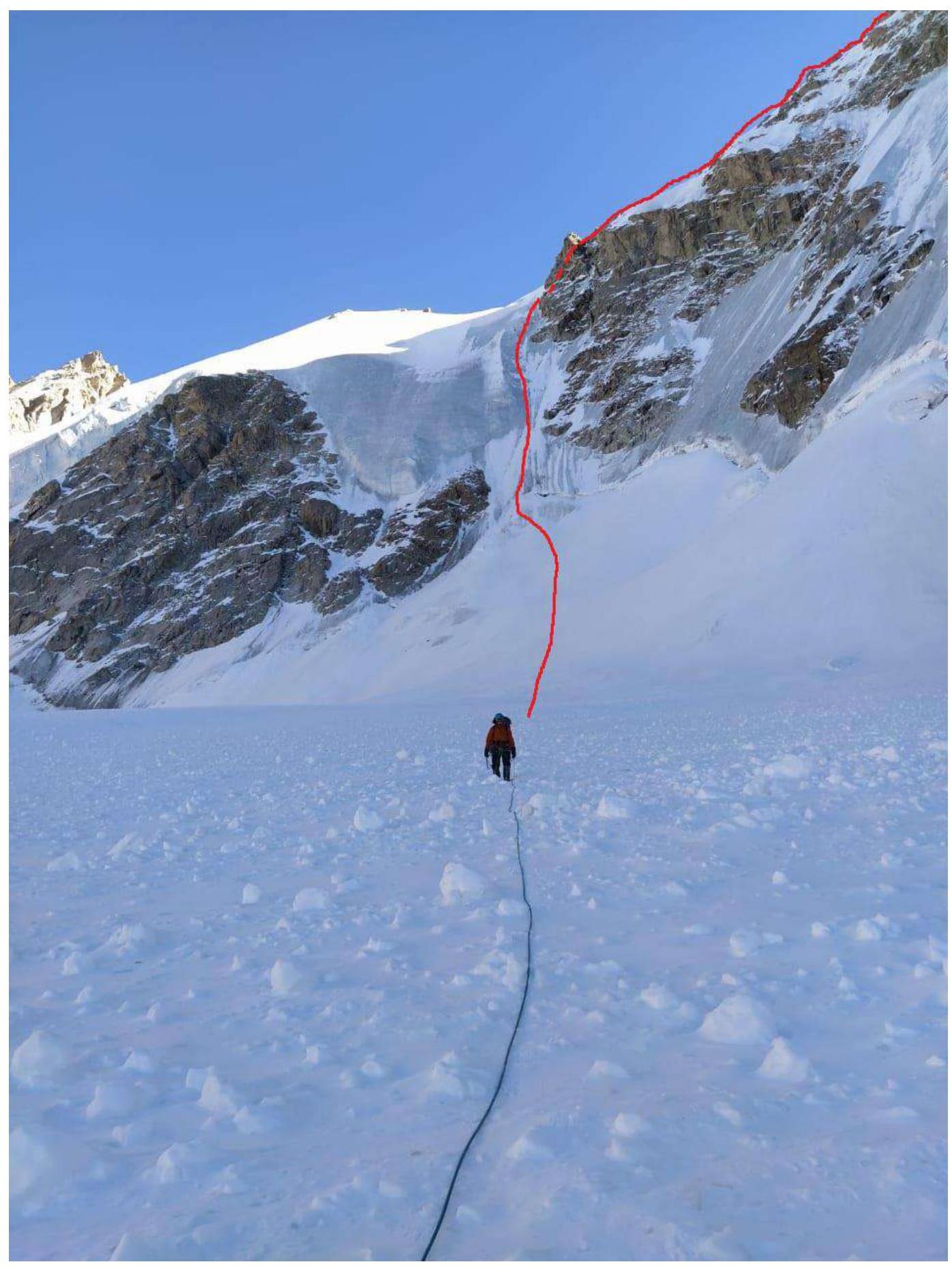
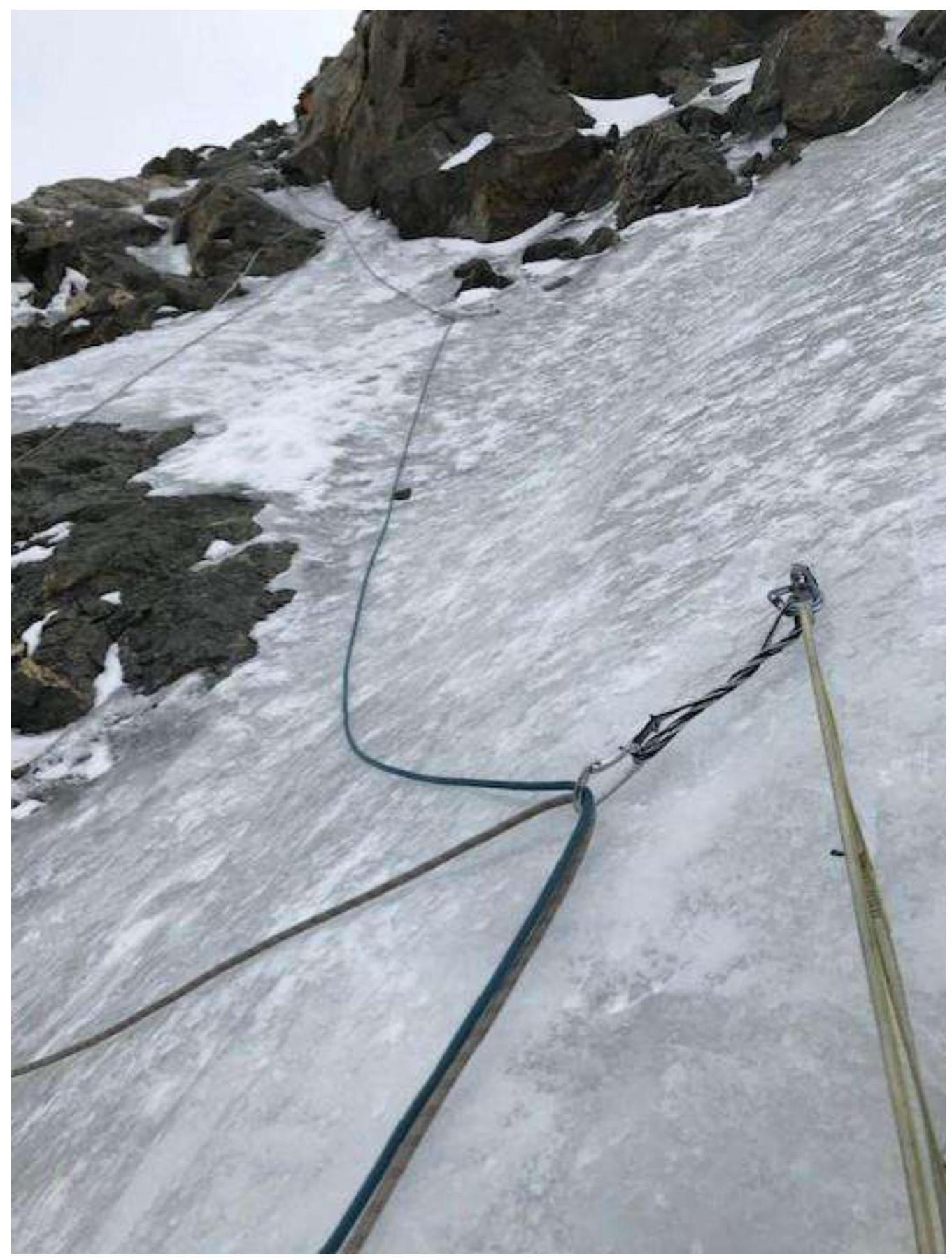
- R0–R2 — after crossing the bergschrund, an ice wall 150 m long leads to the main buttress of the route. Protection on ice screws.
- Section R3–R12 — a pronounced buttress on the North face. Throughout its length, the sections are relatively uniform in difficulty, consisting of rocks covered in ice and snow. Protection elements: ice screws, camalots, anchors. Clearing and finding cracks takes a significant amount of time.
Key sections: R6–R8, R11–R13 — predominantly mixed climbing with transitions to ITO and rock climbing.
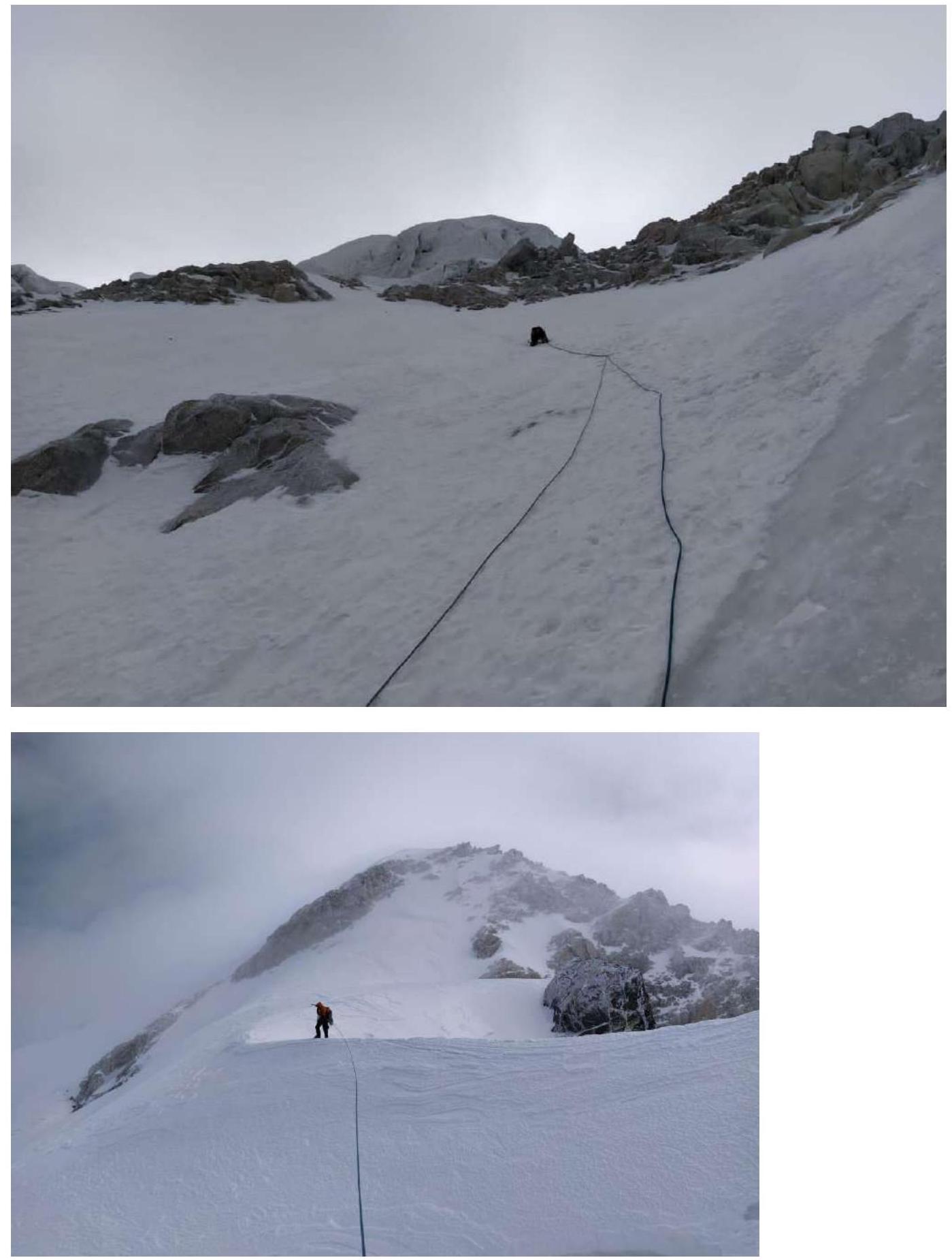
- R13–R22 — beginning of the second day of ascent after a noticeably red rock in the center of the buttress. Ice predominates, rocks are bypassed on the left via rocky sections.
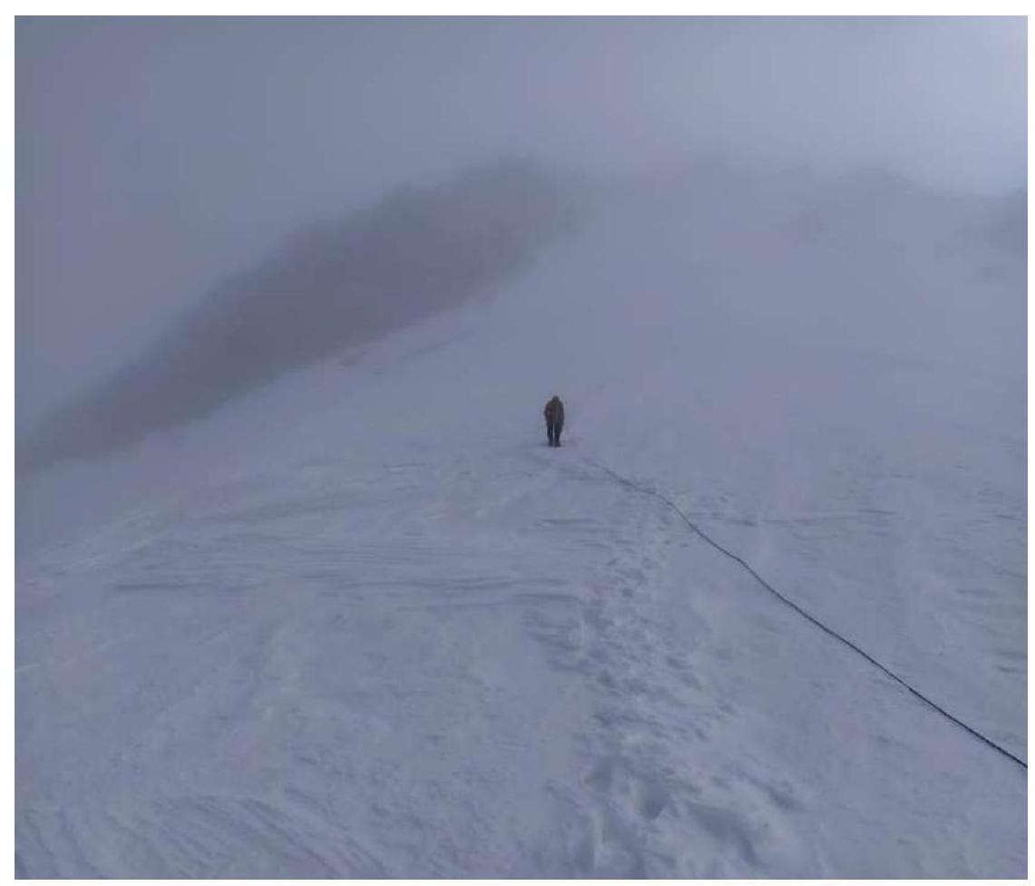
- R23–R26 — gradual flattening, transition from rocks to a snowy ridge leading first to a plateau below the summit tower (possibility of a good bivouac), then via a snowy ascent — to the summit.
Features of the Ascent
The route was climbed in October, resulting in short daylight hours and negative daytime temperatures.
State of the terrain:
- snow-covered, ice-filled cracks
- rocks requiring clearing.
No good bivouac sites were found along the main part of the wall by the team.
- 1st bivouac — seated (4500 m), on a ridge under R13.
- 2nd bivouac — on the descent ridge, after a rappel under a snowy ridge.
The wall part of the route was climbed using a simultaneous climbing technique.
Route diagram in UIAA symbols
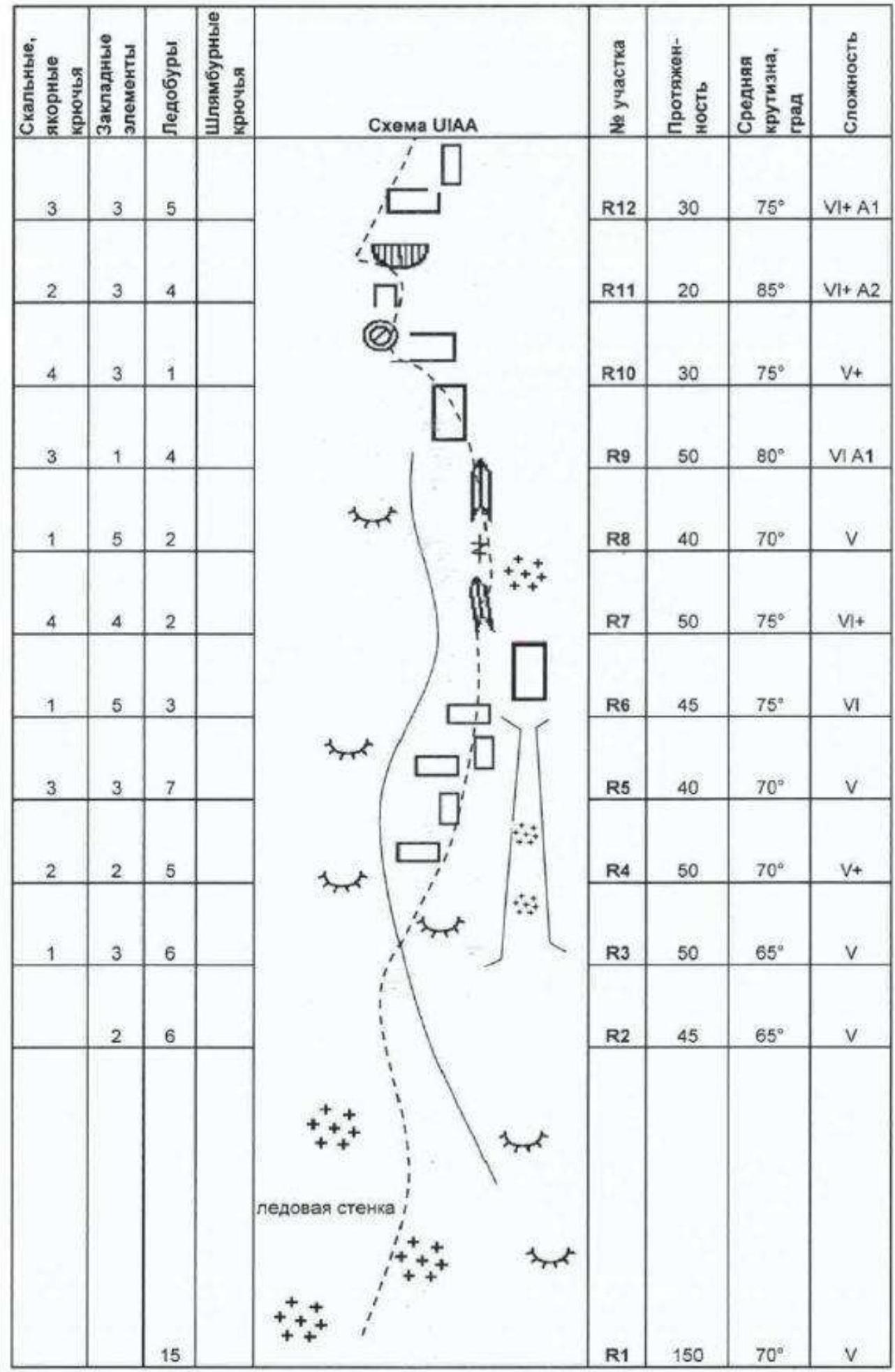
| Rock, Anchor Pitons | Chocks and Friends | Ice Screws | Bolt Pitons | Section | Length | Average Steepness, ° | Difficulty |
|---|---|---|---|---|---|---|---|
| — | — | 15 | — | R1 | 150 m | 70° | V |
| 2 | — | — | 6 | R2 | 45 m | 65° | V |
| 1 | 3 | — | 6 | R3 | 50 m | 65° | V |
| 2 | 2 | — | 5 | R4 | 50 m | 70° | V+ |
| 3 | 3 | — | 7 | R5 | 40 m | 70° | V |
| 1 | 5 | — | 3 | R6 | 45 m | 75° | VI |
| 4 | 4 | — | 2 | R7 | 50 m | 75° | VI+ |
| 1 | 5 | — | 2 | R8 | 40 m | 70° | V |
| 3 | 1 | — | 4 | R9 | 50 m | 80° | VIA1 |
| 4 | 3 | — | 1 | R10 | 30 m | 75° | V+ |
| 2 | 3 | — | 4 | R11 | 20 m | 85° | VIA2 |
| 3 | 3 | — | 5 | R12 | 30 m | 75° | VIA1 |
| 2 | 3 | — | 4 | R13 | 30 m | 70° | V |
| 4 | 3 | — | 4 | R14 | 40 m | 75° | VI |
| 1 | 3 | — | 4 | R15 | 45 m | 65° | V |
| 3 | 3 | — | 3 | R16 | 50 m | 70° | V |
| 1 | 4 | — | — | R17 | 10 m | 75° | VI |
| 1 | 2 | — | 7 | R18 | 40 m | 70° | V |
| 2 | 6 | — | 8 | R19 | 150 m | 60° | V |
| — | — | — | 6 | R20 | 45 m | 65° | IV+ |
| — | — | 10 | — | R21 | 300 m | 40° | IV |
| — | 3 | — | 5 | R22 | 100 m | 55° | IV |
| — | — | — | — | R23 | 200 m | 30° | — |
| — | 1 | — | 3 | R25 | 30 m | 50° | III |
| — | — | — | — | R26 | 50 m | 30° | — |
Graph of the group's movement on the route
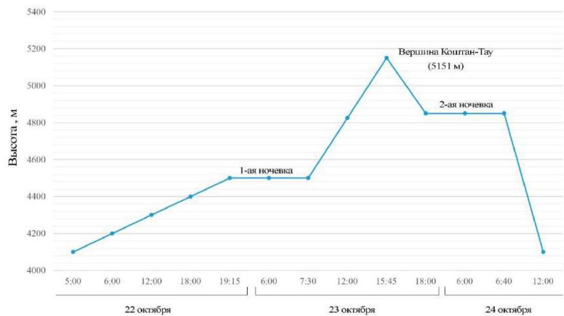
Date and time of movement on the route
Technical photos of the route
Section R4–R5
Section R23
Ascent to the shoulder, 40 min from the summit.
Descent via the North-East ridge — category 4A