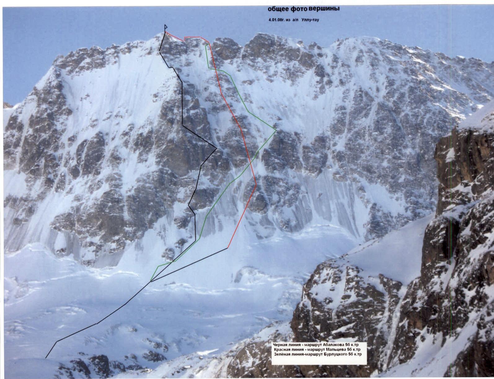
Ullu-Tau Main 4207 m. Right of the rock islands. North wall of the Western ridge. Burlutsky's route.
Passport
- Technical category.
- Central Caucasus, Adyr-Su gorge.
- 5B category of difficulty.
- Route type — ice and snow.
- Height difference of the route is 1100 m.
Route length is 1380 m. Length of category 5 sections — 890 m.
Average slope:
- main part of the route — 57°
- entire route — 47°
-
Total pitons left on the route — 0 pcs., including expansion bolts — 0 pcs. Pitons used on the route: ice screws — 16 pcs., stationary expansion bolts — 0 pcs., including ITO — 0 pcs., removable expansion bolts — 0 pcs., including ITO — 0 pcs. Total artificial protection points used — 0 pcs.
-
Team's man-hours: 19.5 hours, days — 2.
-
Overnights on the route — 1.
-
Leader: Popov Mikhail Lvovich — 1st sports category.
Participants:
- Shestak Oleg Viktorovich — 1st sports category.
- Pis'mennyi Evgenii Aleksandrovich — 1st sports category.
- Motienko Nikolai Ilich — CMS, instructor II category.
Coach — Motienko Nikolai Ilich — CMS, instructor II category.
-
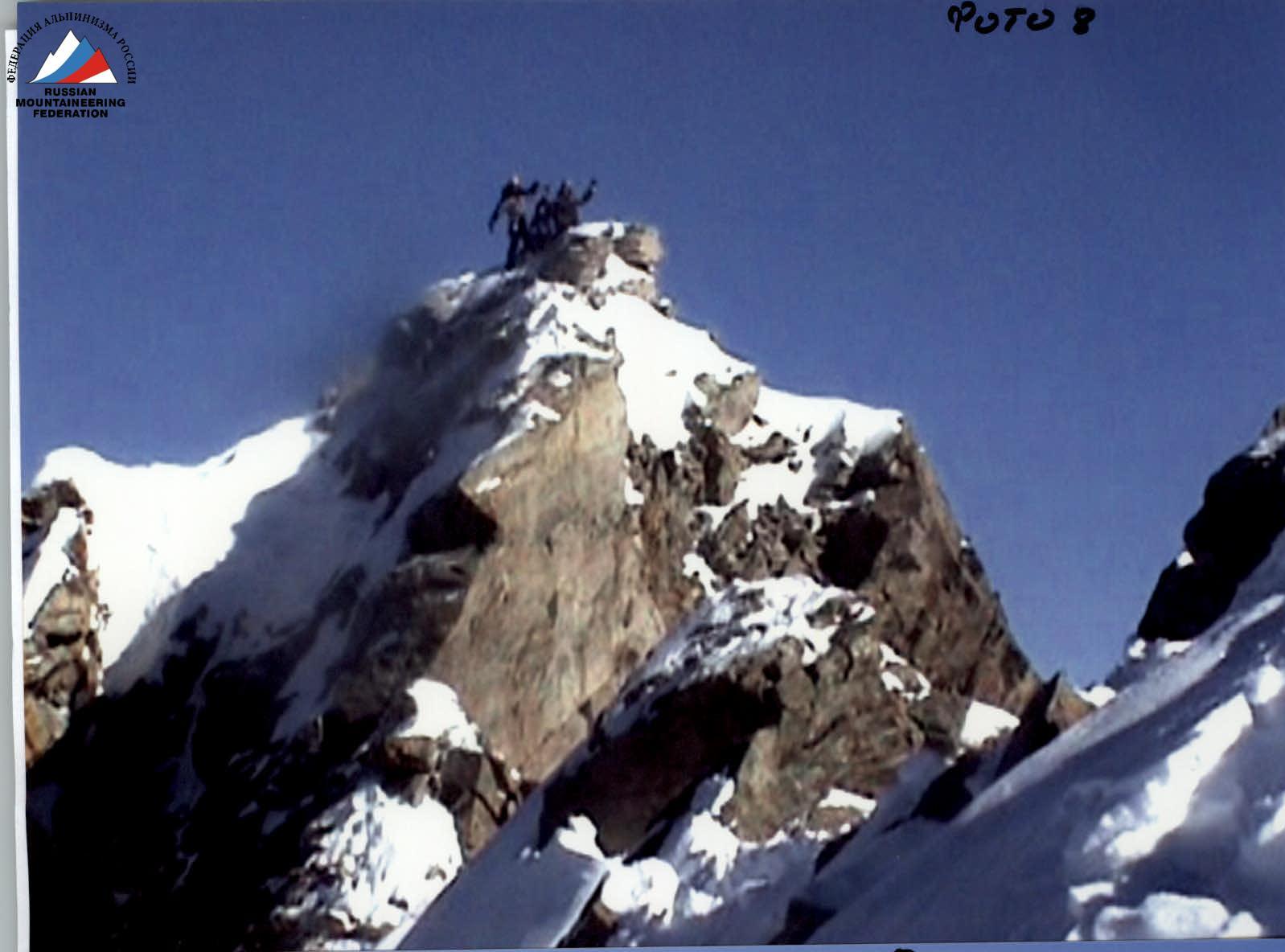
Approach to the route: January 6, 2008, 4:00. Summit: January 7, 2008, 13:00. Return: January 7, 2008, 23:30.
-
Organization: MAC FREELINE. Stavropol Krai team.
 ↗
Profile of the wall on the right
↗
Profile of the wall on the right
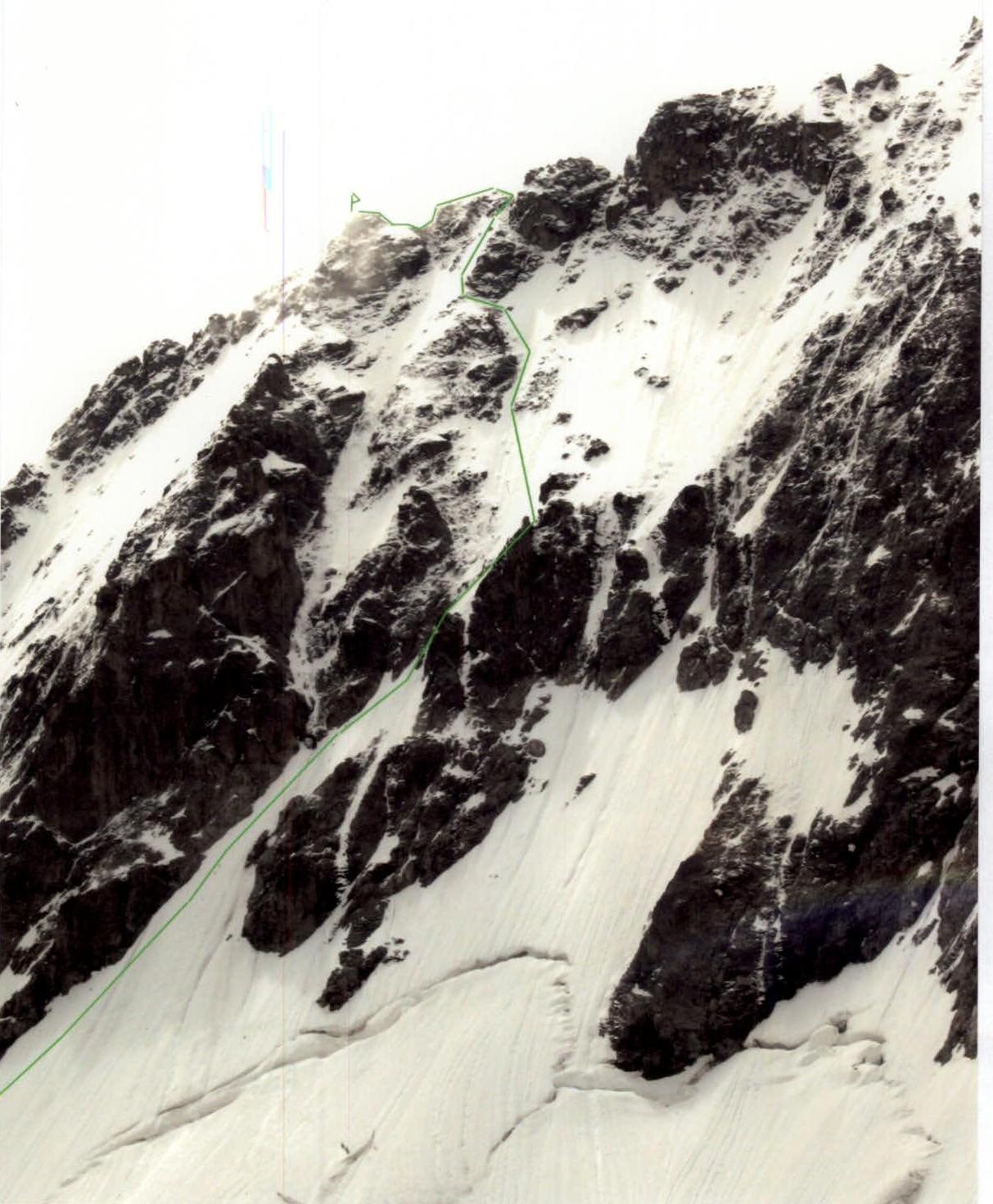
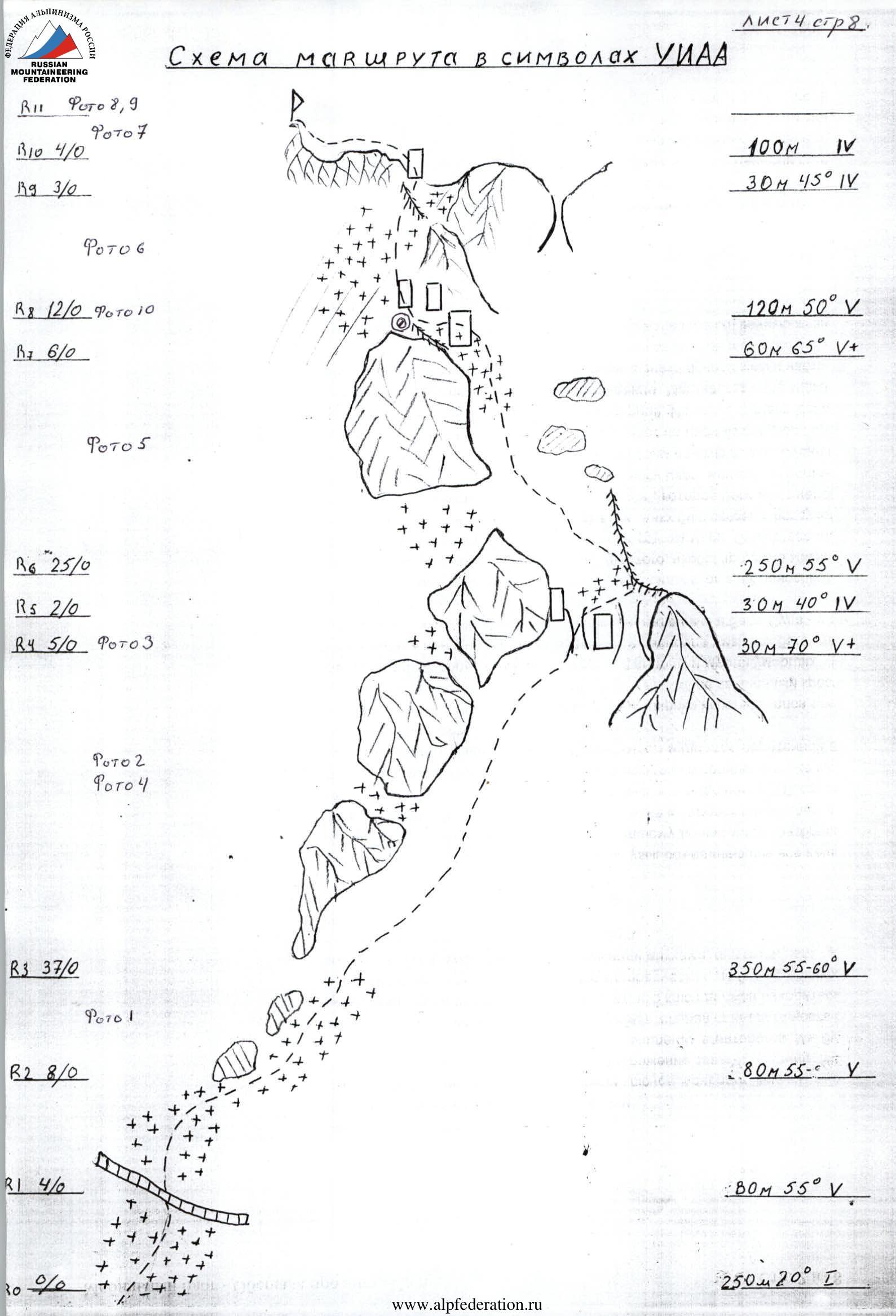
 Route diagram in UIAA symbols
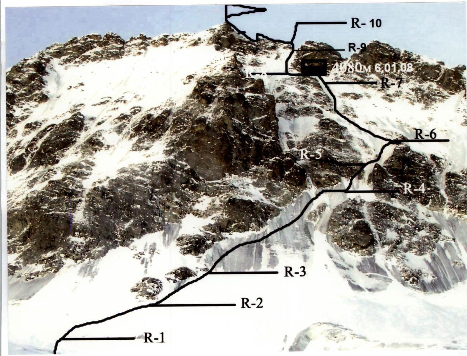
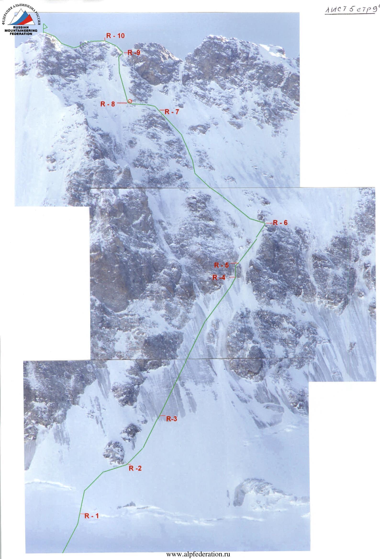
Route description
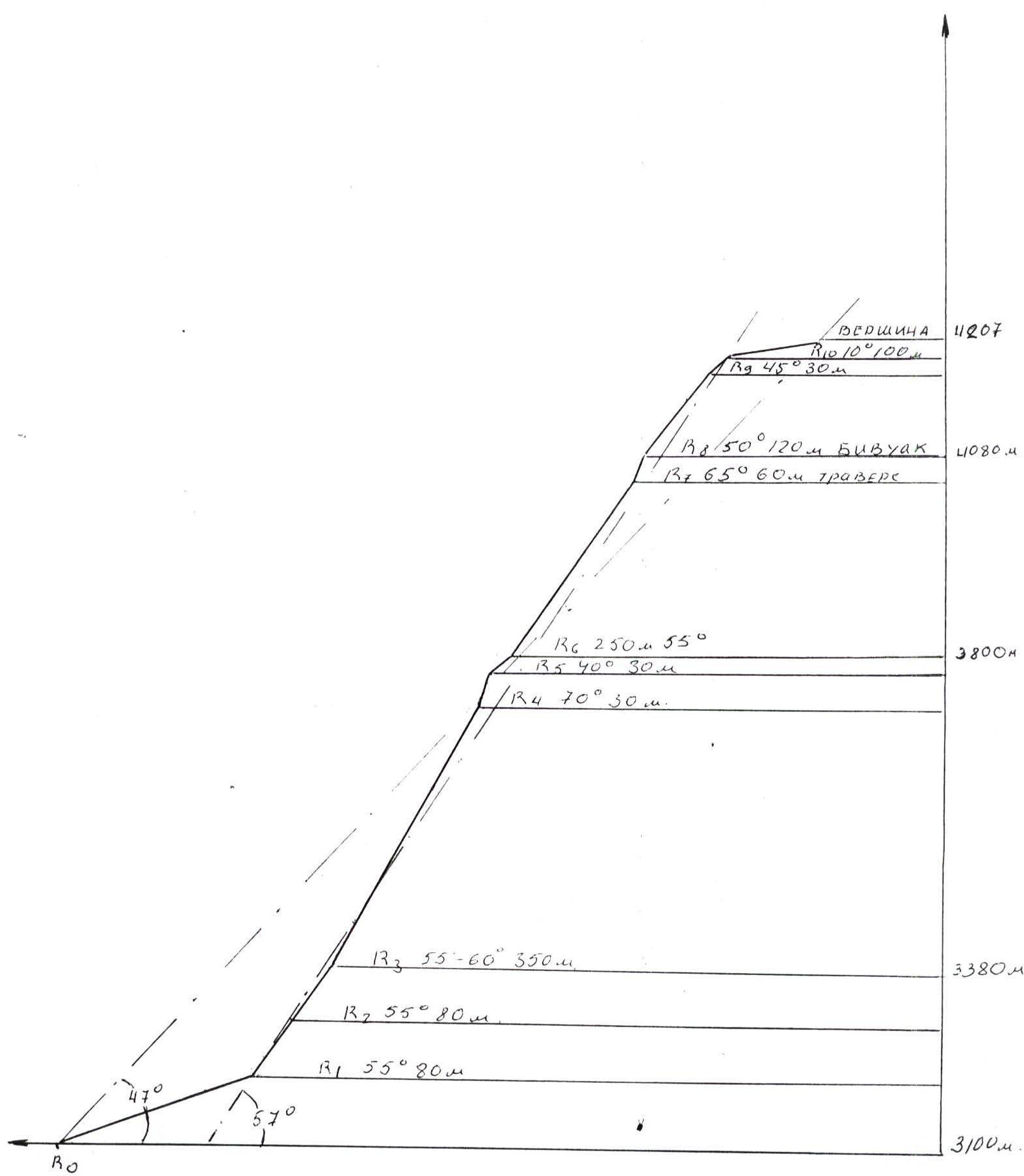
R0–R1. From the initial bivouac, at the "Central" campsite, upwards towards the rocky "rhombus". Simple snow slope, using snowshoes. Slope steepness — 20°.
R1–R2. Overcoming the bergschrund, belay via ice axe. Then move right-upwards on a steep difficult snow slope (ice under snow in the upper part) towards the 1st rocky island of Maltsev's route. Movement:
- initially simultaneous;
- then alternate, belaying via ice screws;
- using ice tools for passage.
Section characteristics:
- slope steepness — 55°;
- difficulty category — 4;
- length — 80 m.
R2–R3. Along the rocky islands, ascent to the start of the ice section without snow. Ice covered with snow, belay using ice screws, using ice tools for passage. Slope steepness — 55°, 5, 80 m.
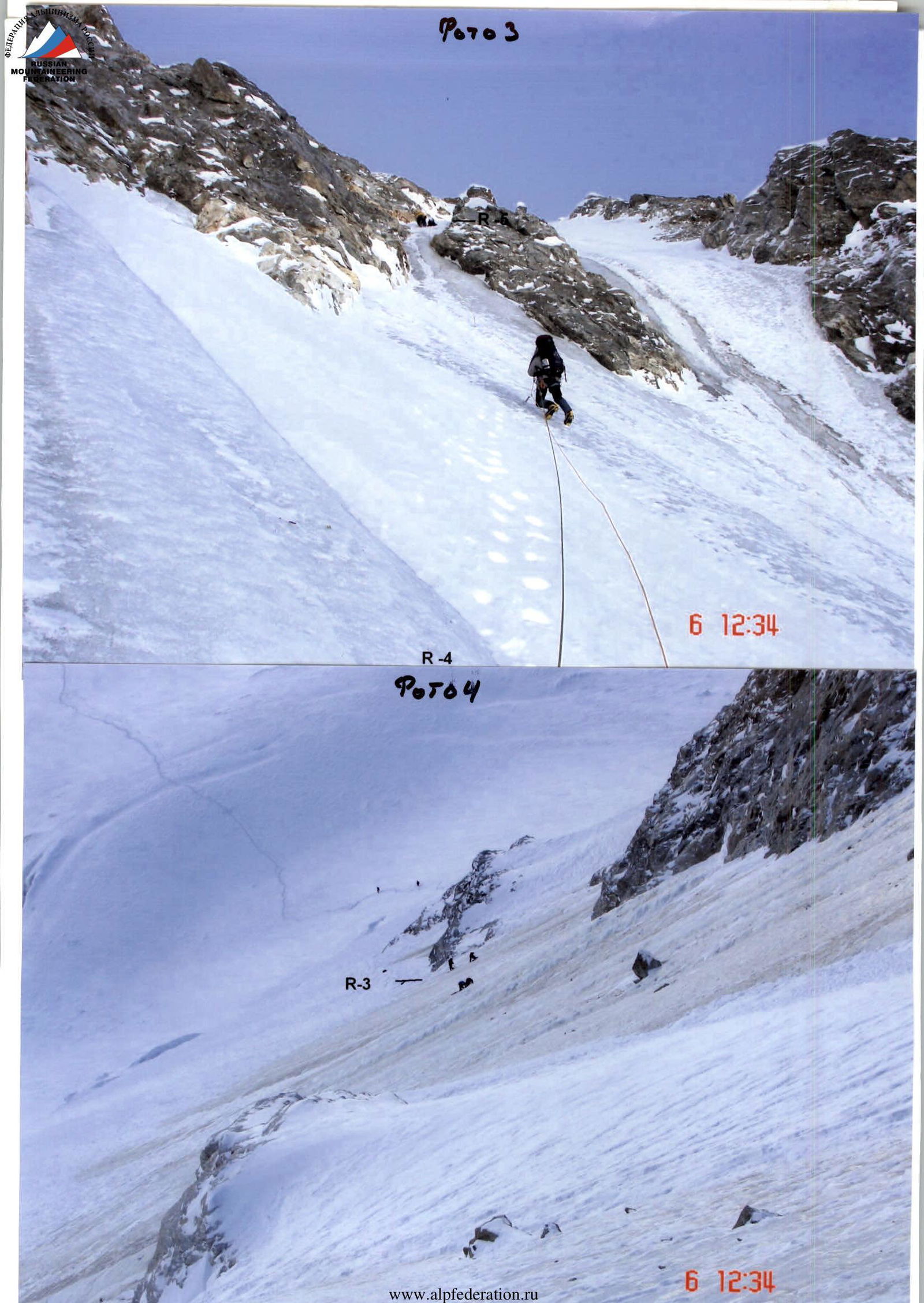
R3–R4. Steep ice ascent upwards to the right towards the start of a narrow steep couloir. Alternate belay, ice tools. Steepness 55–60°, 5, 350 m.
R4–R5. Narrow steep ice couloir, difficult climbing (key section of the route). For the first climber:
- excellent front-pointing technique is required;
- it is advisable to set up "perils".
Exit from the couloir to the right onto the top of a small rocky outcrop. 70°, 5, 30 m.
R5–R6. Move upwards to the right onto a snow cornice on the right rocky islands, convenient place for rest 30 m, 40°, 4.
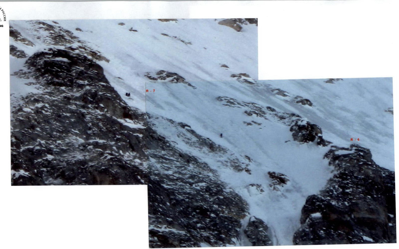
R6–R7. Then upwards to the left on a steep ice slope, partially covered with snow. Ascent along the Maltsev islands upwards to the start of a difficult traverse with an ascent onto the snow and ice ridge. Alternate belay, ice tools.
- 55–60°
- 5
- 250 m
R7–R8. Difficult traverse with an ascent onto the snow and ice ridge. Rocks with ice, covered with snow. Carefully choose belay points. Soft and loose snow in the upper part.
- Ice tools, screws
- 65°
- 5
- 60 m
Here on the ridge — it is possible to carve out a place for a bivouac.
R8–R9. Exit onto an ice slope, move upwards, then to the right on difficult rocks, to a ridge saddle.
- Ice tools, screws
- 50–55°
- 5
- 120 m
R9–R10. From the ridge saddle to the left, wall 40°, 30 m, 4 — until reaching the easing ridge.
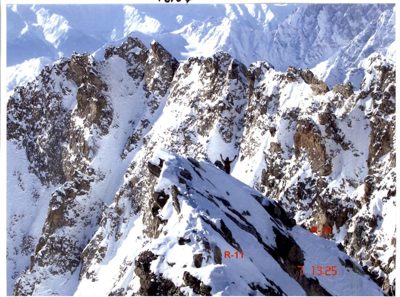
R10–R11. Move along a simple ridge to the right, towards the summit of Ullu-Tau Main. Movement is possible with simultaneous belay, belaying via outcrops.
- 100 m
- 4
Descent via the ascent route.
Team's tactical actions
The team decided to climb the route with preliminary processing. For this, they took 5 ropes. On January 5, 2008, by 13:00 they reached the bergschrund. They started to the left of the description, as they found a convenient bridge across the "berg".
They fixed ropes from the first rocky outcrop:
- 1st rope
- 2nd rope
- 3rd rope
- 4th rope
The next day:
- they left the first 2 ropes on the route for descent;
- movement was carried out with alternate belay;
- the team worked with two leads.
After the "key" section, they moved 30 m to the right onto a small ridge. They gathered there, rested for 15 minutes, and changed the lead.
After three ropes:
- they started looking for a bivouac site to the left on the second Maltsev island. Unfortunately, they only wasted time;
- after 3 ropes, on the top of the 3rd Maltsev island, in the dark they found a ridge with a slope of 35–40°;
- they carved out a semi-reclining bivouac in the ice. They used backpacks tied to ice screws to create a platform.
10 m from the bivouac, they found a tent and a rope frozen in the ice — they used it as a belay station during descent.
In the morning, leaving their backpacks, they climbed 2.5 ropes to the ridge. They left the last rope for descent. On the ridge, they moved simultaneously, in two teams, belaying via outcrops. Descent was via the ascent route, using a self-removing ice screw. They did not change the first and last climbers on the descent.
They used:
- 4 "Grivel" ice screws;
- 2 "Ural-Alp" ice screws;
- 12 "Irbis" ice screws;
- 5 ice tools.
No rock climbing equipment was used.
Recommendations
Having "Grivel" ice screws — will greatly simplify life. If only "Irbis" is available, it is possible to spray automotive de-icing fluid inside before screwing into the ice. "BD" — is very helpful, especially when removing. For screwing in "Irbis", they used:
- a long 15 mm wrench.
On the bivouac, they used chemical heating pads for their feet, which saved them from severe frostbite. Due to the strong frost, most of the food — bread, sausage, cheese, etc. — became unusable — "stone". There was no time to melt.
On the descent, they used a "Grivel" ice screw for self-removal, as the "Irbis" ones froze solid instantly, and the de-icing fluid had run out by then.
Route safety assessment
At this time of year, the route is safe. Due to frosts, there are no rockfalls. The snow cover is small, and there are no snow cornices. There is no avalanche danger.