Ascent Passport
- Winter category.
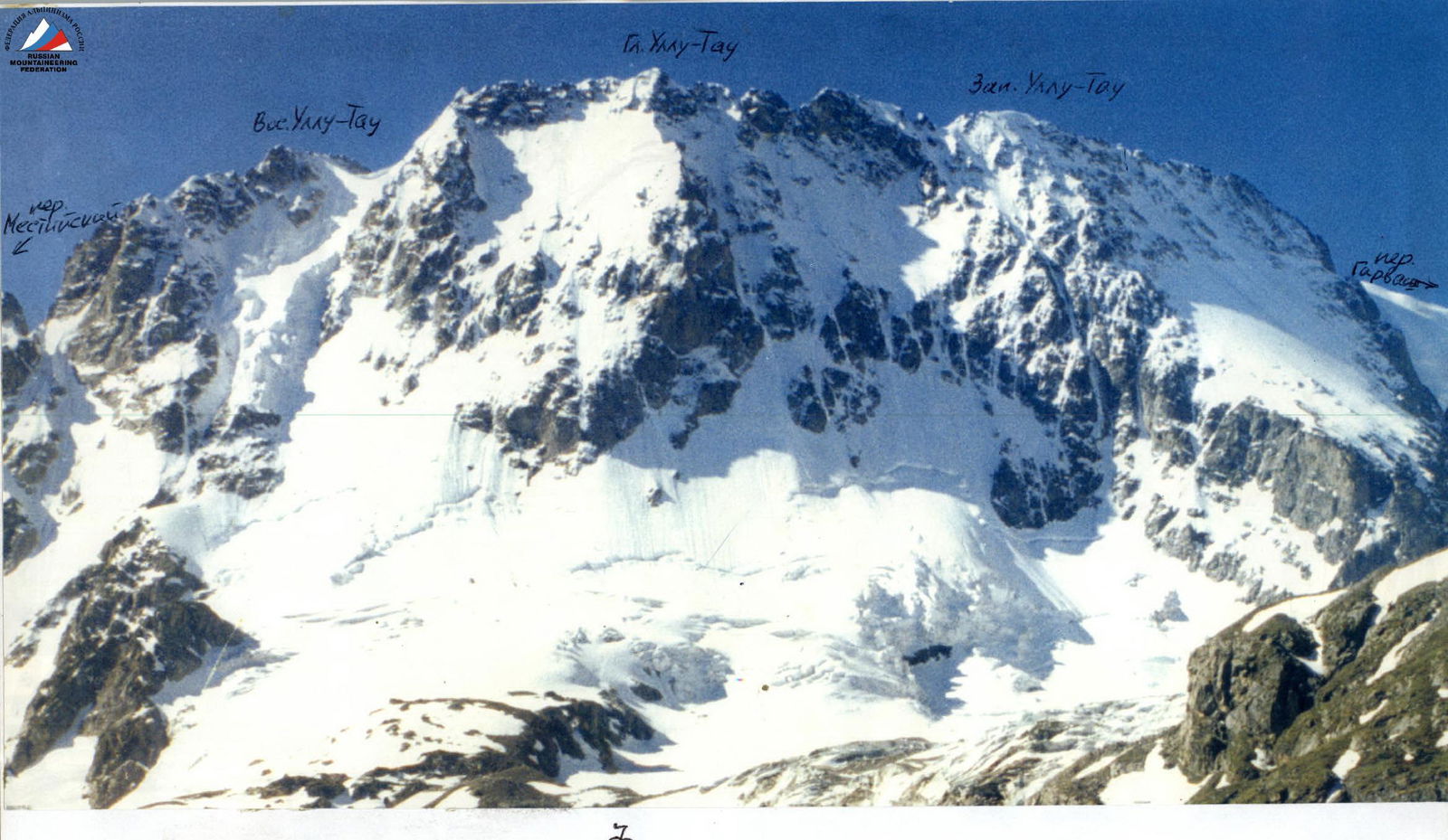
- Central Caucasus, Adyr-Su gorge.
- Ullu-Tau Glavnaya peak to the right of the rocky islands (Burlutsky's route).
- Category of difficulty 5B ice-snow, 2nd ascent. 1994.
- Height difference — 870 m; length — 1200 m (wall section — 950 m). Length of sections with 5th category of difficulty — 910 m. Average steepness of the wall section — 56°.
- Number of ice screws used — 105 (0)
- Team's climbing hours — 12.5 hours (11.5 hours — on the wall) and 2 days.
- Overnight stays: 1 — on the ridge in a tent.
- Team leader: Kulbachenko V.E. — Master of Sports. Participant: Bishirov A.P. — Candidate for Master of Sports.
- Departure for the route — February 19, 2000. Summit — February 20, 2000. Return — February 20, 2000.
- The ascent was organized by the Moscow Federation of Alpinism.

General photo of the summit
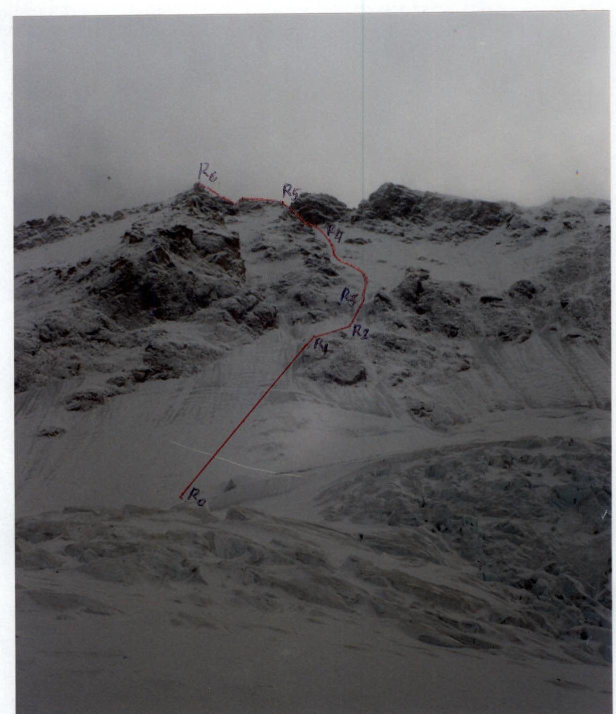
- Team's route
- V.L.'s route
- V. Maltsev's route
The photo was taken on February 17, 2000 at 13:00.
Team's tactical actions
On February 19 at 6:30 (at dawn) the team started the ascent. On the bivouac, they put on harnesses, helmets, and crampons. Around 7:00 the rope team crossed the bergschrund and began ascending the wall.
The movement was carried out alternately. On the sections:
- R0–R1
- R3–R4
- R4–R5 — Kulbachenko led first
On the sections:
- R1–R2
- R2–R3
- R5–R6 — Bishirov led first
For organizing the belay station, 2 ice screws were used; during the ascent, the number of ice screws varied from 2 to 3 per rope, depending on the steepness and condition of the slope. The first climber chose the direction of movement so that the ice fragments and falling rocks flew past the lower climbers. The entire route was traversed on the front points of the crampons using two ice axes.
At 15:00 the team reached the area of the summit of the 2nd rocky island, where they had a snack. At 18:00 the team reached the West ridge of Ullu-Tau Glavnaya and set up a bivouac on a sloping ledge on the ridge.
On February 20, they left the bivouac at 10:00 because visibility was zero before that, and reached the summit at 11:00. Movement along the heavily snowed ridge was very slow. At 12:00 they descended to the overnight stay and at 12:30 began their descent along the ascent route, removing ice screws. The wands with flags left at the belay points were too short, and they were able to find only 3 out of 20.
By 19:00 the team had descended to the cave at the start of the route, and by 23:00 they were at the "Ullu-Tau" rescue base.
A representative of the rescue service monitored the team's ascent and descent from the territory of the "Djailyk" rescue base.
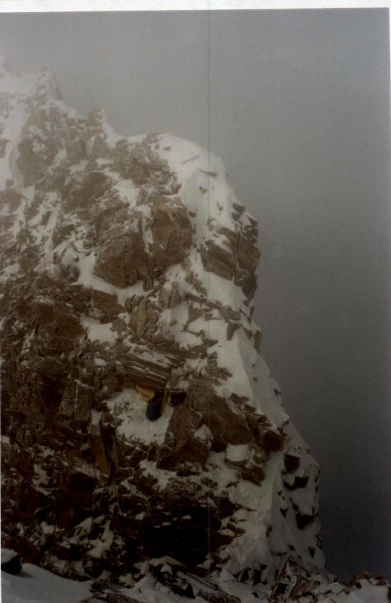
Bivouac on the ridge
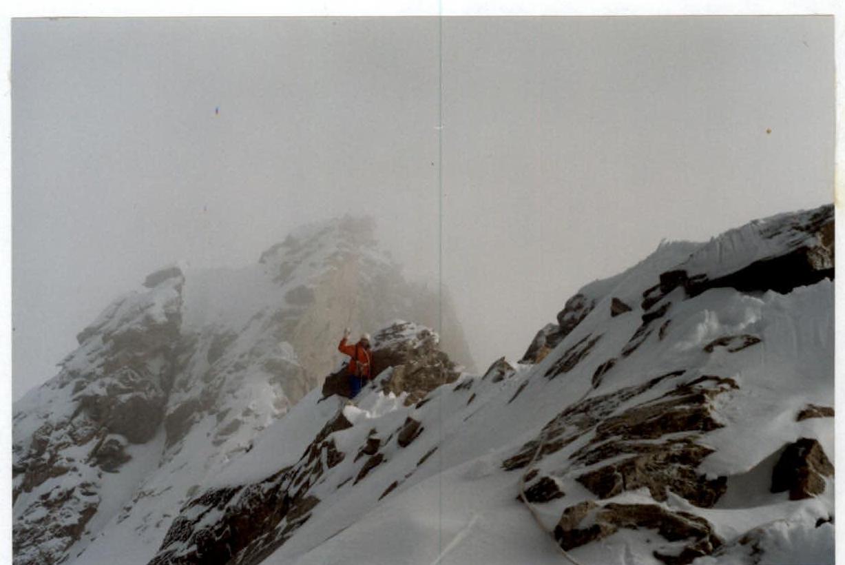
100 m to the summit.
Technical photo of the route
Photopanorama
Route diagram in symbols
| Section | Steepness, deg. | Length, m | Difficulty |
|---|---|---|---|
| R6 | 250 | 3 | |
| R5 | 120 | 5 | |
| R4 | 340 | 5 | |
| R3 | 30 | 5 | |
| R2 | 60 | 5 | |
| R1 | 400 | 5 | |
| R0 | |||
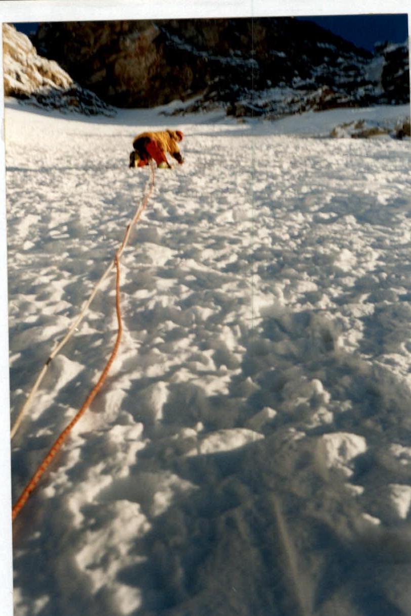 |
Two ropes away from section R4–R5
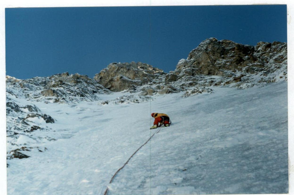
First rope of section R3–R4