
North Caucasian Federal District and Southern Federal District Alpine Climbing Championship, Altitude-Technical Category
Report
On the ascent to the summit of Dzhailyk via the left part of the 3rd wall of the southern ridge shoulder (Li route)
Category 5B complexity by the team from Rostov Oblast from July 24 to July 25, 2024
I. Ascent Passport
| 1. General Information | ||
|---|---|---|
| 1.1 | Full Name, Sports Rank of the Leader | Kravchenko Inna Anatolyevna, CMS |
| 1.2 | Full Name, Sports Rank of Participants | Shchekinova Tatyana Viktorovna, CMS |
| 1.3 | Full Name of Coach | Vasilyev Andrey Sergeyevich |
| 1.4 | Organization | FAS RO, a/c "Planeta" |
| 2. Characteristics of the Ascent Object | ||
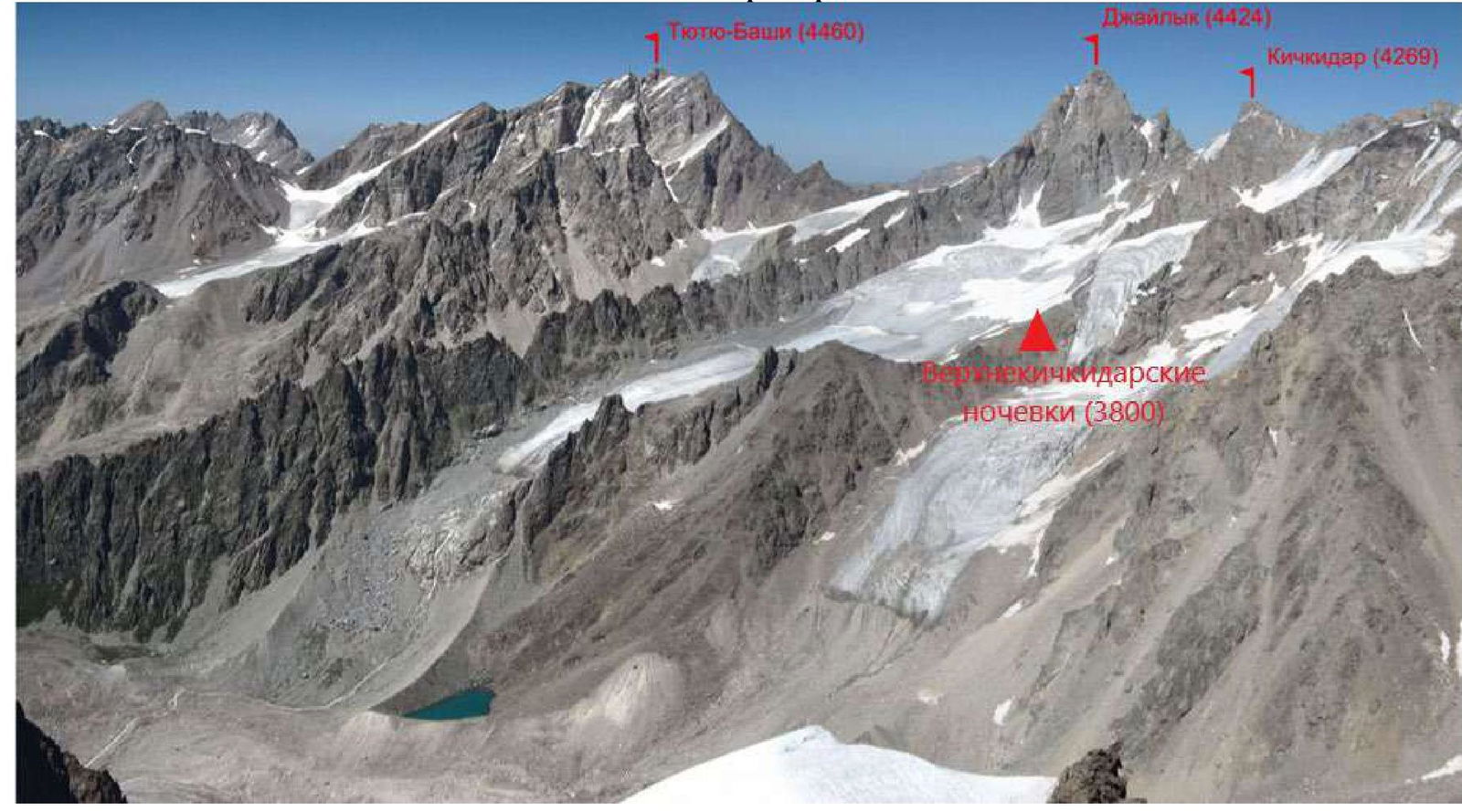
| 2.1 | Region | CAUCASUS |
| 2.2 | Valley | From the summit of Gumachi to Kitlod Pass (Adyrsu, Lekzyr, Chegem valleys) |
| 2.3 | Name and Height of the Summit | Dzhailyk, 4424 m |
| 3. Characteristics of the Route | ||
| 3.1 | Name of the Route | Left part of the 3rd wall of the southern ridge shoulder (Li) |
| 3.2 | Proposed Category of Complexity | 5B |
| 3.3 | Degree of Route Exploration | - |
| 3.4 | Relief Characteristics of the Route | Rocky |
| 3.5 | Height Difference of the Route (altimeter or GPS data) | 730 m |
| 3.6 | Length of the Route (in meters) | 1000 m |
| 3.7 | Technical Elements of the Route (total length of sections with varying complexity and relief characteristics) | Category V complexity combination — 200 m. Category VI complexity combination — 120 m, including A1 — 85 m, A2 — 50 m. |
| 3.8 | Average Steepness of the Route, (°) | 55° |
| 3.9 | Average Steepness of the Main Part of the Route, (°) | 85° |
| 3.10 | Descent from the Summit | Via the southern ridge ("Monakh") 5A V. Ruzhevsky |
| 4. Characteristics of Team Actions | ||
| 4.1 | Time of Movement (team's working hours, in hours and days) | 2 days, 15 hours |
| 4.2 | Overnight Stay | Overnight stay at the "Monakh" rock outcropping |
| 4.3 | Time Spent on Route Preparation | 4 hours (from the overnight stay on the route) |
| 4.4 | Departure onto the Route | 6:00 July 24, 2024 |
| 4.5 | Reach the Summit | 13:10 July 25, 2024 |
| 4.6 | Return to Base Camp | 12:00 July 26, 2024 |
| 5. Responsible for the Report | ||
| 6.1 | Full Name, e-mail | Shchekinova Tatyana Viktorovna, Tanyashekinova@rambler.ru |
II. Ascent Description
1. Characteristics of the Ascent Object
1.1. General Photo of the Summit
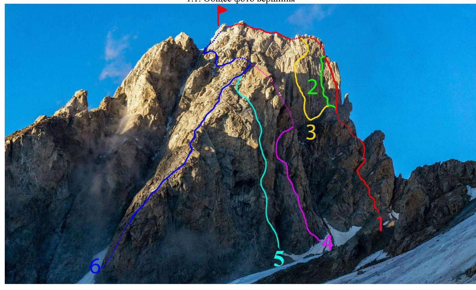
- via the southern ridge ("Monakh") (V. Ruzhevsky, 1967), 5A
- via the 3rd wall of the southern ridge shoulder (D. Laskavy, 1978), 5B
- via the left part of the 3rd wall of the southern ridge shoulder (V. Li), 5B
- via the 2nd southern bastion of the 3rd rib (I. Khatskevich) 5B
- via the 1st southern bastion of the 3rd rib (M. Franzuzov, 1970) 5B
- via the 3rd rib ("Damskaya") (V. Ruzhevsky, 1964) 5A
1.4. Panoramic Photo of the Area
2. Characteristics of the Route
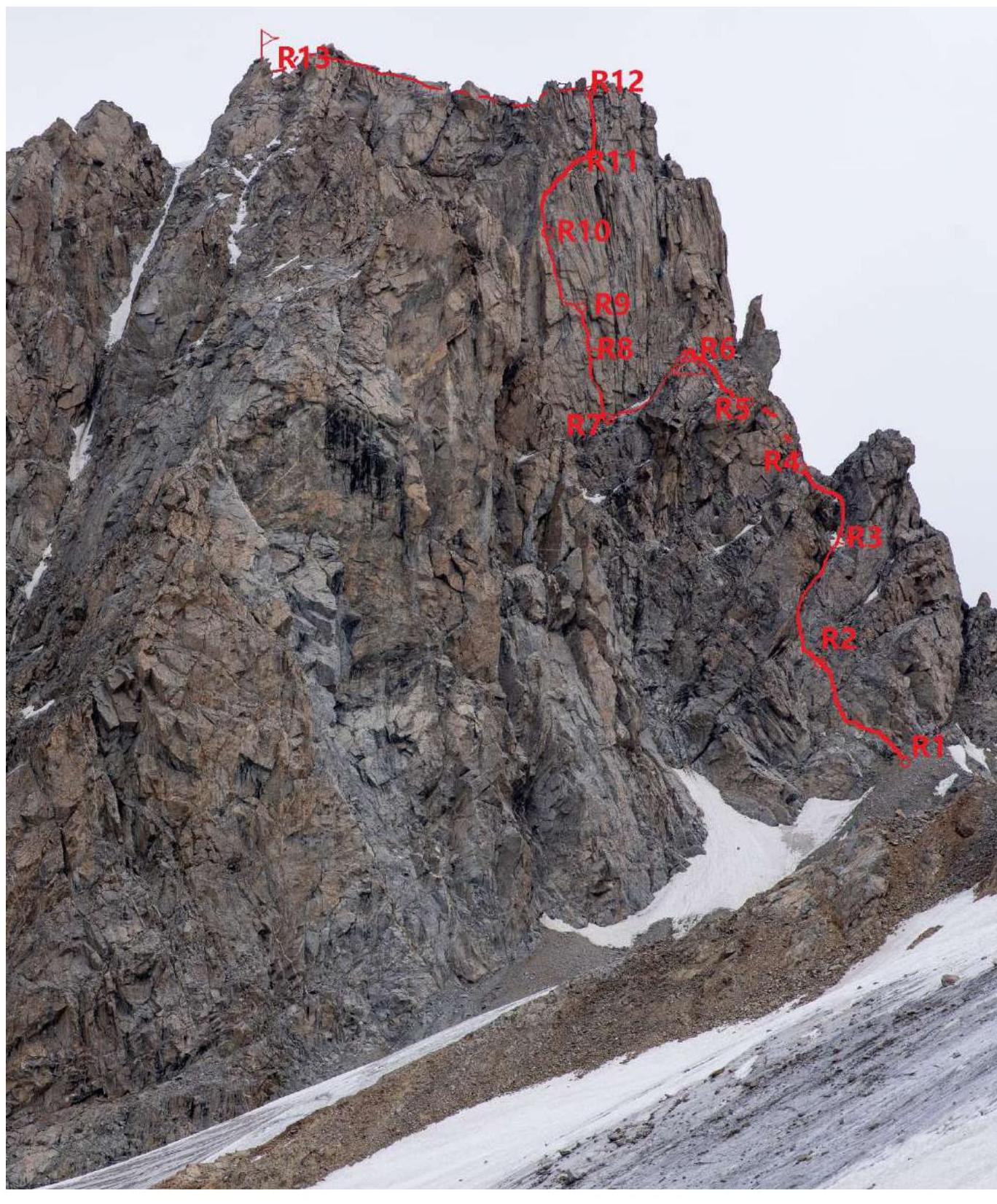
2.1. Technical Photograph of the Route
 2.2. Route Diagram in UIAA Symbols
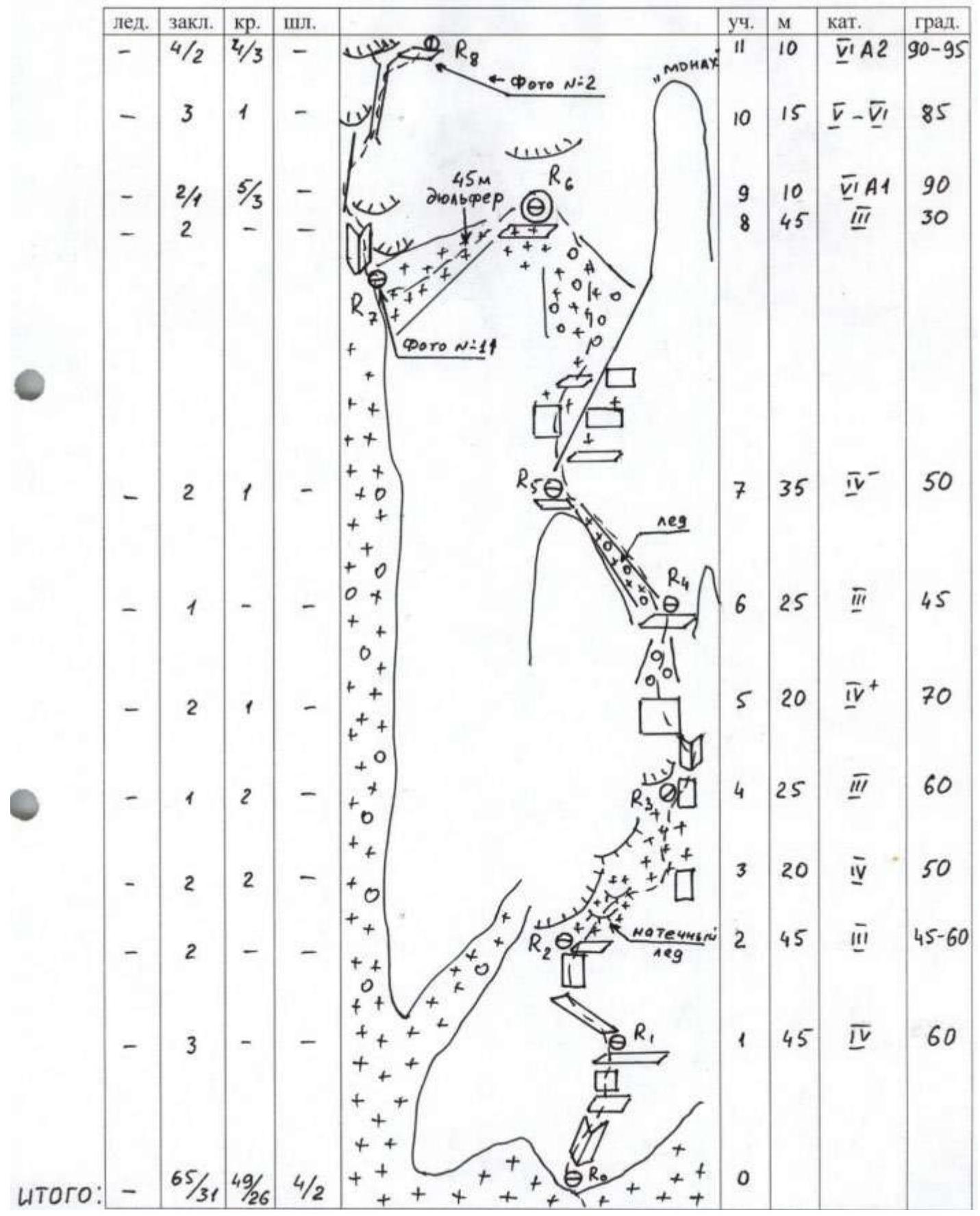

| Ice | Pitons | Crampons | Bolts | Section № | Length, m | Category | Steepness, ° |
|---|---|---|---|---|---|---|---|
| - | - | - | - | 25 | 340 | 2 | 10–50 |
| - | - | - | - | 24 | 80 | 3 | 45 |
| - | - | - | - | 23 | 100 | 2 | - |
| - | 3 | 3 | - | 22 | 35 | 4 | 60 |
| - | 4/3 | 2/1 | - | 21 | 10 | 5 | 90 |
| - | 1 | - | - | 20 | 15 | 2 | 45 |
| - | 2/2 | 1 | - | 19 | 5 | 5 | 90 |
| - | - | 1 | - | 18 | 10 | 3 | 50 |
| - | 5/4 | 4/3 | - | 17 | 15 | 5 | 85–90 |
| - | 7/6 | 5/3 | 2 | 16 | 25 | 5 | 75 |
| - | 6/4 | 8/2 | 1/1 | 15 | 15 | 6 | 90 |
| - | 5/3 | 5/2 | - | 14 | 10 | 5 | 85 |
| - | 4/4 | 1/1 | 1/1 | 13 | 5 | 5 | 105 |
| - | 4/2 | 3/3 | - | 12 | 10 | 5 | 90 |
| Total: | 65/31 | 49/26 | 4/2 |
Photo 1. Section R1–R2. Beginning of the route.

Photo 2. Section R3–R4
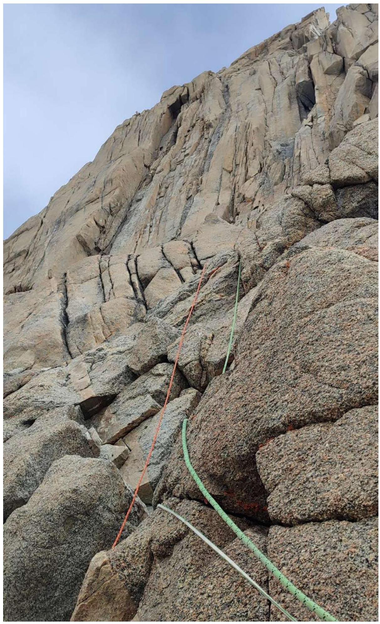
Photo 3. Section R4–R5 (exit to "Monakh")
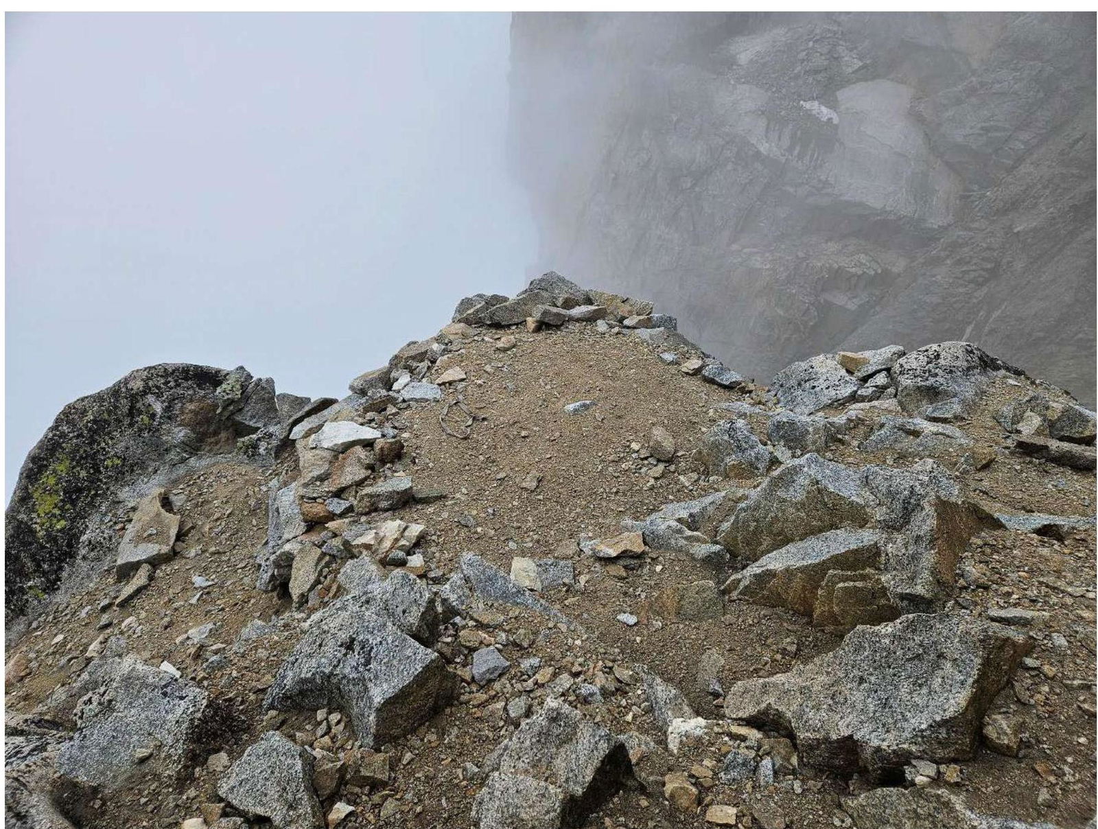
Photo 4. Overnight stay location at "Monakh"
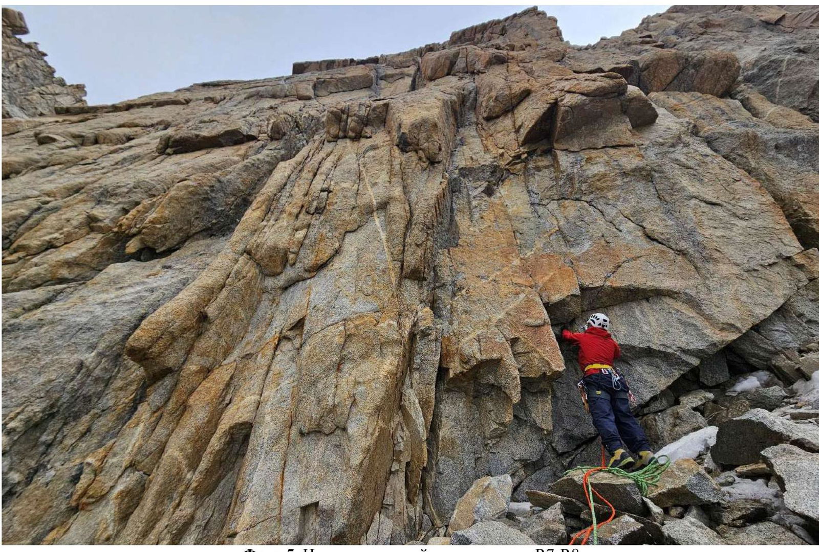
Photo 5. Beginning of the key section R7–R8
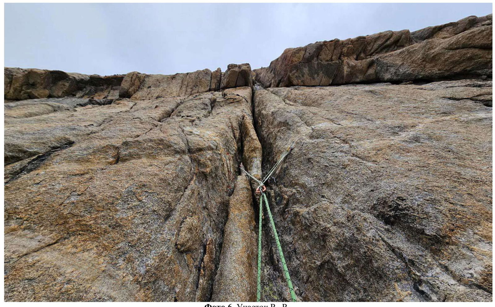
Photo 6. Section R8–R9.
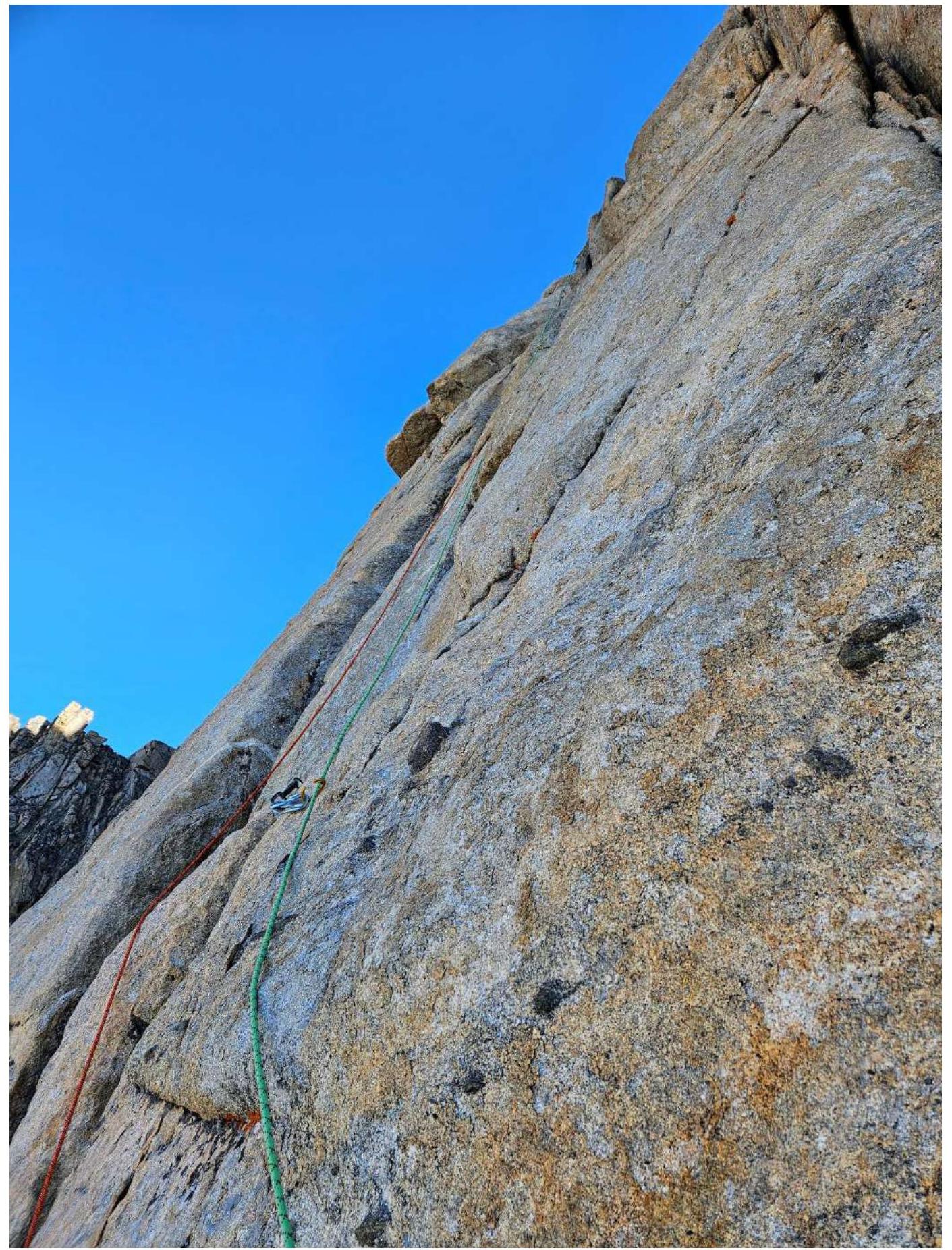
Photo 7. Section R10–R11
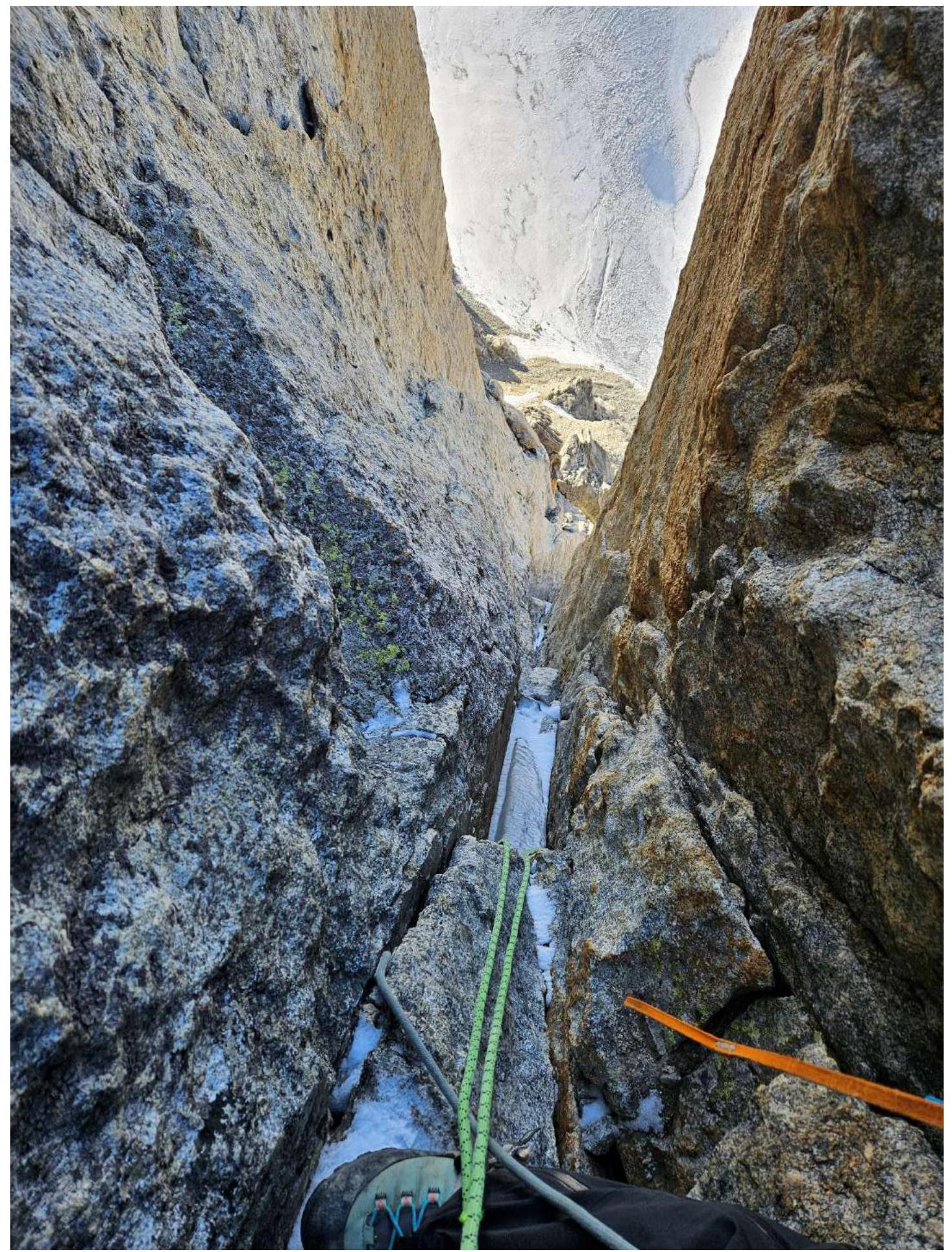
Photo 8. Section R10–R11. View of the chimney from the upper station.
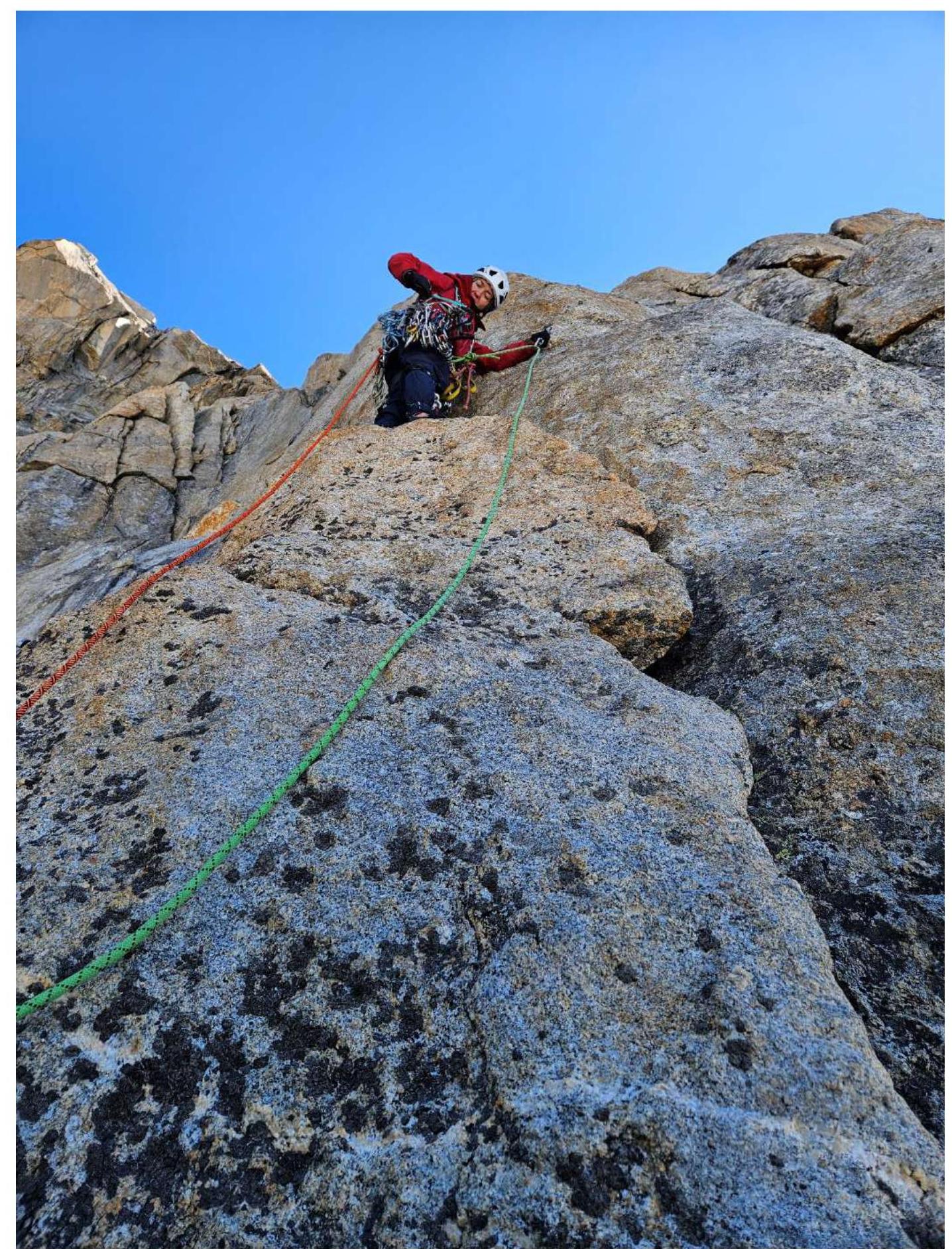
Photo 9. Section R11–R12.
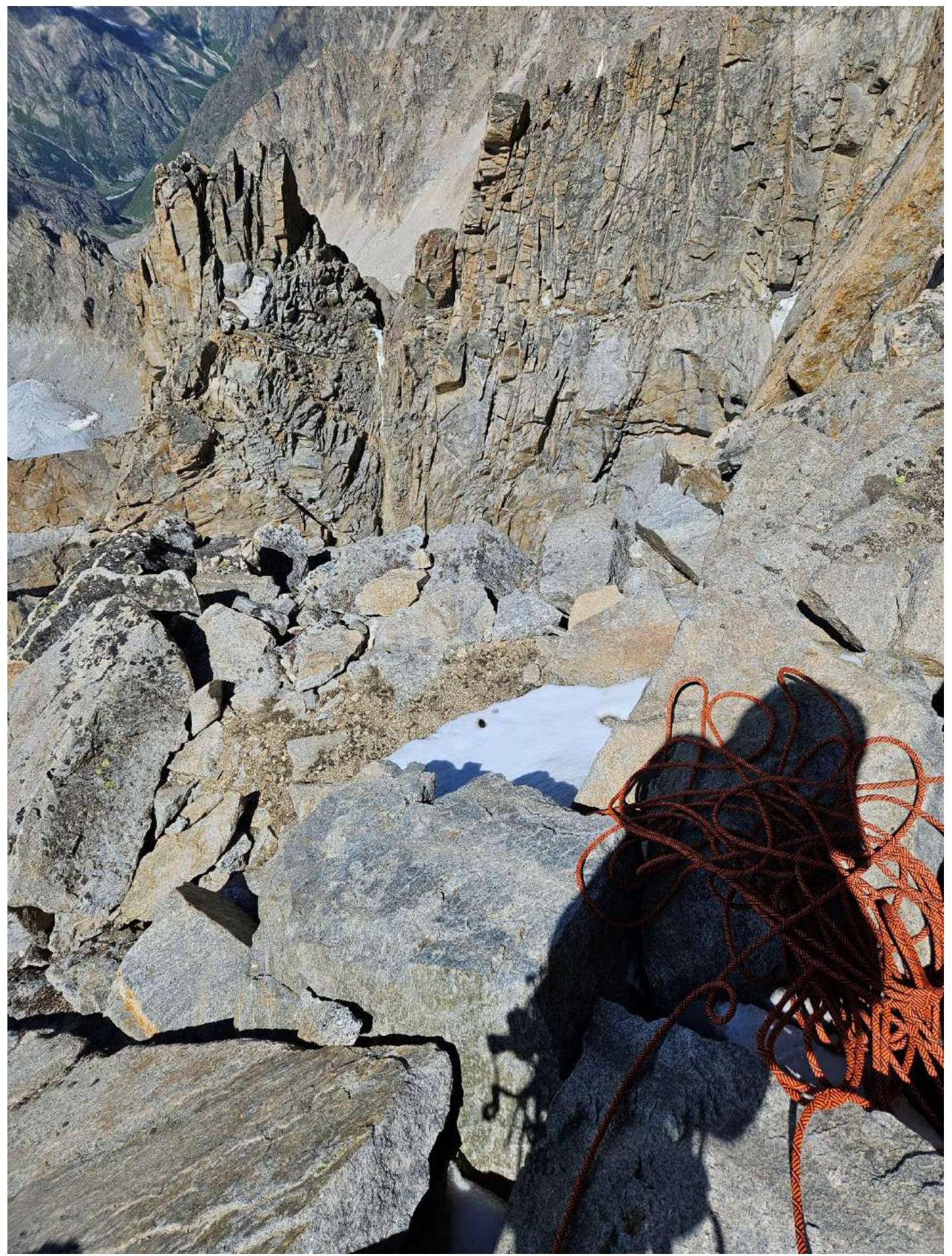
Photo 10. Tent site on R12.
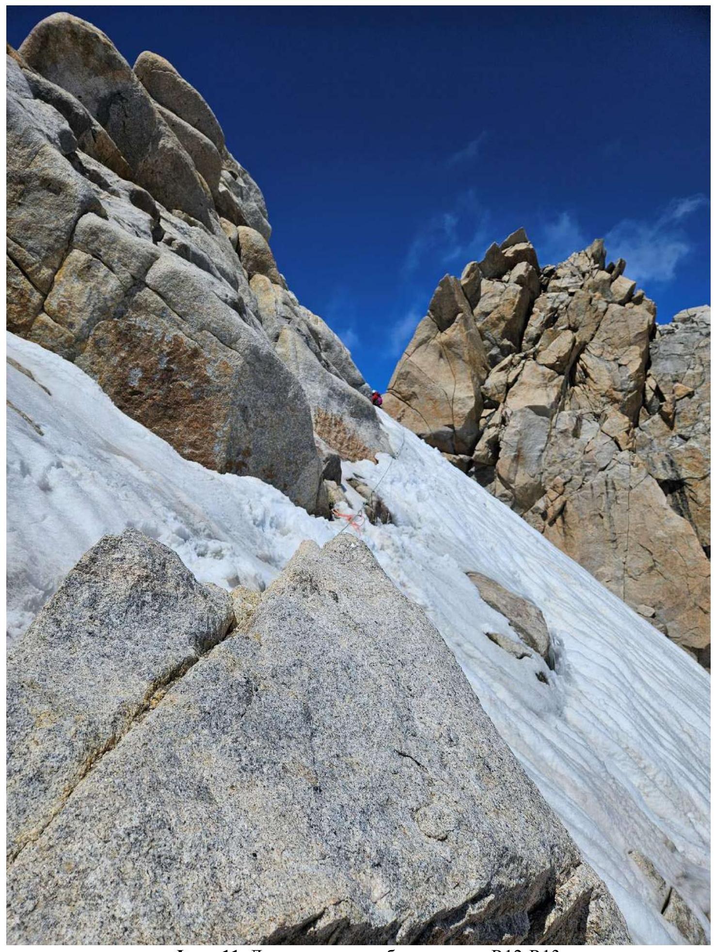
Photo 11. Movement along the ridge, section R12–R13.
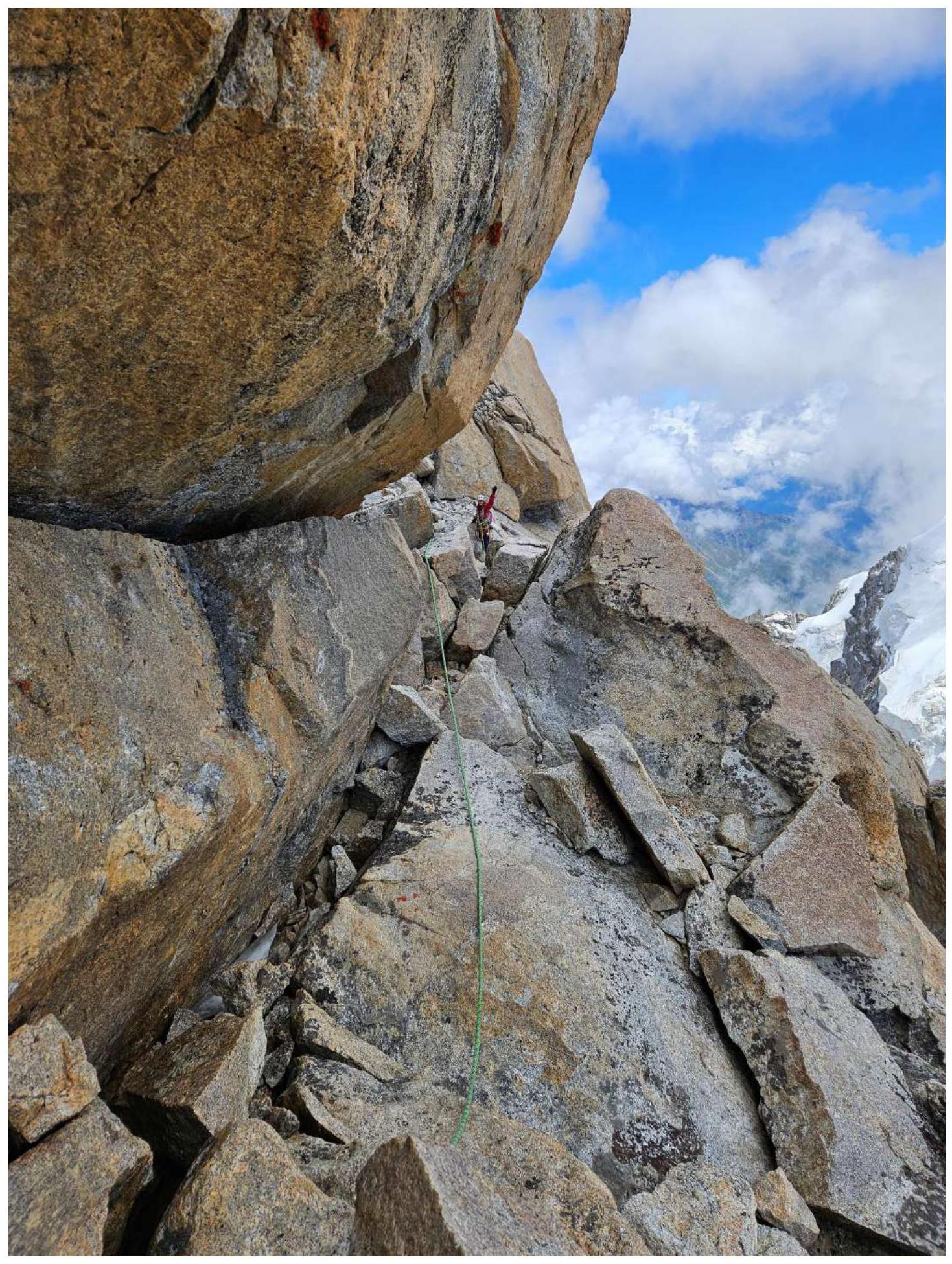
Photo 12. Movement along the ridge, section R12–R13.
3. Characteristics of Team Actions
3.1. Brief Description of the Route Passage.
The approach to the route is via steep scree to the right of rocky outcrops; there are overnight stay locations, but no water, though snow is present to melt. The lower part of the route (R1–R6) is not technically challenging, with short sections of category IV–V complexity. After bad weather, the passage becomes significantly complicated by ice, especially on section R2–R3. We had virtually no ice, just a little. Throughout the route to the ledge under the "Monakh" rock outcropping, there are rappel anchors. Under "Monakh" is a wide, comfortable ledge suitable for overnight stay; ice can be found in crevices.
From the ledge, rappel left and down approximately 45 m. In dry conditions, it's possible to pass carefully without hanging rappel lines. Alternatively, both climbers can move simultaneously.
The main technically challenging part of the route is relatively short (3 ropes) and consists of a steep monolithic rocky bastion. The first rope R7–R8 involves some aid climbing and free climbing, approximately 6a+–6b. The landmark is a "carrot" stuck in the rock and a white rope hanging down. Initially, climb towards the rope, then slightly left along a crack, bypassing a cornice on the left. Then, climb vertically upwards. A flake leads to a chimney closed by a cornice (aid climbing). At the exit, there's a belay station with a Petzl bolt.
Section R8–R9 features a vertical, sometimes overhanging system of cracks, primarily climbed using aid climbing. From the station, climb up and left under a gap in the cornice, passing the cornice with aid climbing; there's a bolt and a "carrot" on the cornice. 10 m above is another station and a control cairn. We didn't find a can; instead, we found a rusty can on R8 and left a note inside.
Section R9–R10: from here, traverse left, 2–3 m, and then climb up a crack, mainly using aid climbing, under a cornice (bolt). The cornice is bypassed on the left. Then, climb up a narrow chimney (in bad weather, filled with snow and ice) to a monolithic slab.
The challenging part ends here; the terrain becomes simpler. Two more ropes lead to the ridge.
Section R10–R11. Climb right and up, initially using aid climbing on a sloping ledge, then the terrain becomes simpler, and you reach a comfortable ledge suitable for overnight stay. From here: — Climb up a chimney, partly using aid climbing — Then, climb simpler walls and chimneys — Exit onto the ridge at R12.
Throughout the route, we mainly used cams and anchor pitons. Once, we placed a nut on a cornice during aid climbing.
Then, simultaneous movement along the ridge with protection using cams and anchor pitons. There are icy and snowy sections, requiring crampons for all participants. The "Kleshnya" rock outcropping is bypassed on the left via ledges with snow and ice (connection to Sasorov's 4B route). From here, ascend a snowy-icy slope to the saddle of the southern ridge. Then, traverse along the ridge via simple rocky terrain, descend 5 m down a steep wall (with a local rope), and ascend to the summit pinnacle.
The descent is via the southern ridge on V. Ruzhevsky's 5A route ("Monakh"), with many rappel stations and anchors. The first rappel is best done 10 m before the end of the ridge (bolts are present). After 35 m, move right around a corner to an intermediate station on pitons, then rappel to a "balcony." At the edge of the community, the rope is usually secured to a bolt lower down with a steel cable.
The route is very logical. The key ropes are interesting, monolithic, and offer good protection.
3.2. Photo of the Team on the Summit with the Control Cairn
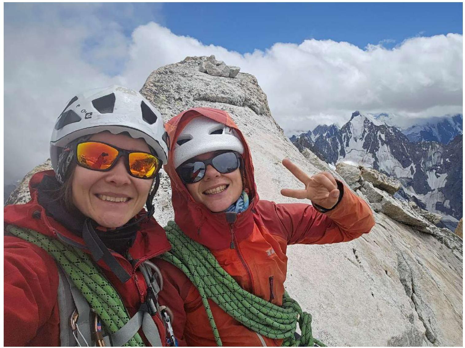
Photo on the summit
4. Characteristics of Weather Conditions
On the first day, July 24, it was cold and foggy. The weather worsened after noon, with snow and occasional rain. The next day was sunny, allowing for comfortable work on the route. However, the weather deteriorated again during the descent.
5. Tactical Actions of the Team
On July 24, the Kravchenko—Shchekinova team departed onto the route. Prior to that, as acclimatization, they climbed the summit of VIAtaupo via a 2A route. The team's condition was good, and the weather forecast for the upcoming days was acceptable.
They left the Upper Kichkidar overnight stay location at 3:30 to approach and start the route early. According to the forecast, the weather was expected to worsen after noon with significant precipitation. The approach to the route was challenging due to steep scree on the right. The leader began working on the route at 6:00. By 9:10, both climbers were on the ledge under "Monakh." The weather was unstable, so they decided not to take risks, although they had enough time to process two key sections.
— They started working on the key sections at 10:10. — By 14:15, they had processed two key sections and descended to the tent. The first day was led by Shchekinova.
The next day, they climbed the processed ropes and began working further on the route at 7:00. By 11:30, they reached the southern ridge and were on the summit at 13:13. The second day was led by Kravchenko. By 16:30, they descended to the overnight stay at "Monakh," and as the weather began to deteriorate again, they decided to stay overnight.
The next day, they started rappelling down at 7:00, reached the base of the route by 8:30, and returned to the Upper Kichkidar overnight stay location by 10:00. After lunch, they headed down at 11:30 and returned to the Ulu-Tau camp by 14:30.
Comments
Sign in to leave a comment