Rostov Region Climbing and Rock Climbing Federation
Report
on the ascent to the summit of Chaget-chat 2963.8 m via the south-eastern ridge presumably category 1B, first ascent
Ascent Passport
- Region: Western Caucasus, Arkhyz area, Sofiyskoe valley, section 2.1 of the mountain route classifier.
- Summit: Chaget-chat (2963.8 m), via the south-eastern ridge.
- Proposed category: 1B, first ascent.
- Route type: rock climbing.
- Elevation gain: 160 m Route length (technical part): 500 m. Average slope of the technical part: 20°.
- Pitons left on the route: 0 "Pitons" used on the route: 15 (loops, chocks) Bolts and ITO were not used.
- Travel time: 7 hours, 1 day.
- Descent from the summit via the western slope.
- Leader: Andrey Dergachev, 1st sports category, instructor category III.
Participants:
- A. Smolin, 3rd sports category
- R. Mesaoutov, 3rd sports category
- E. Runets-Nesterova, 3rd sports category
- A. Barinova, novice
- I. Abornev, novice
- I. Pelkin, novice
- A. Smolina, novice
- R. Gromov, novice
- I. Runets-Nesterov, novice
- I. Slepkov, novice
- V. Lebedinsky, novice.
- Date of ascent: May 2, 2013. Departure from camp: 7:00 Start of the route: 9:00 Summit arrival: 12:00 Start of descent: 13:00 Return to camp: 15:00
- Rostov Region Climbing and Rock Climbing Federation.
- Report author: Andrey Dergachev.
aderg@narod.ru
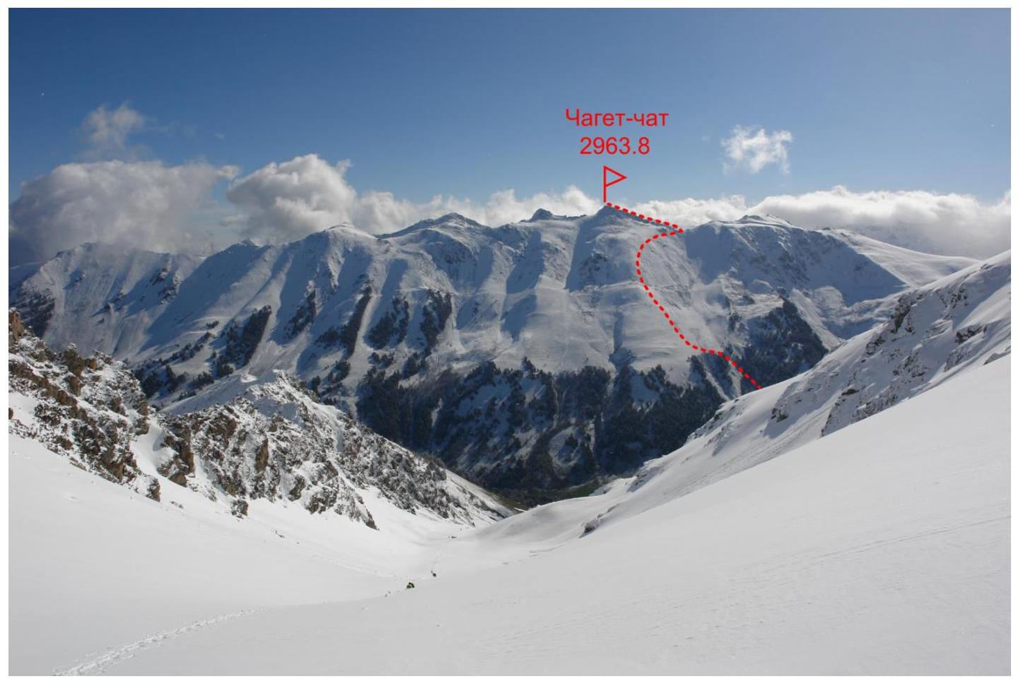
Fig. 1. General view of the Chaget-chat ridge from the west. May 8, 2008.
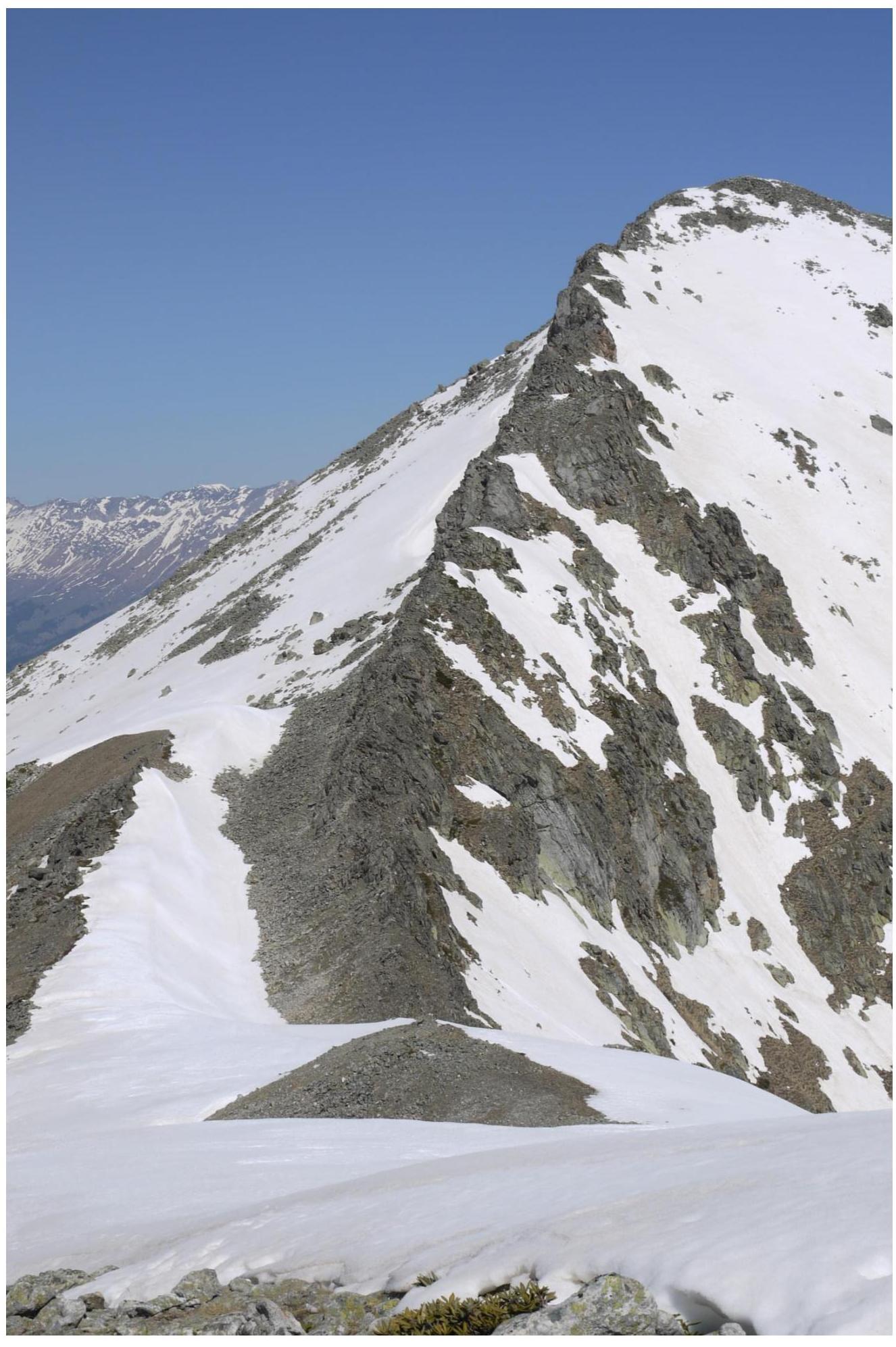
Fig. 2. General view of the south-eastern ridge of Chaget-chat from the south-east. May 2, 2013.
Geographical description of the region and the ascent object
The ascent object — Chaget-chat summit (2963.8 m) — is located in the Zelenchuksky district of the Karachay-Cherkess Republic, in the Chaget-Chat ridge of the Western Caucasus, and is the highest point of this ridge.
The ascent was made from the Sofia river side. The base camp was located in a clearing in the Sofia river valley, on the south-western slope of the Chaget-chat ridge, at an altitude of about 2000 m. Nearby (less than 1 km) is the "Glacier Farm" tract.
Path to the base camp:
- from Arkhyz settlement by car on asphalt road to the bridge over the Arkhyz river – 4 km
- then on a dirt road to the Taulu clearing – 2.5 km
Further, a broken dirt road leads into the Sofia river valley, unsuitable for regular vehicles. To the upper part of the valley ("Glacier Farm" tract) from the Taulu clearing is 8 km, it can be reached on foot or by ordering a high-clearance vehicle.
The Chaget-chat summit was previously used for training ascents by participants of the Novocherkassk Mountain Club (Rostov Region Climbing and Rock Climbing Federation). The route is very convenient for working with a training group, allowing:
- to practice various rope techniques on rock terrain,
- to ensure safety — in case of necessity, it is possible to stop the ascent and descend from the ridge to the slope almost anywhere.
In addition, in complex snow conditions, when the approaches to the Spartak overnight stays and the "Bulgarian Corner" are avalanche-prone, the route may be the only alternative for a novice group's ascent.
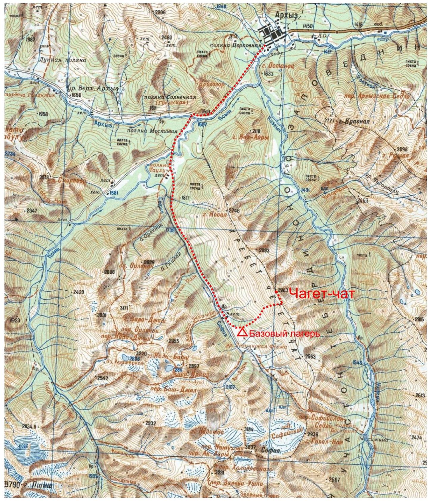
Fig. 3. Overview map of the region
Table 1. List of technical sections of the route
| Section | Length, m | Slope, degrees | Terrain type | Difficulty category | Number of pitons |
|---|---|---|---|---|---|
| R0–R1 | 400 | 20 | Rocky ridge | II–III | 15 |
| R1–R2 | 100 | 10 | Rocky-scree ridge | I–II | 0 |

Fig. 4. Route photo
Description of the approach to the start of the technical part of the route
The Chaget-chat summit is visible from the assault camp. Ascend the grassy, then snowy western slope of the Chaget-chat ridge to the right of the summit, towards the ridge depression. In winter and off-season, it can be avalanche-prone! In case of heavy snow, the safest ascent path is along the slope closer to the Sofiyskoe Saddle pass, then along the ridge to the start of the route. The start of the route is at the ridge depression. From the assault camp, 2 hours.
Description of the route passage
Section R0–R1. From the ridge depression, along the rocky ridge, staying in the upper part of the ridge. 20°, 400 m, difficulty category II–III. There are small walls up to category III, passed directly with alternate belay. There are sufficient outcrops for belay organization, and medium-sized chocks can also be used.
Section R1–R2. Along the scree ridge with outcrops of destroyed rocks — exit to the summit. 10°, 100 m, difficulty category II.
Descent along the western slope, for training purposes, it is possible to organize a rappel descent directly from the summit to the slope.
Route photos
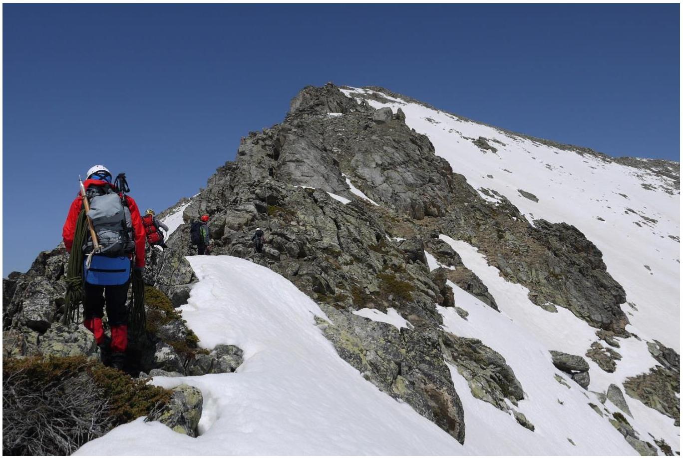
Fig. 5. Section R0–R1
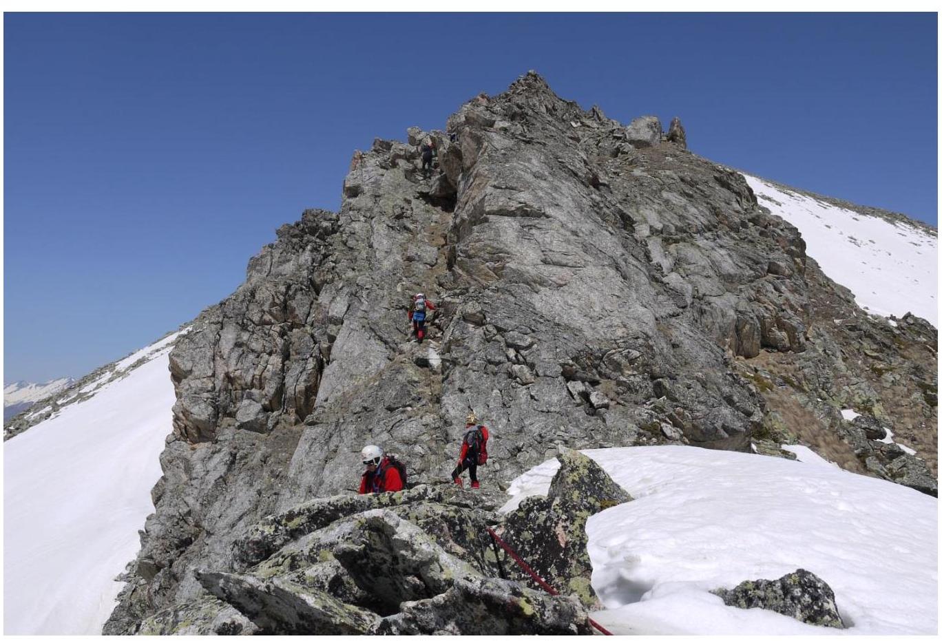
Fig. 6. Section R0–R1
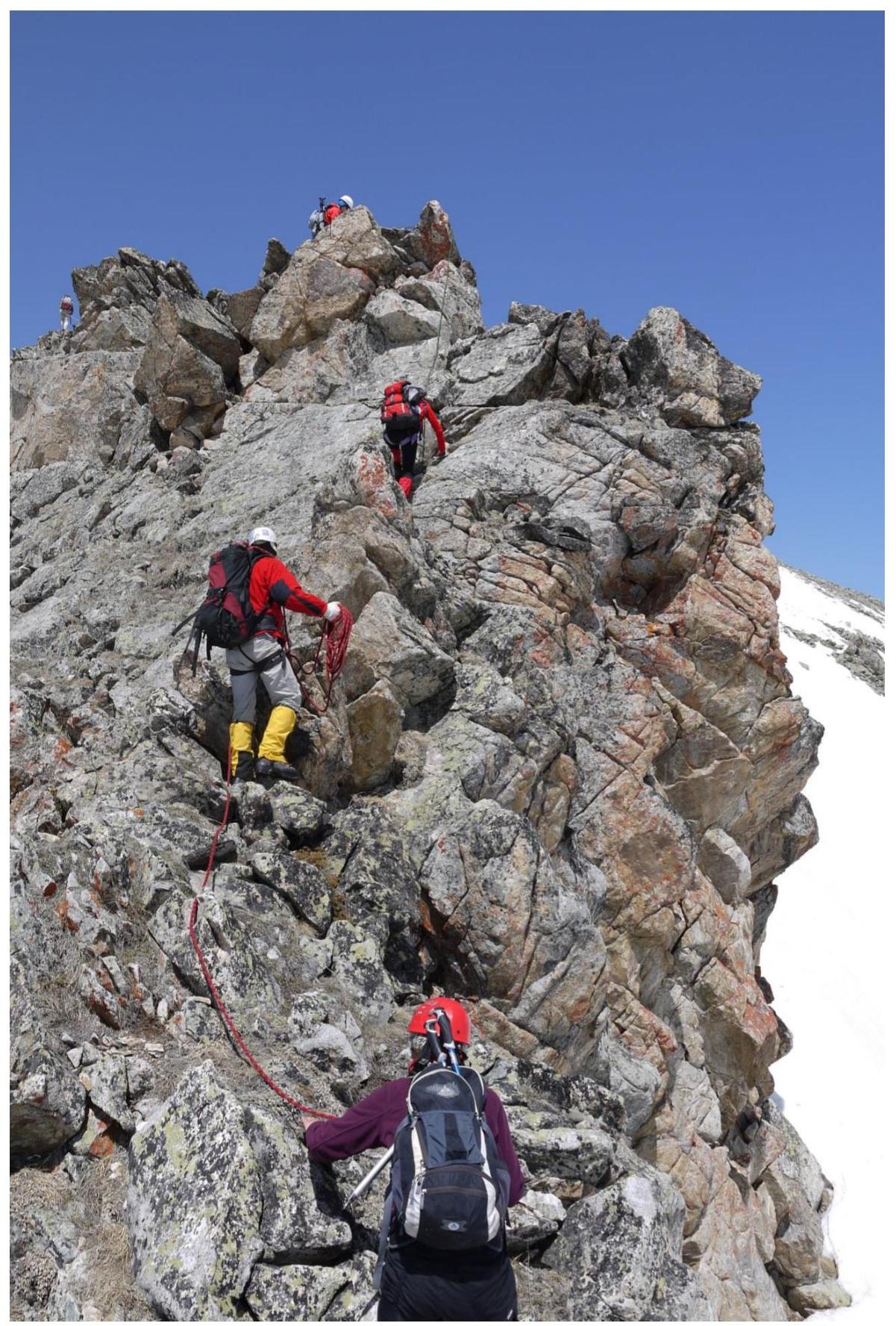
Fig. 7. Section R0–R1.

Fig. 8. Panoramic view from the summit to the Main Caucasian and Sofiysky ridges (east-south-west)
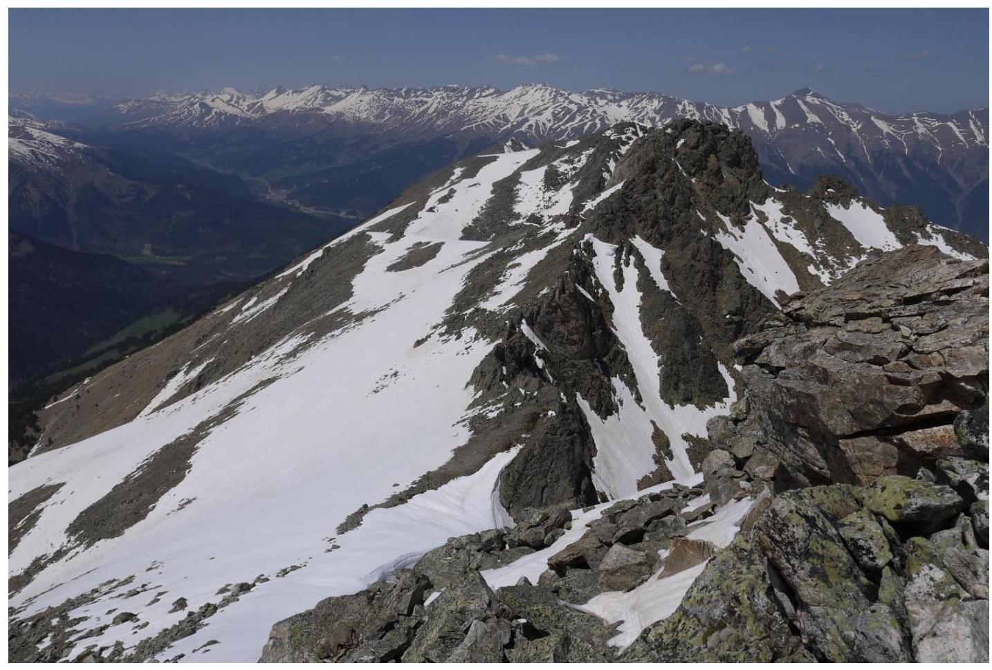
Fig. 9. View from the summit to the north-west.
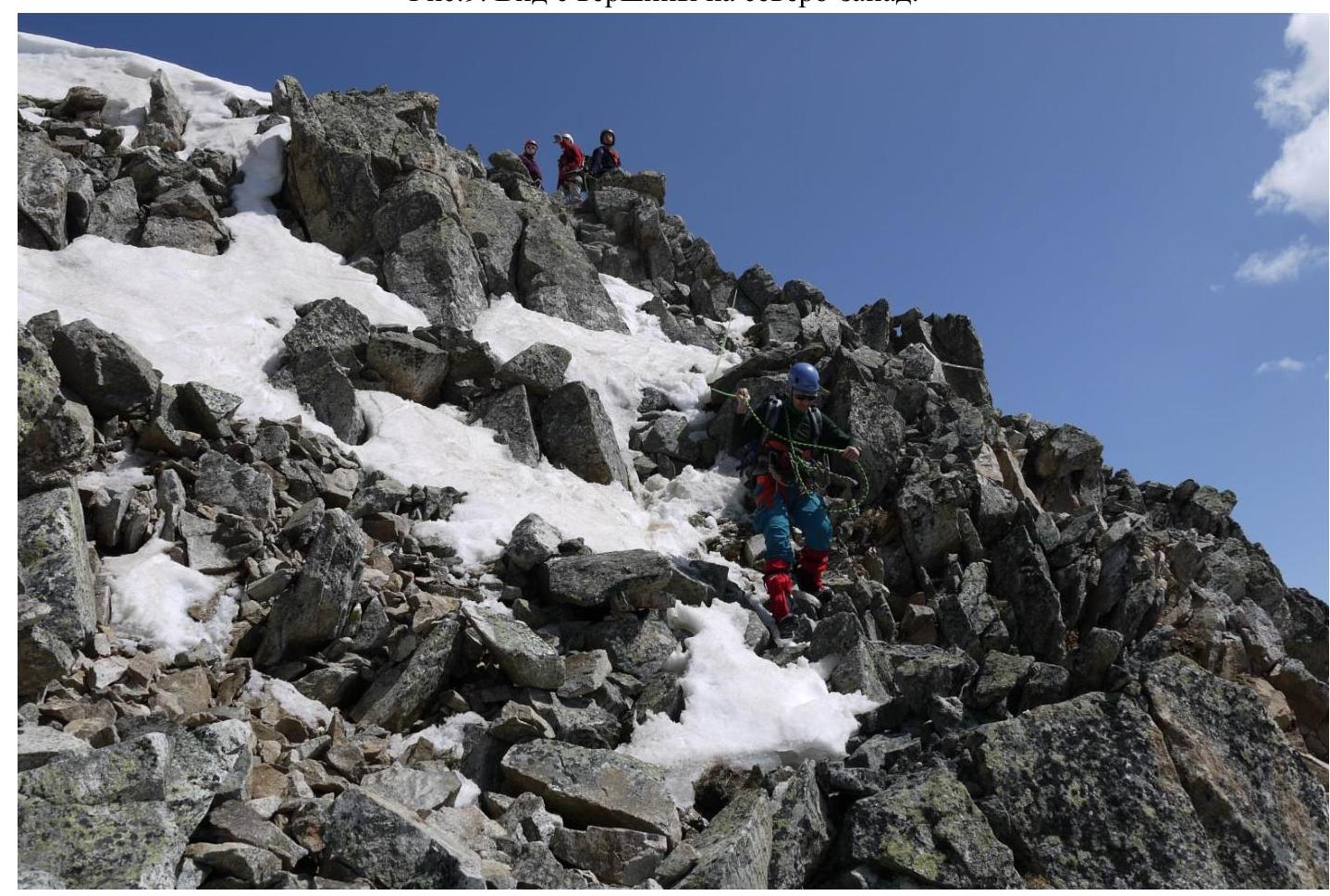
Fig. 10. Descent from the summit
General conclusions
A cairn and a note from a group of rescuers from Stavropol were found on the summit, dated May 2, 2013. The route was repeated under the leadership of A. Dergachev on May 2, 2014. Nearby classified routes in the area:
- category 1B on v. Nadezhda,
- category 1B on v. Kёlbashi,
- category 1B on v. Kislovodsk,
- category 2A on v. Pazardzhik.
The closest route in terms of difficulty is the category 1B route on v. Kislovodsk.
Based on the objective difficulty of the technical part of the route to the summit of Chaget-chat via the south-eastern ridge and comparing it with other routes previously climbed by the participants, it is proposed to classify it as category 1B.