Report
On the first ascent to the summit of Serebryansky Kamen via the traverse route from the 3rd peak to the 2nd (Main) peak, category 1B, by the team of ROO FSO on March 8, 2021
I. Ascent Report
| № | 1. General Information | |
|---|---|---|
| 1.1 | Full name, sports rank of the leader | Babkin Vyacheslav Viktorovich, CMS |
| 1.2 | Full name, sports rank of the participants | Bogavieva Anna Aleksandrovna, 1st sports rank, Novokshonov Andrey Olegovich, 2nd sports rank |
| 1.3 | Full name of the coach | Babkin Vyacheslav Viktorovich, CMS |
| 1.4 | Organization | ROO FSO |
| 2. Characteristics of the Ascent Object | ||
| 2.1 | Region | Northern Urals |
| 2.2 | Valley | - |
| 2.3 | Section number according to the 2013 classification table | 8 |
| 2.4 | Name and height of the summit | Serebryansky Kamen |
| 2.5 | Geographical coordinates of the summit (latitude, longitude), GPS coordinates | N 59° 37′ 42.04″ E 59° 16′ 29.37″ |
| 3. Characteristics of the Route | ||
| 3.1 | Name of the route | traverse from the 3rd peak to the 2nd |
| 3.2 | Proposed category of difficulty | 1B |
| 3.3 | Degree of route development | First ascent |
| 3.4 | Nature of the route terrain | Combined |
| 3.5 | Height difference of the route (data from altimeter or GPS) | |
| 3.6 | Length of the route (in meters) | 1270 m |
| 3.7 | Technical elements of the route (total length of sections of varying difficulty with indication of terrain type (ice-snow, rock)) | Category I difficulty combination — 400 m. Category II difficulty rocks — 40 m. Category II difficulty rocks/combination – 430 m |
| 3.8 | Descent from the summit | Down a non-categorized slope towards… |
| 3.9 | Additional characteristics of the route | Presence of water (snow) |
| 4. Characteristics of the Team's Actions | ||
| 4.1 | Time of movement (team's walking hours, in hours and days) | 7 hours |
| 4.2 | Overnight stays | - |
| 4.3 | Start of the route | 8:00, March 8, 2021 |
| 4.4 | Summit attainment | 13:00, March 8, 2021 |
| 4.5 | Return to the base camp | 15:00, March 8, 2021 |
| 5. Person Responsible for the Report | ||
| 5.1 | Full name, e-mail | Babkin Vyacheslav Viktorovich babkin_vv@mail.ru |
II. Description of the Ascent
1. Characteristics of the Ascent Object
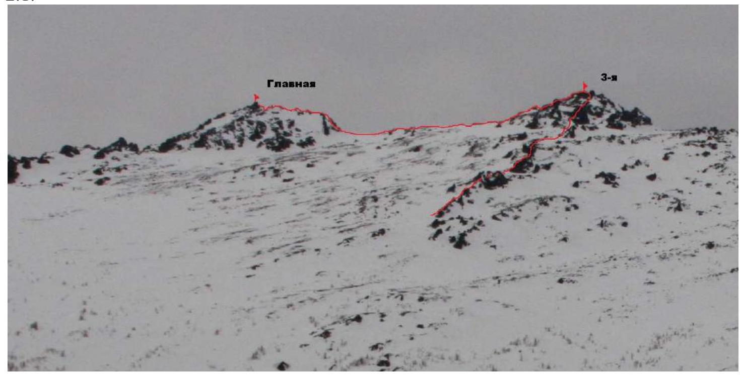
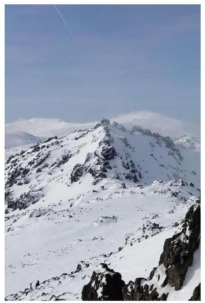
1.1. General photo of the summit.
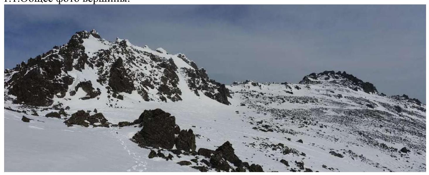 Taken on March 5, 2021. Shot from the review gendarme of the southern spur.
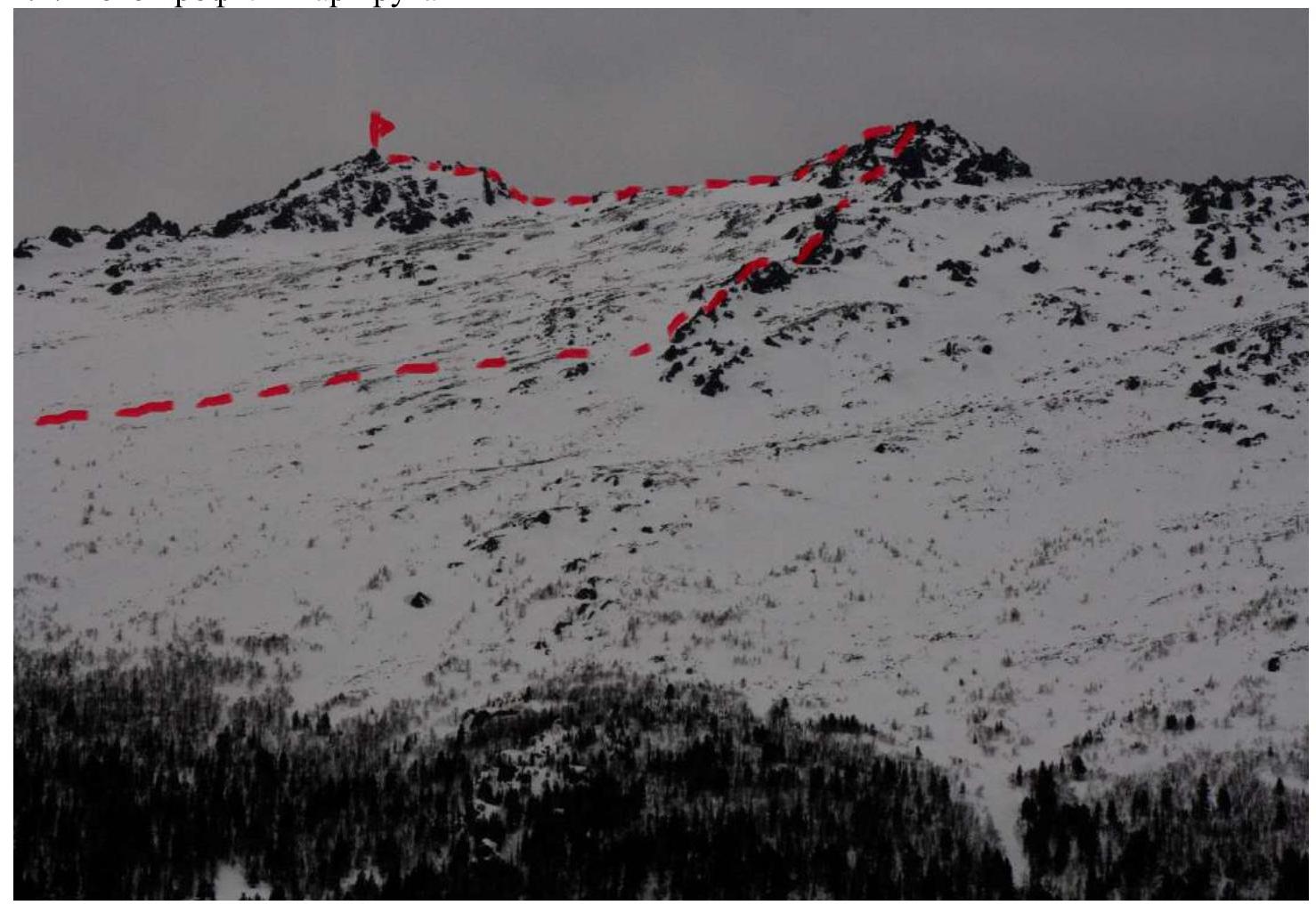
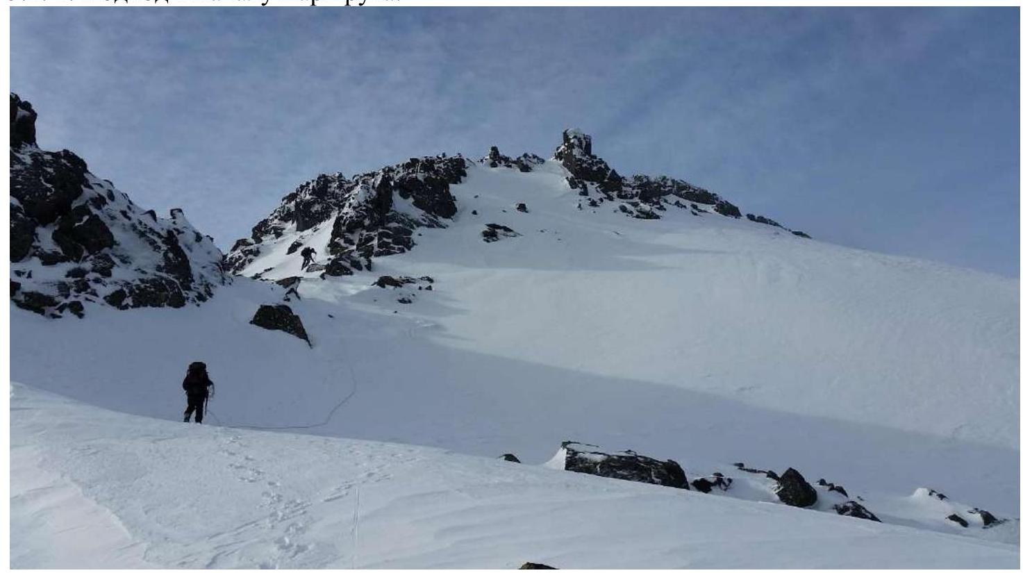
1.2. Photo of the route profile
Taken on March 5, 2021. Shot from the review gendarme of the southern spur.
1.2. Photo of the route profile
 1.3.
1.3.
Photopanorama of the Serebryansky Kamen circus
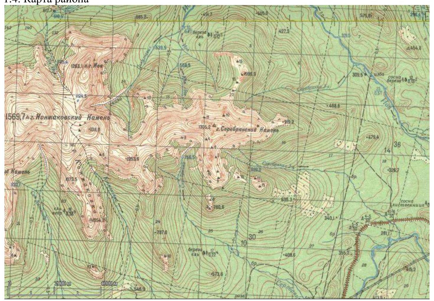
1.4. Map of the area
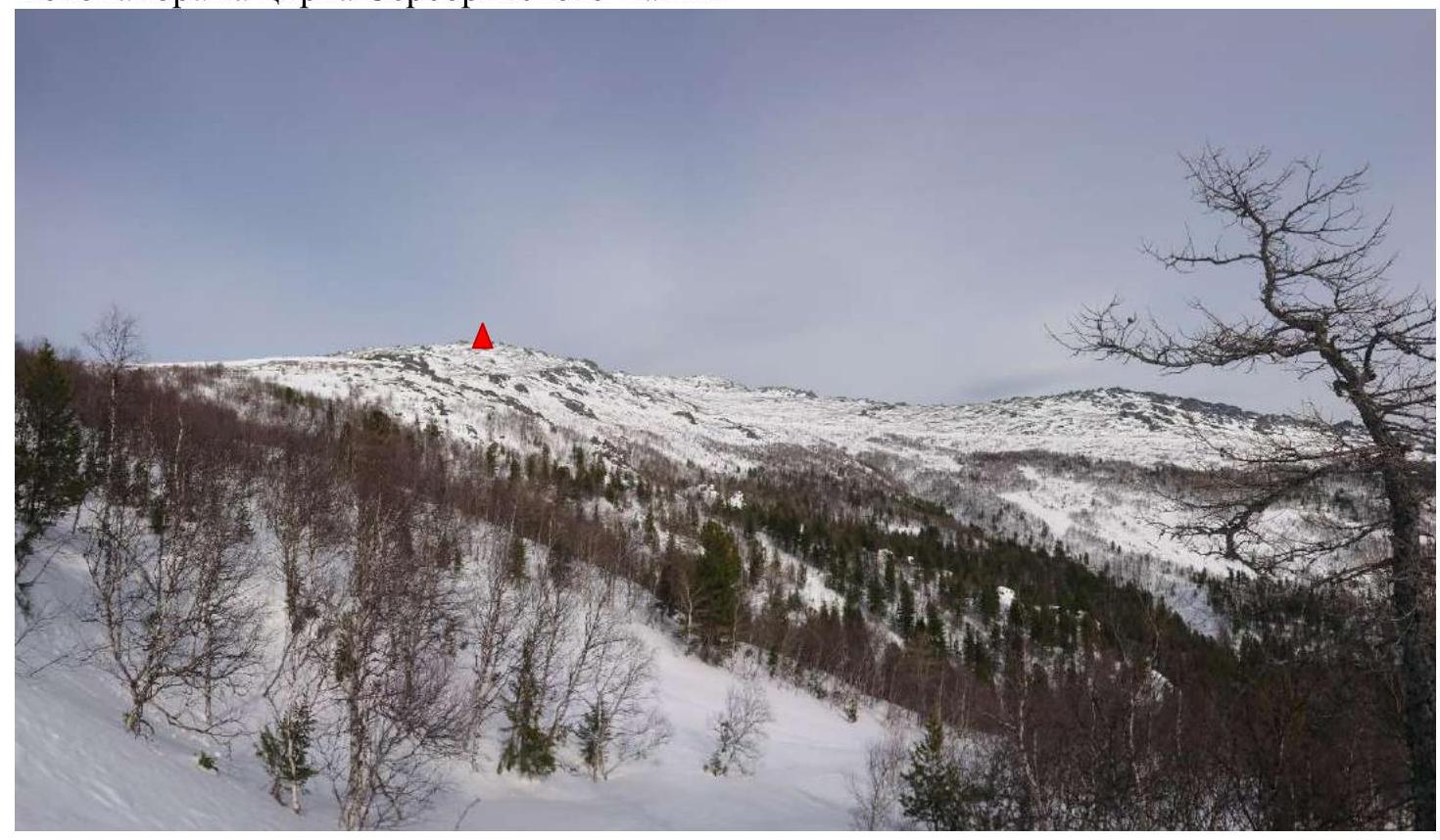
The summit is located in the Northern Urals region, near the city of Karpinsk. There are currently three qualified routes to the summit of Serebryansky Kamen: category 2A, 2B, and 1B. Access is via the Serov highway to Karpinsk, then along the Karpinsk-Kytlym road, stopping at the river Vtoraya Serebryanka at the adjacent technological road to the right, and from there walking 4.5 km uphill along the technological road. On the slopes of the Serebryansky Kamen massif, there is a rescuers' clearing suitable for a base camp. The approach to the route begins from the rescuers' clearing to the pre-summit plateau, taking about 2 hours, and involves trekking along a snow-covered rocky ridge, where it is necessary to mark the path or use GPS due to winds and limited visibility. From the plateau, the eastern ridge is clearly visible, with the eastern peak, locally known as "Tret'ya Serebryanka" (Third Serebryanka), visible to the right. The approach from the Vtoraya Serebryanka plateau towards the eastern ridge to the start of the route in the cats takes 30 minutes.
2. Characteristics of the Route
2.1.
2.2. Technical characteristics of the route sections
| Section № | Terrain type | Category of difficulty | Length, m | Type and number of hooks |
|---|---|---|---|---|
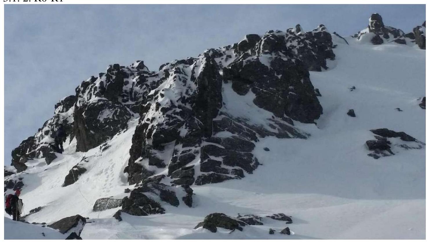
| R0–R1 | Combined, 30° | 2 | 120 | 0 |
| R1–R2 | Combined, 15° | 1 | 50 | 0 |
| R2–R3 | Combined, 15° | 2 | 310 | 4 pcs., placements |
| R3–R4 | Combined, 20° | 1 | 350 | 0 |
| R3–R4 | Rocky, 35° | 2 | 40 | 5 pcs., placements |
3. Characteristics of the Team's Actions
3.1.1. Approach to the start of the route.
3.1.2. R0–R1
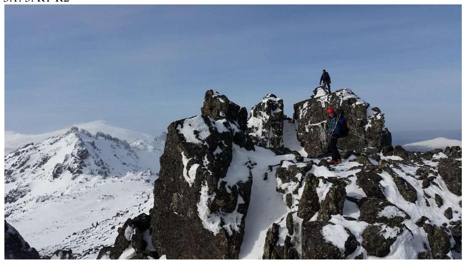
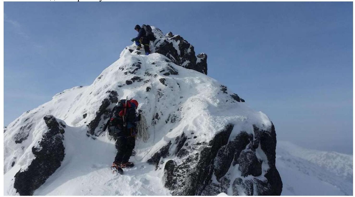
3.1.4. Traverse of the ridge to the 3rd peak of Serebryansky Kamen. R2–R3.

3.1.5. R3–R4.
3.1.6. Summit attainment. R4–R5.
| Section № | Description | Photo № |
|---|---|---|
| R0–R1 | Convenient stop to prepare for the route. Exit to the start of the ridge of the Third peak of Serebryansky Kamen. The route goes towards the peak, bypassing the gendarmes on the right, the second rope leads to the central part of the ridge, combined terrain of the second category of difficulty, insurance through ledges and loops. | 3.1.2 |
| R1–R2 | Attainment of the 3rd peak of Serebryansky Kamen, where a tour and a memorial plaque are installed. | 3.1.3 |
| R2–R3 | Descent from the peak towards the 3rd peak of Serebryansky Kamen, traverse of a sharp ridge of the second category, convenient insurance, suitable for large placement elements. | 3.1.4 |
| R3–R4 | The ridge flattens and turns into a saddle between the peaks, the passage does not require insurance. | 3.1.5 |
| R4–R5 | Exit to the 3rd (Main) peak of Serebryansky Kamen simultaneously, from north to south along an arc with an exit to the pre-summit plateau, where a triangulation mark is installed, leading to the summit via a steep wall, with alternating insurance. | 3.1.6 |
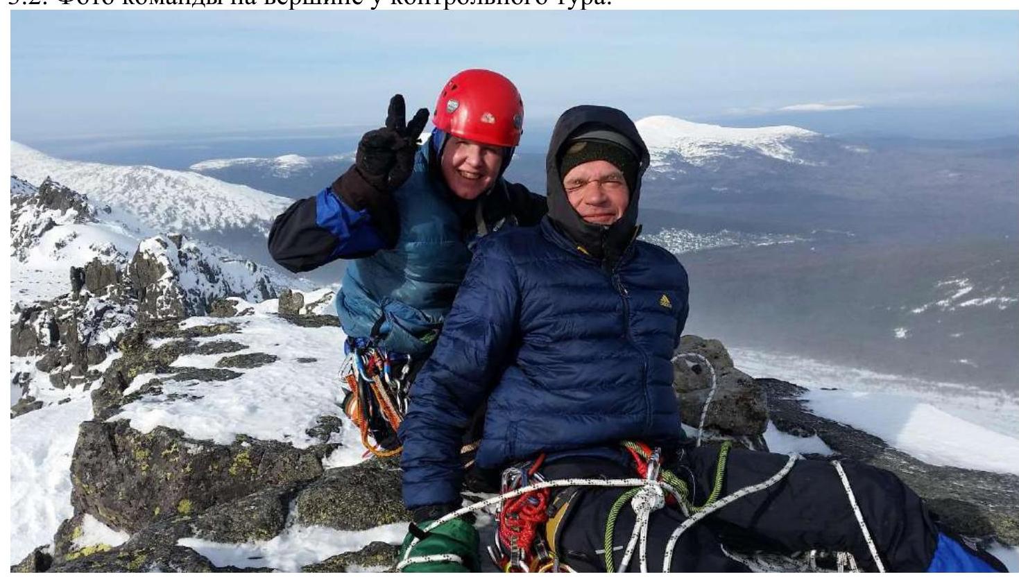
3.2. Photo of the team at the summit by the control tour.
 3.3. The route is objectively safe. Mobile communication is absent on the route. Descent from the summit: rappel to the plateau under the summit, then down to the plateau without organizing rope teams (the descent path is marked), then along the approach path.
Recommendations for subsequent climbers:
The route is similar in ascent logic and orientation, as well as in the set of obstacles, to the category 1B route to v. Kurtash (along the NE ridge). A feature of the route is its dependence on weather conditions, as strong winds may pose a risk of being blown off the sharp ridge. The exit towards the main peak from the north is a particularly windy area with difficult orientation; it is recommended to have GPS and extra batteries. The descent from the summit of Vtoraya Serebryanka leads south towards the settlement of Kytlym, is non-categorized, almost always marked with markers, and does not require rope work.


