
Report
Ascent Report
on Mt. Aiguille de la Glière (2852 m), 2A cat. dif., Aiguilles Rouges Massif, Auvergne-Rhône-Alpes, France.
Leader: Olennikov S. A. Coach: Molodozhen V. A.
I. Ascent Passport
| №№ p.p. | 1. General Information | |
|---|---|---|
| 1.1 | Full Name, sports rank of the leader | Olennikov S. A. — CMS |
| 1.2 | Full Name, sports rank of the participants | Gagloev N. A. — 3rd sports rank, Stepanyants E. E. — 3rd sports rank, Brilin D. V. — badge |
| 1.3 | Full Name of the coach | Molodozhen V. A. — MS |
| 1.4 | Organization | a/c "Polytechnic", St. Petersburg |
| 2. Characteristics of the Ascent Object | ||
| 2.1 | Region | Chamonix |
| 2.2 | Valley | Chamonix Valley |
| 2.3 | Section number according to the 2013 classification table | 10.3 |
| 2.4 | Name and height of the peak | Aiguille de la Glière. Height 2852 m |
| 2.5 | Geographical coordinates of the peak (latitude/longitude), GPS coordinates (1) | 45°59′39.9″ N 7°0′35.4″ E |
| 3. Route Characteristics | ||
| 3.1 | Route name | "Modern Times". |
| 3.2 | Proposed category of difficulty | 2A cat. dif. |
| 3.3 | Degree of route exploration | - |
| 3.4 | Character of the route terrain | rocky |
| 3.5 | Height difference of the route (altimeter or GPS data) | 160 m |
| 3.6 | Route length (in meters) | 200 m |
| 3.7 | Technical elements of the route (total length of sections of varying difficulty with indication of terrain character (ice-snow, rocky)) | II cat. dif. rocks — 180 m. III cat. dif. rocks — 20 m |
| 3.8 | Descent from the summit | Along the trail to Chamonix Valley |
| 3.9 | Additional route characteristics | Water is absent on the route |
| 4. Characteristics of the Team's Actions | ||
| 4.1 | Travel time | 3 hours |
| 4.2 | Overnight stays | Site, ledge — (choose) |
| 4.3 | Departure on the route | 10:30, July 28, 2018 |
| 4.4 | Reaching the summit | 13:30, July 28, 2018 |
| 4.5 | Return to the base camp | 15:30, July 28, 2018 |
| 5. Responsible for the Report | ||
| 5.1 | Full Name, e-mail | Stepanyants E. E., Gagloev N. A. stepakatya@ya.ru |
General photo
of the summit.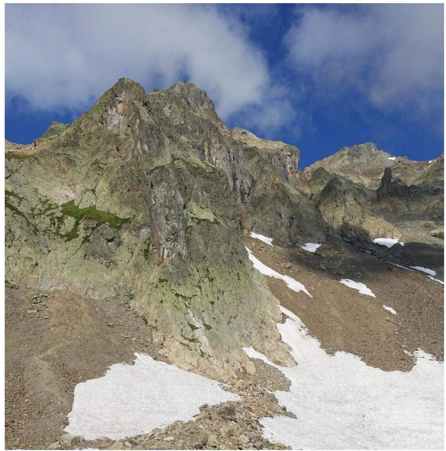
Photo of the summit Aiguille de la Glière, taken near the Télésiège de l'Index.
Overview of the Aiguilles Rouges Massif
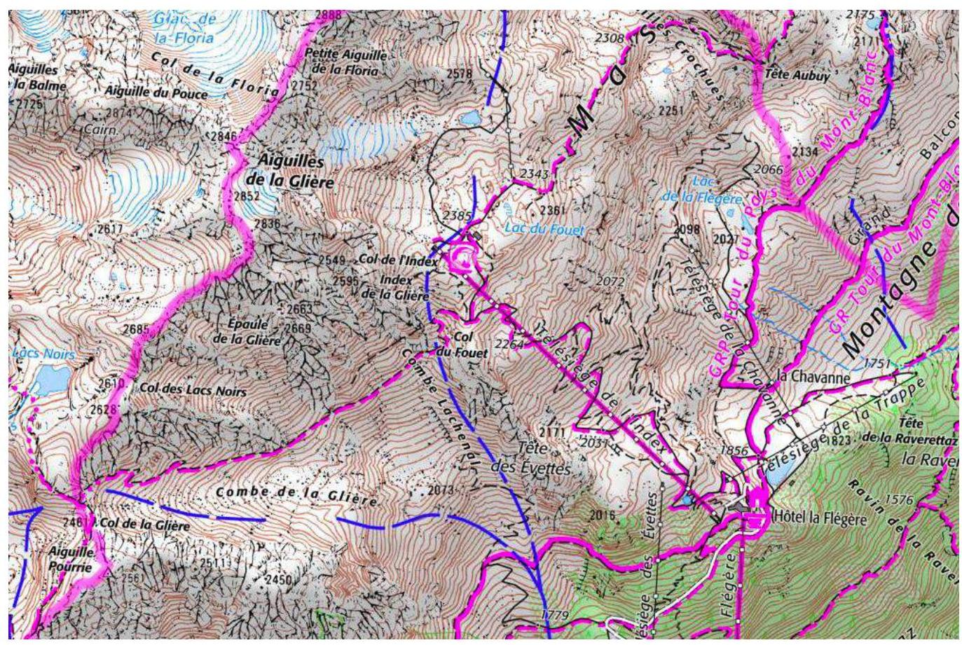
Map of the Aiguilles Rouges Massif. Aiguille de la Glière. Height 2852 m — a mountain in the Aiguilles Rouges massif, located in France.
Geographical coordinates of the summit: 45°58′12.0″ N 6°51′49.7″ E. The team's ascent to the summit of Aiguille de la Glière took place from the Télésiège de l'Index (2396 m).
The ascent to the summit of Aiguille du Tour was part of the training camp of the St. Petersburg Alpine Club "Polytechnic" (St. Petersburg) in July-August 2018.
Technical photograph of the route
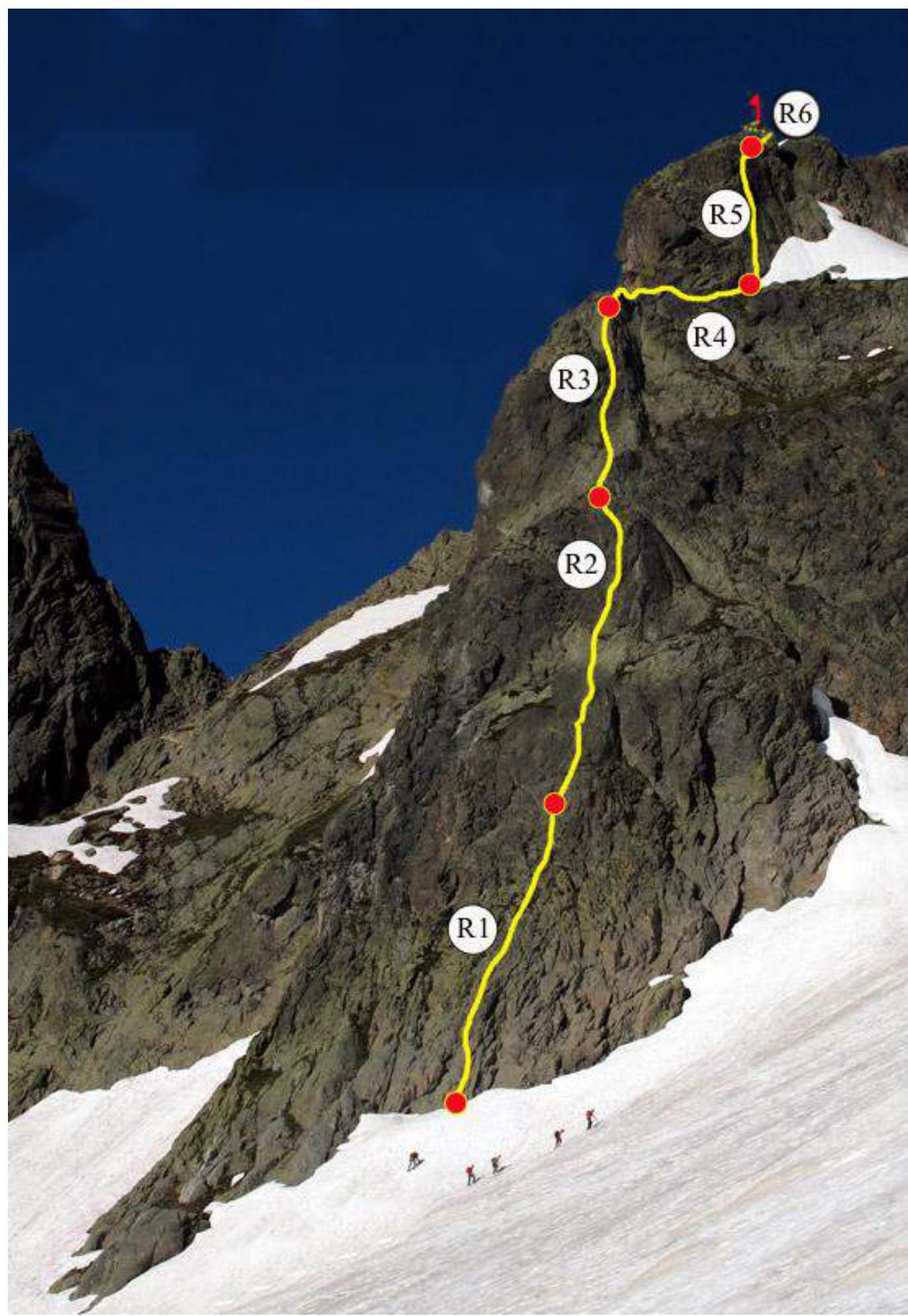
| Section № | Length, m | Steepness, ° | Terrain Character | Category of Difficulty | Number of Pitons |
|---|---|---|---|---|---|
| R0–R1 | 50 | 45 | rocks | II | - |
| R1–R2 | 50 | 35 | rocks | II | - |
| R2–R3 | 30 | 40 | rocks | II | - |
| R3–R4 | 25 | 30 | rocks | II | - |
| R4–R5 | 20 | 60 | rocks | III | - |
| R5–R6 | 25 | 20 | rocks | II | - |
Brief Description of the Route Passage by Sections.
Approach — from the Télésiège de l'Index, ascend along the snowfield, and then along the rocks to a well-defined buttress. Our route is the middle one of three, approximately 10 m to the right of the "Mani puliti" route.
R0–R1 — easy climbing on broken, lying rocks, shifting slightly to the right towards the drilled station. II, 45°, 50 m
R1–R2 — continue climbing in the direction of a large "positive" feature (here it is possible to make a station). Then upwards, veering to the left at the end. II, 35°, 50 m
R2–R3 — climb onto the pre-summit tower, ignoring the line of bolts to the right (this is the neighboring "Nez Rouge" route). II, 40°, 30 m
R3–R4 — after climbing, move to the right to the middle line of bolts. II, 30°, 25 m
R4–R5 — the key pitch of the route. Pleasant climbing on handholds. Straight up and slightly to the left at the end. III, 60°, 20 m
R5–R6 — ascend to the summit along simple rocks. II, 20°, 5 m
Descent along the trail in the direction of the summit/Index couloir. At the end of the trail, a short rappel (28 m).
General Recommendations for the Route
A good, logical route, partially equipped with bolts. It is one of the most popular in the area. Interesting for training ascents. For training groups, it is recommended to bring a set of friend-cams for organizing intermediate anchors.
Photo illustration
of the report.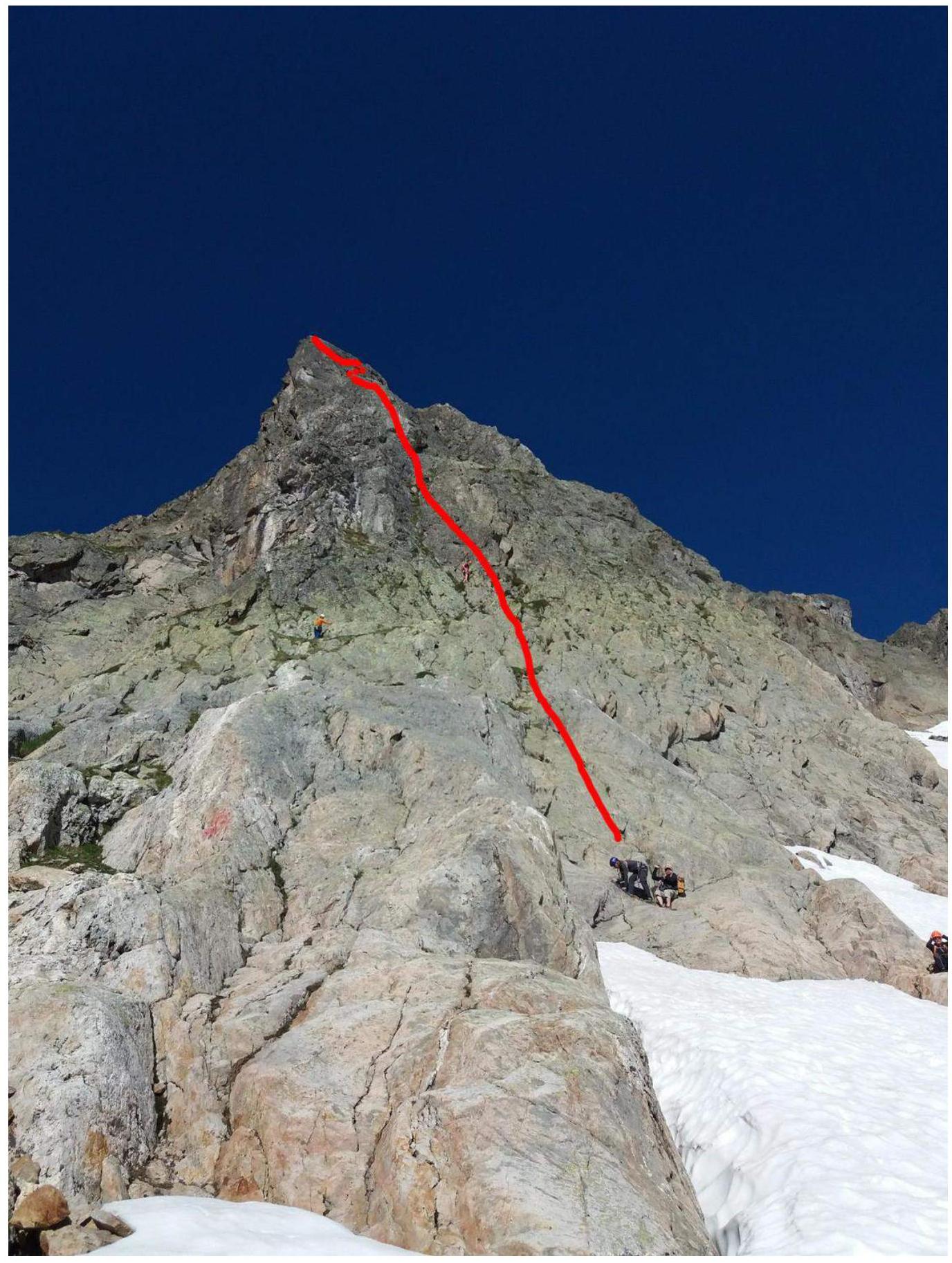
Photo 1. The route
from below.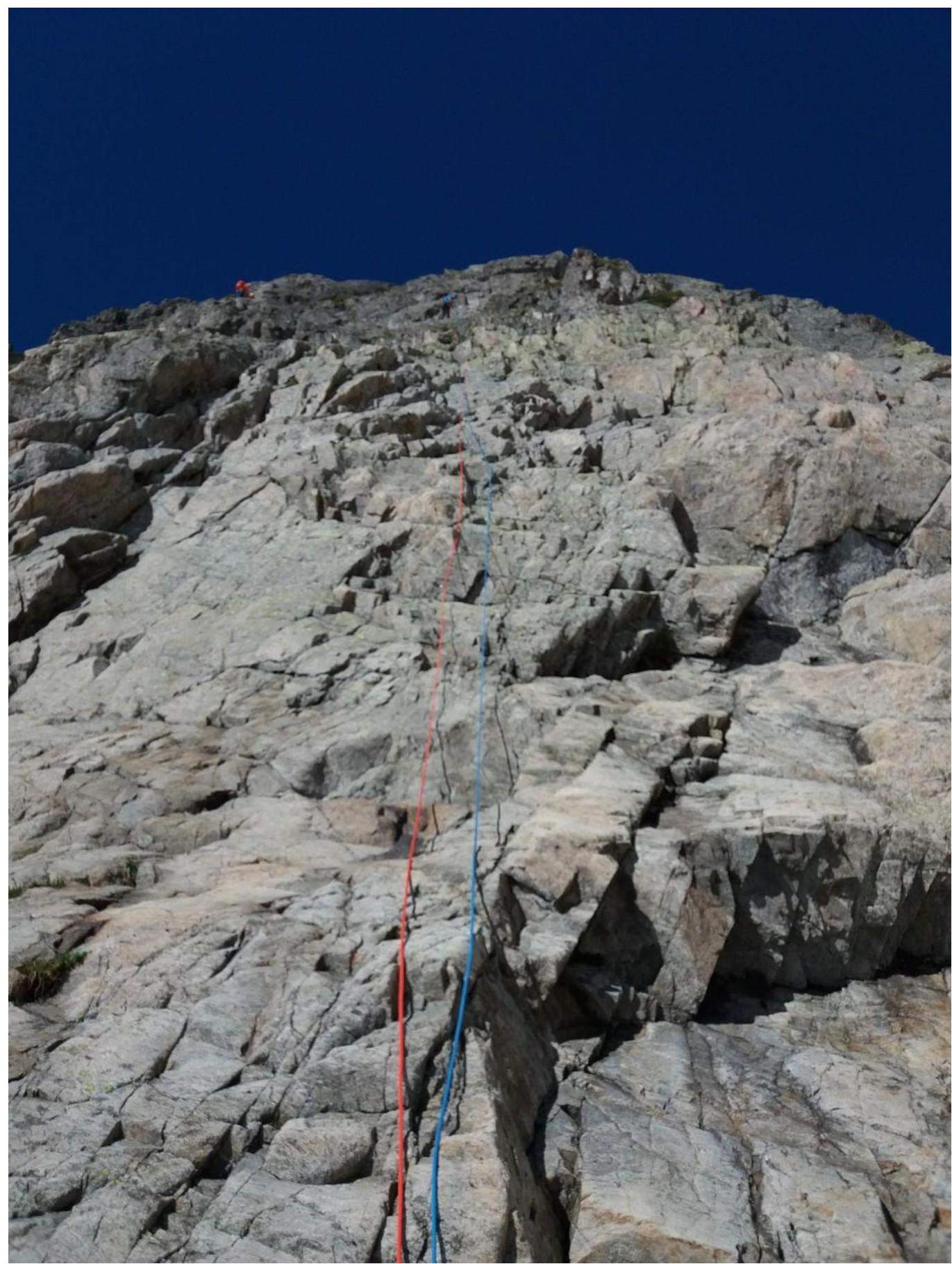
Photo 2. View of the section
R2–R3.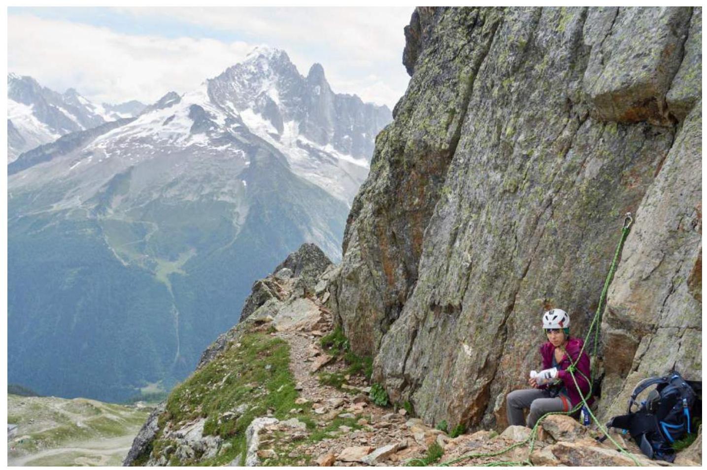
Photo 3. At the station before the key
pitch.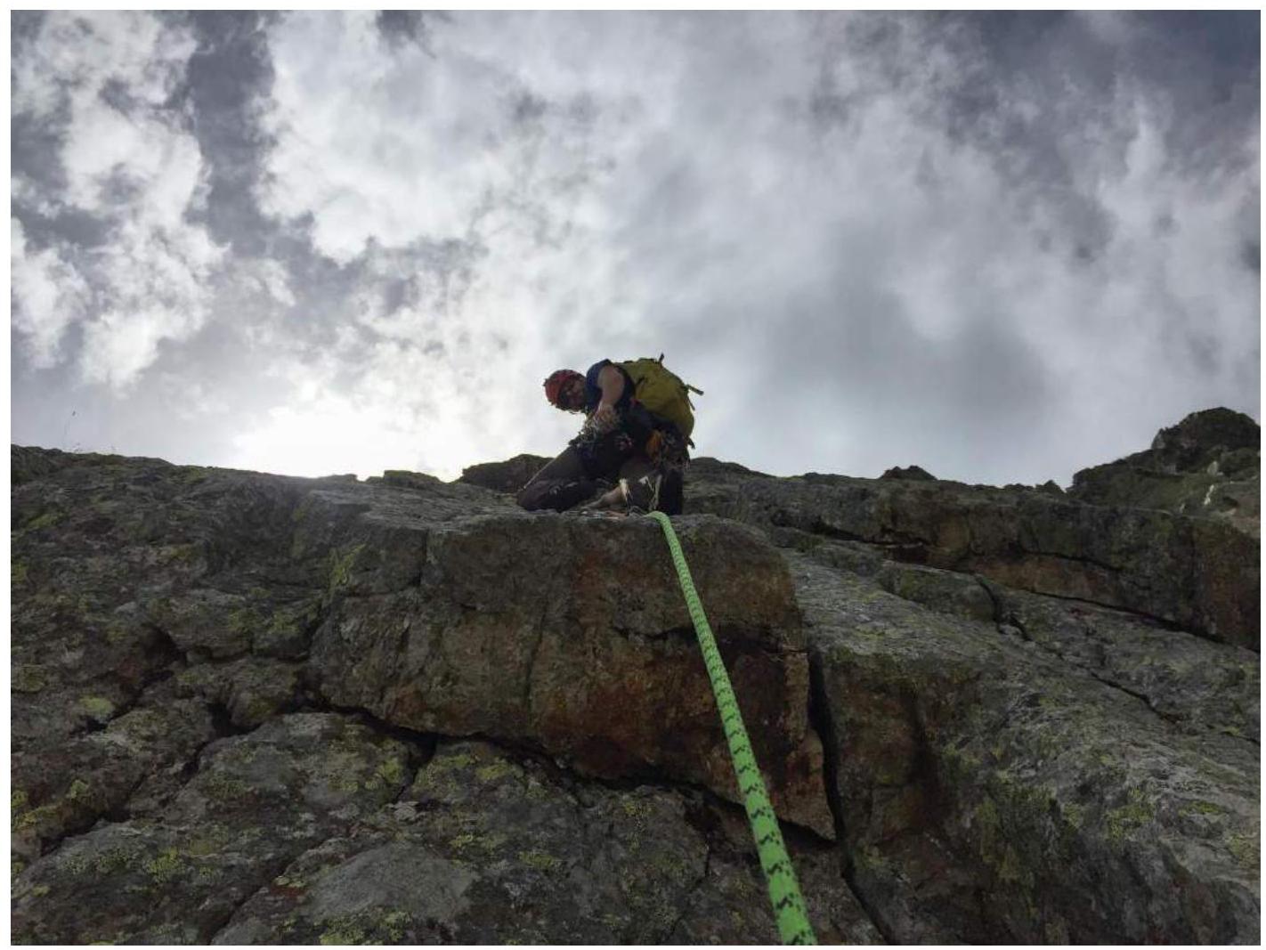
Photo 4. Section R4–R5. The "key"
of the route.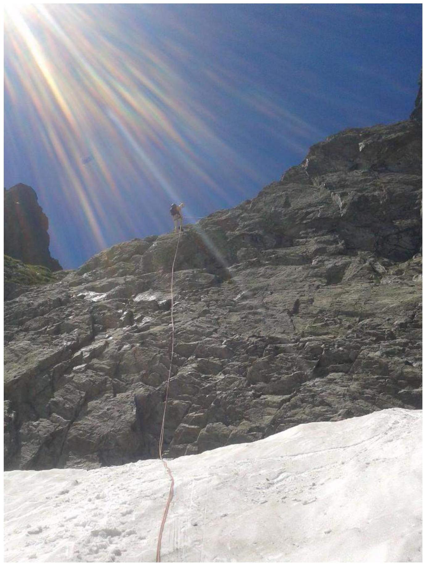
Photo 5. Rappel