
Report
On the ascent of Amin Brakk peak, 5850 m, via the west face, Karakoram. June 15 – July 30, 2004, cat. diff. 6B
Russian Championship in the high-altitude technical class
- Moscow Alpine and Rock Climbing Federation
- Coach: Yu.P. Tinin
- Leader: V.V. Rozov
- Moscow
2004
Passport
-
High-altitude technical class
-
Karakoram, Nangma Valley, Kande Valley
-
Amin Brakk peak 5850 m via the Northwest face, a variation of the "Czech Express" route
-
Category of complexity approximately 6B (American classification VII, A3+, free climbing 6B)
-
Route length — 1740 m
-
Length of sections with 6 category of complexity — 1030 m.
-
Heights:
Height of the starting point of the route (point R0) — 4600 m, height of the summit — 5850 m, height difference — 1250 m
-
Average steepness of the wall section — 85°
-
Equipment used:
Friends — 208 pcs., aliens — 251 pcs., skyhooks — 38 pcs., rock hooks — 328 pcs., BICs — 36 pcs., RURPs — 40 pcs., copperheads — 83 pcs., skyhooks — 38 pcs., cam hooks — 15 pcs., pitons at belay points — 59 pcs., ice screws — 8 pcs.
-
Days worked on the route including processing — 21. Climbing hours — 325
-
Hanging nights on platforms — 11
-
Leader Rozov Valery Vladimirovich — Master of Sports
-
Participants: Lastochkin Alexander Nikolaevich — Master of Sports, Seregin Arkady Borisovich — Master of Sports, Dorfman Lev Vitalievich — Candidate for Master of Sports, Kovalev Sergey Viktorovich — Honored Master of Sports
-
Coach: Yu.P. Tinin
-
Route processing start date: June 28, 2004.
Departure on the route: July 12, 2004, summit departure: July 19, 2004, return to base camp: July 22, 2004.
-
Moscow Alpine and Rock Climbing Federation
Team Leader V.V. Rozov
Team Coach Yu.P. Tinin
Amin Brakk 5850 m
Amin Brakk peak is located in Karakoram (Nangma Valley, Kande Valley). Access to this area is through Skardu: from Skardu to Kande village by jeep takes 7 hours, followed by a two-day hike to the base camp, which is located on the moraine of the glacier under the west face of Amin Brakk at an altitude of 4300 m. From the base camp to the start of the route — 1.5 hours walk along the moraine and glacier.
The west face of Amin Brakk was first discovered by Spanish climbers in 1995 during an ascent of Navaz Brakk peak via the northwest face. In 1996, Jon Lazkano, Adolfo Madinabeita, and Jose Tamayo returned to this area and attempted to climb Amin Brakk via the west face. Due to bad weather, the Spanish were forced to retreat. In 1998, South Korean climbers unsuccessfully attempted to continue the Spanish route. In July 1999, Czech climbers Marek Holecek, Filip Silhan, and David Stastny completed the line started by the Spanish in 1996 and ascended to the summit of Amin Brakk. The route was named "Czech Express." In August 1999, a team of Spanish climbers (Silvia Vidal, Pep Masip, Miguel Puigdomenech) established a route called Sol-Solet (VII, 6C+, A5) along the west face. In 1999, this route was nominated for the "Golden Ice Axe"; 140 m of this route has a category of A5.
The summit is composed of granite. There are many hidden cracks and expanding flakes. The west face is potentially dangerous in terms of rockfall and icefall in the second half of the day.
Movement schedule on the Amin Brakk west face route
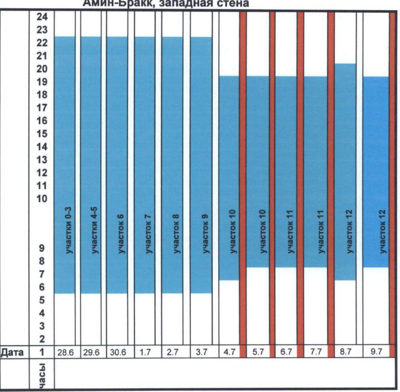
- rest in base camp or on platforms
- route processing
- work on the route
- descent
- satisfactory weather
- heavy snowfall, wind, low cloud cover

Technical characteristics of the route on the west face of Amin Brakk peak 5850 m
| Section No. | Length/Steepness | Cat. diff. | Section description | UIAA scheme | Equipment |
|---|---|---|---|---|---|
| R6 | 60 m, 70–80° | A1, 5 | Movement upwards along the internal corner under the overhang vertically. The belay point is set under the overhang. |  | Aliens-16, rock hook-8, friend-8, stopper-12, piton-2 |
| R5 | 60 m, 80–85° | A2, 5 | Vertically upwards along the crack towards the overhang with a 2 m outreach. The overhang is passed on the left side. A platform was set under the overhang. | 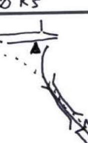 | friend-18, alien-23, stopper-17, rock hook-11, piton-4 |
| R4 | 60 m, 80–85° | A2, 6 | Vertically upwards along the internal corner, which intersects 2 overhangs with a 1 m outreach. Overhangs are passed through a crack. The belay point is set on a 20 cm wide ledge. | 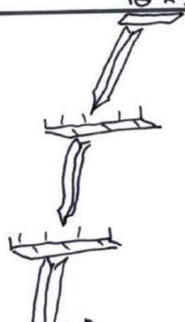 | friend-17, stopper-24, rock hook-15, alien-19, piton-2 |
| R10 | 60 m / 90° | A3+ | Movement along the wall with micro-relief towards the internal corner. | 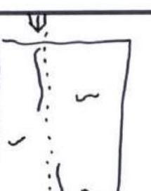 | piton-2, skyhook-9, RURP-8, BIC-13, copperhead-17, rock hook-28 |
| R9 | 45 m / 90° | A3 | Movement upwards along a blind crack. Sparse relief, flaking slabs. | 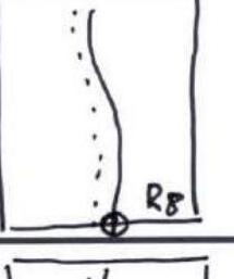 | alien-4, rock hook-29, BIC-5, RURP-8, friend-7, piton-2 |
| R8 | 50 m / 90° | A3 | Movement along a blind crack. Sparse relief, flaking slabs. | 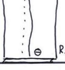 | alien-8, rock hook-31, RURP-7, copperhead-10, BIC-6, piton-3 |
| R7 | 50 m / 80–85° | A2 | The overhang with a 1.5 m outreach is passed head-on, then vertically upwards along the wall with micro-relief. Many "breathing slapsticks." The belay point is set on a 30 cm wide ledge. | 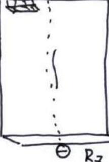 | piton-2, RURP-8, BIC-13, copperhead-17, rock hook-28 |
| R14 | 60 m (90°) | A3 | Three overhangs with out-reaches of 2, 3, and 7 m respectively. Passed through a system of cracks. For convenience of belaying, an intermediate belay point was set above the second overhang. | 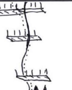 | friend-20, alien-19, rock hook-25, stopper-18, piton-4 |
| R13 | 60 m (90°) | A3 | Traverse to the right. Sparse relief. At point R13, our route joins the "Czech Express" route. Three platforms were set at point R13. |  | piton-6, BIC-5, rock hook-35, alien-23, copperhead-15 |
| R12 | 30 m / 90° | A3+ | Traverse to the right. Sparse relief. Blind cracks. | 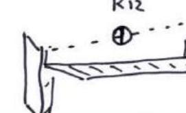 | skyhook-4, RURP-3, copperhead-15, rock hook-29, piton-2 |
| R11 | 40 m / 90° | A3+ | Internal corner. Blind cracks. |  | skyhook-12, RURP-6, BIC-7, copperhead-13, rock hook-21, piton-2 |
| R22 | 50 m / 80° | 5 | Movement vertically upwards along a crack. Exit to a snow ledge under the summit towers. | 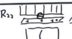 | friend-8, stopper-9, alien-5, piton-2 |
| R17–R21 | 275 m / 90° / 2.75 m | A1–A2 | Movement vertically upwards along a chimney. Many loose rocks. During bad weather, avalanches come down the chimney. In many places, the chimney is filled with ice. |  | friends-56, aliens-61, rock hook-30, pitons-12, stopper-48 |
| R16 | 60 m / 85° | A2 | Movement upwards and to the right into the base of the chimney along a crack. | 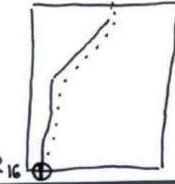 | piton-2, friend-12, stopper-15, rock hook-6, alien-7 |
| R15 | 60 m / 90° | A2 | Movement vertically upwards along a crack. | 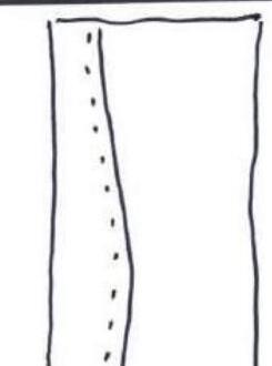 | friend-15, stopper-14, rock hook-9, alien-21, piton-2 |
| R31 | 60 m / 70° | 5 | Traverse to the right along a 20 m ledge, then up a snow-ice couloir to the summit. | 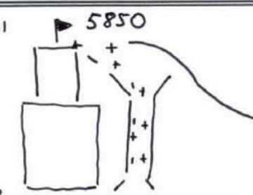 | ice screw-2, stopper-3, piton-1 |
| R30 | 60 m / 60° | 4 | Snow-ice ridge abuts against the rocks of the summit tower. | 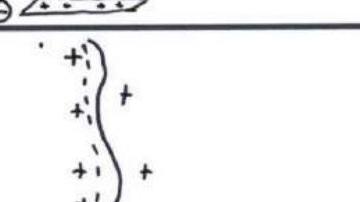 | ice screw-3, piton-1 |
| R29 | 60 m (45–50°) | 4 | Snow-ice ridge. | 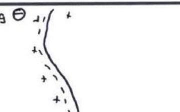 | ice screw-3 |
| R28 | 60 m (50°) | 5 | Rocky ridge. | 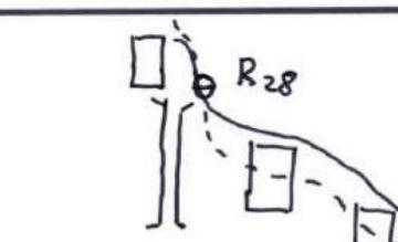 | friend-5, stopper-6, rock hook-2, piton-1 |
| R23–R27 | 300 m / 50–60° | 4 | Firn slope. Movement along the rocks to the right onto a saddle on the south ridge. |  | friend-8, stopper-5 |
Tactical actions of the team
The idea of climbing the west face of Amin Brakk peak was born in the team in 2001 during the ascent of "Rett Syndrome Wall" on El Capitan. The fact is that in 1999, Spanish climbers established a route called "Sol-Solet" on Amin Brakk, which was recognized as the most technically difficult route in the world (two sections of 70 m on the route had an A5 rating). After climbing the Nalu Masortok wall in Greenland in 2003, it was decided to organize an expedition to Karakoram with the goal of ascending Amin Brakk via the west face along a new route. Valery Rozov also planned to make a BASE jump from the summit and from the wall if such an opportunity presented itself.
Team members: Rozov Valery Vladimirovich — leader, Lastochkin Alexander Nikolaevich, Kovalev Sergey Viktorovich, Seregin Arkady Borisovich, Dorfman Lev Vitalievich — high-altitude cameraman, Lifanov Dmitry Timofeevich — high-altitude photographer (during the ascent, he acted as a cameraman and radio operator in the base camp).
The expedition took place from June 15 to July 30, 2004. A Pakistani company, Jasmine Tours, was chosen as the tour operator. The base camp was set up on June 21 on the moraine of the glacier at an altitude of 4300 m, 1.5 hours walk from the Amin Brakk wall. Due to bad weather and lack of visibility, the team was able to choose the intended route line only by June 28. The choice of the route on the right side of the wall was dictated by the presence of a series of overhangs in the middle part, which could allow Rozov to make a jump from the middle of the route.
Due to the lack of water in the middle part of the wall, the group carried 200 liters of water with them.
- June 28, 2004 — Kovalev, Lastochkin, and Seregin start processing the route: 300 m along a snow slope with a steepness of 45° to the rocky belt. On the rocky belt, 2 ropes are fixed, and one rope is fixed across the firn field with a steepness of 55°. Return to base camp.
- June 29, 2004 — Kovalev and Lastochkin process the R4–R5 section. The section consists of rocks with a steepness of 85°. Seregin and Lifanov carry loads along the fixed ropes. Return to base camp.
- June 30, 2004 — Seregin and Lifanov process the R6 section and lift equipment to the upper point. Return to base camp.
- July 1, 2004 — Kovalev and Lastochkin process the R7 section, set up a platform at point R5, and spend the night there. Seregin and Dorfman lift equipment and food along the ropes and return to base camp.
- July 2, 2004 — Seregin and Rozov process the R8 section, return to the platform at point R5. Kovalev and Lastochkin lift equipment along the ropes and head to base camp.
- July 3, 2004 — Kovalev and Lastochkin process the R9 section, spend the night on the platform. Seregin, Rozov, Lifanov, and Dorfman lift loads along the ropes. The pair spends the night on the platform, the others return to base camp.
- July 4, 2004 — Rozov and Seregin partially process the R10 section. The section is heavily hit by ice in the second half of the day. Return to base camp. Bad weather: snowfall with wind.
- July 5, 2004 — Kovalev and Lastochkin complete the processing of the R10 section. Bad weather: snow, wind. The pair returns to base camp.
- July 6, 2004 — Kovalev and Lastochkin process part of the R11 section. Seregin and Lifanov carry loads along the ropes. Bad weather: snow and wind. The group returns to base camp.
- July 7, 2004 — Rozov and Seregin complete the processing of the R11 section. It is snowing. The pair returns to the platform at point R5.
- July 8, 2004 — Rozov and Seregin partially process the R12 section. Good weather. Return to base camp.
- July 9, 2004 — Kovalev and Lastochkin complete the processing of the R12 section and return to base camp.
- July 10, 2004 — Kovalev and Lastochkin restore damaged ropes on the R0–R1 section.
- July 11, 2004 — Rest day.
- July 12, 2004 — The team departs in the composition: Rozov, Seregin, Kovalev, Lastochkin, Dorfman. Rozov and Dorfman lightly pass the fixed ropes and process the R13 section. Kovalev, Lastochkin, and Seregin lift loads and remove ropes up to point R5. Rozov, Dorfman, and Seregin spend the night on the platform at point R11, Kovalev and Lastochkin spend the night at point R5. Due to increased rockfall danger, the group decides to move to the right onto the "Czech Express" route.
- July 13, 2004 — The team transfers all loads to point R13, where three platforms are set up under a giant overhang.
- July 14, 2004 — Rozov and Dorfman process the R14 section. Bad weather.
- July 15, 2004 — Kovalev and Lastochkin process the R15 section. Bad weather: snow and wind.
- July 16, 2004 — Kovalev, Lastochkin, and Seregin process the R16 and R17 sections. Bad weather: snow and wind.
- July 17, 2004 — Rozov and Dorfman process the R18 and R19 sections. Bad weather.
- July 18, 2004 — Rozov and Dorfman process the R20–R22 sections. Bad weather.
- July 19, 2004 — The team departs from the platforms at 4:00 AM in full composition. At 11:00 AM, the group gathers at point R22. Then, they traverse along a snow-covered ledge to the right onto a snow field. The field is passed under the rocks of the summit tower from left to right. They exit onto the south ridge and ascend to the summit along the ridge. The team reaches the summit in full composition at 16:00. Bad weather. L. Dorfman takes a photo on the summit, while Seregin hammers in a piton to organize the descent from the summit tower. Descent along the ropes to the platforms at point R13. Bad weather.
- July 20, 2004 — The team remains on the platforms due to bad weather.
- July 21, 2004 — The weather is bad in the morning, but according to the forecast, it is expected to improve after noon. Therefore, the group starts moving up the ropes at 8:00 AM to organize a BASE jump site for Rozov. A platform is set up at point R20. At 18:00, Rozov makes the jump and lands on the moraine near the base camp. The team removes the ropes and descends to the platforms at 23:00.
- July 22, 2004 — Descent along the ascent route from 4:00 AM to 22:00. Ropes are removed, and all equipment and remaining food are taken down.
Route description by sections
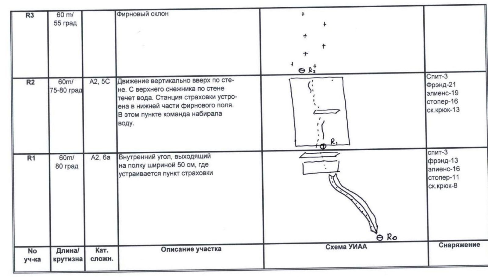
R0–R1. 60 m, 80°, cat. diff. A2, 6. From the snow tongue along the internal corner, which goes from right to left. A station of two pitons is set on a 50 cm wide ledge. An intermediate piton is hammered in to fix the ropes.
R1–R2. 60 m, 75–80°, cat. diff. A2, 5. Movement vertically upwards along the wall. The station is set at the base of the firn field. An intermediate piton is hammered in to fix the ropes.
R2–R3. 60 m, 55°. Movement along the firn. The station is set at the upper edge of the slope on the rocky wall in the internal corner.

R3–R4. 60 m, 80–85°, cat. diff. A2, 6. Movement along the internal corner, which is intersected by two overhangs with an outreach of up to 1 m. The station is set on a 20 cm wide ledge.
R4–R5. 60 m, 80–85°, cat. diff. A2, 5. Movement along the crack upwards under the overhang. The overhang with a 2 m outreach is passed on the left side. A platform was set under the overhang.
R5–R6. 60 m, 70°, cat. diff. A1, 5. Movement along the internal corner to the overhang. The station is set under the overhang.
R6–R7. 50 m, 80–85°, cat. diff. A2. Passage of the overhang with a 1.5 m outreach, movement along the wall with micro-relief. Many "breathing slapsticks." Exit to a ledge. The section is heavily hit by rocks and ice in the second half of the day.
R7–R8. 50 m, 85–90°, cat. diff. A2. Movement along the wall along an indistinctly expressed blind crack.
R8–R9. 45 m, 90°, cat. diff. A3. Movement along an indistinctly expressed blind crack.
R9–R10. 60 m, 90°, cat. diff. A3+. Movement vertically upwards along the wall with micro-relief. Blind cracks. Skyhooks, BICs, RURPs, copperheads are used during the passage.

R10–R11. 40 m, 90°, cat. diff. A3+. Movement along an indistinctly expressed internal corner. Blind cracks, flaking slabs.
R11–R12. 30 m, 90°, cat. diff. A3+. Movement to the right. Sparse relief. Blind cracks.
R12–R13. 60 m, 90°, cat. diff. A3. Traverse to the right under the overhang, exit onto the "Czech Express" route.

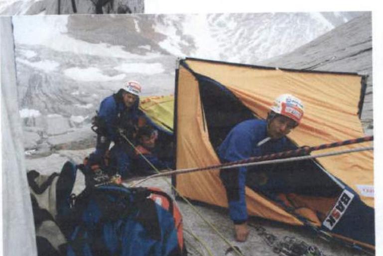
At point R13, three platforms are set up.
R13–R14. 60 m, a series of overhangs with out-reaches from 2 to 7 m, cat. diff. A3. Movement along a crack, the first overhang has a 2 m outreach, the second 3 m, the third 7 m. All are passed head-on through the crack. For convenience of belaying, an intermediate belay point was set above the third overhang, subsequently the ropes were straightened, so one rope was enough from point R13 to the top of the third overhang.
R14–R15. 60 m, movement along a crack vertically upwards. Cat. diff. A2, 90°.
R15–R16. 60 m, cat. diff. A2, 85°. Movement upwards and to the right into the base of the chimney.
R16–R21. A hanging chimney, in many places filled with ice. Many loose structures. Cat. diff. A1–A2, 5–6. The length of each of the five sections is 55 m.
- 55 m
- 55 m
- 55 m
- 55 m
- 55 m
R21–R22. 60 m, 70°, cat. diff. 5. Exit to a snow ledge under the summit towers.
R22–R27. 5 ropes of 60 m. Movement along a firn slope with a steepness of 50–60° along the rocks of the summit tower to the right towards a saddle on the south ridge.
R27–R28. 60 m, cat. diff. 5. Movement along a rocky ridge.
R28–R30. 2 ropes of 60 m to the base of the summit tower. Snow-ice ridge with a steepness of 45–60°.
The belay point R30 is set on a piton hammered into the wall of the tower and on aliens.
R30–R31. 60 m. Traverse to the right along a snow ledge for 20 m, then up a snow-ice couloir with a steepness of 70° — exit to the summit. No signs of Czech or Spanish climbers were found on the summit. Descent from the tower directly to the belay station at point R30 along the ropes. At point R29, an ice screw with a loop is left. Further descent from point R28 vertically downwards for 60 m onto the firn slope, bypassing the saddle (point R27).
P.S. The approach to the route along the snow slope, as well as sections R0–R12, are hit by rocks and ice in the second half of the day.
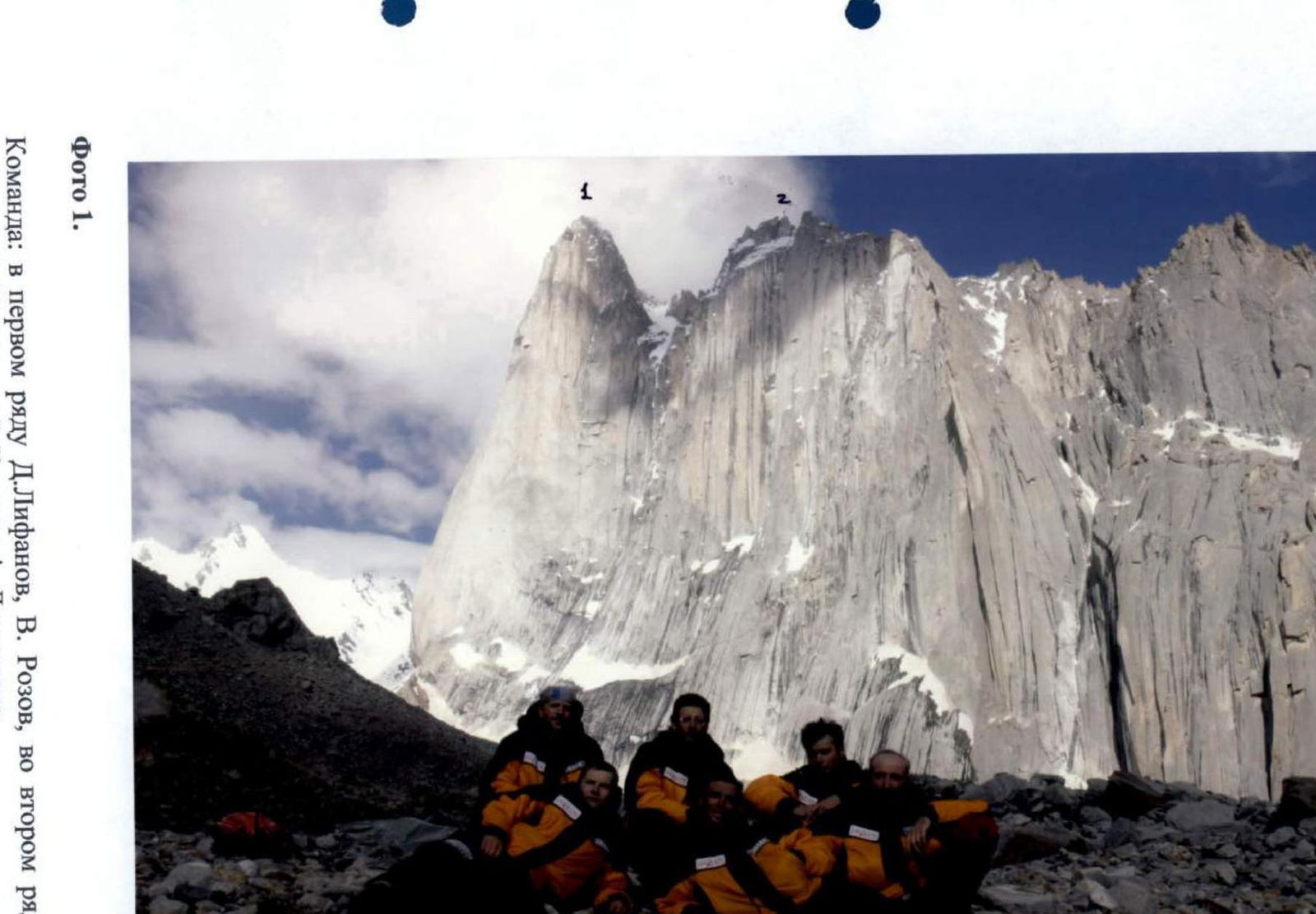
Photo 1
Team members:
- D. Lifanov,
- V. Rozov,
- A. Seregin,
- L. Dorfman,
- S. Kovalev,
- A. Lastochkin.
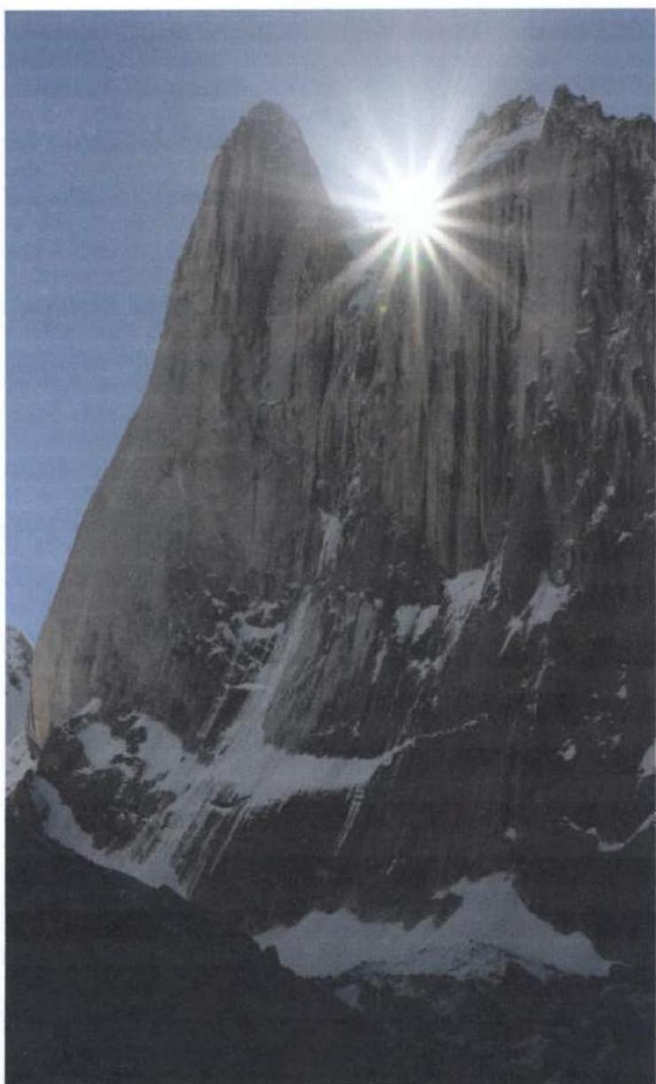
1 — Amin Brakk peak 5850 m, 2 — Navaz Brakk peak 5700 m.
Photo taken from the base camp.
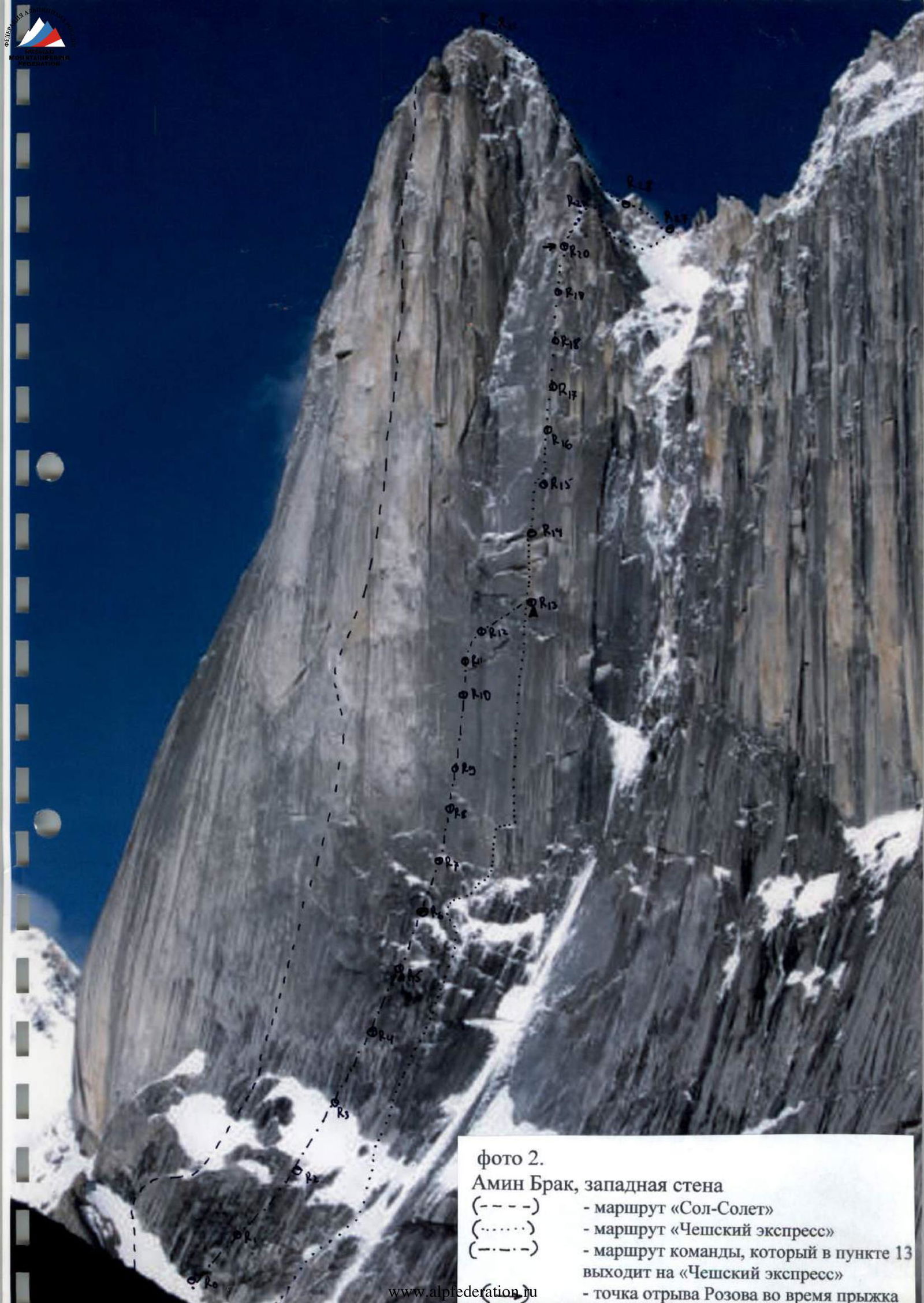
Photo 2. Amin Brakk, west face
- (— — —) — "Sol-Solet" route
- (....... ) — "Czech Express" route
- (— — —) — team's route, which joins "Czech Express" at point R13
- (— — —) — point of Rozov's jump
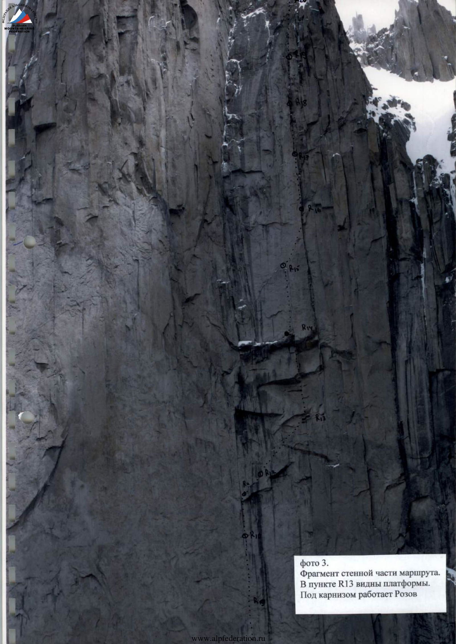
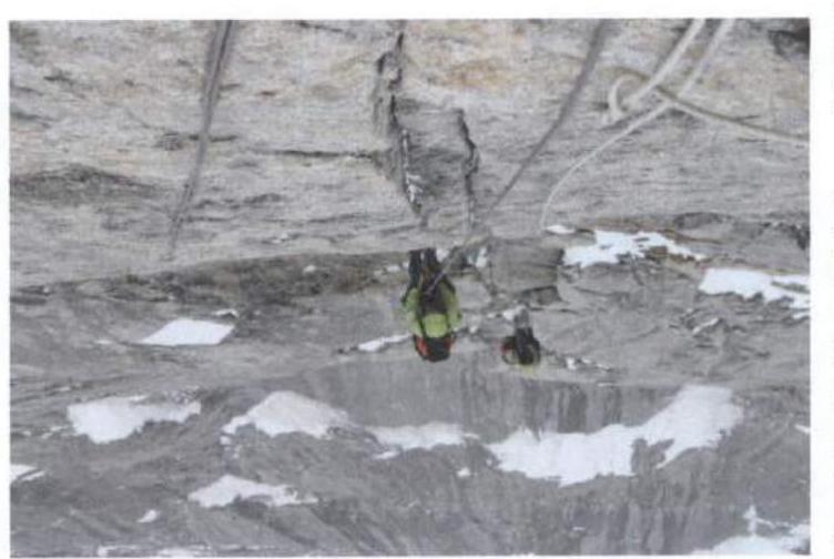
Photo 3. Fragment of the wall section of the route
At point R13, platforms are visible. Rozov is working under the overhang.
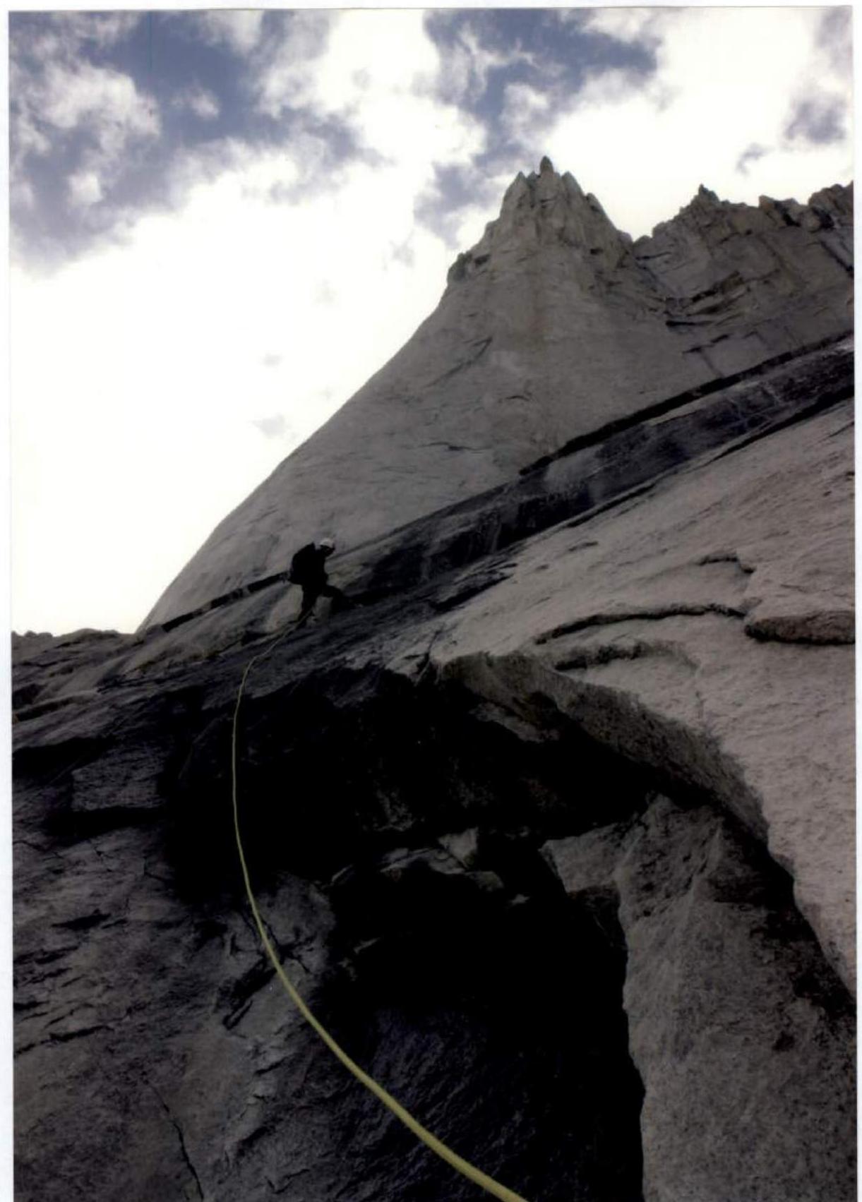
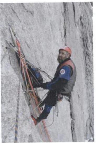
Photo 4. Movement along the ropes on section R0–R1
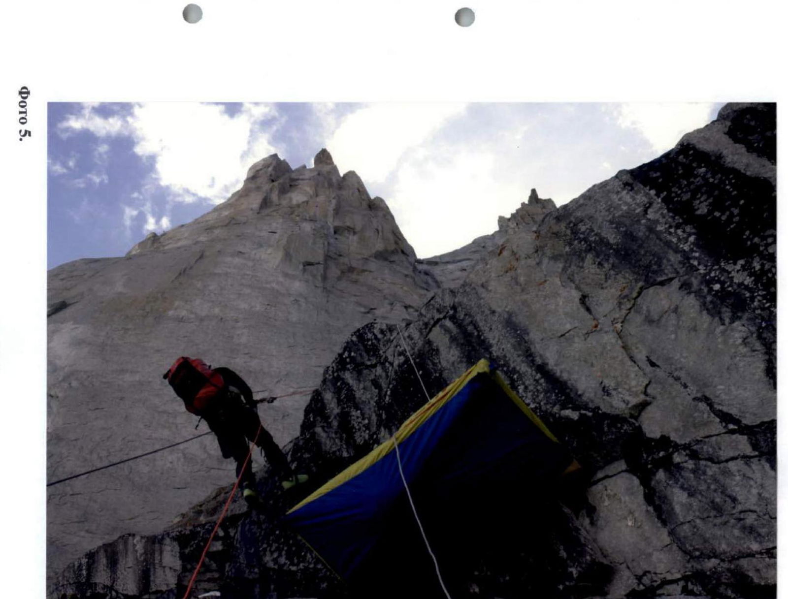
Photo 5. Movement along the ropes on section R4–R5
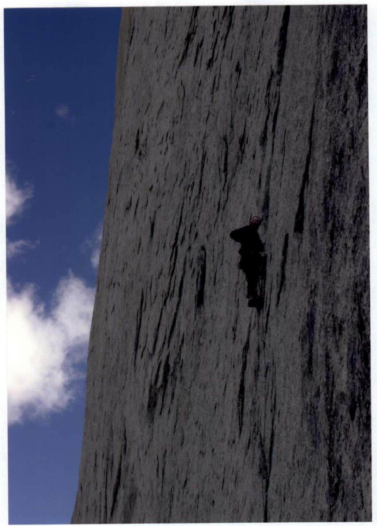
Photo 6. S. Kovalev working on section R9–R10
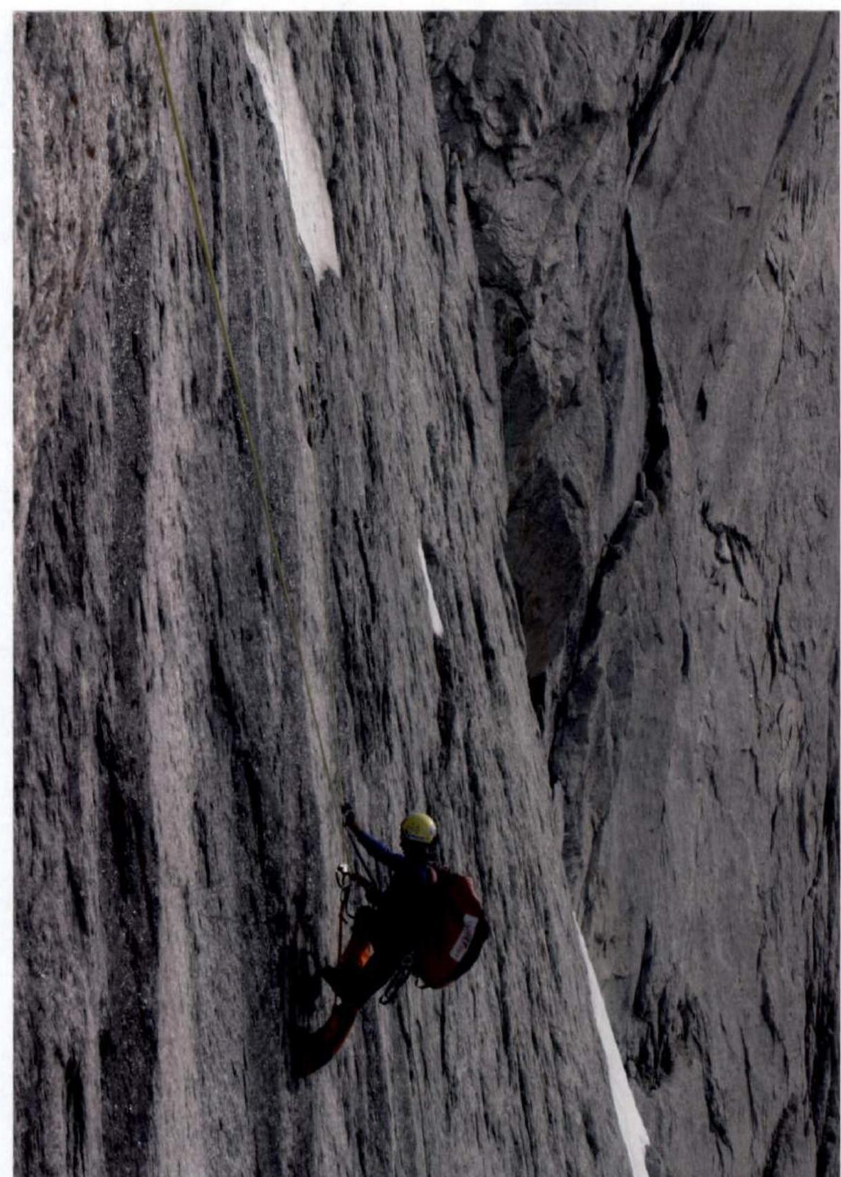
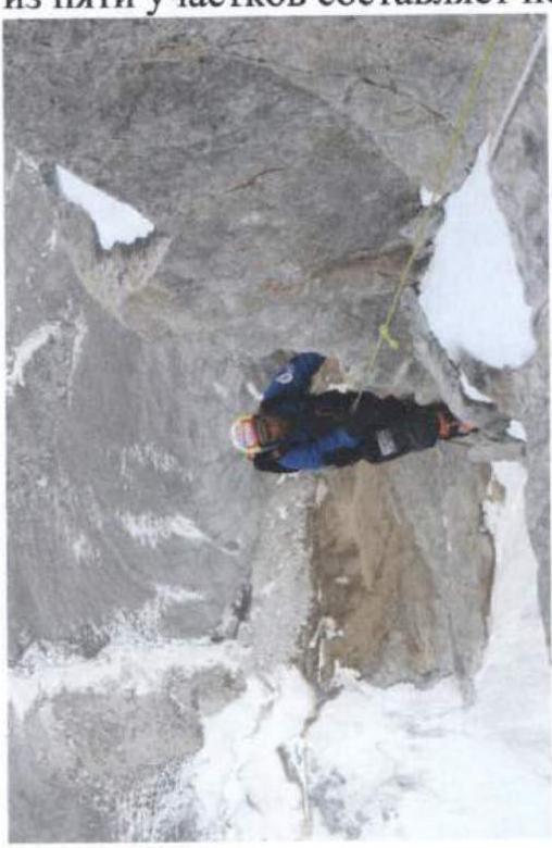
Photo 7. V. Rozov passing the ropes on section R7–R8
![img-39.jpeg]({"width":1220,"height":1708,"format":"Jpeg","uri":"https://summitx.info/media/1/Uxx28VjllJ ↗
Comments
Sign in to leave a comment