ALPINISM FEDERATION OF NOVOSIBIRSK REGION
Report
On the ascent of the team from Novosibirsk
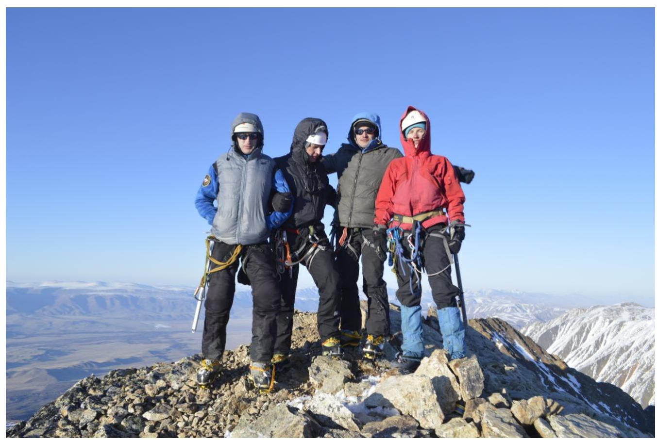
to the summit of Kyzyl-Tash 3486 m via the northwest slope icefall. Presumably 4B category of difficulty. First ascent. Leader: Ivliev Andrey Vladimirovich Team members: Kulishova Alena Maratovna Pintusov Anton Nikolaevich Syutkin Andrey Leonidovich
Ascent Details
- Region — Altai Republic, North-Chuya Ridge
- Summit — Kyzyl-Tash 3486 m via the northwest slope icefall
- Presumed category — 4B category of difficulty
- Route type — Ice climb.
- Route characteristics: main section elevation gain 480 m, route length — 740 m. length of sections with 5th category of difficulty — 110 m, 4th category of difficulty — 190 m average steepness of main section 55°
- Equipment used on the route: ice screws — 74
- Climbing time — 10.5 hours, duration — 1 day.
- Leader: Ivliev Andrey Vladimirovich 1st sports category Team members: Kulishova Alena Maratovna 2nd sports category Pintusov Anton Nikolaevich 2nd sports category Syutkin Andrey Leonidovich 2nd sports category
- Team coach: Filatov Sergey Alekseevich Master of Sports
- Departure date: To the route — at 8:00, May 4, 2015 To the summit — at 18:30, May 4, 2015 Return to Base Camp — at 22:10, May 4, 2015
- Ascent organized by — Alpinism Federation of Novosibirsk Region 2015
General view of the route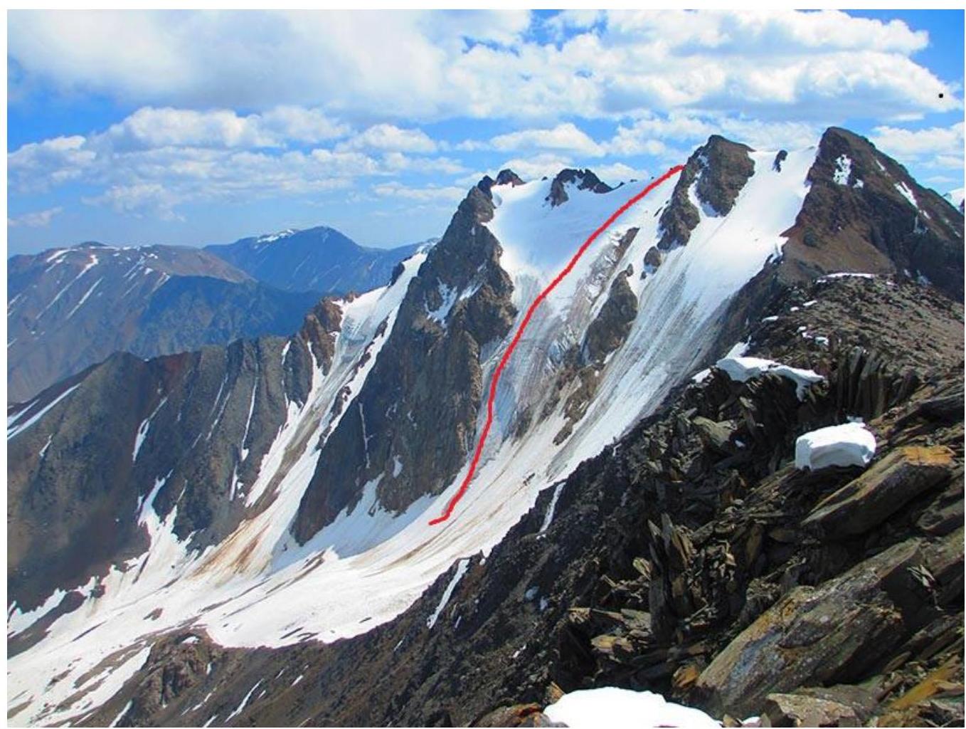
Digitized with Google
Area photopanorama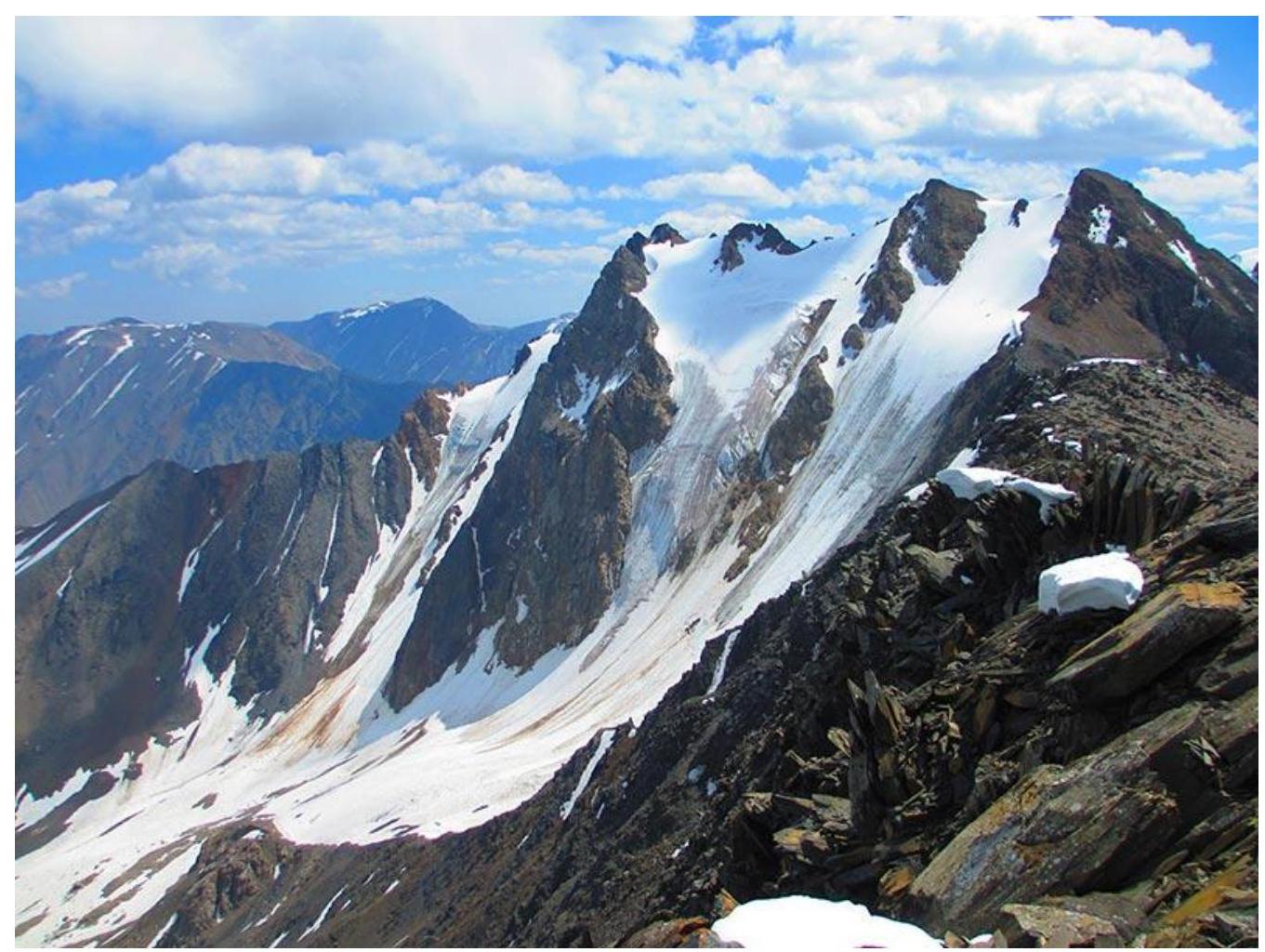
Ascent area diagram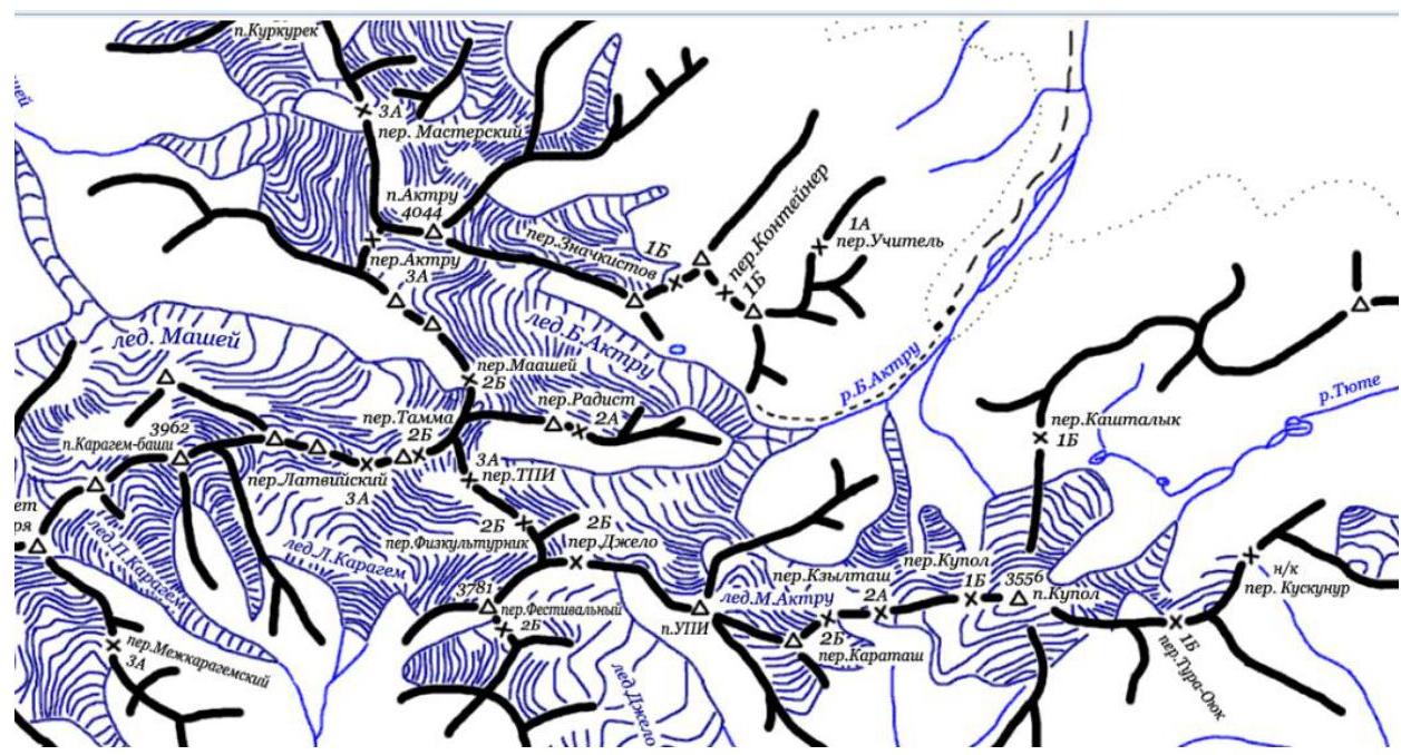
Team Tactics
This year in Aktru gorge, between April 30 and May 11, FANSО climbers made about 20 ascents, including 2 first ascents.
At home, when choosing the route, we paid attention to the icefall on the northwest slope of Kyzyl-Tash peak. Since there is only one 3A route on this slope, which goes much to the right, we decided to create a new, more interesting and challenging route through the center of the icefall.
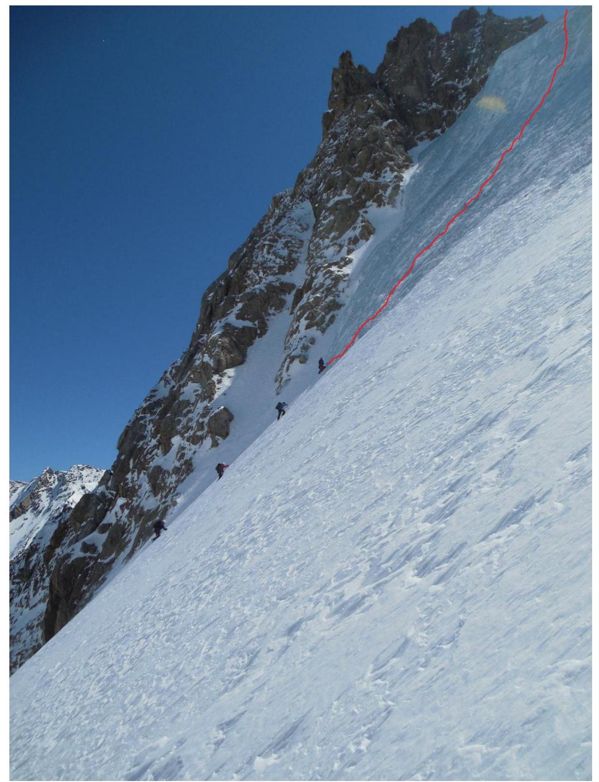
On May 4, 2015, at 6:00, we left Aktru Base Camp and approached the start of the route at 8:00 via Uchitel pass. The key section of the route, the icefall itself, begins almost immediately. Then there's a slight flattening of the glacier to 50–55°, and further to 35–40°, reaching the pre-summit ridge. We reached the ridge at 18:15, bypassing the summit to the right along snowy ledges, and summited at 18:30.
We descended to Base Camp at 22:10.
| № | Ice screws | ||
|---|---|---|---|
| 4 | 10 |  | II, 100 m, 30–35° |
| 3 | 20 |  | III, 230 m, 40–45° |
| 2 | 20 |  | IV, 190 m, 50–55° |
| 1 | 24 |  | V, 120 m, 75–80° |
| 0 |  | I, 100 m, 30° |
Section R0–R1: Start of the route, snowy slope. The angle of inclination decreases in the upper part.
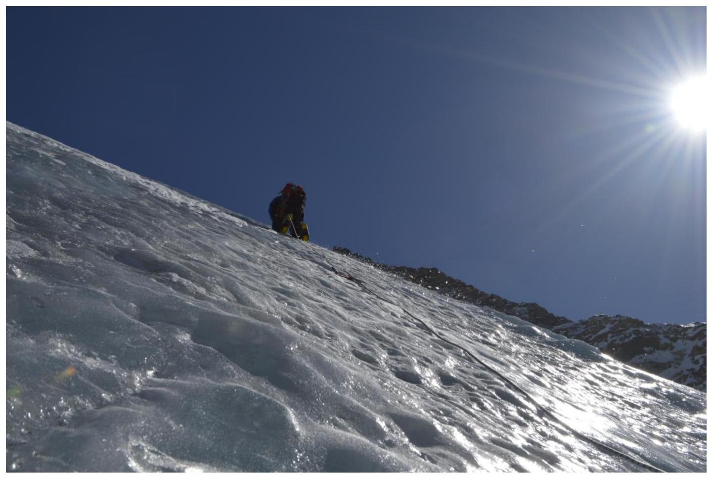
Section R1–R2: Key section of the route. Icefall with a steep slope. Climbed with thorough ice screw protection.
Section R2–R3: Ice slope. Slight flattening. Climbed with thorough ice screw protection.
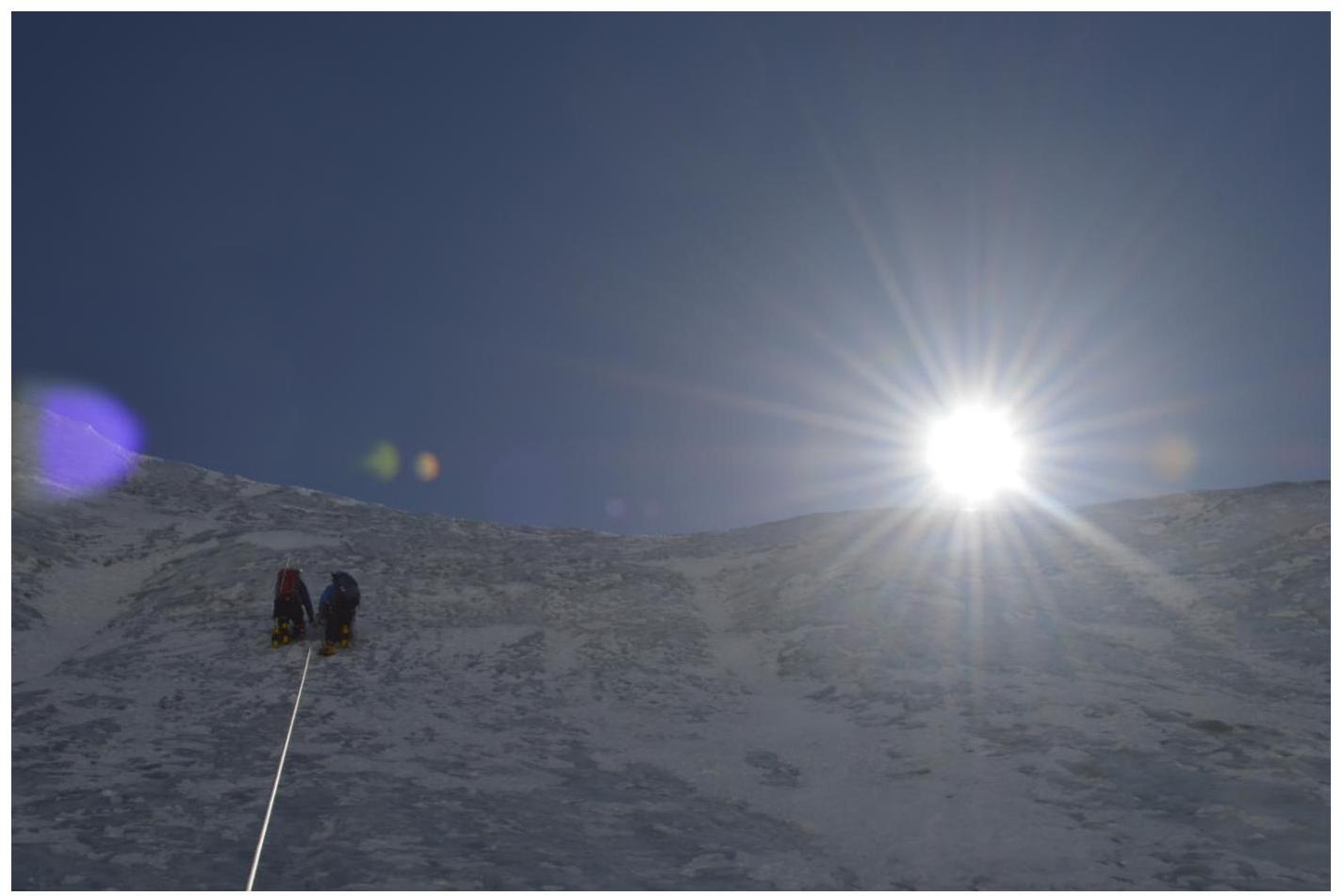
Section R3–R4: Further flattening of the ice slope to 30–35°. Transition to a snowy slope. Exit to the pre-summit ridge 50–70 m and the summit.
Section R1–R2
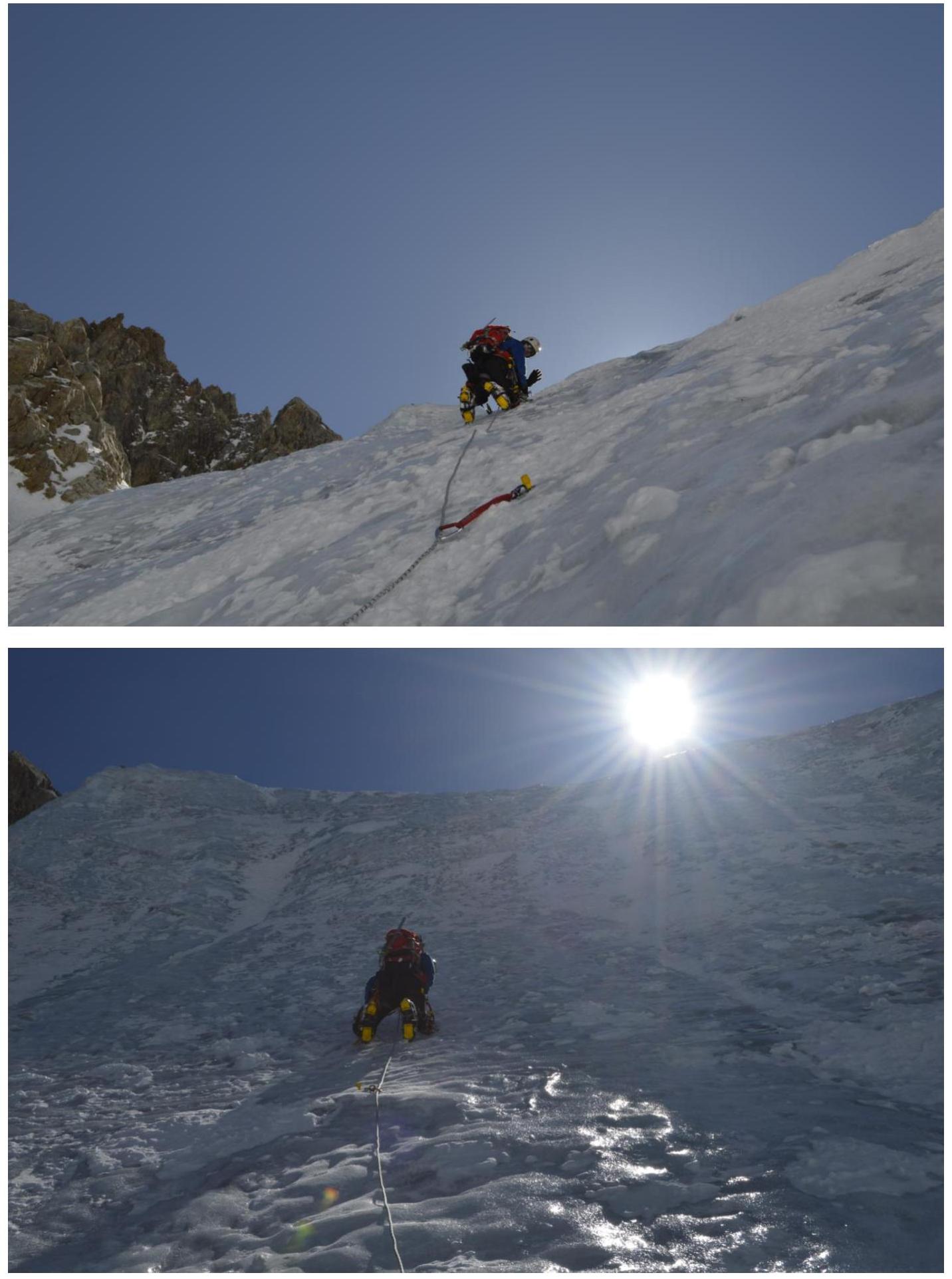
Section R2–R3
Section R3–R4
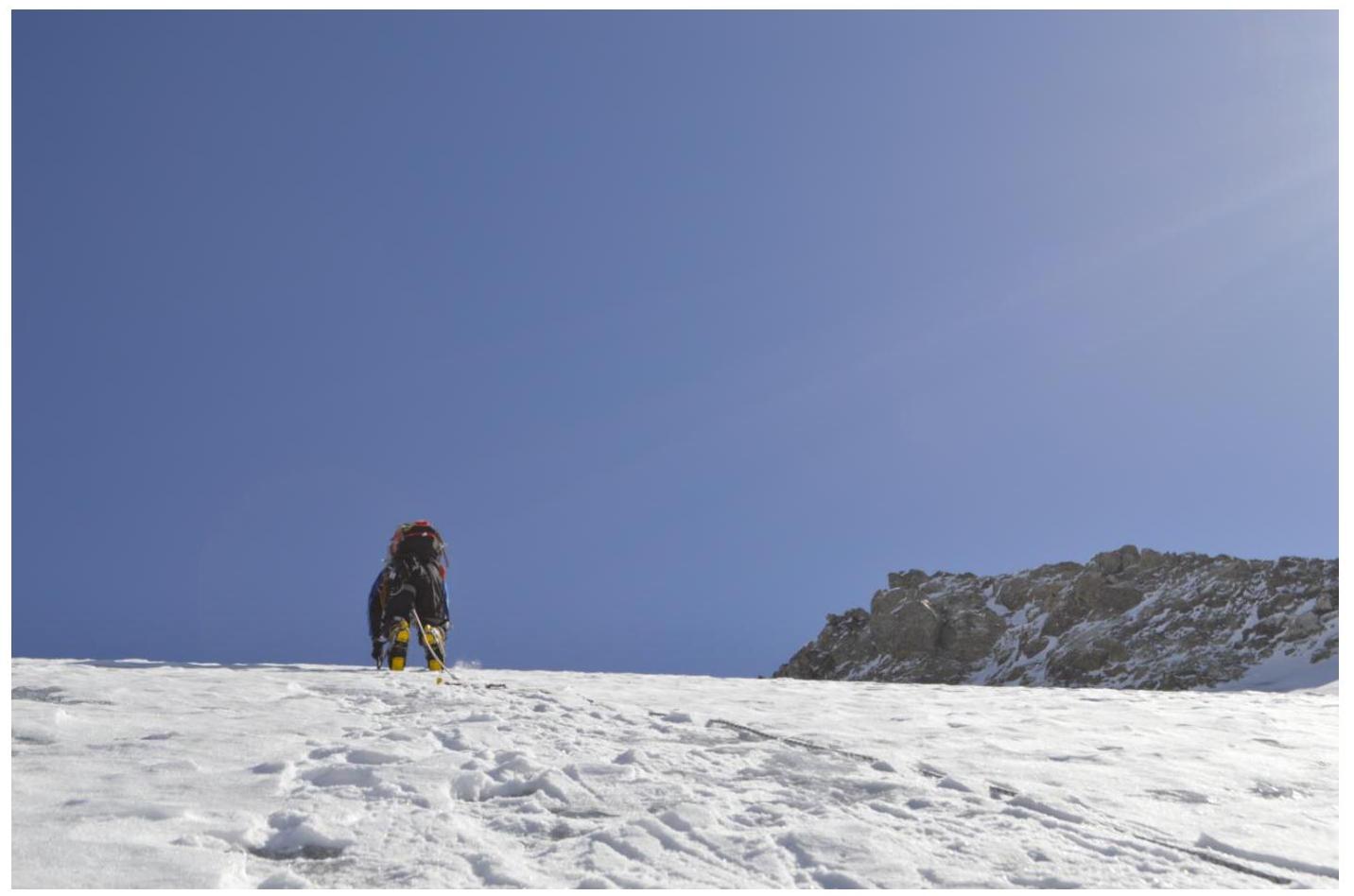
Kyzyl-Tash peak, May 4, 18:30