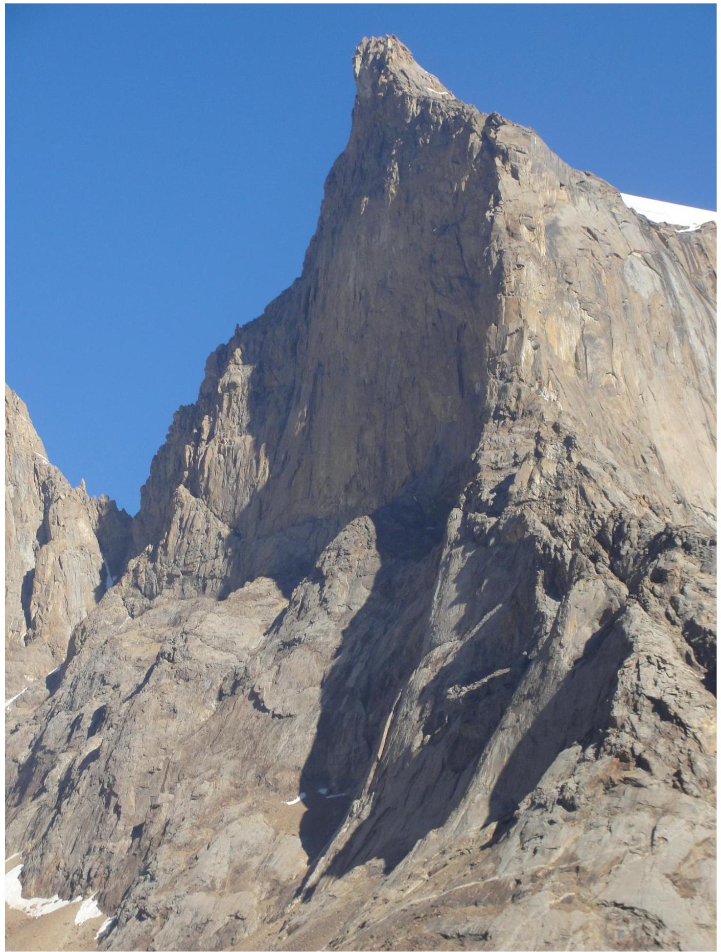
Ascent Report on Peak Iskander via the South Face
Ascent Passport
- Pamir-Alay, Turkestan Range, Laylyak gorge, 5.4.2. 36a
- Peak Iskander, 5120 m, via the South Face (Zhiltsov's route, 1998)
- 6A category of difficulty (4th ascent)
- Route character: rock
- Route height difference: 1030 m, wall height 625 m (by altimeter)
Route length: 1320 m. Section lengths:
- V category of difficulty — 345 m.
- VI category of difficulty — 245 m. Average steepness:
- main part of the route — 85°
- entire route — 65°
- Number of "kruki" left on the route:
total: 0; including piton hooks: 0. Number of "kruki" used on the route:
- stationary piton hooks: 0 (including ATO: 0)
- removable piton hooks: 0 (including ATO: 0). Total number of artificial support points (ATO) used: 58. Number of chocks and friends: 146 (including ATO: 41). Number of pitons: 38 (including ATO: 9)
- Team's total climbing hours: 40 h 5 min
- Team leader: Khramov Andrey Rimovich, Candidate Master of Sports
Team members:
- Chudinov Pavel Dmitrievich, 1st sports category
- Marusov Pavel, 1st sports category
- Chudinova Valeriya Dmitrievna, Candidate Master of Sports
- Coach: Nasedkin Oleg Yurievich, Candidate Master of Sports
- Departure to the route: 15:00, July 28, 2013
Reached the summit: 15:00, July 31, 2013. Returned to Base Camp: 18:00, August 1, 2013
Descent via the South Face, following the ascent route.
| 5150 | 5100 | 5050 | 4950 | 4900 | 4850 | 4750 | 4700 | 4650 | 4550 | 4500 |
|---|---|---|---|---|---|---|---|---|---|---|
| 4450 | 4350 | 4300 | 4250 | 4200 | 4150 | 4100 | 4090 | 4050 |
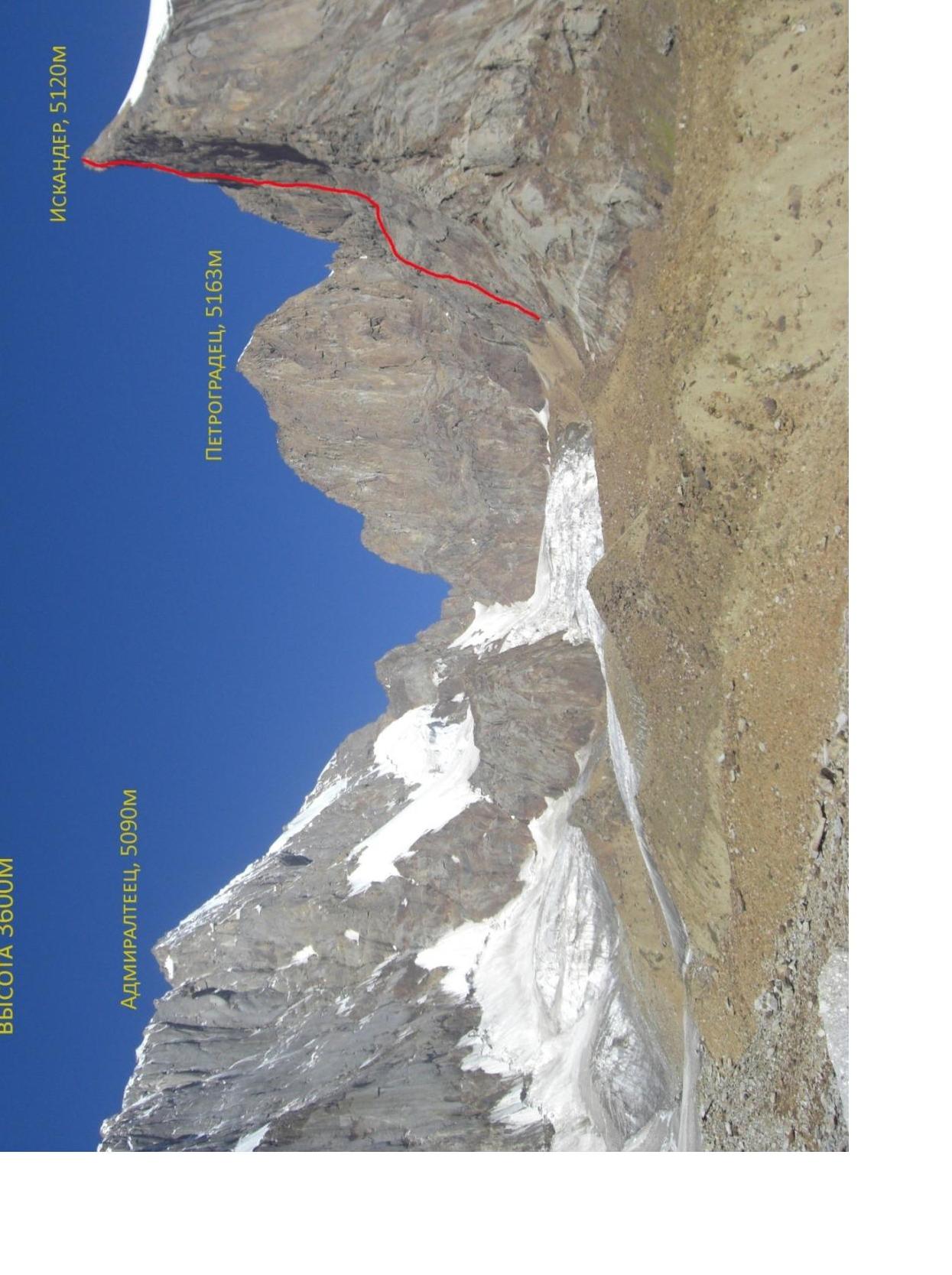
Photo #3. Panorama of the area. Taken from Lake Anzuh, distance 4 mm, height 3600 m
Admin. 5080 m
| Pitons | Chocks | ATO | 13 | |||
|---|---|---|---|---|---|---|
| 2/2 | 7/7 | 12 | 45 м, 95°, VI, A2 | |||
| 4 / 4 | 4 / 4 | 10 | 12 м, 95°, VI, A2, rp-c; 15 м, 95°, VI+, A3 | |||
| 1 | 9 | 7 м, 70°, III | ||||
| 4 | 8 | 15 м, 55°, IV | ||||
| 1 | 5 | 7 | 50 м, 65°, V | |||
| 6 | 50 м, 0–65°, I–III | |||||
| 5 | 100 м, 25°, III | |||||
| 8 | 4 | 50 м, 30–90°, III–V | ||||
| 8 | 3 | 45 м, 60°, IV | ||||
| 5 | 2 | 45 м, 60°, IV | ||||
| 5 | 1 | 45 м, 65°, IV | ||||
| 0 | 100 м, 25°, I | |||||
| Pitons | Chocks | ATO | Section № | Length, steepness, difficulty | ||
| :--: | :--: | :--: | :--: | :--: | :--: | |
| 1 | 5 | 30 | 45 м, 85°, V | |||
| 1 | 28 | 15 м, 60°, IV | ||||
| 27 | 10 м, 50°, III | |||||
| 4/4 | 4 / 4 | 10 | 26 | 15 м, 90°, VI+, A3 | ||
| 2 / 2 | 2 / 2 | 7 | 25 | 12 м, 90°, VI+, A2 | ||
| 1 | 2 | 24 | 10 м, 85°, VI | |||
| 2 | 23 | 15 м, 80°, V | ||||
| 2 | 22 | 3 м, 120°, VI, A2, 8 m rope stretch 1.5 m | ||||
| 4 | 4 | 12 | 21 | 20 м, 85°, VI+, A3 | ||
| 2 | 6 | 20 | 45 м, 85°, V | |||
| 1 | 1 | 19 | 8 м, 90°, V+ | |||
| 5 | 18 | 30 м, 85°, V | ||||
| 1 | 17 | 10 м, 50°, III | ||||
| 4 | 1 | 16 | 15 м, 90°, V+, A1 | |||
| 2 | 12 | 15 | 65 м, 85°, V | |||
| 1 | 4 | 14 | 15 м, 65°, IV | |||
| 1 | 13 | 10 м, 85°, VI | ||||
| 3 | 6 | 40 | 120 м, 20°, II | |||
| --- | --- | --- | --- | --- | ||
| 5/4 | 4 | 39 | ||||
| 2/2 | 5/3 | 10 | 38 | 55 м, 80°, VI | ||
| 37 | 5 м, 120°, VI+, A2 | |||||
| 1 | 36 | 25 м, 95°, VI, A2 | ||||
| 2 | 2/1 | 1 | 35 | 10 м, 60°, IV | ||
| 1 | 3 | 34 | 8 м, 95°, VI, A1 | |||
| 1 | 33 | 10 м, 90°, VI+ | ||||
| 2 | 4 | 32 | 10 м, 70°, V | |||
| 1 | 3 | 31 | 35 м, 90°, V+ | |||
| 1 | 3 | 30 | 15 м, 90°, V+ |
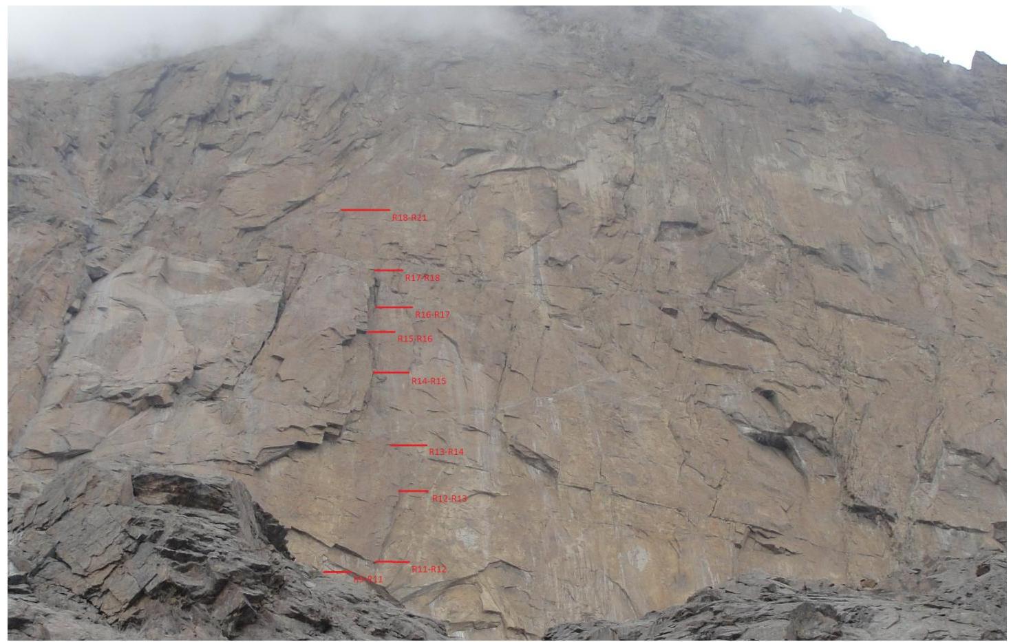
View from R5–R6 on the key part of the route.
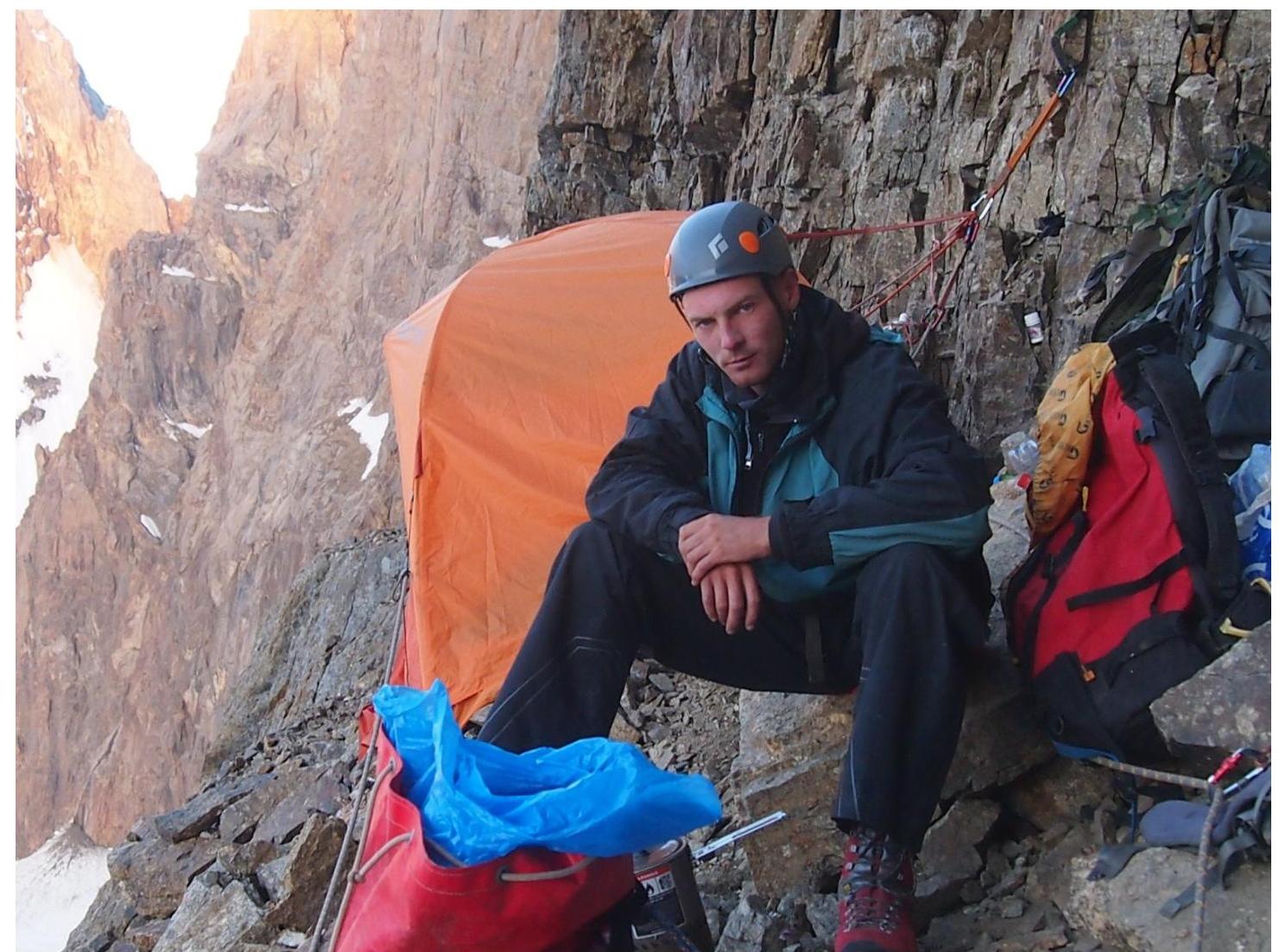
Overnight stay under a cornice on R9.
Passing the railing on R12–R13.
Internal corner on R13–R17.
R14–R15.
R22–R23. Climbing on "humming" ledges.
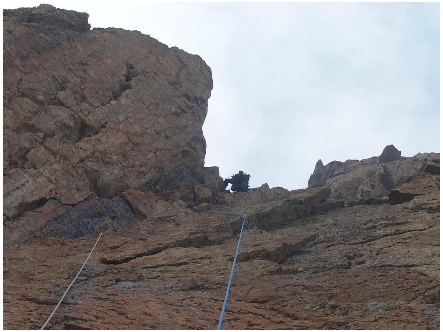
R24–R25.
R26–R27.
R26–R27.
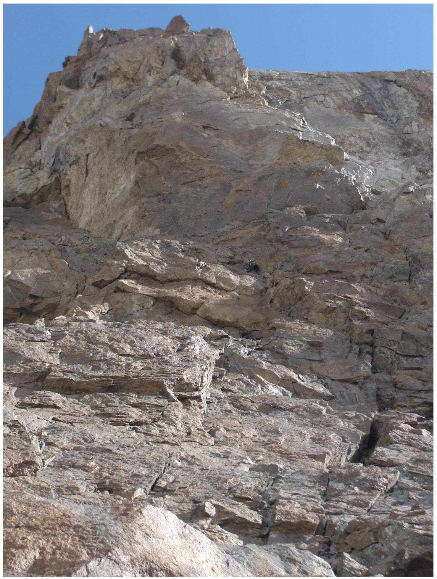
View from the assault overnight stay on the summit tower.
R37–R38. Cornice.
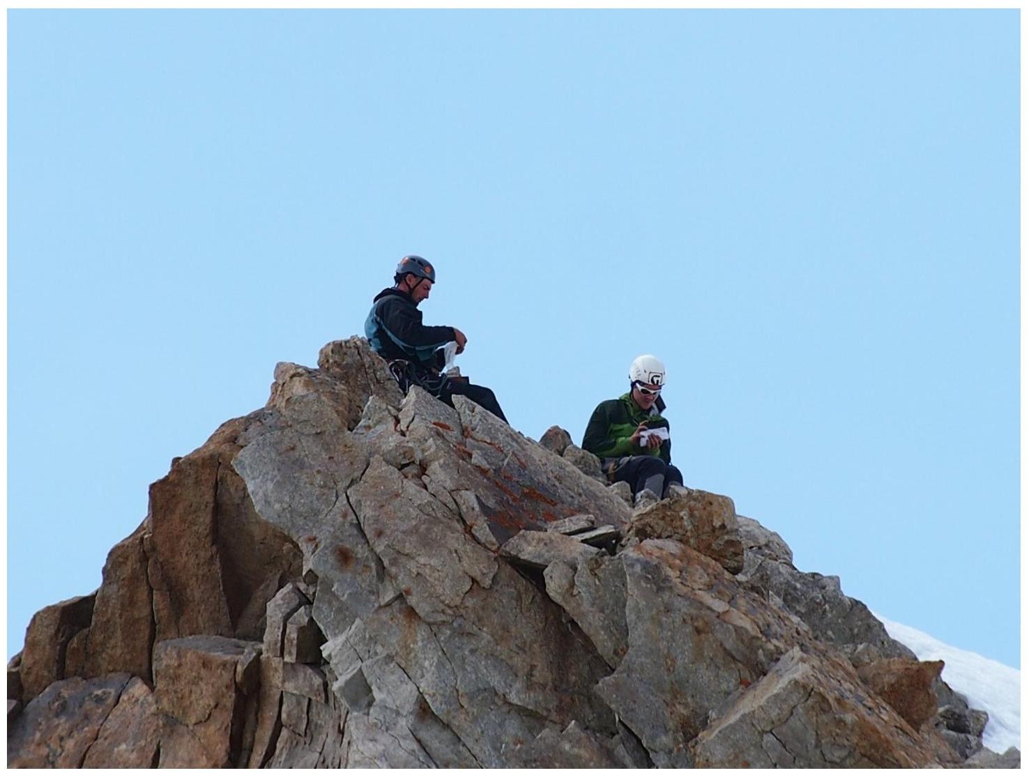
Summit.
Route Description by Sections
R0–R1: Scree slope leading to the base of the couloir. Then rightwards along an inclined scree shelf, crossing a stream, to reach the internal corner.
R1–R2: Up the corner for 40–45 m to a small ledge.
R2–R3: Up to a large inclined ledge resembling a "mulda".
R3–R4: Leftwards and upwards, traverse left behind a ridge, up 5 m to a ledge.
R4–R5: Up the wall-steps and ledges, 50 m.
R5–R7: Scree slope leading to the wall. 150 m. III.
R7–R9: Along a slab under a cornice, bypass it on the left via an internal corner, behind which is a wide ledge. In its right part, there is a safe overnight stay under a protected cornice. Possible to set up 2 tents.
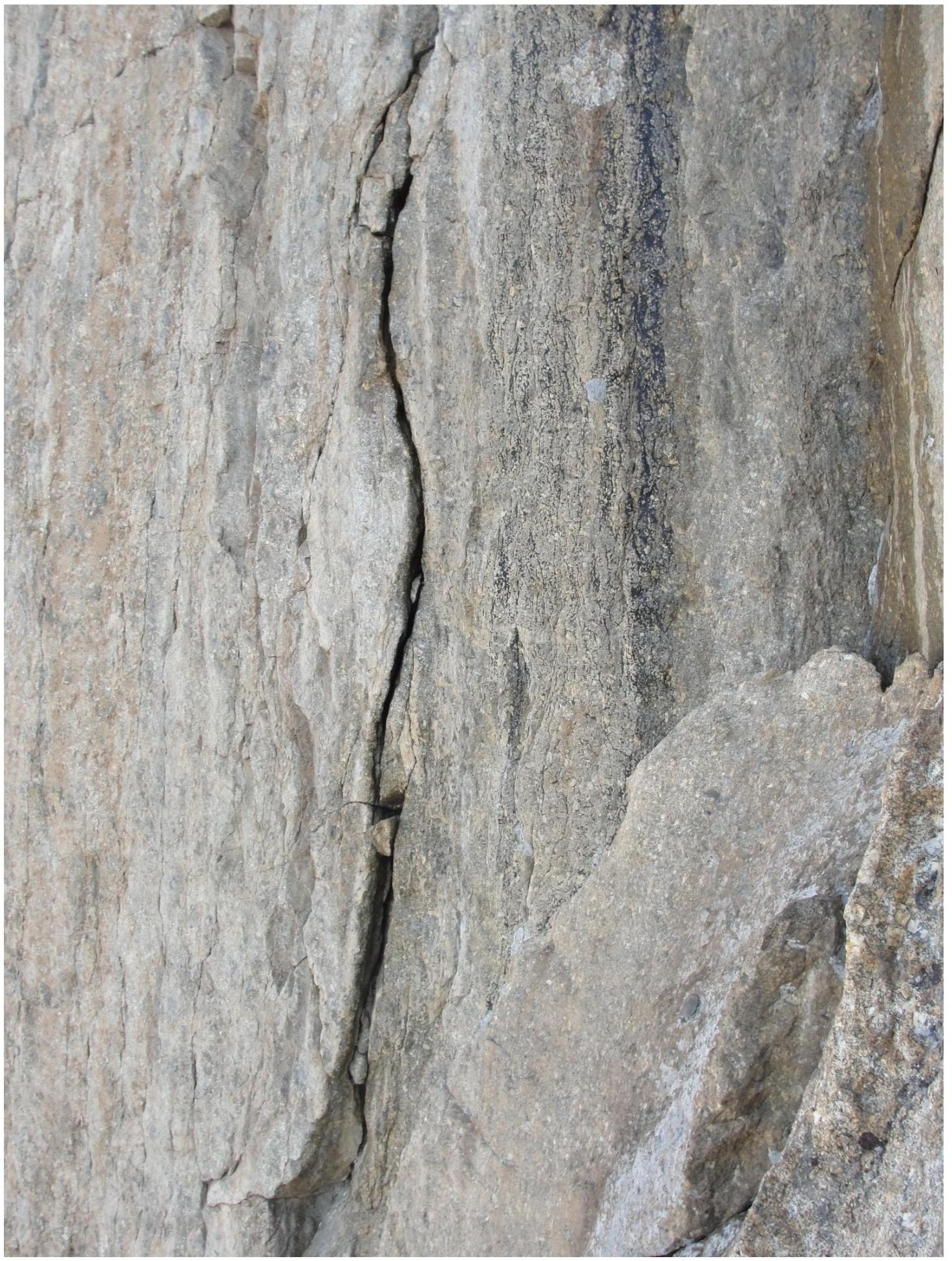
R9–R11: Up a simple wall to an internal corner. A нависающий internal corner (anchors). Gaps are filled with "scale", need to be cleaned.
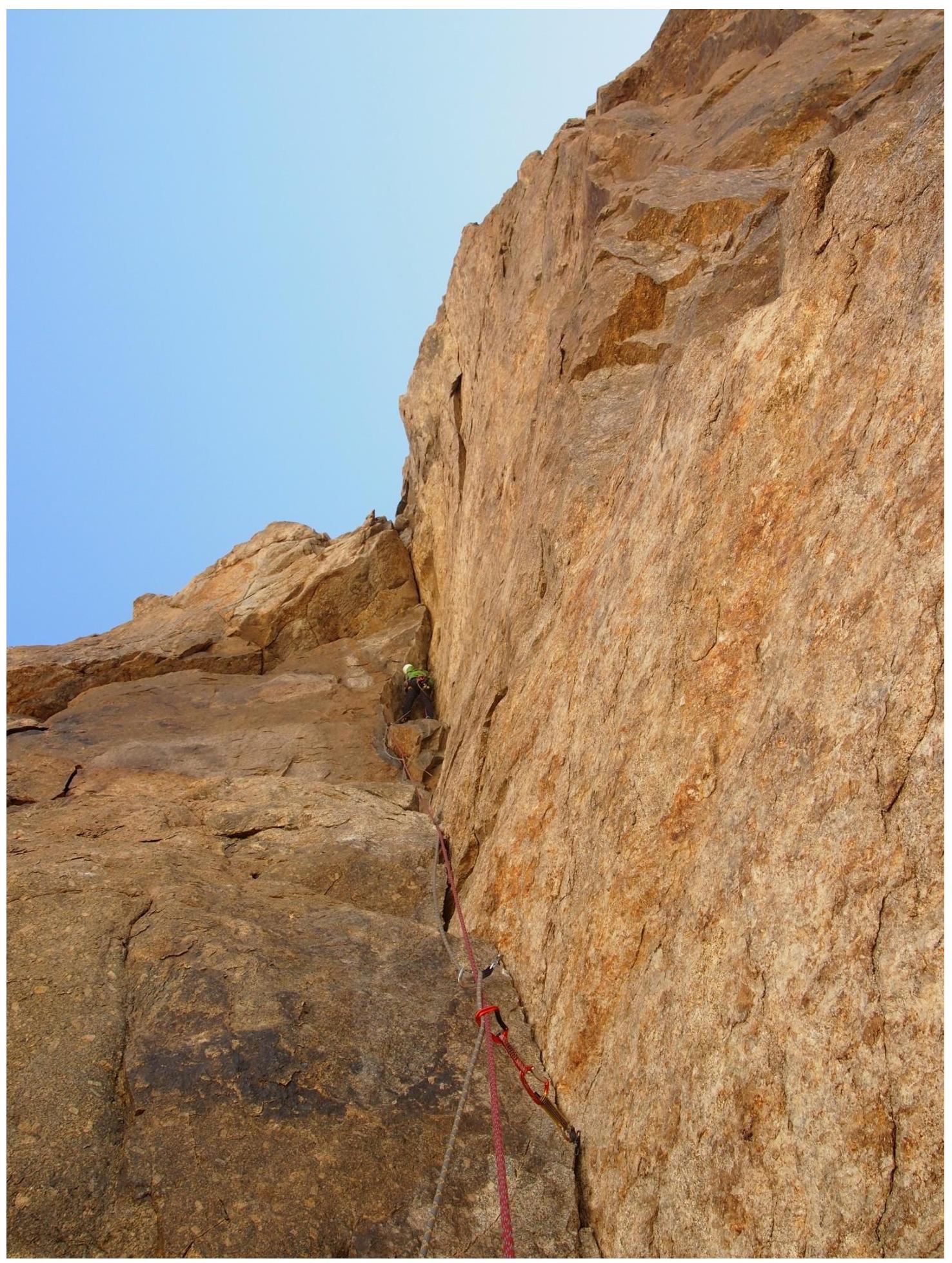
R11–R12: Complex traverse climbing under the cornice to the base of a large нависающий internal corner. At the end of the traverse, there are ATO on chocks and friends along a crack at the base of the cornice.
R12–R13: Up the internal corner. It's better to make a stance in the upper part of the internal corner, as the relief after is very poor for protection. Mainly chocks and friends.
R13–R14: Traverse left under a slab 5 m, a blind crack, anchors. Up the crack 6 m. ATO on anchors and chocks. A 2 m pendulum to a large ledge at the base of a crack going leftwards and upwards. There is a hook with a rappel ring on the ledge.
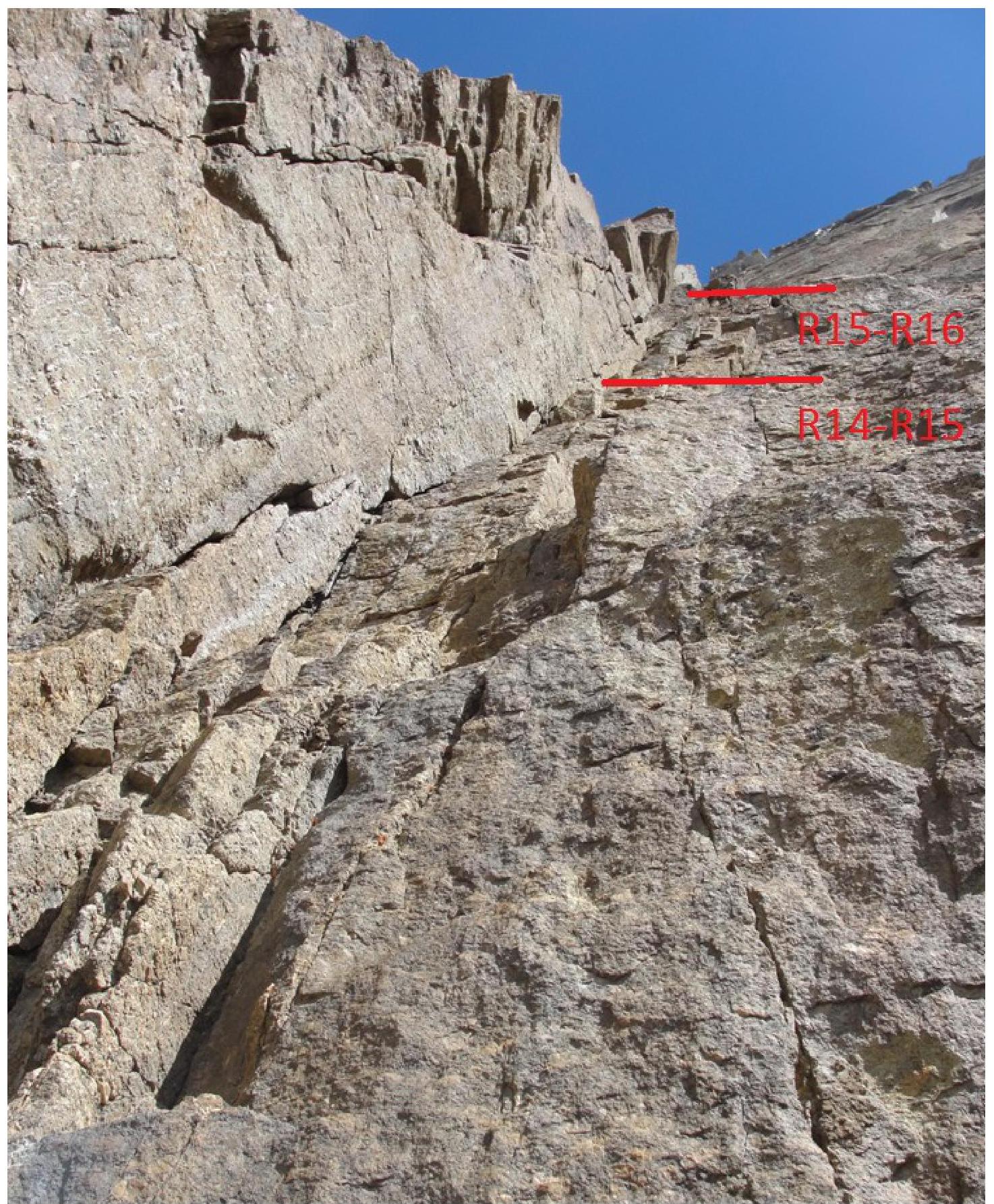
R14–R15: A simple internal corner leads to the base of a large internal corner.
R15–R17: Along the wall with rich relief for protection and climbing, to the right of the internal corner. Further along a chimney with a plug. Chocks, friends.
R17–R18: Leftwards along simple rocks to reach a large ledge. On the ledge, there is a platform suitable for an overnight stay for 3 people. It's possible to accommodate 2–3 more people on a second ledge.
R18–R21: Steep wall. Pleasant climbing. Good protection, using a variety of equipment.
R21–R23: Rightwards and upwards along "humming" ledges 40 m.
R23–R24: Up the wall to the right to a convenient stance opposite the start of a large internal corner. Do not enter the internal corner or the indistinct couloir to its right, which is filled with ice.
R24–R27: Further upwards and bypassing the cornice on the left (10 m) — exit to a ledge, then leftwards and upwards along a crack.
R27–R28: Simple climbing to a large ledge, suitable for an overnight stay.
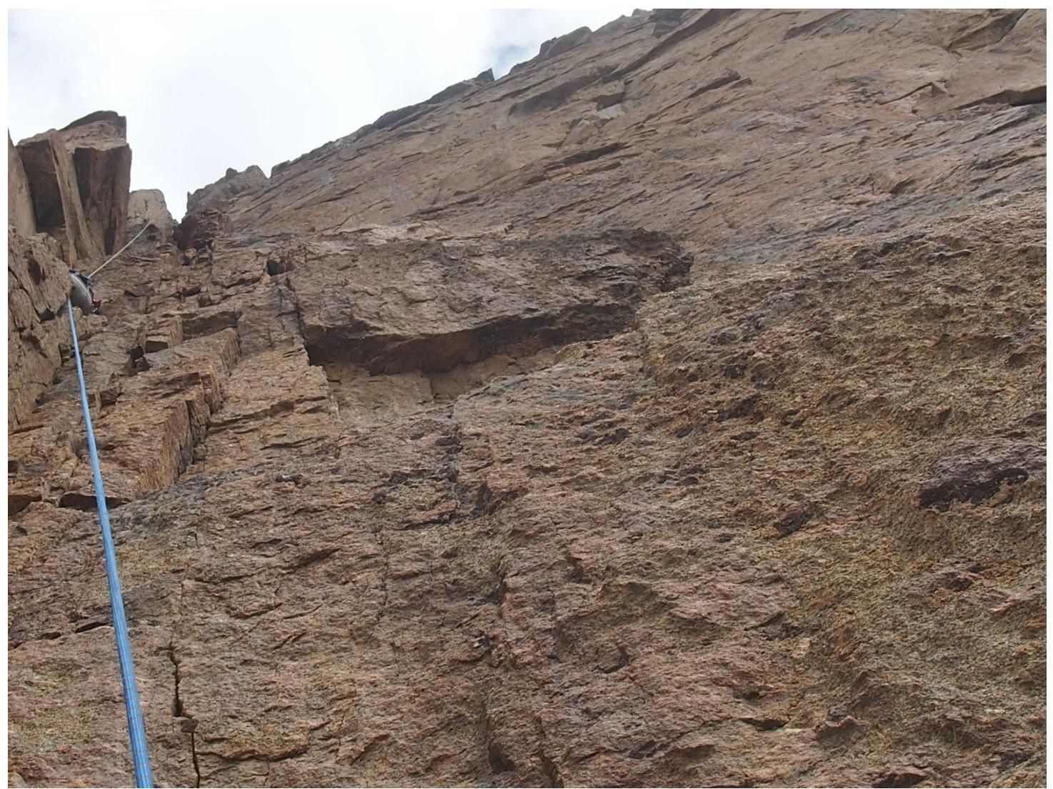
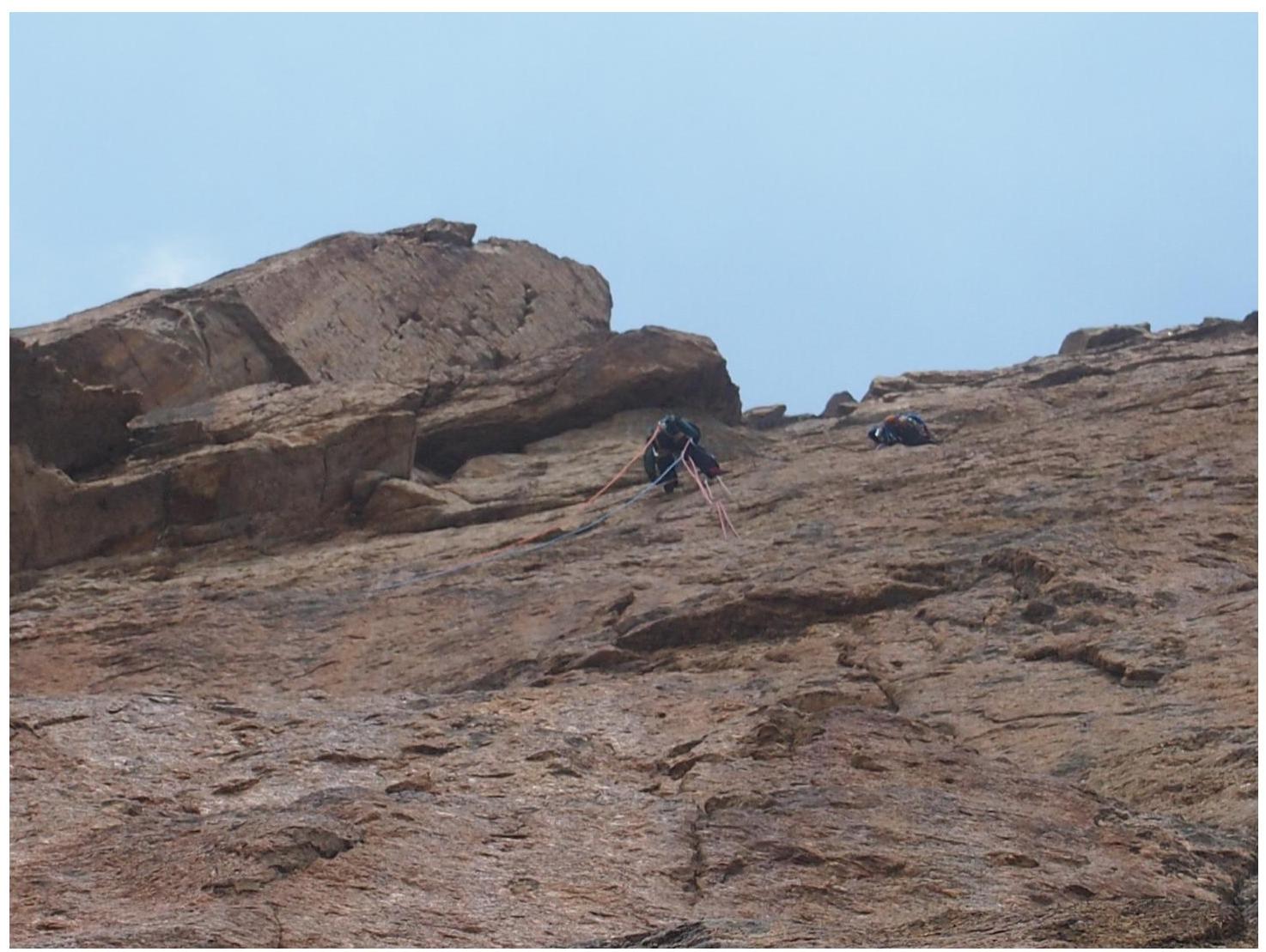
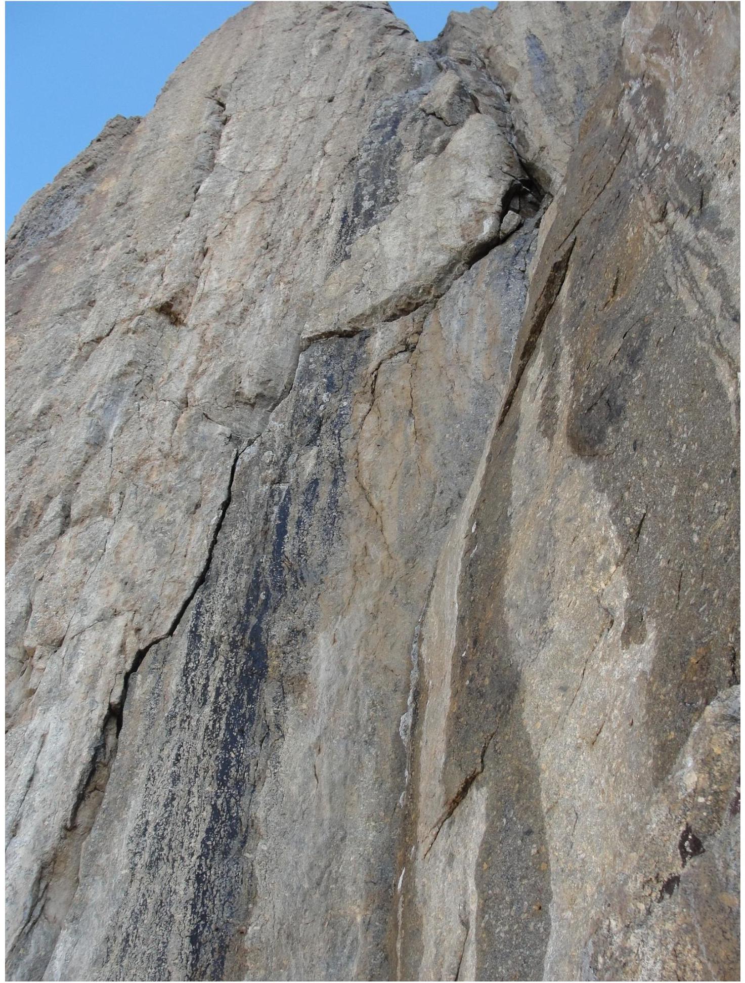
R28–R33: Wall with rich large relief leading to the base of the summit tower. There are loose rocks. Large chocks, medium and large friends.
R33–R35: Vertical wall, then a weakly нависающая crack ending with a small cornice. One pitch on ATO.
R35–R36: Climbing along an internal corner to an inclined ledge, which is also reached by Golubev's route.
R36–R38: Up the internal corner, bypassing the summit tower, under a cornice. Initially, climbing, then ATO with underclimbs. Cornice on ATO, stance behind the cornice. Large, medium chocks, friends.
R38–R39: Steep internal corner, местами лед. Pleasant climbing to a large ledge. Possible overnight stay.
R39–R40: Simple ridge leading to the summit.
Approach
Peak Iskander is located in the Turkestan Range, in the upper reaches of the Laylyak gorge, in its left tributary — the Aksu gorge.
Approach:
- From the village of Ozguryush, up the Laylyak gorge
- Further up the Aksu gorge to the base camp at the site of the former Alay camp (5–6 hours)
From the base camp:
- Up the left bank of the Aksu River
- Ascend the moraine to the Aksu glacier cirque
- Cross the stream flowing from the slopes of Peak Blok
- Enter the Aksu glacier cirque
- Approach the wall of Aksu (3.5 hours from BC)
Further:
- Along the wall of Aksu and the "pillar" of Admiralteets to approach Iskander
- From the overnight stay under Aksu — 3–4 hours
Schedule 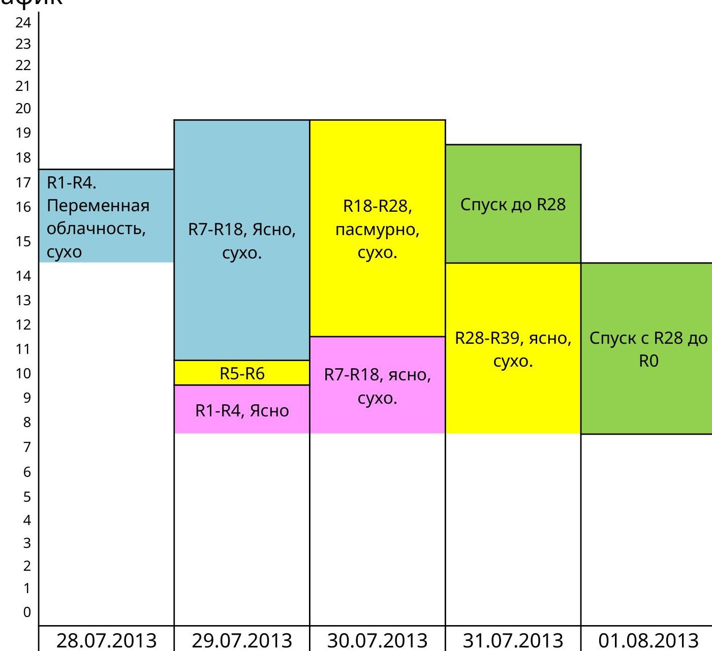
| Processing the lower, simple part of the route | We start. Processing the first key, set up for an overnight stay under the key. | Climb the previously traversed section, reach the assault overnight stay. | Reached the summit, descend to the assault overnight stay. | Descent |
|---|---|---|---|---|
| Processing | ||||
| Climbing the previously processed section | ||||
| Without processing | ||||
| Descent |
Height gain schedule 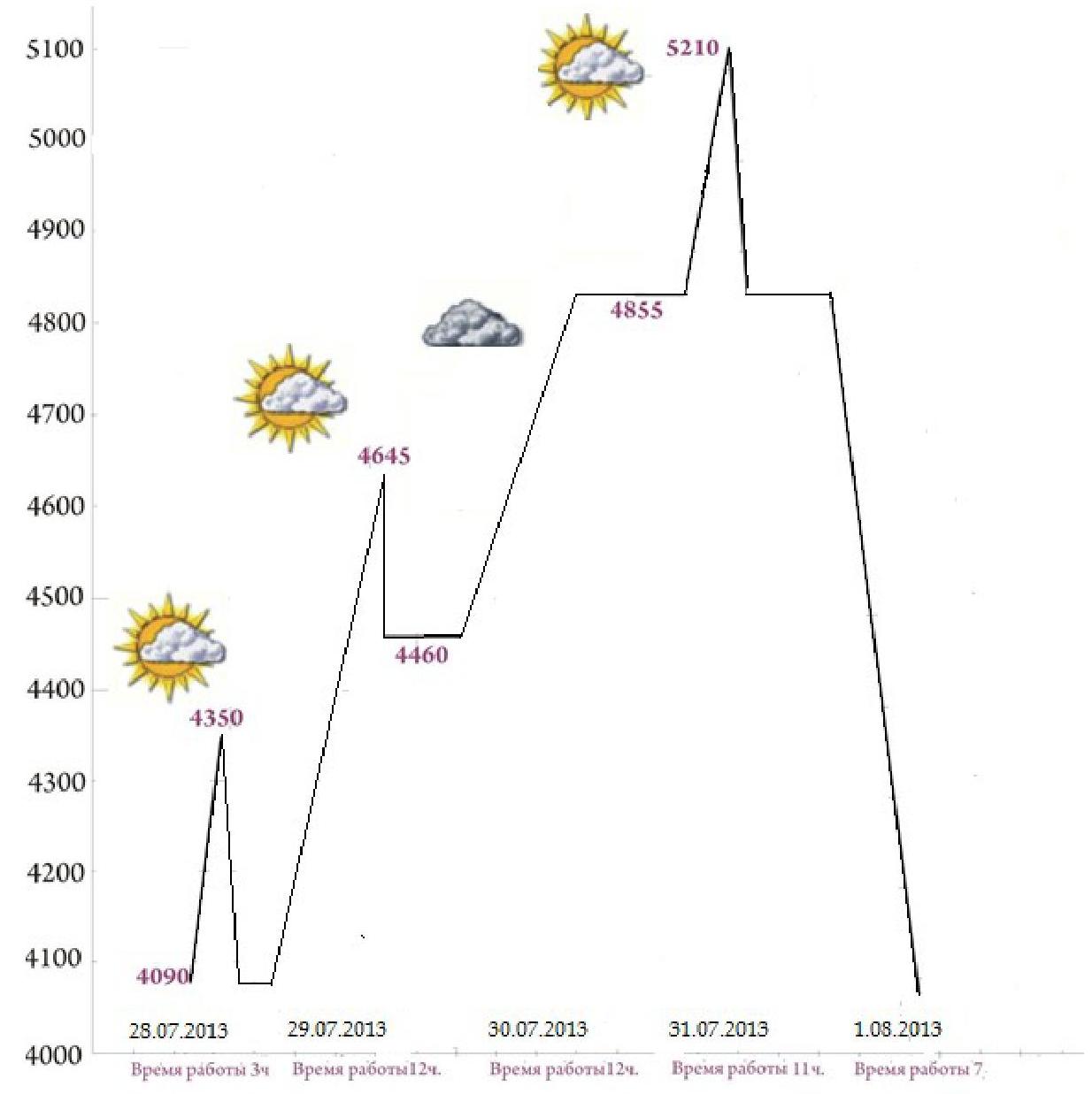
General Characteristics of the Route
The route was first ascended in 1998 by a team of 3 people in 7 days.
The route starts to the left of a large, indistinct couloir.
The route can be divided into 2 unequal sections:
- Simple beginning R0–R7
- Complex wall part R7–R39, which leads almost to the summit.
The route is rockfall-prone!!! The lower part of the route (especially after 12:00), as this part is exposed to rocks falling from the summit bastion.
Water sources:
- There is water at the start of the route.
- Water can be obtained from a snowpatch by rappelling 1 pitch from R7 (but the snowpatch is exposed to rocks falling from the summit tower).
- There is snow on the summit.
There are no other water sources on the route.
Tactical Actions of the Team
Since for most participants this was the first ascent of 6A category of difficulty, the tactic chosen was a capsule style.
The team used 6 ropes:
- 5 dynamic ropes, 50 m each.
- 1 static rope, 60 m.
The first climber climbed on two ropes.
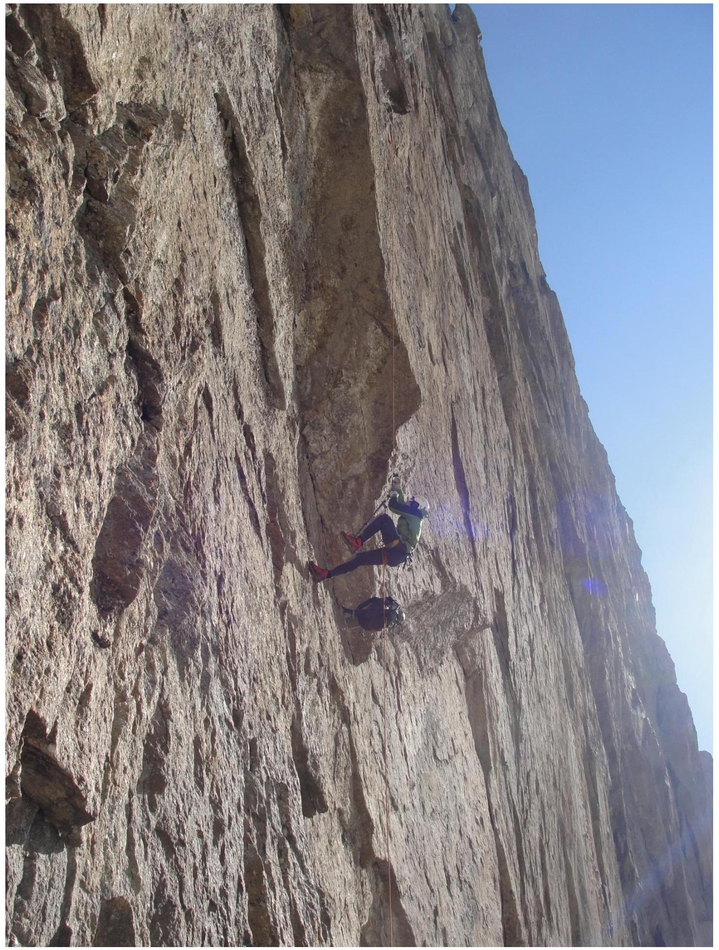
The first climbers were Chudinov Pavel and Marusov Pavel. During their turns, the first climbers ascended without rucksacks, wearing rock shoes.
They carried:
- water.
Initially, the following items were not taken on the route:
- skyhooks;
- drill.
The Laylyak gorge area is frequently visited. Therefore, a map-scheme of the area is not provided (see Recommendations for Classification of Ascent Routes and Requirements for Ascent Report for Classification. Approved by the Presidium of the Russian Mountaineering Federation (Protocol No. 17 of May 23, 2010)).