124
Brief description of the approach to the route
From the Dughoba alpine training and sports base, follow the Dughoba River upstream to the Sukhoy Log gorge (1.5–2 km), 15–20 minutes. Here, cross the Dughoba River via a bridge to the right (orographic) bank. Then ascend Sukhoy Log to the ridge between the peaks Maly Zamok (3450 m) and Glavny Zamok (3943 m). The ascent takes 2.5–3 hours. From the ridge, descend to the right via a trail, bypassing the cirque without significant loss of elevation, to the opposite slope. Then traverse northward across scree slopes to a couloir descending from Peak Khurdzhum S. (3600 m) — 300–350 m. Ascend the scree-filled couloir 60–70 m upward and traverse across scree shelves 120 m northward to a "cork" (a huge overhanging rock, 15×10 m in size). The route then proceeds upward to the left, onto the cork and to the 3rd ridge from the crest. Overall, the approach from the Dughoba alpine base to the start of the route takes 5–6 hours.
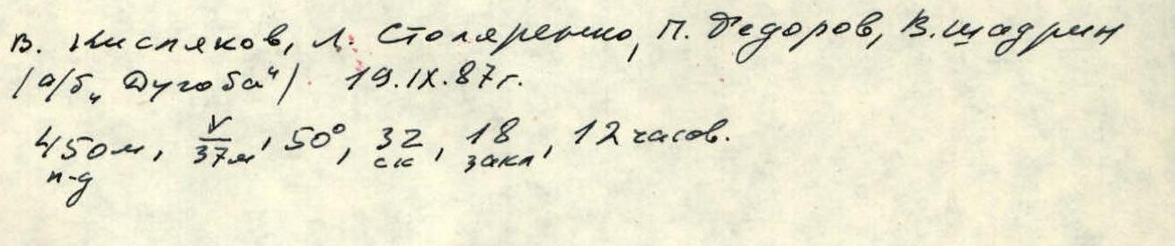
V. Kislyakov, L. Stolyarenko, P. Dedorov, V. Shadrin. May 10, 1987 (Dugobich). 450 m, 150°, 32 pitches, 18 hours.
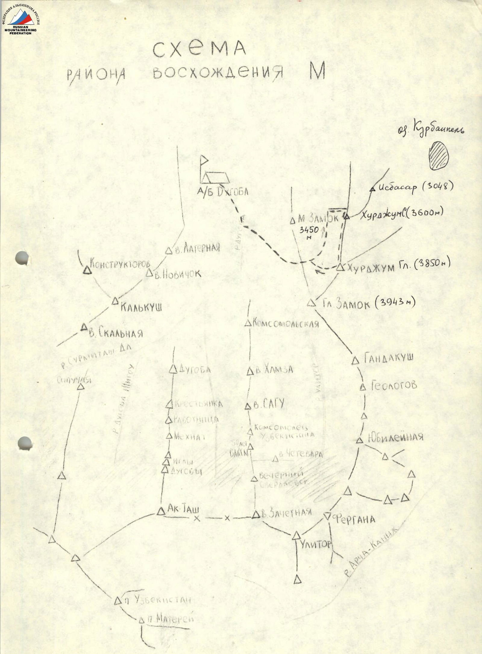
Scheme of the climbing area
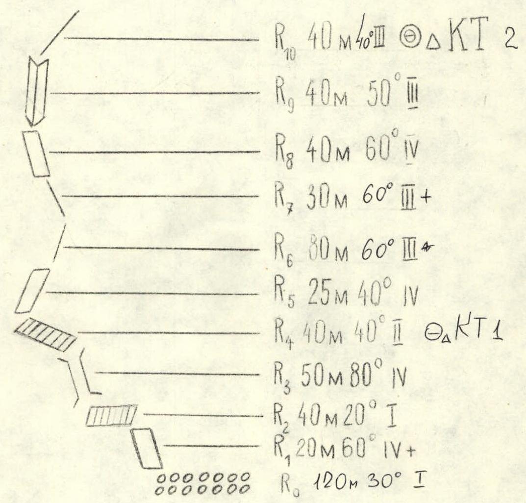
Route diagram on Peak Khurdzhum Gl. in UIAA symbols WESTERN RIDGE
R10: 40 m, 40°, 2, difficulty category 2 R9: 40 m, 50°, 3 R8: 40 m, 60°, 4 R7: 30 m, 60°, 3+ R6: 80 m, 60°, 3 R5: 25 m, 40°, 4 R4: 40 m, 40°, 2, difficulty category 1 R3: 50 m, 80°, 4 R2: 40 m, 20°, 1 R1: 20 m, 60°, 4+ R0: 120 m, 30°, 1
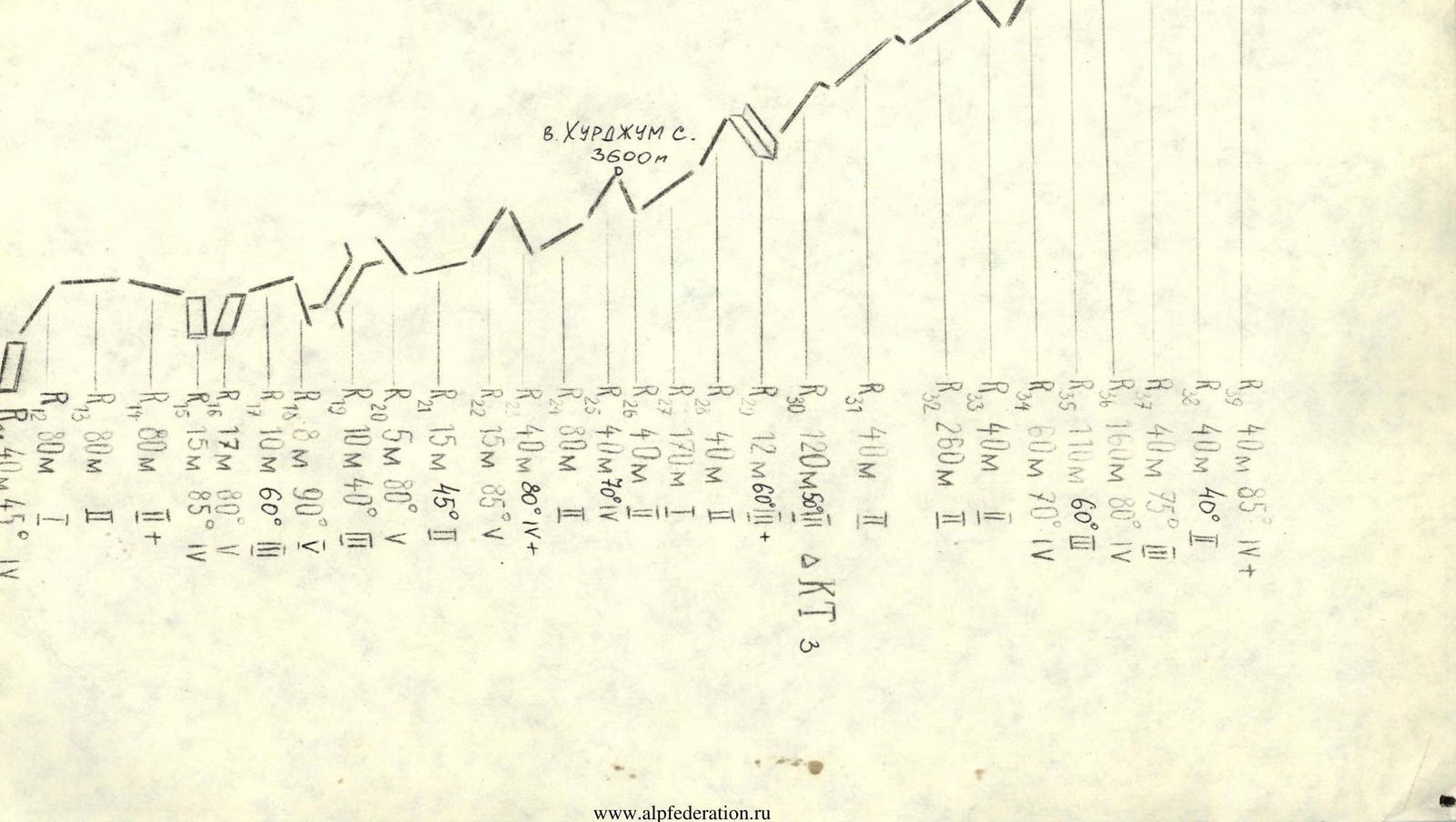
Route diagram on Peak Khurdzhum Gl. in UIAA symbols NORTHERN RIDGE
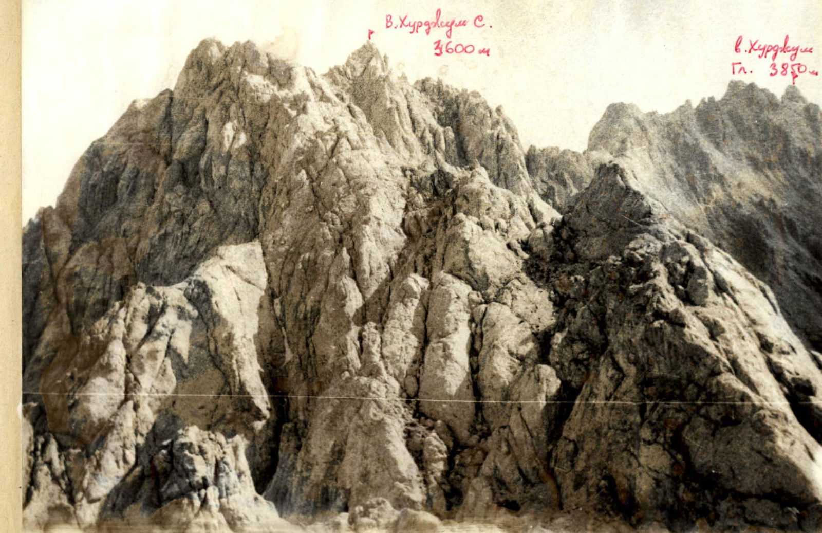
Peak Khurdzhum S. 3600 m Peak Khurdzhum Gl. 3850 m
R39: 40 m, 85°, 4+ R38: 40 m, 40°, 2 R37: 40 m, 75°, 3 R36: 160 m, 80°, 4 R35: 110 m, 60°, 3 R34: 60 m, 70°, 4 R33: 40 m, 2 R32: 260 m, 2 R31: 40 m, 2 R30: 120 m, 50°, 1, difficulty category 3 R29: 12 m, 60°, 2+ R28: 40 m, 2 R27: 170 m, 1 R26: 40 m, 2 R25: 40 m, 70°, 4 R24: 80 m, 3 R23: 40 m, 80°, 4+ R22: 15 m, 85°, 5 R21: 15 m, 45°, 2 R20: 5 m, 80°, 5 R19: 10 m, 40°, 3 R18: 18 m, 90°, 5 R17: 10 m, 60°, 3 R16: 17 m, 80°, 5 R15: 15 m, 85°, 4 R14: 80 m, 2+ R13: 80 m, 1 R12: 80 m, 1 R11: 40 m, 45°, 4
 View of the northern ridge from section R20
 Section R8
