Report
on the first ascent to the summit of Sauk-Djaylyau Central via the ice couloir on the north wall, category 6A, by a team from Tomsk region and St. Petersburg from September 6, 2019 to September 8, 2019.
I. Climbing Report
| 1. General Information | ||
|---|---|---|
| 1.1 | Full name, sports rank of the leader | Tyulyupo Aleksey Vitalyevich, 1st sports rank |
| 1.2 | Full name, sports rank of the participants | Kashevnick Anton Alexandrovich, CMS |
| 1.3 | Full name of the coach | Kashevnick Anton Alexandrovich |
| 2. Characteristics of the Climbing Object | ||
| 2.1 | Region | Gissar-Alay |
| 2.2 | Valley | Archakanysh |
| 2.3 | Section number according to the 2013 Classification Table | 5.1.1 |
| 2.4 | Name and height of the summit | Sauk-Djaylyau Central, 5227 m |
| 3. Route Characteristics | ||
| 3.1 | Route name | Via the ice couloir on the north wall |
| 3.2 | Proposed category of difficulty | 6A |
| 3.3 | Degree of route exploration | First ascent |
| 3.4 | Terrain characteristics | Combined |
| 3.5 | Elevation gain | 1377 m |
| 3.6 | Route length (in meters) | 1800 m |
| 3.7 | Technical elements of the route (total length of sections with different difficulty levels, indicating terrain type: ice-snow, rock) | Ice 55° – 850 m. Ice 65° – 35 m. Ice 75° – 400 m. Ice 80° – 200 m. Ice 85° – 80 m. Ice 90° – 90 m. Ice 100° – 5 m. IV rock – 30 m. V+ rock – 15 m. VI rock – 30 m. |
| 3.8 | Average slope of the route | 65° |
| 3.9 | Average slope of the main part of the route | 78° |
| 3.10 | Descent from the summit | Via the ascent route |
| 3.11 | Additional route characteristics | The route is best climbed in autumn as it is prone to rockfall in summer; good bivouac sites are hard to find. |
| 4. Team Actions Characteristics | ||
| 4.1 | Time of movement (team's climbing hours, in hours and days) | 25.5 hours, 2.5 days (+10 hours for descent) |
| 4.2 | Bivouacs | First bivouac in a crevasse, under an overhang Second bivouac on a constructed ledge |
| 4.3 | Route preparation time | None |
| 4.4 | Departure onto the route | 7:00, September 6, 2019 |
| 4.5 | Summit arrival | 13:30, September 8, 2019 |
| 4.6 | Return to base camp | 13:00, September 9, 2019 |
| 5. Person Responsible for the Report | ||
| 5.1 | Full name, e-mail | Kashevnick Anton Alexandrovich, atonik@bk.ru |
II. Climbing Description
1. Climbing Object Characteristics
1.1. Region Overview
The Sauk-Djaylyau massif is located in the northern spur of the Alay range. The massif is nearly 1 km higher than the range. The cirque formed by the Sauk-Djaylyau massif is shaped like a horseshoe open to the north. The cirque contains a large glaciation area of about 5 square kilometers. The Dzhindy-su river flows out of the glacier and descends into the Surmetash valley through a deep canyon.
One of the peaks of Sauk-Djaylyau Central presents a very logical route via a large internal angle filled with ice. In Soviet times, such ice routes were rarely attempted, but with advancements in equipment and ice climbing techniques, ascending this route has become feasible.
The region began to be explored by climbers in the 1970s: the first were Leningrad climbers in 1977. Expeditions visited the region every few years thereafter: 1978, 1980, 1984, and 1986. In the post-Soviet period, expeditions are known to have taken place in 1992 and 1995, after which the region was not visited for a long time...
From recent mountaineering history: in 2015, Aleksey Tyulyupo organized two expeditions to the Sauk-Djaylyau cirque.
Summer Expedition:
- Participants: Tyulyupo Aleksey, Glazunov Yevgeny, Glazenov Sergey, and Dmitrenko Yelena (as an observer); the team accessed the region via Isfayramsay, as far as the road allowed – by car; they managed to complete a first ascent of category 5B.
Autumn Expedition:
- Participants: Tyulyupo Aleksey and Kashevnick Anton; the team made an autonomous approach to the region from the "Dugoba" alpine camp via Ak-Tash pass, exiting the region via the same route; they attempted to ascend Sauk-Djaylyau Central but decided to postpone the climb due to limited resources.
In early 2019, it was decided to return to Dugoba to attempt the previously planned but unfulfilled ascent. The team's main idea was to climb the route in the purest style possible: full autonomy, logical and aesthetically pleasing line, no use of artificial climbing aids (ITOs), using only ice tools, and climbing the entire route on foot by both participants. In practice, everything was executed as planned.
1.2. General Photo of the Summit
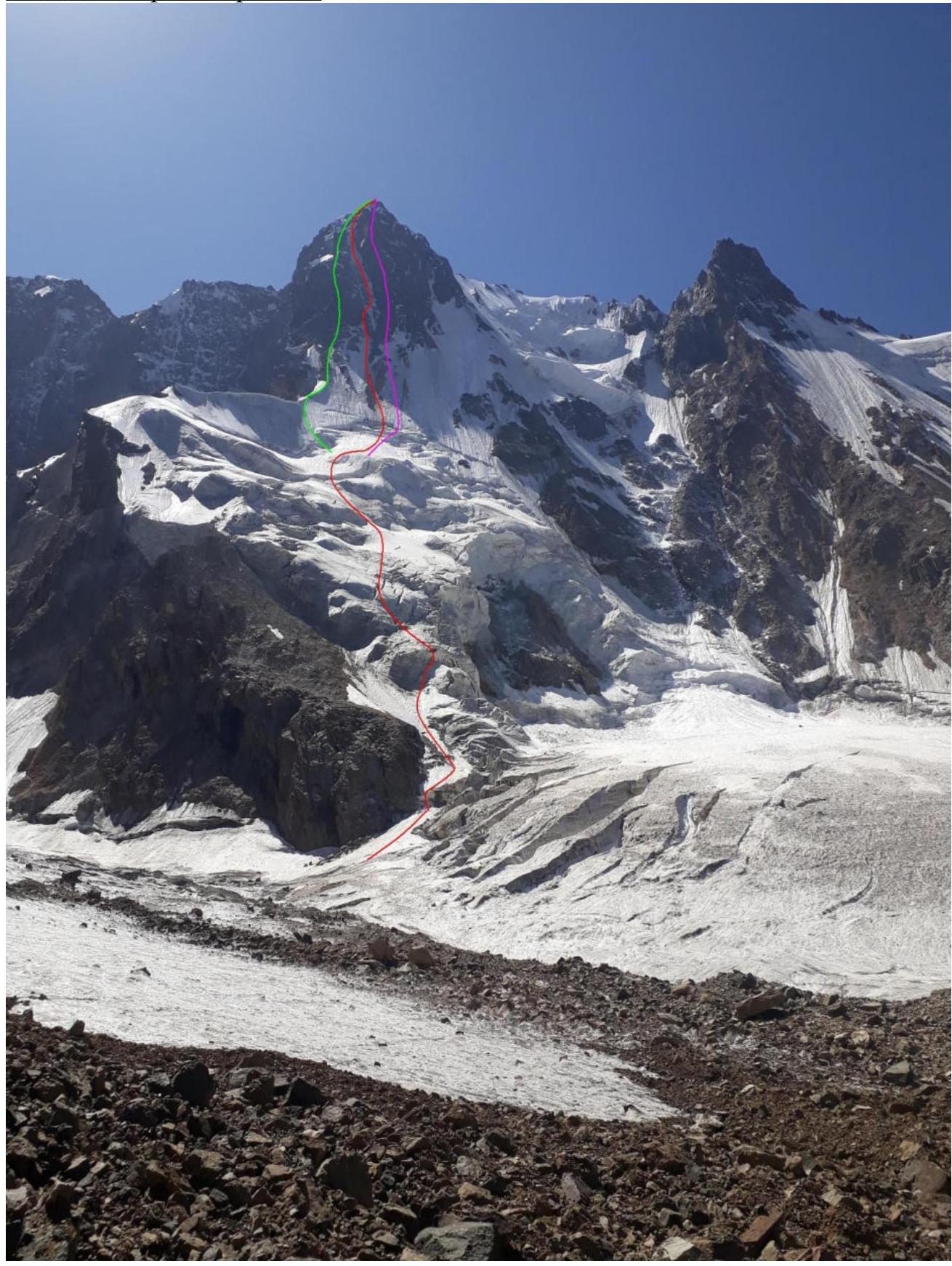
- Green – Moskaltzova
- Purple – Kovtun's route
- Red – the team's route
1.3. Route Profile Photo

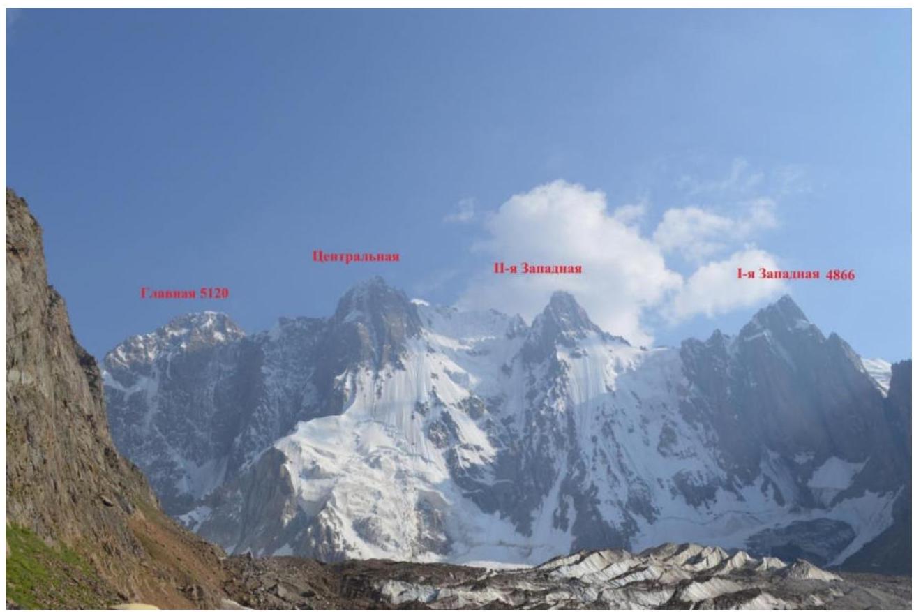
1.4. Panoramic Photo of the Region
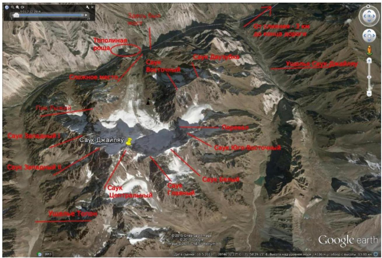
1.5. Region Map
2. Route Characteristics
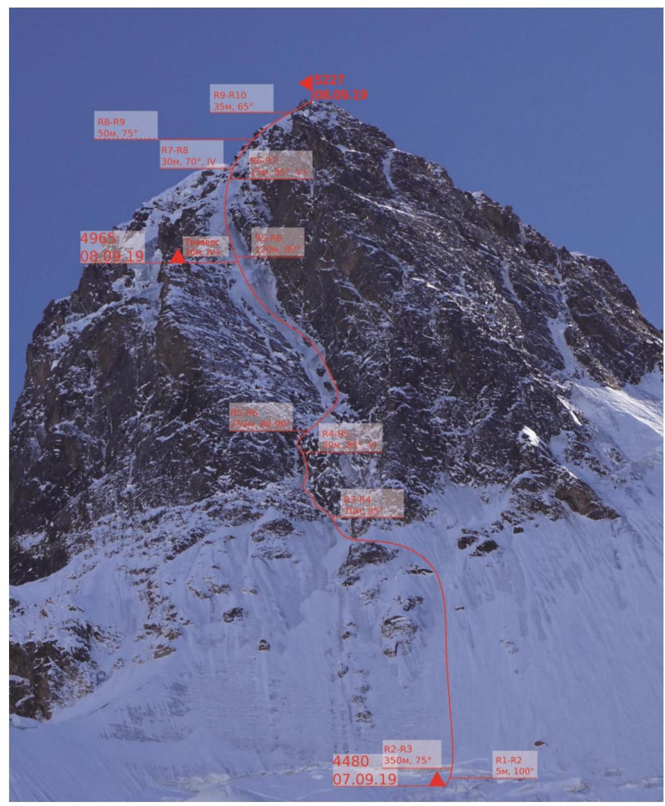
2.1. Technical Photo of the Route
2.2. Route Description by Sections
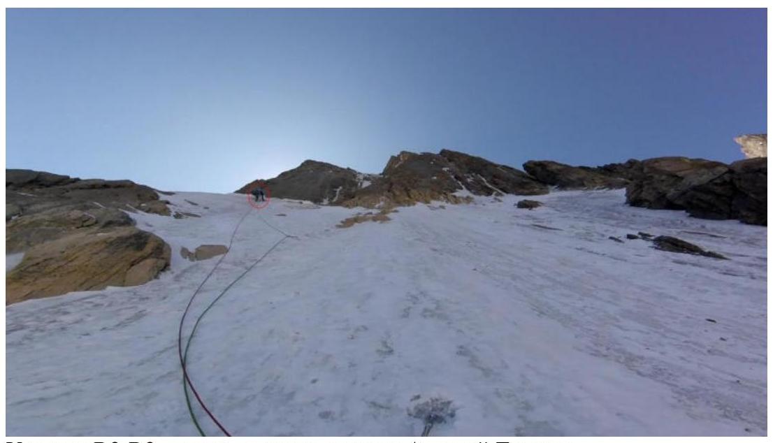
R0–R1 Ice, avg. slope 55°, 850 m, with 3 sections of 5–15 m at 75–85°. R1–R2 Ice, 100°, 5 m. Cornice above the bivouac. R2–R3 Ice, 75°, 350 m. Ice wall; reliable protection. R3–R4 Ice, 85°, 70 m. Unstable ice; careful with protection! R4–R5 Mixed, VI, 85°, 30 m. Demanding climbing, protection on rocks. R5–R6 Ice, 80–90°, 370 m. Varied ice, plenty of... R6–R7 Mixed, V+, 85°, 15 m. Destroyed rocks covered in ice; protection!!! R7–R8 Mixed, IV, 70°, 30 m. Rocks with ice, protection on ice. R8–R9 Ice, 75°, 50 m. Left "stream" to the "cap"; ice screws. R9–R10 Ice, 65°, 35 m. "Cap".
3. Tactical Actions of the Team
2015, Reconnaissance
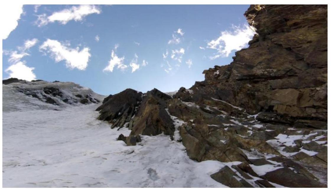
We first observed the route to Sauk-Djaylyau Central in September 2015. We approached the Archakanysh valley from the "Dugoba" alpine camp via Ak-Tash pass and then down the glacier. One day of observation and one day for an attempted ascent were all we had that year. As we navigated through the icefall (section R0–R1) after a snowfall, it became clear that completing the route non-stop under those conditions was not feasible. The ascent was postponed indefinitely.
2019
In early August, team members gathered at the "Dugoba" alpine camp, did a few warm-up climbs: "Stolb" SAGU 5B and the left edge of "Shait" 6A, and then, after resting in the camp, moved towards the Sauk-Djaylyau area via a new route – through Shait valley and Trum pass.
September 4, Approach and Observation
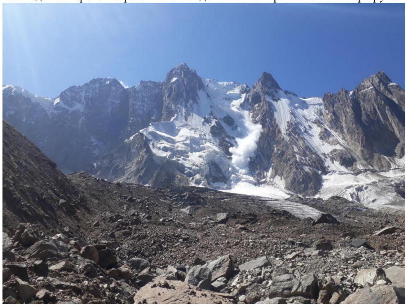
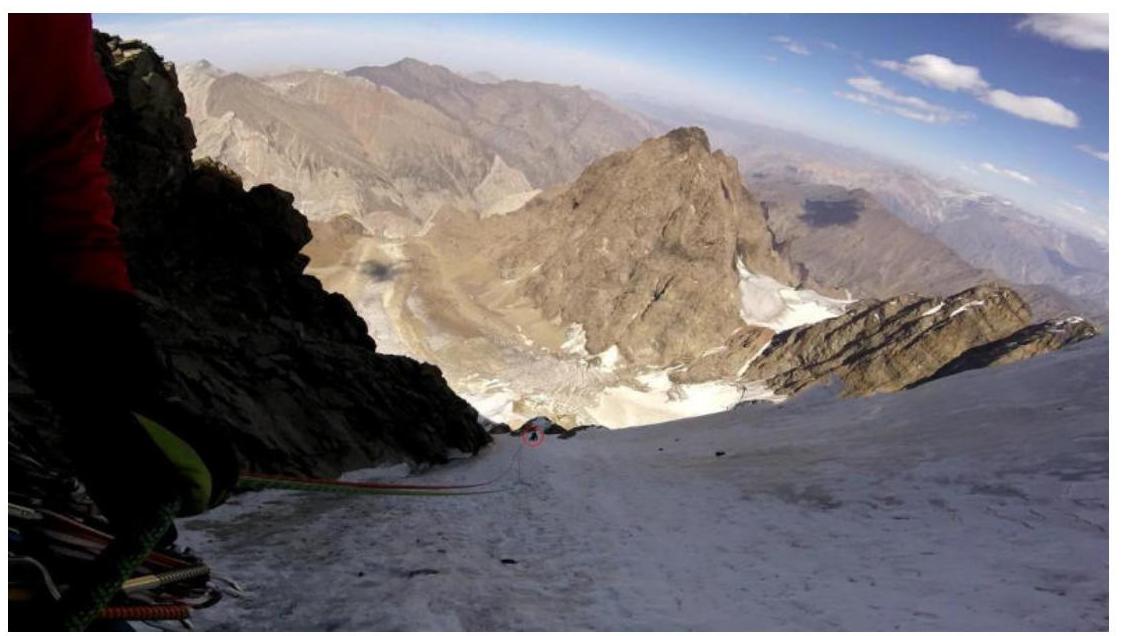
The team ascended to the Sauk-Djaylyau cirque, set up ABC, and spent a day observing the mountain. The photo below shows an ice avalanche to the right of our route.
September 5, Waiting Under the Mountain
The plan was to start the route, but the weather intervened: fog and clouds in the morning, variable cloudiness throughout the day. Luckily, we had a food reserve for bad weather.
View from the tent towards the mountain.
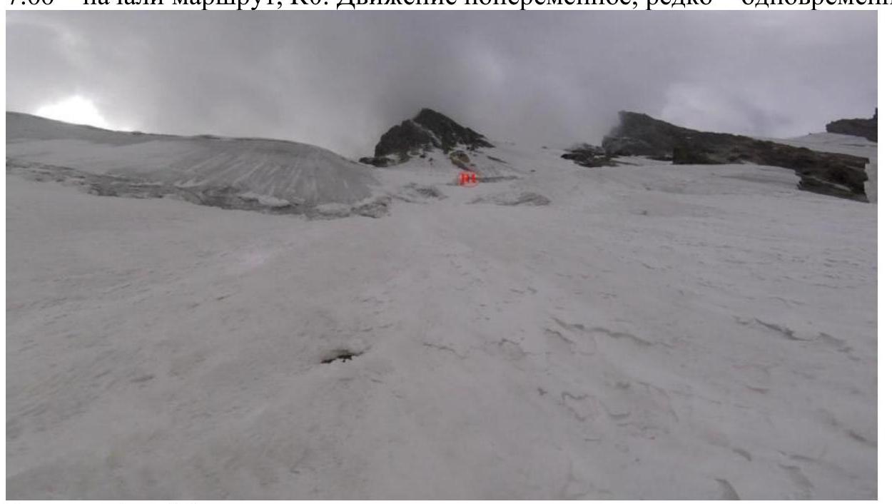
September 6, 1st day of ascent, Anton Kashevnick led first
- 6:00 – left ABC towards the start of the route
- 7:00 – began the route, R0. Movement was alternating, occasionally simultaneous.
 View of the bivouac R1.
12:00 – reached R1 — a convenient ledge for the tent, set up bivouac, and stayed for the night as there was no possibility to bivouac higher.
 Bivouac on R1.
September 7, 2nd day of ascent, Aleksey Tyulyupo led first
5:00 – Started climbing the main part of the route.
 View from R1, a short section of ice with a 100° slope for warm-up. Movement from the bivouac was initially vertical, then after rocky "islands," it went left at 45° — towards the base of a huge internal angle with ice "streams". Climbing the ice in the angle requires attention and caution: sometimes the ice detaches from the rock, and in some places, the ice crust is as thin as 5–10 cm. We moved up the left "stream," and when it ended, we climbed the rock using ice tools, bearing right towards the base of the couloir. Protection was on rock placements.
 Section R2–R3 — middle, Aleksey Tyulyupo in the frame.
 Section R2–R3 — upper part, Aleksey Tyulyupo in the frame.
 Section R3–R4 — "station" on rock due to thin ice.
 Section R3–R4, top – "station" on rock and ice.
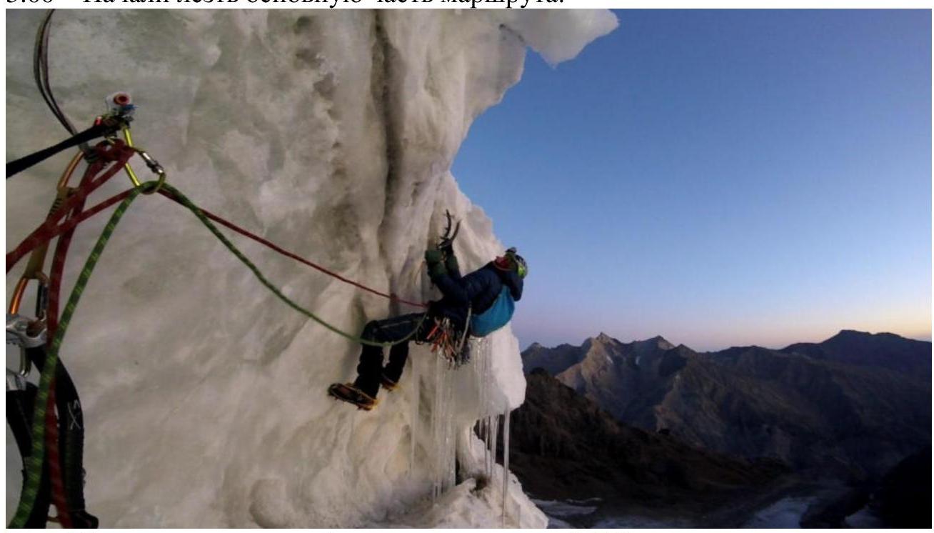
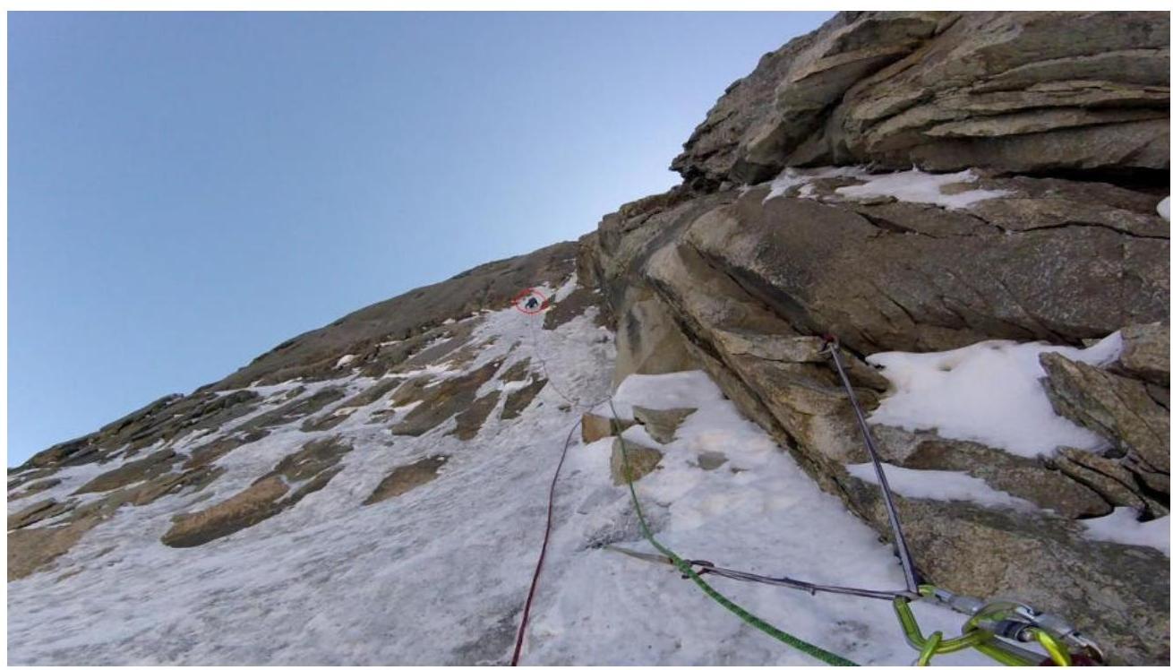
 Section R4–R5, movement on ice, then right on rock. Key section.
After passing the key section, it became possible to reliably belay on ice screws, which was a relief. However, it was still about 250 m to a good bivouac site. The ice in the angle became harder than below because the angle is not exposed to sunlight, and the relative height approaches 5000 m. As the ice shatters into "lenses," the belayer should stand aside from the climber, preferably against the rocks on the right side of the internal angle. We found a bivouac site by making a traverse left for 20 m. We set up the bivouac at 19:00.
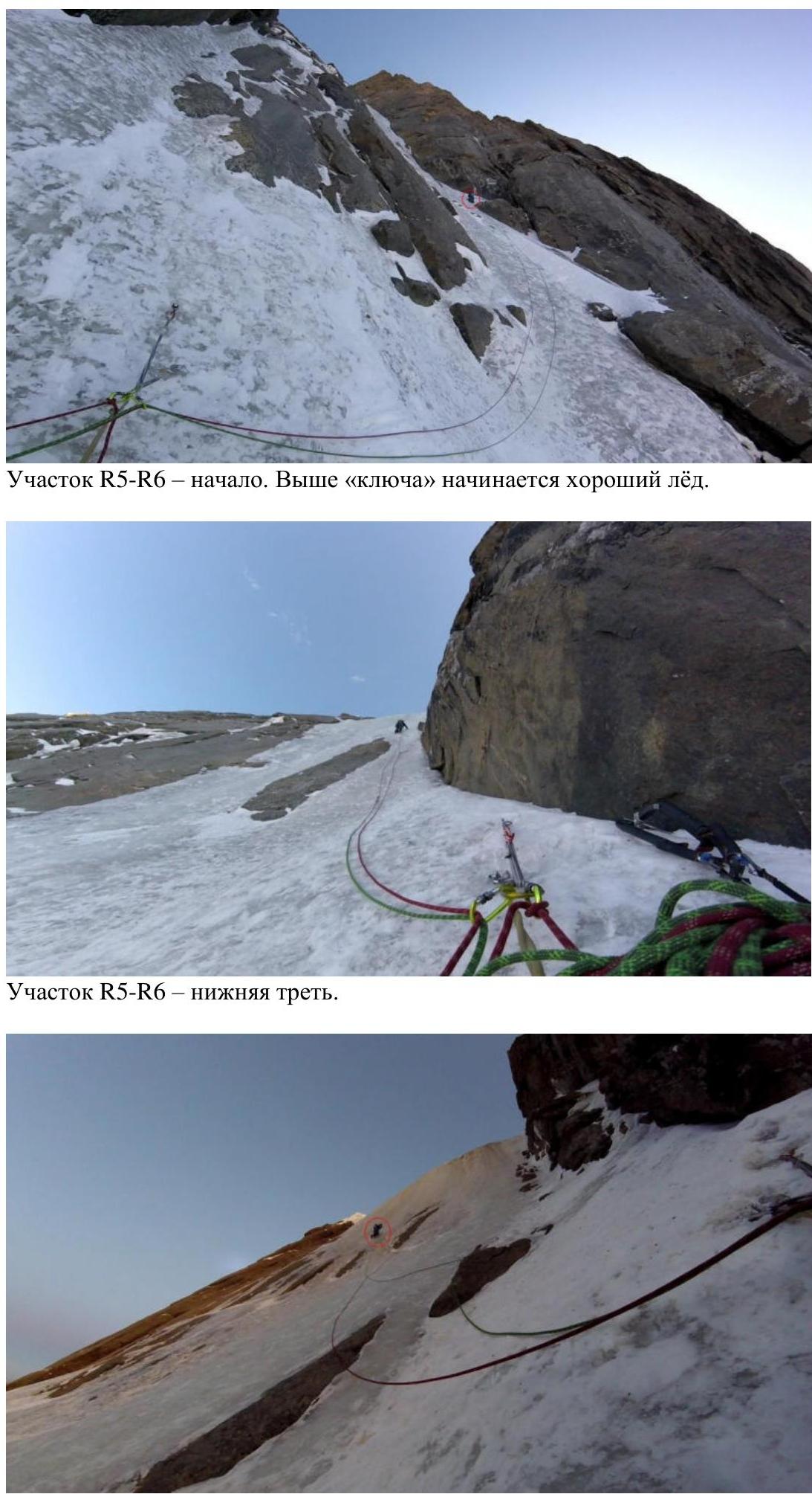 Section R5–R6 — middle. There are slightly overhanging ice sections.
September 8, 3rd day of ascent, Anton Kashevnick led first
7:00 – dismantled the bivouac, left it in place, and continued up the route.
 Bivouac site – a rocky-ospy island 20 m left of the route line.
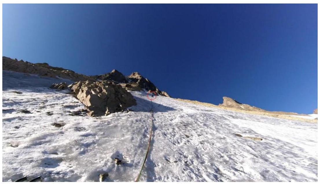
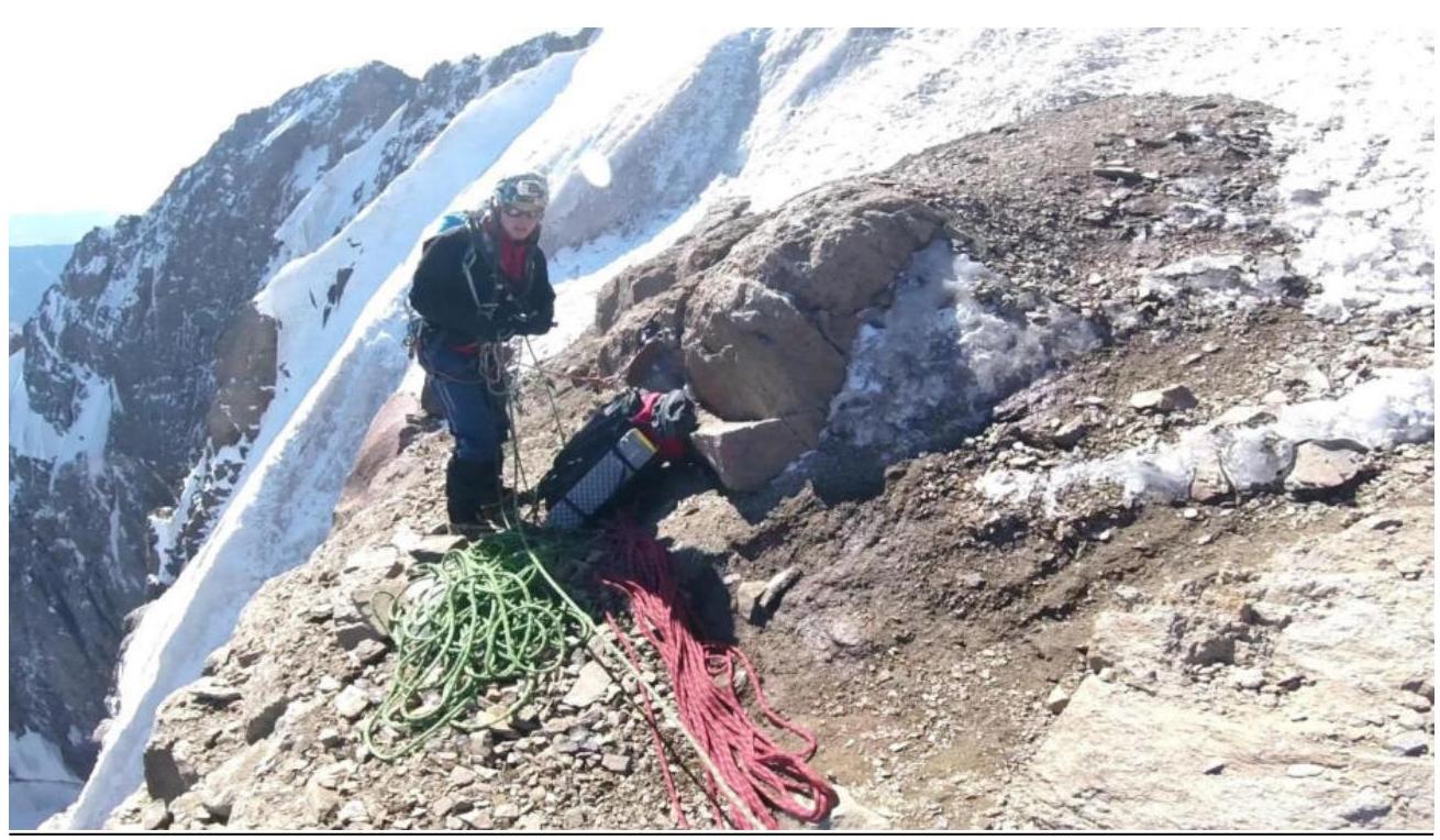
 Section R5–R6 — upper part, continuation of the route. After 120 m of climbing the ice in the internal angle, we reached a section of ice-covered rocks leading to the ridge to the summit. The rocks are not difficult but are destroyed, so it's best to belay on ice and then on the ridge. The ridge consists of initially easy rocks for 30 m, followed by a firn-ice "stream" for 50 m. Then there's the "cap": 35 m of easy ice to the summit.
 View from R6 – section of destroyed rocks leading to the ridge.
 View from R6 downwards. The leader is climbing.
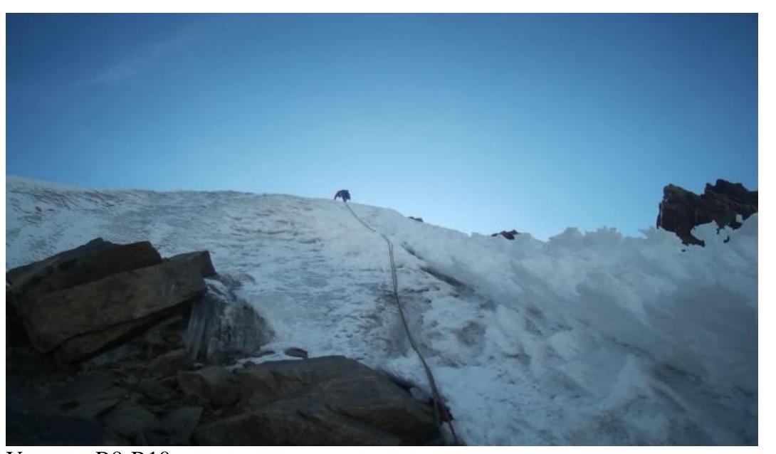 Section R9–R10 – "cap".
3.2. Photo of the Team at the Summit with the Control Cairn, Note, Summit Cairn.
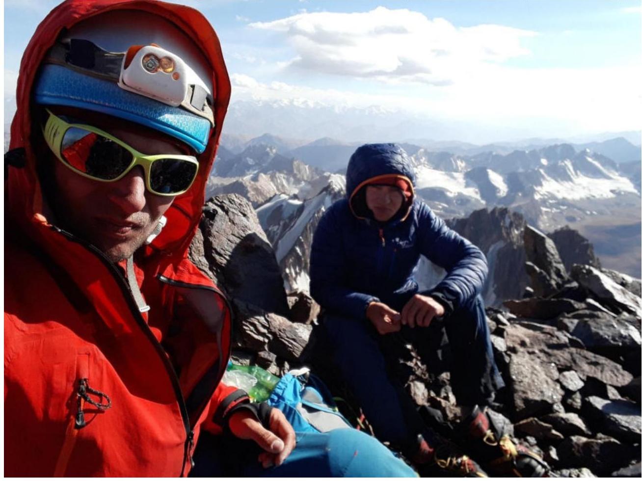 Kashevnick Anton and Tyulyupo Aleksey at the summit, 16:30, September 8, 2019.
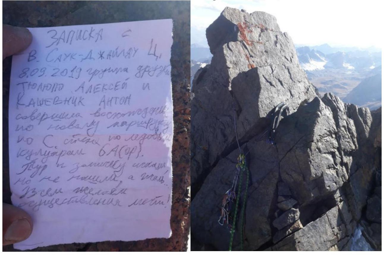 Unfortunately, a half-hour search for the cairn was unsuccessful. There are several prepared bivouac sites on the summit, indicating that people have been here before, but the cairn might have been destroyed naturally; we built a new one.
3.3. Route Safety Assessment.
In our joint opinion, this route is best climbed in September or October. It's not feasible to access the Sauk-Djaylyau region in spring, and in summer, the entire tower, including the internal angle, is prone to rockfall due to active ice melting. After the first snowfalls, accessing the region becomes highly problematic, and evacuation, if winter sets in, is only possible by helicopter.
Communication options on the route: satellite phone; there's a slim chance of catching a mobile network on the mountain.
Recommendations for future climbers: mandatory observation of the mountain, caution with belaying on mixed terrain sections.
Detailed information on descending from the summit: descent via the ascent route using pitons; a descent to the south is possible but there's no information on bridge crossings (in this case, you'll still have to return to ABC).
3.4. Conclusion on the Preliminary Route Assessment.
The route is attractive due to its logical line, variety of terrain, need for correct tactical planning and resource management, and remoteness from civilization (minimum 3 days from "Dugoba" alpine camp; the approach from below, via Isfayramsay, is currently not possible due to the region being declared a reserve). The difficulty of this route begins with choosing the right season (the route is dangerous in summer, and it's too late to climb after snowfalls); the route requires mandatory preliminary observation, a good weather forecast, and favorable avalanche conditions. The main part of the route is snow-ice, but the ice here comes in all possible consistencies: soft with a firn crust at the bottom, a thin layer detaching from the rock without reliable protection in the middle, and hard, refrozen "bottled" ice that shatters into lenses at the top. The rocky sections require good technique for moving with ice tools and the ability to belay using rock placements while climbing. The route's length implies the need to carry a bivouac and plan bivouac sites in advance. The main challenge of the route is the extended internal angle with a slope of over 80°, where there's no good bivouac site, meaning you need to climb the section in a day, bivouac below it, and then continue above. We'd like to emphasize the full autonomy of our ascent: 3.5 days of approach to the mountain, 1.5 days of observation, 2.5 days to the summit, descent – almost a full day (2 times 0.5 days with a bivouac), and 2.5 days back to "Dugoba". The climbed route required participants to be fully concentrated, committed, and to apply a large amount of knowledge and skills typical of mountaineers. In our assessment, the route's category of difficulty is 6A.