№ 558.7.7 dated 14.01.1986
Ascent Passport
I. Ascent class: rock climbing 2. Ascent area: Tian Shan, Ugam ridge 3. Peak, its height, and ascent route: 2nd NE peak Druzhba, 4030 m. Via NW edge of NE ridge 4. Proposed difficulty category: 2A 5. Route characteristics: * elevation gain: 600 m * average slope: 43° * length of sections: I – 550 m, II – 290 m, III – 30 m 6. Pitons used: * for belay, for creating, etc.: * rock: 2 * ice: — * bolt: — 7. Total climbing hours: 7 8. Number of nights and their characteristics: none 9. Full name of the leader and participants, and their sports qualification: * Lukyanov Yu.A. — II sports category * Ofitserov V. — II sports category * Proskurin A.L. — I sports category * Yarovoy S.I. — II sports category * Rafikov Sh.R. 10. Team coach: none II. Date of departure and return: September 28, 1984
Brief description of the approach
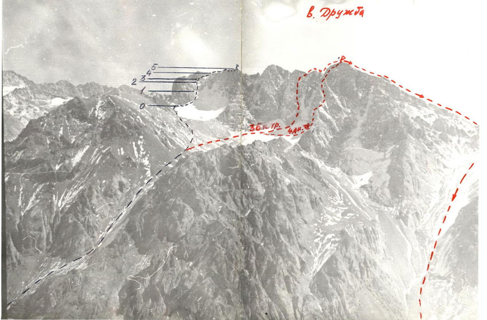
The 2nd NE peak Druzhba, 4030 m, is located in the Ugam ridge (Tian Shan) southwest of the peak "Sairamsky" — the highest point in the area.
From Chimkent city, follow the asphalt road to the "Sinegorye" pioneer camp and then along the dirt road along the Sairam-Su river to the base camp (see the map of the area). From here, follow a good trail along the Kergely river up to the campsite at the lower moraine lake (3 hours walking).
The approach to the start of the route is made via a wide snowy couloir between the peaks "Sypuchaya" and "Obmancivaya", and then along a wide snowy plateau to the NE part of the Druzhba peak wall (see the map of the area).
The approach from the lake campsite to the route takes 3 hours.