Ascent Passport
I. Ascent class — combined 2. Ascent area — Western Tian Shan Ugam ridge 3. Peak Druzhba 4100 m via the 2nd buttress of the North-West wall 4. Proposed complexity category — 4A 5. Route characteristics height difference — 400 m length of sections with 5–6 difficulty category — 65 m average steepness — 70° 6. Pitons driven for protection to create ITO rock — 28 ice — 10 7. Number of climbing hours — 10 hours 8. Number of overnight stays — none 9. Participants' full name, their qualification:
- Budyanskiy V.N. — 1st sports category
- Gasanov Sh.R. — 1st sports category
- Proskurin A.L. — 1st sports category
- Khvan A.V. — 2nd sports category
- Team coach — Rafikov Sh.R.
- Organization — Chimkent Regional Council "Enbek" VD SO "Trud"
Brief description of the approach to the route
From the base camp located at the "Bure-vestnik" clearing, follow the Kergety gorge to the campsite near the lower lake, 1.5–2 hours.
From the campsite:
- via a wide couloir between the peaks Sypuchaya and Obmanchivaya
- exit to the plateau under the North-West wall of Druzhba (2 hours).
Brief explanation for the diagram
The route follows the 2nd buttress of the north-west wall, counting the central buttress as the first. The start of the route is a snow-ice slope intersected by a bergschrund in its lower part. The steepness of the ice in the upper part reaches 70°. Transition to rocks in the lower part of the buttress is via a wall. Further movement is upward through a cleft. This is the most challenging section of the route. Climbing is difficult on the right part of the wall. Protection is via pitons and through placements. The wall leads to a good ledge, where there is a control cairn. From the ledge, movement is upward on rocks of III–IV category difficulty for 100 m. Then, a section of IV–V category difficulty to the left on a smooth wall. After the wall, to the left on inclined ledges that lead under the final wall. The ascent to the summit is along the main ridge. Descent to the south along the ridge, and then via a couloir to the upper lakes.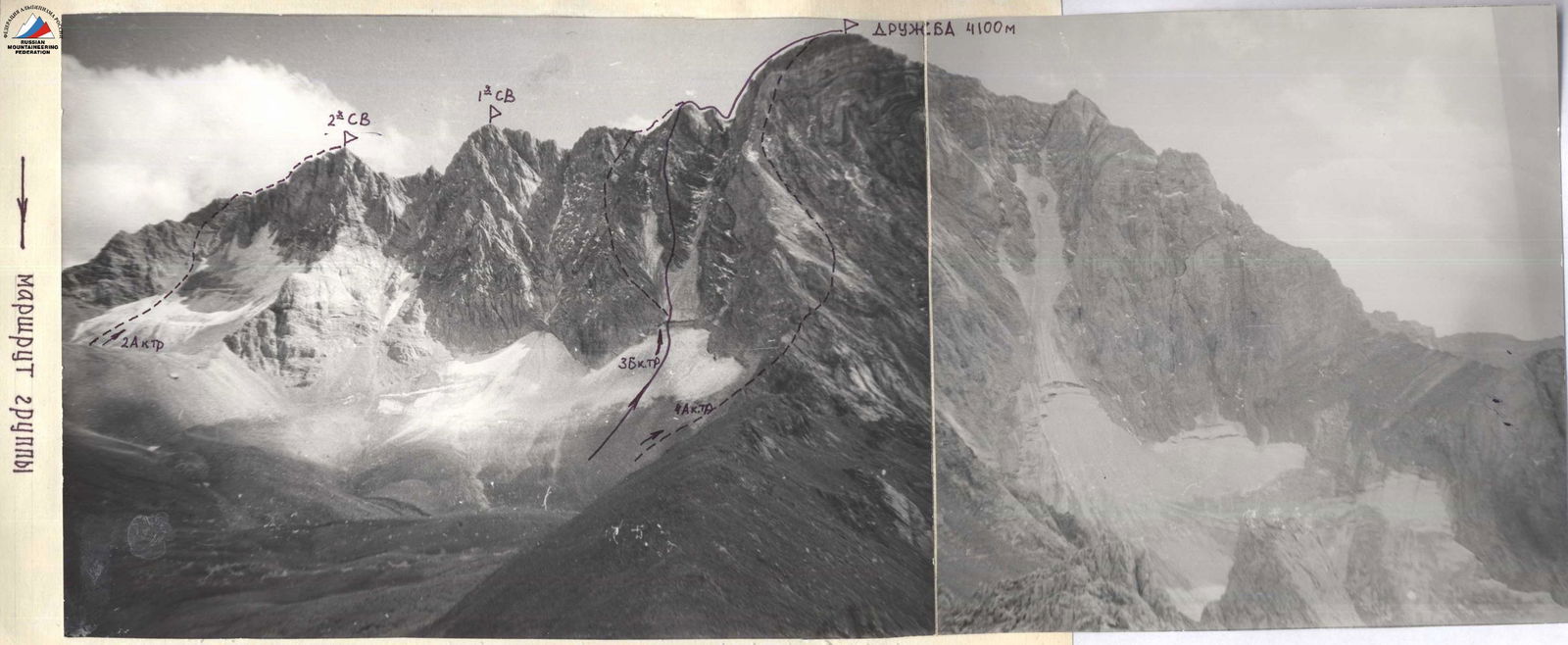

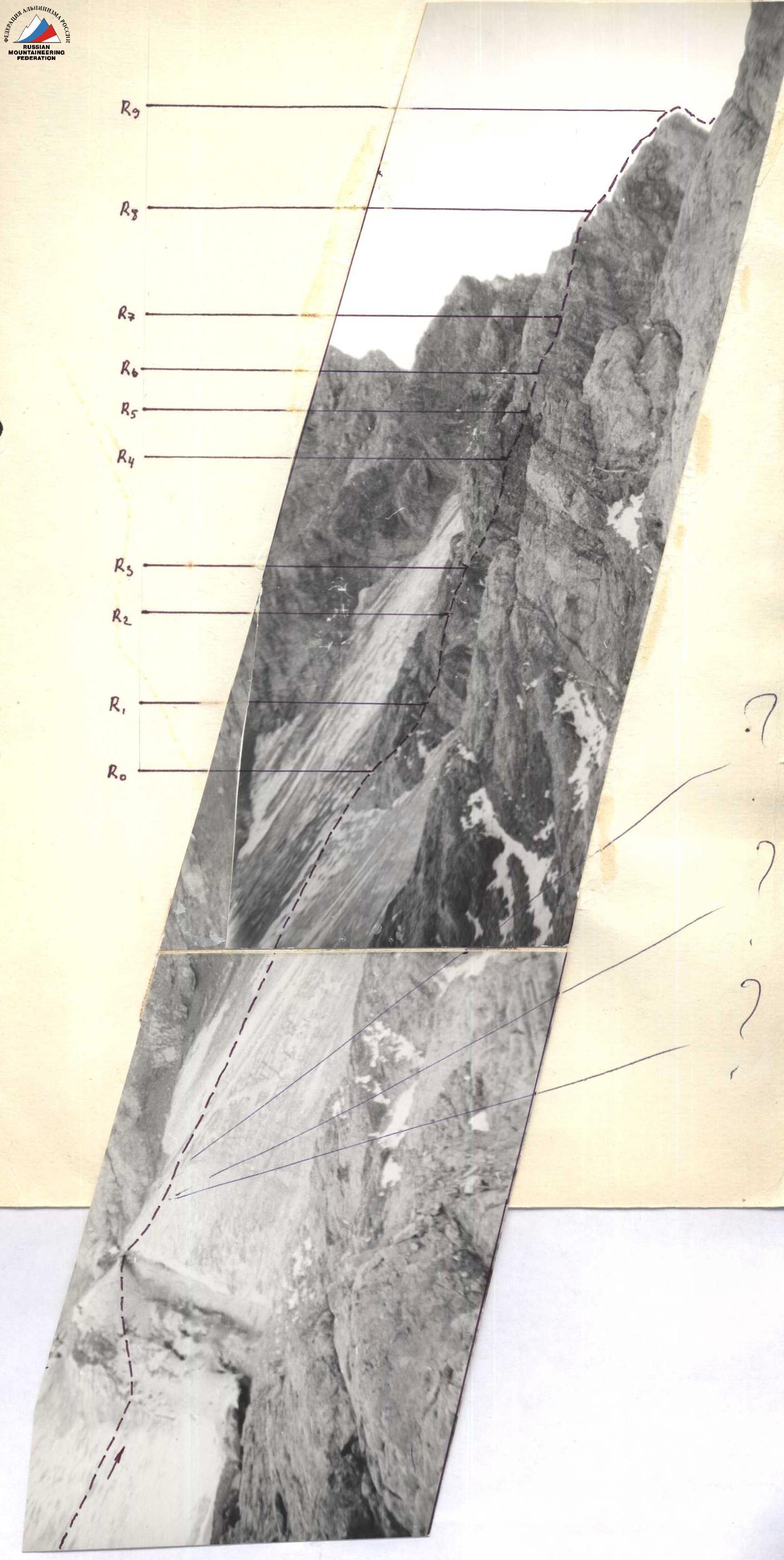


Bastion of the western ridge
- Rafikov's route 5A category difficulty
- Route of the double team 5B category difficulty (original)