
p. Korona (3rd) 4700 m
Report
Of the joint team
of Tomsk, Kemerovo regions and St. Petersburg on the ascent to p. Korona (3rd) 4700 m via the western glacier "3B", (sl)
Participants:
Temerev I.M., Suzdaltsev E.E., Kashevnil A.A.
I. Ascent Details
| № | 1. General Information | |
|---|---|---|
| 1.1 | Full name, sports rank of the team leader | Temerev Ivan Mikhaylovich — Master of Sports |
| 1.2 | Full name, sports rank of the participants | Suzdaltsev Egor Evgenievich — Candidate Master of Sports, Kashevnil Anton Alexandrovich — Candidate Master of Sports |
| 1.3 | Full name of the coach | independently |
| 1.4 | Organization | - |
| 2. Characteristics of the ascent object | ||
| 2.1 | Region | Tian-Shan, Kyrgyz Range |
| 2.2 | Valley | Ala-Archa valley |
| 2.3 | Section number according to the 2020 classification table | 7 |
| 2.4 | Name and height of the peak | Pik Korona (3rd) 4700 m, via the western glacier. |
| 2.5 | Geographical coordinates of the peak (latitude/longitude), GPS coordinates | 42°30′27.20″ N, 74°33′58.23″ E |
| 3. Characteristics of the route | ||
| 3.1 | Name of the route | Rossiya-2 |
| 3.2 | Proposed category of difficulty | 3B |
| 3.3 | Degree of route development | First ascent |
| 3.4 | Nature of the route relief | ice and snow |
| 3.5 | Elevation gain of the route (altimeter or GPS data) | 550 m |
| 3.6 | Length of the route (in meters) | 800 |
| 3.7 | Technical elements of the route | I diff. ice — 300 m. II diff. ice — 170 m. III diff. ice — 150 m. IV diff. ice — 165 m. V diff. ice — 15 m. Glacier travel — 620 m. Descent via the ascent route — 3 sections, 180 m. Average steepness of the main part of the route — 60° |
| 3.8 | Descent from the summit | Via 3B diff. into Ala-Archa valley |
| 3.9 | Additional characteristics of the route | Water absent, much ice and snow. Pitons used on the route: ice — 22, incl. ITO — 0. |
| 4. Characteristics of the team's actions | ||
| 4.1 | Time taken (team's travel hours, in hours and days) | 7 hours, 1 day |
| 4.2 | Overnight stays | Site, ledge — no overnight stay |
| 4.3 | Departure for the route from Rats'ek overnight stays | 7:00, January 30, 2016 |
| 4.4 | Start of movement on the route | 10:00, January 30, 2016 |
| Arrival at the summit | 16:20, January 30, 2016 | |
| 4.5 | Return to base camp | 21:00, January 30, 2016 |
| 5. Responsible for the report | ||
| 5.1 | Full name, e-mail | Temerev I.M., ivantem@mail.ru |
General view of the route
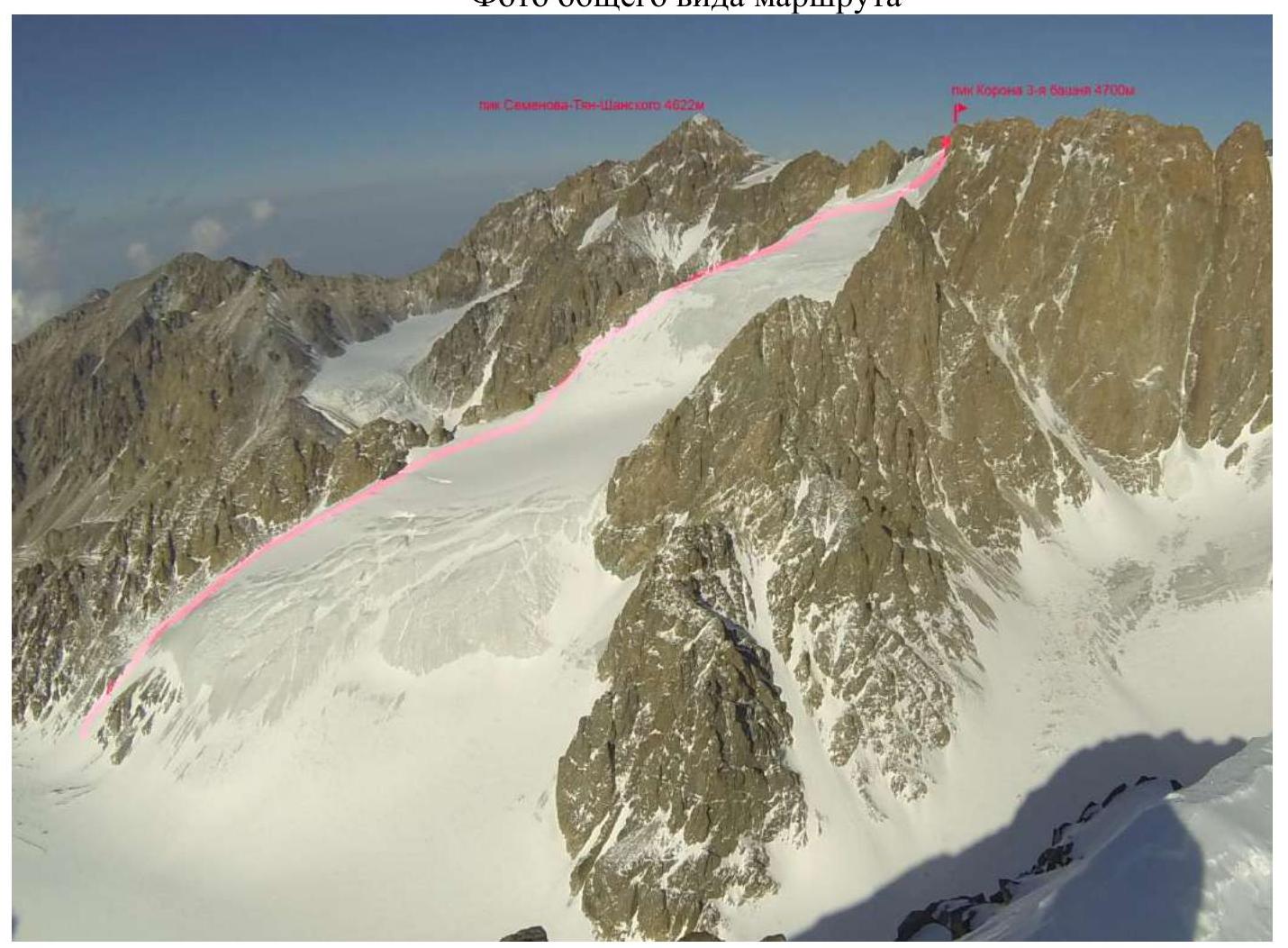 Route Rossiya-2 — Temerev, Suzdaltsev, Kashevnil 2016.
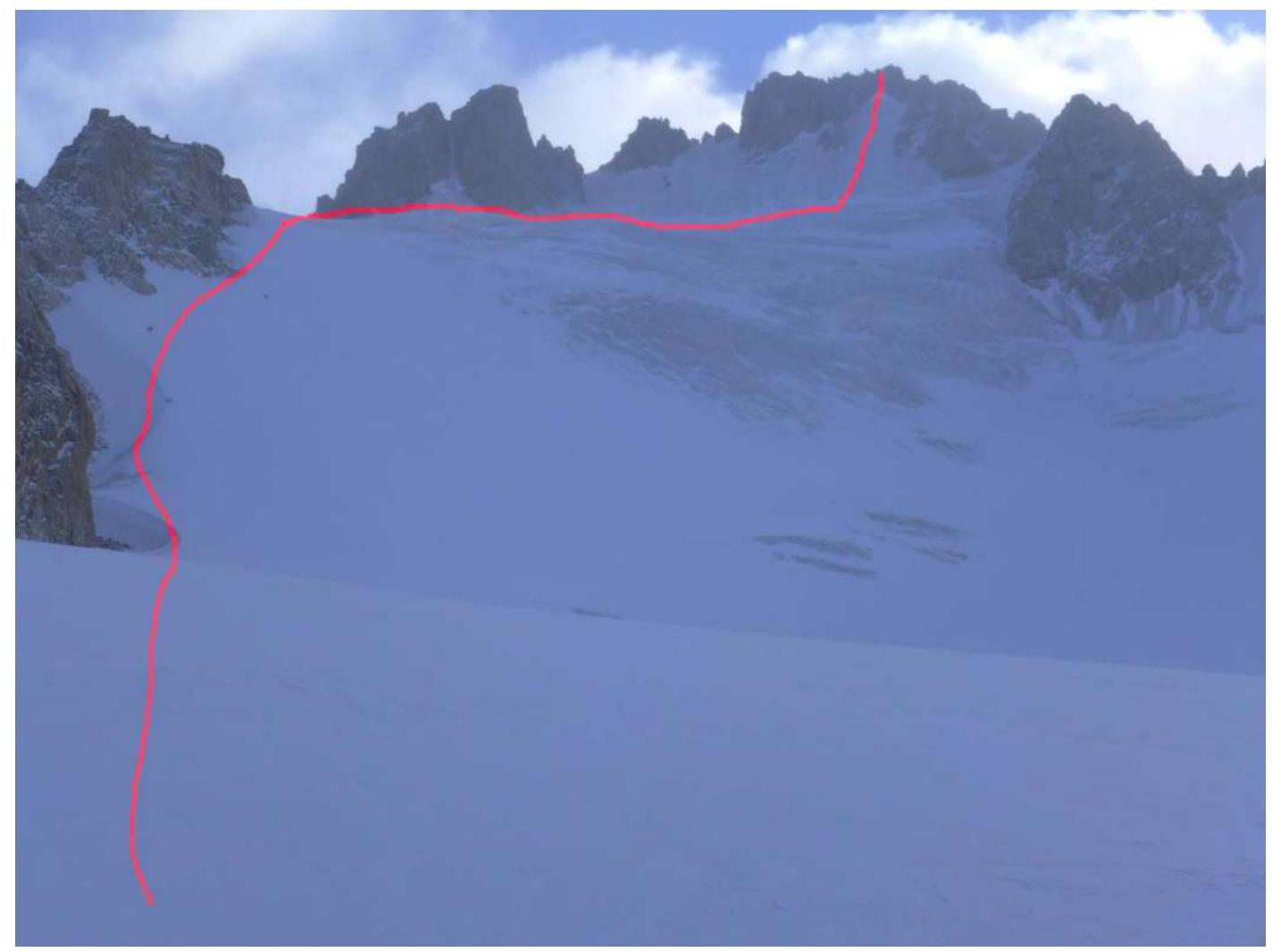
Profile of the route
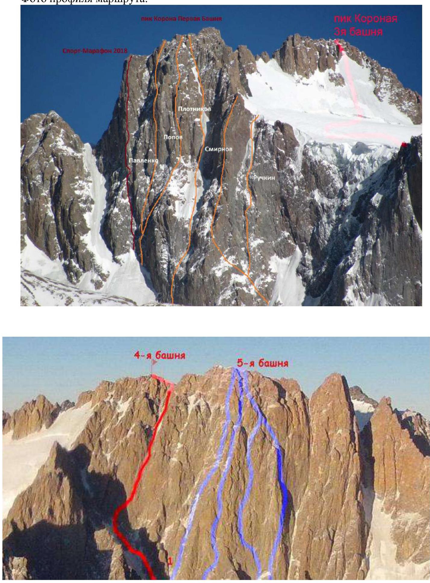
Panoramic view of the area

1 — Semenov Tian-Shansky peak 4875 m, 2, 3, 4 — Korona — massif with peaks 4750–4860 m, numbers indicate: 1st, 2nd and 3rd towers, to the left are visible 4th, 5th and 6th towers. 5 — Izyiskatel peak 4400 m. 6 — Kosmonavtov peak 4200 m. 7 — Baylyan-Bashi 4700 m. 8 — Simagin peak 4400 m. 9 — Svobodnaya Korea peak 4740 m.
Route diagram in UIAA symbols

Route description by sections
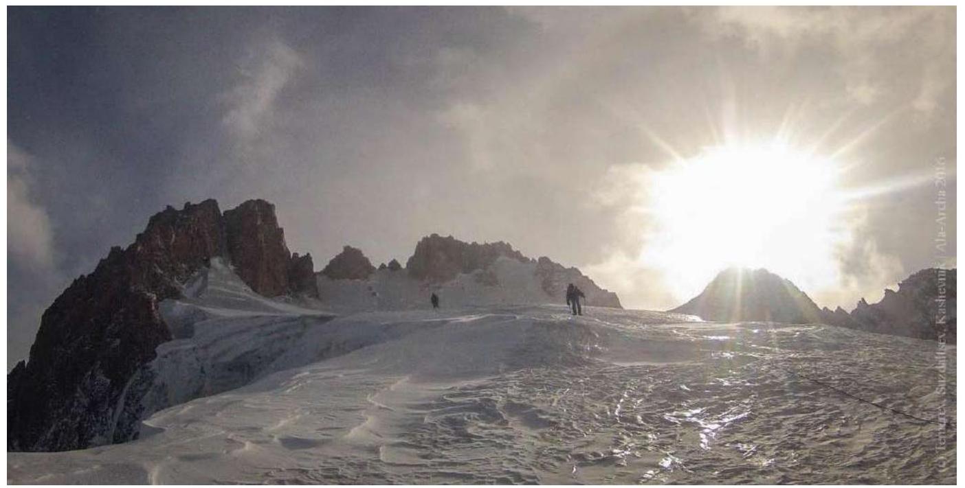
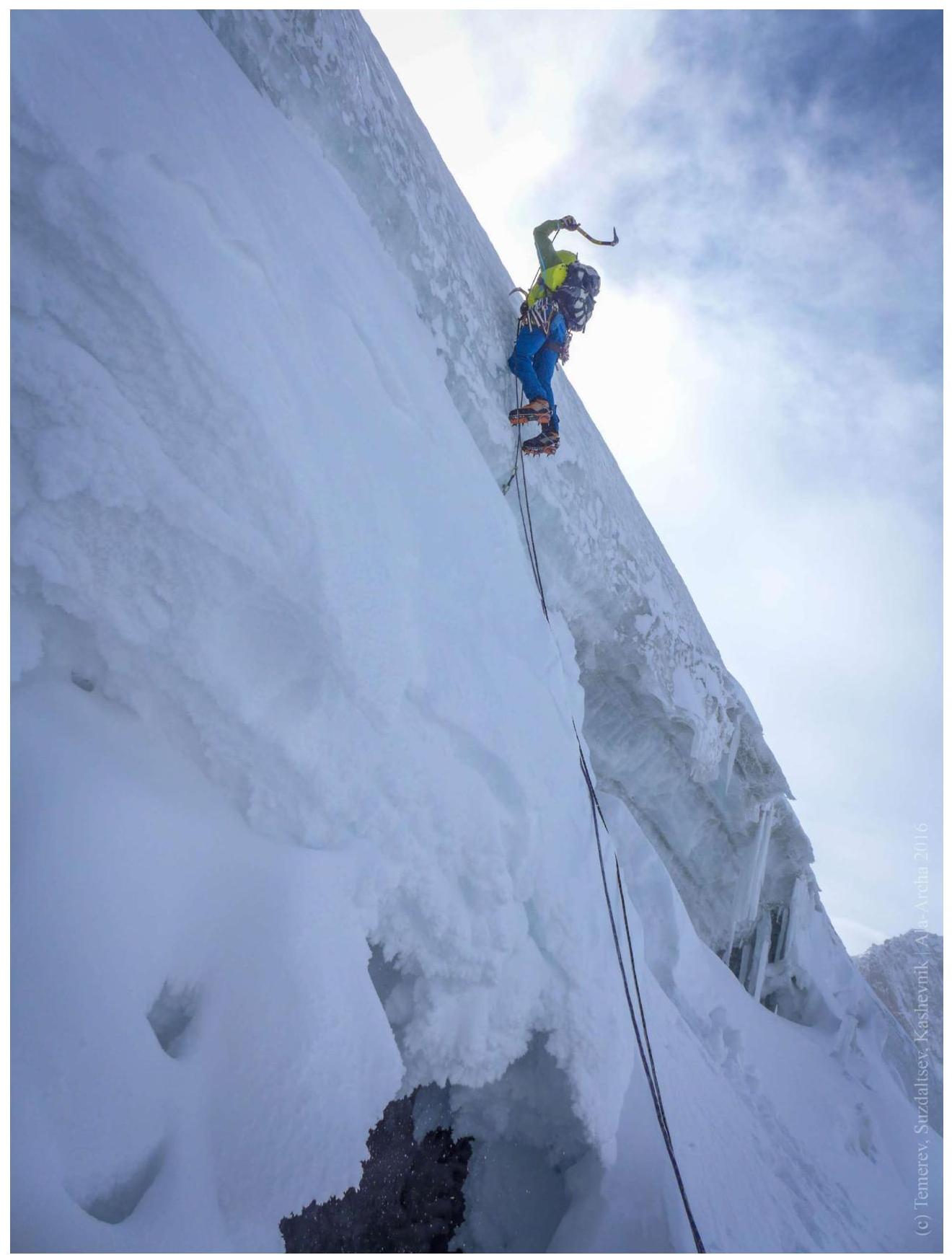
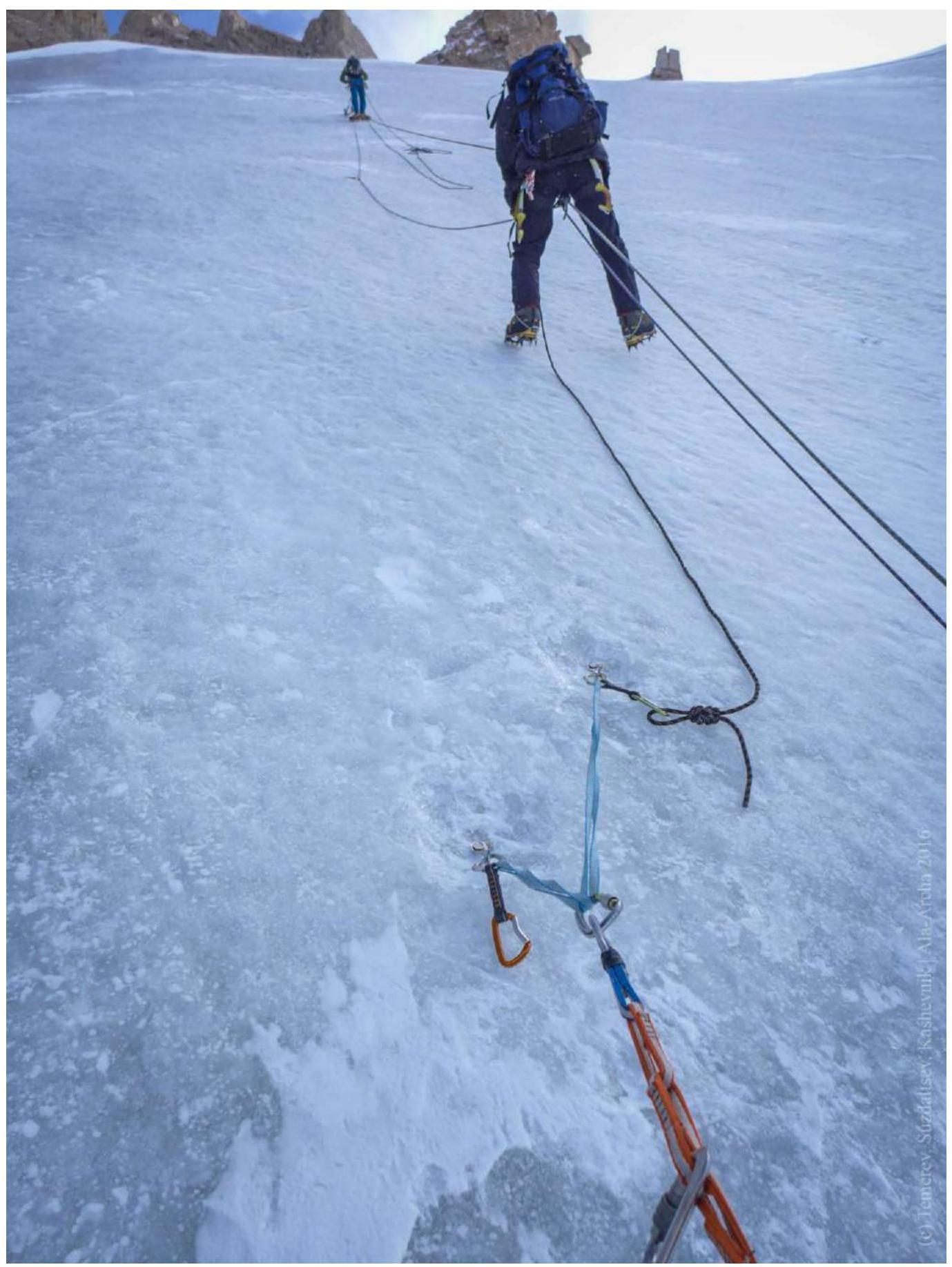
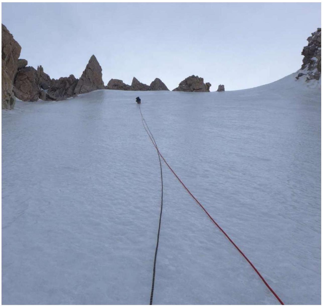
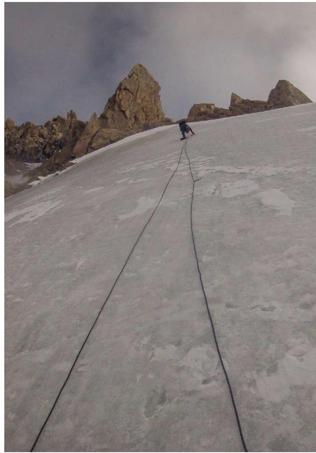
From Korona overnight stays, move towards Koronsky glacier (Ak-Sai) and further along its right orographic side. R1 620 m, I–III, 35–40°. Move simultaneously (in steep places, in a rope team) along the right orographic side of Koronsky glacier (Ak-Sai) towards the shoulder on the ridge (exit of Plotnikov's route). Then up and gradually to the right under the imaginary "waterfall line" from the summit of Korona 3rd Tower. R2 15 m, V, 90°. Cross the bergschrund at a convenient spot, pass the steep ice wall and reach the main ice field. R3 45 m, IV, 60°. Up the glacier. R4 60 m, IV, 60°. Up the glacier. R5 60 m, IV, 60–70°. Up the glacier. Enter the couloir. Initially on ice, at the end a few meters on rock — exit onto the Korona ridge and the summit.
Route thread
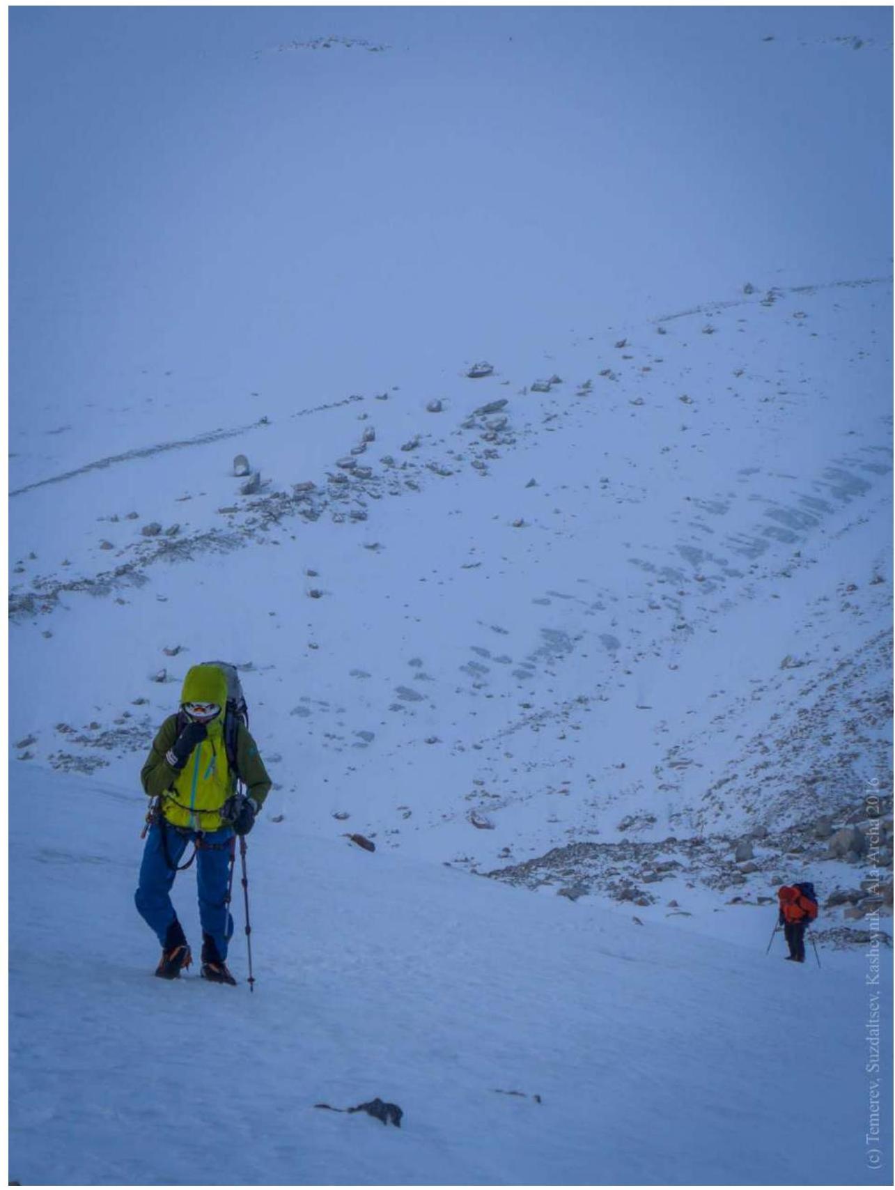
Photos of route sections
R1 Photo 1
R1 Photo 2
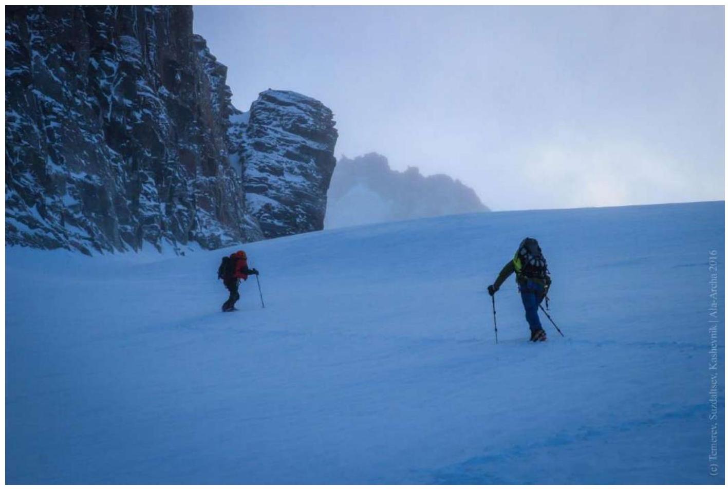
Photo 3
R2 Photo 4
R3 Photo 5

R4 Photo 6
R5 Photo 7
R5 Photo 8
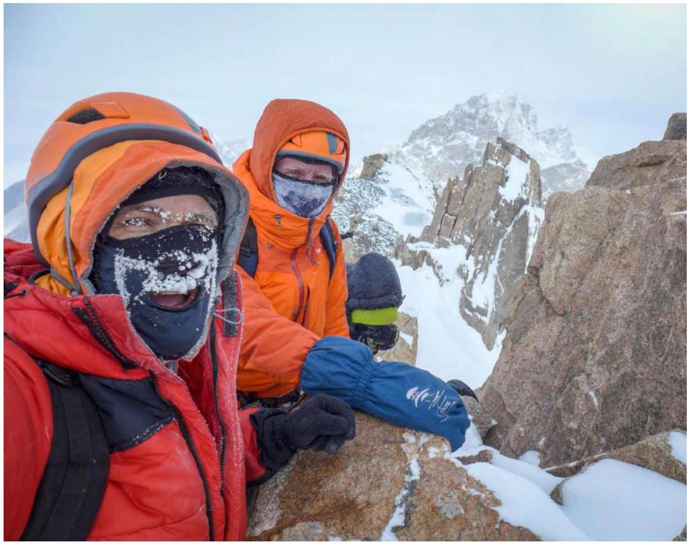
On the summit
Comments
Sign in to leave a comment