
Passport
- Kyrgyzsky Ridge, Ak-Sai gorge.
- Peak Svobodnoy Korei, 4740, via the cascades of the central part of the North face (Ruchkin's Route, 1997).
- 6A category of difficulty, 2nd ascent.
- Combined.
- Height difference of the route: 800 m Route length: 910 m Length of sections: 5th category of difficulty — 540 m 6th category of difficulty — 165 m Average steepness: main part of the route: 78° entire route: 67°
- Pitons left on the route: total — 0, including bolted pitons — 0. Pitons used on the route: stationary bolted pitons — 0, TCO — 0 removable bolted pitons — 4, TCO — 4. Total artificial points of support used — 110.
- Team's travel hours — 32 hours and days — 4.
- Overnight stays: on a platform.
- Team leader: Evgeny L. Novoseltsev, 1st sports category. Participants: Nikolai N. Gutnik (Kyrgyzstan).
- Coach: Valery N. Pershin, Master of Sports of International Class.
- Departure to the route: 8:15, February 19, 2000. Summit reached: 17:00, February 22, 2000. Return to Base Camp: 18:00, February 23, 2000.
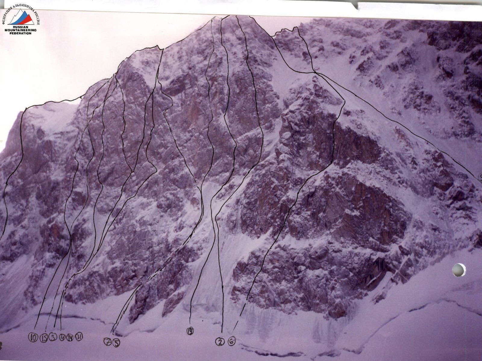
North face of Peak Svobodnoy Korei
- Andreev's route (1959)
- Mychislyaev's route (1961), 5B
- Studenin's route (1966), 6B
- Kustovsky's route (1969), 6B
- Bezzubkin's route (1969), 6B
- Bagaev's route (1974), 5B
- Popenko's route (1975), 6B
- Lod's route (not in the photo) (1976), 5B
- Barber's route (1976), 5B
- Shvab's route (1982), 5B
- Semiletkin's route (1988), 6B
- Zakharov's route (1992), 6B
- Ruchkin's route (1997), 6B
- Mikhailov's route (1999), 6B/6C
- Krasnoyarsk team's route (2000)
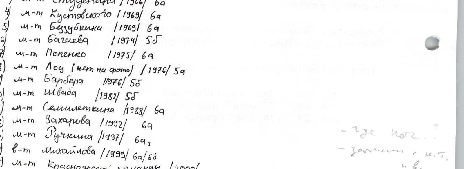
Photo taken on February 19, 2000. Shooting point: Ak-Sai glacier, 500 m to the wall.
Comments
Sign in to leave a comment