Report on the First Ascent of the Route to Peak Baychechekay via the Center of the Northern Glacial Slope
Ascent Passport
- Tian-Shan, Kyrgyz Range, Ala-Archa gorge
Peak Baychechekay, 4515 m, via the center of the northern glacial slope (from the couloir) Proposed category: 4A, first ascent. Route type: ice-snow. Height difference: 450 m. Route length: 650 m
- Section lengths: II category — 150 m, III — 350 m, IV — 150 m
- Average slope: main part of the route — 45°
Total route — 40°
- Number of "cruxes" left on the route: total — 0
- Total equipment used on the route: ice screws — 45, no pitons or protection gear used.
- Total artificial points of support (APS) used — 0
- Team's total climbing hours: 11 hours, 1 day (no overnight stays)
- Team:
Sergey Seliverstov (leader), Roman Lyapunov, Konstantin Kravets.
- Coach: Fedor Popov
- Departure to the route: 7:00, January 10, 2012
Reached the summit: 16:00, January 10, 2012. Returned to Base Camp: 18:00, January 10, 2012.
General View of the Summit
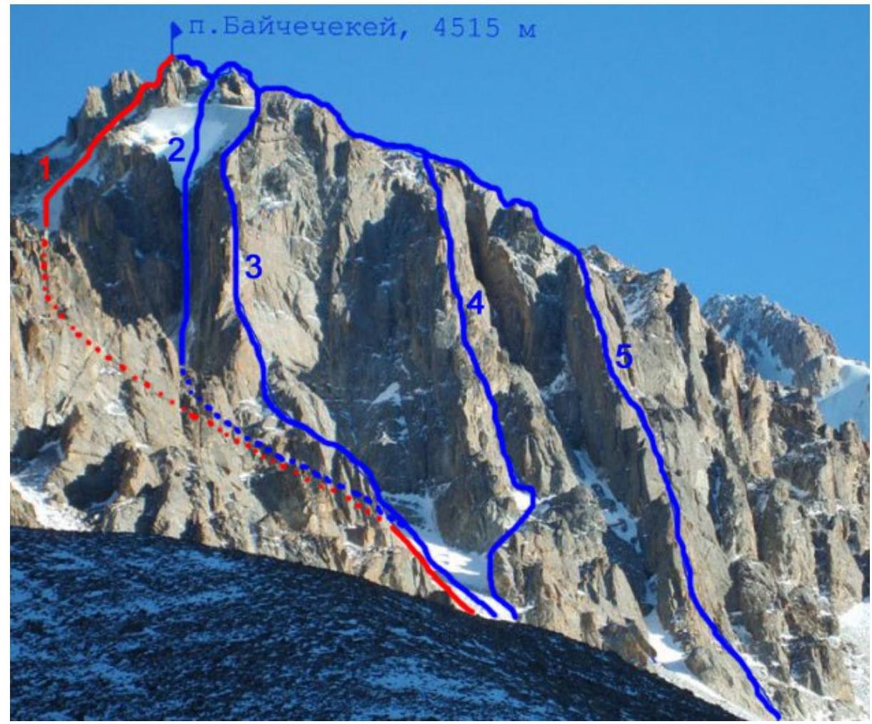
1 — team's route, center of the northern face; 2 — via the ice couloir of the western wall, 5A category, Ilyushenko, 1989; 3 — via the SW buttress, 5A category, B. Kuzmenko, 1977; 4 — via the central buttress of the 3rd wall, 5A category, V. Polyak, 1983; 5 — via the right buttress of the 3rd wall, A. Schwab, 1980.
Route Profile
| Section | Category | Slope | Length |
|---|---|---|---|
| R4–R5 | III | 25–30° | 50 м |
| R3–R4 | IV | 45–50° | 150 м |
| R2–R3 | III | 35–40° | 300 м |
| R1–R2 | II | 30° | 100 м |
| R0–R1 | I | 30° | 200 м |
Route scheme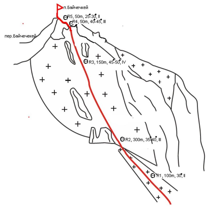
Route Description
Departure from "Ratsek" camp at 7:00. Reached the route at 9:30. On the summit at 16:00. Returned to "Ratsek" camp at 18:00. Approached via the trail leading to "Nauka" camps. Before reaching "Nauka" camps, started ascending a large talus leading to the couloir under the northern slopes of the summit. The same talus is used to approach the Ilyushenko route (5A category) via the ice couloir of the western wall. Upon approaching the Ilyushenko route, put on helmets, crampons, and harnesses.
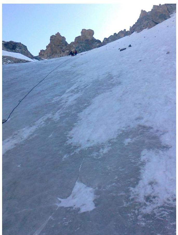
- R0–R1Movement along a gentle snow-ice couloir. After 200 m — a "sentinel" rock standing directly in the couloir. Made the first belay station under the "sentinel". 30°, 200 m, I.
- R1–R2Bypassed the "sentinel" on the right via gentle ice. 30°, 100 m, II.
- R2–R3Main part of the route. Moved along ice between rocky outcrops towards the ice saddle. 35–40°, 300 m, III.
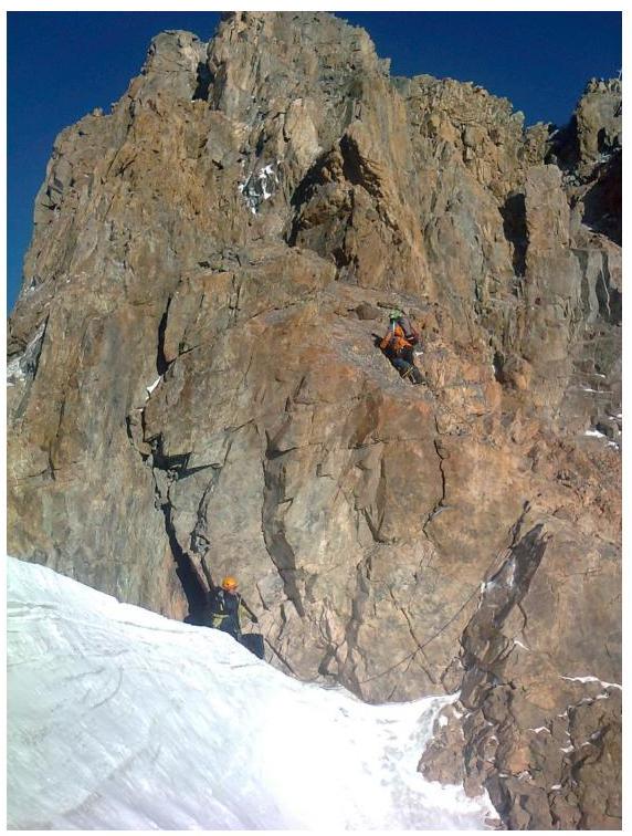
- R3–R4Moved along steeper ice, reaching the saddle between the main and secondary summits. 45–50°, 150 m, IV.
- R4–R5Rocky section. 50 m, 25–30°, III.
Simultaneous movement. Descent — rappel — 30 m towards the Baychechekay-Skryabin saddle, then descended to the saddle, and followed the trail to Base Camp — "Ratsek" camps.
Section R1–R2
Section
R2–R3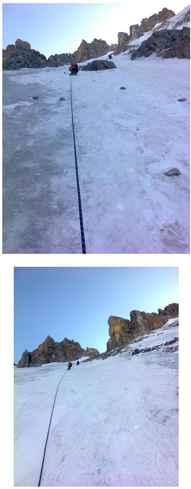
Digitized by Google Section
R3–R4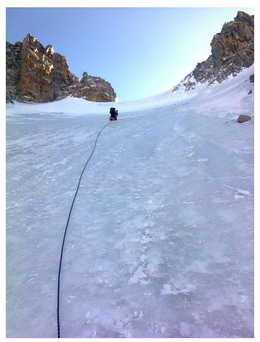
Section
R4–R5