
- Peak Bailyan (1st), 4700 m, via northwest wall, 2010 (first ascent)
- As a two-person team
- Central Tian Shan. Kyrgyz Range. Aksai gorge.
- Section in Classification 7.4
Report
on the first ascent of the team of the Federation of Alpinism and Rock Climbing of Sverdlovsk Region (FAiS Sverdlovsk Region) on Peak Bailyan (1st), 4700 m, route "Doroga domoy" (Road Home), via the northwest wall.
- Cat. difficulty: 5Bz
Addresses
620092, Yekaterinburg, Novgorodtseva st., 9/3, apt. 17 Dashkevich Sergey Aleksandrovich Ph. +79122436251 Dash-sa@mail.ru Yekaterinburg 2010
Report on the ascent of Peak Bailyan (1st)
Contents
- Climbing passport — 3
- Photo of the general view of the peak — 4
- Brief description of the ascent — 5
- Note from the summit — 5
- Drawn route profile — 6
- UIAA scheme — 7
- Route description by sections — 8
- Photos from the route — 9
1. Climbing Passport
Region — Central Tian Shan. Kyrgyz Range Peak — Bailyan (1st), 4700 m, via northwest wall Proposed — 5Bz cat. difficulty, first ascent. Route character — combined
Route Characteristics
Height difference of the route — 511 m. Height difference of the wall part of the route — 471 m. Route length — 700 m. Length of the wall part of the route — 600 m. Average steepness of the route — 51°. Average steepness of the wall part — 54°. Length of sections with 6th cat. difficulty — 100 m, 5th cat. difficulty — 110 m.
Left on the route:
- Pitons — 0
- Nuts and cams — 0
Pitons used on the route:
- Bolts — 0
- 'Lepeсток' pitons (a type of piton) — 0
Total artificial aids (AIDs) used — 0. Number of climbing hours to the summit — 6, with descent — 9, days — 1. Number of bivouacs — 0. As a two-person team. Participants:
- Dashkevich Sergey Aleksandrovich, Master of Sports
- Tretyakov Boris, 1st sports category
Team coaches:
- Pershin Valery Nikolaevich, Honored Master of Sports, Honored Coach
Date of departure
for the climb — March 5, 2010 to the summit — March 5, 2010 return — March 5, 2010
Organization: FAiS Sverdlovsk Region.
- General photo of Peak Bailyan, 4700 m.
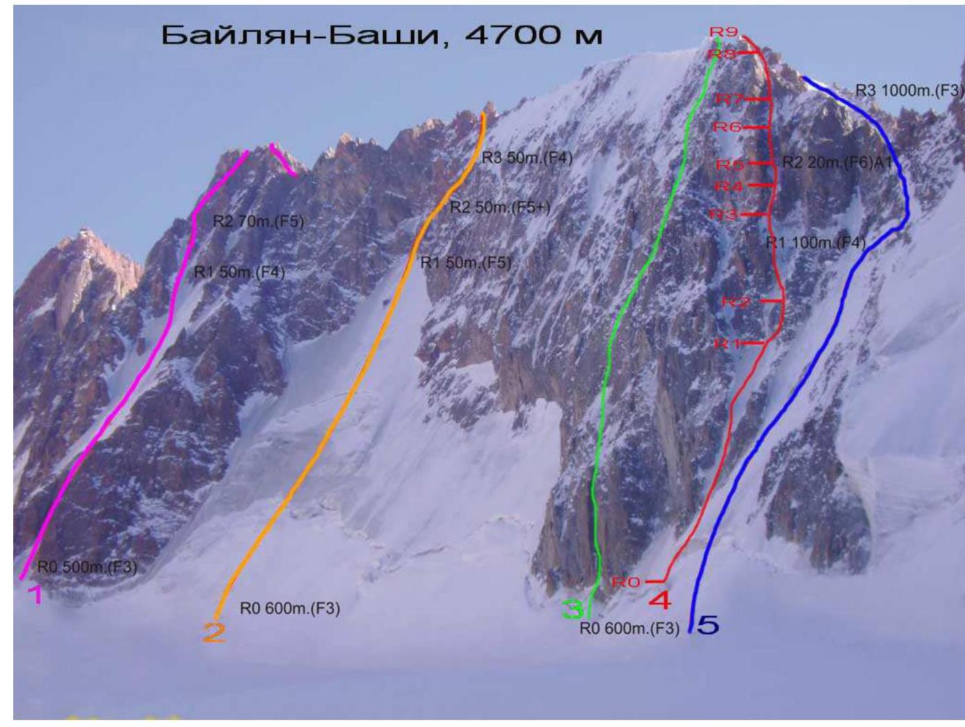
1 — via N wall, 5A (Russian scale), V. Denisov, 1970 2 — via center of NW wall, 5A (Russian scale), A. Nekrasov, 1984 3 — via center of NW wall, 6A (Russian scale), B. Kuzmenko, 1985 4 — route of the team, 2010 5 — via NW wall, traverse, 5B (Russian scale), V. Mansurov, 1961
3. Brief description of the ascent
On the northwest wall of Peak Bailyan, 4700 m, five routes have been laid from 4A to 6A. All of them have a combined terrain character. The largest number of rock sections is located in the right part of the wall. The Kuzmenko route, 6A cat. difficulty, passes here. Also, in this part begins the popular traverse of the Bailyan towers, 5B cat. difficulty (Mansurov's route). However, there is still enough space on the wall for first ascents.
We laid our route between the Kuzmenko 6A and Mansurov 5B routes. The route is quite interesting, strongly reminiscent of Ruchkin's "Mobilnykh" route on the first tower of the Corona, but with a more complex rock belt. The route is logically divided by three rock steps.
- The maximum category of free climbing (dry tooling) here is M5+.
- Considering the classification of routes adopted in the area, I believe that the route corresponds to 5B cat. difficulty.
To complete the route, the team used an alpine style, which made it possible to climb the wall in one day, without prior processing, AIDs, and bivouac. We descended already in the dark by the light of flashlights. We recommend making ascents only in the winter period due to the strong rockfall danger of any couloir routes.
4. Note from the summit
The note from the summit was not retrieved due to the difficulty of finding it in the winter period.
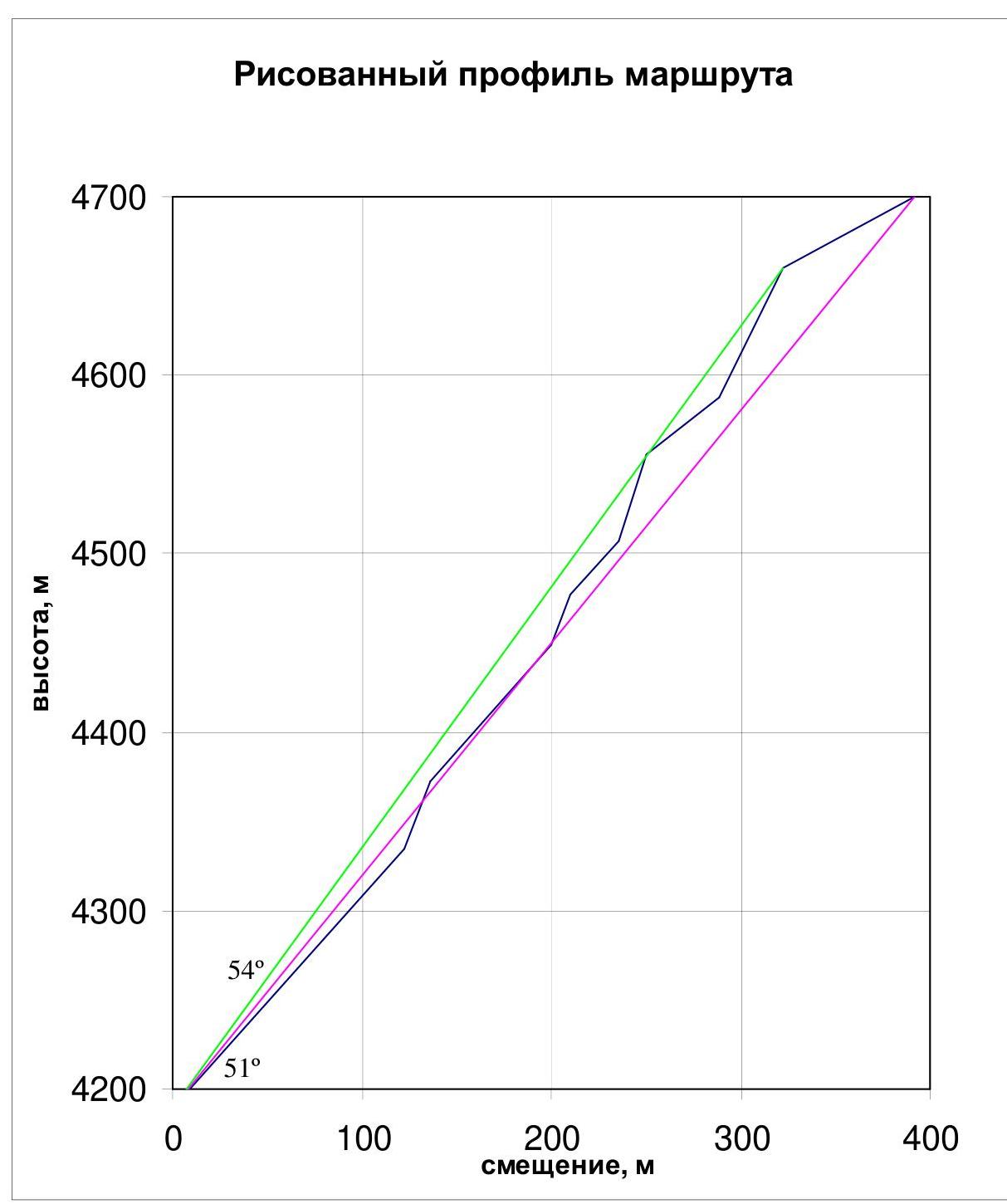
- Drawn route profile.
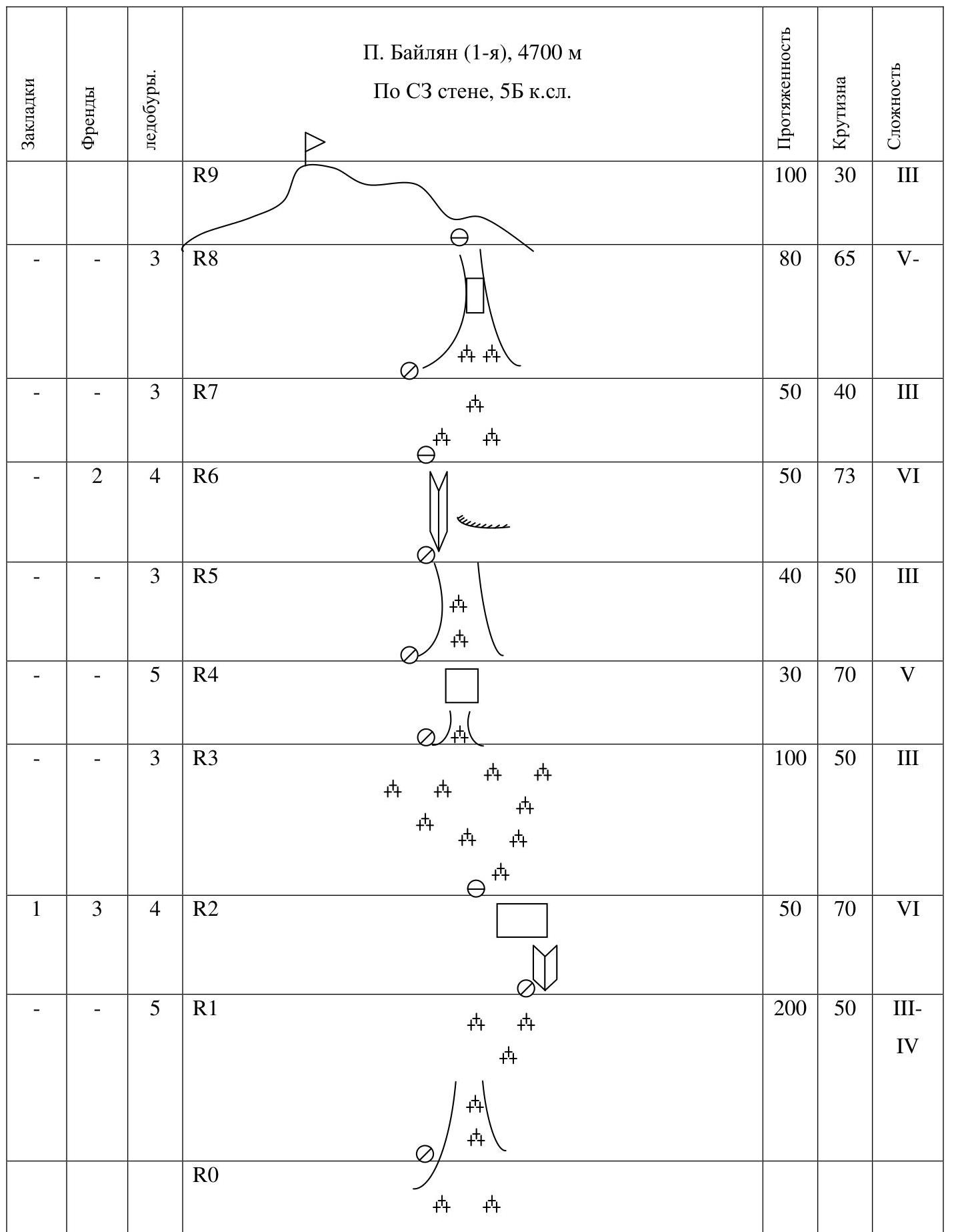
6. UIAA scheme
7. Route description by sections
The beginning of the route is slightly to the left of the Mansurov route, pressing against the right buttress of the northwest wall.
Section R0–R1: From the bergschrund upwards into the ice couloir and further straight up in the direction of the narrow ice groove on the first rock step.
- 20 m, ice wall 70°
- 200 m, 50°, cat. difficulty III–IV
Section R1–R2: The rock step was climbed via the inner corner on the right, as the ice groove turned out to be unsuitable for free climbing. For protection, medium and large-sized cams were used. 50 m, 70°, cat. difficulty VI (M5+)
Section R2–R3: Move upwards and to the left in the direction of the "Ryжие скалы" (Red Rocks) — the summit tower. To the right of the rocks begins a rock couloir, местами залитый натёчным льдом (partially filled with ice). 100 m, 50°, III
Section R3–R4: Up the ice groove to the right of the "Ryжие скалы" straight up. 30 m, 70°, V (M3)
Section R4–R5: On easy ice, approach the left part of the couloir under the rocks. 40 m, 50°, III
Section R5–R6: Move up the left part of the couloir. The rocks are complex. Character of the section:
- местами тонкий натёчный лёд, узкие ледовые ручейки ( местами thin ice, narrow ice streams)
- Сильно рубить молотками нельзя, так как они скалываются до скал (It is not possible to cut strongly with ice axes, as they break off to the rocks)
- For protection, a couple of medium-sized cams were used
- местами закручивались буры наполовину рабочей длины (in places, ice screws were screwed in halfway their working length)
50 m, 73°, VI (M5)
Section R6–R7: On an easy snow-ice slope, approach under the upper part of the summit tower. 50 m, 40°, III
Section R7–R8: Up the rock couloir, местами, с натёчным льдом (partially with ice), exit onto the ridge. The rocks are unpleasant. Protection points are rare. It was not possible to place any rock protection. For protection, ice screws were used (not fully screwed in). 80 m, 65°, V– (M4)
Section R8–R9: Along the ridge to the summit 100 m, III
Descent direction: via the ascent route
8. Photos from the route
 8.1. Crossing the bergschrund.
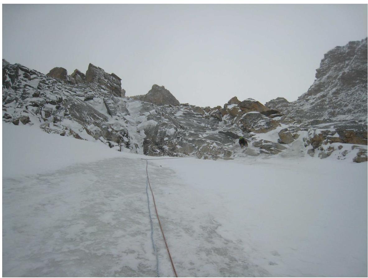
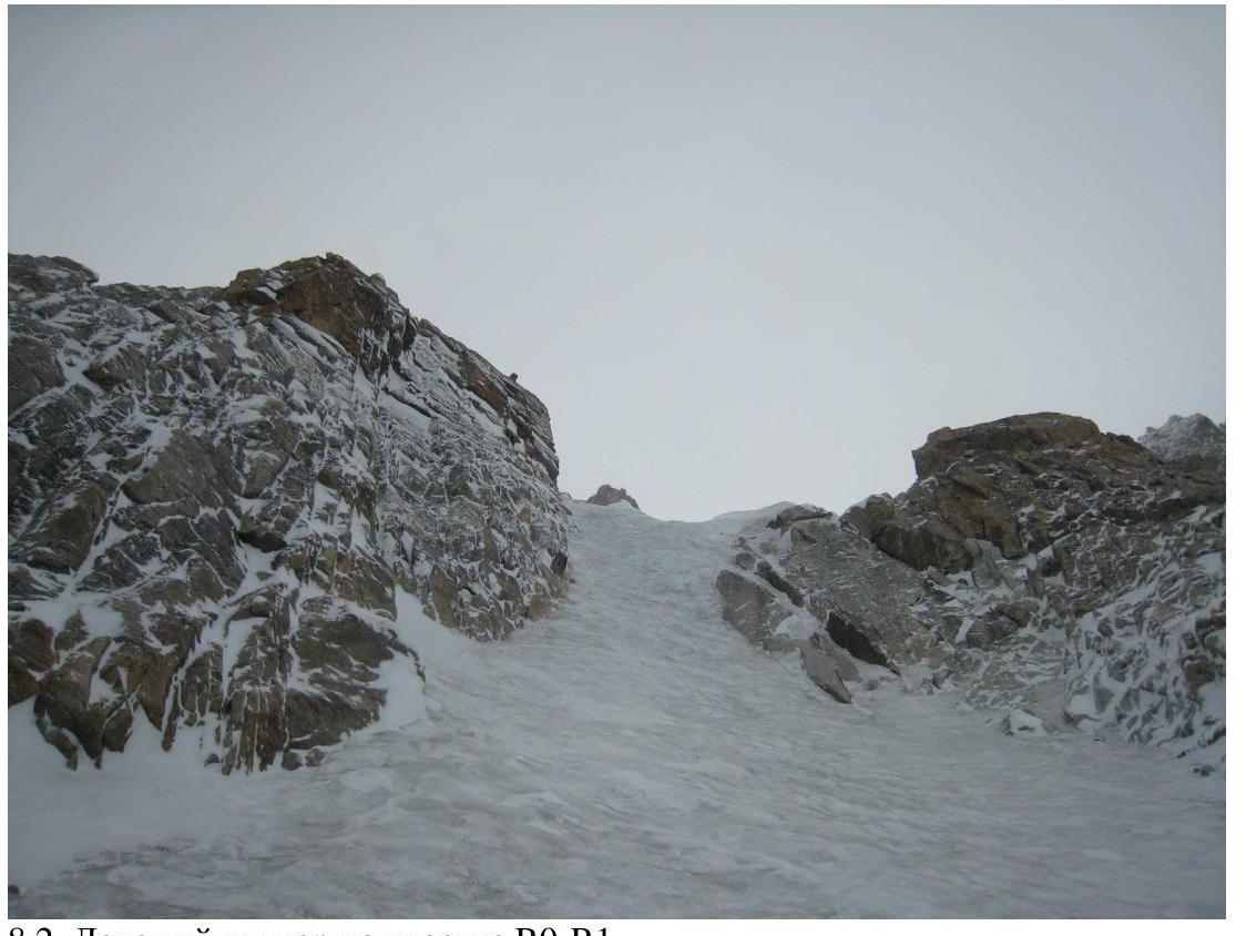 8.2. Ice couloir on section R0–R1.
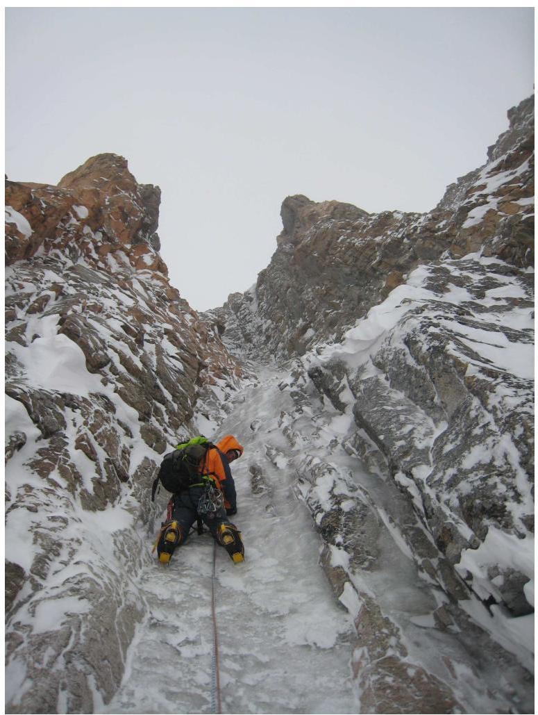
 8.3. R1–R2. Climbing the first rock step.
 8.4. R3–R4. Ice groove in the couloir.
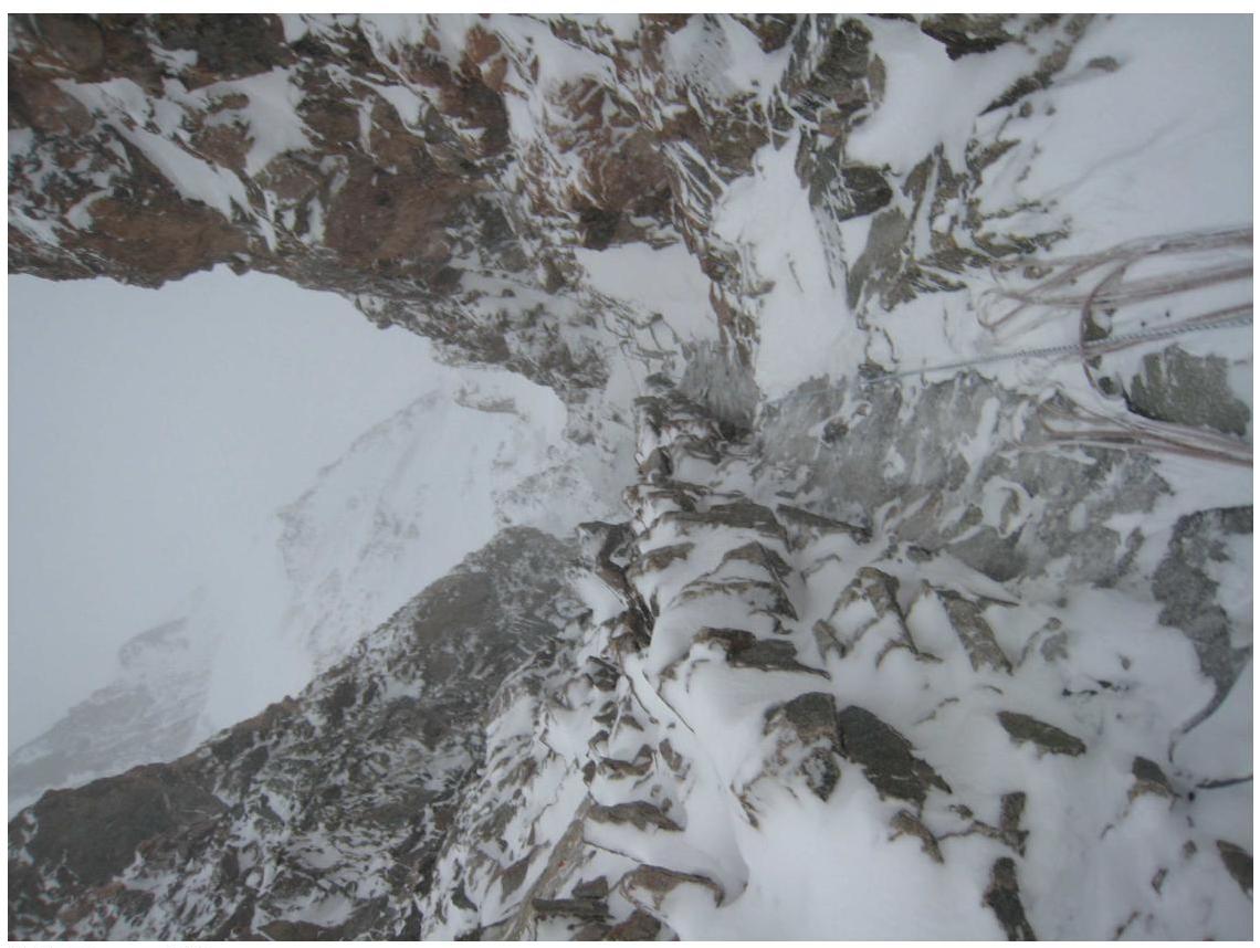 8.5. View from R6 downwards.
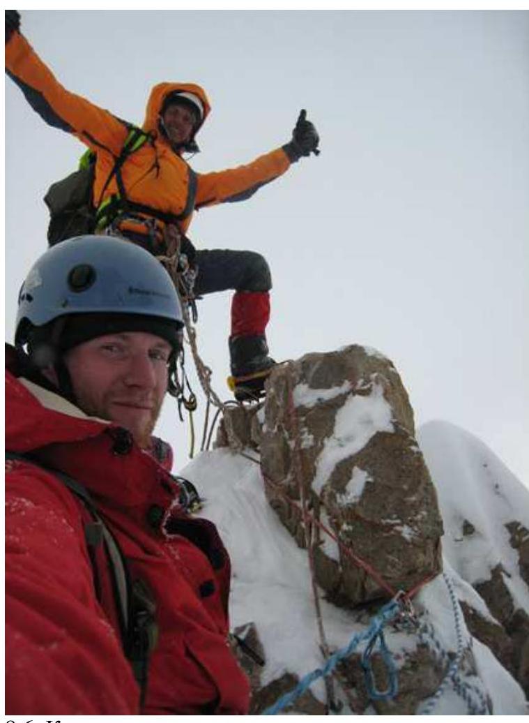 8.6. Team on the summit.
Comments
Sign in to leave a comment