Ascent Passport
- Ascent class — technical
- Ascent region, ridge, gorge — Tian-Shan, Inylchek ridge
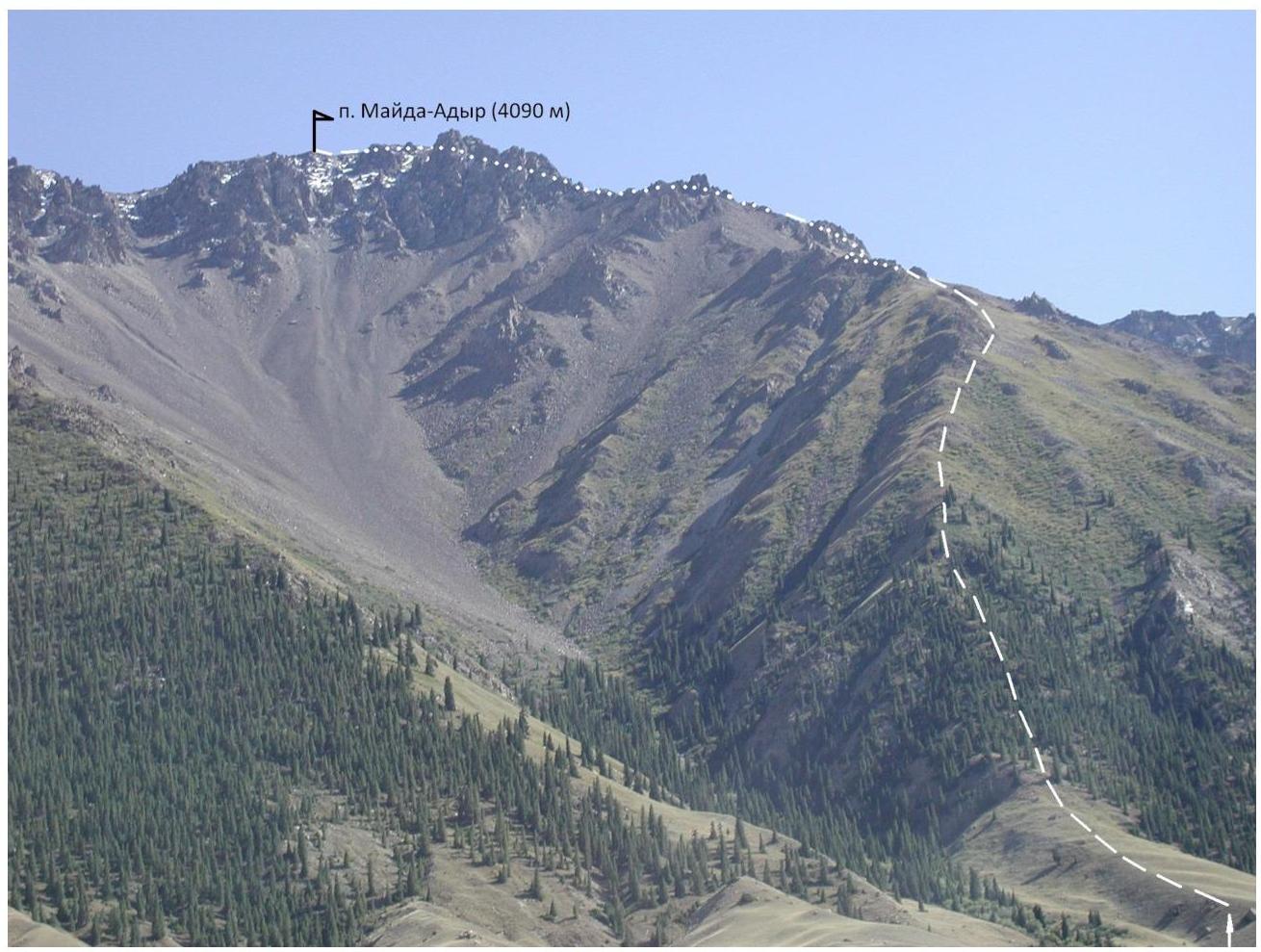
- Peak, its height, ascent route — Mayda-Adyr, 4090 m, via the right N ridge
- Route difficulty category — 1B cat. diff.
- Route characteristics:
Elevation gain — 1590 m, section length — average slope —
- Pitons hammered for belay:
rock — ice — protection gear —
- Number of climbing hours — 12 h
- Number of nights and their characteristics — none
- Climbers:
Leader — Solomatin Petr Ivanovich. Participants: — Zamorin Sergey 10. Team Coach — Solomatin Petr Ivanovich
- Organization — Federation of Alpinism, Rock Climbing and Ice Climbing of the Kyrgyz Republic
- Date of ascent and return from the peak:
Departure to the route and return — July 25, 2007
 □
□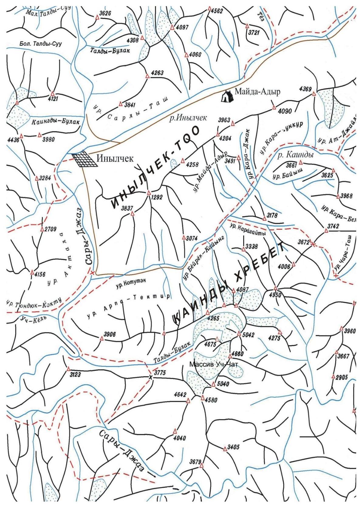
Orographic scheme of the region
Description of the approach to the route and ascent
The path from the location of the Mayda-Adyr alpine base of Tian-Shan Travel company (2500 m) begins with an ascent to a terrace (15 minutes), then an ascent along the terrace and, before reaching the forest, we cross to the opposite side of the tract (15–20 minutes). Then, along the forest-covered slopes, we ascend to the right ridge, without reaching the destroyed rocks, and traverse along the grassy and talus slopes to reach the watershed ridge with a slope of 30–35°. The ridge consists of destroyed rocks with separate standing rocky islands, which are bypassed. Ascent to the summit.
Descent is done via the ascent path.

