Ascent Passport
I. Ascent class — rock climbing
-
Ascent area — Tian-Shan, Trans-Ili Alatau ridge, Sredniy Talgar gorge.
-
Peak TAGANAI, 3800 m, West wall.
-
Estimated cat. difficulty — 2B
-
Route characteristics:
- Height difference — 430 m.
- Length of sections with 5th category of difficulty — none
- Average steepness — 60°.
- Pitons hammered in: for belaying:
- rock pitons — 8
- ice pitons — 1 (for descending from the summit)
- bolt pitons — none for creating artificial holds — none
-
Number of climbing hours — 5 hours
-
Number of nights on the route — none
-
Ascent participants:
- Meshkov Igor Nikolayevich — Master of Sports
- Petrashko Grigory Arsenyevich — Master of Sports
- Team coach — Ganyalin V.A.
II. Date of departure and return — June 19, 1978 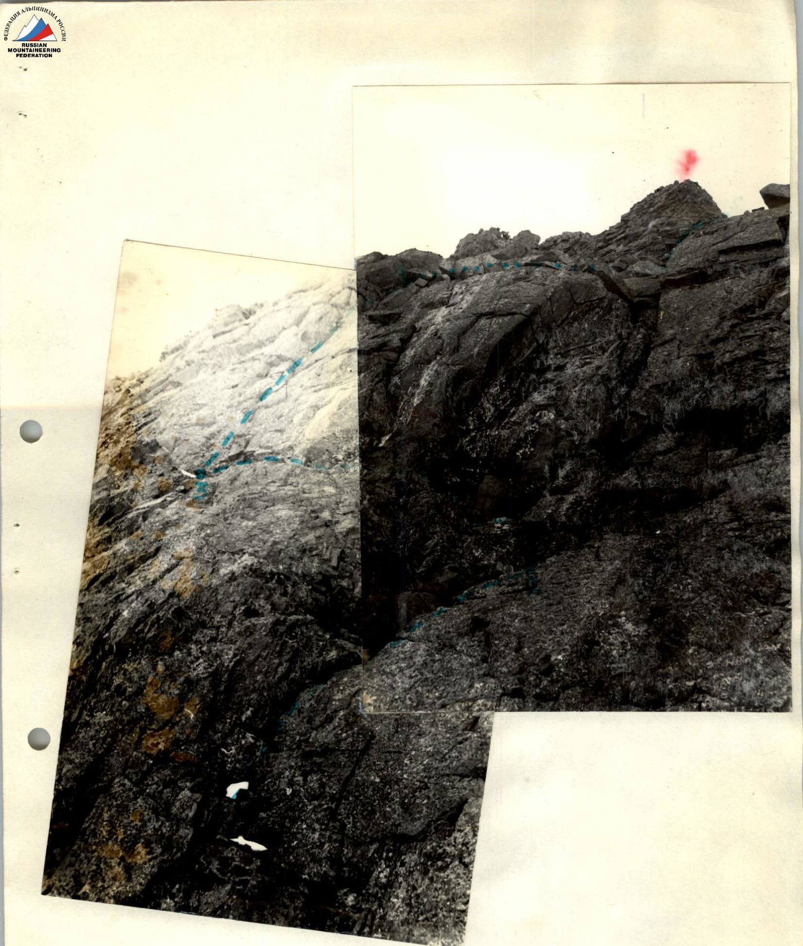
Ascent route of 3B category of difficulty.
Table of main route characteristics

| Date | Designation | Average steepness, in degrees | Length, in meters | Terrain type | Difficulty | Condition | Weather | Pitons (rock) | Pitons (ice) | Pitons (bolt) |
|---|---|---|---|---|---|---|---|---|---|---|
| June 19 | R0–R1 | 30 | 300 | scree couloir | 1 | not rockfall-prone | Clear | – | – | – |
| R1–R2 | 50 | 15 | inner corner | 3 | solid rocks | – | 1 | – | – | |
| R2–R3 | 20 | 30 | wide ledge | 2 | solid rocks | – | 1 | – | – | |
| R3–R4 | 60–70 | 25 | rock wall | 4 | solid rocks, slabs | – | 3 | – | – | |
| R4–R5 | 50 | 60 | rock wall | 3 | solid rocks | – | 2 | – | – | |
| R5–R6 | 30 | 30 | rock ridge | 2 | fractured rocks | – | – | – | – | |
| R6–R7 | 75 | 8 | rock wall | 4 | monolith | – | 1 | – | – |
Description of the approach to the start of the route
From the "Talgar" alpine camp, follow the trail in a northeasterly direction, past the helicopter pad to the "Sukhoy Log", then to the "Panoramnыy punkt". Then follow the trail along the ridge overgrown with grass to the "Dolina skifov". Here, in a wide hanging valley with a lake, there are convenient areas for overnight stays. The approach to the overnight stay site from the camp takes 2–2.5 hours.
From the bivouac, move east across the hills overgrown with grass towards the old moraine of the Malyutka glacier, flowing from the Tis pass. (1 hour walking) Ascend to the moraine along large stones on the left, near the rocks (30 minutes) and then follow the lateral moraine to the base of the scree couloir leading to the saddle behind the Big Gendarme, to the base of the west wall of the peak (20 minutes). The wall route begins from the saddle, where there is a control cairn.