
Ascent to the summit "Enbek"
The altitude above sea level according to the altimeter is 3920 m. The summit is located in the Dzungarian Alatau, in its Main northern ridge. It is situated in the gorge of the Karasai river, a tributary of Aksu, in the left spur of the Main ridge.
From the northeast - an ice wall that starts from the glacier and ends on the summit ridge. Steepness is 45–50° and from the east and southeast - destroyed rocks, partially covered with snow.
From the south - a rocky ridge. To the west - a large scree, which ends in rocks at the bottom.
Departure at 6:00. The path is in the Karasai river gorge. Exit to the "Enbek" pass via scree at 9:00. Further - along the ridge to the south. To the left - an ice wall, to the right - a frozen scree. Movement is exactly along the ridge.
Three ascents are overcome. Before the fourth ascent - an ice couloir, which descends to the west to the Koksai river valley. The ascent is icy. Crampons and insurance via an ice axe. The length of the steep part of the ascent is 50–60 m, with three pitons hammered into it. Steepness is 45–50°. Further path is along the ridge of frozen rocks. On the summit at 12:00. Return to the west via scree with exit to the couloir. Descent to the Koksai valley at 15:00 (descent took 2 hours). To the base camp at 18:00.
The weather is cold with wind, continuous cloud cover. The ascent was made on September 15, 1963, as part of the group:
- KONDRATYEV - leader - CMS
- GATSUTS - III sports category
- SOROKIN - III sports category
- RCHENOVA - III sports category
Estimated degree of difficulty - 2A.
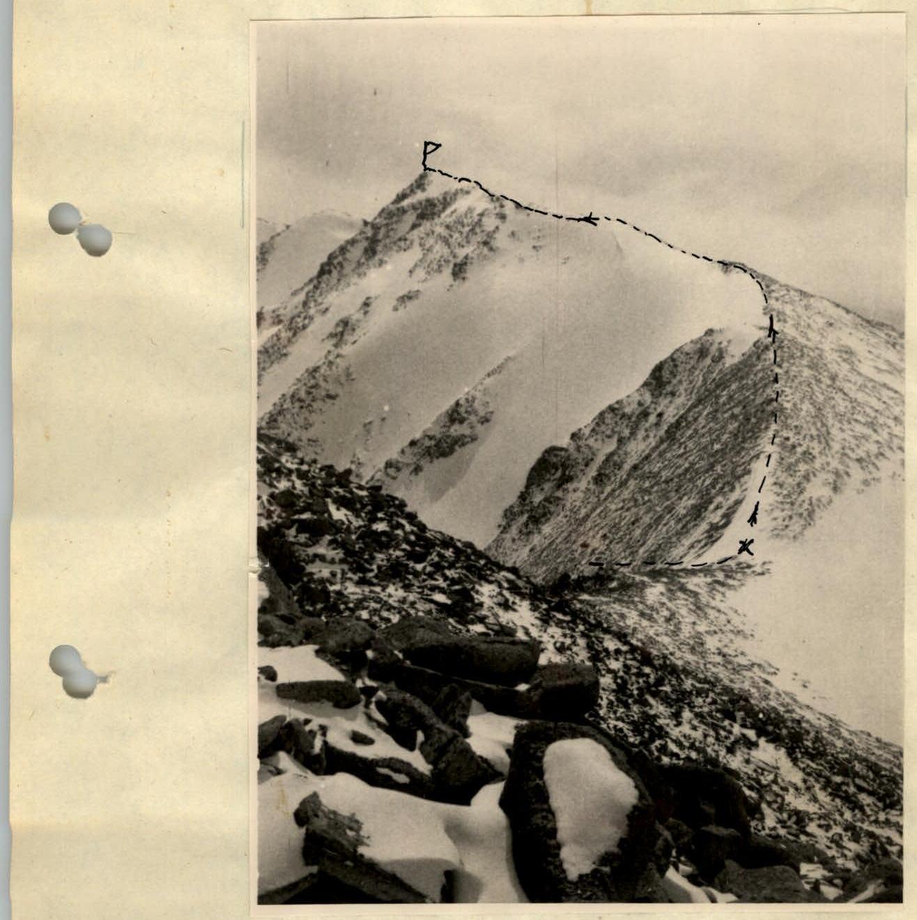
Enbek 3920 m - route of movement

Comments
Sign in to leave a comment