Russian Mountaineering Championship
High-Altitude Technical Class 2020
REPORT
On the ascent of the combined team of Krasnoyarsk Krai and Moscow, Parfenov A.A. – Lebedev N.M. to Peak Zvezdny, 2265 m, via the Center of the NE wall, 6A (Khvostenko, 01)
I. Ascent Passport
| 1. General Information | ||
|---|---|---|
| 1.1 | Full Name, sports rank of the leader | Parfenov A.A. (MS) |
| 1.2 | Full Name, sports rank of the participants | Lebedev N.M. (CMS) |
| 1.3 | Full Name of the coach | Zakharov N.N. (ISMS), Balezin V.V. (ISMS) |
| 1.4 | Organization | Krasnoyarsk Krai Federation of Alpinism |
| 2. Characteristics of the Ascent Object | ||
| 2.1 | Region | Western Sayan, Ergaki Ridge |
| 2.2 | Section number according to the classification table | 6.2 |
| 2.3 | Name and height of the summit | Peak Zvezdny, 2265 m |
| 3. Route Characteristics | ||
| 3.1 | Route Name | Via the center of the NE wall |
| 3.2 | Category of difficulty | 6A |
| 3.3 | Terrain characteristics of the route | Rocky |
| 3.4 | Altitude difference of the route (altimeter or GPS data) | 500 m |
| 3.5 | Route length (in meters) | 600 m |
| 3.6 | Technical elements of the route (total length of sections of varying difficulty) | Category 1 difficulty – 50 m, Category 3 difficulty – 30 m, Category 4 difficulty – 20 m, Category 5 difficulty – 150 m, Category 6 difficulty – 250 m |
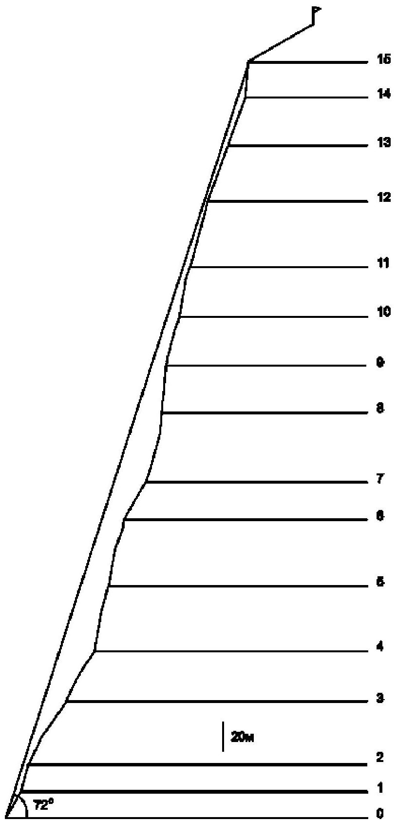
| 3.7 | Average steepness of the route (degrees) | 72° |
| 4. Characteristics of the Team's Actions | ||
| 4.1 | Time in motion (team's marching hours, in hours and days) | 15 hours, 1 day |
| 4.2 | Overnight stays | No, descended to the camp at Lake Svetloe |
| 4.3 | Time spent on route preparation | Without preparation |
| :--: | :--: | :--: |
| 4.4 | Departure onto the route | 6:50 |
| 4.5 | Arrival at the summit | 21:50 |
| 4.6 | Return to the base camp | 23:50 |
| 5. Meteorological Conditions | ||
| 5.1 | Temperature, °C | 20 °C |
| 5.2 | Wind speed, m/s | 5 m/s |
| 5.3 | Precipitation | Continuous rain throughout most of the day |
| 6. Person Responsible for the Report | ||
| 6.1 | Full Name, e-mail | Parfenov A.A., patriodemoerte@mail.ru |
II. Ascent Description
1. Characteristics of the Ascent Object
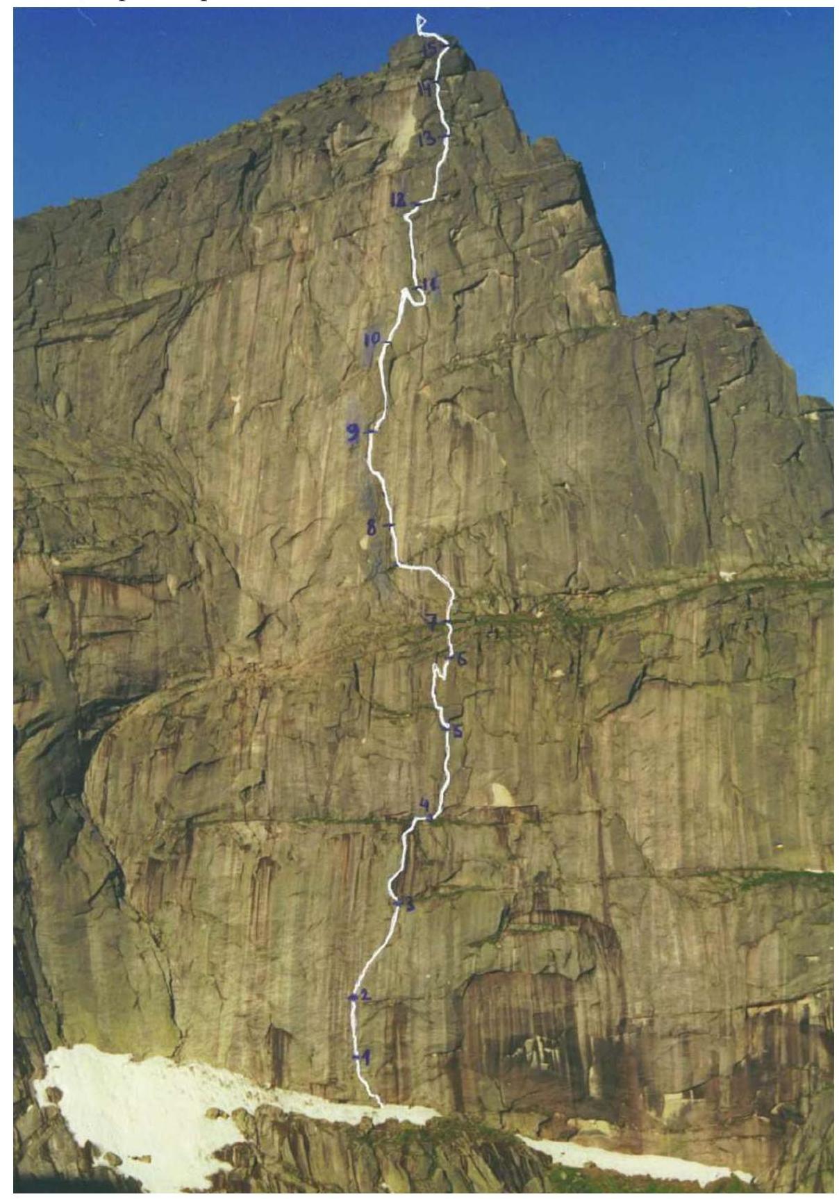
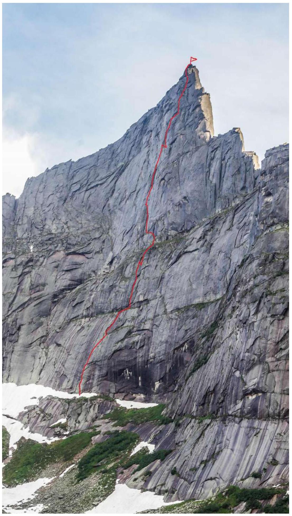
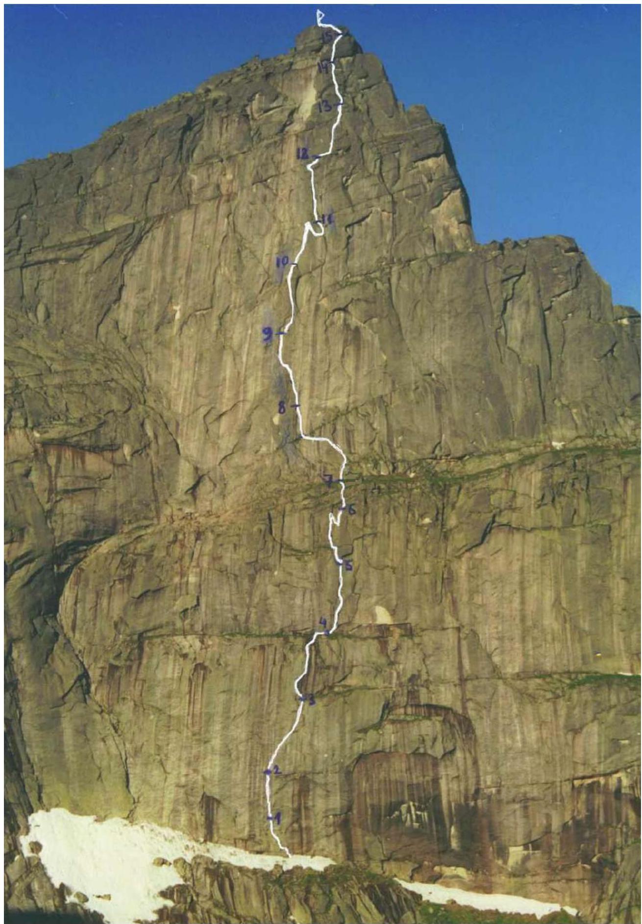
1.1 General Photo of the Summit
Route taken by the team
1.2 Photo of the Route Profile
1.3 Hand-Drawn Profile of the Route
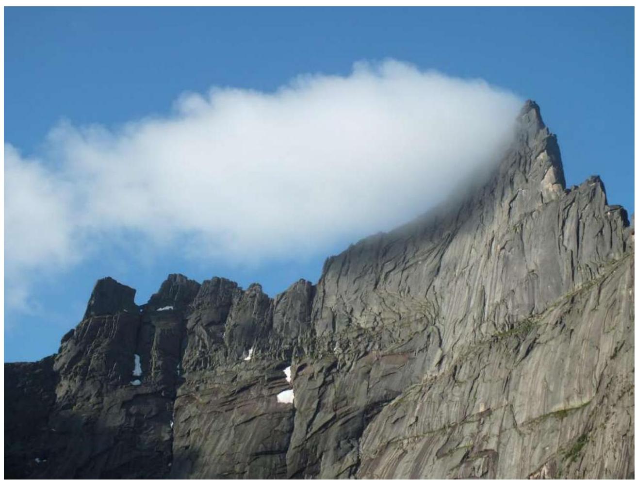
1.4 Photopanorama Zvezdny East–Zvezdny Main
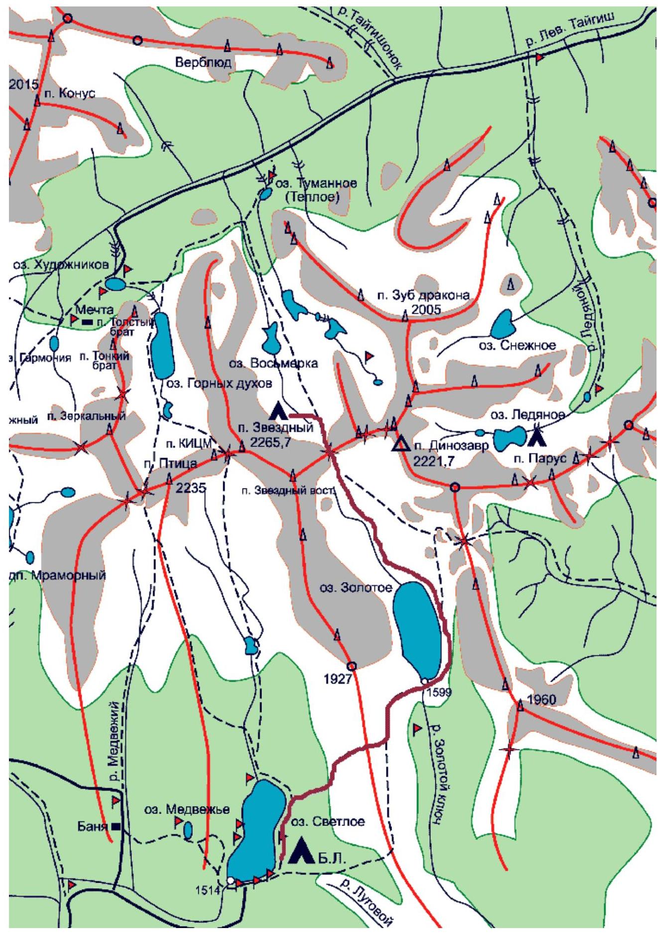
1.5 Map of the Area
2. Route Characteristics
2.1 Technical Photograph of the Route
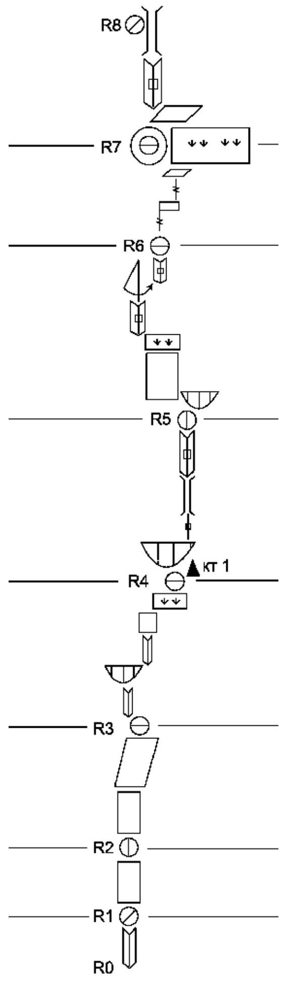
2.2 Route Diagram in UIAA Symbols
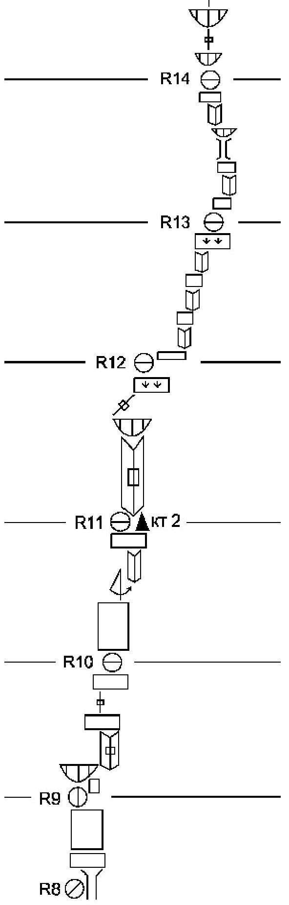
2.3 Route Description by Sections
The approach from the base camp at Lake Svetloe past Lake Zolotoye through Pikanтный Pass takes 3–3.5 hours. The advance camp is located directly under the Northeast wall of Peak Zvezdny. It takes 15 minutes to reach the start of the route from the camp. The route begins at a large grassy ledge at the base of the wall along an inner corner. At the start of the route, there is a cairn made of stones.
R0–R1: Inner corner, then along a diagonal ledge to the left into the next inner corner, which ends in a spall. Total length is 20 m. The belay station is on a ledge.
R1–R2: A 20 m wall is climbed using skyhooks. To the right, a small cornice (30 cm) remains untouched. The belay station is at the level of the cornice on a stationary bolt.
R2–R3: A 20 m wall with skyhooks, small stoppers, and some free climbing. The route leads to a small ledge. After the ledge, the terrain becomes easier. A monolithic slab with ledges and holds is traversed via free climbing for 30 m (protection on removable bolts). The belay station is on a grassy ledge in the lower part of a large sickle-shaped feature that goes left upwards.
R3–R4: Up the sickle-shaped feature — a corner with a slit that transitions into a 15 m cornice. Under the cornice, a traverse to the right. A corner with a slit for 15 m. A 10 m wall with free climbing. The route leads to a grassy ledge under a cornice. Along the ledge to the right for 10 m. The belay station is under the cornice. Control cairn #1 is in the slit under the cornice.
R4–R5: A removable bolt is placed on the cornice. A 5 m slit transitions into a chimney that cannot be climbed via free climbing. Along the inner corner for 20 m to a cornice. "Live" blocks!!! Under the cornice, a belay station is set up on a removable bolt.
R5–R6: Traverse on removable bolts to the left around the corner onto a monolithic slab. Along the monolithic slab for 25 m using skyhooks. The route leads to a grassy ledge. An inner corner for 15 m. A pendulum swing to the right onto a neighboring slit. Along the slit for 5 m, leading to a shoulder.
R6–R7: A system of vertical slits and ledges for 30 m to a large grassy ledge. An excellent bivouac site.
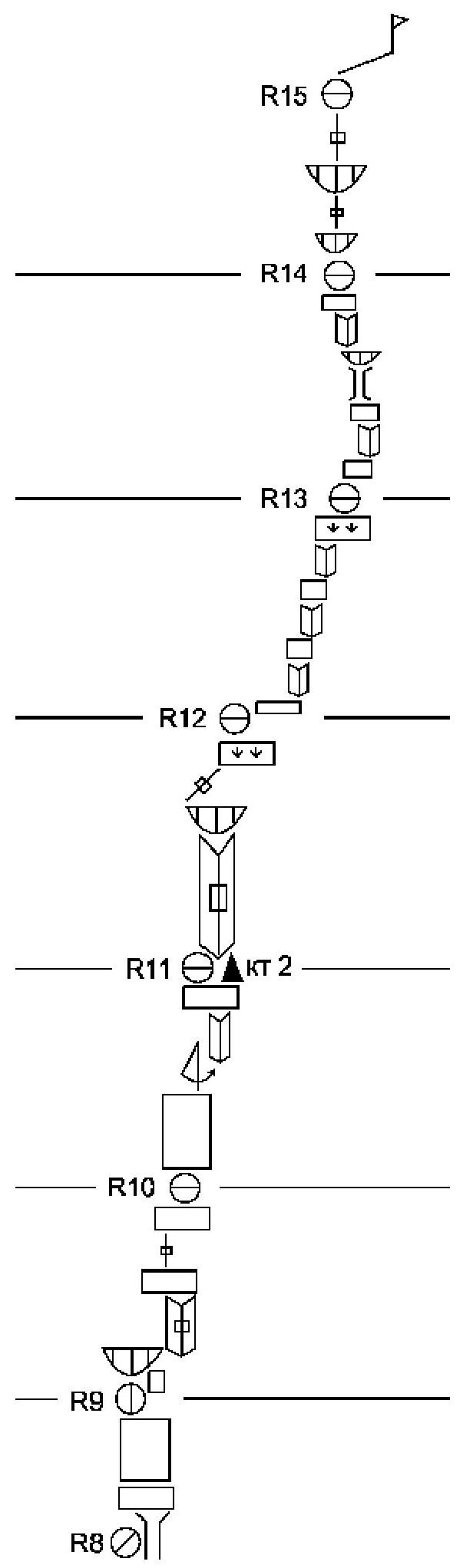
R7–R8: Along a diagonal ledge with a 50° slope for 25 m to the left and upwards via free climbing. An inner corner with slits for 25 m, transitioning into a 25 m chimney. A semi-hanging belay station is set up in the chimney.
R8–R9: Out of the chimney onto a ledge. A 20 m vertical wall is climbed using skyhooks. At the end, there is a stationary bolt.
R9–R10: To the right and upwards under a cornice using skyhooks for 5 m. The cornice is bypassed on the right. An inner corner for 20 m to a ledge. Along a slit to the next ledge for 10 m. The belay station is on a removable Petzl bolt.
R10–R11: Along a 25 m wall using skyhooks to a Petzl bolt. From the bolt, a pendulum swing to the right for about 10 m into an inner corner. Along the corner for 15 m to a ledge. Control cairn #2 is on the ledge in a slit.
R11–R12: A corner with a slit for 35 m to a cornice. The cornice is bypassed on the left. A diagonal slit to the right and upwards for 10 m to a ledge.
R12–R13: Along a narrow (10 cm) ledge to the right for 10 m. A system of corners and ledges for 40 m, generally heading to the right and upwards.
R13–R14: A system of corners, ledges, and chimneys for 35 m. Along the way:
- A small cornice is climbed directly via a slit.
- The general direction is left and upwards.
- The belay station is on a ledge under a cornice in a niche.
R14–R15:
- A cornice (0.5 m) is climbed directly via a slit.
- A 10 m slit.
- A second cornice (1 m) is climbed using artificial aids via a slit.
- A 15 m slit leads to a pre-summit shoulder.
- To the summit, 50 m along the ridge.
Descent
Via V. Lebedev's route, 5A along the SW edge (or simply "Kant"), 1.5–2 hours to the base camp at Lake Svetloe.
3. Characteristics of the Team's Actions
3.1 Brief Description of the Route Ascent
Since the route was planned to be completed within daylight hours (15 hours), and the descent was scheduled for pre-sunset or nighttime, the decision was made to start the ascent from the ABC located at Lake Vosmerka, descending along the "Kant" route, which is equipped with bolted protection, into the valley of Lake Svetloe, and returning to the base camp in the evening of the same day.
On July 26, 2020, the team arrived at the ABC at Lake Vosmerka. For two days, heavy rain poured down, so they were only able to start the route on July 28, 2020.
At 6:50 on July 28, 2020, the leader began moving on section R0–R1. The first part of the route to the ledge at the end of section R6–R7 was led by Parfenov A.A. The team reached the ledge at 13:30. From there to the summit, Lebedev N.M. led. The team reached the summit at 21:50. The descent along the "Kant" route took 40 minutes, and by 23:50, the team had returned to the base camp at Lake Svetloe.
Throughout the ascent, the leader moved in rock shoes, opting for climbing wherever possible, under continuous drizzle.
The team's movement was carried out in a simultaneous manner, with the leader always being belayed by two ropes, and between the 1st and 2nd team members, there was always a belay station and several intermediate protection points.
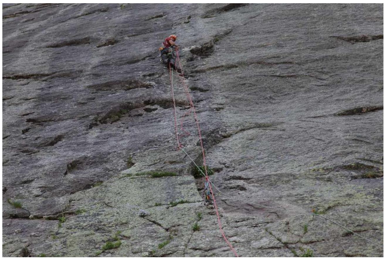
Photo 1. Gear transfer on section R1–R2. Alexander Parfenov is leading.
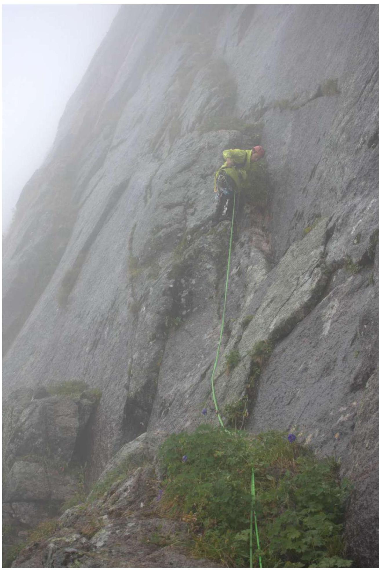
Photo 2. Nikolai begins work on section R7–R8.
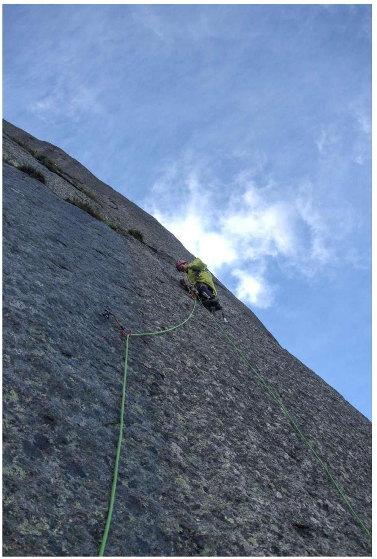
Photo 3. Nikolai continues work on section R10–R11.
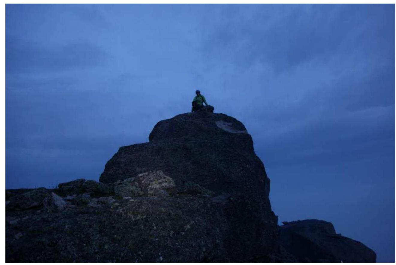
Photo 4. And the ascent to the summit already in the twilight.