Climbing Passport
- Center of Western Sayan, Ergaki ridge, 6.2.
- Zvezdny peak, via S wall center (via "Mirror")
- First ascent, 6A category of difficulty.
- The route is rocky.
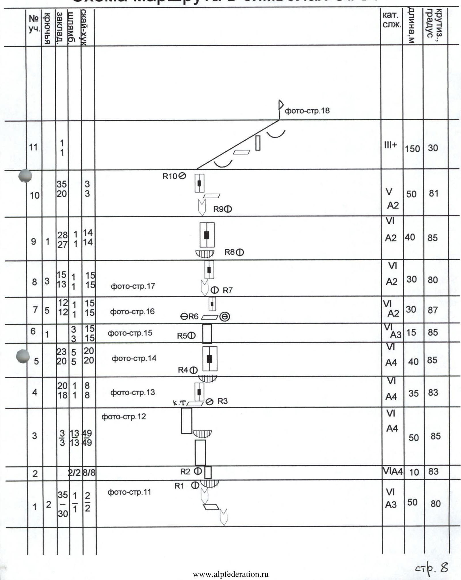
- Elevation gain along the route according to altimeter — 350 m.
Route length — 500 m. Length of sections:
- V category of difficulty — 50 m
- VI category of difficulty — 300 m. Average steepness:
- main part — 84°
- entire route — 62°
- Pitons left on the route:
total 12, all are bolted. Pitons used on the route:
- bolted stationary — 12, including artificial climbing holds (ACH) — 12
- bolted removable — 16, including ACH — 16
Total artificial climbing holds (ACH) used — 151.
-
Team's climbing hours: 52 hours, 5 days.
-
Leader: Terentyev Alexander Yurievich (Candidate for Master of Sports)
Participants:
- Tsyganov Dmitry Valerievich (Candidate for Master of Sports)
- Chereshnev Oleg Nikolaevich (1st sports category)
- Koryukin Igor Vitalievich (Candidate for Master of Sports)
-
Coach: Zakharov N.N., Honored Coach of Russia
-
Departure for the route: 8:00, February 23, 2001.
Reached the summit: 14:00, February 27, 2001. Returned to base camp: 21:00, February 27, 2001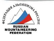
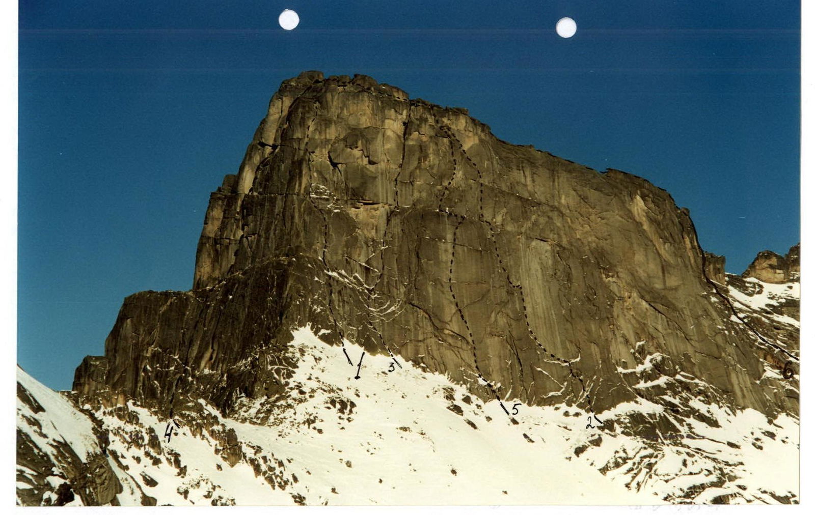
Area photopanorama
Brief Overview of the Climbing Area
Ergaki ridge is located in the central part of Western Sayan. The ridge stretches about 80 km from West to East with a maximum width of 70 km. Features of the area:
- Predominance of heavily dissected steep terrain
- Ancient glaciers
- Active erosion processes formed bizarre granite peaks in the southern part of the ridge.
The climate of the area is very harsh:
- Winter frosts reach –45–50°C
- Summer is cool and rainy
- Frequent thunderstorms
- Large number of trees struck by lightning — tangible evidence of existing danger.

For climbers, the most attractive areas are those adjacent to the peaks Zvezdny (2221 m), Ptitsa (2170 m), Zub Dragona (2070 m). Convenient approaches, trails, firewood, and water allow setting up a camp anywhere. Since the late 1980s, climbing clubs began to hold training camps in the area:
- Novokuznetsk,
- Abakan,
- Minusinsk,
- Krasnoyarsk,
- Norilsk.
Later, when the area gained climbing status, routes were classified. By the 2000 season, the following routes were climbed and classified: 1B – 2, 2A, 2B – 4, 3A, 3B – 3, 4A, 4B – 3, 5A, 5B – 8, 6A – 5.
Time breakdown looks approximately like this:
- From the Abakan — Kyzyl highway (622 km, bridge over the Tushkanchik river) with a good load — 3.5–4 hours to the base camp at Svetly lake.
- From here, training ascents to Ptitsa and Zvezdny peaks are mostly made. Approaching the route takes 1.5–2 hours.
- Approaching the area for technically complex climbs, specifically the cirque formed by the walls of Zub Dragona, Dinosaur, and North Wall of Zvezdny, takes 4 hours.
Frequent fogs that form during unstable weather create certain problems for such transitions, especially for groups that are here for the first time. In non-harvest years, there have been cases of bears approaching camps at night and before dawn.
Route Diagram in UIAA Symbols
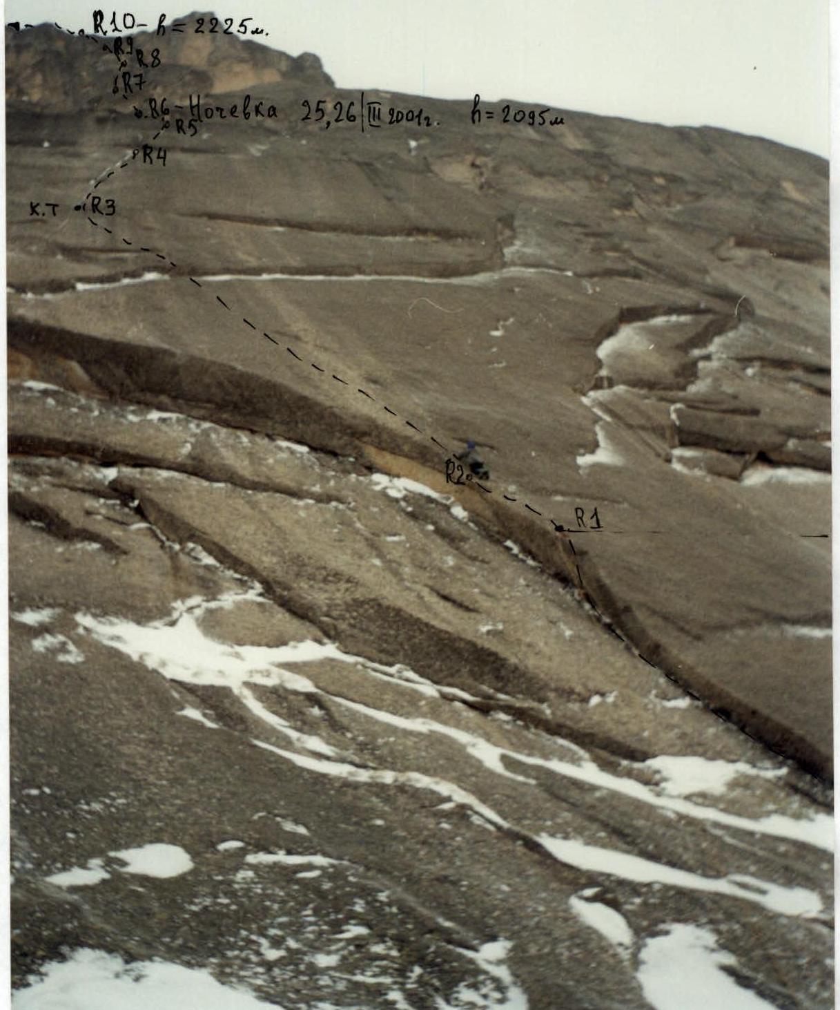
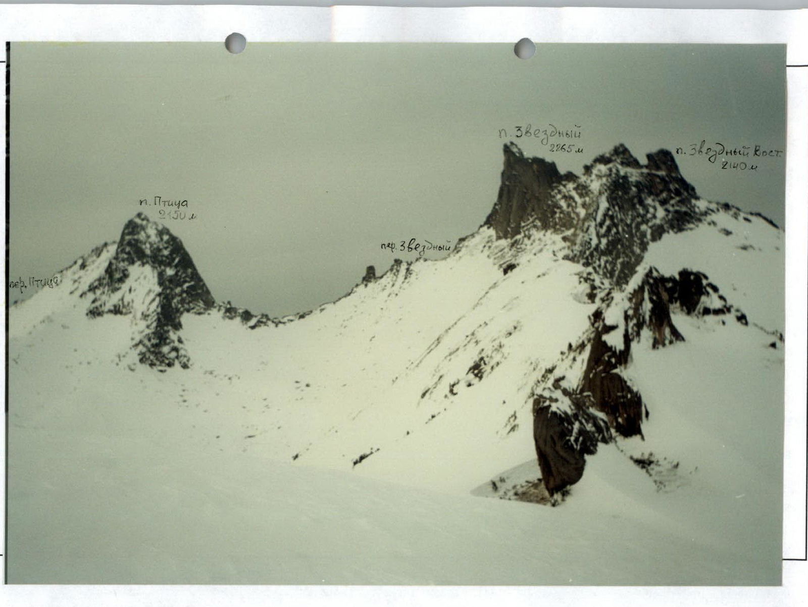
Technical photo of the route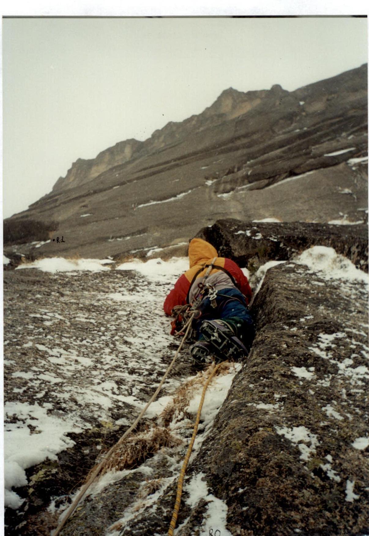
Passage of Section R0–R1.
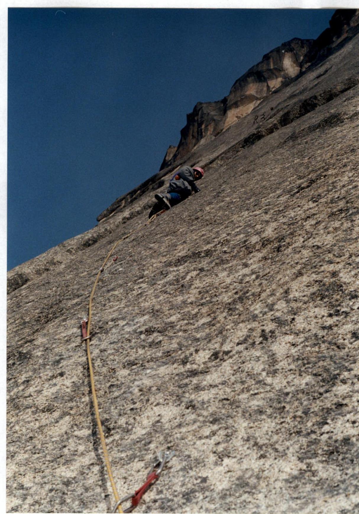
Passage of Section R2–R3 on skyhooks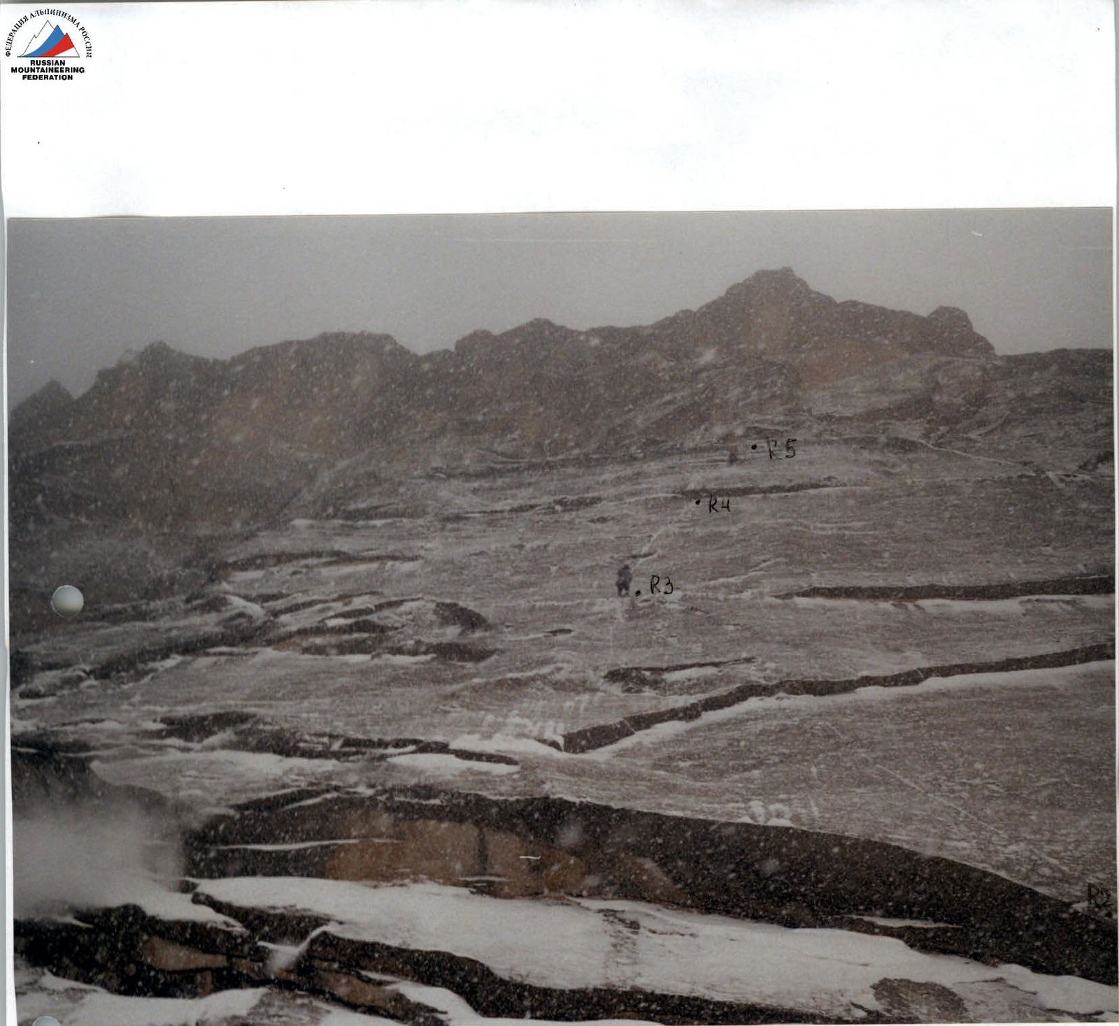
Section R3–R4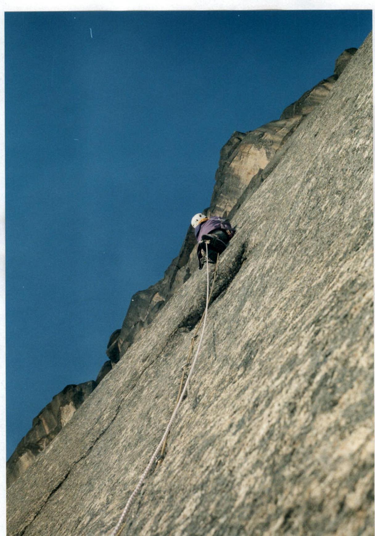
Section R4–R5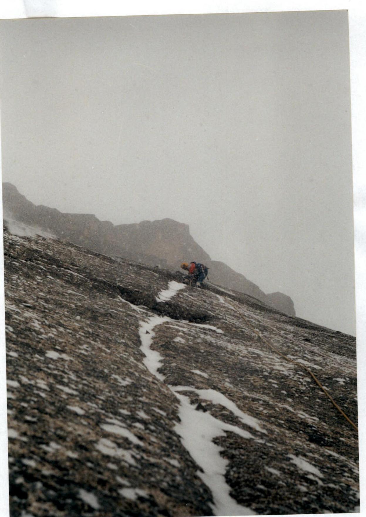
Section R5–R6
Section R7–R8.