
Report
ON THE FIRST ASCENT TO THE SUMMIT OF GEOMORFOLOGOV (2155) VIA THE SOUTHERN WALL COULOIR (THROUGH THE BIG FROZEN WATERFALL) CATEGORY 3B ROUTE IN WINTER CONDITIONS FROM 24.02.2023 TO 25.02.2023
I. Ascent Passport
| 1. General Information | ||
|---|---|---|
| 1.1 | Full Name, Sports Rank of the Team Leader | Parfen'tev E.P. II sports rank |
| 1.2 | Full Name, Sports Rank of Participants | Bezgodova O.V. II sports rank Kuklin O.Yu. II sports rank |
| 1.3 | Coach Name | |
| 1.4 | Organization | |
| 2. Characteristics of the Ascent Object | ||
| 2.1 | Region | Tunkinskie Gol'tsy |
| 2.2 | Valley | "Eloty-Khargun" |
| 2.3 | Classification Table Section Number (2013 edition) | 6.1.2 |
| 2.4 | Name and Height of the Summit | Geomorfologov 2155 m (height according to topographic map) |
| 2.5 | Geographical Coordinates of the Summit (Latitude/Longitude), GPS Coordinates *(1) | N51°49'40.5568" E101°56'39.1606" |
| 3. Route Characteristics | ||
| 3.1 | Route Name | Southern wall couloir (through the big frozen waterfall) |
| 3.2 | Proposed Category of Difficulty | 3B in winter conditions |
| 3.3 | Degree of Route Exploration | First ascent |
| 3.4 | Route Terrain Characteristics | Combined |
| 3.5 | Route Elevation Gain (calculated) | 770 m (according to GPS) |
| 3.6 | Route Length [m] | 1451 |
| 3.7 | Technical Elements of the Route (total length of sections with different difficulty categories, indicating terrain type (ice-snow, rock)) | I cat. diff. ice, rocks — 1065 m. II cat. diff. ice, rocks — 228 m. III cat. diff. ice, rocks — 24 m. IV cat. diff. ice, rocks — 32 m. V cat. diff. ice, rocks — 94 m. VI cat. diff. ice, rocks — 8 m. |
| 3.8 | Average Steepness of the Route, (°) | 29 |
| 3.9 | Average Steepness of the Main Part of the Route, (°) | 53 (R0–R7) |
| 3.10 | Descent from the Summit | Down the southern slope towards the Eloty-Khargun river |
| 3.11 | Additional | The route was completed in winter conditions |
| Route Characteristics | ||
| :--: | :--: | :--: |
| 4. Characteristics of Team Actions | ||
| 4.1 | Time of Movement (team's walking hours, indicated in hours and days) | 12 hours — walking hours on the route. 20.5 hours — walking hours from BL to BL. 2.5 hours — approach to the route from BL. |
| 4.2 | Overnights | - |
| 4.3 | Time of Route Development | - |
| 4.4 | Departure on the Route | 08:30; 24.02.2023 |
| 4.5 | Arrival at the Summit | 20:30; 24.02.2023 |
| 4.6 | Return to the Base Camp | 02:30; 25.02.2023 |
| 4.7 | Ice Screws Used | 32 pcs. |
| 4.8 | Anchors Used | - |
| 4.8 | Protection Gear Used | - |
| 4.8 | Friends Used | - |
| Including ITO | - | |
| 4.9 | Total Used | 32 pcs. |
| 5. Weather Conditions Characteristics | ||
| 5.1 | Temperature, °C | –5…–18 |
| 5.2 | Wind Speed, m/s | Calm on the southern slope, NW wind 8 m/s on the ridge |
| 5.3 | Precipitation | None |
| 5.4 | Visibility, m | Clear |
| 6. Responsible for the Report | ||
| 6.1 | Full Name, e-mail | Bezgodova O.V., ola.bezgodova.23@yandex.ru |
- The team's route to the summit of Geomorfologov via the southern wall couloir (through the big frozen waterfall)
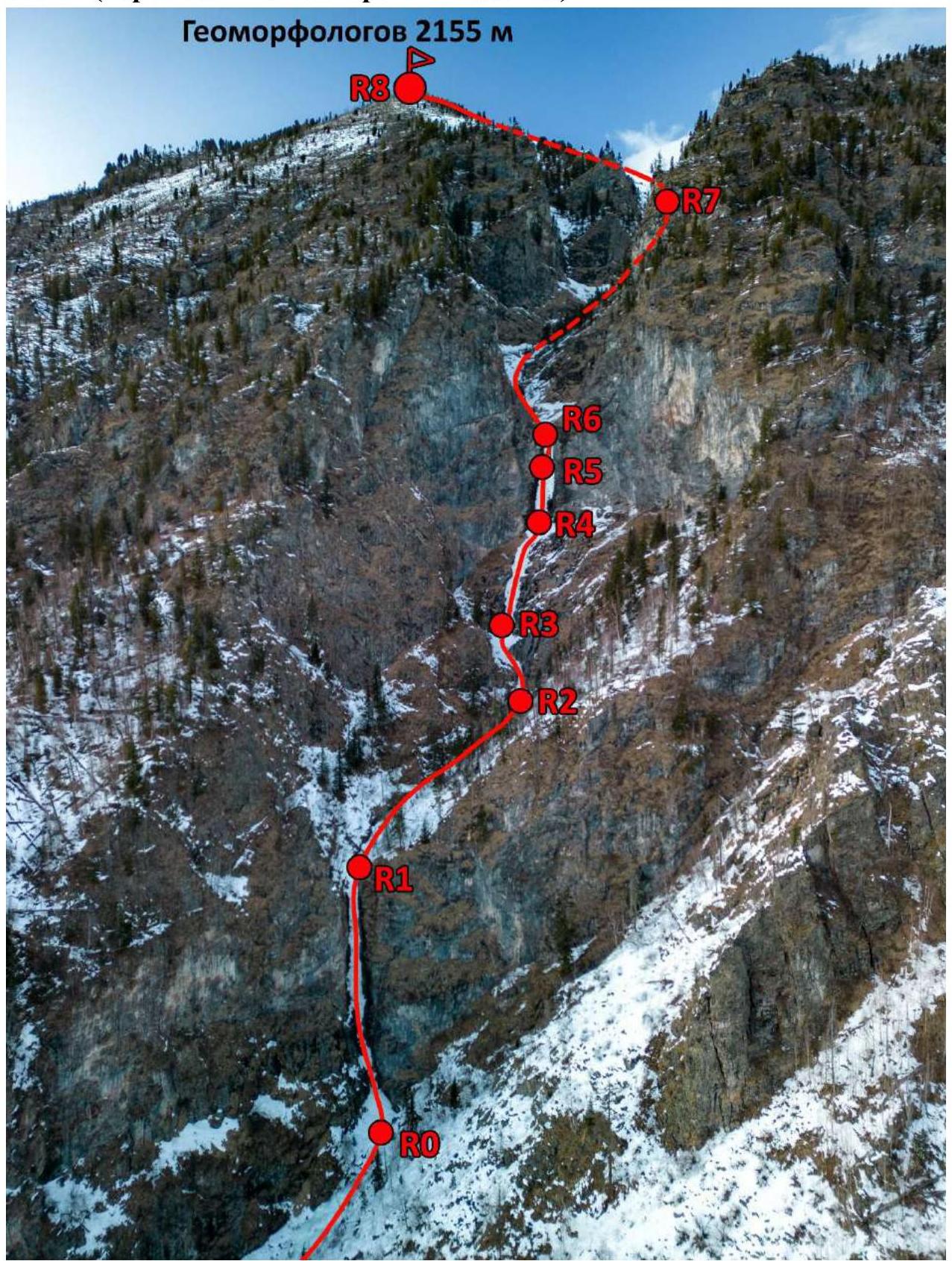
1.1. Technical photograph of the route thread: upper part. 1.2. Technical photograph of the route thread: middle part.
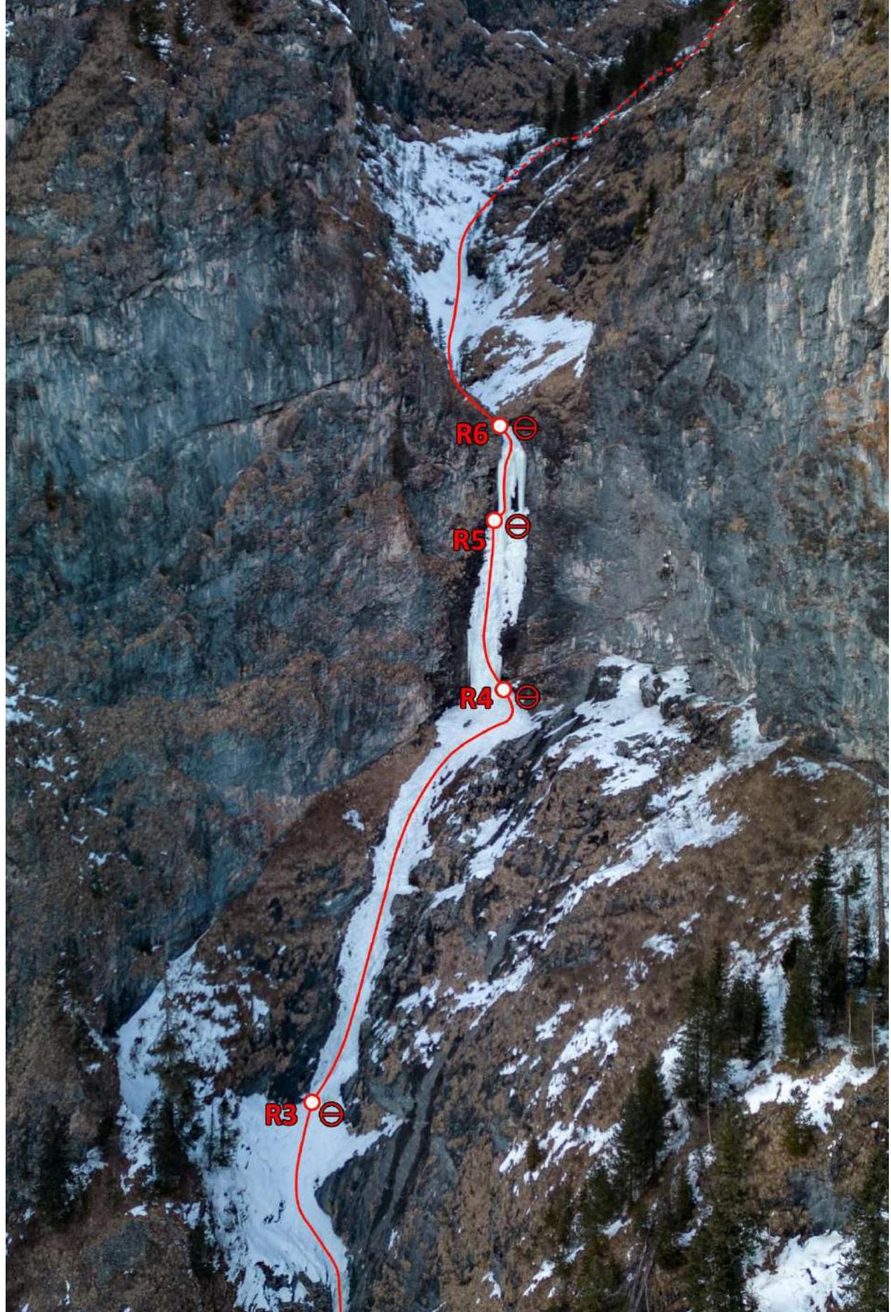 1.3. Technical photograph of the route thread: lower part.
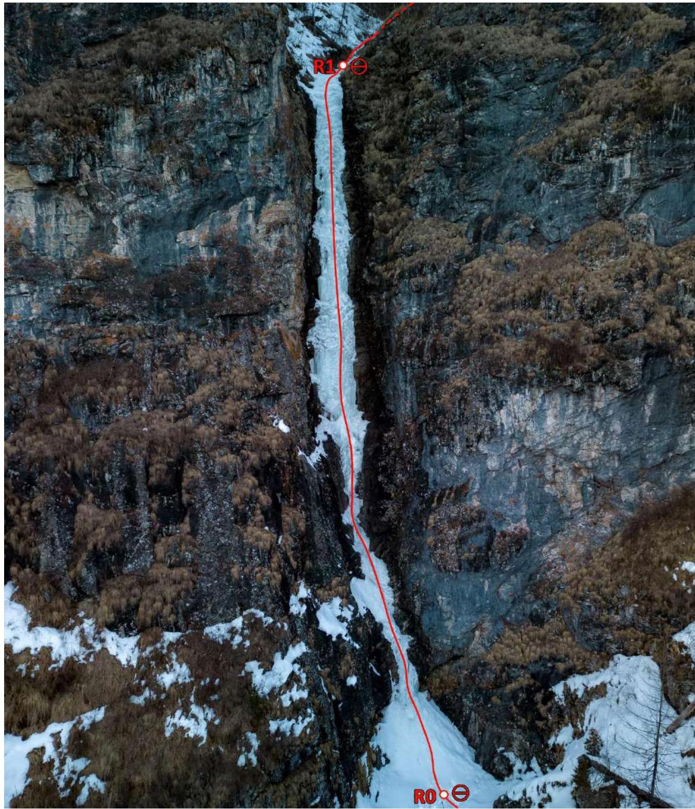
1.4. Route Profile
Hand-drawn profile of the route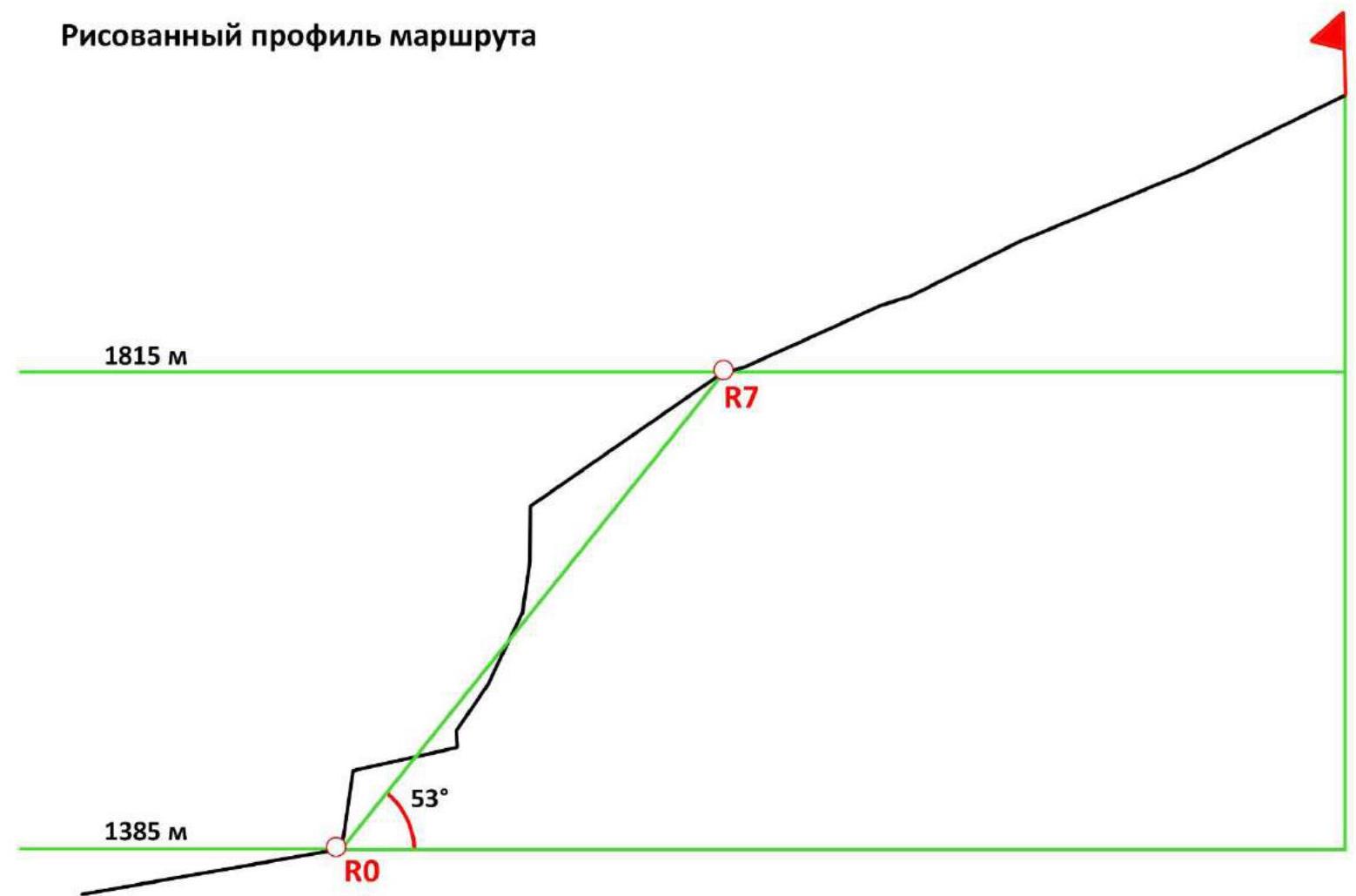
- General Characteristics of the Ascent Area.
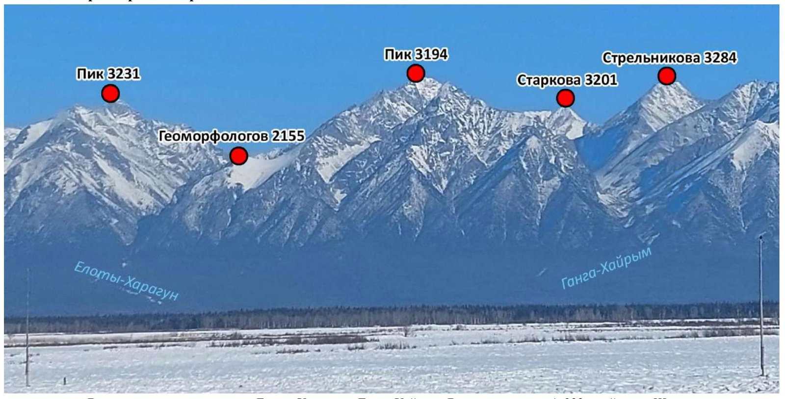
Summits in the vicinity of the rivers Eloty-Khargun and Ganga-Khairym. View from the A-333 highway in the area of Shimki village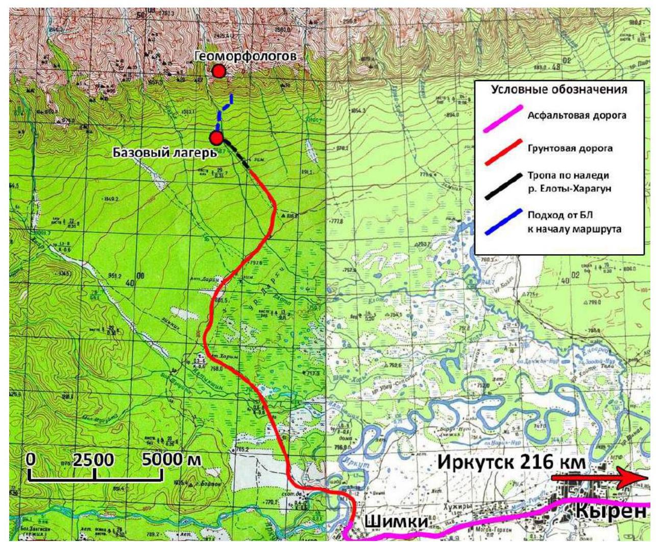
Topographic map of the area (General Staff 1986 edition)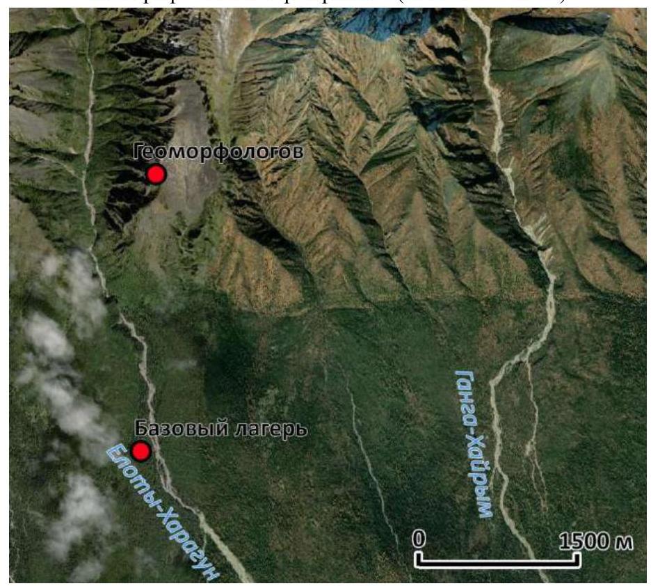
Black line — approach to the route, red line — route to the summit
The summit of Geomorfologov (2155 m) is located in the Eloty-Khargun river valley. This area of the Tunkinskie Gol'tsy (Eastern Sayan) is poorly developed in terms of infrastructure. There are no asphalt roads, and dirt roads (winter road) are only accessible during the winter-spring period (December to early April). During the rest of the year, the marshy terrain hinders the passage of vehicles, except for high-clearance vehicles (tractors, Ural, KamAZ, etc.). In the summer, it is possible to reach the area via:
- through the village of Tagarkhay,
- bypassing the valleys of the Barun and Zun-Khandagai rivers, etc.
There is no direct path, as crossing the Irkut River is only possible on ice during the winter-spring period. The most comfortable time to visit is late February to early March, when nighttime temperatures are almost never below –15 to –20°C, and daytime temperatures range from –5 to 0°C. At this time, the dirt road has a solid surface in the morning, allowing the marshy lowlands to be bypassed on solid ground without water.
In the area of the Ganga-Khairym and Eloty-Khargun rivers, there are climbing routes (4 routes according to the "Eastern Sayan" guidebook) with difficulties ranging from 1B to 3A on the summit of Strelnikov (3284 m, the highest point of the Tunkinskie Gol'tsy), as well as the summits of Tamara (3141 m) and Starkov (3187 m). Ice routes in this area have not been previously attempted.
In the future, the area can be developed for new summer and winter climbing routes. The summits are rich in ridges and counterforts that have not been climbed before. There are also summits that have never been visited by climbers. Overall, the area is very interesting and has great potential.
To enter the territory of the Tunkinskiy National Park, a permit must be obtained on the park's official website.
3. Characteristics of Team Actions
3.1. Team Tactical Plan
No ascents have been made to the summit of Geomorfologov, and there are no established climbing routes. The ice flow of Geomorfologov was discovered in 2019 during a reconnaissance of approaches to the summit of Strelnikov by Parfen'tev E.P. and Kuklin O.Yu. The team decided to target the unnamed summit marked on the 1989 topographic map with a height of 2155 m.
The ascent was planned for late February (February 24) due to more stable snow and ice conditions in the area and favorable weather conditions compared to the spring period. On the day of the ascent, the air temperature during the day was around –5 to –18°C, and there was calm on the southern slope, while a northwest wind blew on the ridge.
On February 23, the team departed from Irkutsk and was transported to the base camp. On February 24 at 06:00, they began their ascent. The approach to the route (1385 m) from the base camp (1010 m) took 2.5 hours due to deep snow and fallen trees. The team (Parfen'tev E.P., Bezgodova O.V., Kuklin O.Yu.) was accompanied by Kolesnikov A.O., whose tasks included:
- conducting photo and video filming of the first ascent using a drone,
- maintaining radio communication.
3.2. Tactical Actions of the Team on the Route
The team (Parfen'tev E., Bezgodova O., Kuklin O.) used two ropes (dynamic). All participants climbed the route using ice tools. On the R0–R2 section, Bezgodova O.V. worked first, and on the R2–R6 section, Parfen'tev E.P. worked first. On the R6–R8 sections, due to deep snow, team members worked alternately.
The group's equipment included: 14 ice screws (3–13 cm, 9–18 cm, 2–21 cm), 4 anchors, 3 loops, 14 quickdraws, 2 dynamic ropes 1/2 of 60 and 80 m, 3 pairs of ice tools.
Radio communication was maintained every hour. The descent from the summit was made down the southern slope, littered with fallen trees, towards the Eloty-Khargun river, and then along the frozen riverbed. The team arrived back at the base camp at 02:30 on February 25, 2023.
3.3. Description of the Route Passage by the Team
The route to the summit of Geomorfologov via the southern wall couloir (through the big frozen waterfall) begins at an altitude of 1385 m, coordinates N51°48'57.9915" E101°56'57.8895".
R0–R1
60 m, 55–85°. The route begins with a 4 m wall (IV), which slightly eases (III) and transitions into a porous ice wall 51 m high (first key section, V). Thin ice with firn and snow, many cavities. In some places, the ice mass is detached from the rock. Protection via ice screws is unreliable. At the top, on a gentle section, there is a station to the right on 2 screws. Movement is alternating.
R1–R2
110 m, 10–20°, I–II. A gentle ice section. Simultaneous movement along the frozen riverbed.
R2–R3
60 m, 50–75°. A 4 m wall 75° (III), followed by a section of reliable firn and ice (II). Simultaneous movement. Protection via ice screws. Station to the left on 2 screws.
R3–R4
40 m, 60°, III. Simultaneous movement on ice with firn. Protection via ice screws. Possible ice and rockfall on the station. When approaching the next ice wall, it is recommended to set up a station on the right side. Station to the right on 2 screws.
R4–R5
29 m, 85°, V. A porous ice wall ending in an "ice pillar." Protection via ice screws. Alternating movement. Behind the pillar, there is a convenient and reliable place for a station, which eliminates "bombardment" by ice. Station to the left on 2 screws.
R5–R6
22 m, 90–95°, VI. "Ice pillar." Second key section. Unreliable protection. Caution: the pillar may have a crack and collapse.
R6–R7
370 m, 20–30°, I–II. A series of simple cascades (2–4 m) on the glacier until exiting the stream bed.
R7–R8
760 m, 15–30°, I. Then, to the left along the slope to the southern ridge.
- The summit is a rocky elevation with scree.
- Control cairn.
3.4. UIAA Scheme
Geomorfologov. UIAA Scheme. Southern wall couloir (through the big frozen waterfall)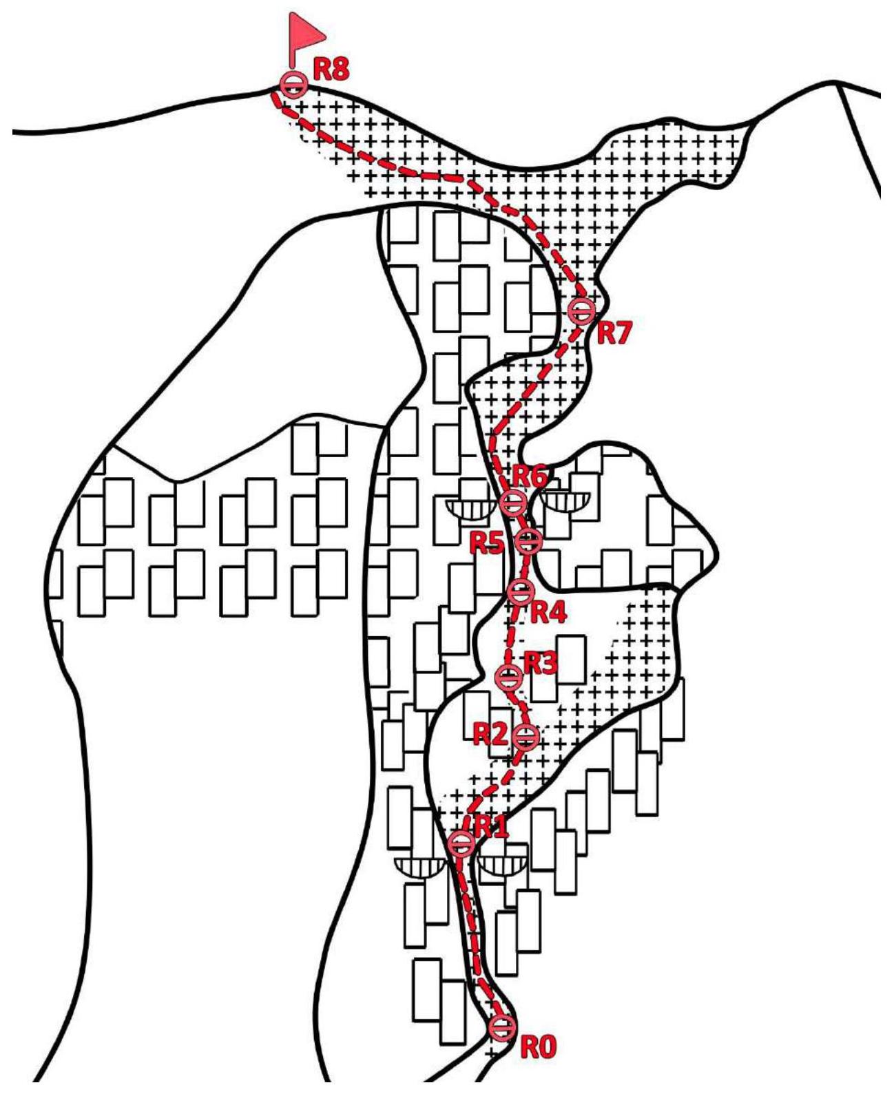
3.5. Character and Complexity of the Terrain on the Route by Sections.
| Section | Terrain Character by Sections | Number of Ice Screws | UIAA Difficulty | Length [m] | Average Steepness [°] |
|---|---|---|---|---|---|
| R0–R8 | TOTAL | 32 | I–VI | 1451 | 29 |
| R0–R1 | Ice Ice, rocks, snow Ice | 10 | IV III V | 4 5 51 | 70 55 85 |
| R1–R2 | Rocks, ice, snow | 0 | I II | 100 10 | 10 20 |
| R2–R3 | Ice, snow Ice Ice, snow | 4 | III II II | 4 2 54 | 75 55 50 |
| R3–R4 | Ice, snow Ice, snow Ice, snow | 3 | IV III I | 28 7 5 | 70 40 15 |
| R4–R5 | Ice | 6 | V | 29 | 85 |
| R5–R6 | Ice Ice Ice | 9 | V VI V | 6 8 8 | 90 95 90 |
| R6–R7 | Ice, snow Snow Ice, snow Snow Ice, snow | 0 | II I III I III | 160 47 6 153 4 | 10 15 60 20 55 |
| R7–R8 | Rocks, snow Snow | 0 | I I | 320 440 | 25 15 |
3.6. Brief Description of the Route Passage
| Section | Description | Photo Number |
|---|---|---|
| R0–R1 | Vertical dense ice 4 m (IV), followed by thin ice with rocks and firn 5 m (III), transitioning into a vertical wall of loose ice with cavities and firn 51 m (V) | 1,2 |
| R1–R2 | Cascades of ice on rocks with snow and trees (I–II) | 2 |
| R2–R3 | Wall of dense ice 4 m (III). More gentle section of ice with snow (II). Snowy ice wall with porous firn (II). | 2,3,4 |
| R3–R4 | Dense ice 28 m (IV), gradually easing (III) and transitioning into an ice ledge. | 2,4 |
| R4–R5 | Vertical porous ice wall 29 m (V) | 2, 4, 5, 6, 7 |
| R5–R6 | Overhanging (95°) ice pillar with cavities and a crack on the entire surface (V–VI) | 2,6,7 |
| R6–R7 | Cascades of ice on snow and rocks (I–III). | 2,8 |
| R7–R8 | Exit to a snowy slope. Snow-covered rocks (I). Transition to the summit ridge. | 9,10 |
4. Recommendations
We evaluate the route as a combined category 3B in winter. The route is recommended for experienced sports teams. The team leader should:
- confidently move on ice,
- be able to organize protection on porous ice,
- avoid sections with potential icefall due to the risk of ice structure collapse.
The condition of ice on glaciers changes from year to year, depending on the amount of summer precipitation and temperature regime during transitional seasons (autumn, spring). Therefore, there is a possibility of deterioration in ice conditions and a change in the category of difficulty of the route. In the 2023 season, the glaciers of the Tunkinskie Gol'tsy had an unreliable ice structure, and many ice walls were detached from the rock base and posed a risk of collapse.
Protection on ice formations in the form of:
- "Abalakov threads",
- "Ice hooks",
- "Mushrooms", etc.
is extremely unreliable and can lead to loss of a protection point or a participant's fall. Therefore, it is necessary to either use additional rock protection points or bypass these sections along more reliable ice.
There are two possible descent options from the summit of Geomorfologov: along the ascent route and down the southern slope of the summit. The second option was chosen because the ice condition along the ascent route did not allow for reliable protection, and there were no suitable trees for rappelling. The difficulty of descending the southern slope lies in the fallen trees after forest fires, which hindered fast and safe movement down the slope.
Route Photos
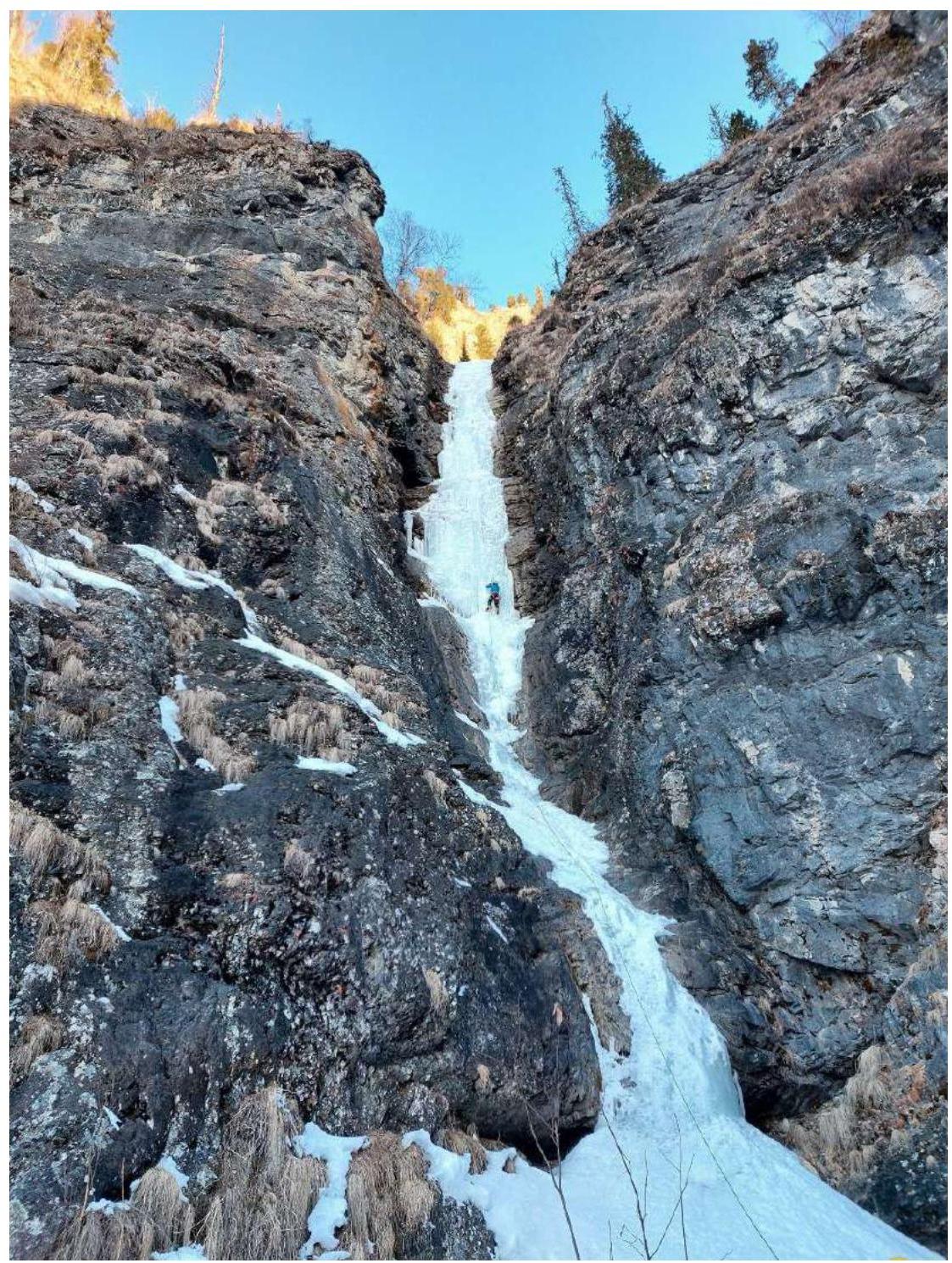
Photo 1. Section R0–R1. Leader Bezgodova O.V. First key section of the route.

Photo 2. General view of sections R0–R6. Section R1–R2 is a gentle ice riverbed with fallen trees and rocks.
Photo by Kolesnikov A.O.
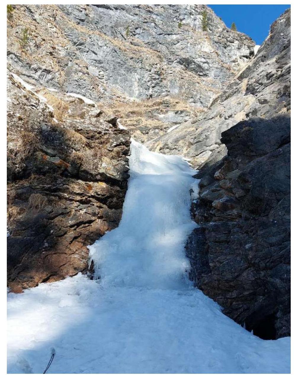
Photo 3. Section R2–R3. Ice wall 4 m 50–75°.
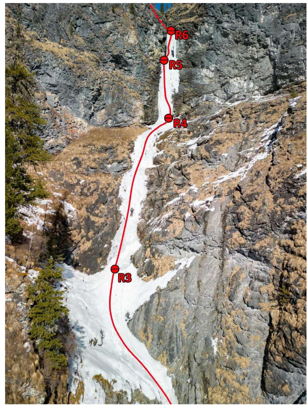
Photo 4. General view of sections R2–R6. On section R3–R4, Parfen'tev E.P. is leading. Photo by Kolesnikov A.O.
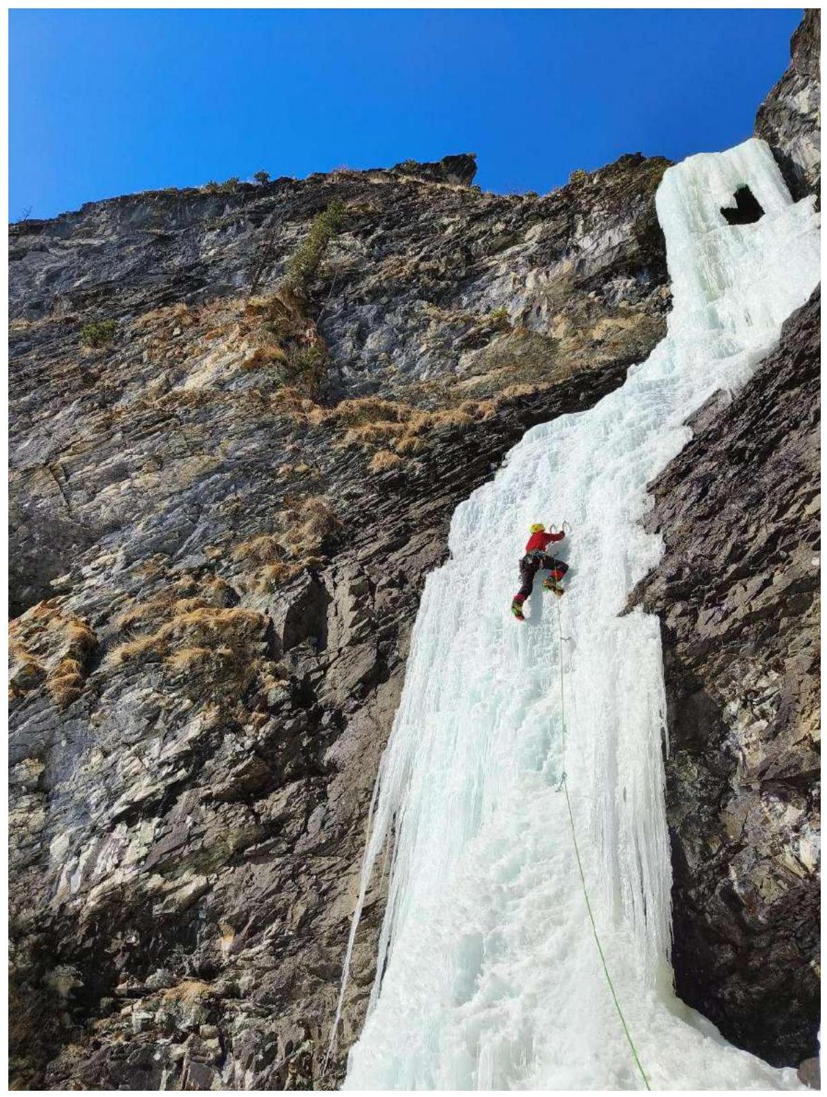
Photo 5. Section R4–R5. Parfen'tev E.P. is leading.
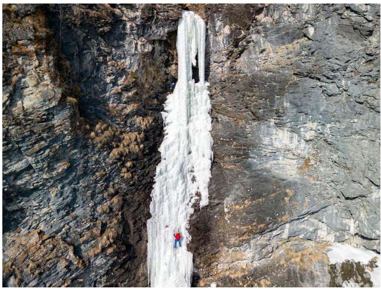
Photo 6. Section R4–R5. Bezgodova O.V. is on the station, accepting Kuklin O.Yu. Photo by Kolesnikov A.O.
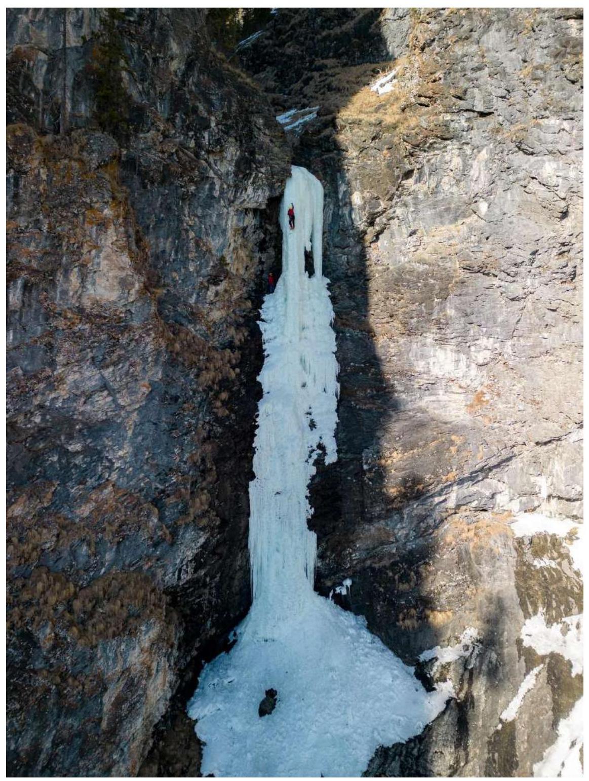
Photo 7. Parfen'tev E.P. on the second key section of the route R5–R6. Kuklin O.Yu. is on the station. Photo by Kolesnikov A.O.
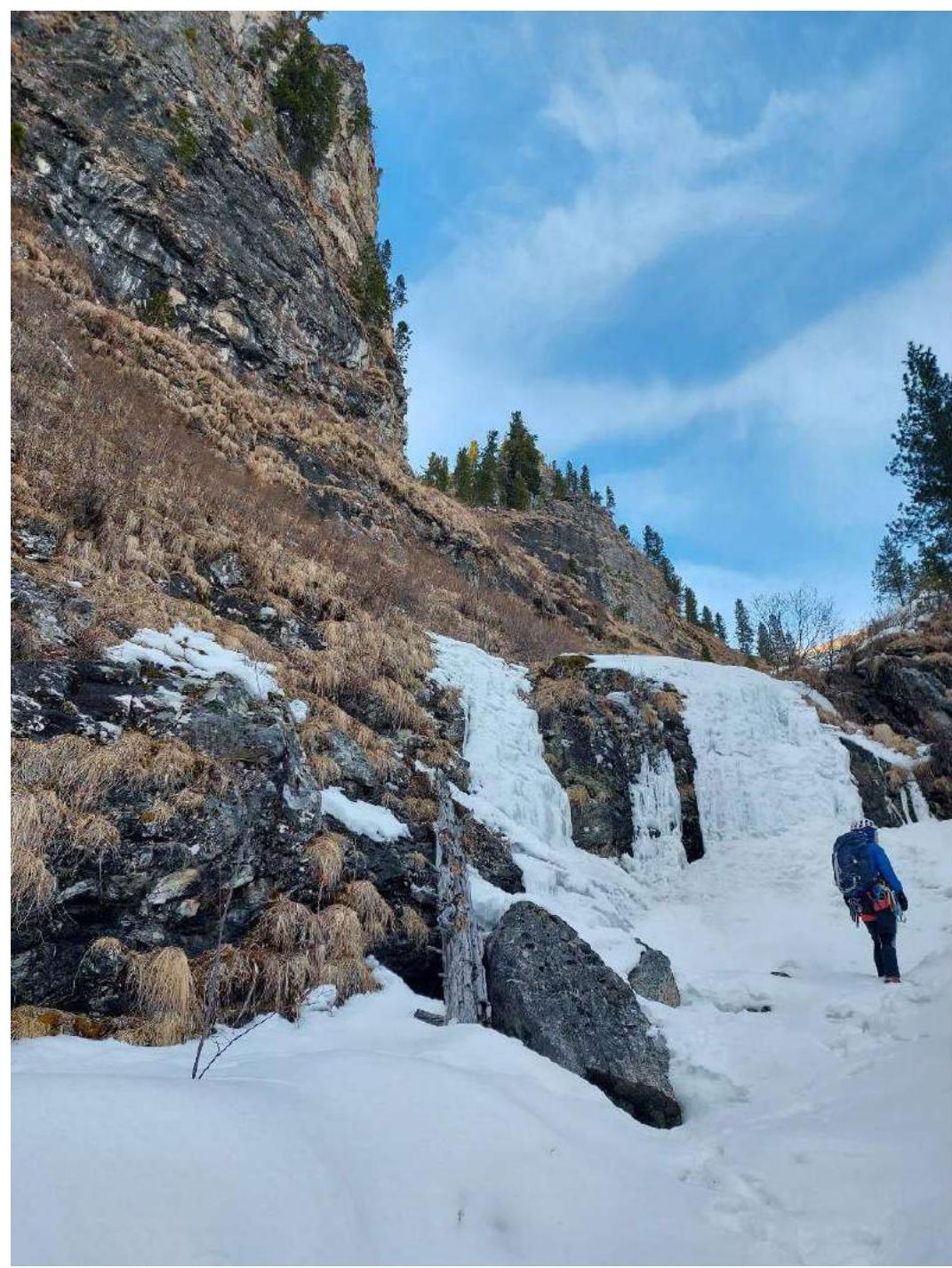
Photo 8. Section R6–R7 with a series of simple ice walls up to 4 m. Bezgodova O.V. is in the photo.
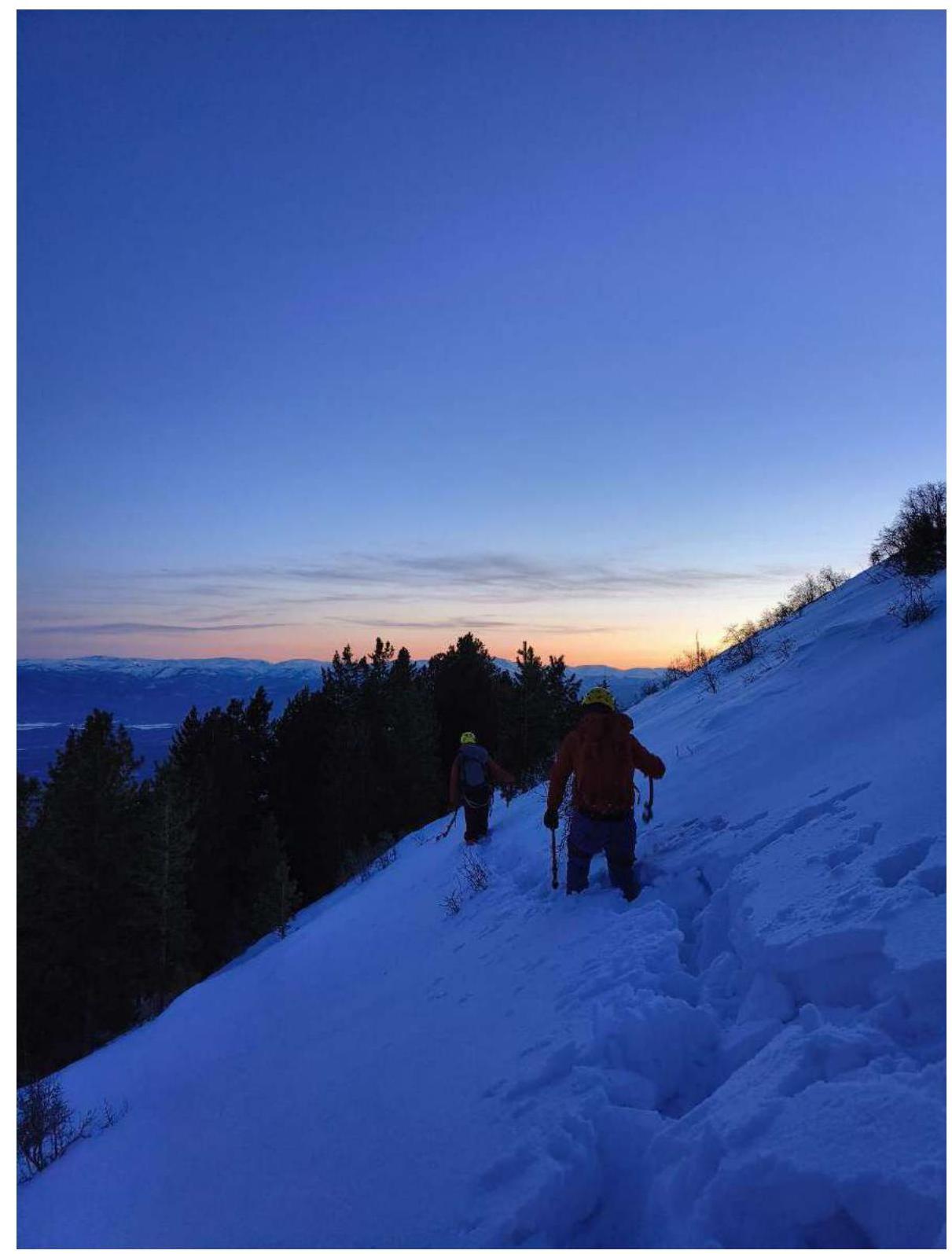
Photo 9. Section R7–R8. Slope section before reaching the ridge. Parfen'tev E.P. and Kuklin O.Yu. are in the photo.
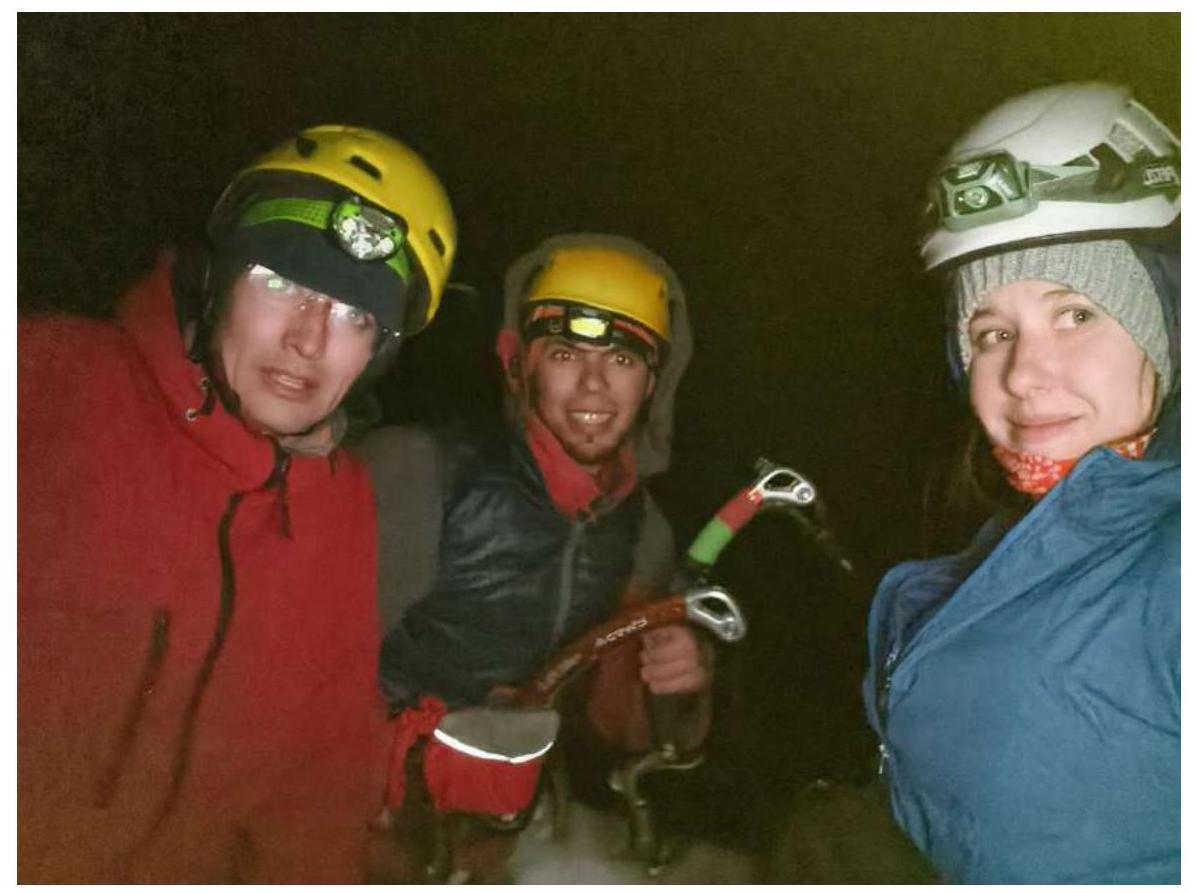
Photo 10. Photo at the summit of Geomorfologov 2155 m. In the photo (from left to right):
- Kuklin O.Yu.
- Parfen'tev E.P.
- Bezgodova O.V.
Comments
Sign in to leave a comment