
Krasnoyarsk City Alpine Federation
Report on the first ascent of Mt. Monakh 2850 m Via the Eastern ridge Approximately 3B category of difficulty. Krasnoyarsk 2021
Route Passport
| № | 1. General Information | |
|---|---|---|
| 1.1 | Full name, sports rank of the leader | Katanaev S.Yu., CMS |
| 1.2 | Full name, sports rank of participants | Bobrovsky I.M. – III sports rank, Shlentov I.D. – III sports rank, Shilovsky A.Yu. – III sports rank, Kagirov A.F. – III sports rank. |
| 1.3 | Full name of coach | Katanaev S.Yu. |
| 1.4 | Organization | Krasnoyarsk City Alpine Federation |
| 2. Characteristics of the Ascent Object | ||
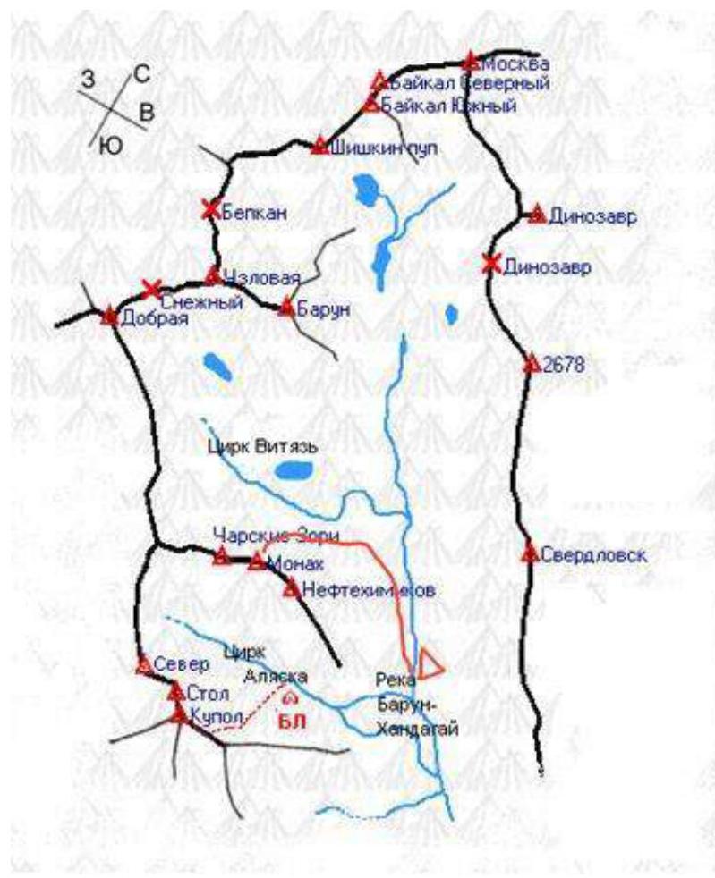
| 2.1 | Region | Eastern Sayan |
| 2.2 | Gorge | Baruun-Khandagai Gorge |
| 2.3 | Section number according to the 2013 classification table | 6.1.2. |
| 2.4 | Name and height of the summit | Mt. Monakh, 2850 m. |
| 2.5 | Geographical coordinates of the summit (latitude/longitude), GPS coordinates *(1) | 51°55′24.54″ N 102°10′90″ E. |
| 3. Route Characteristics | ||
| 3.1 | Route name | Eastern Ridge |
| 3.2 | Proposed category of difficulty | 3B |
| 3.3 | Degree of route exploration | First Ascent |
| 3.4 | Terrain characteristics of the route | Combined |
| 3.5 | Height difference of the route (altimeter or GPS data) | 600 m. |
| 3.6 | Route length (in meters) | 720 m. |
| 3.7 | Technical elements of the route (total length of sections of various difficulty categories with terrain characteristics) | I cat. diff. ice/rocks/combination – 300 m. II cat. diff. ice/rocks/combination – 0 m. III cat. diff. ice/rocks/combination – 180 m. IV cat. diff. ice/rocks/combination – 200 m. V cat. diff. ice/rocks/combination – 60 m. Glacier travel – 0 m. Rappelling (on descent) 6 ropes, 200 m. |
| 3.8 | Descent from the summit | Via 3B cat. diff. to Vityaz Gorge |
| 3.9 | Additional route characteristics | Presence (absence) of water |
| 4. Characteristics of Team Actions | ||
| 4.1 | Time of movement (team's walking hours, in hours and days) | 11 hours, 1 day |
| 4.2 | Overnights | None |
| 4.3 | Start of the route | 06:00, October 21, 2021 |
| 4.4 | Reaching the summit | 13:00, October 21, 2021 |
| 4.5 | Return to base camp | 17:00, October 21, 2021 |
| 5. Person Responsible for the Report | ||
| 5.1 | Full name, e-mail | Bobrovsky I.M. Ivb94@mail.ru |
The route was first ascended by the team of the Irkutsk City Alpine and Climbing Club "Vityaz". The ascent was made in the winter season and was rated as a 3B category route. Leader: Gorbunov Nikolai Ilich – CMS Participants: Arzamazov A.A. – II sports rank; Chuprov A. – II sports rank. Coach: Yakovenko Alexander Nikolaevich
Passing sections R0–R3 in winter is considered by our team as a combined route, as the couloir and rocks are filled with flowstone ice.
Katanaev S.Yu.'s team recommends the following for passing the route in winter:
The route (lower part) is recommended to be passed in crampons: snowy rocks, flowstone ice. In summer, a prepared team can pass these sections with free climbing.
It's more convenient to approach the route from the "Vityaz" circus.
Descent is possible both via the ascent route and via 2B from the saddle between Mt. Monakh and Mt. Charskie Zori. The descent via the ascent route seemed more convenient and faster to us – about 5 rappels.
Overview of the Ascent Area, Sports Characteristics, and Tactical Team Actions
Mt. Monakh is located in the upper reaches of the Baruun-Khandagai Gorge, Tunkin Ridge, Eastern Sayan, between Mt. Charskie Zori (to the west) and Mt. Neftekhimikov (to the east). Two classified routes of 2B category of difficulty have been laid to it from the south and north and then along the Western ridge, and several unclassified routes from the northern side. The route we chose for the first ascent passes along the Eastern ridge from the "Vityaz" circus. We chose the most logical line; the route is monolithic, with very few loose rocks; it's necessary to have anchor hooks; in winter, it's recommended to bring ice tools; there's flowstone ice. The route remained completely clean after passage. According to the team's assessment – strong 3B with sections of difficult climbing, but too short for 4A.
Map-scheme of the Baruun-Khandagai Gorge and the approach path to the route.
General view of Mt. Monakh from the "Vityaz" circus.
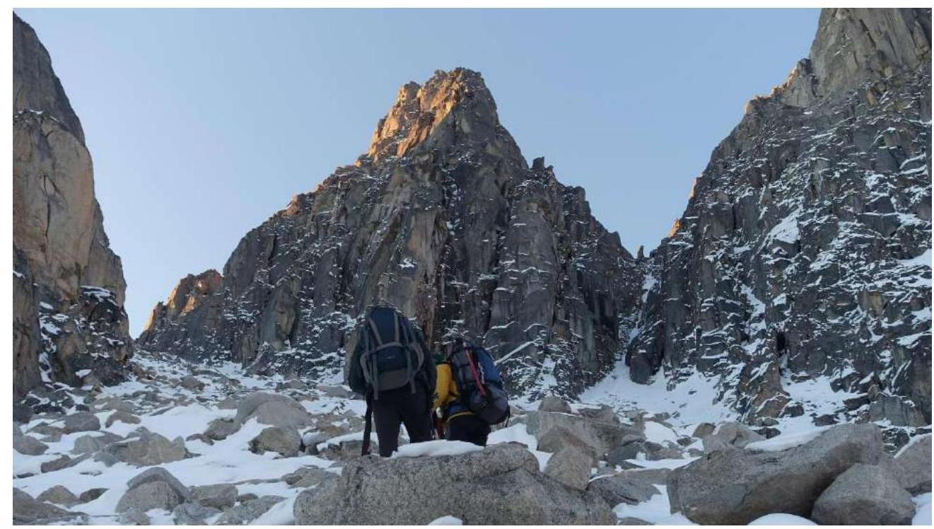 Fig. 1. General view of Mt. Monakh on the approach to the route.
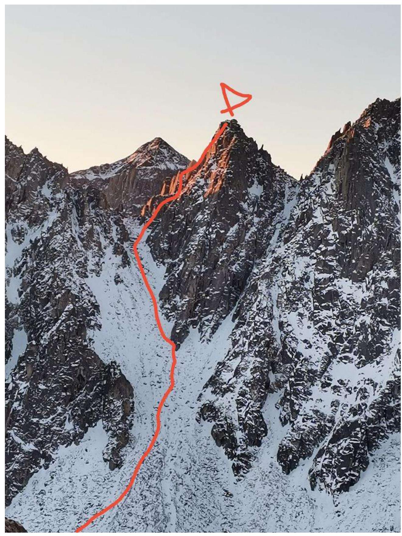 Fig. 2. Line of the team's route. Shot from the summit of Baruun.
UIAA Scheme
Mt. Monakh 2850 m. 3B via the Eastern ridge.
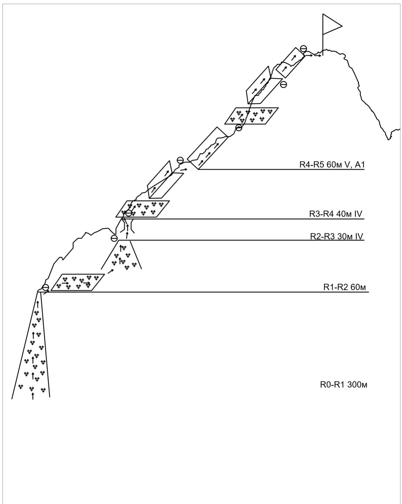
Route Description by Sections
R0–R1. 300 m.
The route starts from the Vityaz circus. Along the couloir, not reaching the saddle between Mt. Monakh and Mt. Neftekhimikov, we bypass the rocky bastion along the snowy ledges to the right. Before the start of the couloir, there's a convenient platform for putting on gear.
R1–R2. 60 m, 45° I
Along the couloir, covered with flowstone ice. Station on the left along the way on the rocks. Used gear: medium cams 3 pcs, anchors 1 pc, station loop 120 cm.
R2–R3. 30 m, 55° IV
From the couloir, exit to the left into a vertical chimney 7 m (landmark on the rocky gendarme on the ridge), leading to a ledge, station on a rocky outcrop. Used gear: cams 3 pcs, local loops 120 cm, 60 cm.
R3–R4. 40 m, 50° IV
Further along an inclined, 50-degree internal corner, we exit onto the ridge. Station on an outcrop on the ridge. Medium and large cams 2 pcs, extenders 60 cm, local loop 120 cm.
R4–R5. 60 m V A1
Climbing on the right side of the ridge through a steep monolithic slab with a characteristic vertical crack. Difficult climbing on monolithic rocks, 5th cat., possibly climbing with the use of some A1. We bypass the gendarme to the left along inclined ledges, station on a rocky outcrop. Used gear: cams 2 pcs, anchors 1 pc, local loop 120 cm. Further along the ridge through alternating snowy inclined ledges and small internal corners, exit to the summit. Climbing on monolithic rocks, 4th cat. Used gear: medium and large cams 4 pcs, local loop 120 cm. Station on an outcrop before the summit, to the summit in a team. Descent is possible both via the ascent route and towards the saddle between Monakh and Charskie Zori via 2B; it's more convenient to descend via the ascent route.
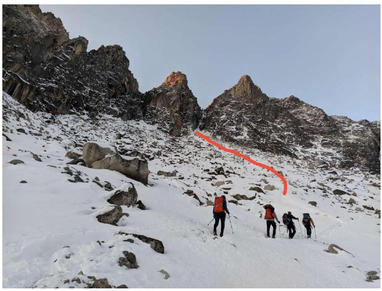 Fig. 3. Approach from the Vityaz circus.
 Fig. 4. Section R0–R1.
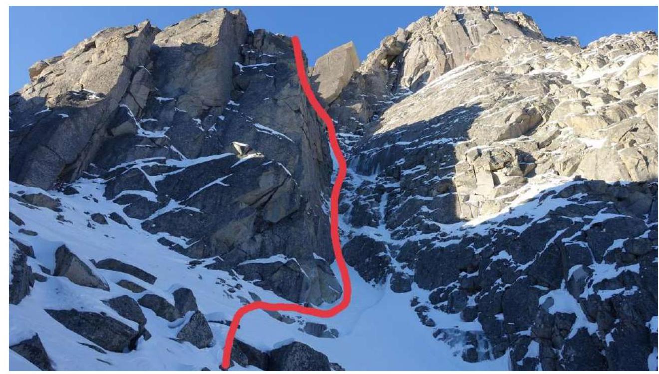 Fig. 5. Section R1–R2. A convenient ledge for putting on gear is visible.
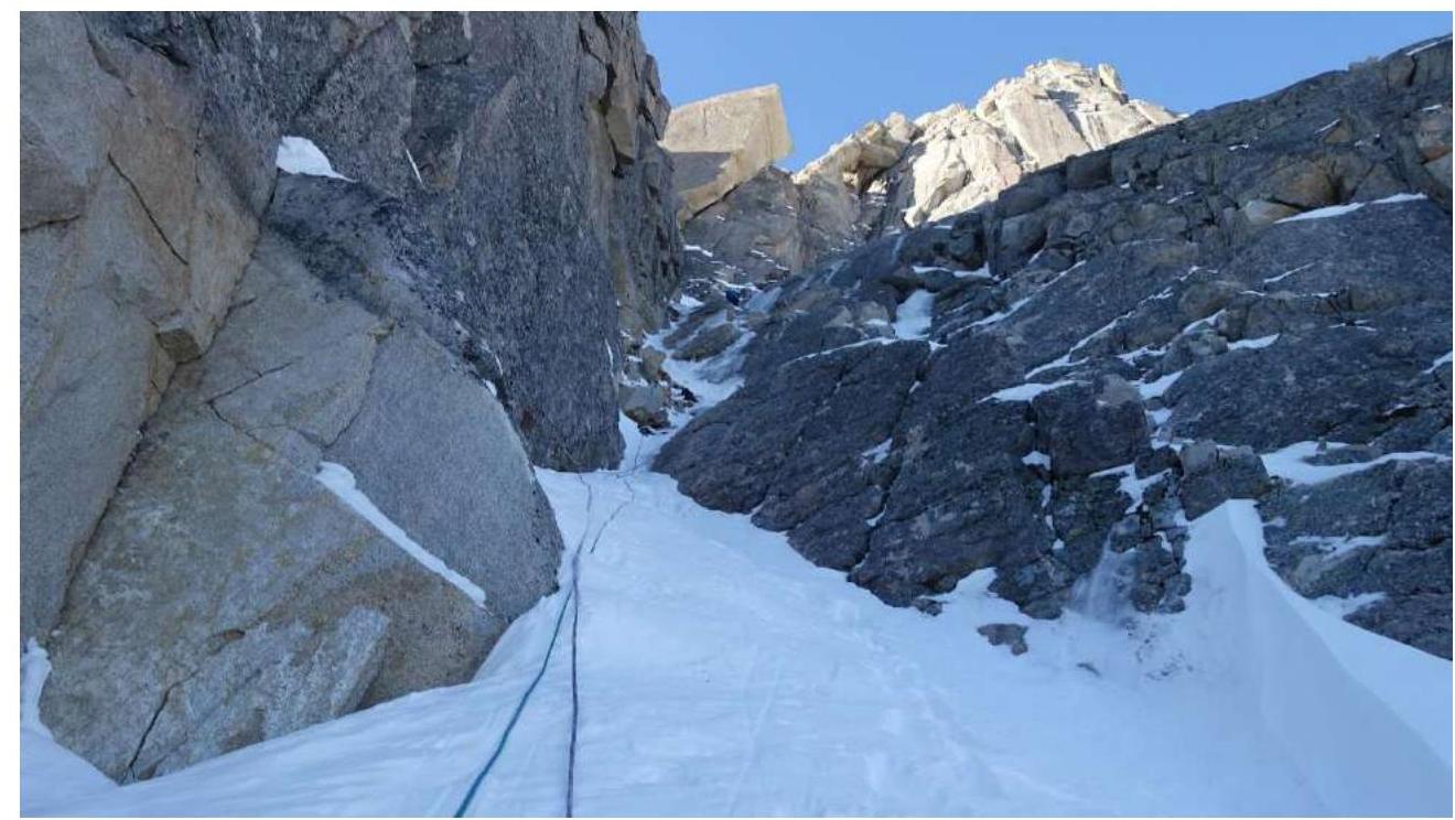 Fig. 6. View from the R1–R2 couloir.
 Fig. 7. Section R2–R3. Passing the chimney leading to a ledge with a convenient station.
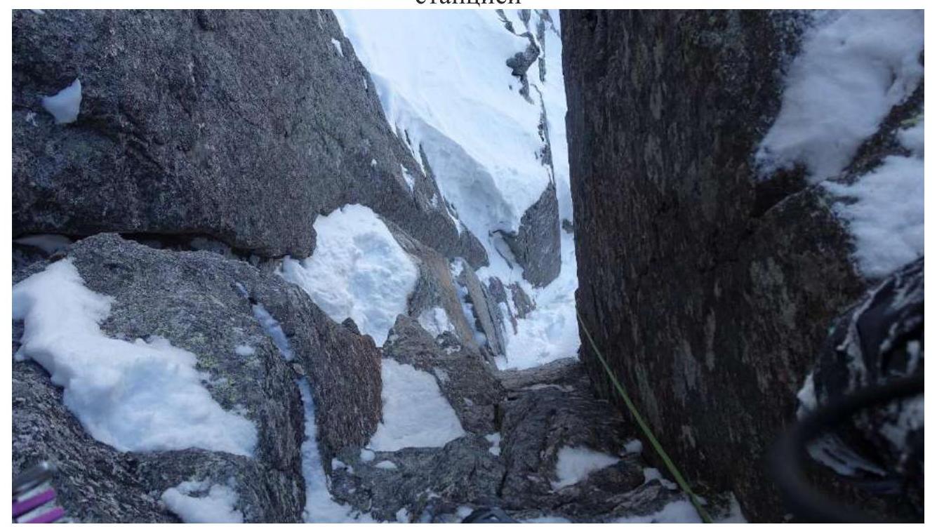 Fig. 8. Chimney on section R2–R3.
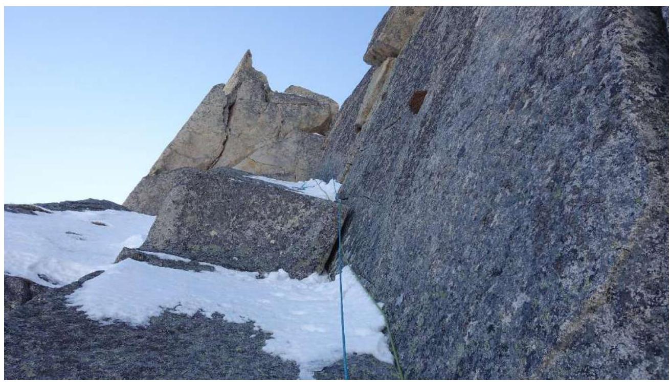 Fig. 9. Section R3–R4. Internal corner leading to the ridge.
 Fig. 10. Section R4–R5. Key section. Difficult climbing on monolithic rocks.
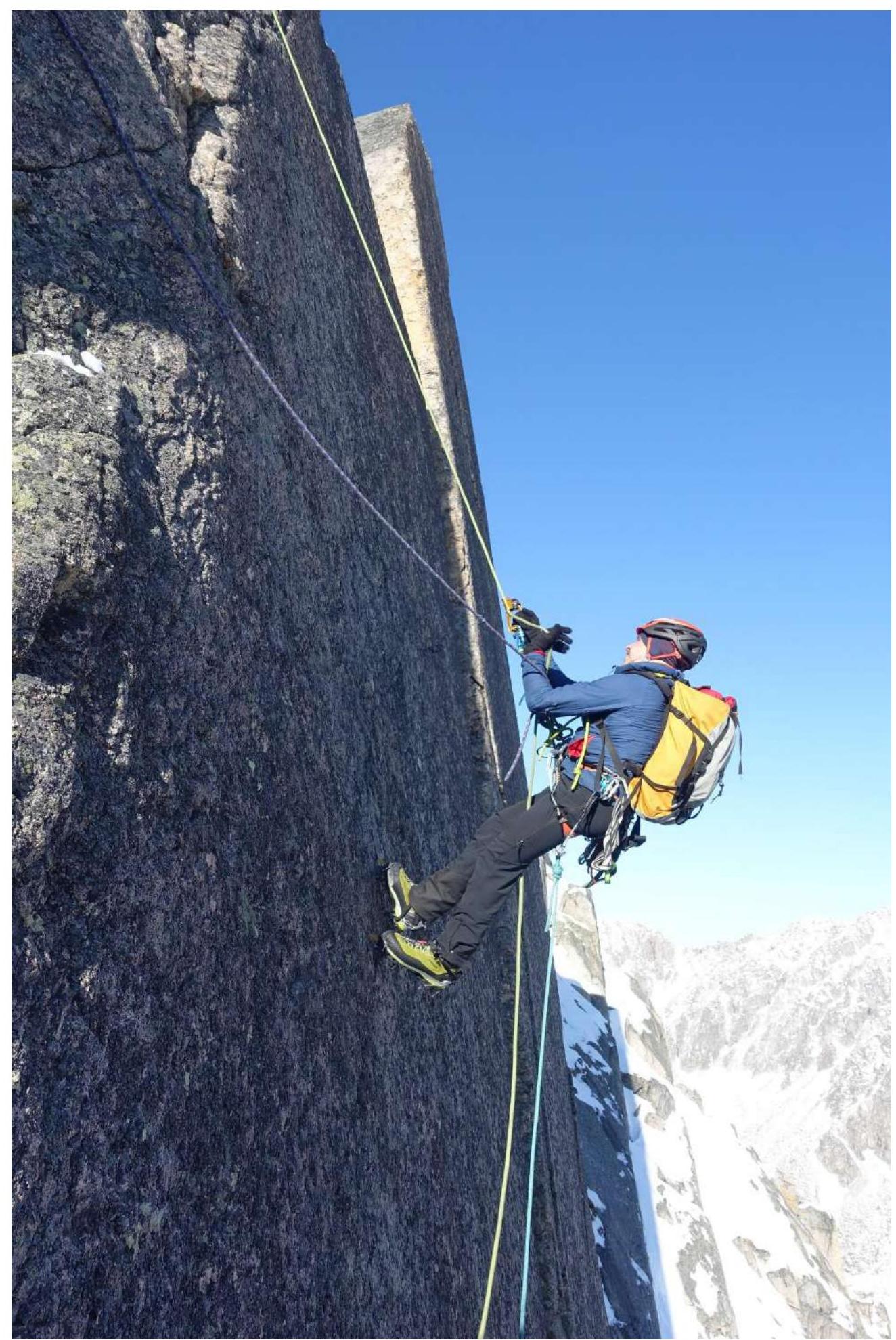 Fig. 11. Second on the key.
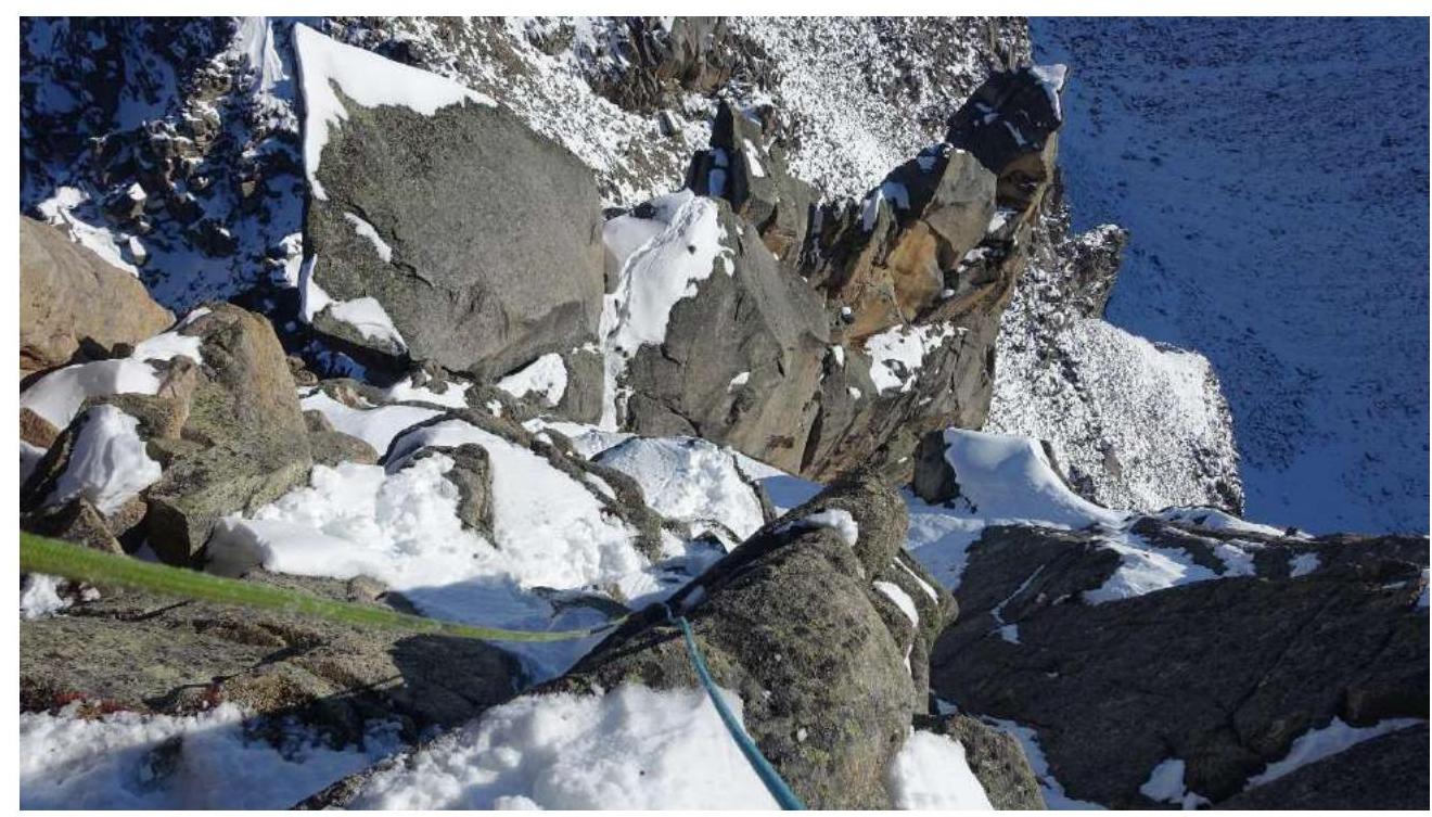 Fig. 12. On the ridge before the summit.
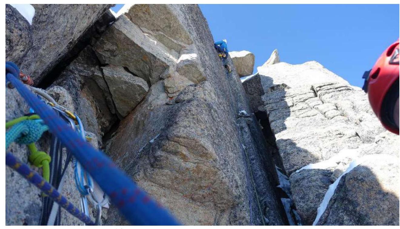 Fig. 13. Last ropes before the summit.
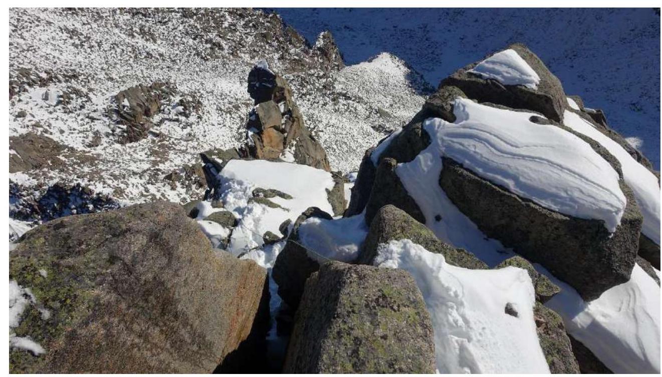 Fig. 14. Exit to the summit.
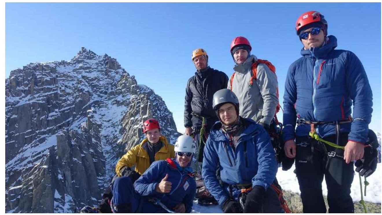 Fig. 15. On the summit.
Comments
Sign in to leave a comment