Report form for routes of 1B–3B category of complexity.
Report
ON THE FIRST ASCENT TO THE SUMMITS GAYDUK – BASMACH VIA THE SOUTHERN RIDGE, TRAVERSE, ORIENTIRING 3B CATEGORY OF COMPLEXITY BY THE TEAM OF BAIKAL ALPINISM SCHOOL ON OCTOBER 11, 2018.
Irkutsk 2020
I. Climbing Report
| №№ | 1. General Information | |
|---|---|---|
| 1.1 | Full name, sports rank of the leader | Afanasyev A.E. — Master of Sports |
| 1.2 | Full name, sports rank of the participants | Grigoryev A.F. — 2nd sports rank, Lisov M.A. — 2nd sports rank, Sirotenko R.O. — 3rd sports rank, Tashlykov V.I. — 3rd sports rank, Shevtsov I. — 3rd sports rank |
| 1.3 | Full name of the coach | Afanasyev A.E. — Master of Sports |
| 1.4 | Organization | Baikal Alpine School |
| 2. Characteristics of the Climbing Object | ||
| 2.1 | Region | Eastern Sayan, Tunkinskie Goltsy ridge, Vetryany region |
| 2.2 | Valley | Serebryanoe |
| 2.3 | Section number according to the 2013 classification table | 6.1.2 |
| 2.4 | Name and height of the summit | Mt. Gayduk, 2479 m — Basmach, 2382 m |
| 2.5 | Geographical coordinates of the summit (latitude/longitude), GPS coordinates *(1) | |
| 3. Route Characteristics | ||
| 3.1 | Route name | S ridge |
| 3.2 | Proposed category of complexity | 3B |
| 3.3 | Route exploration level | First ascent |
| 3.4 | Route terrain type | Combined |
| 3.5 | Route elevation gain (altimeter or GPS data) | 229 m |
| 3.6 | Route length (in meters) | 1155 m |
| 3.7 | Technical elements of the route (total length of sections of various complexity with terrain type indication) | 1st cat., rocks — 620 m. 2nd cat., rocks — 415 m. 3rd cat., rocks — 50 m. 4th cat., rocks — 55 m. 5th cat., rocks — 15 m. Rappelling (on descent) — 50 m |
| 3.8 | Descent from the summit | non-category complexity to the pass between Mt. Abrek–Basmach and W couloir to Serebryanoe valley |
| 3.9 | Additional route characteristics | Snow. No water in summer |
| 4. Team Actions Characteristics | ||
| 4.1 | Movement time (team's walking hours, in hours and days) | 1 day: 10 h 10 min |
| 4.2 | Overnight stays | no |
| 4.3 | Route start | 8:20, October 11, 2018 |
| 4.4 | Summit ascent | 16:30, October 11, 2018 |
| 4.5 | Return to base camp | 20:30, October 11, 2018 |
| 5. Report Responsible | ||
| 5.1 | Full name, e-mail | Afanasyev A.E., anevg09@mail.ru |
II. Climbing Description
1. Climbing Object Characteristics
1.1. General photo of the summit.
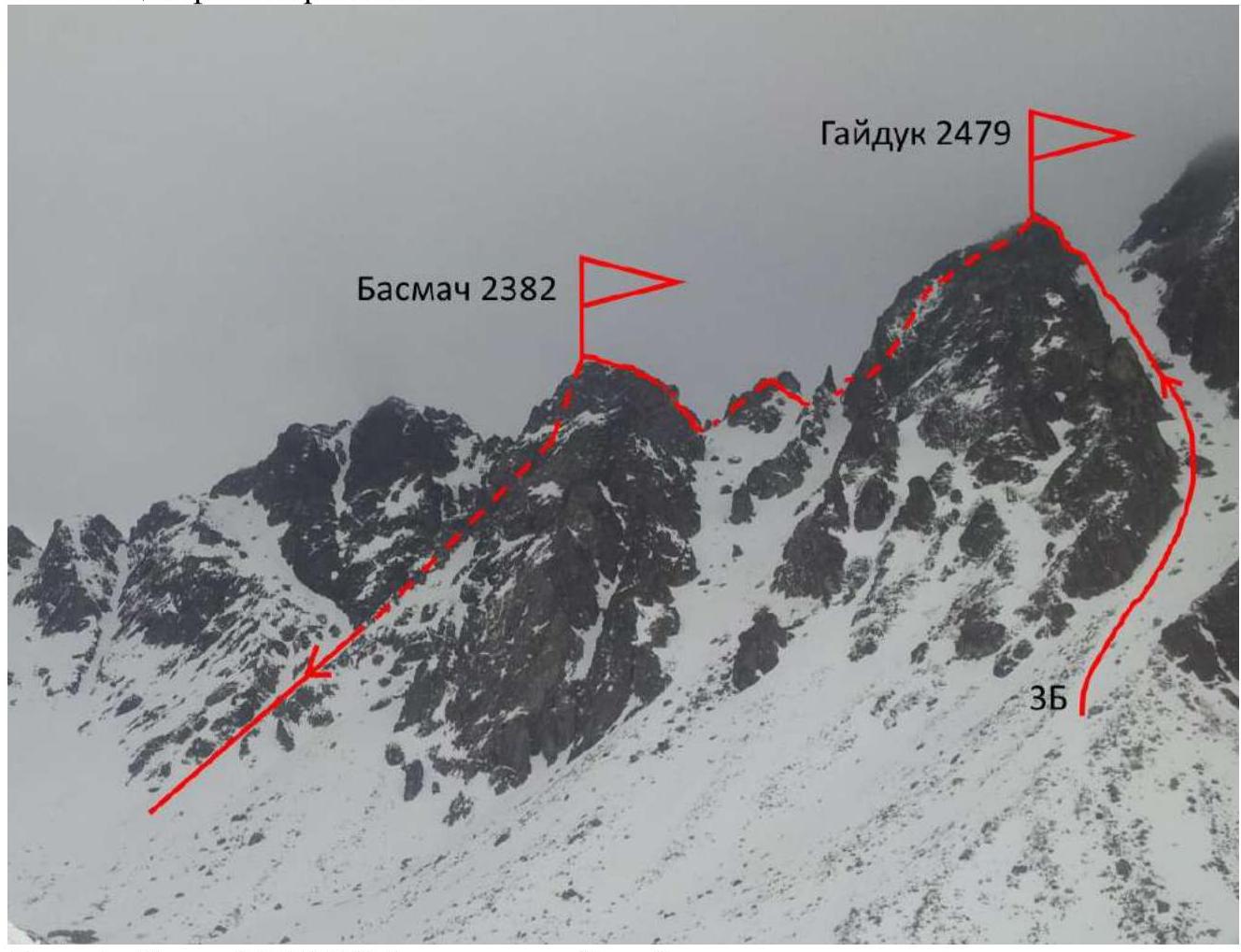
Photo 1. Taken on October 12, 2018 from Serebryanoe valley.
1.3. Photopanorama of the area.
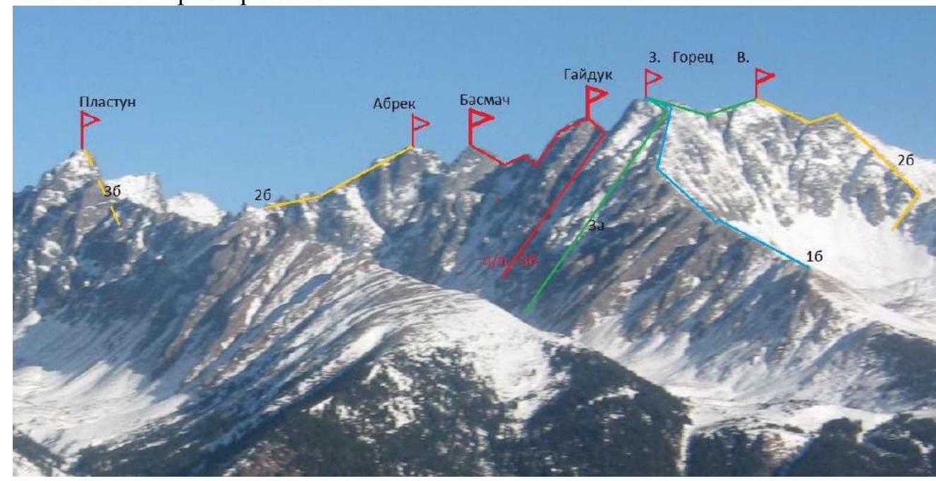
Photo 2.
1.4. Area map.
Approach from Irkutsk to the region is 200 km by good road to Khurai-Khobok village. Further on a logging road by an all-terrain vehicle about 10 km to an altitude of 1200. From the end of the road, 2 hours up the mountain on a well-trodden path to the base camp just below Serebryanoe lake in the forest near Vesenneye lake.

Photo 3.
1.4a. Route map.
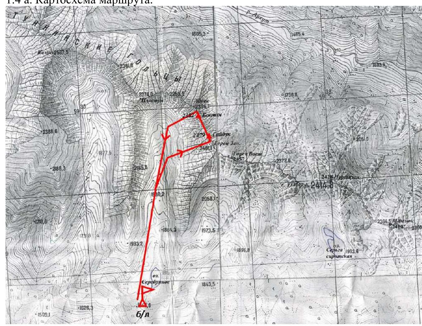
Photo 4.
2. Route Characteristics
2.1. Technical photo of the route.
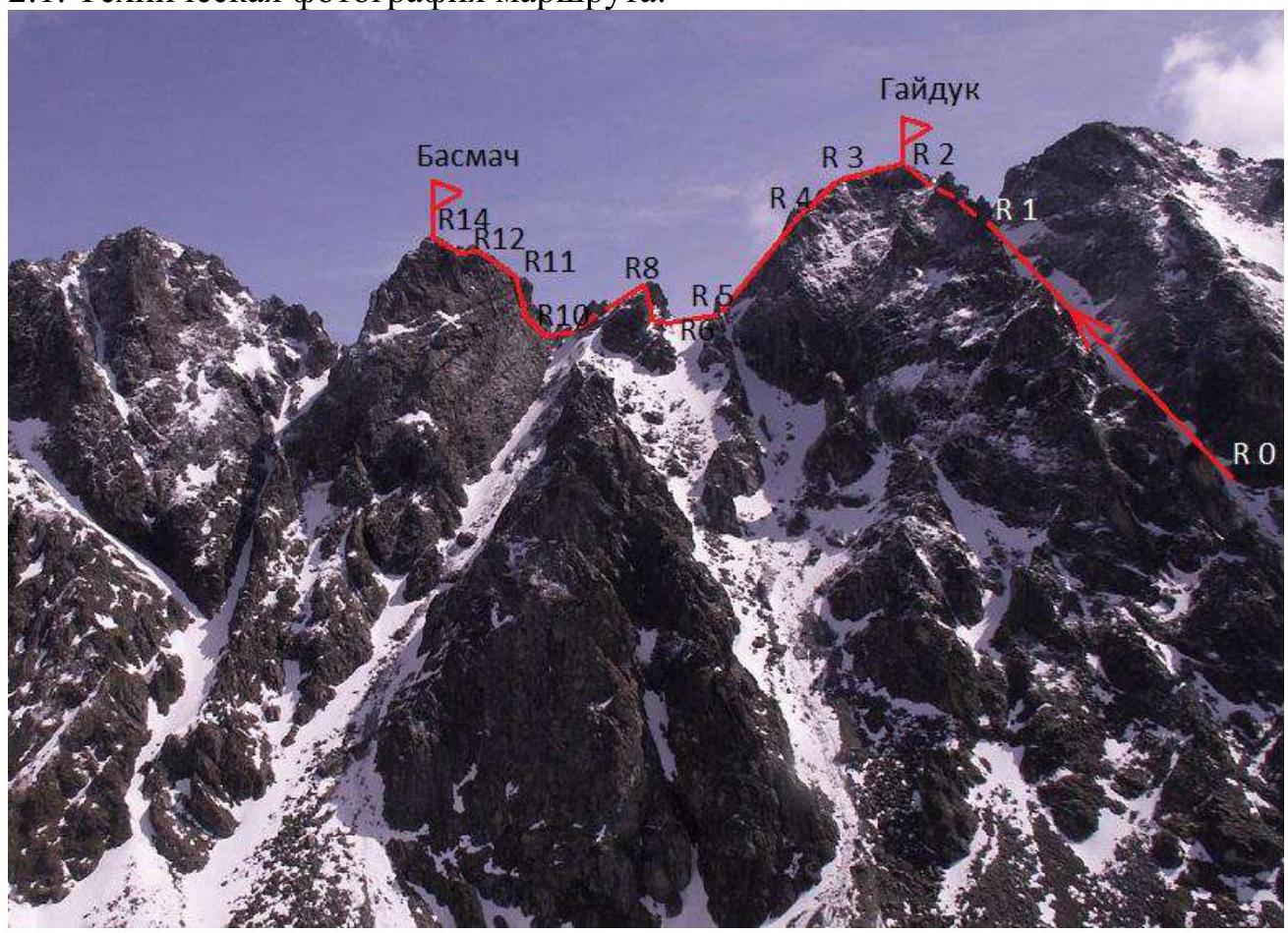
Photo 5.
2.3. Technical characteristics of route sections.
| Section № | Terrain type | Category of complexity | Length m, slope ° | Type and number of pitons |
|---|---|---|---|---|
| R0–R1 | Snow couloir | 1 | 500, 35 | |
| R1–R2 | Ridge | 2 | 100, 45 | |
| R2–R3 | Wide ridge | 1 | 30, 0 | |
| R3–R4 | Ridge | 2 | 65, 30 down | |
| R4–R5 | Ridge | 2 | 120, 40 down | 3 r. |
| R5–R6 | Saddle | 1 | 50, 0 | |
| R6–R7 | Slope | 1 | 30, 30 | |
| R7–R8 | Rock wall | 5 | 15, 75 | 3 cams |
| R8–R9 | Slope | 1 | 40, 5 down | |
| R9–R10 | Ridge | 3 | 15, 0 | 1 r. |
| R10–R11 | Wall | 4 | 40, 80 | 3 cams, 3 r. |
| R11–R12 | Outer corner | 4 | 15, 70 | 2 cams |
| R12–R13 | Outer corner | 3 | 35, 50 | 3 cams |
| R13–R14 | Ridge | 2 | 30, 5 |
3. Team Actions Characteristics
3.1. Brief description of the route passage. (To be completed).
From the base camp to the start of the route — 45 minutes walk. The approach is better made on the left side of the Serebryanoe valley to confidently find the couloir. The route starts in the couloir between the summits:
- Gorets Zapadny (right)
- Gayduk (left)
| Section № | Description | Photo № |
|---|---|---|
| R0–R1 | Snow couloir | |
| R1–R2 | Ridge | 6 |
| R2–R3 | Wide ridge | 7 |
| R3–R4 | Ridge | |
| R4–R5 | Wide ridge | 8 |
| R5–R6 | Saddle | 9 |
| R6–R7 | Slope | 10 |
| R7–R8 | Rock wall | |
| R8–R9 | Slope | 11 |
| R9–R10 | Ridge | 12–13 |
| R10–R11 | Wall | 13–14 |
| R11–R12 | Outer corner | |
| R12–R13 | Outer corner |

Figure 6. Section 3. Summit Gayduk.
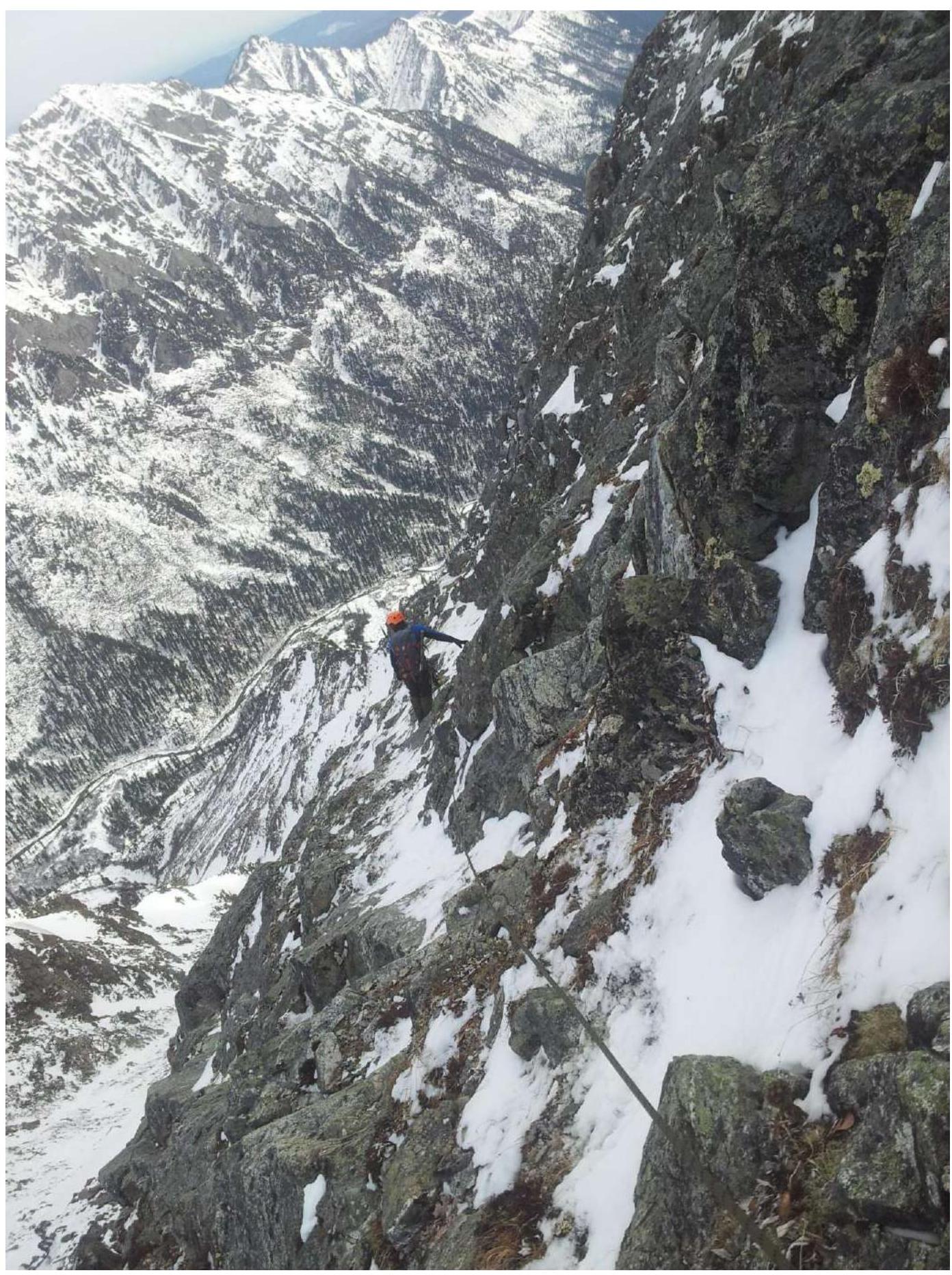
Figure 7. Sections 4–5.
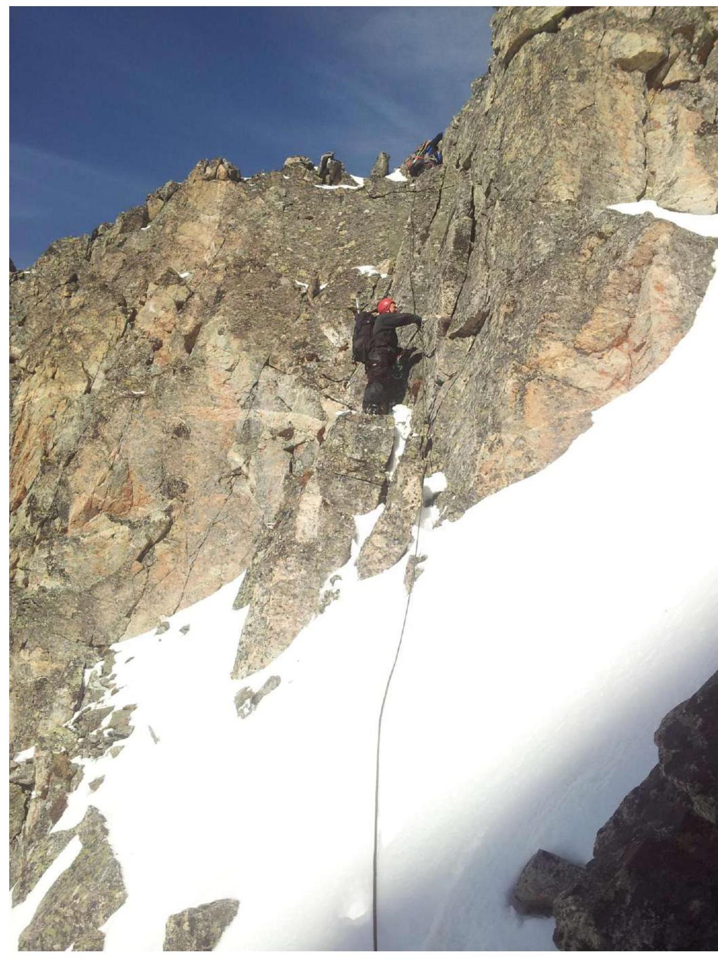
Figure 8. Sections 7–8.
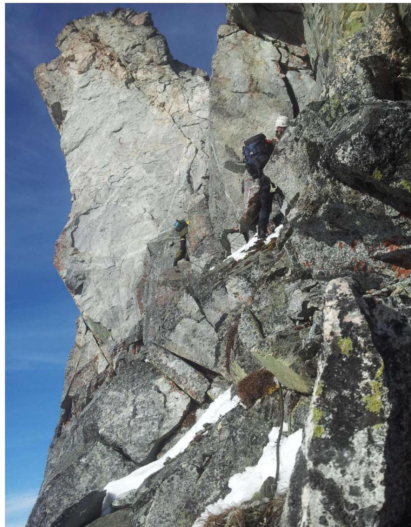
Figure 9. Sections 10–11.
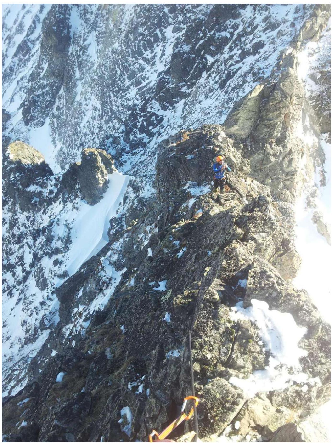
Figure 10. Sections 12–13.
3.2. Photo of the team at the summit Basmach near the control tour.

Photo 11.
3.3. The route is safe. There is cell phone coverage throughout. Descent from Mt. Basmach first 10 m back along the ridge, then 50 m to the left to the north, rappelling towards the saddle with Mt. Abrek. Further down a steep narrow couloir with stations on pitons, 3 sports descents. The route corresponds to 3B category.