Passport
- Class of first ascents.
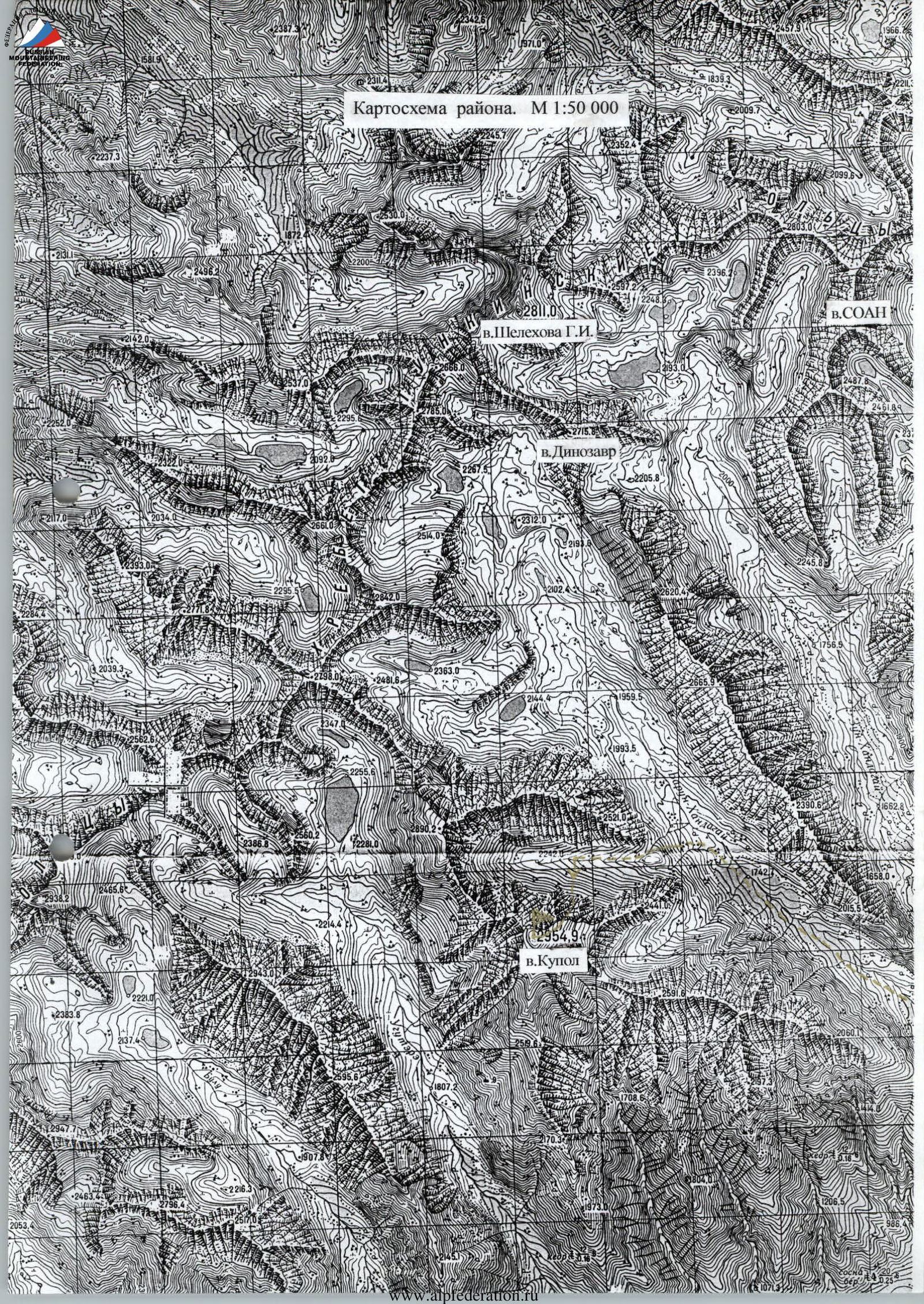
- Eastern Sayan, Tunkinskiye Goltsy ridge, Barun-Khandagai gorge, 6.1.
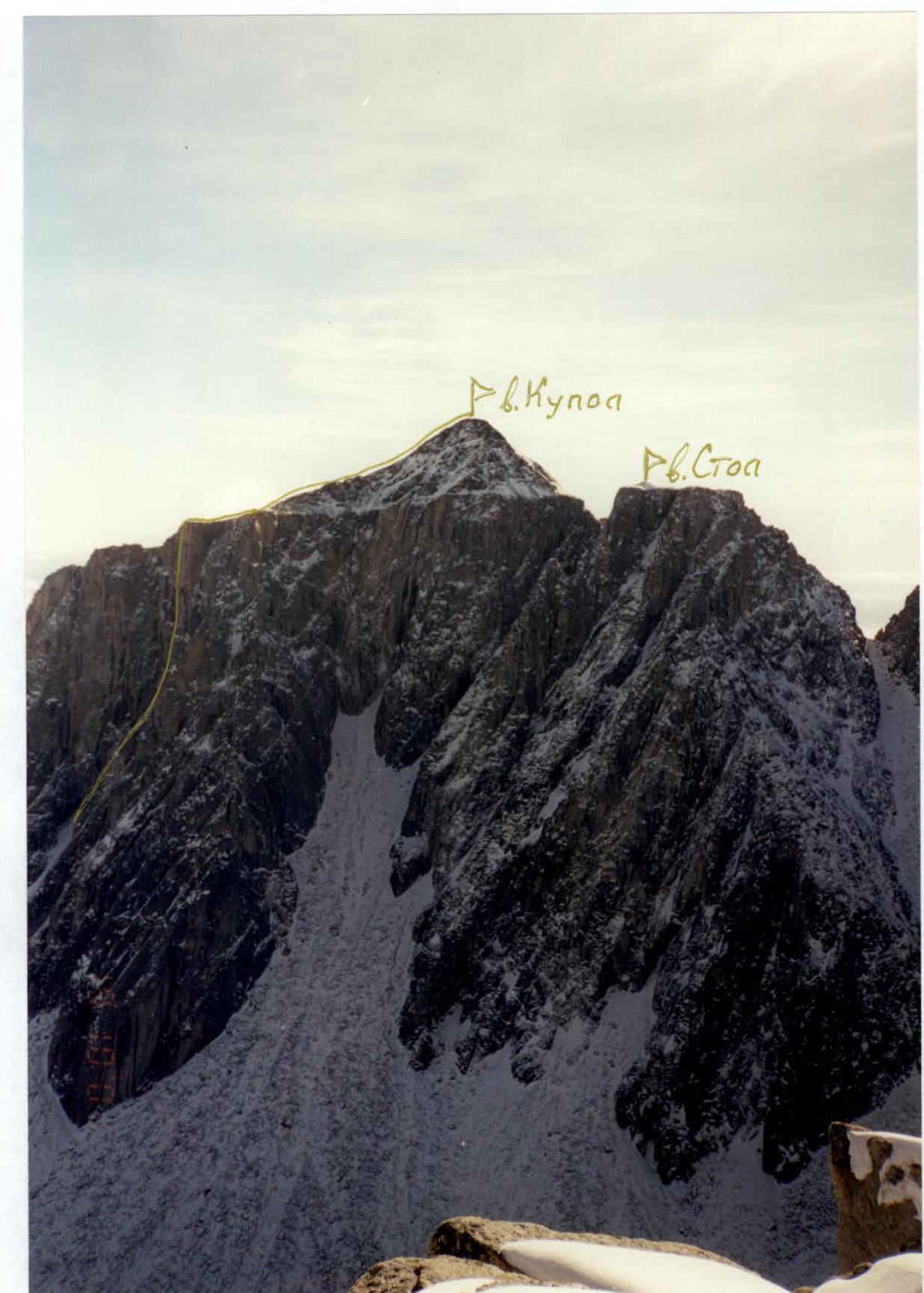
- V. Kupol via the North face of the East shoulder, 2955 m.
- Proposed 6A category of difficulty, first ascent. The nature of the route is rocky.
- Height difference: total route – 554 m, wall part – 425 m; length: total route – 730 m, wall part – 461 m, overhanging part ("blade") – 141 m; length of sections: 6th category of difficulty – 207 m, 5th category of difficulty – 145 m; average steepness of the wall part of the route — 79°.
- "Hooks" left: total – 13, including pitons – 8; used: chocks – 82/67, rock pitons – 96/56, ice screws – 4, pitons – 10/5, including removable – 2/1; total artificial aids used – 128.
- Team's climbing hours – 49, days – 6 (1 – processing, 5 – route).
- Overnights – 4 in hammocks.
- Team leader: Afanasyev A.E. (MS); participant: Khandazhapov B.A. (CMS).
- Coach: Afanasyev A.E.
- Preliminary processing – September 18, 2002, route – September 20–24, 2002, summit – September 24, 2002 at 19:00, return to base camp – September 25, 2002 at 00:30.
- Organization: Sibirian Military District SCA branch, Irkutsk.
 V. Kupol
Photopanorama of the area
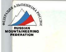
Beach. V. Kupol. V. Stol.
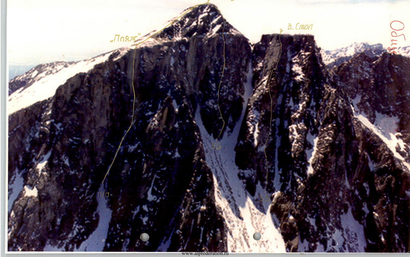
Drawn profile of the route. 2955 m.
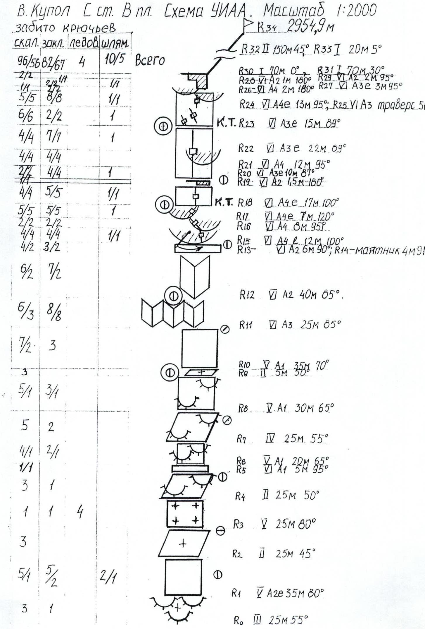
 V. Kupol Sst. V plesha. Scale 1:2000.
Photo of the wall profile on the right.
Map of the area. Scale 1:50 000.
Ascent graph.
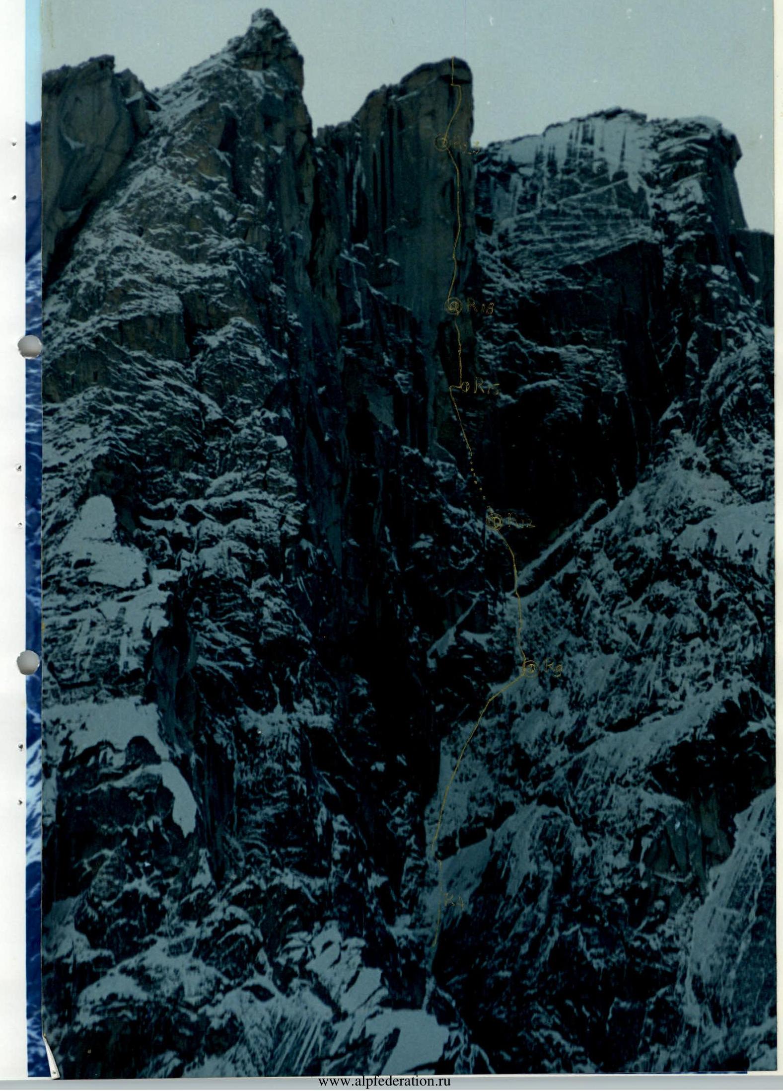
Technical photo of the North face of the East shoulder of V. Kupol.

Tactical actions of the team
The route via the North face of the East shoulder of V. Kupol through the overhanging outer corner ("blade") is interesting due to its extended vertical and overhanging section (149 m in total), which is a unique rarity in the Eastern Sayan. During the 2001 gathering, the outer corner was photographed and it was determined that a series of cracks and fissures run through the entire "blade," including the upper cornice, along the left edge along the "blade." The lower part of the route from the top of the couloir to the base of the inner corners follows a logical path — a fault with a steepness of 60–65°. The question remained of how to reach the "blade": either by swinging left or by going right through a huge overhang. This question was resolved during preliminary processing, when it became clear that: on the left option — the inner corners are without cracks, and the path along the faults logically leads to a large sharp inner corner "cut," leading under the overhanging "blade" on the right.
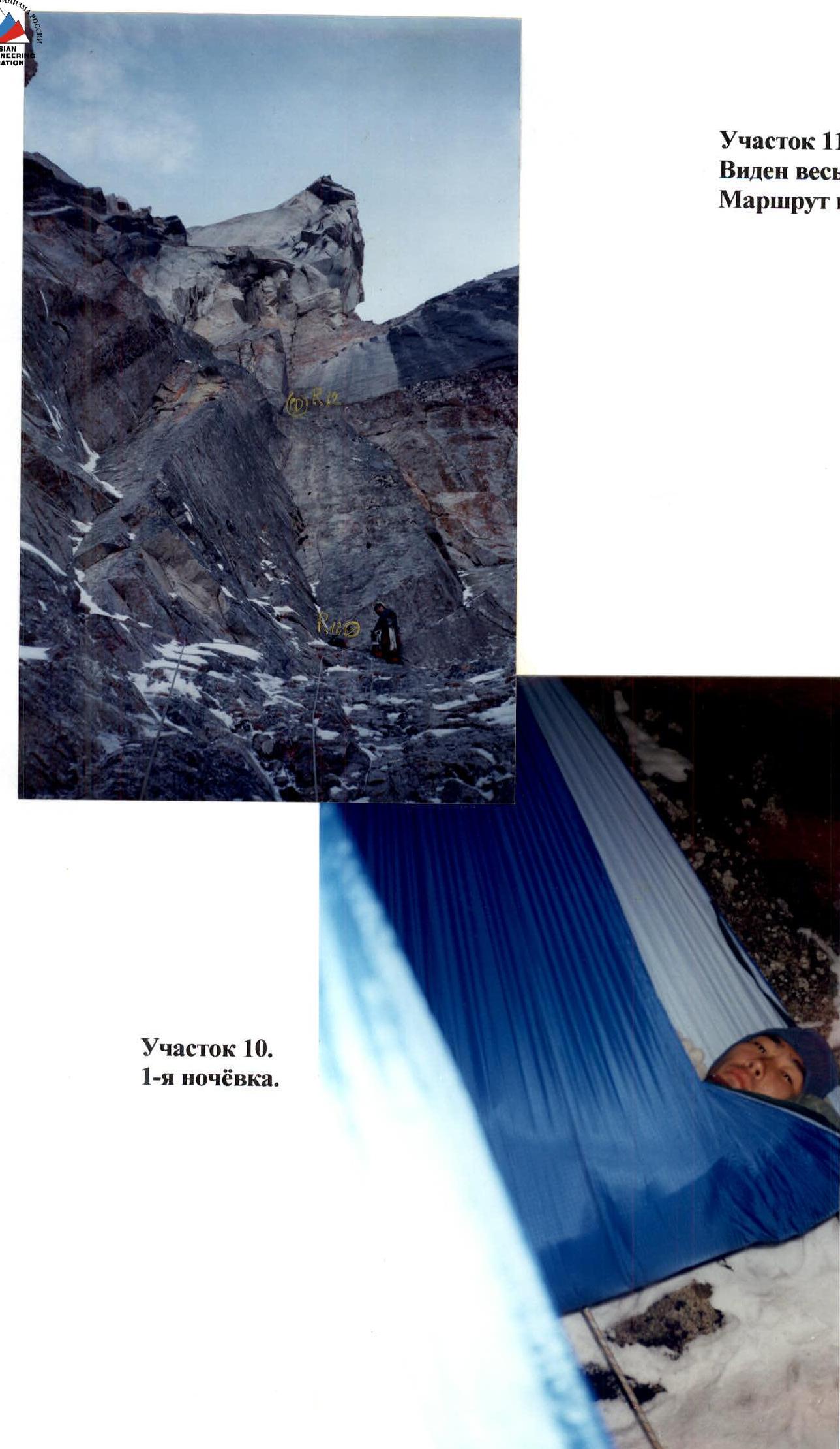
Since there were no large ledges on the route, it was decided to set up overnight stays in hammocks (see photo), which were sewn specifically for this ascent and weighed 550 g each. All overnight stays were indeed hanging; there were only small ledges for the gas burner, and not everywhere: on the 3rd overnight stay, the burner with a pot for cooking was hung on a hook.
In September, snow on the north faces of the peaks Stol–Kupol no longer melts, so the issue of drinking water was solved on the route: on the first overnight stay, there was enough snow for the night and to fill plastic bottles (3.5 l); on the second overnight stay, there was enough snow for the night; for the 3rd and 4th nights, water was carried along. On the morning of September 24, there was an excess of water: abundant snow had fallen, and even under our cornice and overhang, enough snow had blown into the hammocks, onto backpacks, and onto ledges.
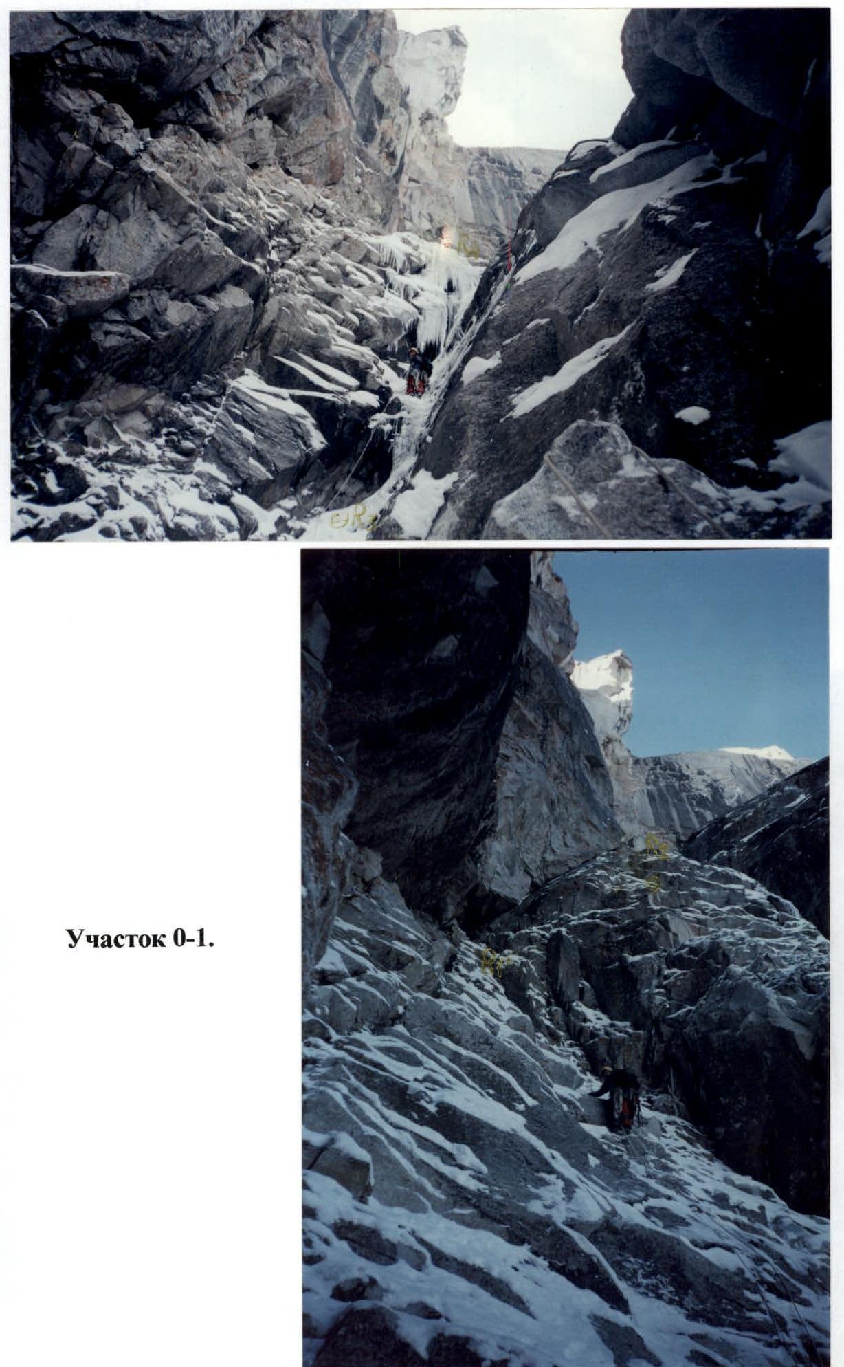
During processing on the R3–R4 section, an ice flow (see photo) 25 m long was encountered. Bypassing it would have been significantly more complicated. The duo prepared for this form of relief as well: they carried ice screws and ice axes. Ice rivers form in many places on this wall due to the melting of snow on the southern slopes and the penetration of water through cracks onto the northern cold slopes, and freezing occurs there already in early September. The first climber went in crampons up to the top of the inner corner (section R13), i.e., as long as there was snow on the rocks. Above, they mostly went belayed. In addition to the usual set for a complex wall route, they took wide chocks (hexes and tubes), pitons (20 pcs.), and sky hooks. When pulling up the second backpack on key sections (R15–R18 and R23–R30), a third rope was used, which was damaged during processing of section R12–R13. For this purpose, a method of self-dropping a backpack hanging on a hook was used. Every day, after determining a convenient place for an overnight stay, processing of the upper sections was carried out.
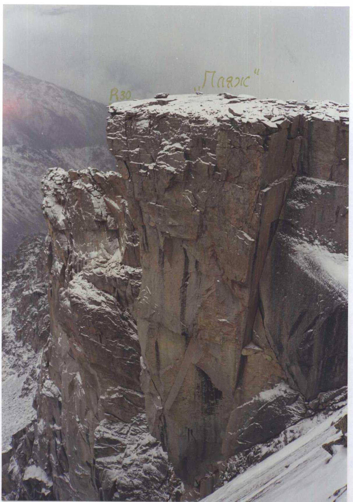
On the overhanging part of the route, there are no detours or simpler paths. Possibly, there are two more options for passing the upper large cornice: left and right; we propose the most direct, short, and beautiful one.
On the route, in the area of the 3rd and 4th overnight stays (sections R18 and R23), two control cairns were left in bottles on ledges without stones.
V. Kupol via the North face of the East shoulder. Route description by sections
The route begins at the top part of the central couloir of the North face of the East shoulder of V. Kupol.
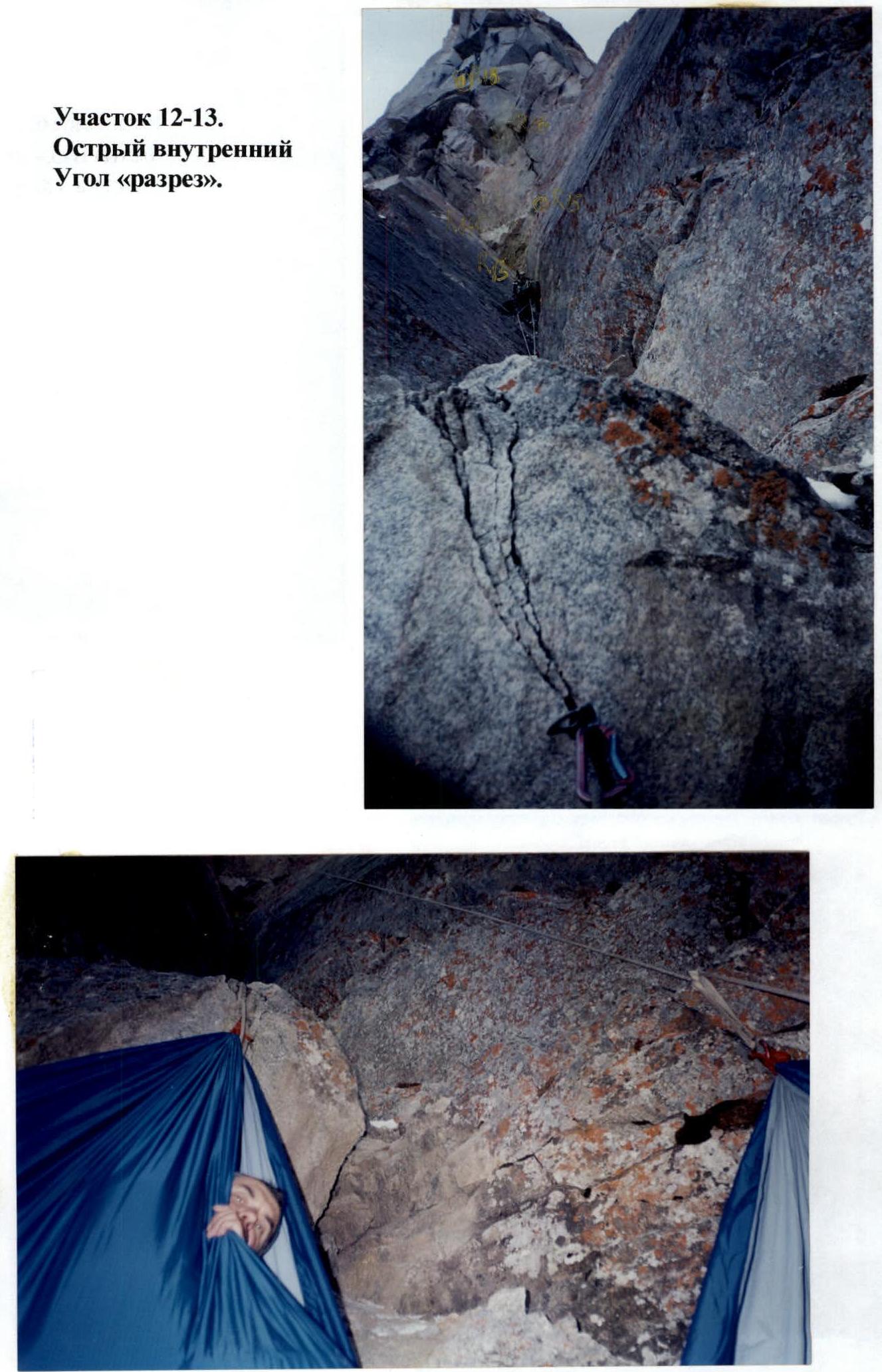
R0–R1 — 3, 25 m, 55°: ram's foreheads. R1–R2 — 5, A2e, 35 m, 80°: smooth wall. R2–R3 — 2, 25 m, 45°: snow-ice couloir. R3–R4 — 5, 25 m, 80°: ice flow. R4–R5 — 2, 25 m, 50°: snow-ice groove in the inner corner. R5–R6 — 6, A1, 5 m, 95°: wall. R6–R7 — 5, A1, 20 m, 65°: wall, ram's foreheads. R7–R8 — 4, 25 m, 55°: ram's foreheads. R8–R9 — 5, A1, 30 m, 65°: wall. R9–R10 — 2, 5 m, 50°: snow-covered slab, 1st overnight stay. R10–R11 — 5, A1, 35 m, 70°: ram's foreheads. R11–R12 — 6, A3, 25 m, 85°: 3 inner corners with cracks, movement along the right one, 2nd overnight stay. R12–R13 — 6, A2, 40 m, 85°: sharp inner corner, almost a chimney inside, right face overhangs by 1–2°. R13–R14 — 6, A2, 6 m, 90°: continuation of the inner corner, right face overhangs. R14–R15 — 6, 4 m, 91°: pendulum to the right along cracks to a vertical crack — beginning of the "blade." "Blade" — a huge overhanging outer corner of the north wall. R15–R16 — 6, A4e, 12 m, 100°: middle crack. R16–R17 — 6, A4, 8 m, 95°: crack in the inner corner, leads slightly left under the cornice. R17–R18 — 6, A4e, 7 m, 120°: overhanging crack, left side is a ceiling, exit to a cornice niche on the left ledge; above the ledge, an overhanging slab of a spall, after 5 m it becomes monolithic, on the right a short crack. Traverse along the ledge to the left crack; 3rd overnight stay. A control cairn is left on the ledge. R18–R19 — 6, A4e, 17 m, 100°: middle crack leads under a square cornice. R19–R20 — 6, A2, 1.5 m, 180°: one-sided cornice, exit left through a face onto a ledge for two feet. R20–R21 — 6, A3e, 10 m, 87°: middle crack (through a spall). R21–R22 — 6, A4, 12 m, 95°: middle crack, overhangs. R22–R23 — 6, A3e, 22 m, 89°: middle crack on the right along the "crescent" between black streaks; "crescent" — a rock scar in the shape of a waning crescent moon; exit to the top of the "crescent" onto a double ledge in the inner corner; 4th overnight stay. On the upper ledge — a duplicate control cairn. R23–R24 — 6, A3e, 15 m, 89°: "cobweb" — an interlacing of small cracks. R24–R25 — 6, A4e, 13 m, 95°: crack widening from medium to wide, with a loose block in the middle part; leads under a large cornice. R25–R26 — 6, A3, 5 m, 95°: traverse under the cornice along the middle crack to the left. R26–R27 — 6, A4, 2 m, 180°: ceiling, wide crack. R27–R28 — 6, A3e, 3 m, 95°: wide crack in the inner corner leads under a small cornice. R28–R29 — 6, A2, 1 m, 180°: one-sided cornice, left side is a slight overhang, right side is a ceiling. R29–R30 — 6, A2, 2 m, 95°: vertical middle crack; exit onto a "beach" plain. "Beach" — a flat field with large stones on the eastern shoulder of V. Kupol. R30–R31 — 1, 70 m, 0°: "beach" field. R31–R32 — 1, 70 m, 30°: ridge. R32–R33 — 2, 150 m, 40°: slope. R33–R34 — 1, 20 m, 5°: ridge to the summit.
V. Kupol S st. V pl. UIAA scheme. Scale 1:2000. 2954.9 m.
Section R3–R4. Ice flow.
Section R0–R1.
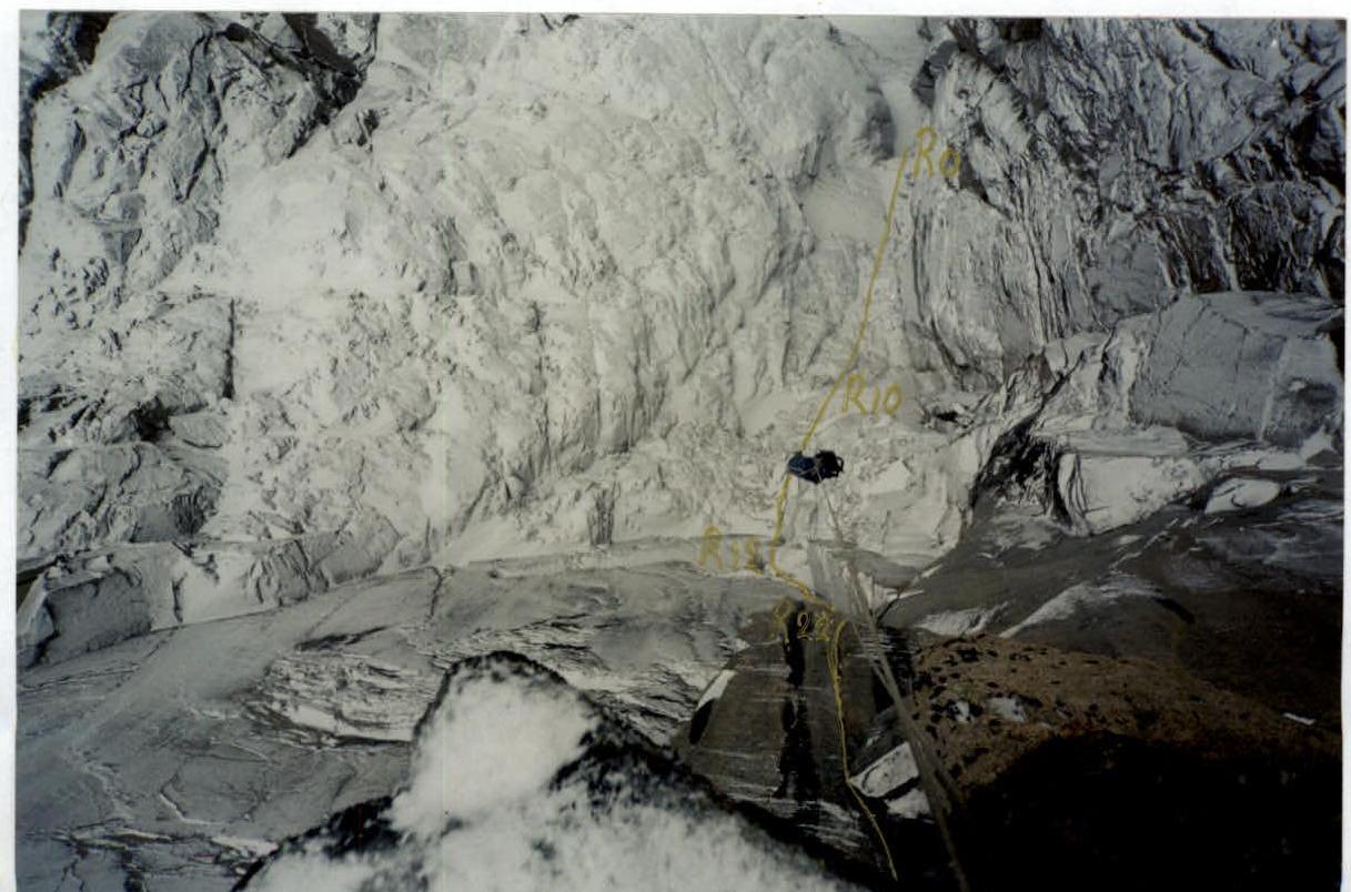
Section R11. The entire route above is visible.
Section R12–R13. Sharp inner corner "cut."
Section R12. 2nd overnight stay.
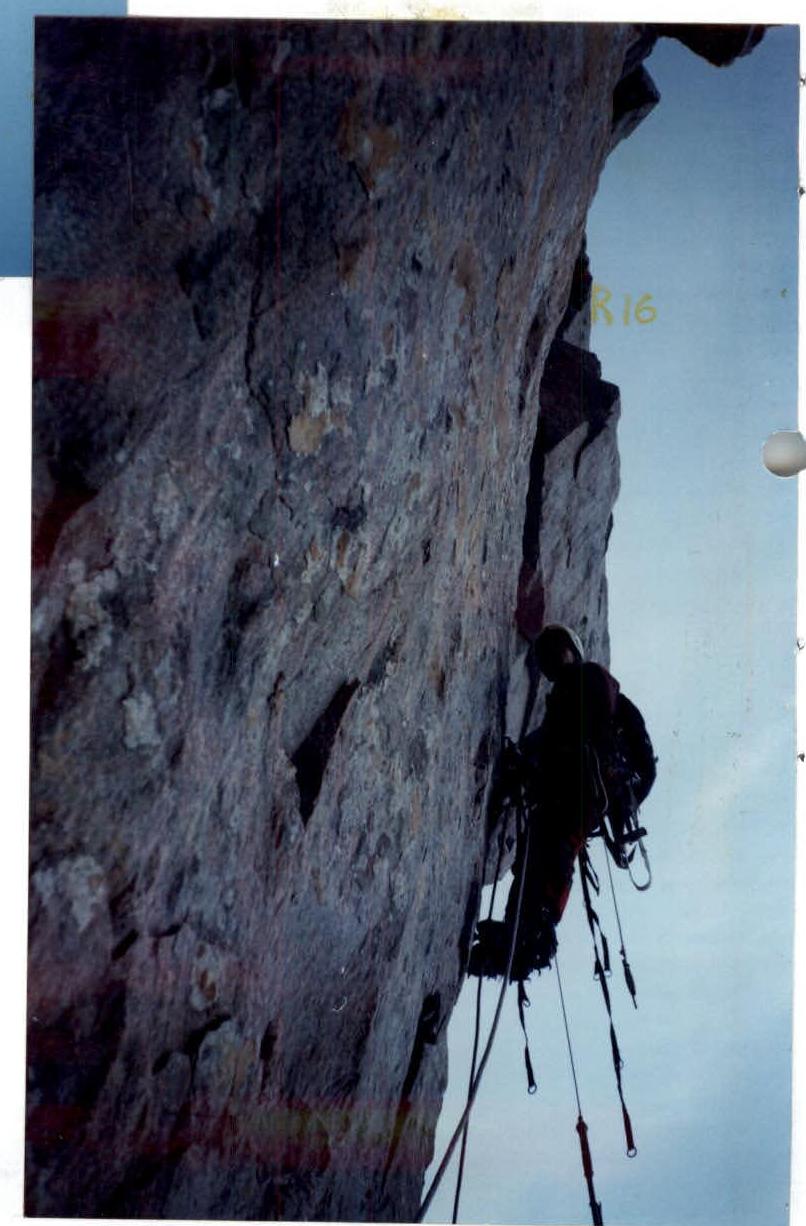
Section R16. The path to section R18 is visible.
Section R15–R16. From the first one, the following hang vertically: — ladders, — punch, — hammer.
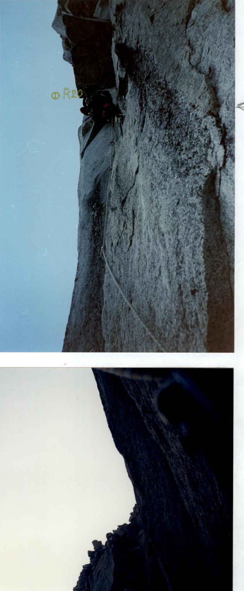
Section R19–R20. Cornice.
Section R18. Backpack being pulled up.
Section R20–R21. "Crescent" is visible on the left.
Section R20. Belayer sitting on a backpack.
Section R24–R25. "Cobweb" has been passed.
To the right is the "blade's edge."
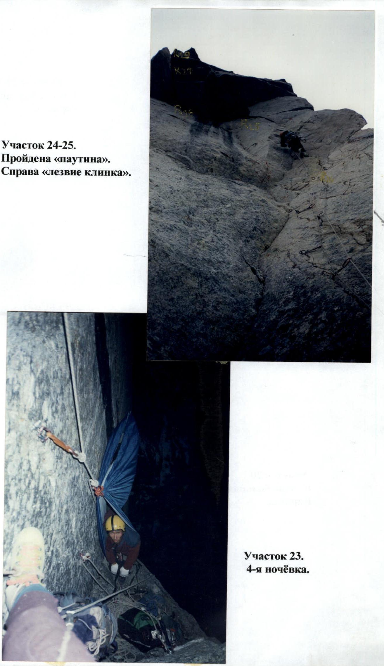
Section R23. 4th overnight stay.
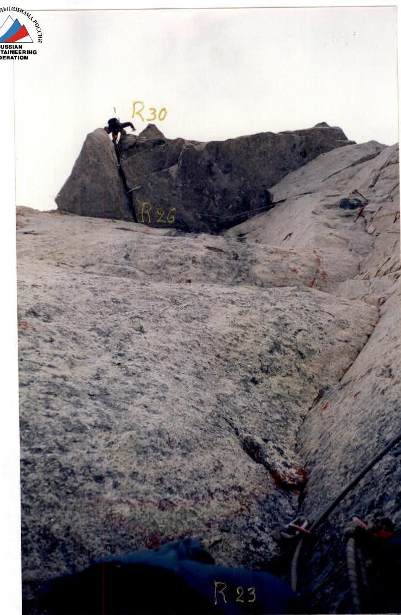
Section R29–R30. Exit from the large cornice.
Icicles show the vertical.
Section R20. Beginning of the large cornice.
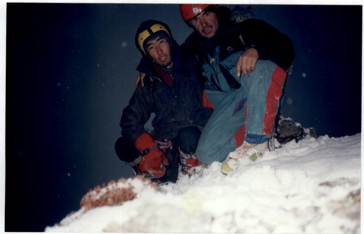
Section R34. Summit.
View from section R30 down onto the route.