
REPORT ON THE FIRST ASCENT OF ZARECHNAYA SEVERNAYA (2350) PEAK BY THE "GULLY OF THE NORTH-WEST SLOPE" ROUTE CATEGORY 3B DIFFICULTY IN WINTER BY THE TEAM OF THE IRKUTSK ALPINISM SECTION FOR THE PERIOD FROM JANUARY 4, 2020 TO JANUARY 4, 2020
Team Leader: Zhdanov Dmitry Andreevich
Irkutsk 2020
I. Ascent Passport
| 1. General Information | ||
|---|---|---|
| 1.1 | Full Name, Sports Rank of the Leader | Zhdanov D. A., 2nd sports rank |
| 1.2 | Full Name, Sports Rank of Participants | Antonov O. A., 2nd sports rank, Serebrennikov E. N., 2nd sports rank |
| 1.3 | Full Name of Coach | - |
| 1.4 | Organization | Irkutsk Alpine Section |
| 2. Characteristics of the Ascent Object | ||
| 2.1 | Area | Tunkinskie Goltsy |
| 2.2 | Valley | "Upper Canyon of Irkut" |
| 2.3 | Section Number according to the 2013 Classification Table | 6.1.2. |
| 2.4 | Name and Height of the Peak | Proposed: Zarechnaya Severnaia 2350 m. |
| 2.5 | Geographical Coordinates of the Peak (latitude/longitude), GPS Coordinates *(1) | N51°78380′ E100°73317′ |
| 3. Characteristics of the Route | ||
| 3.1 | Route Name | Gully of NW slope |
| 3.2 | Proposed Category of Difficulty | 3B |
| 3.3 | Degree of Route Exploration | First Ascent |
| 3.4 | Relief Characteristics of the Route | Combined |
| 3.5 | Height Difference of the Route (calculated) | 617 m |
| 3.6 | Route Length (indicated in meters) | 1600 m |
| 3.7 | Technical Elements of the Route (total length of sections with different difficulty categories, indicating relief characteristics (ice-snow, rocky)) | I cat. dif. ice — 268 m. II cat. dif. ice — 78 m. III cat. dif. ice — 48 m. IV cat. dif. ice — 40 m. V cat. dif. ice — 22 m. |
| 3.8 | Average Steepness of the Route, (°) | 23° |
| 3.9 | Average Steepness of the Main Part of the Route, (°) sect.0–12 | 36° |
| 3.10 | Descent from the Summit | along the S ridge, through the saddle and 3rd couloir |
| 3.11 | Additional Characteristics of the Route | The route is sunlit in the second half of the day. |
| 4. Characteristics of the Team's Actions | ||
| :-- | :-- | :-- |
| 4.1 | Time of Movement (team's working hours, indicated in hours and days) | 5 h |
| 4.2 | Overnights | - |
| 4.3 | Time of Route Preparation | - |
| 4.4 | Departure on the Route | 10:00 January 4, 2020 |
| 4.5 | Arrival at the Summit | 15:00 January 4, 2020 |
| 4.6 | Return to the Base Camp | 17:00 January 4, 2020 |
| 4.7 | Ice Screws Used | 41 pcs |
| 4.8 | Pitons Used | - |
| 4.9 | Total Equipment Used | 41 pcs |
| 5. Characteristics of Weather Conditions | ||
| 5.1 | Temperature, °C | −15–−10 |
| 5.2 | Wind Speed, m/s | light wind, 1–2 m/s |
| 5.3 | Precipitation | None |
| 5.4 | Visibility, m | Clear |
| 6. Person Responsible for the Report | ||
| 6.1 | Full Name, e-mail | Zhdanov D. A., gerendal@mail.ru |
Technical photograph of the challenging part of the route through the NW slope gully on Zarechnaya Severnaia peak

Unfortunately, due to the terrain, the route is not visible from a single point. Initially, only the lower part of the route is visible, but as you move westward, the route becomes invisible (hidden by ridges), and then only the upper part of the route is visible.
2. General Characteristics of the Ascent Area
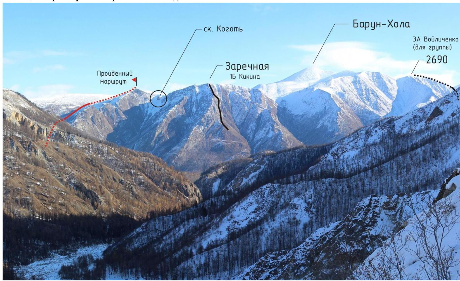
Photopanorama of the area. Shooting point: Belyi Irkut, ascent to the alpine camp on the forest boundary, bypassing the Moguveka icefall.
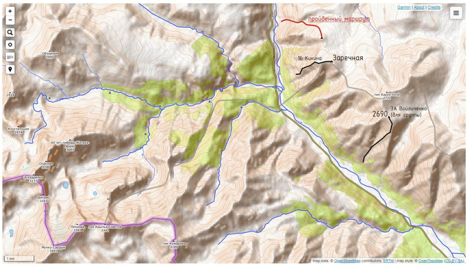
Fig 2. Map of the ascent area: https://opentopomap.org/#map=12/51.7609/100.6938 ↗
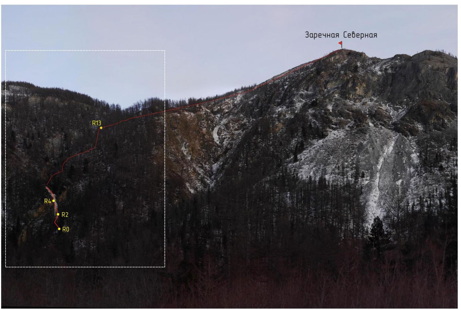
Fig 3. Technical photograph of the route. View of the route from the west.
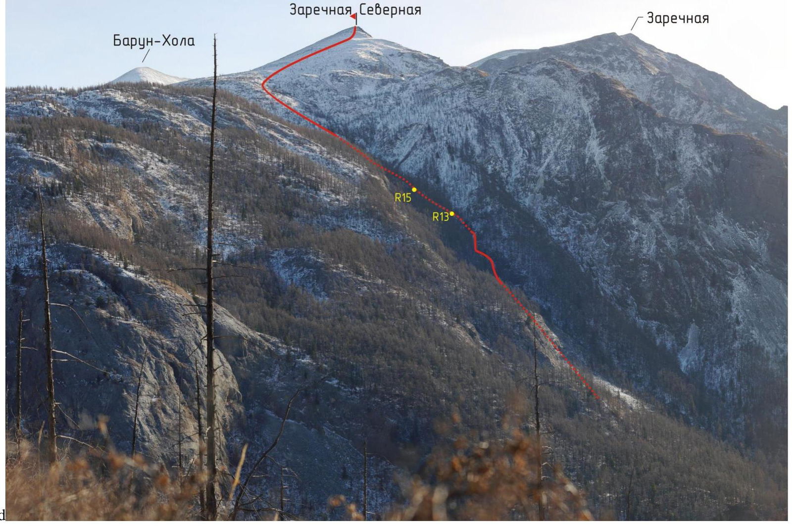
Fig 4. Technical photograph of the route. View of the route from the northwest.
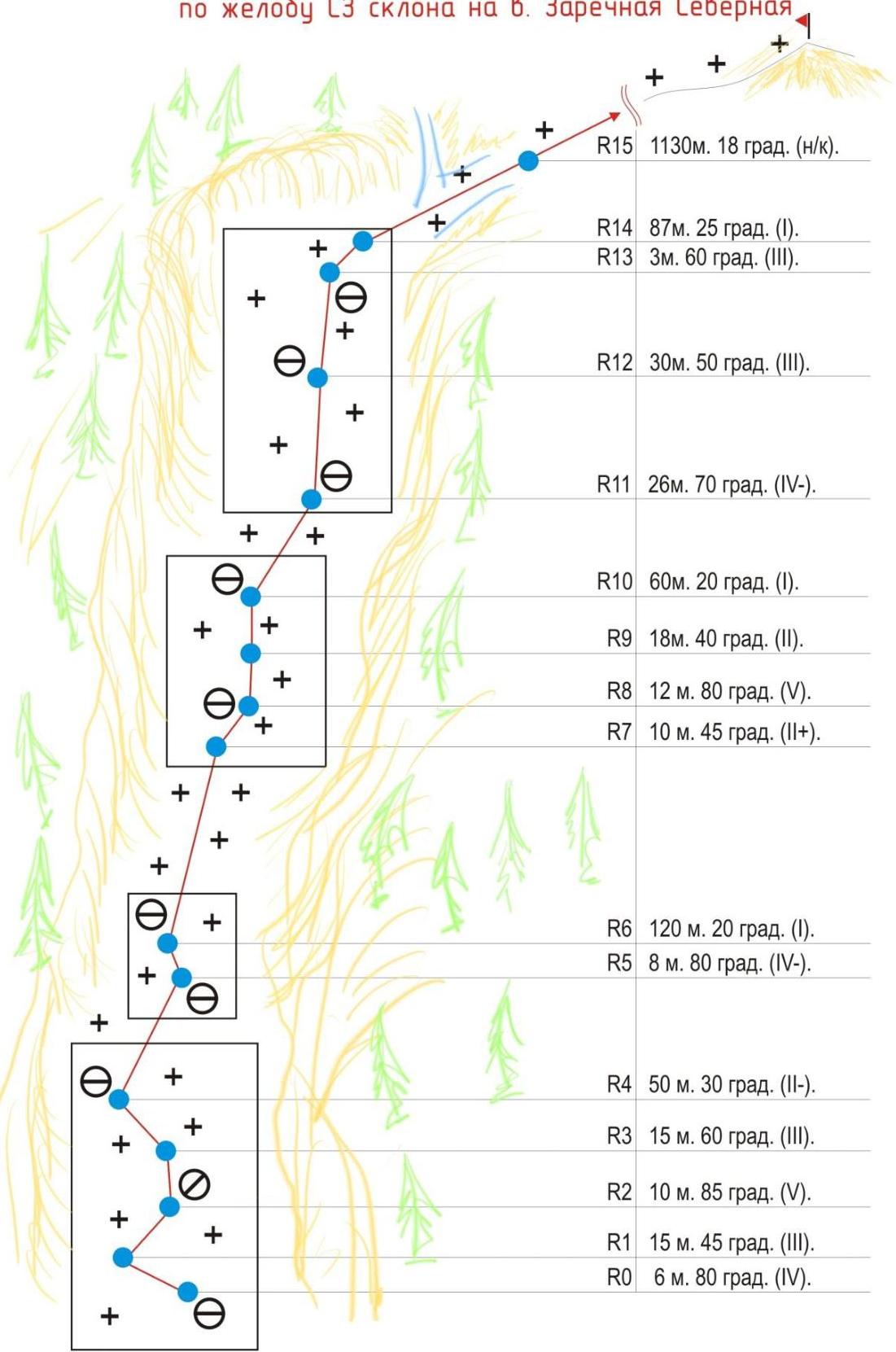
UIAA Scheme of the key part of the 3B route through the NW slope gully on Zarechnaya Severnaia peak
3. Characteristics of the Team's Actions
3.1 Tactical Plan of the Team
The Ekhe-Nuga area is located in the Irkut River floodplain, downstream from the confluence of the White Irkut and Black Irkut rivers, 325 km from Irkutsk (see Map of the ascent area). This area is being actively developed by Irkutsk climbers and ice climbers.
The central alpine peak of the area is Zarechnaya peak (2400 m), which has a rocky route 1B (Kikina, 2008).
The ascent target was a nameless peak (2350 m) located northwest of Zarechnaya. The peaks are separated by a wide saddle, in the center of which stands a rocky outcrop resembling a claw on a finger (see Photopanorama of the area).
The steep, rocky northwest slope of the chosen peak is cut by a deep and narrow gully of a stream flowing from a high-altitude tundra plateau adjacent to the peak from the north. In mid-winter, a powerful dry icing forms along the stream bed, with steep steps. This ice flow was chosen as the ascent route (Fig. 3, 4).
The team arrived in the area on January 2, 2020, and set up camp 30 minutes from the start of the route on the Irkut River bank, at an altitude of 1500 m. The starting point of the route is at an altitude of 1600 m. The ascent was planned for January 4; on January 3, the team conducted reconnaissance and active acclimatization.
Technical equipment taken on the route:
- 10 ice screws
- 4 anchors
- 2 station slings
- 10 quickdraws
- 4 screwgate carabiners
- 3 pairs of ice axes
- 2 dynamic ropes, 30 m each.
3.2 Tactical Actions of the Team on the Route
The first climber on the route was Antonov O. on a double rope. The second climber was Serebrennikov E., and the third was Zhdanov D.
On challenging sections, the first climber would climb the full length of the rope, if the terrain allowed, and set up stations in convenient locations, belaying the second and third climbers through an autoblock.
The second and third climbers moved simultaneously at a short distance from each other to be able to control falling ice.
To speed up the passage of the route on less challenging sections, the team switched to simultaneous movement with a change of leader; the second climber would start working as the leader.
The entire route was climbed without the use of fixed ropes.
3.3 Brief Description of the Route Passage
| Section # | Description | Photo # |
|---|---|---|
| R0–R1 | 6 m. 80° (4). Start of the route. From station # 0, we move left away from the ice curtain. | 1,2 |
| R1–R2 | 15 m. 45° (3). Diagonal traverse to the right under the rocks. Station # 1. | 1,3 |
| R2–R3 | 10 m. 85° (5). Up and left along the wall. | 1,4,5 |
| R3–R4 | 15 m. 60° (3). Along the cascades for the length of the rope. Station # 2. | - |
| R4–R5 | 50 m. 30° (2-). Along the cascading ice to the wall. Station # 3. | - |
| R5–R6 | 8 m. 70° (4-). Ice step. Station # 4. | 6 |
| R6–R7 | 120 m. 20° (1). From station # 4 along the gentle ice in a very narrow canyon. | - |
| R7–R8 | 10 m. 45° (2+). Under the left base of the ice wall. Station # 5. | 7 |
| R8–R9 | 12 m. 80° (5). Challenging ice wall. | 7,8,9 |
| R9–R10 | 18 m. 40° (2). Exit from the wall. Station # 6. | |
| R10–R11 | 60 m. 20° (1). Simple ice cascades. Station # 7. | 10 |
| R11–R12 | 26 m. 70° (4-). Series of ice walls and shelves. Station # 8. | 10,11,12 |
| R12–R13 | 30 m. 50° (3). Continuation of the walls. Station # 9 behind a tree. | - |
| R13–R14 | 3 m. 60° (3). Overcoming the ice threshold. Then we move simultaneously. | - |
| R14–R15 | 87 m. 25° (1). Simultaneously. местами мокрый лед. Exit from the canyon to the shrubbery. | - |
| R15–R16 | 1130 m. 18° (n/k). Through the shrubbery, reach the fork of two couloirs. Here the ice ends. You can unrope. Continue the ascent directly up the slope between the couloirs along the rocky slope with sparse trees until the terrain flattens out onto the tundra landscape and then reach the summit. | 13,14,15 |
4. Photographs from the Route
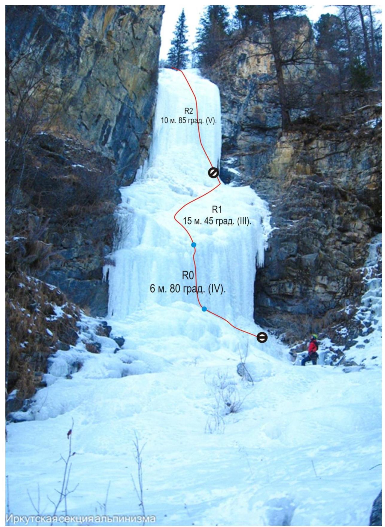
Photo 1. Start of the route.
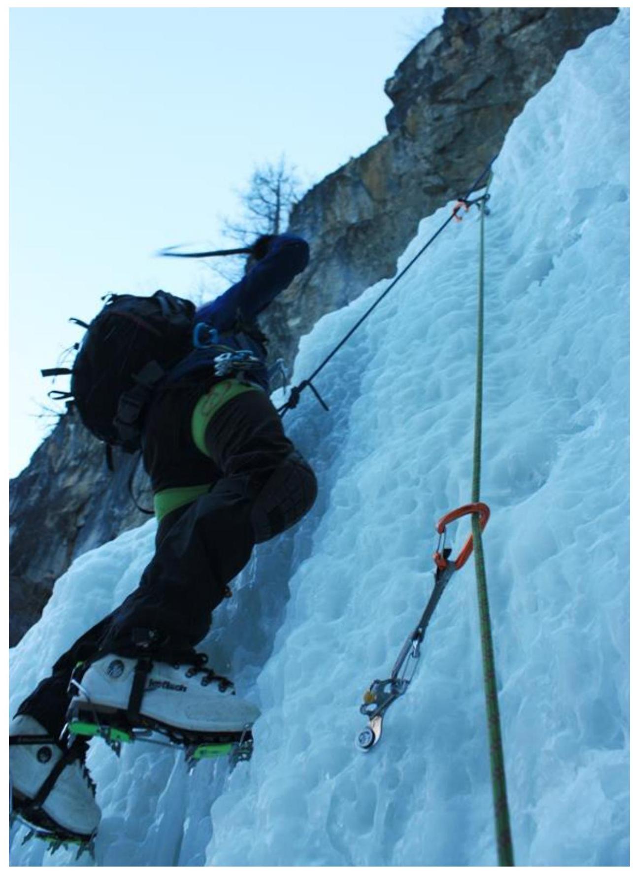
Photo 2. The second climber starts working on section R0–R1 from station # 0. 
Photo 3. View of station # 1. The second and third climbers work simultaneously on R1–R2.
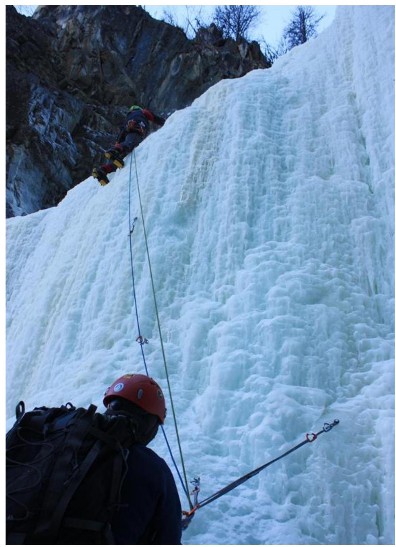
Photo 4. At station # 1. R2–R3: the first climber exits beyond the ledge.
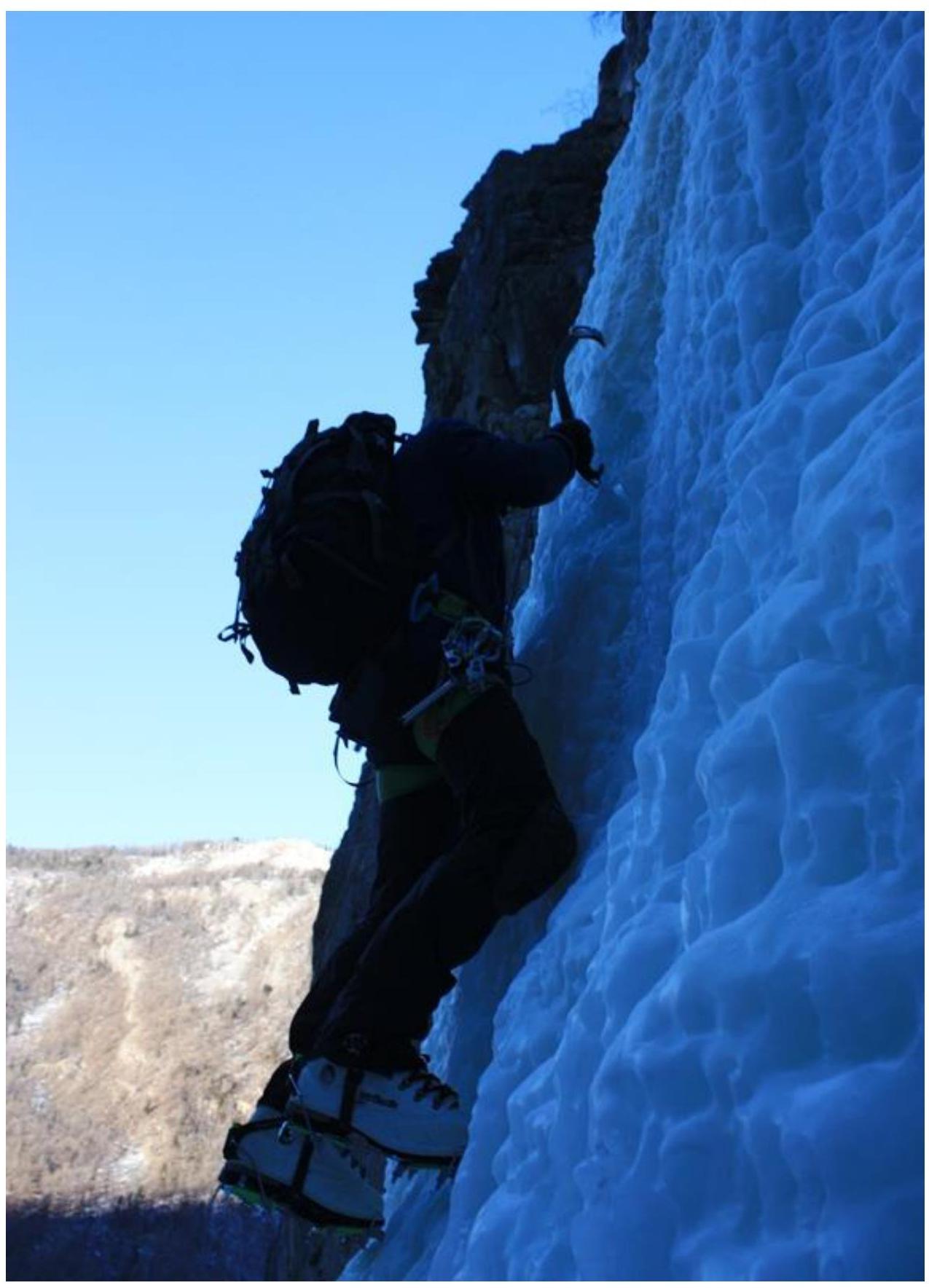
Photo 5. Station # 1. The second climber starts working on R2–R3.
Photo 6. Change of leader. Alternate movement on R5–R6 from station # 3.
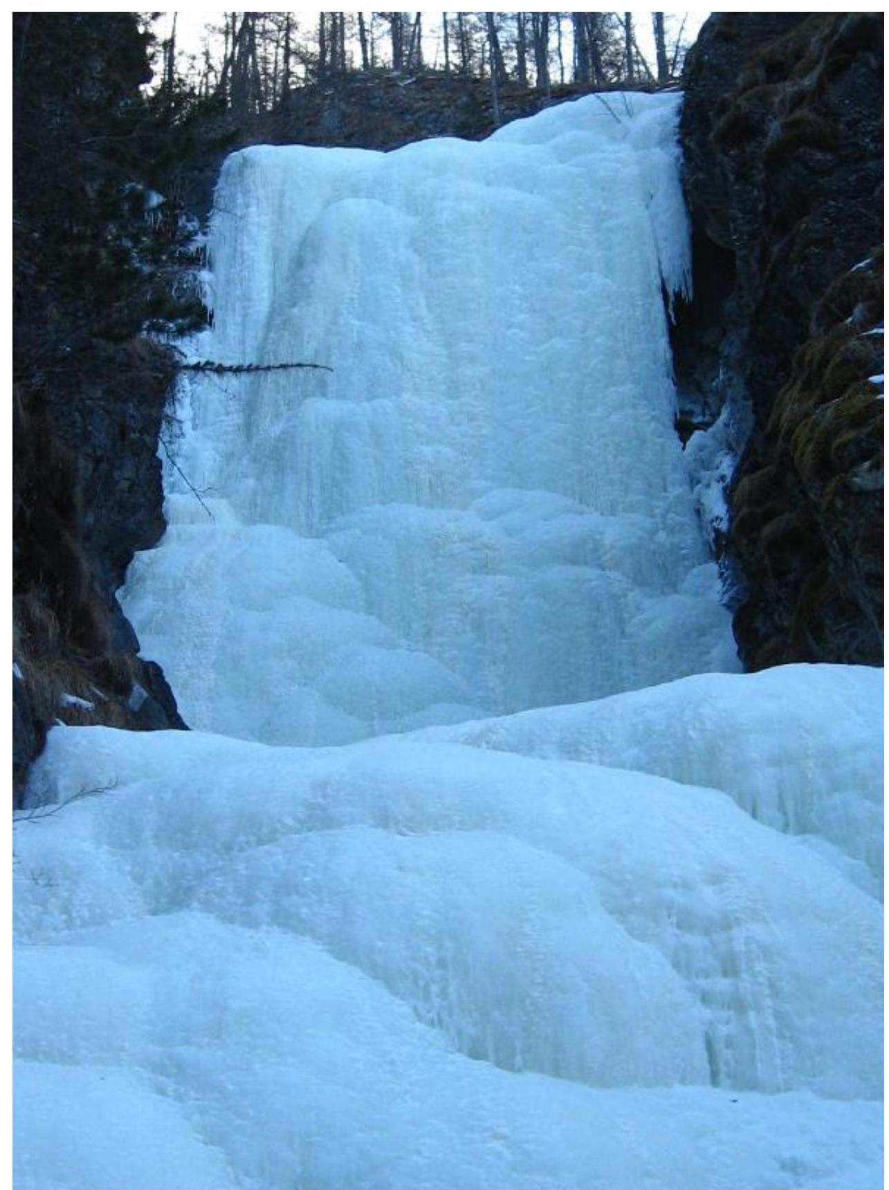
Photo 7. View of R7–R8 and R8–R9.

Photo 8. Leader working on R8–R9. View from station # 5.
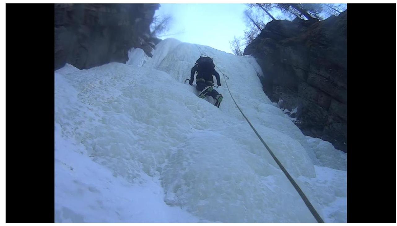
Photo 9. The second climber working on R8–R9. Screenshot from video recording.
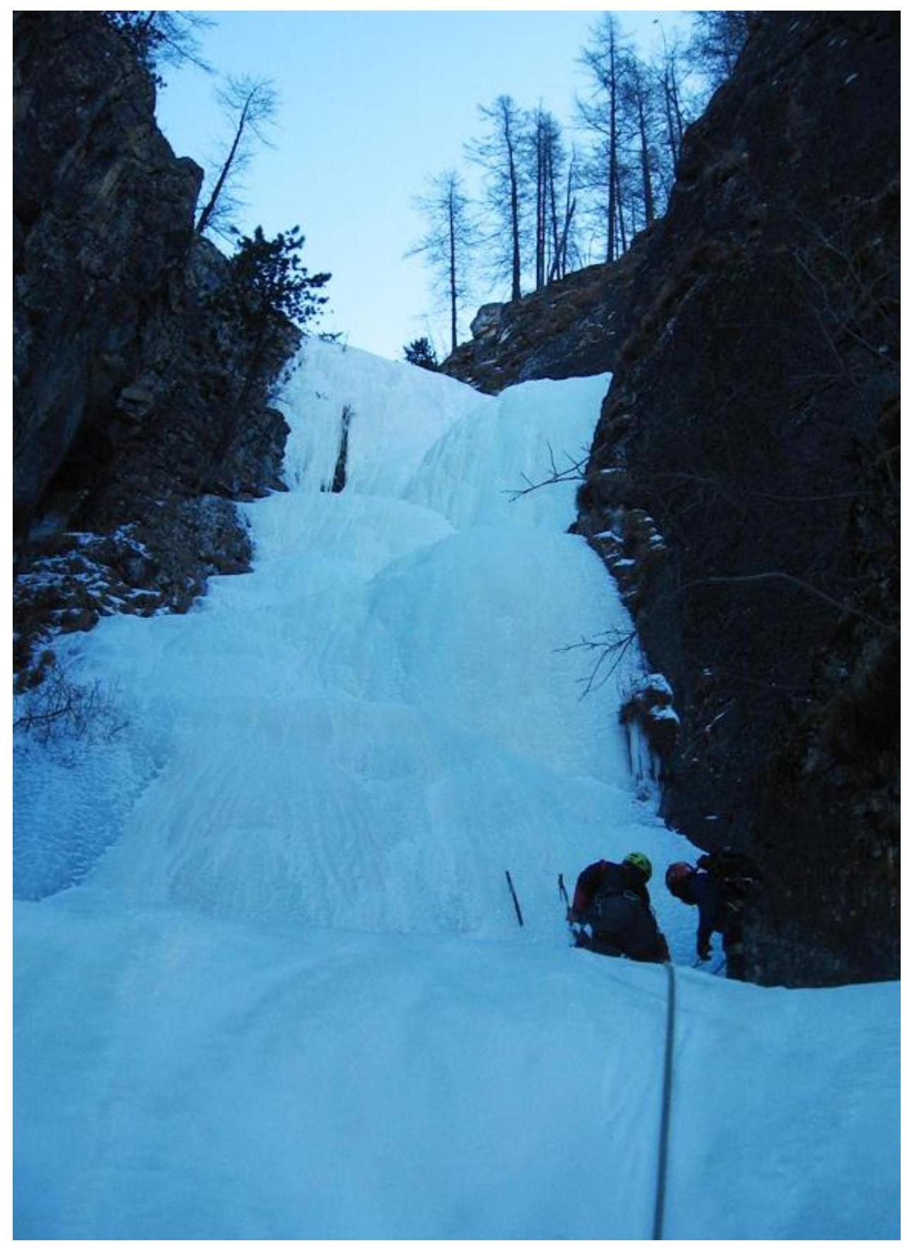
Photo 10. View from the end of R10–R11 to station # 7, R11–R12, and R12–R13.
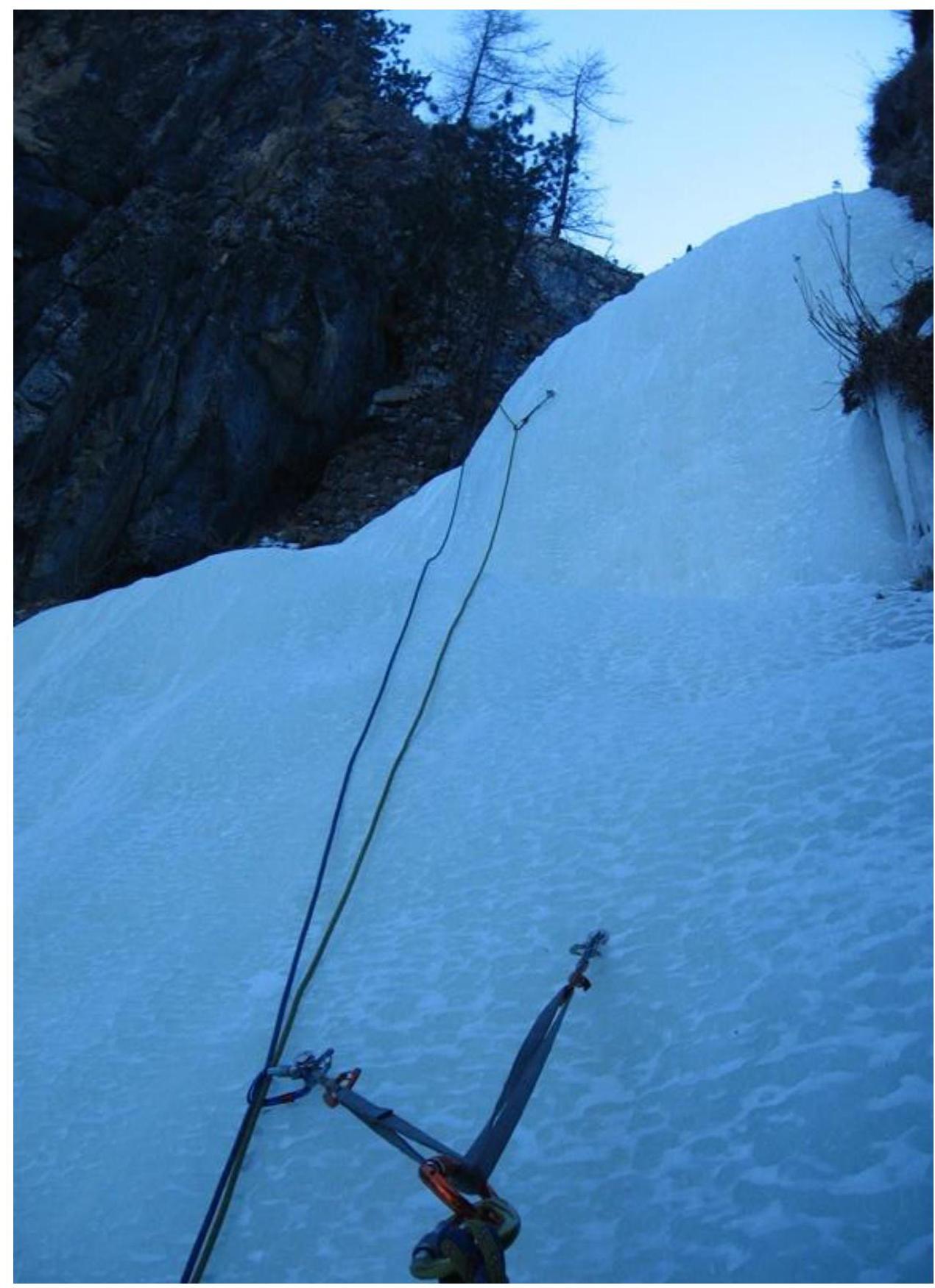
Photo 11. View from station # 7 to the start of R11–R12.
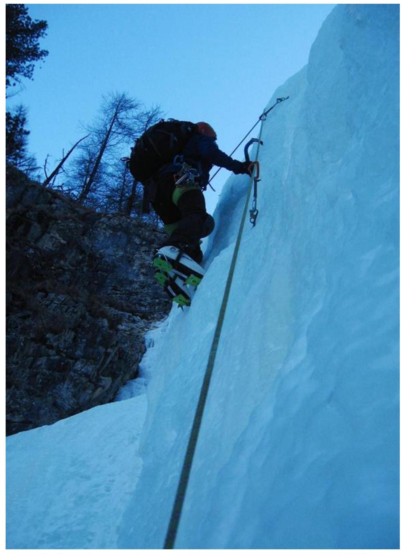
Photo 12. The second and third climbers work simultaneously on R11–R12
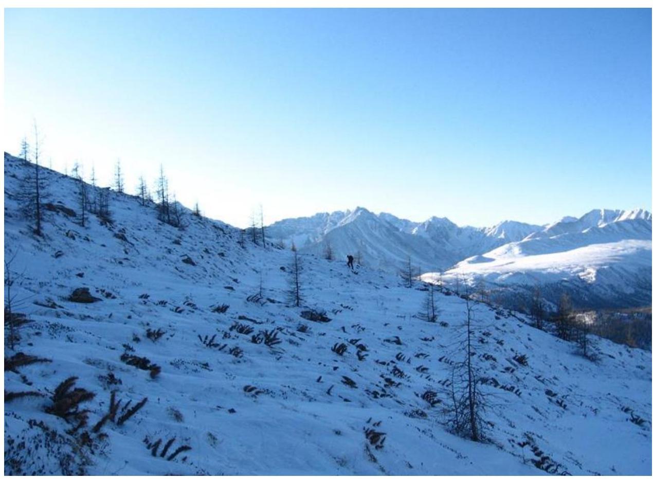
Photo 13. Slope before reaching the summit.
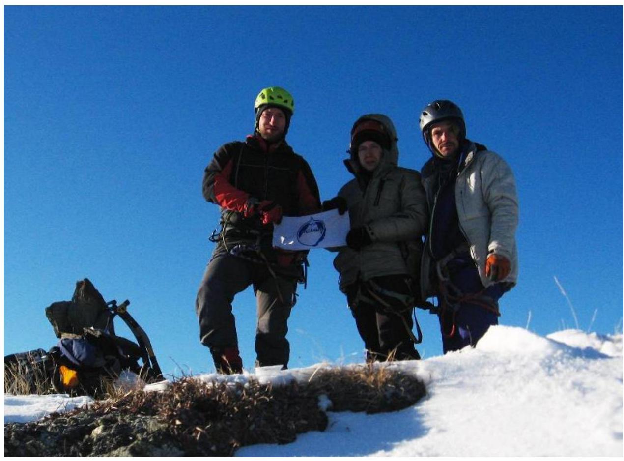
Photo 14. Photograph from the summit.
List of participants:
- Antonov O.
- Serebrennikov E.
- Zhdanov D.
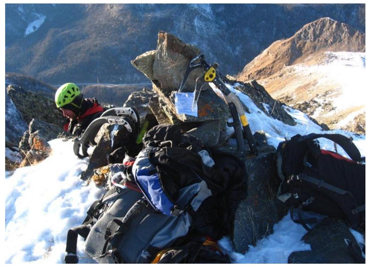
Photo 15. Built a control cairn, left a note.
Comments
Sign in to leave a comment