Brief Overview of the Climbing Area in the Moguvek Valley, Big Sayan Ridge
The climbing area is located in the Buryat Republic, on the border with Mongolia, in the Big Sayan Ridge and its part - the Munku Sardyk Ridge - in the upper reaches of the Moguvek and Beliy Irkut valleys. The hub of the area is the massif of Munku Sardyk mountain 3491 m - the highest point of the Sayan Mountains. The area is 300 km from Irkutsk in almost a strictly western direction. From Irkutsk to Mondy settlement, there is a good asphalt road of state importance. The road to the area goes as follows:
- From Irkutsk to Mondy settlement, there is a good asphalt road of state importance.
- From Mondy settlement - 25 km along a gravel road leading to the Okinsky district of the Buryat Republic, to the bridge across the Beliy Irkut River.
- Then the road goes to the pass.
- The path to the foot of Munku Sardyk mountain and the mountaineering training ground in the Moguvek valley runs along the canyon of the Beliy Irkut and Moguvek rivers from a height of 1400 to 2200 m, i.e., to the forest boundary.
Features of the section:
- In winter, this section is traversed on ice with crampons.
- Above the canyon and the forest boundary, the Moguvek river valley is wide, trough-shaped.
- In the upper part, above the second cirque, there is a cirque lake Ehoi.
From the road to the base camp at the forest boundary - 4 hours of approach.
According to these indicators, the Moguvek valley area is the most accessible today among all, even closer, mountaineering areas of Eastern Siberia.
Passport of the Ascent to the Katka-dura Peak 3064 m, via the South Ridge, 2B category of difficulty
- East Sayan, Big Sayan Ridge, Moguvek valley, section 6.1.1.
- Katka-dura Peak 3064 m, via the South Ridge.
- Proposed 2B category of difficulty, first ascent.
- The nature of the route is rocky.
- Height difference 400 m, length 807 m, average steepness 30°.
- Pitons hammered: rock and chock 19.
- Team's travel time – 6 hours.
- No overnight stays on the route.
- Group: Afanasyeva O.A. 3rd sports category Afanasyev A.E. Master of Sports Bobrysheva A.A. 3rd sports category Grigoryev A.F. 2nd sports category Ilyinsky V.A. 3rd sports category Popov N.V. badge holder Saetgalina I.N. badge holder
- Coach: Afanasyev A.E. Master of Sports
- Ascent to the summit and return on May 9, 2009.
The route was repeated on May 28, 2017, by a group of two mountaineering instructors and two military personnel with the second level of mountain training.
Description of the Ascent Route to the Katka-dura Peak 3064 m, via the South Ridge, 2B category of difficulty
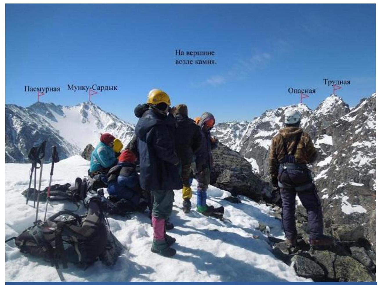
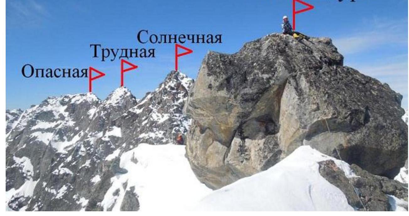
The approach to the route from the base camp at the forest boundary takes 2 hours. The route begins from the middle of the wall of the left ridge of the southwest exposure along a ledge that crosses the lower part of this wall upwards to the right. The route is characterized by a richness of rocky and ice-snow relief. It is convenient for training groups to practice diverse movements in rope teams and on belays, as well as for psychological training at the level of Sayan triples and relatively short approaches. Among the "B" category routes in the area (Kryl'ya Sovetov, Pasmernaya, Dynamo, Solnechnaya), this route will be the most technically challenging.
- Sect. 0–1, 60 m, 40°, II- – Snowy ledge upwards to the right.
- Sect. 1–2, 30 m, 50°, III- – Icy rocky slab (continuation of the ledge).
- Sect. 2–3, 30 m, 45°, II- – Snowy diagonal ledge in the same direction. Exit to the rocky ridge. In summer, this section is traversed along the ridge to the right of the diagonal ledge due to a smooth slab instead of a snowy slope.
- Sect. 3–4, 30 m, 55°, II+ – Reliable rocks along the ridge. Exit to a wide couloir located to the right.
- Sect. 4–5, 20 m, 25°, I- – Crossing the couloir to the right rocky ridge of southwest exposure.
- Sect. 5–6, 50 m, 50°, II+ – Along the internal angle with grass, transition to the right ridge.
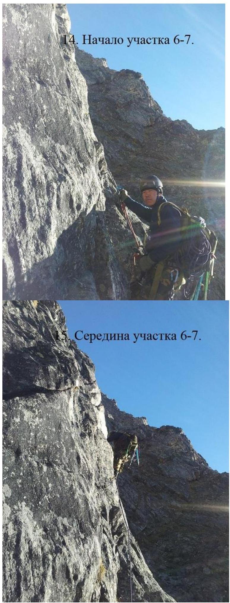
- Sect. 6–7, 50 m, 50°, III- – Rocky ridge. At the end of the section, the ridge is represented by sharp, isolated large blocks with gaps between them and abysses on the sides.
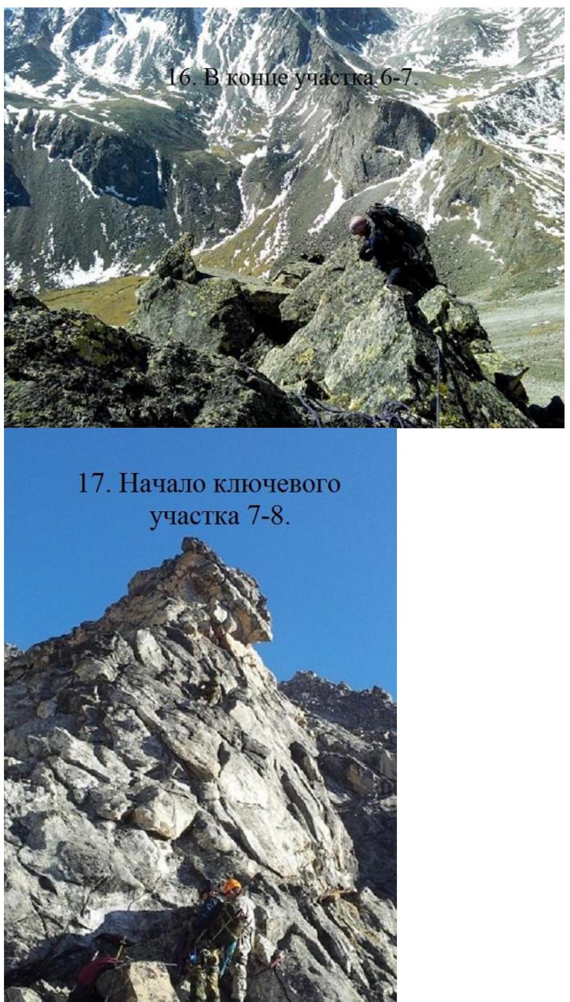
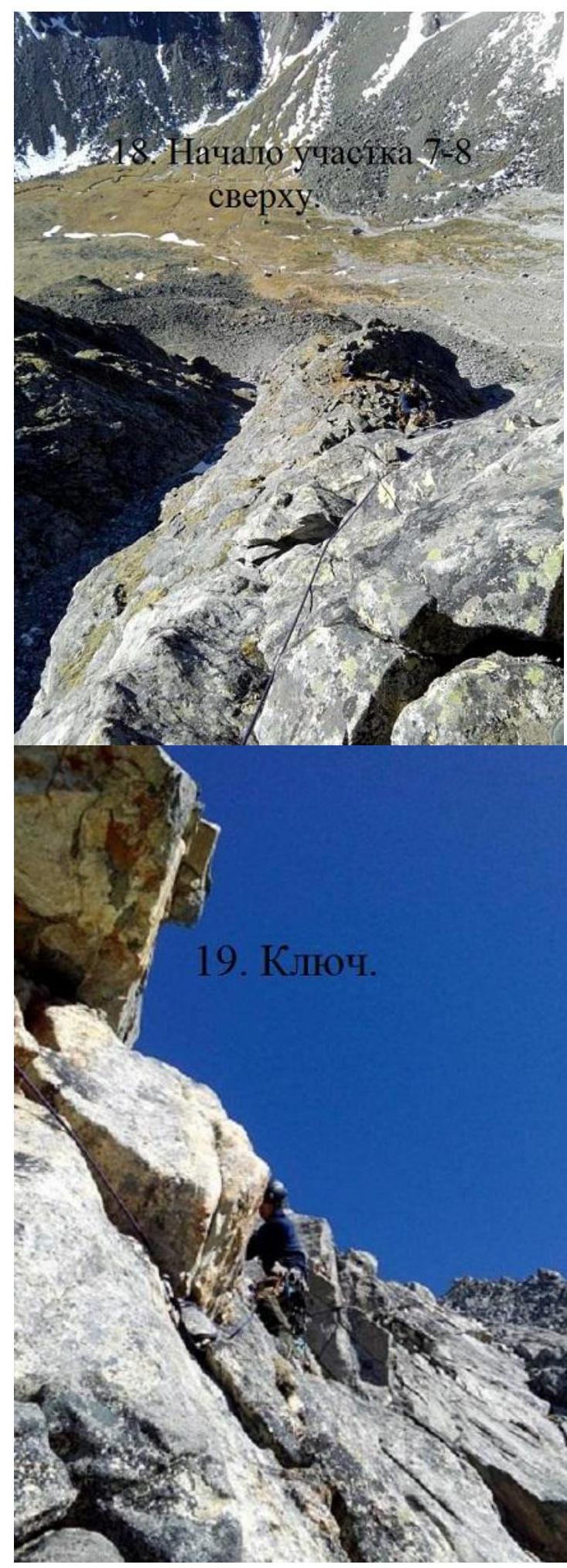
- Sect. 7–8, 65 m, 70°, IV+ – Bypassing the gendarme on the right in the upper part. Reliable rocks. The key point of the section and the entire route is the transition behind the right angle of the gendarme under the rocky cornice of the gendarme's summit. Exit to the ridge.
- Sect. 8–9, 30 m, 40°, II+ – Rocky ridge and 3 m descent to a saddle.
- Sect. 9–10, 40 m, 35°, I+ – To the right towards the right couloir, bypassing a light-colored gendarme.
- Sect. 10–11, 45 m, 45°, II- – Rocky slab to the right of the gendarme.
- Sect. 11–12, 100 m, 40°, I- – Destroyed rocks.
- Sect. 12–13, 50 m, 50°, II- – Monolithic rocks along the ridge of the South ridge. Exit to the junction of the south ridge and the south buttress.
- Sect. 13–14, 150 m, 30°, I- – Scree slope. Exit to the East ridge to the right of the summit.
- Sect. 14–15, 50 m, 10°, I- – Along the snowy ridge to the left along the way.
- Sect. 15–16, 7 m, 80°, V- – Summit rock. With a cairn on it.
Descent along the West ridge to the Gorny pass and down a snowy couloir to the south into the Moguvek valley.
 Route map 2B to the Katka-dura peak.
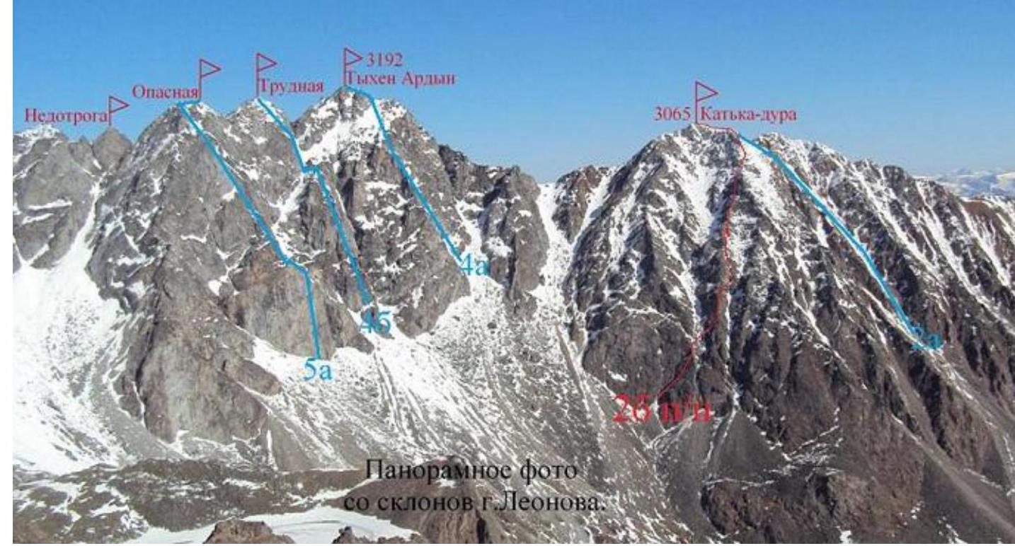 Panoramic photo from the slopes of Leonov mountain.
 Technical photo.
R16
Technical photo.
R16
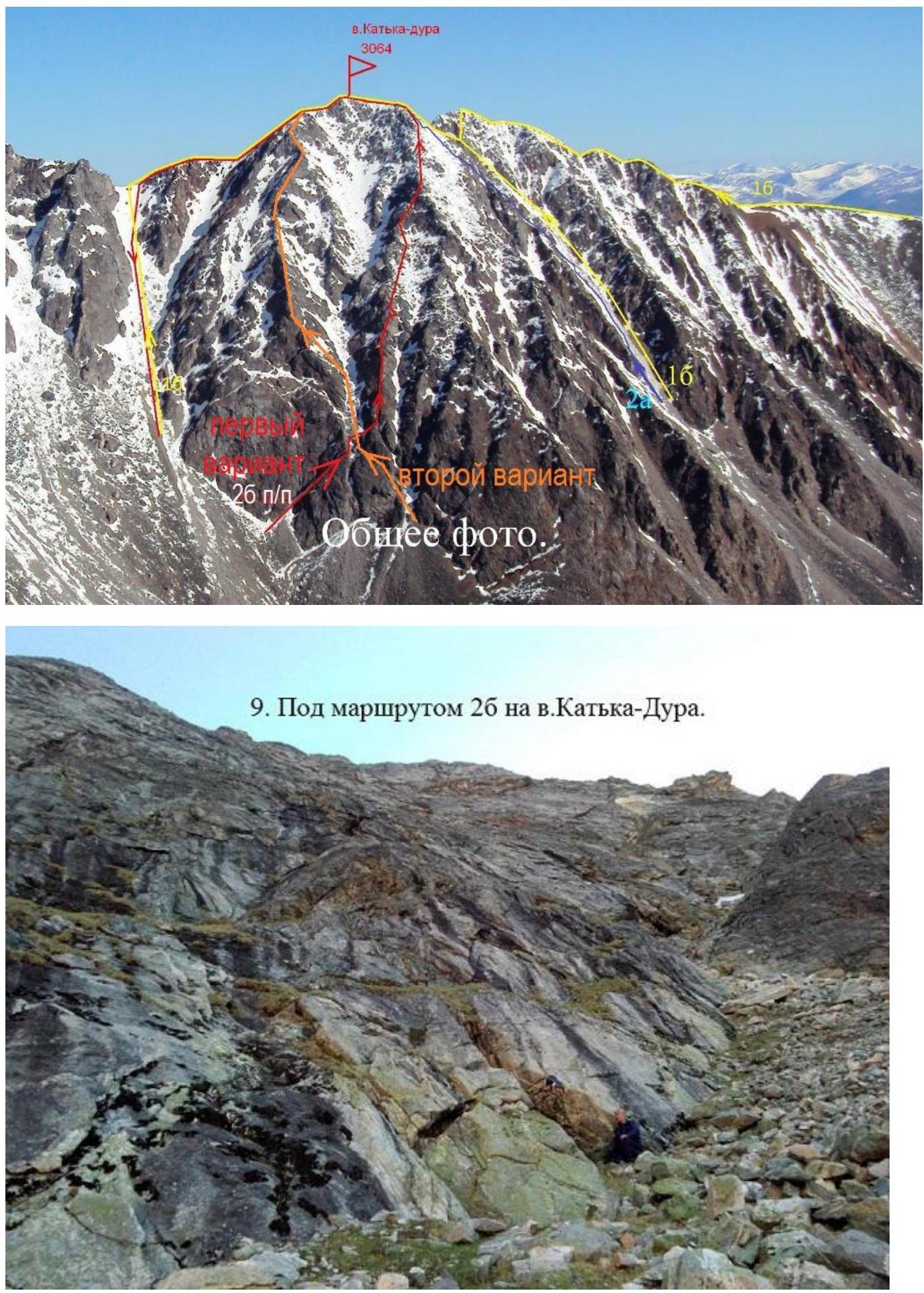 General photo.
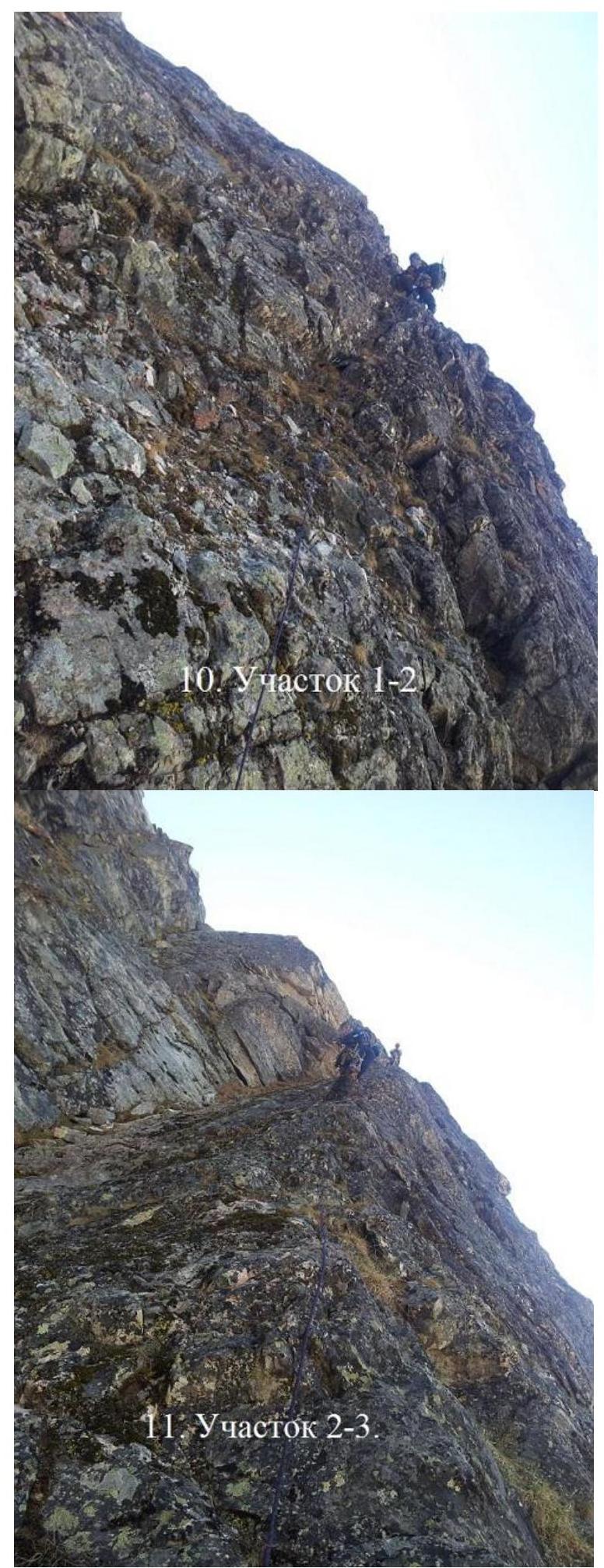
- Below route 2B to the Katka-dura peak.
- Section R1–R2.
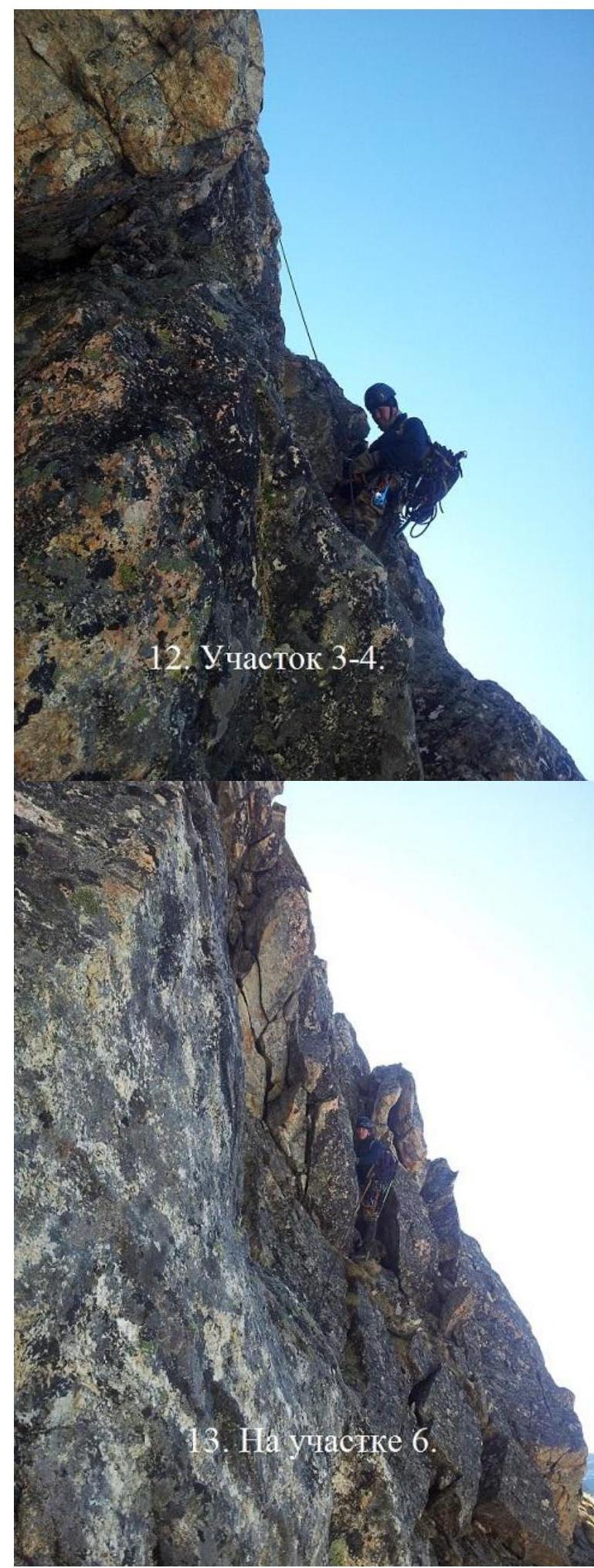
- Section 3–4.
- Section R2–R3.
- Section R3–R4.
- Beginning of the key section 7–8.
- On section R6.
- Key.
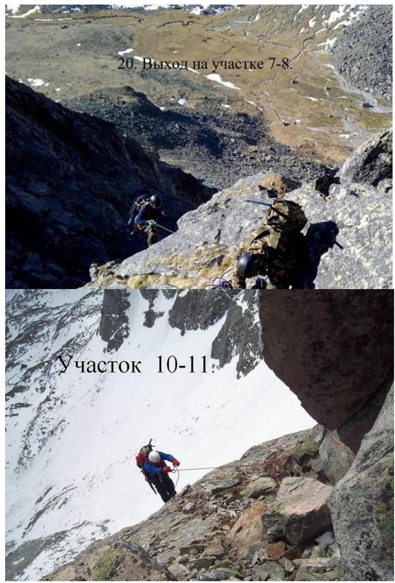
- Exit on section R7–R8.
To the summit rock - one at a time.
Katka-dura
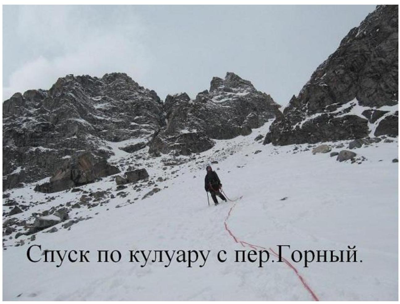 Descent along the couloir from the Gorny pass.