BRIEF DESCRIPTION OF THE APPROACH TO THE ROUTE
Leader V. Vasilenko +3, 1978 From the base camp located at the 58th km of the Khorog - Osh highway, we approach the Gaf Glacier along the left (orographically) side of the Nemacdar River. We ascend to the Gaf Pass via its left part. The approach time is 5–6 hours from the base camp. The entire approach path is clearly visible from the 59th km of the Khorog - Osh highway.
General view of the peak 5204 m from the East.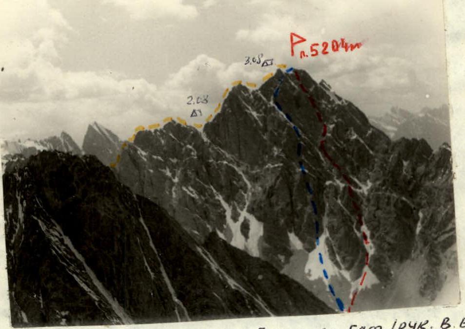 — route along the S ridge from Gaf Pass (leader V. Vasilenko) — route along the E face (leader I. Orbei) — route along the center of the E face (leader Kh. Kornys).
Peak Gif
Beginning of the S ridge
— route along the S ridge from Gaf Pass (leader V. Vasilenko) — route along the E face (leader I. Orbei) — route along the center of the E face (leader Kh. Kornys).
Peak Gif
Beginning of the S ridge
Map of the area worked by the 4C 6CO, A6a (3) 3 group, with the designation of ascent routes in 1978, June 28 — August 10. Base camp "Fann Mountains"
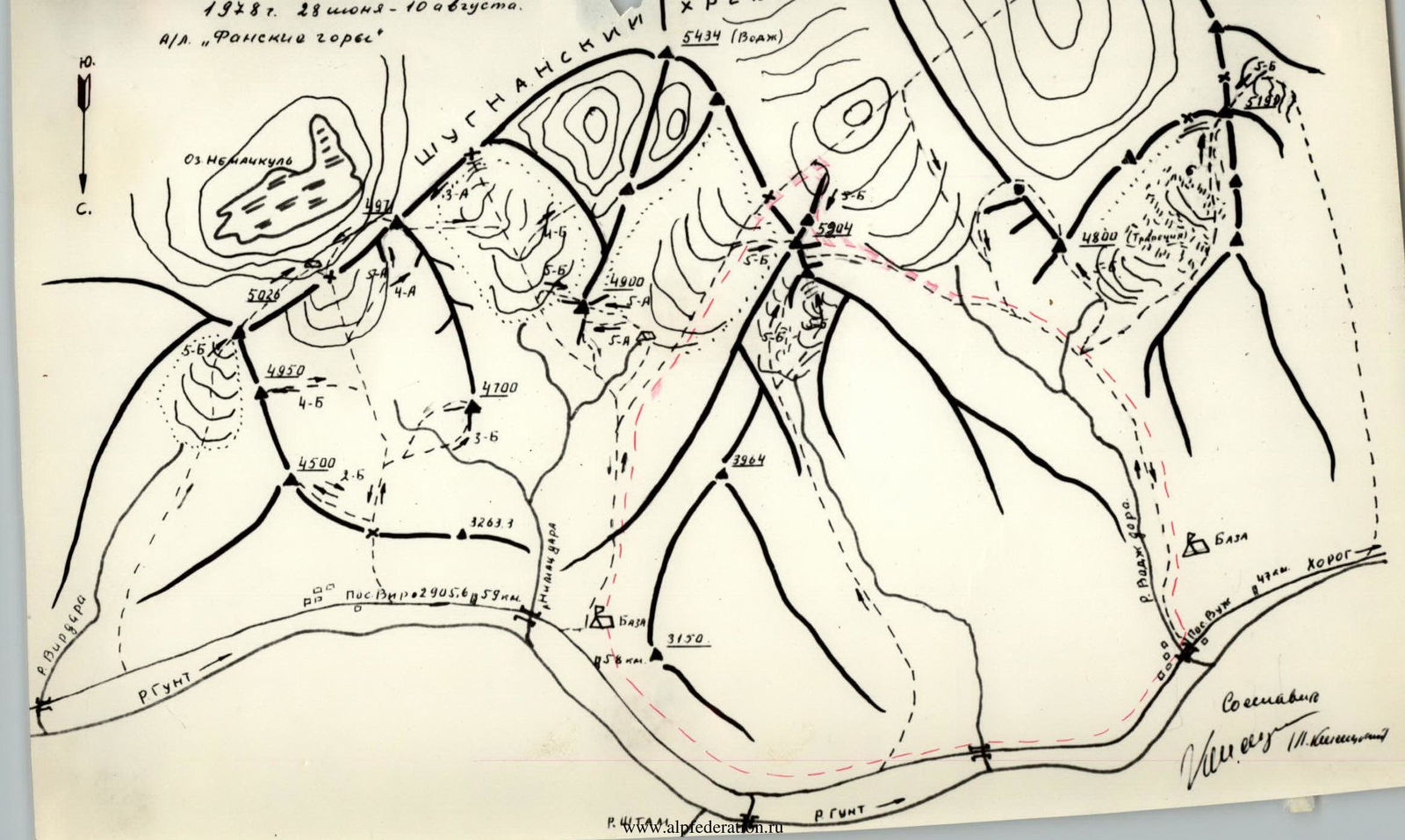
TABLE OF MAIN CHARACTERISTICS OF THE ASCENT ROUTE Ascent route No. 5204 along the southern ridge from Gaf Pass
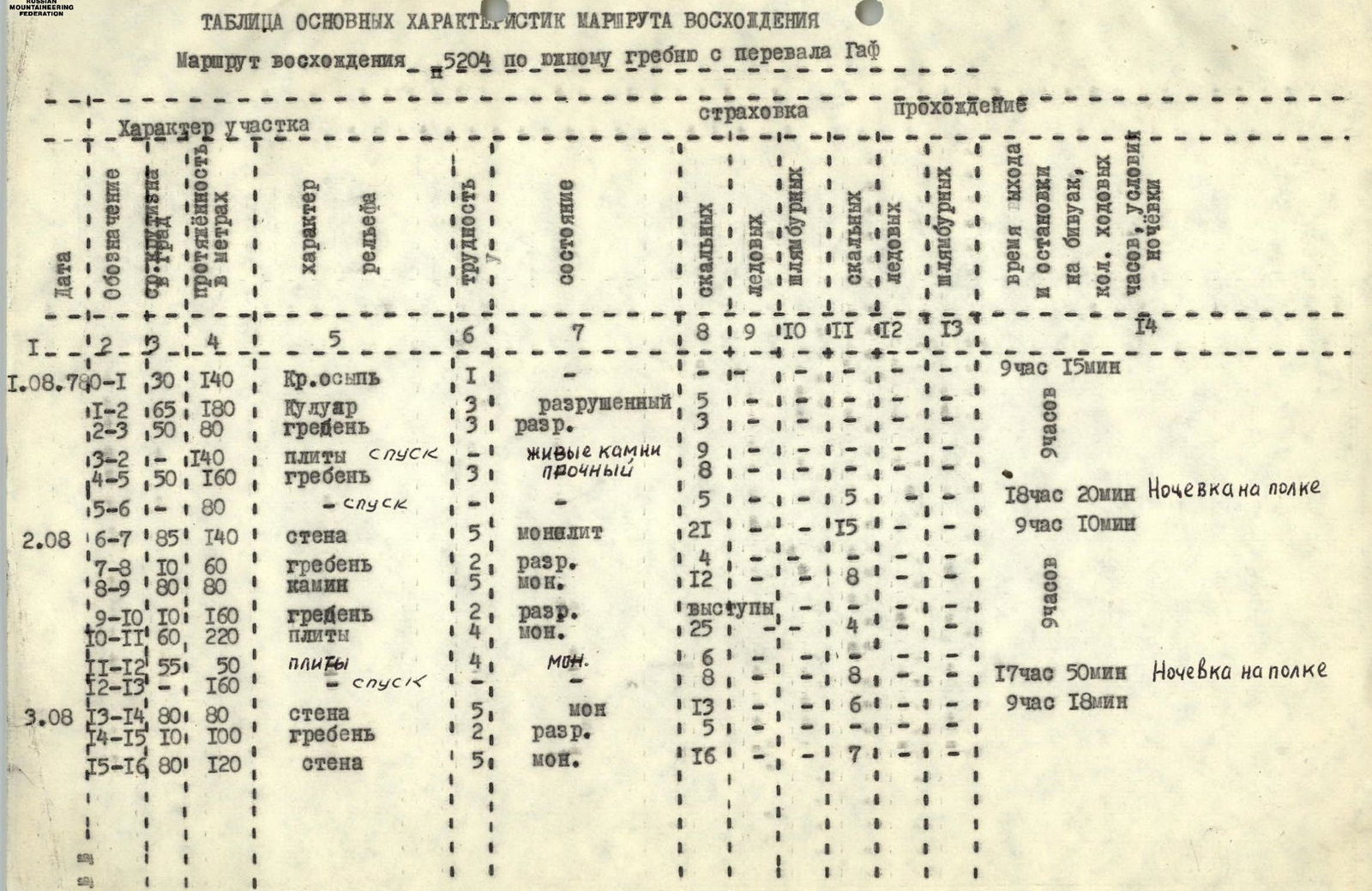
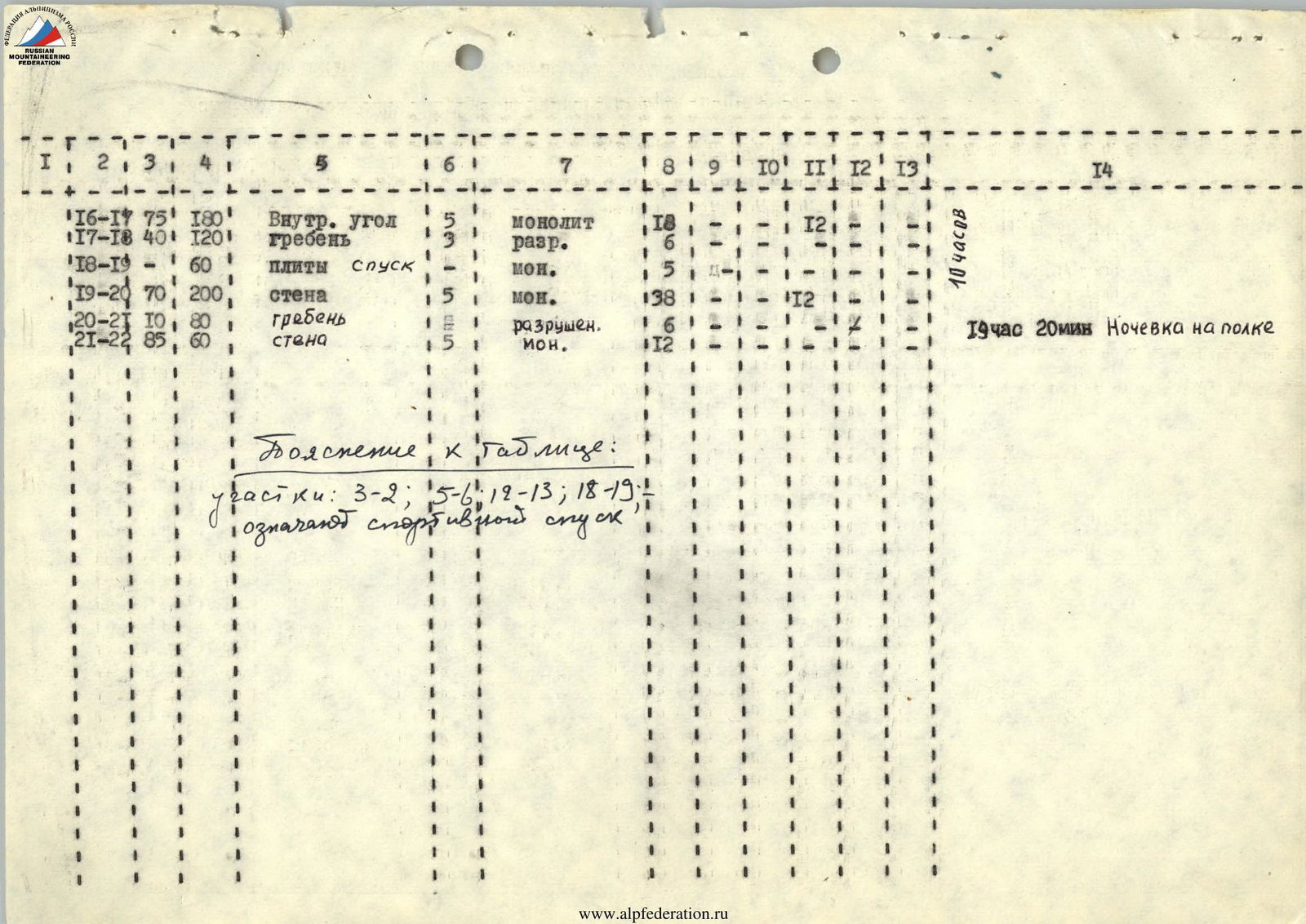
Explanation for the table: Sections: 3–2; 5–6; 12–13; 18–19 indicate a sports descent.
2014
2013 2014 2015 2016 2017 2018 2019 2020

 Sections: 19–20, 20–21, 21–22
 Sections: 15–16, 16–17, 17–18