Ascent Log
-
Western Pamir, Yazgulyam Range
-
Peak 4723 m, via the eastern slope (first ascent)
-
Proposed category — 2A cat. dif., first ascent.
-
Route type: snow and ice.
-
Route elevation gain — 170 m (by altimeter).
Route length — 260 m. Average steepness:
- main part of the route — 50°.
- entire route — 35–40°.
-
Pitons left on the route:
total — 0; incl. drilled pitons — 0. Pitons used on the route:
- ice screws — 24, incl. artificial aids — 0. Total artificial aids (AIDs) used — 0.
-
Team's total climbing hours: 3 hours.
-
Leader: Gushanоv Andrey Rafailovich, 2nd sports category
Participant: Winter Andrey Lvovich, 2nd sports category
-
Coach: Volkov Mikhail Evgenievich, Candidate Master of Sports, 2nd category.
-
Approach to the route: August 5, 2008, 9:40 AM
Summit reached: August 5, 2008, 12:45 PM. Return to Base Camp: August 5, 2008, 3:40 PM.
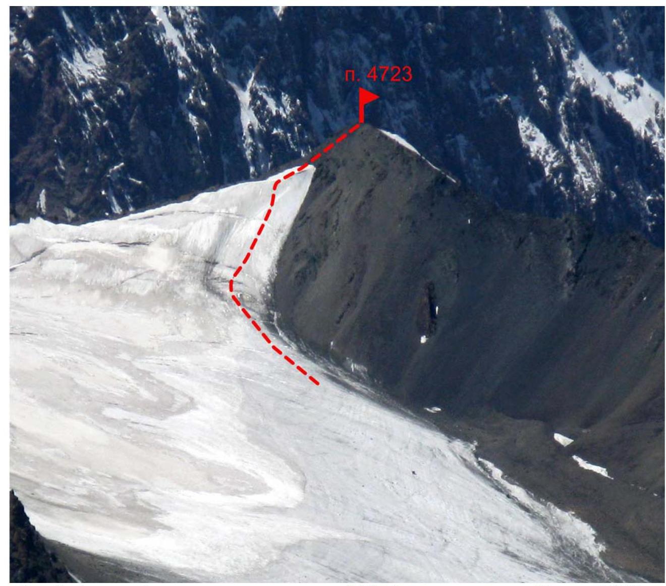
Fig. 1. Photograph of the eastern slope of Peak 4723. Taken on July 28, 2008, from the slope of Peak Dinosaur.
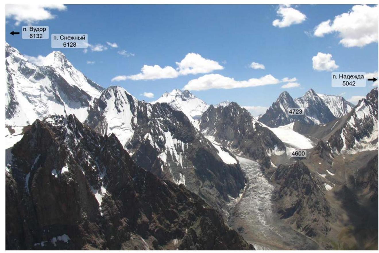
Fig. 2. Panorama of the NW spur of the Yazgulyam Range, branching off from Peak Snowy. Taken on July 28, 2008, from the slope of Peak Dinosaur.
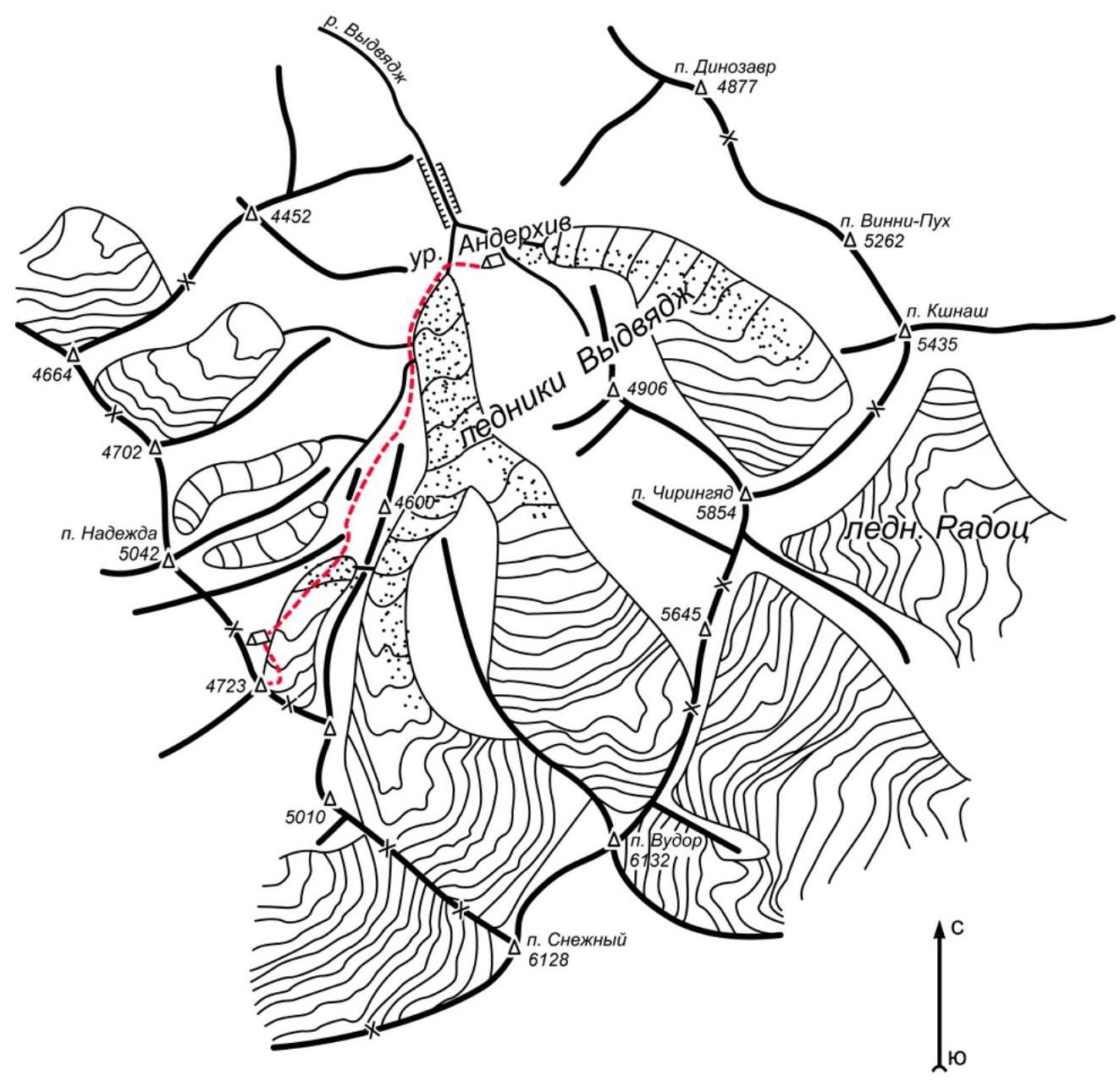
Fig. 3. Map of the area. Scale 1:50,000
Brief Description of the Climbing Area
Peak 4723 is located in the western part of the Yazgulyam Range, in the NW spur branching off from Peak Snowy, between Peak Snowy and Peak Hope.
The area is characterized by its inaccessibility — long drives and approaches, gorges, and canyons that require mountaineering skills even on the approach. Apparently, this explains its undeveloped state from an alpinistic perspective. Significant glaciation is characteristic, with heavily crevassed glaciers and icefalls. The area is unique in terms of its sporting opportunities and aesthetic appeal.
So far, only two expeditions have visited this area:
- 1982 — USSR Championship — "Lokomotiv" sports society team made the first ascent of Peak Chiringyad, followed by a traverse;
- 1989 — Team led by V. L. Bashkirov, first ascent via the center of the western wall of Peak Chiringyad.
Car access is possible up to the village of Jamak (on the Dushanbe-Khorog highway to the confluence of the Yazgulyam and Pyanj rivers, then up the Yazgulyam river). From Jamak village, on foot along the right (orographically) bank of the Yazgulyam river to the village of Zaich. Crossing by bridge. Then along the left (orographically) bank of the Yazgulyam river to the abandoned village of Jafak. Then to the confluence of the Yazgulyam and Vidvyadzh rivers (the trail is difficult for donkeys). A convenient place for an overnight stay. Then along the Vidvyadzh river, first on the left (orographically), then on the right (crossing by bridge or ford) bank to a birch grove. Here is a convenient place for a temporary camp. Crossing to the left bank, approach to the canyon. The left (orographically) side of the canyon is cut by a couloir. To the left of the couloir (when moving from below), an ascent to the upper part of the canyon is possible (climbing category III-IV). Then, along grassy and rocky slopes and a rocky couloir, ascent to the moraine part of the gorge ("Anderkhiv"), under the tongues of glaciers flowing from the slopes of Peak Chiringyad and Peak Vudor. Crossing the Vidvyadzh river to the right (orographically) side. Base camp.
From the base camp, after crossing the Vidvyadzh river to the left (orographically) side — movement along the left edge of the glacier along the lateral moraine. Then:
- Ascent to the moraine.
- Descent into a pocket.
- Ascent along the NW wall of Peak 4600.
- Exit to the glacier descending from the slopes of Peak 4723.
- Ascent along the glacier to the slopes of Peak 4723.
In the upper part of the left moraine of the glacier — a convenient place for an overnight stay. From the base camp — 3-4 hours.

Fig. 4. Route diagram in UIAA symbols for Peak 4723 via the eastern slope.
| Section # | Ice screws | Difficulty | Length [m] | Steepness [degrees] |
|---|---|---|---|---|
| 8 | 2 | II | 70 | 45 |
| 7 | 2 | II | 20 | 30 |
| 6 | 4 | II+ | 20 | 60 |
| 5 | 5 | II | 45 | 45 |
| 4 | 1 | II | 15 | 45 |
| 3 | 1 | II+ | 3 | 60 |
| 2 | 4 | II- | 25 | 30 |
| 1 | 5 | II | 40 | 30 |
| 0 | – | I | 20 | 10 |
Brief Explanation of the Route Diagram (Fig. 4)
Section 3 — crevasse, width varies from 1-3 m, in places with snow plugs.
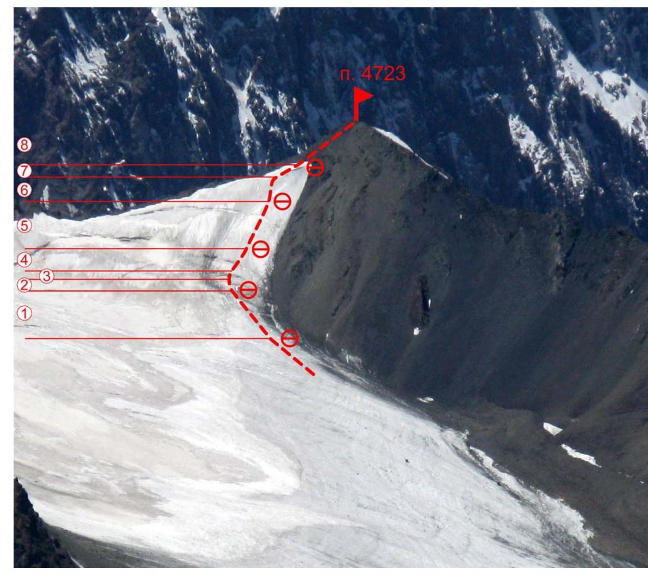
Fig. 5. Technical photograph of the route.