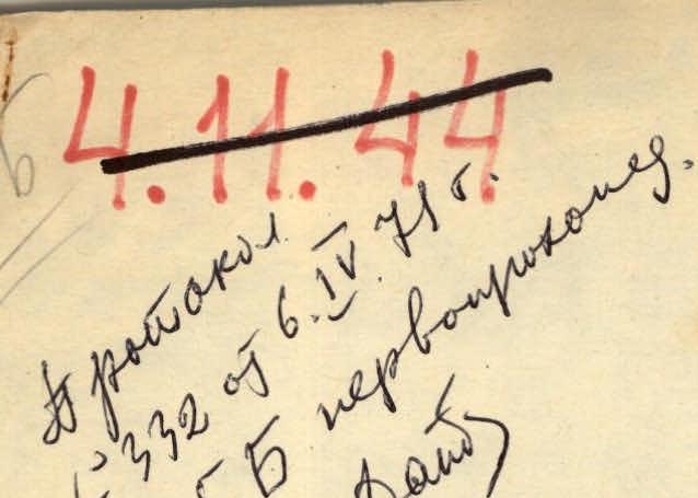
RUSSIAN MOUNTAINEERING FEDERATION 4144. Protocol No. 332 of April 6, 1971 5B first ascent
To the Classification Commission of the USSR Mountaineering Federation
South-Western Pamir
PIK AKADEMIKA KRYLOVA VIA EASTERN WALL
(Moscow Truth) (first ascent, approximately 6th category of difficulty)
Team of the Central Research Institute named after Academician A.N. Krylov
- N. Romanenko — Master of Sports, captain
- G. Chunovkin — Master of Sports, coach
- Yu. Komarov — Master of Sports
- L. Bakursky — Master of Sports
III. Composition of the assault group
- ROMANENKO N. — Master of Sports, captain
- CHUNOVKIN G. — Master of Sports, coach
- KOMAROV D. — Master of Sports
- BAKURSKIY L. — Master of Sports
IV. Brief description of the ascent
July 16. Departure from the base camp located at an altitude of 4000 m under the slopes of "Peak Pamyati zhertv Tetnuld" ["Tetnuldi Victims' Memorial Peak"], moving upstream along the Kinty-Dzherob river, then along the eponymous glacier on its right (orographic) side to the traverse to the object of ascent. Crossing the glacier — directly under the wall. Here, 300 m from the start of the route, at an altitude of 4550 m — a bivouac. Final observation of the wall.
July 17. Departure on the route at 6:00. Approach to the start of the route. The movement begins on a snow-ice slope (1) and then on the left (of three) rock lap from left to right upwards. The climbs are not difficult, the nodal point (2), where all three laps converge, is reached quite simply. Here begins the first bastion. The path is initially:
- 40 m upwards of medium difficulty,
- then 30 m along a narrow inclined shelf to the right upwards (3) bypassing the sheer wall. The climbing is average. Further — along a frozen groove (4) with a steepness of 70–80°, length 60 m. Climbing is very difficult with the use of ladders and artificial support points.
From the groove — left onto a snowy ridge (5). At 16:00 on a steep snow shelf — a bivouac. Time taken to overcome sections 1–5 — 10 hours. 42 rock anchors were hammered in.
July 18. Departure on the route at 5:00. The movement initially follows a snowy slope (6) with a steepness of 50° of medium difficulty, sticking to the left rocky outcrops — under the second bastion. Further — an internal corner (7) with a steepness of 80° and length 60 m, with the upper part being negative. Movement is aided by ladders and artificial support points. Exit from the corner — left onto a shelf. Then — 20 m upwards on rocks of medium difficulty (8) and to the right bypassing the bastion along a shelf (9). Climbing is complex. Exit into a small slippery niche and further — a traverse upwards to the right 30 m of very difficult climbing and straight upwards to the ice kolob. From here 50 m upwards — a sheer rocky chimney (10). It is passed on ladders with the use of artificial support points. The chimney leads to a steep icy shelf (11) under a large ice cornice (12). On the shelf — a bivouac. Processing of the ice wall is carried out — under the cornice. Steepness of the wall is 75–80°. Time taken to overcome sections 6–11 — 14 hours. 56 rock anchors, 2 ice anchors, and 3 piton anchors were hammered in.
July 19. Departure at 6:00. Passing the ice wall on a raised rope, processing the cornice, exit onto a snowy shoulder. Climbing is very difficult. The cornice is overcome with the help of ladders and artificial support points. Further path follows a snowy shoulder, overcoming an ice drop — under the wall. The wall (13) with a length of 80 m and steepness of 75° is initially passed from left to right upwards, then along a shelf from right to left upwards and further in a zigzag. The wall leads under a red belt (15) with a steepness of 70° with shell rock outcrops. Climbing along the belt is very difficult with the use of artificial support points. The belt leads under a snowy ridge (16). Movement along the ridge — to the base of the third rocky bastion. Here — a semi-sitting bivouac. Time taken to overcome sections 12–16 — 12 hours. Hammered in:
- 43 rock anchors
- 6 ice anchors
July 20. Departure at 6:00. Movement from the bivouac — along the right sheer chimney (17), closing in the upper part with a cornice. Movement is aided by ladders and artificial support points. Behind the chimney, the path follows a short wall with a steepness of 70° to the left upwards bypassing the overhanging rock, then along a shelf along a sheer wall traverse to the left onto icy rocks (18). Climbing is complex with the help of ladders. From here — along steep (85°) rocks 30 m straight upwards — into an ice niche (19), then — to the right onto a snowy slope, traverse bypassing and further — through a snow-ice slope (80 m) onto a rocky island (20).
Further — above medium difficulty upwards in the direction of the pre-summit tower, initially 100 m upwards on rocks (21), and then 150 m along a snow-ice slope, bypassing the pre-summit tower and exit through an ice drop — onto a saddle (22). Here — a bivouac. Time taken to overcome sections 12–22 — 10 hours, 37 rock anchors, 5 ice anchors, and 2 piton anchors were hammered in.
July 21. Departure at 7:00. Ascent to the summit along a wall with a steepness of 70–80°, having steps. At the summit at 9:00. Descent from the summit — through "Peak Pamyati zhertv Tetnuld" ["Tetnuldi Victims' Memorial Peak"] to the base camp.
VI. Table of main characteristics of the ascent route
Ascent route — Pik Akademika Krylova via East wall Height difference of the route — 4550–5850 m, i.e., 1300 m. Most difficult sections:
- steepness over 70° — 530 m Steepness of the route:
- overall (counting from the glacier to the summit) — 64°
- from the mark 4940 m to the summit (i.e., 910 m height difference) — 70°
| Date | Section No. | Steepness of section | Length of section | Characteristics of relief | Technical difficulty | Method of passage and belay | Weather | Time of departure | Time of stop | Hours spent | Rock anchors | Ice anchors | Piton anchors | Conditions of overnight stay | Daily ration |
|---|---|---|---|---|---|---|---|---|---|---|---|---|---|---|---|
| July 17 | 1 | 40° | 50 m | Snowy slope | Simple | Simultaneous movement | Good | ||||||||
| 2 | 45° | 100 m | Rocks, ice | Simple | Simultaneous movement | — | |||||||||
| 3 | 60° | 60 m | Rocks | Medium | Anchor belay | — | 6:00 | 16:00 | 10 | 42 | — | — | On a steep snowy shelf | 500 g per person | |
| 4 | 75° | 60 m | Rocks | Complex | Anchor belay, ladders, artificial support points | — | |||||||||
| 5 | 60° | 20 m | Snow on rocks | Medium | Anchor belay | — | |||||||||
| July 18 | 6 | 50° | 100 m | Snow on ice and rocks | Medium | Anchor belay | — | ||||||||
| 7* | 80° | 60 m | Rocks | Very complex | Anchor belay, ladders, artificial support points | — | |||||||||
| 8 | 55° | 20 m | Rocks | Medium | Anchor belay | Satisfactory | 5:00 | 19:00 | 14 | 56 | 2 | 3 | On steep icy rocks | 500 g per person | |
| 9 | 65° | 50 m | Rocks | Complex | Anchor belay | — | |||||||||
| 10* | 90° | 50 m | Rocks | Very complex | Anchor belay, ladders, artificial support points | — | |||||||||
| 11 | 50° | 20 m | Snow and ice on rocks | Medium | Anchor belay | — | |||||||||
| July 19 | 12* | 75° | 20 m | Ice | Very complex | Anchor belay, ladders, artificial support points | Good | ||||||||
| 13 | 40° | 30 m | Snow and ice | Simple | Belay through ice axe | — | |||||||||
| 14 | 75° | 80 m | Rocks | Complex | Anchor belay, ladders | — | 6:00 | 18:00 | 12 | 43 | 6 | — | Semi-sitting | 400 g per person | |
| 15 | 70° | 50 m | Rocks with shell rock outcrops | Very complex | Anchor belay, very difficult due to rock destruction | — | |||||||||
| 16 | 65° | 60 m | Snow on ice | Complex | Belay through ice axe and ice anchors | — | |||||||||
| July 20 | 17* | 90° | 20 m | Rocks | Very complex | Anchor belay, ladders, artificial support points | — | ||||||||
| 18 | 70° | 20 m | Rocks | Complex | Anchor belay, ladders | — | |||||||||
| 19 | 85° | 40 m | Rocks | Very complex | Anchor belay, ladders, artificial support points | — | 6:00 | 16:00 | 10 | 37 | 5 | 2 | On a snowy slope | 400 g per person | |
| 20 | 70° | 80 m | Snow on ice | Complex | Belay through ice axe and anchor | — | |||||||||
| 21 | 65° | 100 m | Rocks | Above medium difficulty | Anchor belay | — | |||||||||
| 22 | 60° | 150 m | Snow on ice | Above medium difficulty | Belay through ice axe | — | |||||||||
| July 21 | 23 | 75° | 50 m | Rocks | Complex | Anchor belay | — | 7:00 | 9:00 | 2 | 8 | — | — | 300 g per person |
NOTE: * Sections with cornices.