
Ascent Log
-
Ascent category: high-altitude technical.
-
Ascent area: Pamir, Shakhdarin Range.
-
Peak, its height, ascent route: Peak Luknitskogo, 5800 m via the North face.
-
Estimated category: 6B.
-
Route characteristics: height difference — 1300 m, length of sections with 5th cat. difficulty — 770 m, 6th cat. difficulty — 310 m, average steepness 68°.
-
Pitons used: for belaying — 275 rock, 8 ice; for creating artificial anchors — 16 rock.
-
Total climbing hours: 37.
-
Number of bivouacs and their characteristics: 3 bivouacs: #1 — on the wall, semi-reclining, uncomfortable; #2 — on the wall, reclining; #3 — on the summit, reclining.
-
Surname, name, patronymic of the leader, participants, their qualification:
Varulin Boris Aleksandrovich, Candidate for Master of Sports, leader Troshchinenko Leonid Andreevich, Master of Sports Bashmakov Mark Mikhailovich, Candidate for Master of Sports Glushkovsky Alexander Edgarovich, Candidate for Master of Sports Kochkin Andrey Agafangelovich, Candidate for Master of Sports Kratovich Leonid Fedorovich, Candidate for Master of Sports Moshnikov Anatoly Ivanovich, Candidate for Master of Sports Khitrov Mikhail Vasilyevich, Candidate for Master of Sports
-
Team coach: Zakhozhiy Mikhail Mikhailovich, Master of Sports, senior instructor.
-
Date of departure and return: 19.07–22.07.1978.
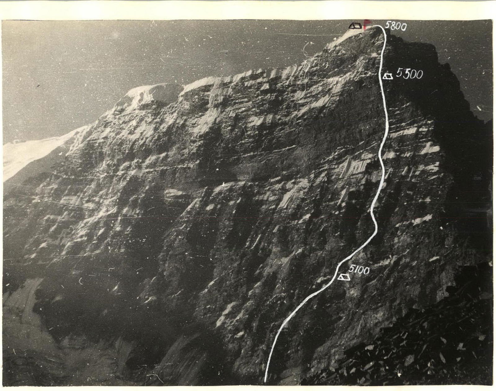
 North face of Peak Luknitskogo
Table of main route characteristics
| Date | Section | Average steepness (deg.) | Length (m) | Terrain characteristics | Difficulty | Condition | Weather conditions | Rock pitons | Ice pitons | Bolt pitons |
|---|---|---|---|---|---|---|---|---|---|---|
| I | 2 | 3 | 4 | 5 | 6 | 7 | 8 | 9 | 10 | 11 |
| 19.07 | 1 | 45 | 90 | snow-firn slope, bergschrund | 4 | dense, frozen, rockfall hazard | cloudy, no precipitation | - | - | - |
| 2 | 50 | 60 | ice wall | 5 | hard ice | 3 | 6, II | |||
| 3 | 85 | 55 | wall | 6 | monolith, large-block rocks | — // — | 15, III | - | - | |
| 4 | 60 | 100 | ledges, internal angle, wall | 5 | rocks destroyed, rockfall hazard | — // — | 23 | - | - | |
| 5 | 50 | 100 | counterfort | 5 | rocks destroyed, wet, rockfall hazard | — // — | 10 (5 protrusions) | - | - | |
| 6 | 50 | 80 | snow counterfort | 5 | icy | 8 (2 protrusions) | - | - | ||
| 7 | 60 | 100 | wall | 5 | rocks destroyed | — // — | 10 (3 protrusions) | - | - |
Departure: 5:30, stop for bivouac 20:00, 12 h 30 min climbing. Overnight on a sloping ledge, 2 tents, semi-reclining, uncomfortable.
T.O.Kh.M., continuation
| I | 2 | 3 | 4 | 5 | 6 | 7 | 8 | 9 | 10 | II |
|---|---|---|---|---|---|---|---|---|---|---|
| 20.07 | 8 | 70 | 60 | wall | 5 | heavily destroyed | good | 14 | - | - |
| 9 | 45 | 90 | sloping ledge | 4 | icy, destroyed | 8 (1 embedded) | - | - | ||
| 10 | 90 | 65 | thin crack, wall | 6 | monolith | — // — | 15, II | - | - | |
| 11 | 100 | 20 | internal angle, cornice | 6 | monolith, wet | 11, IV | - | - | ||
| 12 | 60 | 40 | wall | 5 | destroyed, wet | — // — | 15 | - | - | |
| 13 | 50 | 18 | counterfort | 4 | mixed terrain, rockfall hazard | — // — | 20 | - | - | |
| 14 | 70 | 90 | wall | 5 | stepped rocks, icy | — // — | 25 | - | - | |
| 15 | 85 | 70 | crack, wall, chimney | 6 | monolith, crack filled with ice | — // — | 20, II | - | - |
Departure: 7:56, stop for bivouac 21:00, 12 climbing hours. Overnight on a ridge site, 2 tents, reclining.
| I | 2 | 3 | 4 | 5 | 6 | 7 | 8 | 9 | 10 | II |
|---|---|---|---|---|---|---|---|---|---|---|
| 21.07 | 16 | 60 | 140 | slabs with reverse slope | 5 | destroyed, icy | good | 22 | - | - |
| 17 | 80 | 100 | internal angle, 5 m cornice, wall | 6 | destroyed | — // — | 25, I | 2 | - | |
| 18 | 45 | 90 | firn dome | 4 | icy, calga-sporty | — // — | 4 | 2 | - |
Departure: 8:00, stop for bivouac 21:00, 13 h 30 min climbing. Overnight on the summit, reclining.
Group leader: Barulin. August 15, 1953.
Brief explanations for the table of main route characteristics
Section 1: Hard firn slope, crossed by two bergschrunds. Bergschrunds were used as natural protection from rockfall. The slope was traversed in crampons, one by one, with observation for rocks. Section 2: Ice slope, traversed in crampons with step cutting. Section 3: Steep rock ascent, rocks are large-block, many "loose" blocks, ends with a ledge for 2-3 people. Rockfall is not a concern here — everything falls above. Section 4: Destroyed rock wall. Piton belay. Section 5: Counterfort edge, steep ascents alternate with flattenings, but there is no place for the entire group to gather. Section 6: Snowy counterfort edge, crevices filled with ice. Section 7: Destroyed wall. The path goes up to the right, under the base of the first bastion. Ledge 1.5 × 3 m — overnight stay. Section 8: Heavily destroyed rock wall leads to a long horizontal ledge under the steep ascent of the first bastion. Section 9: Narrow, intermittent, partly icy ledge. Section 10: First bastion, rocks very steep, heavily icy. Section 11: Internal angle and cornice. Passed using ladders. Section 12: Steep wet slabs. The section ends with a large site — second overnight stay of the first ascenders. Section 13: Counterfort. Terrain is mixed, heavily destroyed. Section 14: Stepped rocks, filled with ice. Chimney with an overhang. Section 15: Second bastion. First, exit to an internal angle via a slab, then via very steep rocks-ladders to a sheer chimney, which leads to a wall of tile-like rocks. Section 16: Icy destroyed wall under the pre-summit tower. Section 17: Pre-summit tower. Many "loose" stones. Internal angle ends with a small cornice — ladders. Section 18: Firn dome with a flat summit. To the south and east — cornices.
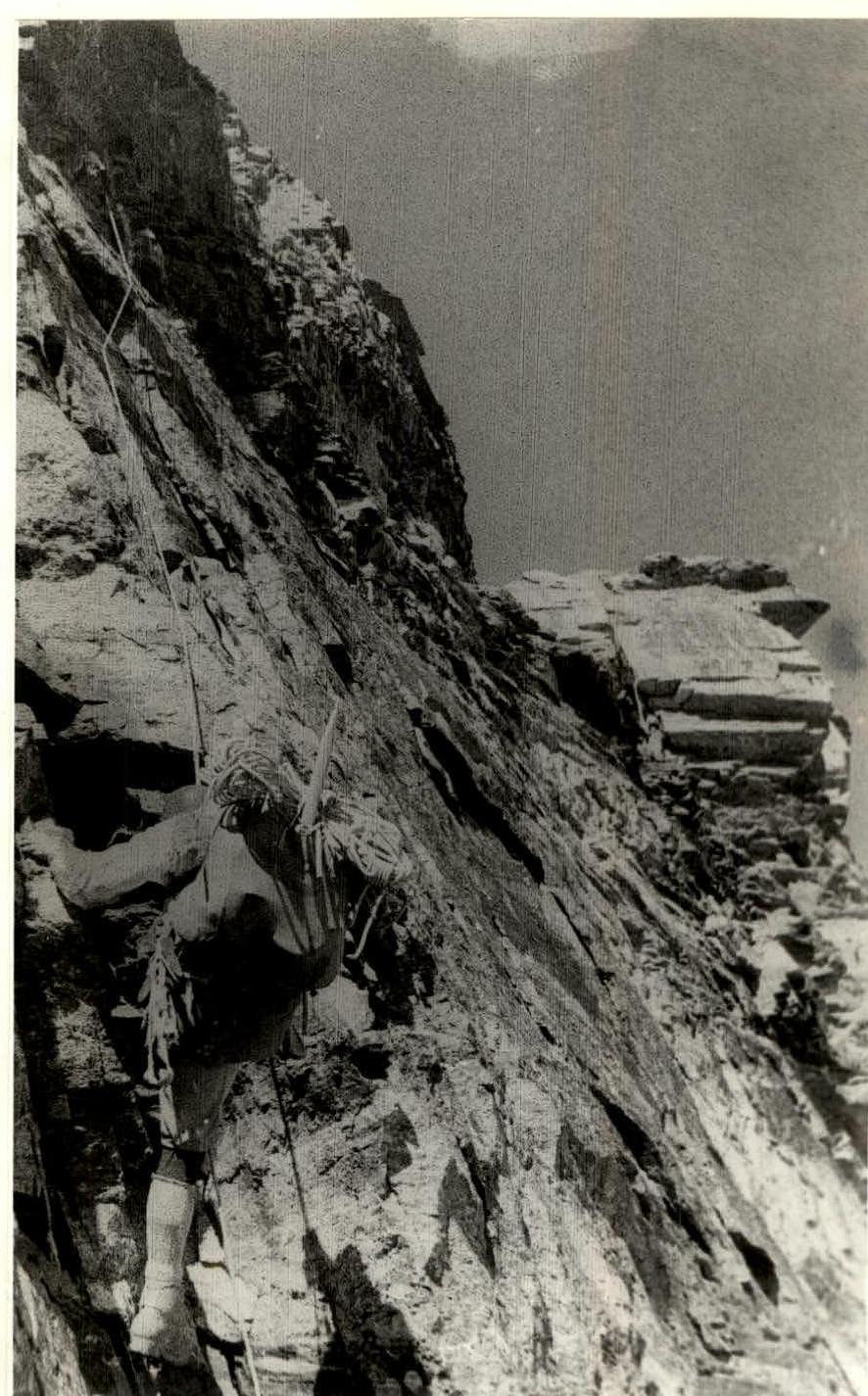 M. Bashmakov overcoming the first bastion (section 10).
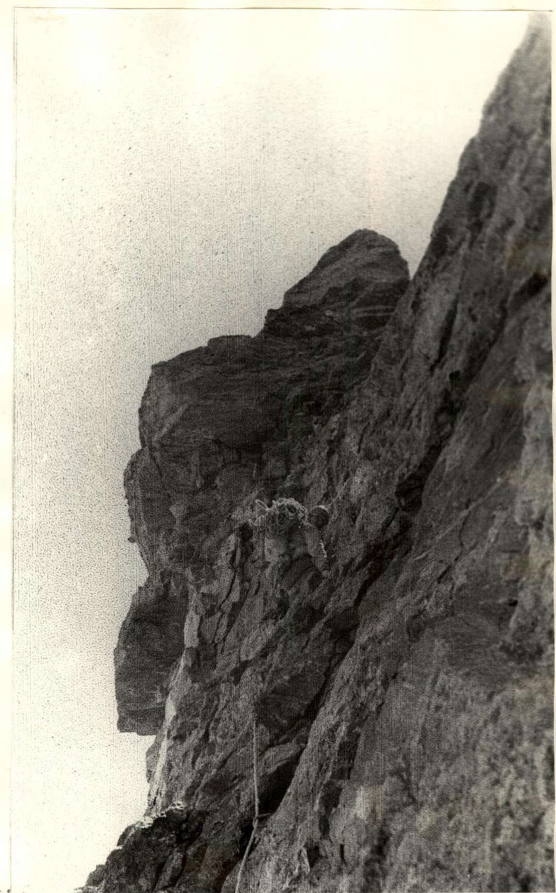 M. Khitrov passing the second bastion (section 15).