Russian Mountaineering Championship, "High-Altitude" Class
Report
On the first ascent to the summit of LENINA (ABU ALI IBN SINA) via the Eastern ridge of Peak Kompleksny, 5A category of difficulty (tentatively), by the team from Voronezh, from August 4 to August 6, 2023.
Ascent Passport
| 1. General Information | ||
|---|---|---|
| 1.1 | Team Leader's Full Name, Sports Rank | Penyaev Ilya Nikolaevich, Master of Sports |
| 1.2 | Team Members' Full Names, Sports Ranks | Gagarinov Alexey Yuryevich, 1st sports rank, Maximova Lomara Aslanovna, Candidate Master of Sports |
| 1.3 | Coach's Full Name | - |
| 1.4 | Organization | - |
| 2. Characteristics of the Ascent Object | ||
| 2.1 | Region | 4. Pamir |
| 2.2 | Valley | 4.4. Trans-Alai Range |
| 2.3 | Section Number according to the 2013 Classification Table | - |
| 2.4 | Name and Height of the Summit | Lenina (Abu Ali ibn Sina), 7134 m |
| 2.5 | Geographic Coordinates of the Summit (latitude/longitude), GPS Coordinates | 39.346984 72.879188 |
| 3. Route Characteristics | ||
| 3.1 | Route Name | - |
| 3.2 | Proposed Category of Difficulty | 5A tentative |
| 3.3 | Route Exploration Degree | first ascent |
| 3.4 | Relief Characteristics of the Route | combined |
| 3.5 | Route Elevation Gain (data from altimeter or GPS) | 3 km |
| 3.6 | Route Length (in meters) | ~10 km |
| 3.7 | Technical Elements of the Route | 1st category ice/rock/combination ~ 7100 m. 2nd category ice/rock/combination ~ 1800 m. 3rd category ice/rock/combination ~ 300 m. 4th category ice/rock/combination — 0 m. 5th category ice/rock/combination — 0 m. 6th category ice/rock/combination — 0 m. |
| 3.8 | Average Steepness of the Route, (°) | 18° |
| 3.9 | Average Steepness of the Main Part of the Route, (°) | 18° |
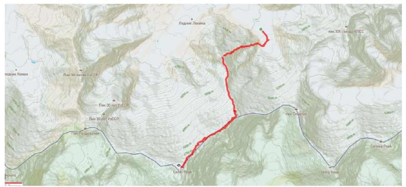
| 3.10 | Descent from the Summit | via 4B category route through Razdelnaya Pass |
| 3.11 | Additional Characteristics of the Route | snow |
| 4. Characteristics of the Team's Actions | ||
| 4.1 | Time in Motion (team's walking hours, in hours and days) | 33 walking hours, 3 days |
| 4.2 | Overnights | prepared sites |
| 4.3 | Time Spent on Route Preparation | - |
| 4.4 | Departure onto the Route | 5:40, August 4, 2023 |
| 4.5 | Arrival at the Summit | 19:30, August 6, 2023 |
| 4.6 | Return to Base Camp | 16:00, August 7, 2023 |
| 5. Weather Conditions | ||
| 5.1 | Temperature, °C | from −15°C to +15°C |
| 5.2 | Wind Speed, m/s | strong wind on the evening of the second and third days (up to 20 m/s) |
| 5.3 | Precipitation | occasional snow |
| 5.4 | Visibility, m | poor visibility on the evening of the second and third days |
| 6. Person Responsible for the Report | ||
| 6.1 | Full Name, e-mail | A. Yu. Gagarinov, ymahaster@gmail.com |
General Photo of the Summit
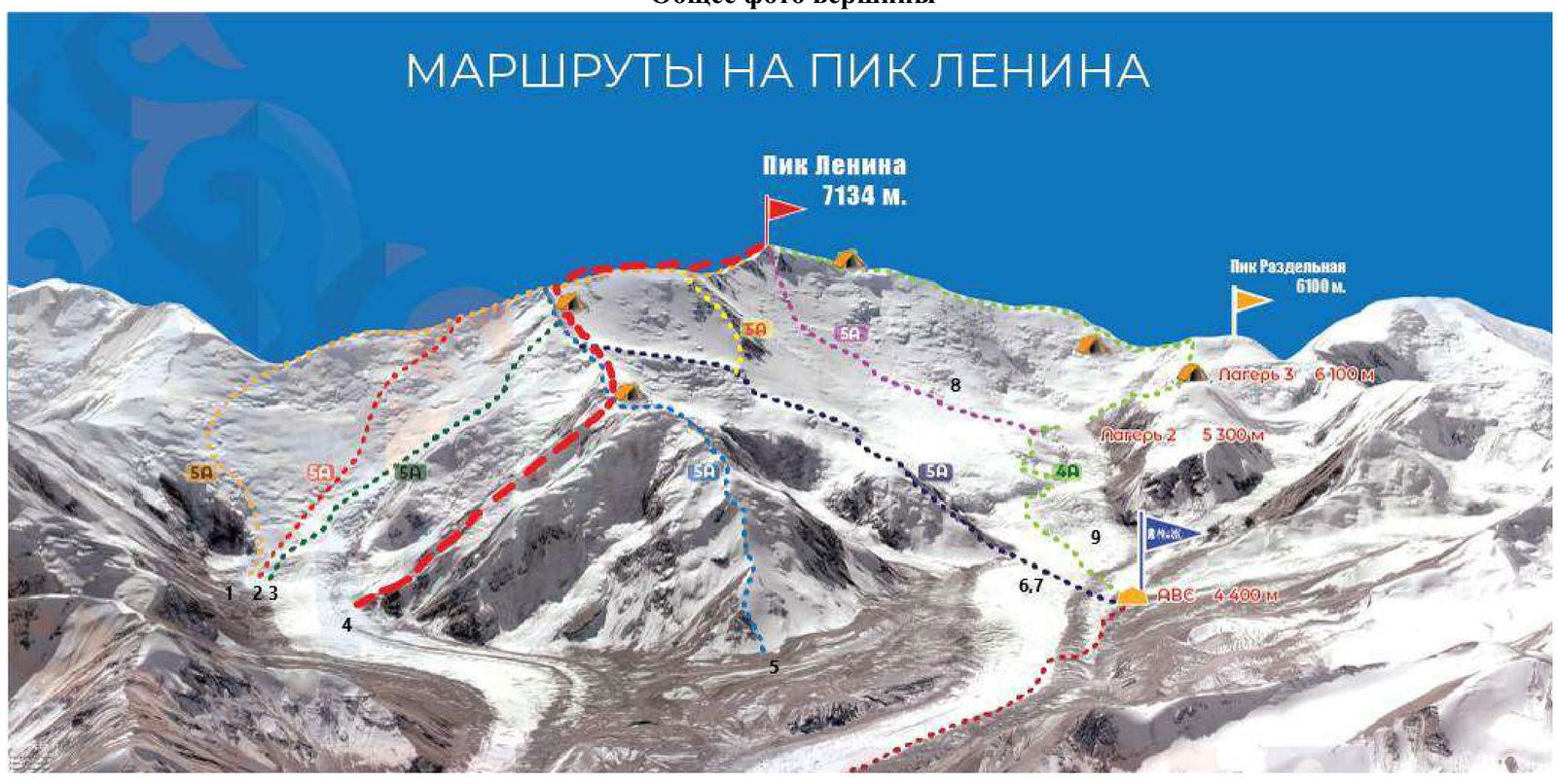
1 — Via the eastern ridge from Krylenko Pass, V. Cheredova (1960) 2 — Via the upper ridge from Krylenko Pass, R. Benoit (1974) 3 — Via the upper second ridge from Krylenko Pass, S. Duog (1974) 4 — Route taken by the team 5 — Via the northern ridge through Kompleksny, Yu. Skurlatov (1967)
6 — Through Lipkin Rock, exiting onto the eastern ridge, V. Ratsek (1950) 7 — Via the buttress of Lipkin Rock, K. Chernukha (1934) 8 — Through the center of the northern slope, Ya. Arkin (1960) 9 — Classic route, A. Kovalyov (1954)
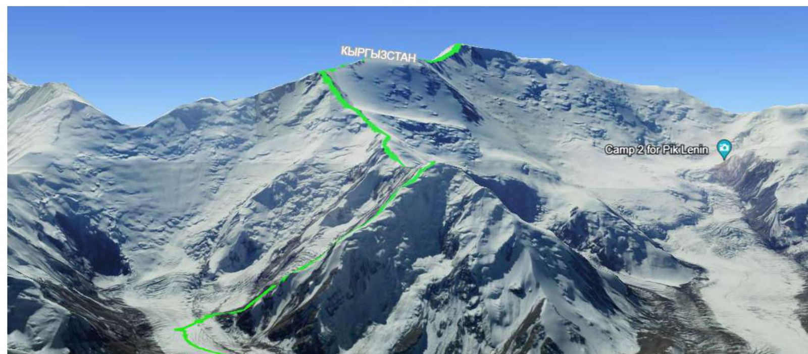
Route Profile Photo
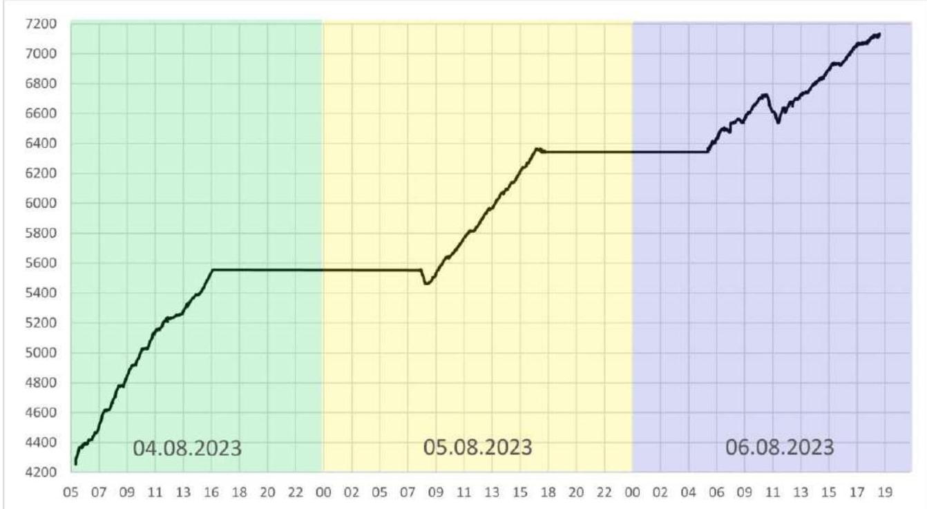
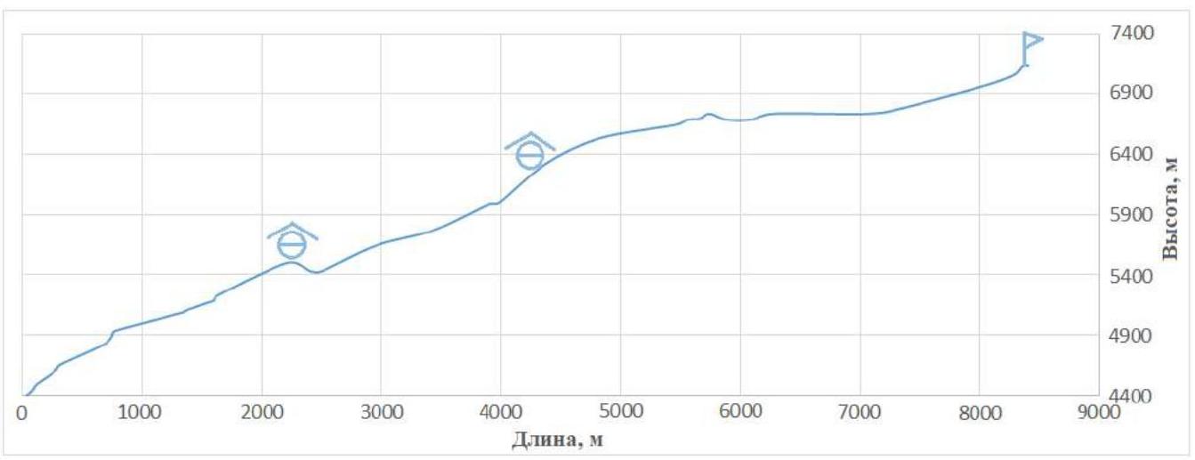
Drawn Route Profile and Ascent Rate
Ascent Object Map
Route Characteristics
| Section # | Name and Number of Pitons | Insurance Points | Route Line in UIAA Symbols | Complexity of Section in Symbols | Section Length, m | Steepness ° | ||
|---|---|---|---|---|---|---|---|---|
| camalots | ice screws | sport pitons | ||||||
| R17–R18 | I | 1 | 50 | 5 | ||||
| R16–R17 | 1 | 1 | III | 3 | 100 | 45 | ||
| R15–R16 | II | 2 | 250 | 25 | ||||
| R14–R15 | I | 1 | 3800 | 0–30 | ||||
| R13–R14 | I | 1 | 2100 | 10–40 | ||||
| R12–R13 | 2 | II | 2 | 300 | 35 | |||
| R11–R12 | II–III | 2–3 | 650 | 10–45 | ||||
| R10–R11 | 1 | 3 | III | 3 | 130 | 55 | ||
| R9–R10 | I | 1 | 200 | 20 | ||||
| R8–R9 | III | 3 | 10 | 70 | ||||
| R7–R8 | I–II | 1–2 | 600 | 15 | ||||
| R6–R7 | 3 | III+ | 4 | 50 | 60 | |||
| R5–R6 | II | 2 | 100 | 45 | ||||
| R4 | R4–R5 | I–II | 1–2 | 400 | ||||
| R3–R4 | II–III | 2–3 | 50 | 50 | ||||
| R2–R3 | I | 1 | 200 | 40 | ||||
| R1–R2 | 1 | II–II+ | 3 | 60 | 55 | |||
| R0–R1 | I | 1 | 100 | 40 |
Technical Description of the Route
The route begins from the eastern branch of Lenin Glacier, below Krylenko Pass, along the eastern ridge of peak (gendarme) Kompleksny. The approach goes initially across a mudflow, then across an open, broken glacier, followed by scree slopes of the eastern ridge. The ridge itself is quite wide with numerous scree slopes alternating with more monolithic rock walls offering various passage options. The most challenging sections are R6–R7 — a rock wall, and traverse R10–R11 — a snow-ice slope with rock outcrops. Above R11, the route becomes snowy. The ascent to the northern ridge of Lenin Peak is made directly through the summit of Kompleksny (R12). The descent into the saddle is made to the right of the ridge and rock gendarmes, with a notable drop in elevation. After R13, there's an ascent to the main ridge (possible snow cornices) and along it to the main, eastern ridge of the peak. The entire extensive eastern ridge poses a technical challenge only at the pre-summit ascent, which is traversed relatively comfortably but requires insurance due to steepness and potential fall depth.
Technical Photo of the Route

Team Actions Characteristics
Acclimatization
Since this was the first 7-thousander for all team members, they approached acclimatization very seriously. The team:
- first ascended Razdelnaya (with a descent to base camp)
- then climbed Lenin Peak via the classic route (4B), also scouting the future descent,
- and returned to base camp to rest
before embarking on the first ascent.
Approach
On August 3, at 18:00, they departed from Camp 1 in a northeast direction, bypassing the slopes of peak Kompleksny along the glacier. By 20:00, they reached the eastern branch of Lenin Glacier, left their backpacks, reviewed the planned line, and the approach.
Day 1, August 4
They departed the glacier at 5:40, began climbing the rocky part of the route at 7:00. They used ropes on several challenging sections (camalots insurance). The confident climbing level of all team members (from 6c to 7b) allowed them to climb the rocky part simultaneously.
Closer to the summit of peak Kompleksny:
- the scree became so unpleasant that they had to put on crampons;
- insurance was provided by camalots and ice screws.
At an altitude of about 5200 m, the rocks transitioned into a snowy slope; they linked up and began to trailblaze. By 16:00, they reached the summit of peak Kompleksny and set up a campsite.
Day 2, August 5
They began moving at 8:00 in a rope team. Initially, they dropped 100 m, then traversed along a complex ridge (insurance via terrain and ice screws). The ridge then became wider and more gentle.
Around 15:00, the weather deteriorated: visibility decreased, strong winds, snow. Due to weather conditions, they halted movement at 17:40, moving left off the ridge in the direction of travel. They carved out a campsite using a shovel, hiding the tent in the slope.
Day 3, August 6
They departed at 6:15, began moving in good weather without a rope.
Mid-day, the weather began to deteriorate again:
- very strong winds arose,
- snow started falling.
100 m from the summit, they encountered hard firn, set up a station, and released the leader with insurance.
They reached the summit at 19:30 in good spirits but in terrible weather.
They planned to descend to 6100 m, but visibility was completely lost, it became difficult to find markers, the descent trail was snowed over, and movement became complicated. They stopped for the night at 6900 m on the Parachutists' Plateau.
Day 4, August 7 (descent)
- The weather is terrible, very strong winds.
- They did not meet any other climbers on the way down until Razdelnaya.
- They rested and snacked at 6100 m.
- Descended to Camp 1 (4450 m).
Route Safety Assessment
The route is predominantly ridge-like, making it preferable to Lipkin and Arkin routes after precipitation. The lower part of the route is a heavily destroyed rocky ridge. Until reaching peak Kompleksny, communication with base may be absent. Further, stable communication is possible either directly with base or through other groups working on the classic route.
It is recommended to have:
- a shovel and a couple of snow anchors for insurance on the pre-summit ascent,
- as well as several nuts and ice screws for the first half of the route.
Descent from the summit is possible via the classic route or Arkin's route. Before reaching the summit, one can descend via Lipkin's route. Descent from peak Kompleksny may pose challenges.
The proposed route difficulty is 5A category. This route is much more complex than the classic route and assumes autonomy throughout the entire passage. Unlike neighboring 5A category routes (Arkin's and Lipkin's), our route is combined rather than ice-snow, requiring a broader set of skills from the climber and increasing the list of necessary equipment. The route taken by the team is also longer than the aforementioned routes.
Photo Illustrations
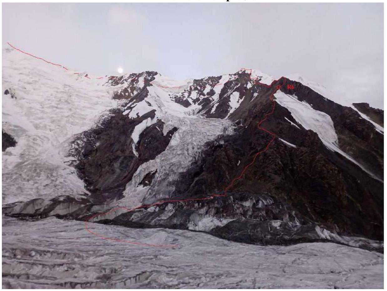
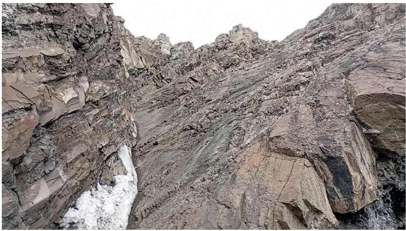
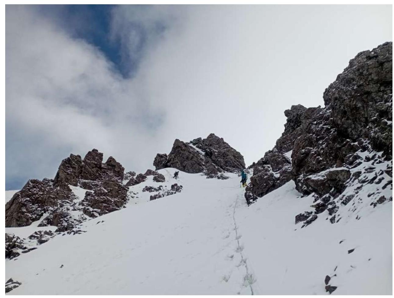
View of the eastern ridge of peak Kompleksny
Section R2–R3
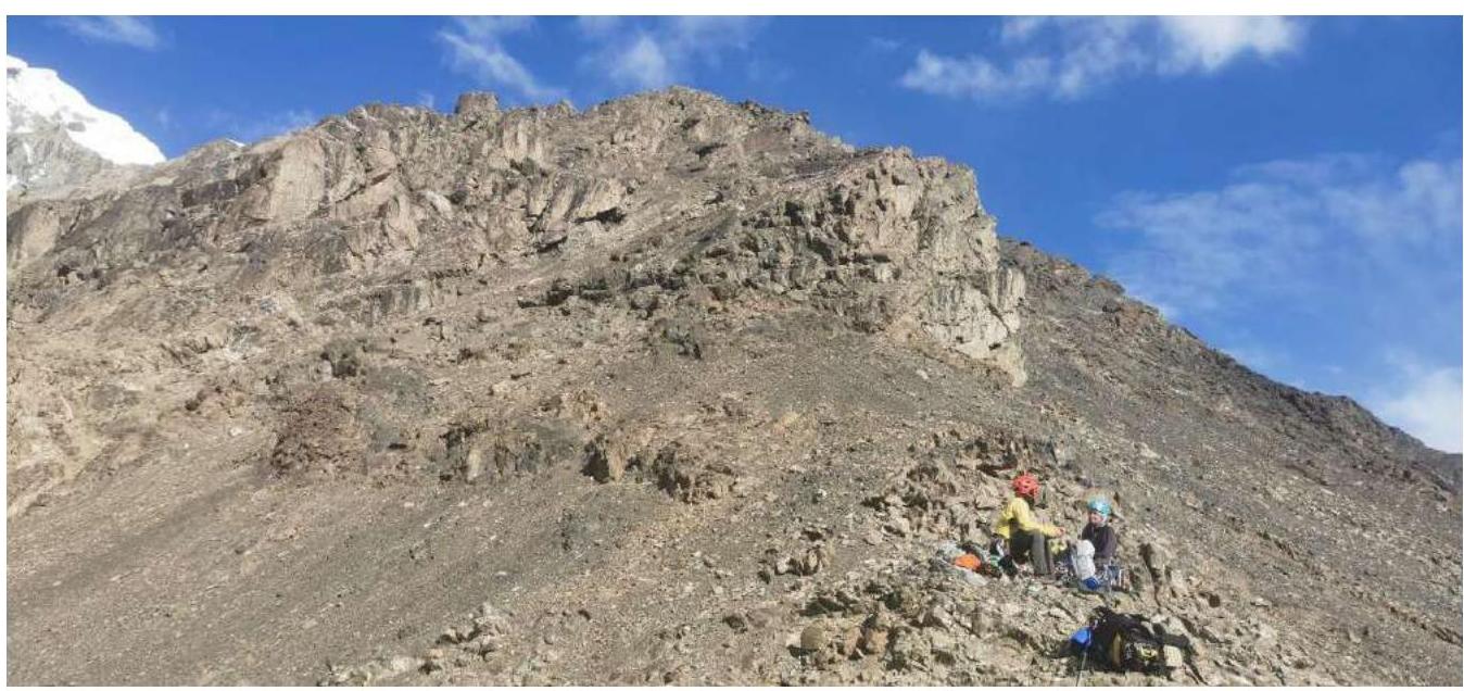
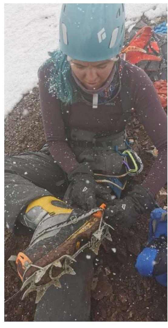
Section R4–R5 (resting)
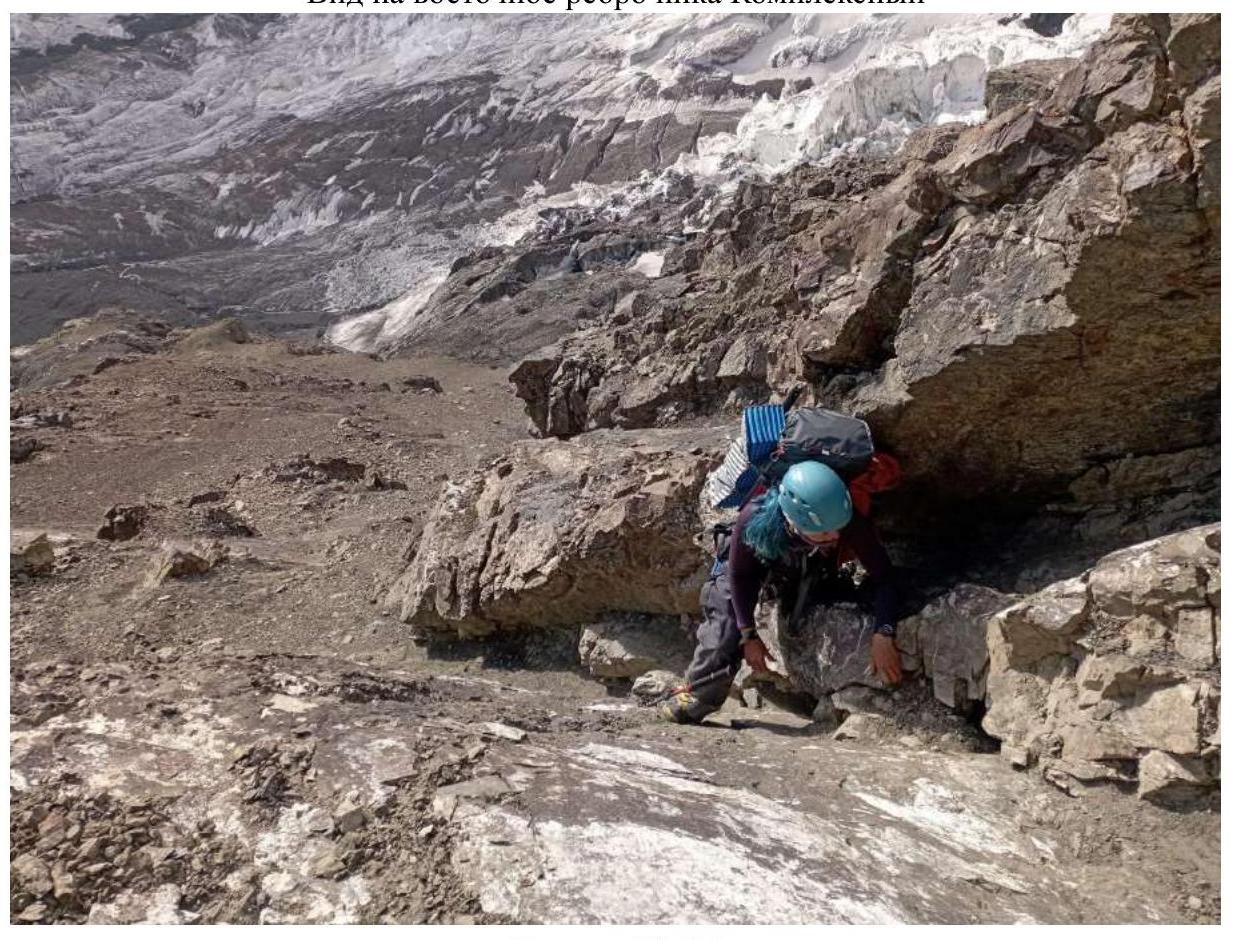
Section R6–R7
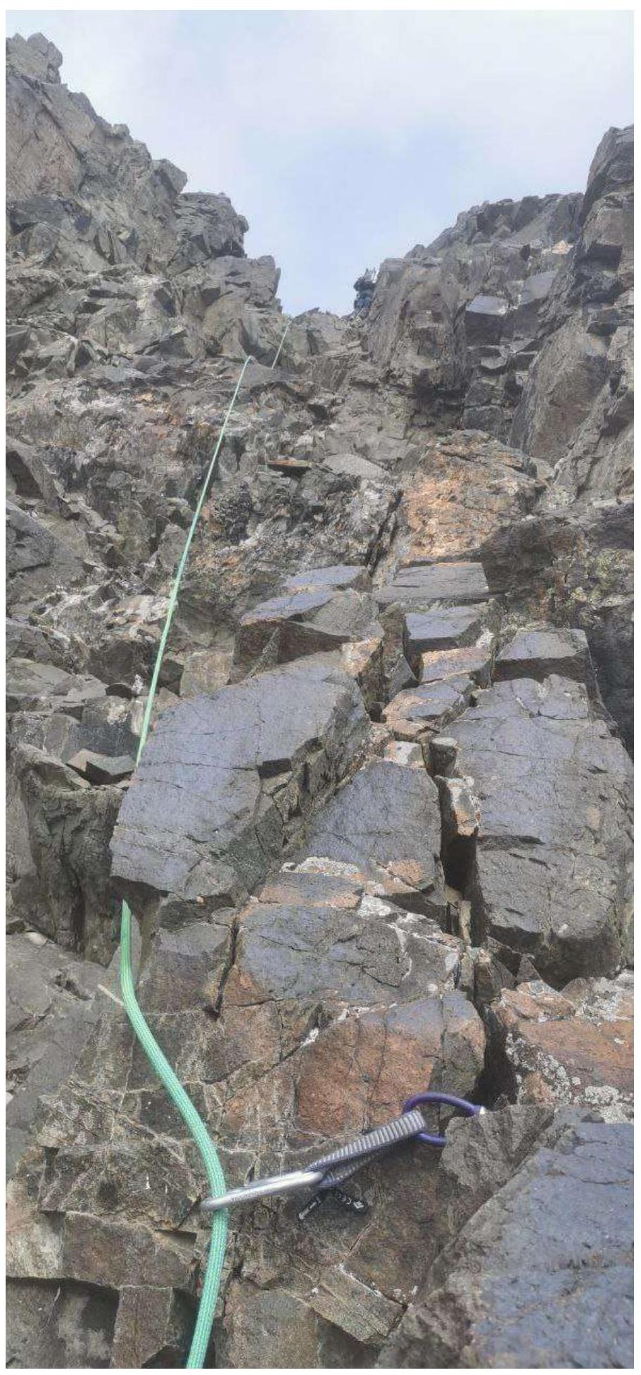
Section R6–R7 (continued)
Section R7–R8
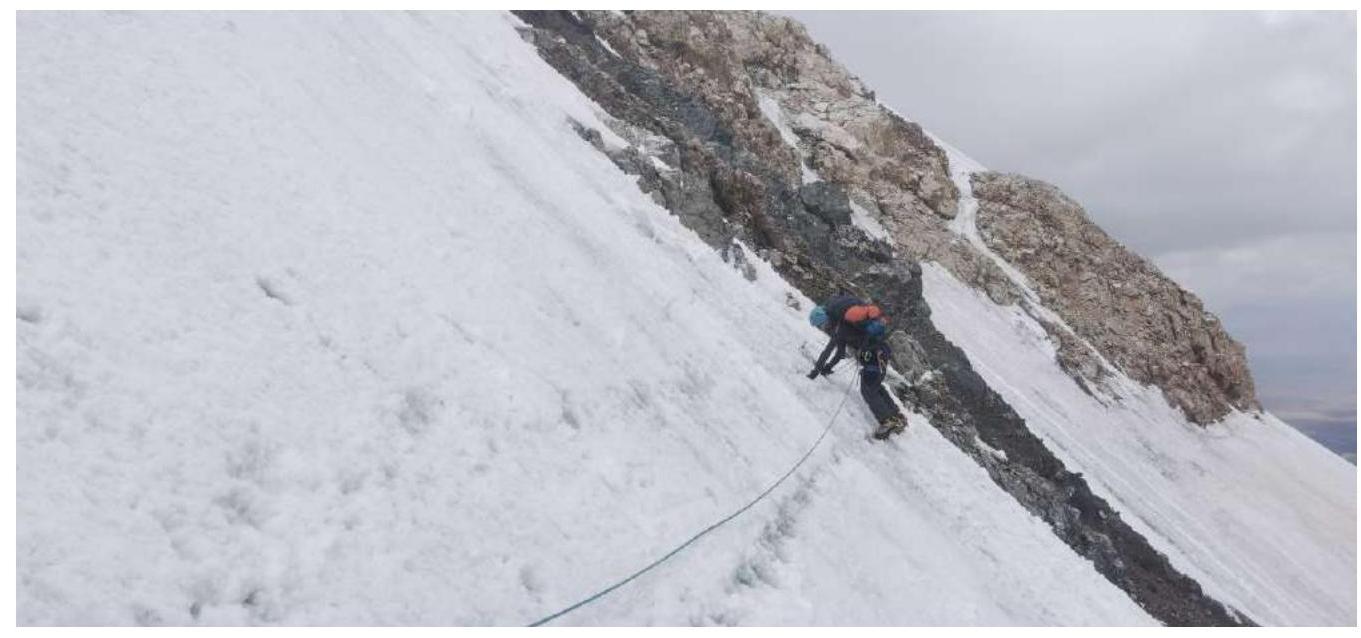
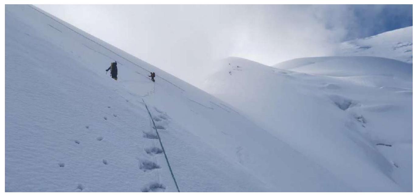
Section R10–R11 (start of traverse)
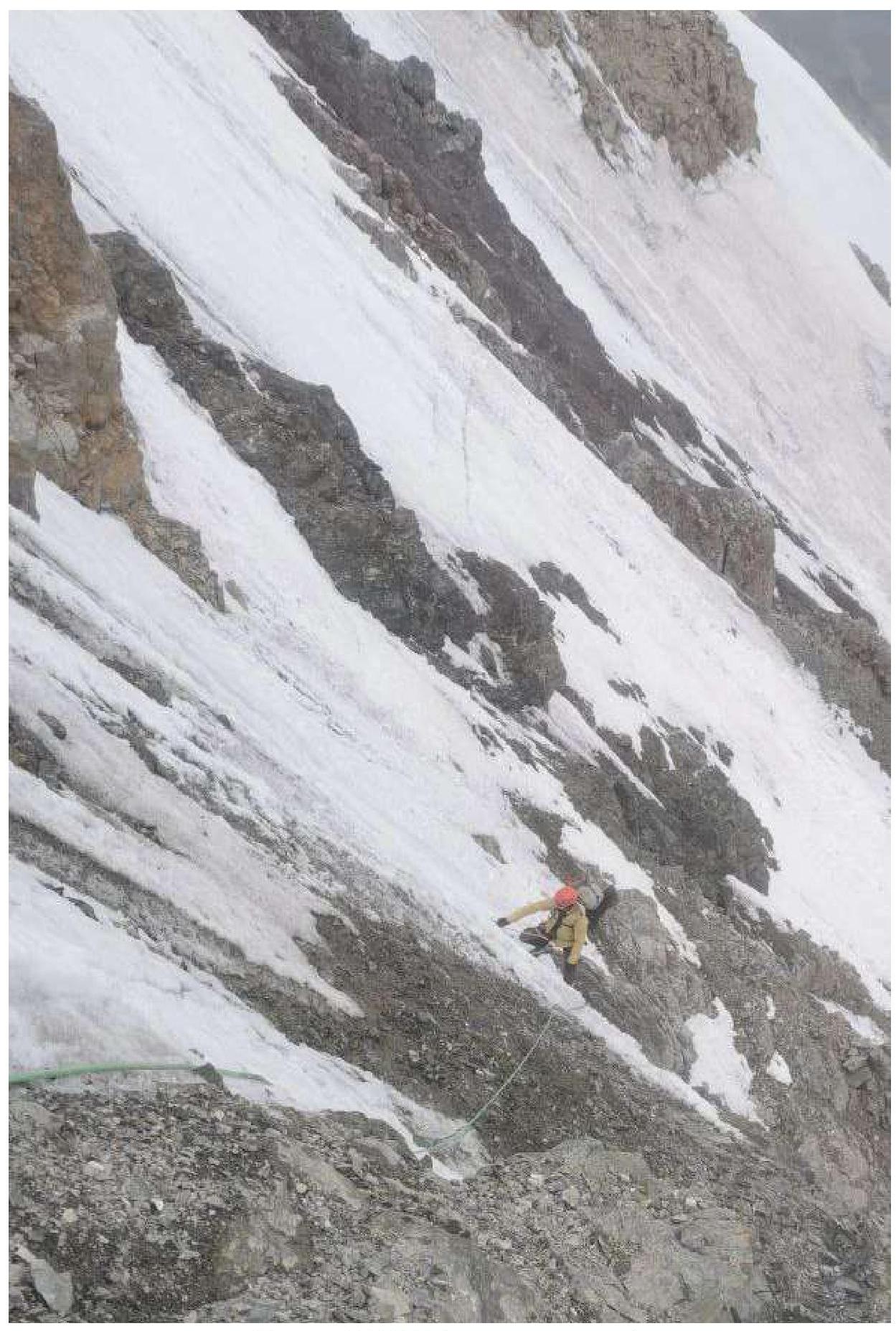
Section R10–R11 (middle of traverse)
View from the middle of section R10–R11 to the end of the traverse
Weather deterioration after the traverse, precipitation.
Section R11–R12 (summit of peak Kompleksny)
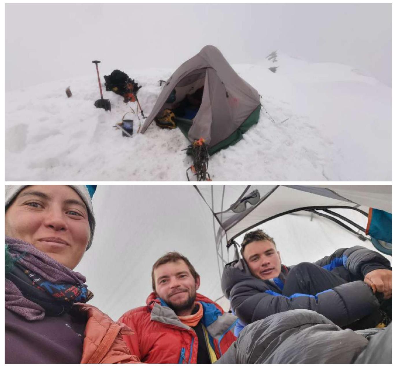
Overnight stay on peak Kompleksny
Section R12–R13 (descent into the saddle)
Section R12–R13, descent into the saddle (view back)
Section R12–R13, exit onto a broad ridge (insurance with ice screws)
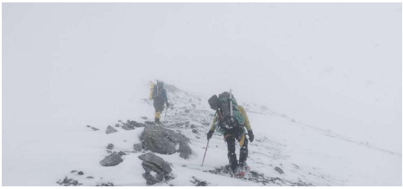
Section R13–R14, weather deterioration
Section R13–R14, considering an overnight stay
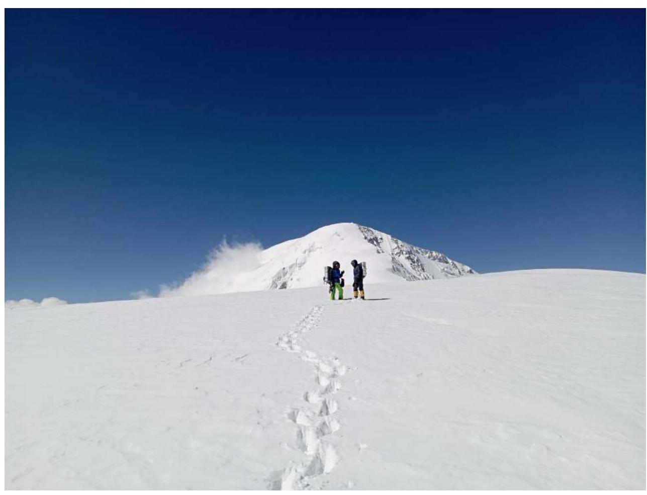
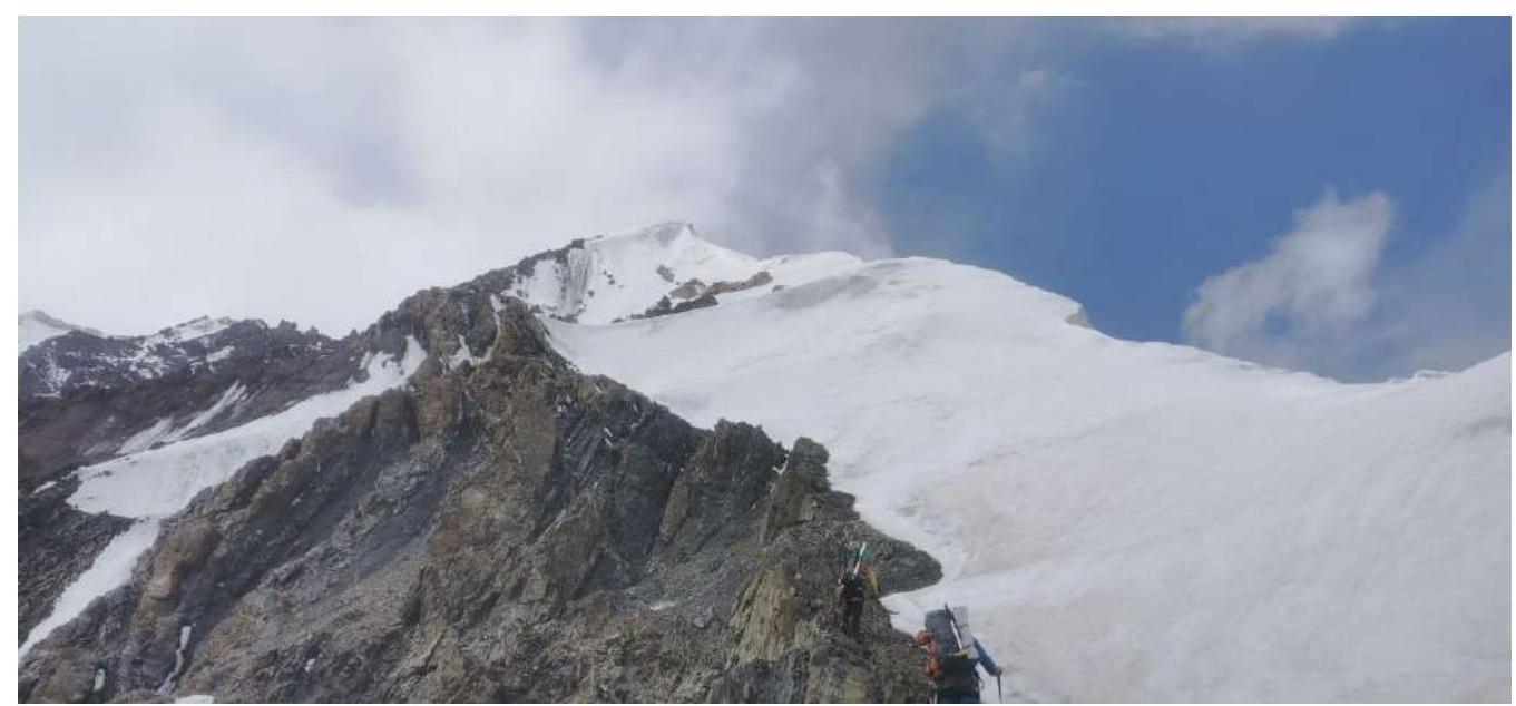
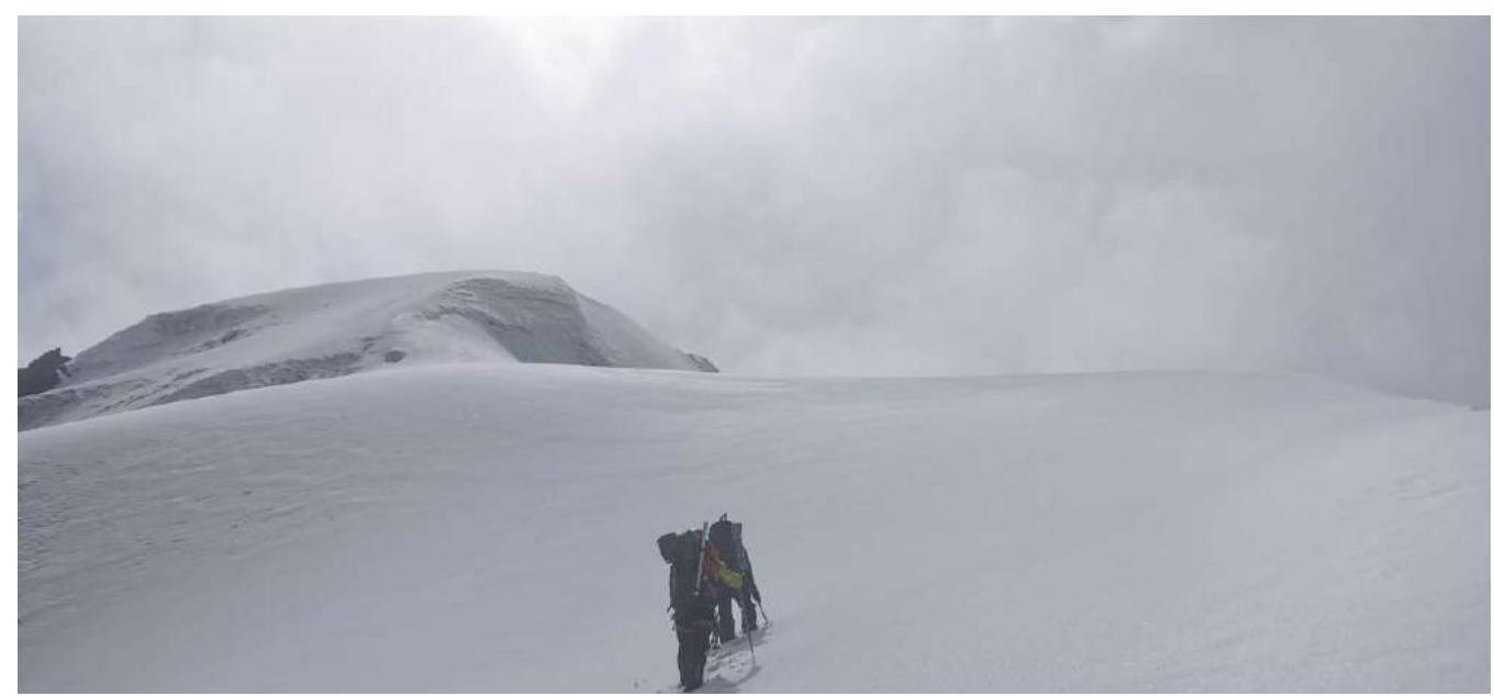
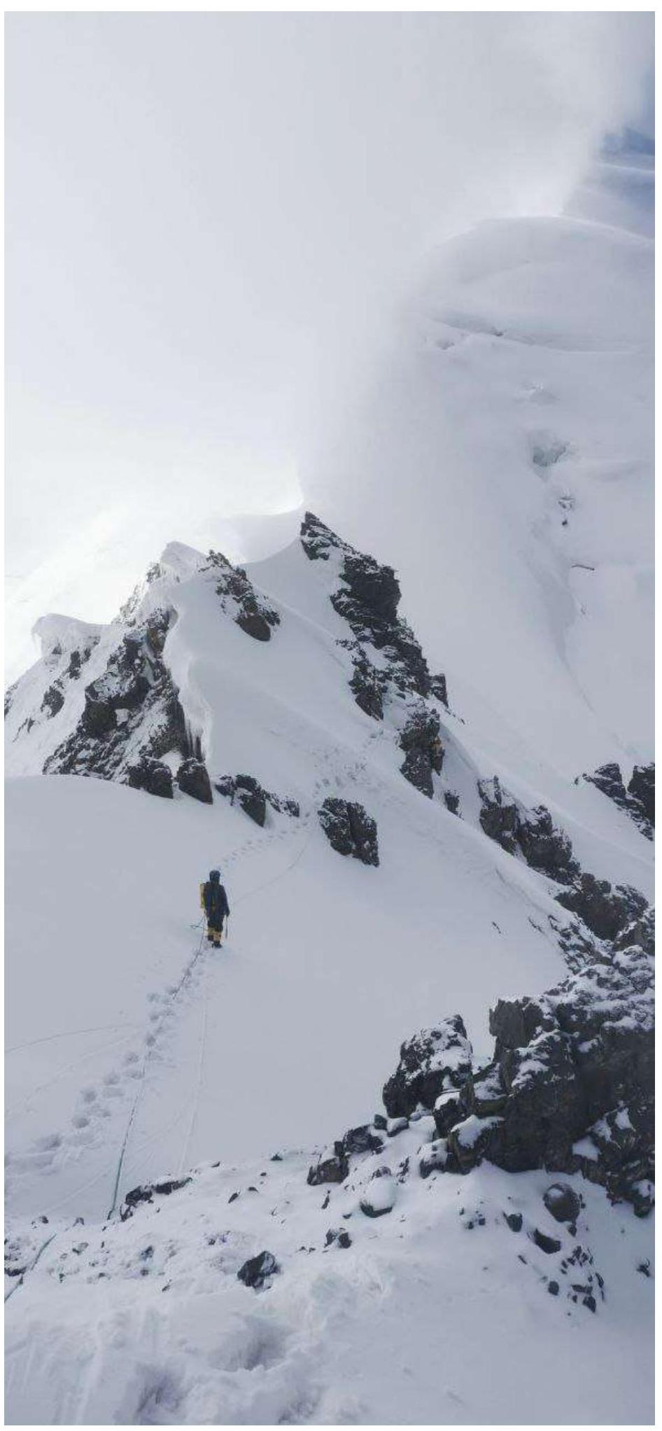
Third day, section R14–R15 (main ridge of Lenin Peak)
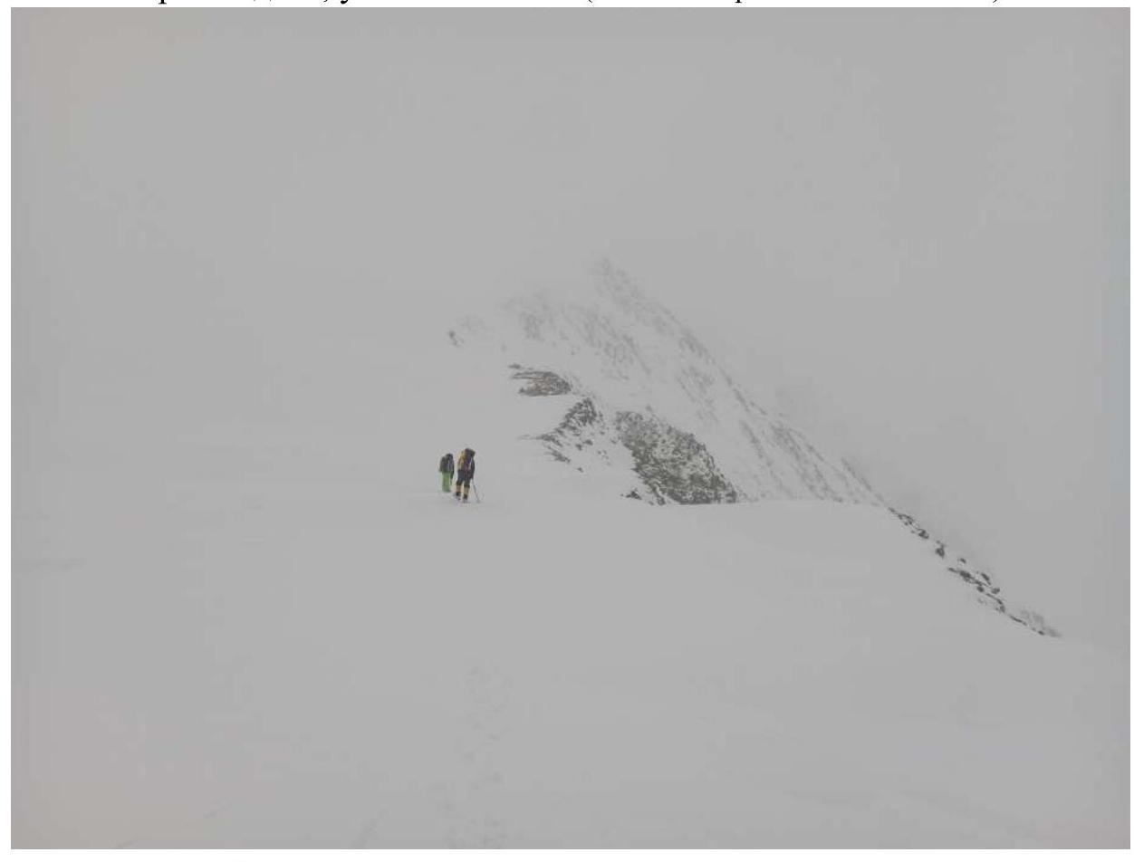
Third day, section R15–R16, weather deterioration
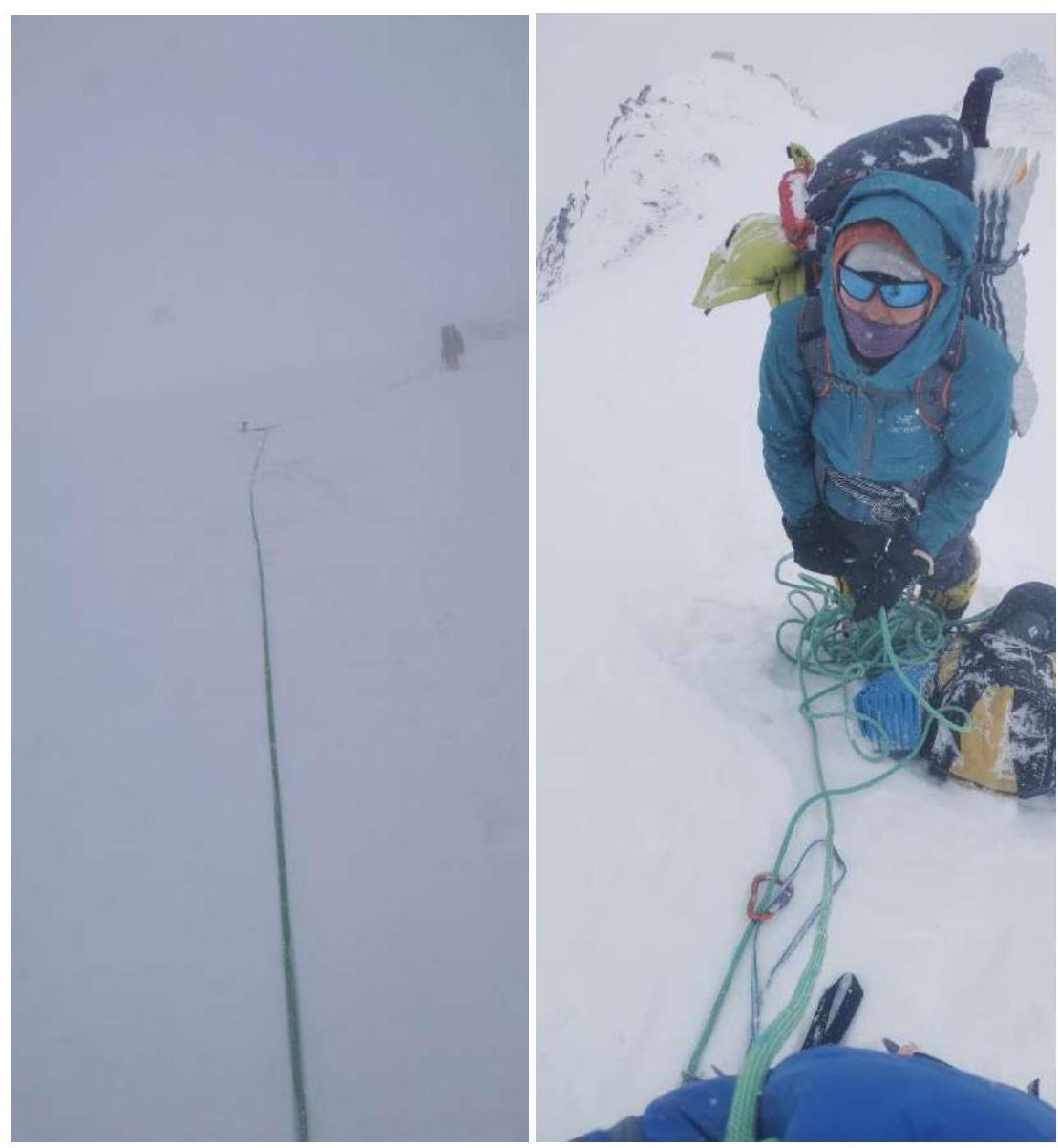
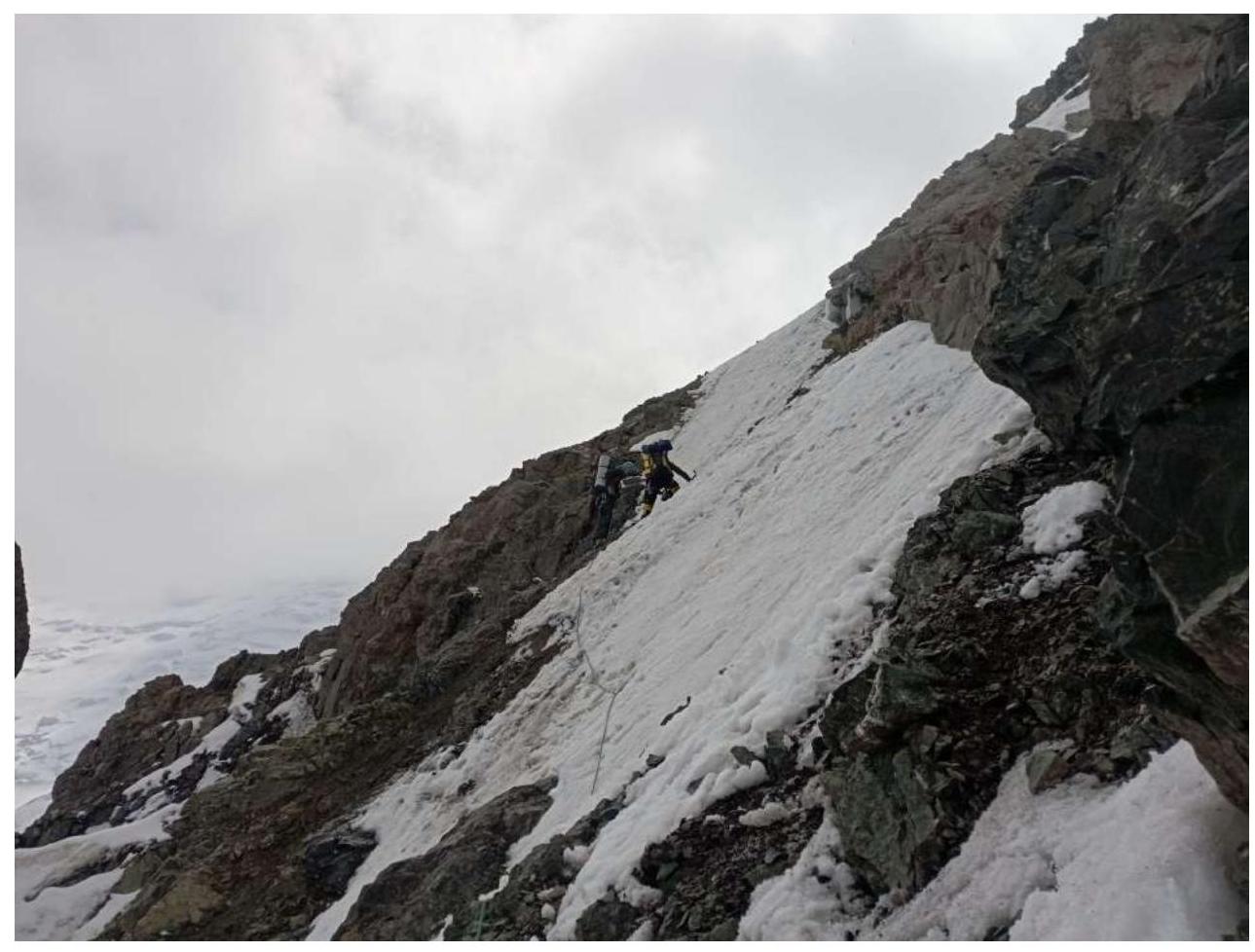
Section R16–R17 (view from the station to the leader and belayer) About 100 m to the summit, bad weather
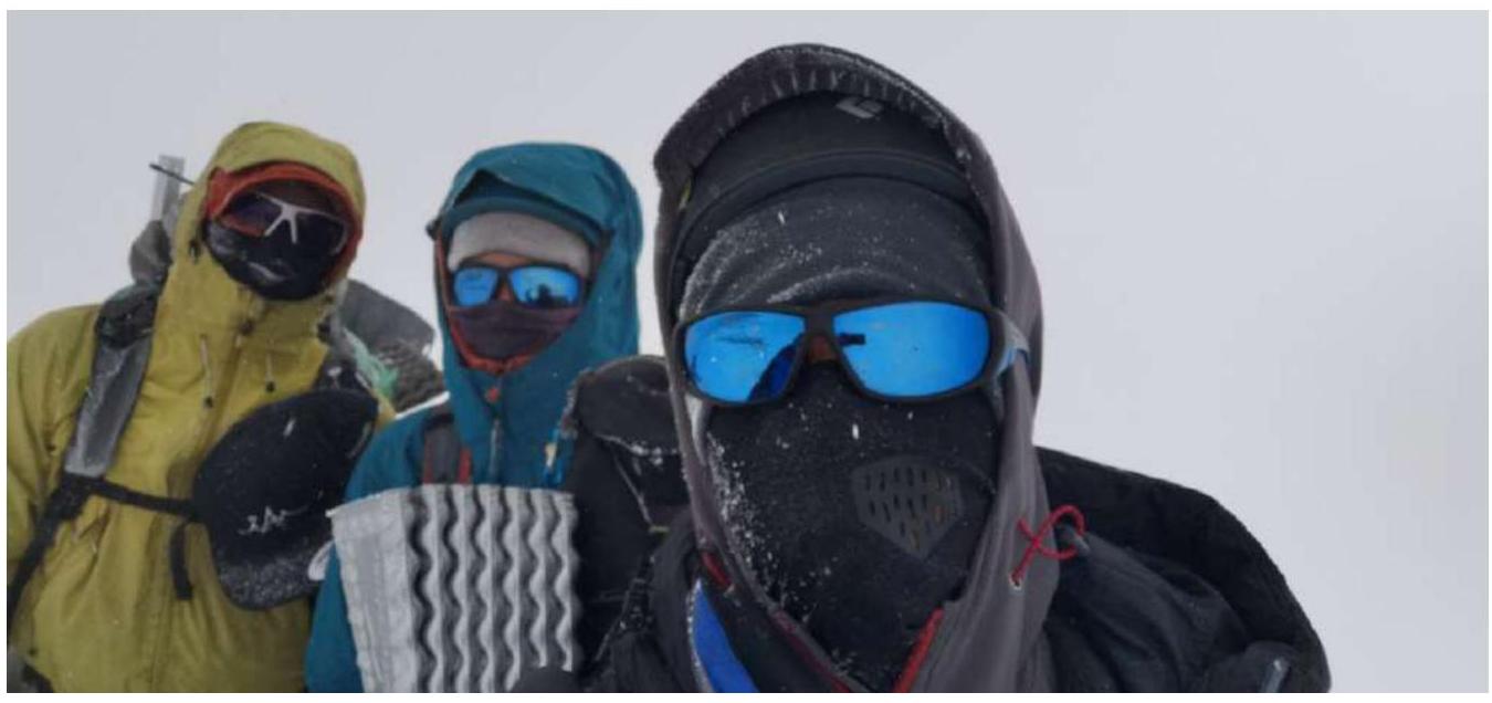
Photo of the team on the summit with the control post
