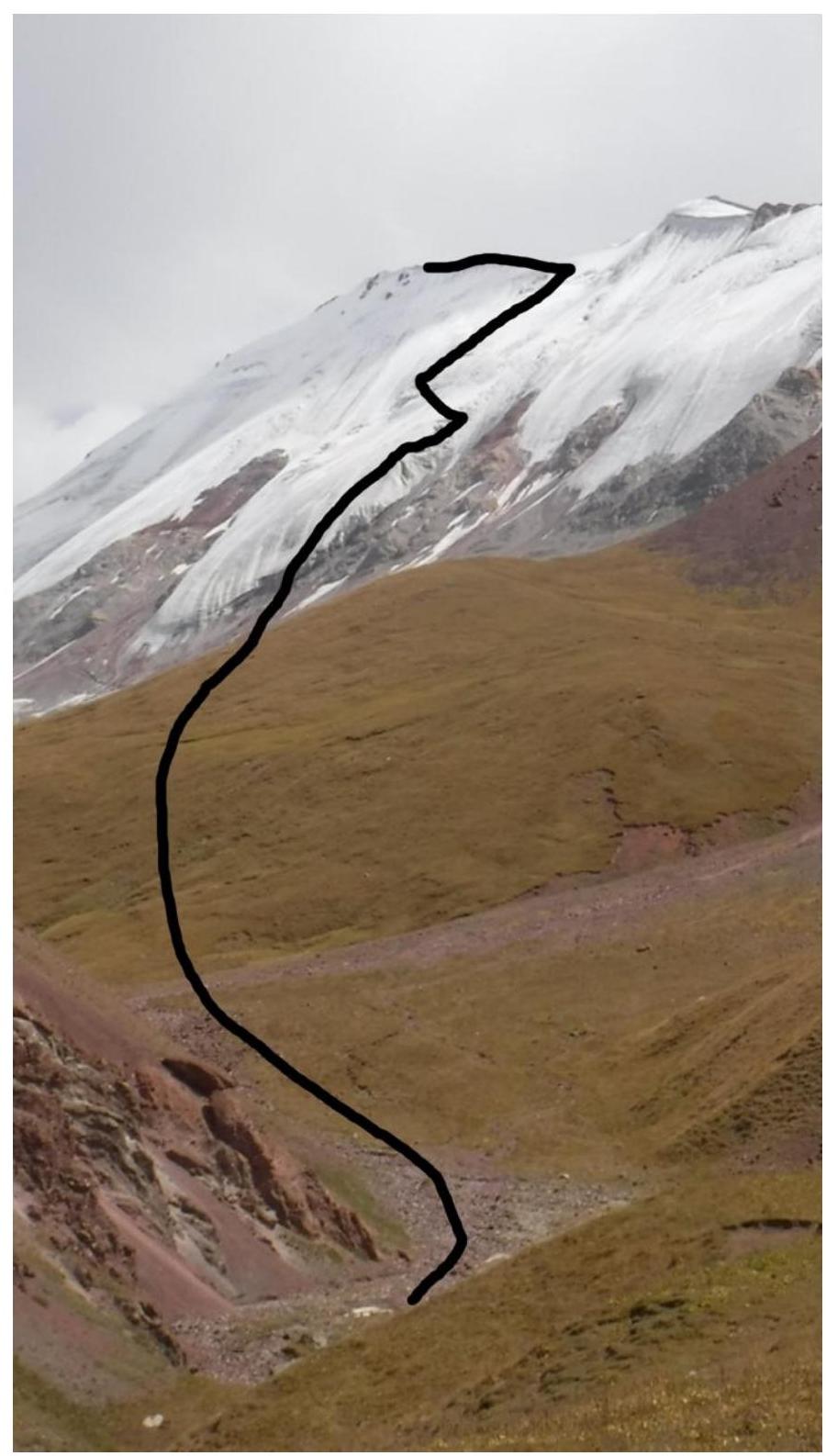
Pamir. Trans-Alai ridge. Peak Musa Dzhaliľ 4729. Assumed category 4A–4B, first ascent of the route. The character of the route is snow-ice.
Route length — 1400 m.
Difficulty sections:
- Cat. 1 — 400 m
- Cat. 2 — 100 m
- Cat. 3 — 600 m
- Cat. 4 — 200 m
- Cat. 5 — 50 m
- Cat. 5+ — 50 m
Average slope of the main part — 50°. Pitons left on the route — 0. Ice screws used — 80. Total amount of technical climbing aids used — 0. Total climbing time — 6 h 30 min (1 day without overnight stay).
Team:
- Sokhatsky Alexander (2nd sports category) — leader
- Inozemtsev Eduard (1st sports category)
Senior coach — Suviga Vladimir Ivanovich.
Start of the route: July 22, 2019 at 6:40. Reached the summit: July 22, 2019 at 13:10. Return to PAMIR base camp: July 22, 2019 at 16:40.
Route scheme:
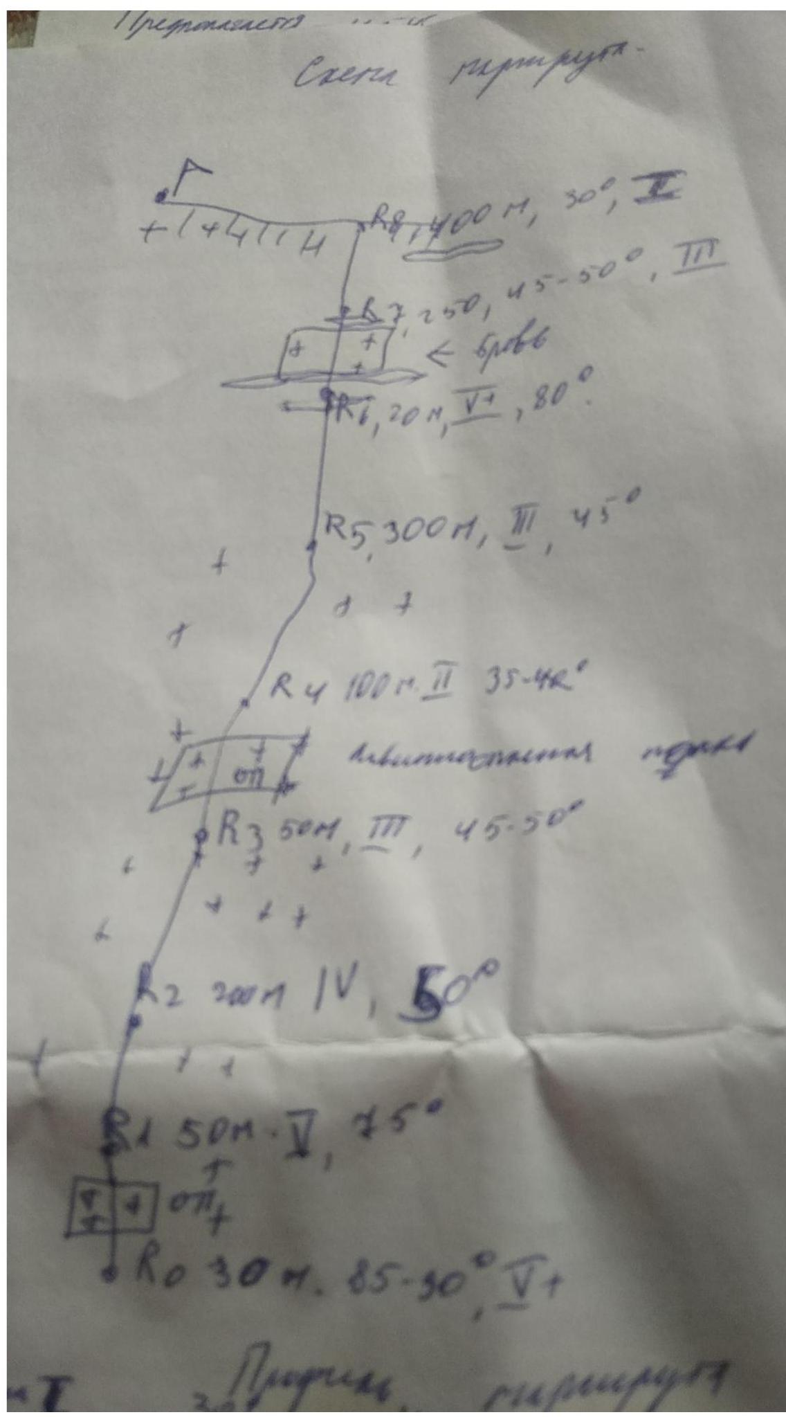
Route profile:
- R0–R1: 5+, 85–90°, 30 m.
- R1–R2: 5, 75°, 50 m.
- R2–R3: 4, 50°, 200 m.
- R3–R4: 3, 45–50°, 50 m.
- R4–R5: 2, 35–40°, 100 m.
- R5–R6: 3, 45°, 300 m.
- R6–R7: 5+, 80°, 20 m.
- R7–R8: 3, 45–50°, 200 m.
- R8–summit: 1, 30°, 250 m.
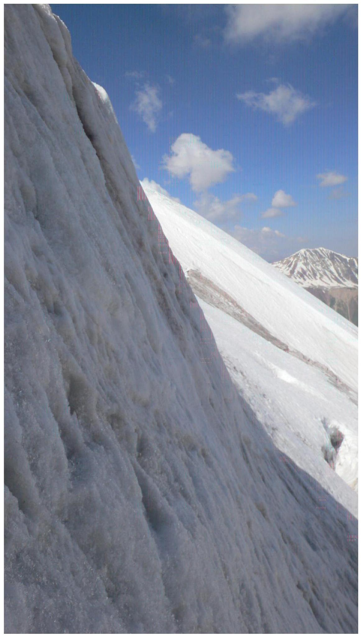
DETAILED DESCRIPTION: From the PAMIR base camp, we descend to the bridge over the Achik-Tash River. We cross the bridge and follow the gorge along the stream to the foot of Peak Musa Dzhaliľ 4729 m. At the boundary between snow and loose rocks, we put on our climbing gear and approach the route for 100 meters along the snow-ice slope. The right part of the tongue is collapsed (see photo), the left one is normal, and that's what we follow.
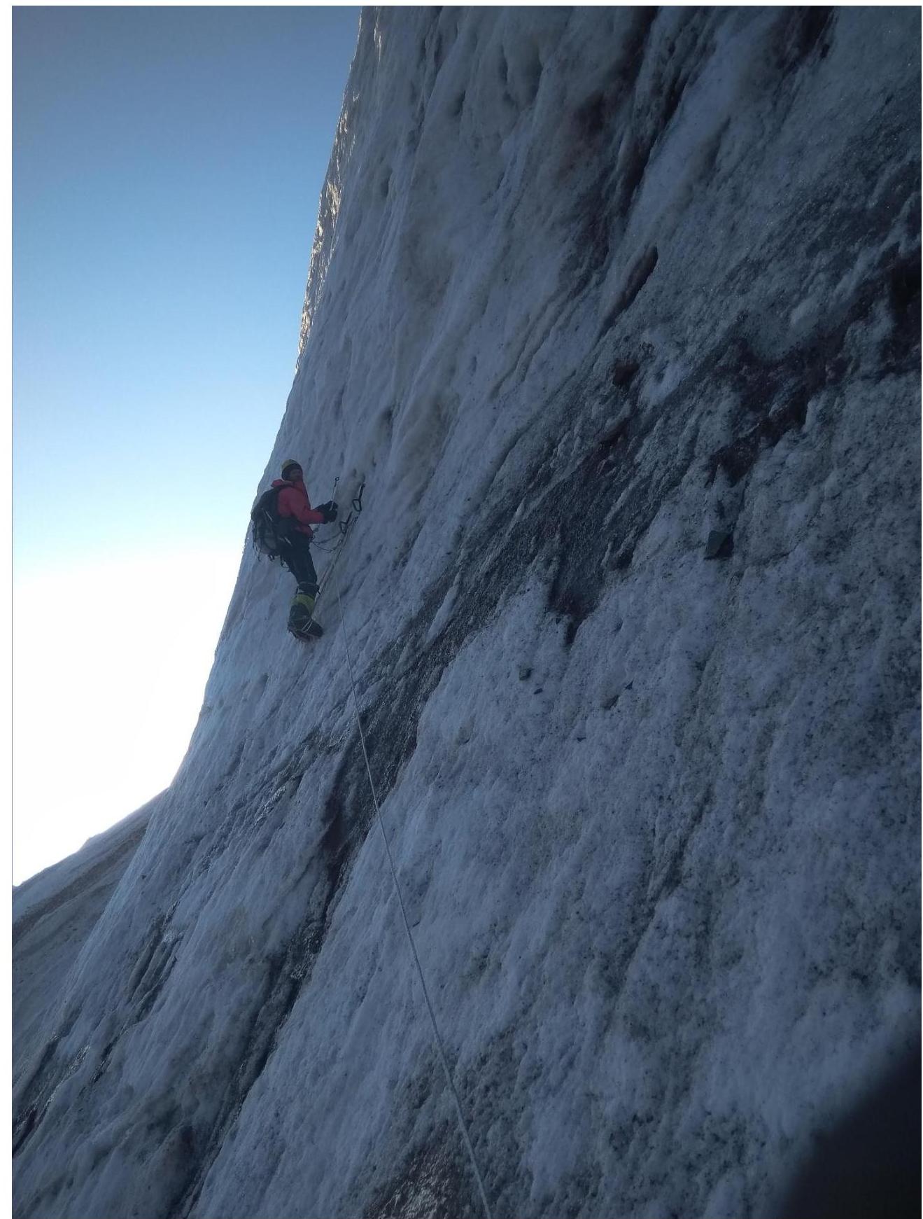
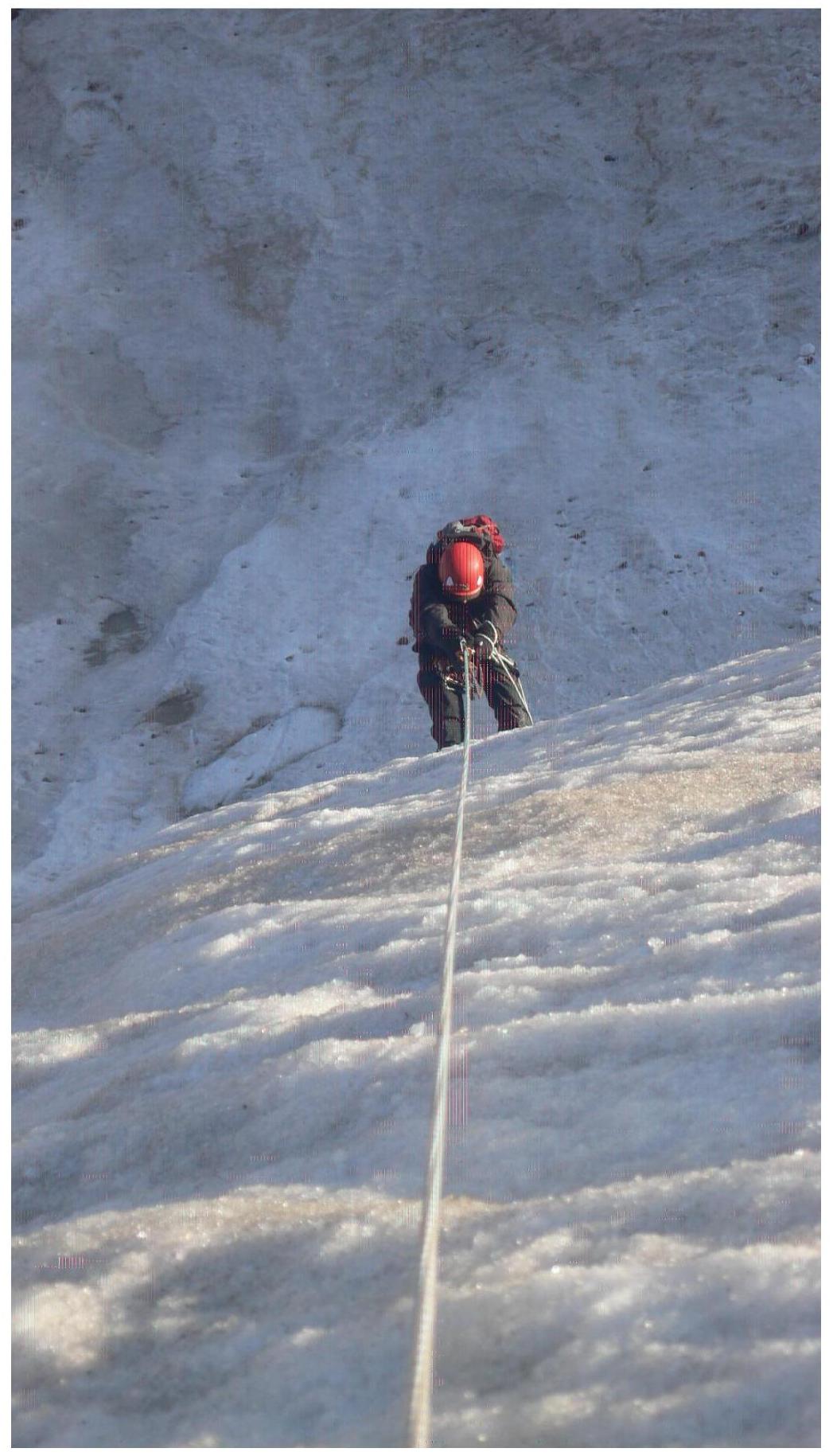
R0–R1: We climb using ice axes with stirrups on the ice wall. Emerging onto a slight flattening, we set up a belay station. The section is only 30 meters but very steep.

 Digitized by Google
R1–R2: We continue climbing with ice axes and stirrups. The slope gradually eases, the ice is good, and there's not much falling debris. Section length is 50 m, 75°.
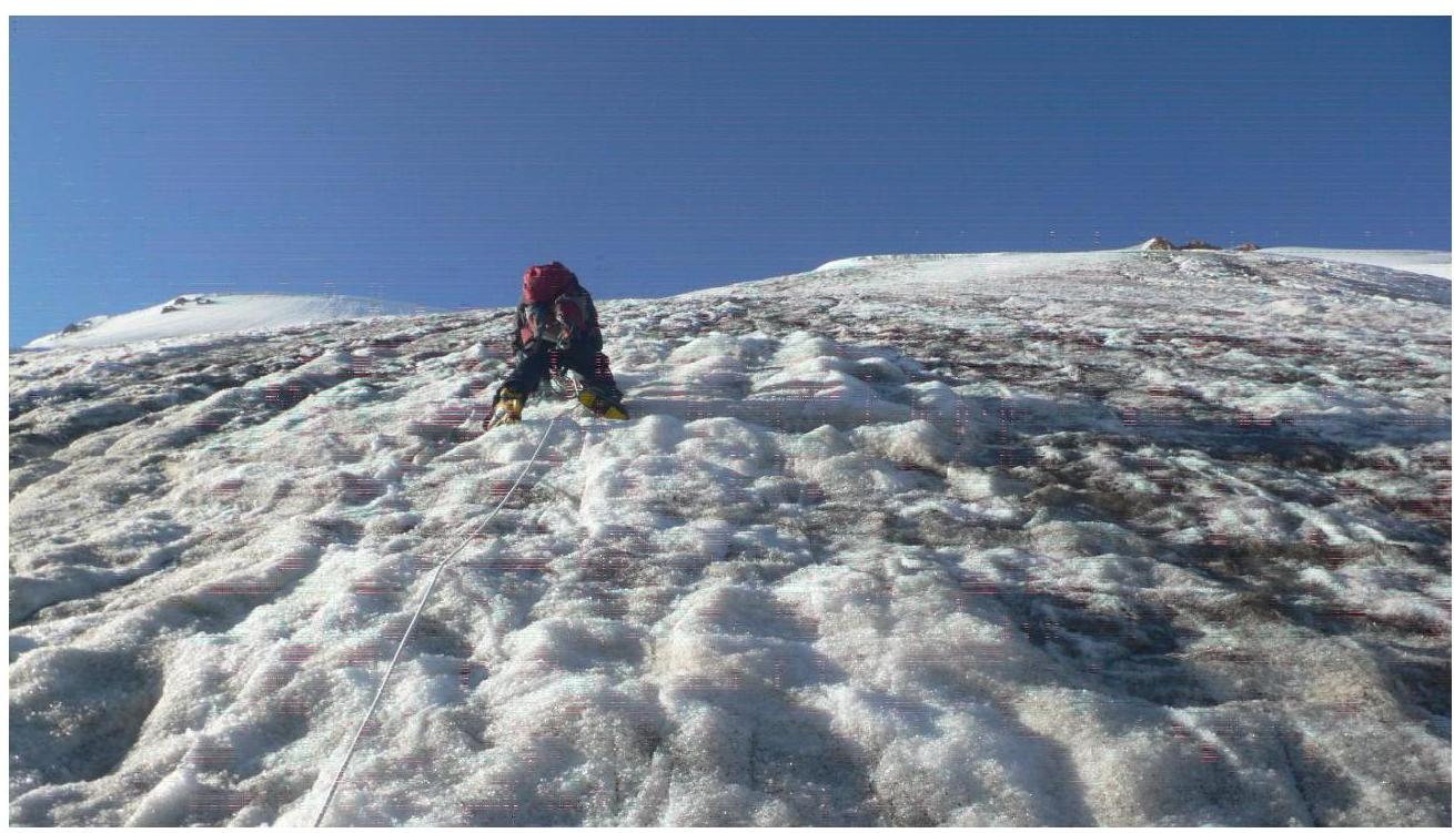
R2–R3: We remove the stirrups and climb using just ice axes. We have to kick our crampons into the ice well because it's in fairly good condition. The section is long — 200 m, 50°.
R3–R4: We appear to be on a 30–40-meter snow "board" at an angle. It turned out to be one of the most dangerous sections. There's 6–8 cm of ice under the snow and a void. To the right, a couple of meters of the "board" breaks off. We hold our breath and carefully bypass it to the left and upwards. Section length is 50 m, 50°.
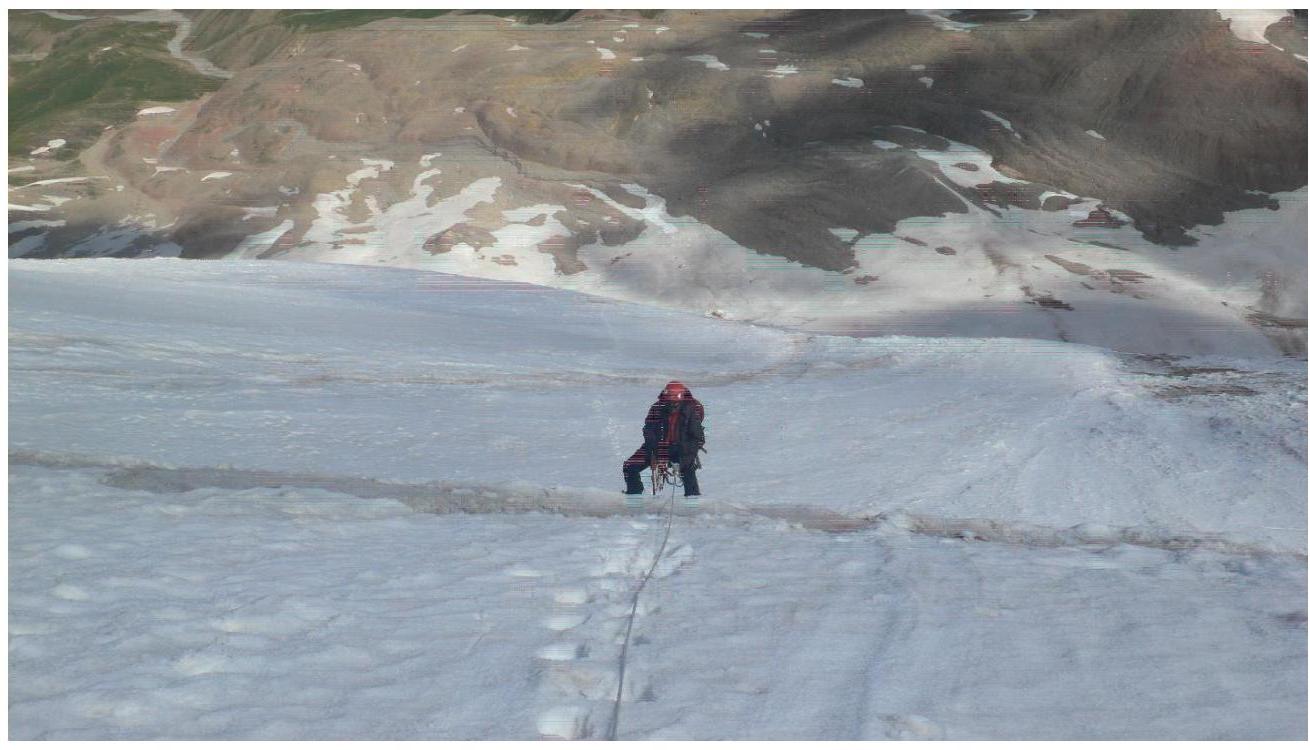
R4–R5: The financial slope eases, we move simultaneously, belaying each other with ice screws. Section length is 100 m, 35–40°.
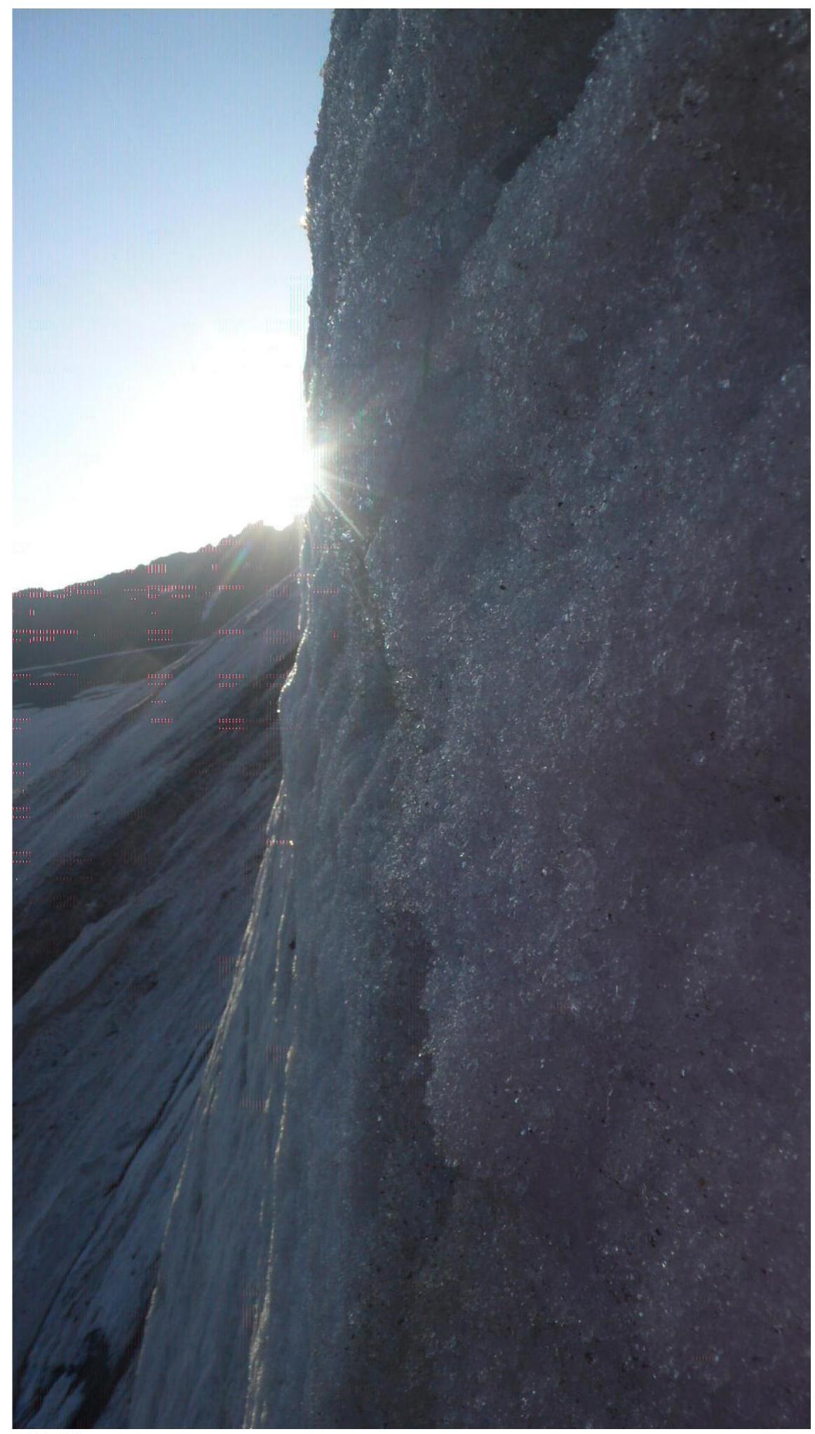
R5–R6: We approach the "brow" (ice wall) via a firn-ice slope. We encounter 2 bergschrunds, the second one is about 5 meters, we pass it carefully to the left, belaying with ice screws. The section is long — 300 m, 45°.
R6–R7: We begin climbing the steep ice wall. Initially, there's a large crevasse that we bypass to the left, belaying with ice screws. The ice wall is steep, but the ice holds well. At the top of the "brow," there's another crevasse. We carefully remove snow and screw an ice screw into the ice to create a handrail. Section length is 20 m, steep wall at 80°.
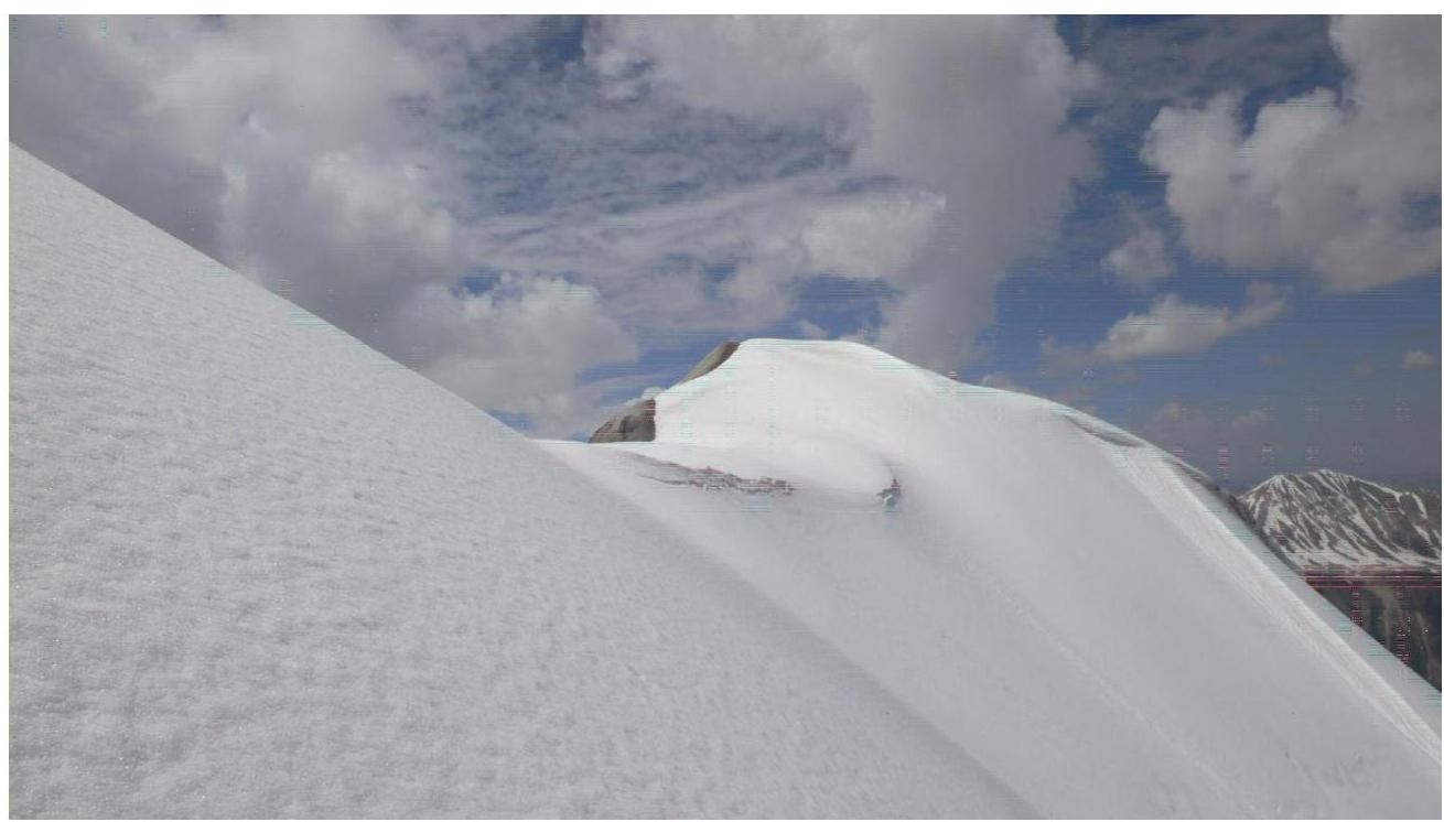
R7–R8: We ascend to the summit ridge via good ice with firn, the climb is quite steep, there's little snow, and there are cornices on the ridge. Section length is 250 m, 50°.
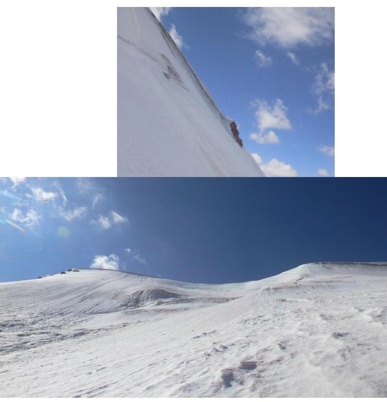
R8–summit: We follow the ridge to the summit, on ice, snow, and loose rocks. Section length is 400 m, 30°.
Descent is via the western ridge in crampons. After descending to the spring, we remove our crampons and head to the camp.